LYNX Blue Line Extension Construction Progress and Station Area Plans
•Download as PPTX, PDF•
1 like•10,931 views

This public meeting will inform the community about the progress of the light rail extension, answer questions, and share the overall vision for the Blue Line Extension alignment.

Recommended
Recommended
More Related Content
What's hot
What's hot (19)
Similar to LYNX Blue Line Extension Construction Progress and Station Area Plans
Similar to LYNX Blue Line Extension Construction Progress and Station Area Plans (20)
Recently uploaded
Recently uploaded (20)
LYNX Blue Line Extension Construction Progress and Station Area Plans
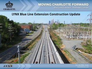
- 1. LYNX Blue Line Extension Construction Update
- 2. • 9.3 miles, 11 stations • 4 park and ride facilities • Approximately 3,100 parking spaces • Accommodates 3-car trains • 25,000+ daily riders • Improvements to North Tryon St. • Connects UNC Charlotte campuses • 22 minute commute from Uptown to UNC Charlotte • Initial peak period service 7.5 minute frequency • Connecting bus services • Revenue service by March 2018 LYNX Blue Line Extension (BLE) Project Overview
- 3. What is a Station Area Plan? • Framework for Future Growth and Land Development • Land Use, Community Design, Mobility, & Open Space Policies for each station • Considers Environmental, Infrastructure, and Public Facility Policies • Identifies Public and Private Investments and Strategies • Represents a Shared Vision for the Future • Ask us about Place Types and the Development Ordinance Update!
- 4. • 36th Street – 3-The Plaza – 23-Shamrock • Sugar Creek – 4-Belmont – 13-Nevin Rd – 59-Hidden Valley • Old Concord Rd – 39-Eastway • University City Blvd – 44-IBM Drive – 54-URP • JW Clay/UNCC – 22-Graham – 29-JW Clay/UNCC – Concord Connector Proposed Bus Connections
- 5. Cross Charlotte Trail • The Cross Charlotte Trail is a 30+-mile trail and greenway facility that will stretch across the city. • A celebration and ribbon cutting was held on May 3rd for the Cordelia Park segment. • A public meeting will be held for the Davidson to Matheson segment on May 10th.
- 6. • Pedestrian path and lighting installed Uptown • Landscaping at Parkwood Station • Installing station elements – signs, benches, windscreens, barrier fence 9th Street to 25th Street Stations
- 7. NECI - Parkwood Avenue Streetscape • Street improvements will include a shared- use path, sidewalks, lighting, landscaping, and traffic signals • Improves access to 16th St., Davidson St. • Being coordinated with proposed development projects in the area
- 8. NECI - 25th Street Streetscape • New street connecting Brevard St. to Davidson St. • Connects Villa Heights to the 25th St. station • To include sidewalks, landscaping, lighting, and on- street parking • Being coordinated with proposed development projects in the area
- 9. • Closures – East 36th Street – Craighead Road • Norfolk Southern building track on new freight alignment • Building Craighead Road up to meet new grade at crossing 36th Street to Sugar Creek Stations New Freight Tracks Existing Freight Tracks 36th Street Station Light Rail Tracks
- 11. NECI- N Tryon Street & 36th Street Streetscape • Extends the BLE improvements • Improvements will include bicycle lanes, sidewalks, landscaping, lighting and crosswalks • Improves access to N. Tryon St. and to Davidson St.
- 12. Sugar Creek Parking Deck • Approx. 630 Parking Spaces • 16 Covered Bicycle Spaces, 3 Bus Bays • Approx. 5,000 Square Feet for CATS facilities and Safety & Security
- 13. NECI - Sugar Creek Streetscape • Ties into NCDOT grade separation project on Sugar Creek Rd. • Improvements will include bicycle lanes, sidewalks, landscaping, lighting and crosswalks. • Improves connections to Tryon St. and The Plaza
- 14. Project Update E. Sugar Creek Rd. Bridge Contract completion date: 2/28/2019
- 15. • Installing station elements – signs, benches, windscreens, barrier fence • Miscellaneous work on signals • Active work in median – Think Safety! Old Concord to Tom Hunter Stations
- 16. Old Concord Road Park and Ride • Surface Parking Lot with Approx. 330 Parking Spaces • 14 Covered Bicycle Spaces • 2 Bus Bays
- 17. NECI - Orr Road • Restores left turn access to Hidden Valley neighborhood • Direct connection to Elgywood Ln.
- 18. NECI - Tom Hunter Road Streetscape • Improvements may include bus stops, will include bicycle lanes, sidewalks, landscaping, lighting and crosswalks. • Improved connections to Monteith, Elgywood
- 19. University City Blvd Parking Deck • 6 Levels with Approx. 1,500 Parking Spaces • 24 Covered Bicycle Spaces, 3 Bus Bays • 5 Active Use Spaces
- 20. NECI - Rocky River Road West Street Improvements • Provides pedestrian and bike connection for several neighborhoods to access the LYNX BLE station • Connects N. Tryon to Toby Creek Greenway • Project will include medians, bike lanes and wider sidewalks • Public meeting May 11
- 21. • Paving and installing pavement markings • Trees planted at stations and along sidewalk • Installing permanent roadway signs University City Blvd to McCullough Stations
- 22. North Bridge South Bridge New Bridges Over I-85 • North Bridge (Research Dr. to J.W. Clay Blvd.) • Local Connections o Employment centers o Blue Line Extension stations o UNC Charlotte o 4 Greenways • Bike and pedestrian facilities • Alternatives to highly congested major thoroughfares • North Bridge public meeting in early June 13
- 23. South Bridge (University Pointe Blvd.)– Project goals • To create multi-modal travel choices and provide connectivity. • To provide access to CATS future Blue Line Extension station at McCullough Drive • To redistribute traffic away from City Boulevard and Harris Boulevard • Ribbon Cutting May 9th
- 24. NECI - McCullough Drive Extension • Extension connects McCullough Dr to WT Harris Blvd. • Improves vehicle, pedestrian and bicycle access and circulation
- 25. NECI - McCullough Drive Streetscape • Street improvements will include buffered bicycle lanes, sidewalks, landscaping, lighting and crosswalks. • Project includes improved pedestrian connection to IKEA Boulevard.
- 26. • Preparing for final paving • Miscellaneous work on traffic and pedestrian signals • Final adjusting storm drain inlets and curb JW Clay/UNCC to UNC Charlotte Main Stations
- 27. • 5 Levels with Approx. 800 Parking Spaces • 14 Covered Bicycle Spaces, 2 Bus Bays • 7 Active Use Spaces JW Clay Parking Deck
- 28. NECI - JW Clay Streetscape • Improvements will include a separated bikeway (cycle track), sidewalks, landscaping, lighting, and crosswalks/traffic signals. • Project to include tie-in to Barton Creek Greenway. • Project design, schedule being coordinated with North Bridge North Bridge
- 29. UNC Charlotte Main Station • Installing maintenance access road • Working on station plaza • Final adjusting track and OCS
- 30. Email alerts - Notify Me How You Can Stay Informed www.ridetransit.org www.charlottefuture.com CATS Customer Service: 704-336-RIDE (7433) City of Charlotte Customer Service: 311
Editor's Notes
- The LYNX Blue Line Extension is scheduled to begin service in SPRING 2017. The extension is broken into 2 segments: Segment A runs from uptown to Old Concord Road and runs adjacent to the existing railroad corridor. The second segment begins at Old Concord Road and runs up toward UNC-Charlotte Campus down the median of N. Tryon Street. The LYNX Blue Line Extension offers consistent travel time (22 minutes) – travel time will be the same the first day of operation as it is in 2035 Congestion free commute – operating in a dedicated railroad ROW and then in the median we will be constructing in N Tryon The Charlotte Metro region has been working hard on creating livable communities and neighborhoods for quite some time. City Council adopted our first growth initiative in the early 1990’s, known as Centers & Corridors, followed by an integrated Transit and Land Use Plan, to encourage growth & redevelopment in those areas where growth could be supported, while preserving existing neighborhoods and allowing more conventional development to occur where appropriate. As you may imagine, we have found that there are benefits to a more focused, compact development pattern such as: More efficient use of public investments and infrastructure Optimizes use of land – preserves open space Improves environmental quality – minimizing street widths and parking lots greatly reduces surface runoff and improves water quality Improves access to jobs & services
- There is a station area plan for each station What is a station area plan? It’s a policy guide that provides a vision for future growth and development. There are two separate documents that collectively cover all 9 stations from Parkwood Station to JW Clay Blvd./UNC Charlotte Station. They provide detailed land use, community design and transportation, and open recommendations for each station area. And they identify public and private investments and strategies needed to realize the plan vision – many of those have been presented tonight as NECI or CIP projects but some will occur through private development or other funding. The vision established in these plans helps to set clear expectations of future development within each transit station area. In addition to any questions about area plans, Planning staff is here to introduce a new initiative related to the Development Ordinance Update – stop by the table for more details
- Additional Closure: Roadway closure at Craighead in the spring for Norfolk Southern reconstruction of their grade crossing and spur track. Up to 8 weeks of closure at Craighead Graded area to the left of the NS train is the future location for the NS tracks. NS will be building these new tracks this winter. Note the spinners on top of the Sugar Creek Station canopies.
- The tracks just below 36th St canopies and station are the current location for NS trains. These tracks will be moved west to the new bridge and graded area that was visible on the previous slide.
- Sugar Creek Road is closed while NCDOT builds a bridge for vehicular traffic OVER the railroad tracks. This bridge will carry motorists over the NS tracks, the BLE tracks and the future high-speed rail corridor.
- Additional Closure: Upcoming Sugar Creek Rd closure for NCDOT grade separation project, immediately following BLE closure
- The contractor is installing the curbs and sub-base surface. The parking lot will be paved with asphalt. Drainage work is continuing on the outer edges of the property. Finishing work on the Old Concord station platform will continue, along with track and systems work in the area.
- . At this stage we are installing the steel beams, foundations and all the underground utilities. This work will continue for the next few months and precast will start going up around June.
- 22
- Improve pedestrian and bicycle mobility between North Tryon Street and WT Harris Boulevard
- Improve pedestrian and bicycle mobility between North Tryon Street and WT Harris Boulevard
- Stay up to date on the Blue Line Extension through various ways. bluelineextension@charlottenc.gov telltransit@charlottenc.gov