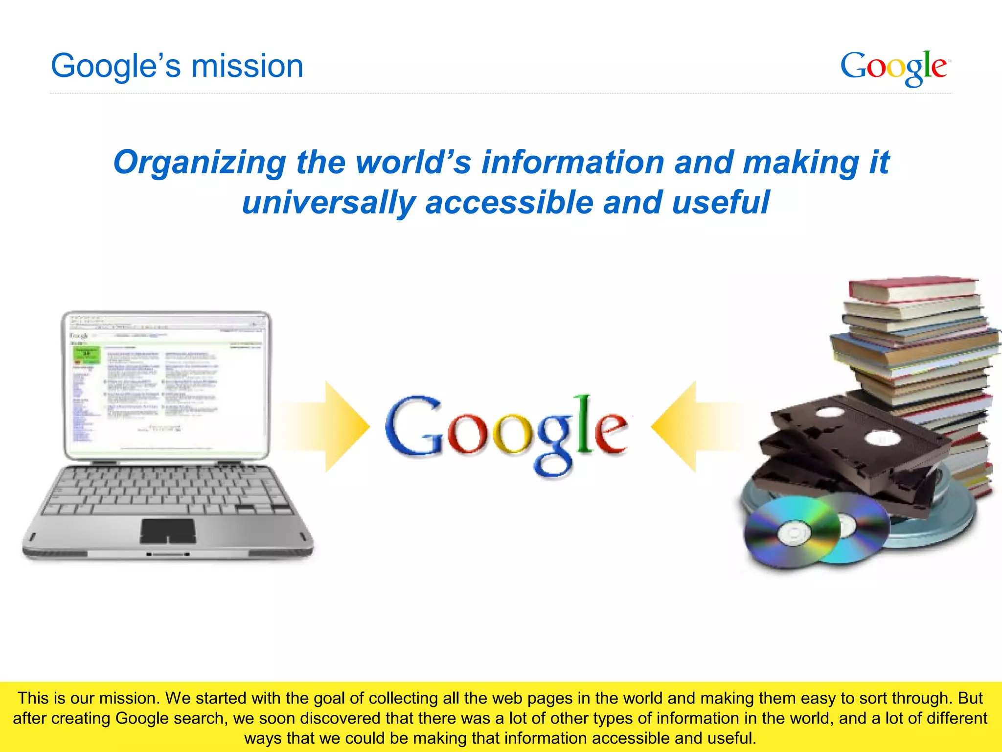
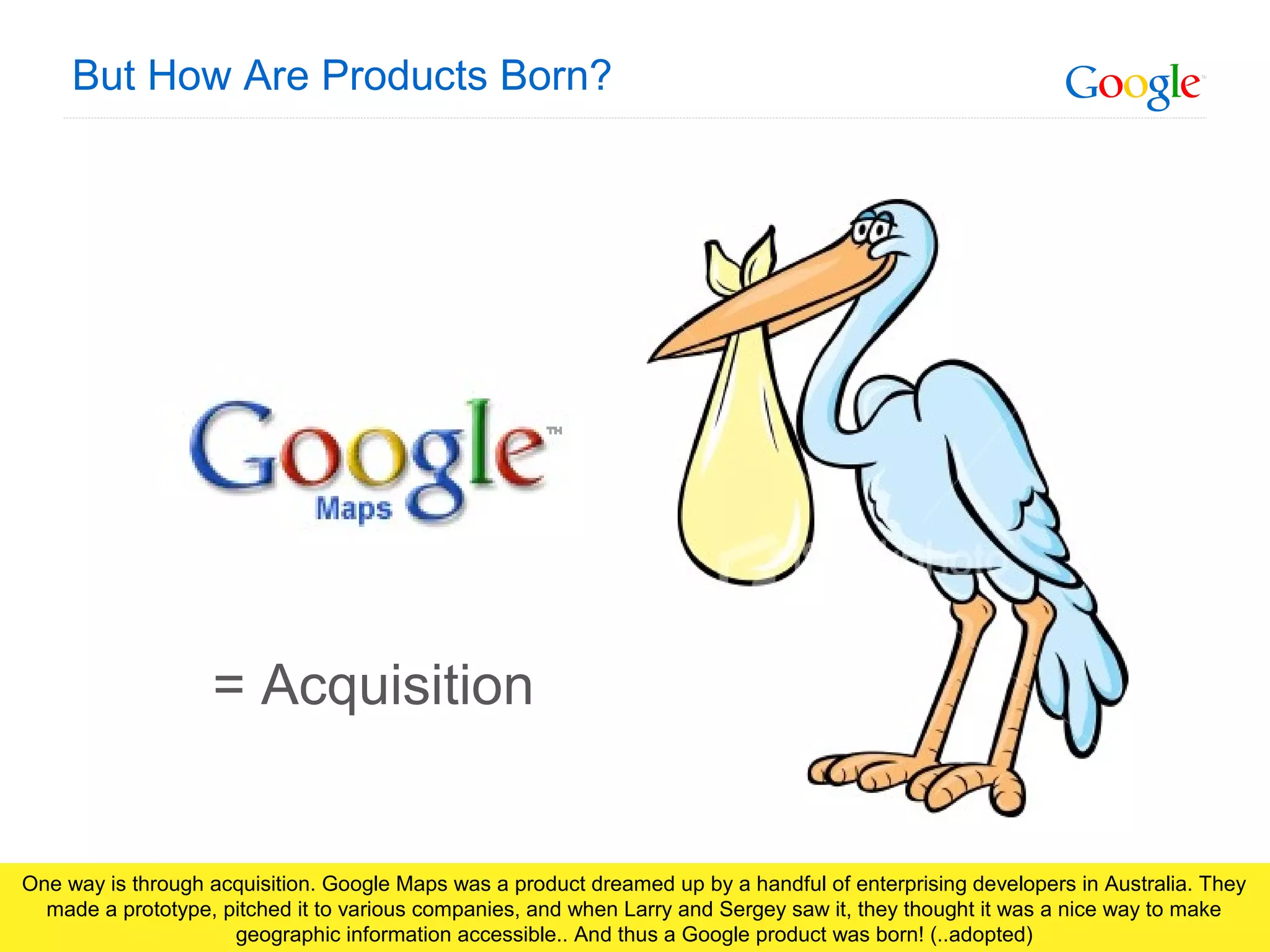
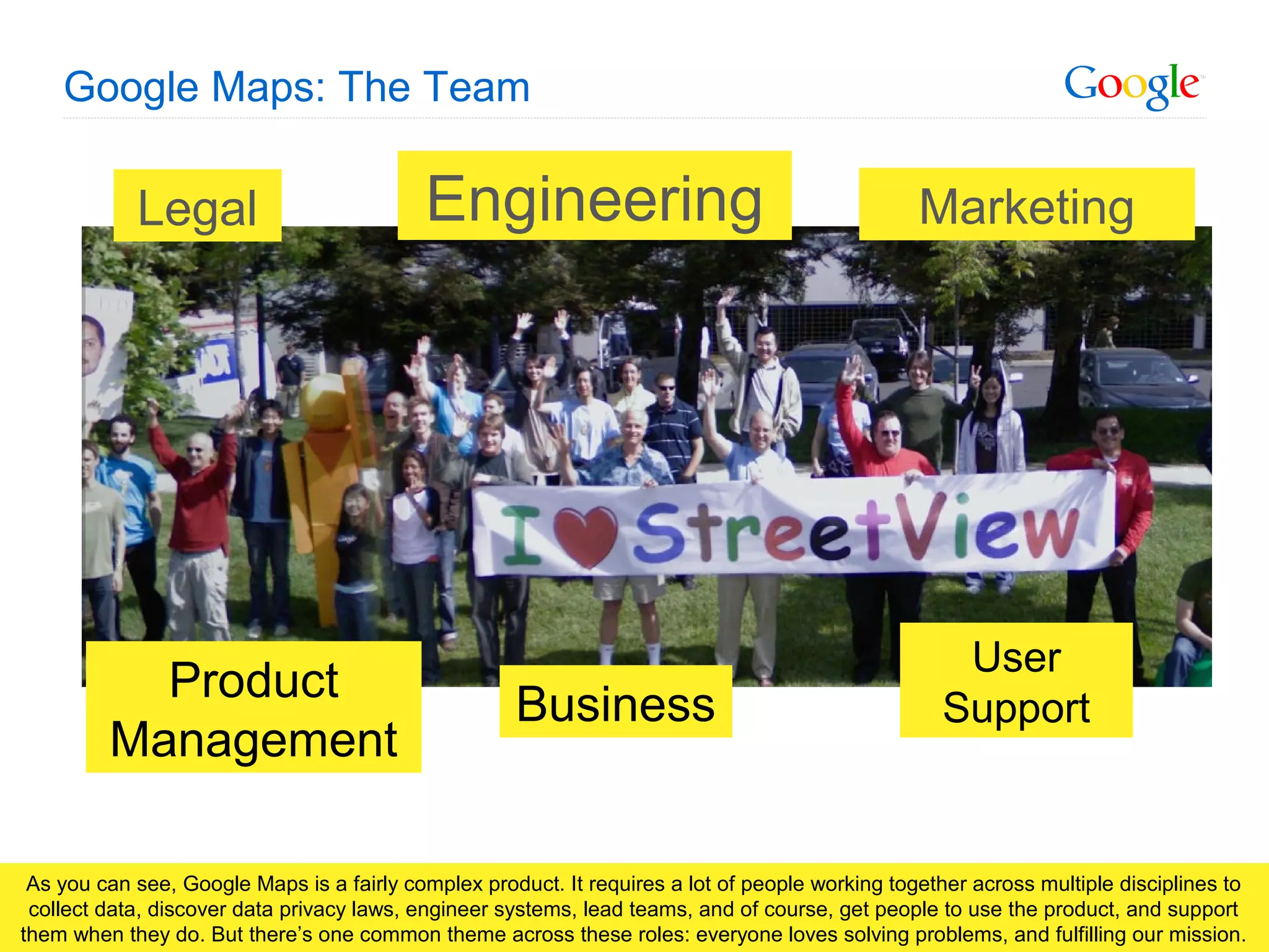
Visualizing Your Cause In Google Earth Maps @ NTC 2010googlenten
Learn how maps can improve communication both with internal decision-making and communications with the world. Tell your story by flying people around the 3D globe and bring your cause to life. Learn what you need to get started on building your map and creating custom specialized visualizations.
http://earth.google.com/outreach
We have created this Power Point Presentation for SEO beginners. This can serve as Robots.txt guide for SEO beginners. This PPT includes some instructions & examples to use robots.txt.
TELERATE SMART BUSINESS SUPPORT SYSTEM .
Your Business. Out of the Box.
TELERATE is the first fully flexible BSS (business support system) which ideally customizes to your business model and translates branch typical requirements in the field of rating, billing and customer care into efficient processes.
For further press information as well as graphical material you can call us or send us an e-mail at press@konzeptum.de.
www.telerate.de
AMP (Accelerated Mobile Pages) - SEO restart 2016Desingdev
Přednáška Michala Vojáka na SEO restart 2016 o AMP. Accelerated Mobile Pages rozhodně řeší velký problém. Revoluce v mobilním vyhledávání nebo jen pokus a slepá ulička?
A slide show by Dental Media explaining some of the most important ranking factors that Google use for their search engine.
Dental Media are a specialist dental SEO agency.
It doesn’t matter how accurate this number is. The sheer magnitude of it is still intimidating. Especially for someone only starting to rank their site.
Google Ranking Game Changer! Disavow Links & What it Means for Your SEODemandWave
Remember that “$100 for 500 links” deal you bought? Well, it backfired.
Finally, marketers can disavow the legacy links that are weighing on your search rankings like concrete shoes. Whether created by ‘black hat’-wearing competitors, or purchased cheaply offshore, those spammy links are triggering the ‘Penguin’ Penalty.
Join Alex Dunks, Senior SEO Analyst, and learn:
- How to efficiently assess your backlinks and decide which to disavow
- How this relates to this year’s other radical ranking changes
- How to leapfrog your slower competitors and own the top search results
Webmarketing123 is a Bay Area Digital Marketing Agency. Our distinctive approach: pair a metrics-rich methodology with an understanding of our clients’ unique business goals and challenges. We combine a deep expertise across industry verticals, smart use of automation, and efficient use of analytics to inform data-driven decision-making. At Webmarketing123, each client has a dedicated team employing a strategic mix of Organic Search (SEO), Paid Search (PPC) advertising, and/or Social Media Marketing (SMM) to create remarkable, results-driven marketing programs.
Ebriks-Tips for Google Ranking Evolution.georgepaulv
Ebriks-SEO Services company here showing the details about the Google Ranking Evolution.Google Ranking used a variety of methods to determine which pages are displayed first in the results.The Google Ranking Position Checker tool that we have developed will automatically query Google's search engines.If you want to more info then please on visit www.ebriks.com
2009 AAG presentation for the "Is Google Good for Geography?" session.
Can the GeoWeb Get the Public to Care about Geography? The Positive Externalities of a Web Enabled Ecosystem
This talk from November, 2012 discusses some surprising initiatives and accomplishments from Google with links to YouTube videos. Contact the author at gregwilde@gmail.com.
This slidedeck presents a brief scan of the web mapping and geographic information (GIS) tools that were explored during the Indigenous Mapping Workshop 2014 (IMW2014) held at the University of Victoria 25-28 August 2014.
The workshop was attended by 100+ participants, representing more than 40 First Nations, Metis and Inuit communities from across Canada.
The Workshop was jointly hosted/organized by the Union of British Columbia Indian Chiefs, the Firelight Group, Google Earth Outreach, and the University of Victoria, Anthropology Department.
The scan is not comprehensive, favouring the tools that were explored in the Day3/4 "deep dives".
More information on the tools and workshop are available here: http://imwcanada.earthoutreach.org
Finding Your Way - Campus Mapping and Big Data - #econfpsu16farktal
Wayfinding and map data: so many (conflicting) data sources out there, so little time . And so much potential for losing your future students before you can even make the pitch. We’ll look at ways to correct your campus data in major mapping systems, and then look at some fairly easy-to-build and inexpensive options for building mobile-friendly interactive maps for your campus. (Elements: The Web Conference at Penn State 2016, Marketing Track Session)
SII-PIV 54 Spatial and Environmental Injury Surveillance, based on Cape Town, South Africa. So what is the project about? It is about seeing if we can use the geospatial web to work with trauma surgeons, nurses, health officials, to represent trauma injury data in a useful way. It is very informal due to working with coarse data, poor and dangerous neighbourhoods. We focus on ‘one on one’ interactions between the user and the application. And lastly, we hope that these tools will be practical in the health world.
Finding Your Way - Big Data vs. Wayfinding On Your Campus - #heweb15 #aim7farktal
Wayfinding and map data: so many (conflicting) data sources out there, so little time . And so much potential for losing your future students before you can even make the pitch. We’ll look at ways to correct your campus data in major mapping systems, and then look at some fairly easy-to-build and inexpensive options for building mobile-friendly interactive maps for your campus. (HighEdWeb 2015 Conference, AIM7 Track Session)
ViziCities - Lessons Learnt Visualising Real-world Cities in 3DRobin Hawkes
ViziCities is an open-source 3D city visualisation platform powered by JavaScript, WebGL and many other cutting-edge Web technologies. Think SimCity meets the real world!
In this talk, Robin Hawkes, ViziCities’ creator will highlight the development issues experienced along the way and show you how he overcame them – ranging from how you tackle the realtime processing of thousands of 3D buildings without locking up the browser, to how you visualise the entire world without needing a server or your own geographic data source.
Similar to Google Products: Deep Dive on Google Maps (20)
Making JavaScript Libraries More ApproachablePamela Fox
A talk given at NotConf in Phoenix, Texas in 2012.
(Alternative title: Why nested ternary operators make me want to kick inanimate objects in the nuts.)
A talk given at WDCNZ 2011. Abstract:
"We all know what “user experience” is and we know that it’s important. We analyze drop-off rates for sign-in flows, do A/B testing on color schemes, and organize user focus groups for new features. But we rarely talk about the “developer experience” - what we all go through each time we try to use a developer tool, library, or API. How do we decide what tool to use? Is it easy to integrate with our development environment? How flexible is the API? Where do we go when something goes wrong? Those are the sort of questions that we can ask to understand what it’s like for a developer to use a product - and where it can be improved.
Whether you simply use developer products or you actually build one yourself, you should walk away from this talk with ideas on how to make a great developer experience - and why it matters."
Talk given by Pamela Fox (me) at Ignite Melbourne, all about my favorite type of sleepwear. Remember to submit pics of you in your onesie to footedandfabulous.com!
Presented at Ignite Sydney 2010 as part of Global Ignite week, this talk introduces the ultra feminine Computer Engineer Barbie, and why it's a damn good thing.
Google Wave 20/20: Product, Protocol, PlatformPamela Fox
These slides introduce the various facets of Google Wave. They were originally delivered as a talk in the 20/20 style (20 slides, 20 seconds each) at the Adobe Platform Users Group Sydney. The slides have been captioned with what was approximately said.
Growing up Geek: My Dad, the Computer ScientistPamela Fox
An Ignite talk given at Google I/O, about my life with two geeky parents and how I got involved in web development and related areas.
I've pasted my pre-scripted lines on top of the slides so that it makes sense.
I'm entering this in the Tell a Story contest since it happens to be a story, and there's a checkbox for entering it. :)
Living in the Cloud: Hosting Data & Apps Using the Google InfrastructurePamela Fox
In the modern web, the user rules. Nearly every successful web app has to worry about scaling to an exponentially growing user base and giving those users multiple ways of interacting with their data. Pamela Fox, Maps API Support Engineer & Developer advocate, provides an overview of two technologies - Google App Engine and the Google Data APIs - that aim to make web development and data portability easier.
Most modern websites still place a large burden on the server, constantly sending it requests and asking it to do heavy computations. In the brave new world, the client is king and the server is its faithful shadow. In this talk, we'll look at how cutting-edge technology like Gears, HTML5, and Google App Engine can be used to create websites where the caching, storage, and computing is done primarily in the browser/desktop and the server is used merely as a backup store.
Presented at Webstock 2009.
Original version (not PPTed):
http://tr.im/clientkilledserver
UiPath Test Automation using UiPath Test Suite series, part 4DianaGray10
Welcome to UiPath Test Automation using UiPath Test Suite series part 4. In this session, we will cover Test Manager overview along with SAP heatmap.
The UiPath Test Manager overview with SAP heatmap webinar offers a concise yet comprehensive exploration of the role of a Test Manager within SAP environments, coupled with the utilization of heatmaps for effective testing strategies.
Participants will gain insights into the responsibilities, challenges, and best practices associated with test management in SAP projects. Additionally, the webinar delves into the significance of heatmaps as a visual aid for identifying testing priorities, areas of risk, and resource allocation within SAP landscapes. Through this session, attendees can expect to enhance their understanding of test management principles while learning practical approaches to optimize testing processes in SAP environments using heatmap visualization techniques
What will you get from this session?
1. Insights into SAP testing best practices
2. Heatmap utilization for testing
3. Optimization of testing processes
4. Demo
Topics covered:
Execution from the test manager
Orchestrator execution result
Defect reporting
SAP heatmap example with demo
Speaker:
Deepak Rai, Automation Practice Lead, Boundaryless Group and UiPath MVP
Let's dive deeper into the world of ODC! Ricardo Alves (OutSystems) will join us to tell all about the new Data Fabric. After that, Sezen de Bruijn (OutSystems) will get into the details on how to best design a sturdy architecture within ODC.
Accelerate your Kubernetes clusters with Varnish CachingThijs Feryn
A presentation about the usage and availability of Varnish on Kubernetes. This talk explores the capabilities of Varnish caching and shows how to use the Varnish Helm chart to deploy it to Kubernetes.
This presentation was delivered at K8SUG Singapore. See https://feryn.eu/presentations/accelerate-your-kubernetes-clusters-with-varnish-caching-k8sug-singapore-28-2024 for more details.
Builder.ai Founder Sachin Dev Duggal's Strategic Approach to Create an Innova...Ramesh Iyer
In today's fast-changing business world, Companies that adapt and embrace new ideas often need help to keep up with the competition. However, fostering a culture of innovation takes much work. It takes vision, leadership and willingness to take risks in the right proportion. Sachin Dev Duggal, co-founder of Builder.ai, has perfected the art of this balance, creating a company culture where creativity and growth are nurtured at each stage.
UiPath Test Automation using UiPath Test Suite series, part 3DianaGray10
Welcome to UiPath Test Automation using UiPath Test Suite series part 3. In this session, we will cover desktop automation along with UI automation.
Topics covered:
UI automation Introduction,
UI automation Sample
Desktop automation flow
Pradeep Chinnala, Senior Consultant Automation Developer @WonderBotz and UiPath MVP
Deepak Rai, Automation Practice Lead, Boundaryless Group and UiPath MVP
JMeter webinar - integration with InfluxDB and GrafanaRTTS
Watch this recorded webinar about real-time monitoring of application performance. See how to integrate Apache JMeter, the open-source leader in performance testing, with InfluxDB, the open-source time-series database, and Grafana, the open-source analytics and visualization application.
In this webinar, we will review the benefits of leveraging InfluxDB and Grafana when executing load tests and demonstrate how these tools are used to visualize performance metrics.
Length: 30 minutes
Session Overview
-------------------------------------------
During this webinar, we will cover the following topics while demonstrating the integrations of JMeter, InfluxDB and Grafana:
- What out-of-the-box solutions are available for real-time monitoring JMeter tests?
- What are the benefits of integrating InfluxDB and Grafana into the load testing stack?
- Which features are provided by Grafana?
- Demonstration of InfluxDB and Grafana using a practice web application
To view the webinar recording, go to:
https://www.rttsweb.com/jmeter-integration-webinar
Dev Dives: Train smarter, not harder – active learning and UiPath LLMs for do...UiPathCommunity
💥 Speed, accuracy, and scaling – discover the superpowers of GenAI in action with UiPath Document Understanding and Communications Mining™:
See how to accelerate model training and optimize model performance with active learning
Learn about the latest enhancements to out-of-the-box document processing – with little to no training required
Get an exclusive demo of the new family of UiPath LLMs – GenAI models specialized for processing different types of documents and messages
This is a hands-on session specifically designed for automation developers and AI enthusiasts seeking to enhance their knowledge in leveraging the latest intelligent document processing capabilities offered by UiPath.
Speakers:
👨🏫 Andras Palfi, Senior Product Manager, UiPath
👩🏫 Lenka Dulovicova, Product Program Manager, UiPath
GraphRAG is All You need? LLM & Knowledge GraphGuy Korland
Guy Korland, CEO and Co-founder of FalkorDB, will review two articles on the integration of language models with knowledge graphs.
1. Unifying Large Language Models and Knowledge Graphs: A Roadmap.
https://arxiv.org/abs/2306.08302
2. Microsoft Research's GraphRAG paper and a review paper on various uses of knowledge graphs:
https://www.microsoft.com/en-us/research/blog/graphrag-unlocking-llm-discovery-on-narrative-private-data/
Kubernetes & AI - Beauty and the Beast !?! @KCD Istanbul 2024Tobias Schneck
As AI technology is pushing into IT I was wondering myself, as an “infrastructure container kubernetes guy”, how get this fancy AI technology get managed from an infrastructure operational view? Is it possible to apply our lovely cloud native principals as well? What benefit’s both technologies could bring to each other?
Let me take this questions and provide you a short journey through existing deployment models and use cases for AI software. On practical examples, we discuss what cloud/on-premise strategy we may need for applying it to our own infrastructure to get it to work from an enterprise perspective. I want to give an overview about infrastructure requirements and technologies, what could be beneficial or limiting your AI use cases in an enterprise environment. An interactive Demo will give you some insides, what approaches I got already working for real.
Epistemic Interaction - tuning interfaces to provide information for AI supportAlan Dix
Paper presented at SYNERGY workshop at AVI 2024, Genoa, Italy. 3rd June 2024
https://alandix.com/academic/papers/synergy2024-epistemic/
As machine learning integrates deeper into human-computer interactions, the concept of epistemic interaction emerges, aiming to refine these interactions to enhance system adaptability. This approach encourages minor, intentional adjustments in user behaviour to enrich the data available for system learning. This paper introduces epistemic interaction within the context of human-system communication, illustrating how deliberate interaction design can improve system understanding and adaptation. Through concrete examples, we demonstrate the potential of epistemic interaction to significantly advance human-computer interaction by leveraging intuitive human communication strategies to inform system design and functionality, offering a novel pathway for enriching user-system engagements.
LF Energy Webinar: Electrical Grid Modelling and Simulation Through PowSyBl -...DanBrown980551
Do you want to learn how to model and simulate an electrical network from scratch in under an hour?
Then welcome to this PowSyBl workshop, hosted by Rte, the French Transmission System Operator (TSO)!
During the webinar, you will discover the PowSyBl ecosystem as well as handle and study an electrical network through an interactive Python notebook.
PowSyBl is an open source project hosted by LF Energy, which offers a comprehensive set of features for electrical grid modelling and simulation. Among other advanced features, PowSyBl provides:
- A fully editable and extendable library for grid component modelling;
- Visualization tools to display your network;
- Grid simulation tools, such as power flows, security analyses (with or without remedial actions) and sensitivity analyses;
The framework is mostly written in Java, with a Python binding so that Python developers can access PowSyBl functionalities as well.
What you will learn during the webinar:
- For beginners: discover PowSyBl's functionalities through a quick general presentation and the notebook, without needing any expert coding skills;
- For advanced developers: master the skills to efficiently apply PowSyBl functionalities to your real-world scenarios.
Slack (or Teams) Automation for Bonterra Impact Management (fka Social Soluti...Jeffrey Haguewood
Sidekick Solutions uses Bonterra Impact Management (fka Social Solutions Apricot) and automation solutions to integrate data for business workflows.
We believe integration and automation are essential to user experience and the promise of efficient work through technology. Automation is the critical ingredient to realizing that full vision. We develop integration products and services for Bonterra Case Management software to support the deployment of automations for a variety of use cases.
This video focuses on the notifications, alerts, and approval requests using Slack for Bonterra Impact Management. The solutions covered in this webinar can also be deployed for Microsoft Teams.
Interested in deploying notification automations for Bonterra Impact Management? Contact us at sales@sidekicksolutionsllc.com to discuss next steps.
Search and Society: Reimagining Information Access for Radical FuturesBhaskar Mitra
The field of Information retrieval (IR) is currently undergoing a transformative shift, at least partly due to the emerging applications of generative AI to information access. In this talk, we will deliberate on the sociotechnical implications of generative AI for information access. We will argue that there is both a critical necessity and an exciting opportunity for the IR community to re-center our research agendas on societal needs while dismantling the artificial separation between the work on fairness, accountability, transparency, and ethics in IR and the rest of IR research. Instead of adopting a reactionary strategy of trying to mitigate potential social harms from emerging technologies, the community should aim to proactively set the research agenda for the kinds of systems we should build inspired by diverse explicitly stated sociotechnical imaginaries. The sociotechnical imaginaries that underpin the design and development of information access technologies needs to be explicitly articulated, and we need to develop theories of change in context of these diverse perspectives. Our guiding future imaginaries must be informed by other academic fields, such as democratic theory and critical theory, and should be co-developed with social science scholars, legal scholars, civil rights and social justice activists, and artists, among others.
2. Google Confidential and Proprietary
Organizing the world’s information and making it
universally accessible and useful
Google’s mission
This is our mission. We started with the goal of collecting all the web pages in the world and making them easy to sort through. But
after creating Google search, we soon discovered that there was a lot of other types of information in the world, and a lot of different
ways that we could be making that information accessible and useful.
3. Google Confidential and Proprietary
How?
Products!
So, we started creating more products, to deal with the plethora of information on the web. There are a couple ways that products
are “born” at Google.
4. Google Confidential and Proprietary
But How Are Products Born?
= Acquisition
One way is through acquisition. Google Maps was a product dreamed up by a handful of enterprising developers in Australia. They
made a prototype, pitched it to various companies, and when Larry and Sergey saw it, they thought it was a nice way to make
geographic information accessible.. And thus a Google product was born! (..adopted)
5. Google Confidential and Proprietary
But How Are Products Born?
= Local Need
Another reason products start is because of local need. In Australia, people have a particular love for searching real estate listings.
We noticed that people were typing housing queries into Google Maps here, and not getting many good results, so we decided we
should do something about it. Thus, the Google Real Estate Search project was born, and now fulfills a need in the AU market.
6. Google Confidential and Proprietary
But How Are Products Born?
= Feature Parity
Sometimes products are created because we need them to compete. At Google, we value competition because it makes us work
harder. When we came out with Gmail, we noticed other popular email systems had calendars. So we created Google Calendar,
and made our offering to users much more compelling.
7. Google Confidential and Proprietary
But How Are Products Born?
= An Idea
Sometimes we just think a product is a good idea. At Google, we already have many tools for communication and collaboration:
Google docs, Google sites, Gmail, Blogger, etc. But when Lars & Jens (also the creators of Google Maps) proposed Google Wave
to Larry and Sergey, they gave them the go-ahead. There are times when we need to experiment with new ideas, even if they’re not
necessary or competitive, and hope that they make a revolutionary impact on our total offering.
8. Google Confidential and Proprietary
Deep Dive: Google Maps
We have a lot of products. And we have a lot of Googlers. That’s because there are a lot of problems to tackle on any given product,
and we love tackling problems. (That’s what engineering is!) So, let’s do a deep dive on Google Maps, and what makes it hard.
9. Google Confidential and Proprietary
Google Maps: The Product
Released in February 2005.
One of the first AJAX apps and
"slippy maps" implementations.
Features:
Searches:
• Addresses
• Local businesses
• User content
Driving Directions (Transit too)
Traffic Overlay
Street View
KML/GeoRSS Browsing
My Maps
Mapplets
Many people think of Google Maps as just a way to find an address or directions, but it actually offers a lot more than that –
transit/walking directions, real-time traffic, streetview, user-created maps, photo layers, and more.
10. Google Confidential and Proprietary
Google Maps: The Hard Parts: Tiles
But let’s start with the most basic aspect of Google Maps – the road map tiles. When you create roadmap tiles, you are figuring out
how to represent a mass of labels, lines, and shapes at various zoom levels. You need to figure out what is the most important label
to show, and how to arrange labels so that they don’t overlap and visually overwhelm. This isn’t trivial.
11. Google Confidential and Proprietary
Google Maps: The Hard Parts: Tiles
Now, it’s not too hard when you’re creating maps for just one part of the world. But one of the things that makes Google Maps (and
any Google product) so complex is that is an international product, and must cater to users everywhere. So, for example, we have to
decide how to show labels of places in foreign character sets, and decide whether to use a user’s current IP location to affect the
language of the tiles. In the case of Japan, we show both character sets, and manage to squash it all in.
12. Google Confidential and Proprietary
Google Maps: The Hard Parts: Tiles
There are even more differences when you zoom in to another country, because every country has its own way of getting around
and understanding maps. In Japan, they use 7/11 and MacDonalds as landmarks for navigation, so those icons are rendered
prominently on the maps. Another difference is in the icons used for things like churches, hospitals, and hotels. In the US, we simply
use a steeple as a church. In Japan, we would need to use separate temple and shrine icons to be understandable.
13. Google Confidential and Proprietary
Google Maps: The Hard Parts: Tiles
Now, let’s look at problems with satellite tiles – the imagery that we get from satellites orbiting the earth. First of all, there aren’t
enough satellites orbiting everywhere to get real-time data for the whole earth. In fact, much of our imagery can be a year or more
old. Right now, we’re standing in a new building.. so new that it appears like a concrete block in the imagery on Maps.
14. Google Confidential and Proprietary
Google Maps: The Hard Parts: Tiles
Sometimes, we do get more up-to-date imagery, but it’s just not great quality. The resolution might be low, or it might be covered in
clouds. As much as we beg, we just can’t get clouds to get out of the way when we photograph! So, whenever we get new imagery
for an area, we have to carefully analyze its quality and decide whether we should replace the current imagery.
15. Google Confidential and Proprietary
Google Maps: The Hard Parts: Tiles
And sometimes we have to make the decision to use different imagery for two regions that are near to eachother. For example,
whenever land meets ocean, we fade between high resolution beach imagery and a very blurry blue – there’s no point in storing high
resolution imagery of a bunch of ripples over 70% of the world. In some cases, we use different imagery in the same landmass, and
that can sometimes lead to quite a mismatch, as shown above. We haven’t entirely solved this blending and choosing problem.
16. Google Confidential and Proprietary
Google Maps: The Hard Parts: Tiles
Now, after we’ve perfected our road map tiles and satellite tiles, we need to get them to align for our “hybrid” view. That means that
even teeny inconsequential country roads need to match up. Considering the vector road data comes from a different source than
the satellite imagery, they can be hard to align together.
17. Google Confidential and Proprietary
Google Maps: The Hard Parts: Searches
"Wellington Hotel, 871 Seventh Ave. @55th St, 55 Street, New York"
Moving on from the tiles to the searches that you do on top of them. Our search box has to interpret a lot, without much help from
the user. It doesn’t make you specify whether you’re looking for addresses or for business, it doesn’t make you specify the country of
the thing you’re looking for. It just takes strings from users all over the world, and tries to figure out what the heck they’re looking for.
And, wow, addresses can be complex. The example above specifies 3 streets, a business name, and a region name that might be a
city or might be a state – and the search engine has to disambiguate all of that.
18. Google Confidential and Proprietary
Google Maps: The Hard Parts: Directions
Driving directions are even harder than searches, because we have to figure out where the first location is, figure out where the
second one is, and then find the best route between them. That usually means trying to spend the most amount of time on big roads
with higher speed limits, but it also means balancing traffic at different times of day. And sometimes it means kayaking across the
ocean with a pit stop in Hawaii.
19. Google Confidential and Proprietary
Google Maps: The Hard Parts: Directions
Driving directions get even harder when you’re giving them for a country that doesn’t name most of it’s streets. Imagine having to tell
someone how to get from “Unknown Rd” to “Unknown Rd”. It’s not easy.
20. Google Confidential and Proprietary
Google Maps: The Hard Parts: Directions
And then we have the non-driving directions, like walking. These are hard to calculate because most of the data out there is geared
towards drivers, and few data sources specify walkable paths. Google Maps still hasn’t figured out my optimal commute, which goes
through a underground subway path, a parking lot walkway, and a mall. We still need to find ways to source better walking data.
21. Google Confidential and Proprietary
Google Maps: The Hard Parts: Data
To search for places and to calculate directions, we need a lot of underlying data, which we get from various data sources. But, the
world is a massive place, and is constantly under construction, and there will always be inaccuracies in data. So, we needed to find
a *scalable* way to get users to tell us when data was wrong. Instead of having each user painstakingly email us with each problem,
we actually have them fix the problem themselves, on the map. Of course, we have to engineer moderation and anti-spam
mechanisms, but we still get a lot better data feedback with an instant user feedback system.
22. Google Confidential and Proprietary
Google Maps: The Hard Parts: Data
But, there are some issues with letting anyone edit the map, because there is the notion of an “owner” for business results. Should
any old schmoe be allowed to edit the Casino’s location? Shouldn’t we only let the owner do it? Well, how do we know who the
owner is? We usually send them a postcard with a code at their address. But what happens if the owner leaves, but never tells us
that? What if he dies? (Or something less morbid but equally bewildering). These are all interesting issues we face.
23. Google Confidential and Proprietary
Google Maps: The Hard Parts: Real-time Data
So far, all the data I’ve shown is data that we update once a year, once a month, etc. But there’s some data on our maps that’s real-
time – constantly updated – the traffic layer. To have this layer, we needed to build systems that can take in data from traffic data
providers all over the world in a consistent format, and turn that into visual layers for users, and do it all in a matter of minutes.
24. Google Confidential and Proprietary
Google Maps: The Hard Parts: Privacy
So, as you’ve seen, we have *a lot* of data. Sometimes, the amount of data we have can be scary for users. For instance, our
StreetView imagery lets you view buildings and streets before you visit them. But as a side effect, it lets you view people on the
street. So, to make users feel comfortable with this technology, we needed to build technology to detect faces and to blur them. It’s
not easy – at the beginning, we were confusing quite a few horse butts with faces. The horses probably didn’t mind much, but we
have since improved the face detection to leave them out of it.
25. Google Confidential and Proprietary
Google Maps: The Hard Parts: Storage
Tiles, Data, Images
All the tiles and data add up to a lot of storage on our servers. Our tiles are basically an image pyramid, where each tile on a zoom
level splits into 4 more on the next zoom level, and since we go up to 21 zoom levels in some places, that means a massive number
of tiles (see the table above). Plus, we have 4 different map types, so it’s really 4 times a massive number. And then of course,
there’s all the data for searching and directions. Google is one of the few companies that could possibly store this amount of data,
as well as replicate it efficiently for serving users.
26. Google Confidential and Proprietary
Google Maps: The Team
Legal
Business
Engineering
Product
Management
Marketing
User
Support
As you can see, Google Maps is a fairly complex product. It requires a lot of people working together across multiple disciplines to
collect data, discover data privacy laws, engineer systems, lead teams, and of course, get people to use the product, and support
them when they do. But there’s one common theme across these roles: everyone loves solving problems, and fulfilling our mission.
<number>
Google was founded 8.5 years ago by Larry page and Sergey Brin - 2 Stanford PhD students - in their dorm room.
It evolved from an idea that search was important and that as the web grew people would need help finding relevant information quickly and easily
A lot of people misunderstand Google however and think we’re only about search, or even just an online search engine. In fact our purpose and our size is much broader. With products that allow you to search your desktop, the internet, your private company databases and email amongst others; products like Blogger, Picassa, Video/You-tube, Docs and Spreadsheets and many more besides which allow you to communicate, share and collaborate content with others; tools and events such as Google code search, Google Summer of code, Google web APIs which aim to support and develop the software engineering community; and Google maps and local search to help you find businesses, driving directions, opening times…
Google clearly allows you to do a lot more than just search for your nearest Pizza shop’s opening times on a week night!
All of these products are part of our broader purpose of helping to organise the world’s information, to make it universally accessible and useful to all.
<number>
<number>
<number>
<number>
<number>
Show icons like 7/11
Show stations
Show icons like 7/11
Show stations
Show icons like 7/11
Show stations
Show icons like 7/11
Show stations
Show icons like 7/11
Show stations
Show icons like 7/11
Show stations
Show icons like 7/11
Show stations
Show icons like 7/11
Show stations
Show icons like 7/11
Show stations
Show icons like 7/11
Show stations
Show icons like 7/11
Show stations
Show icons like 7/11
Show stations
Show icons like 7/11
Show stations
Show icons like 7/11
Show stations
<number>
Example given only. Will amend as needed for each university visited.