Download as PDF, PPTX
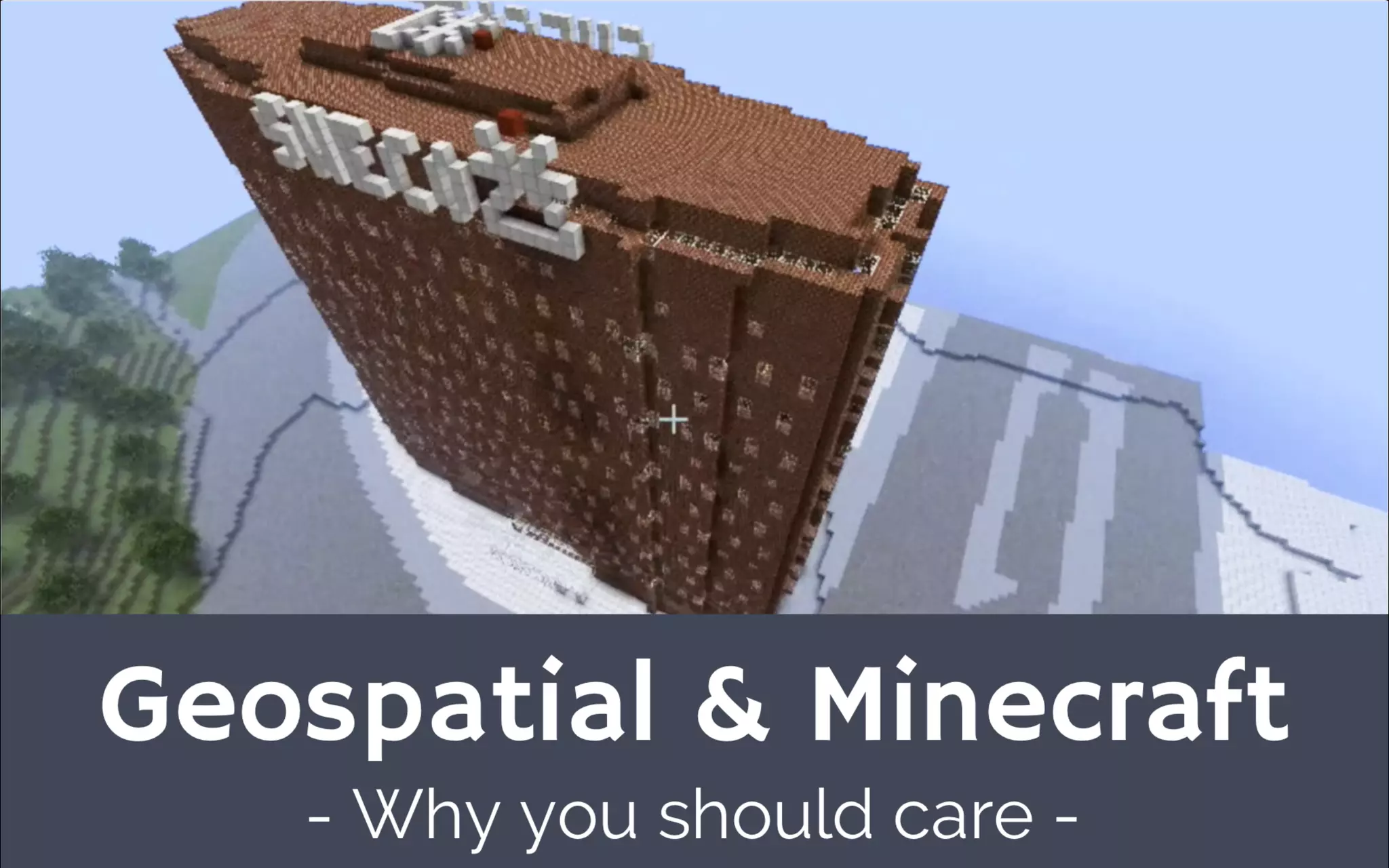

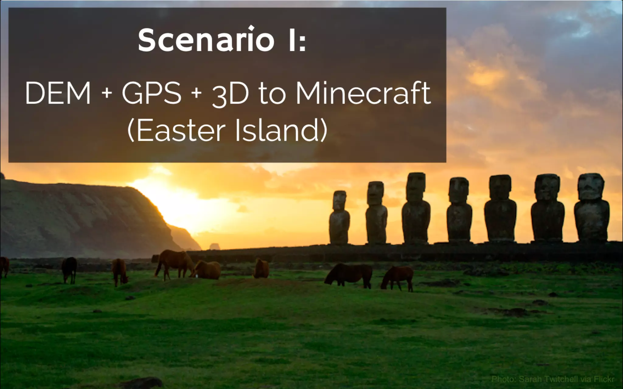
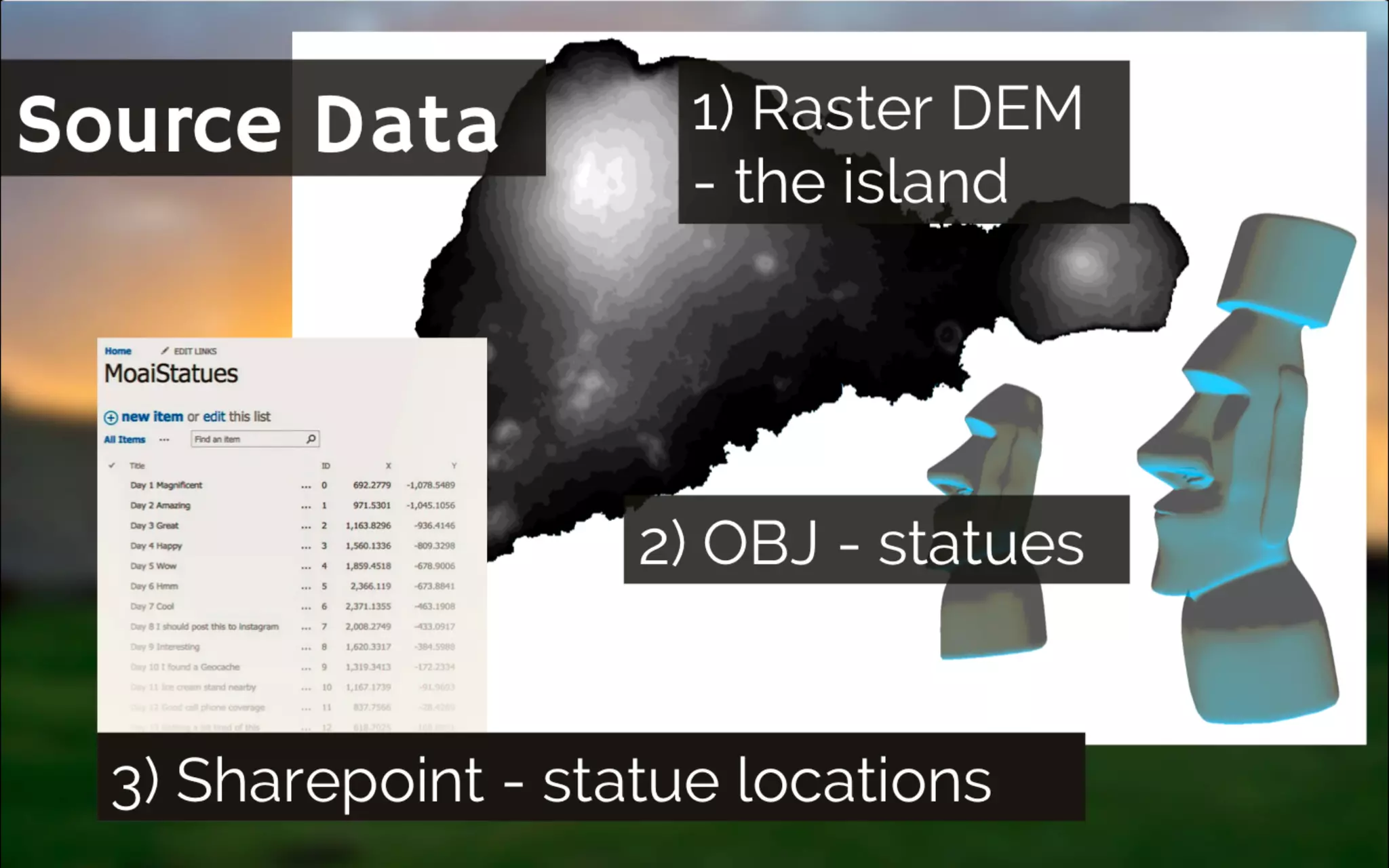
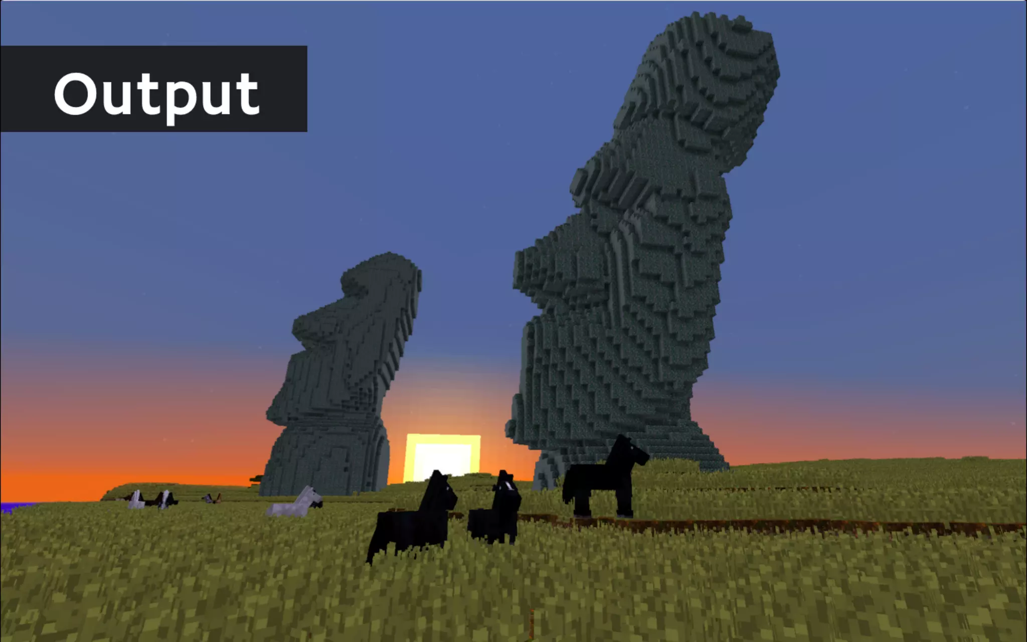
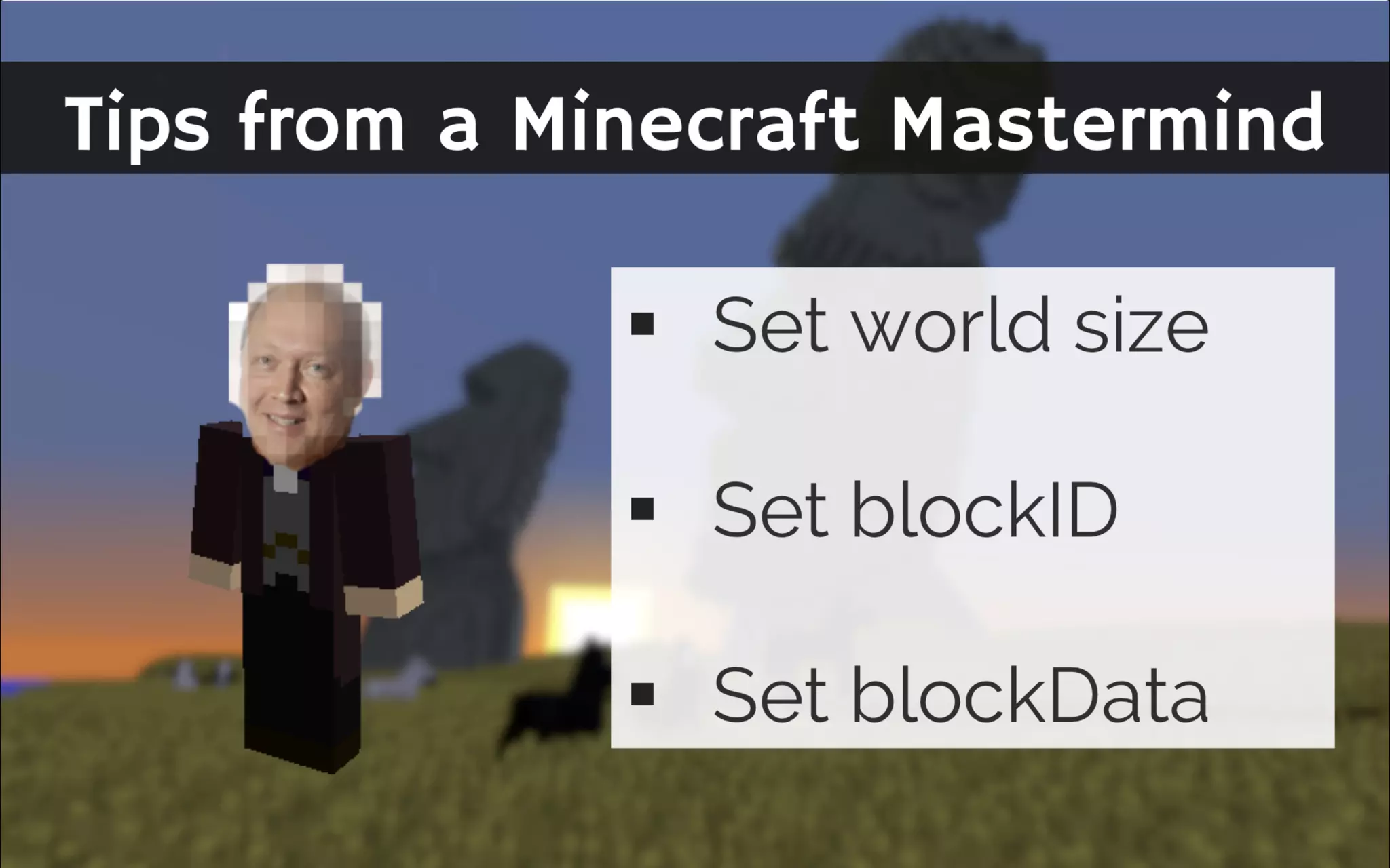
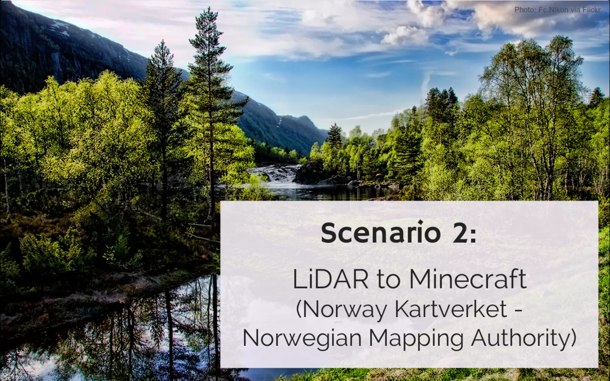
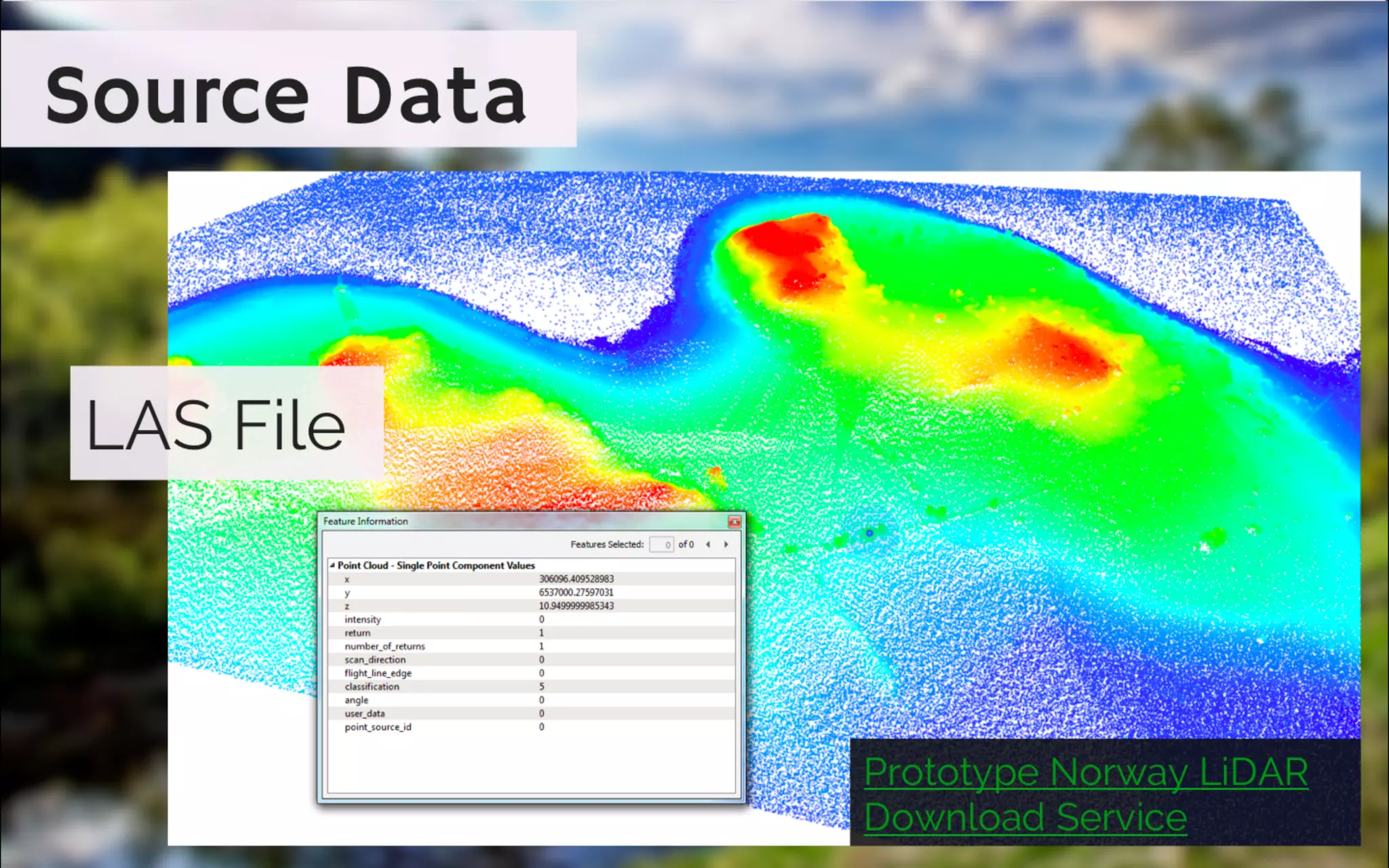
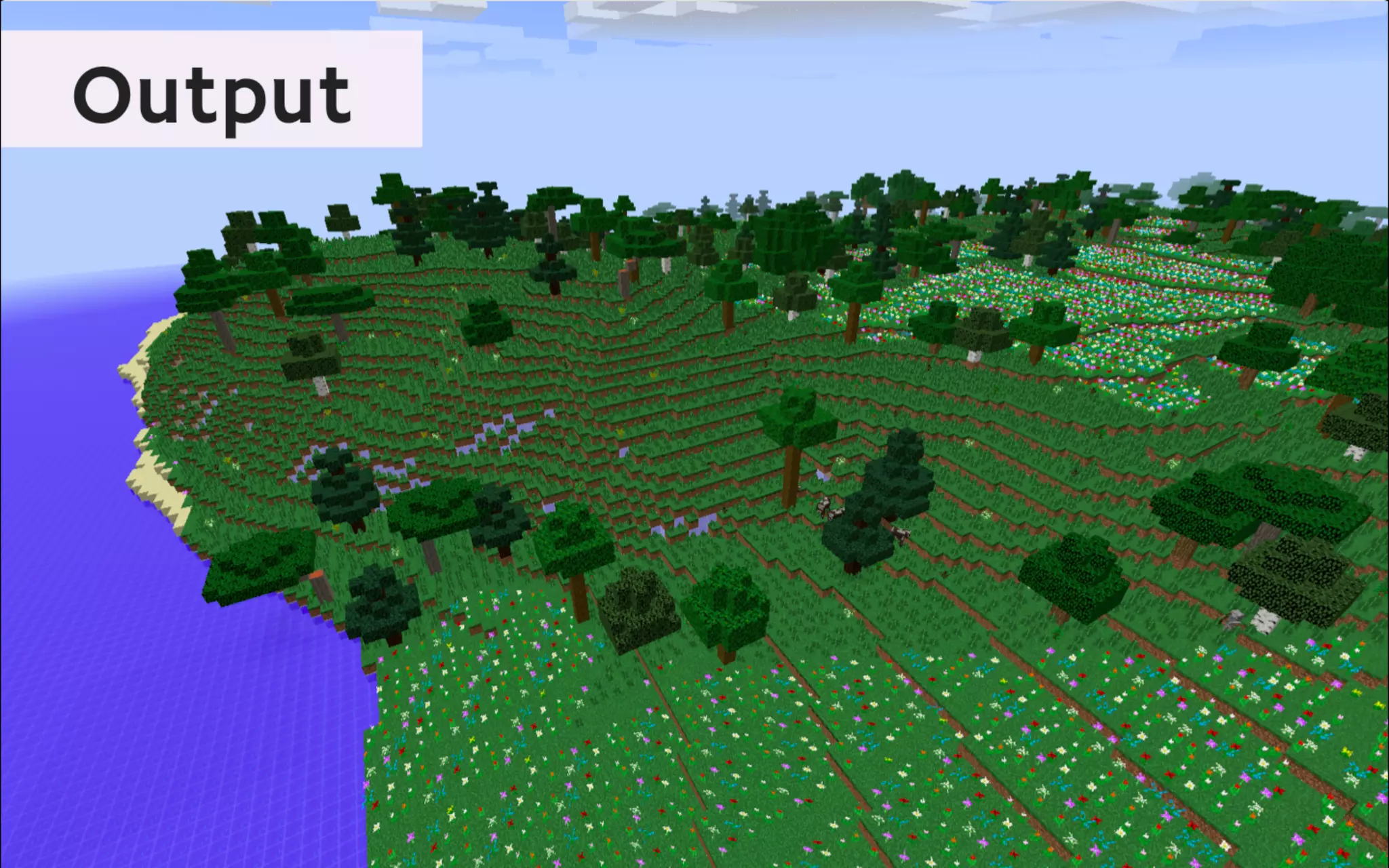
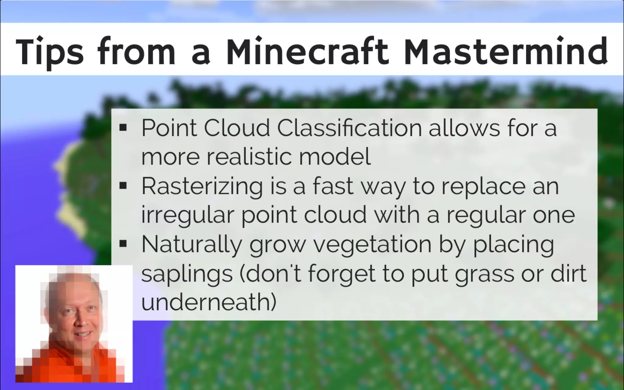
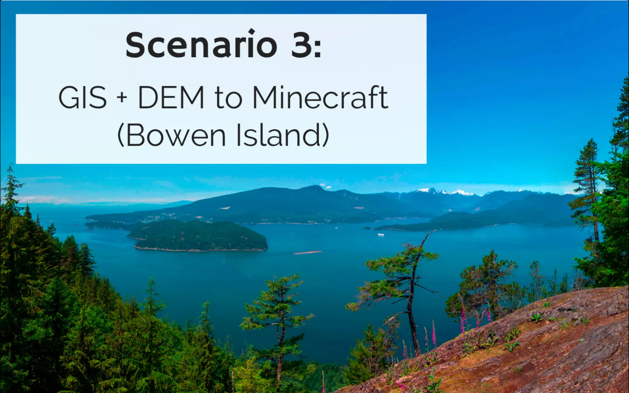
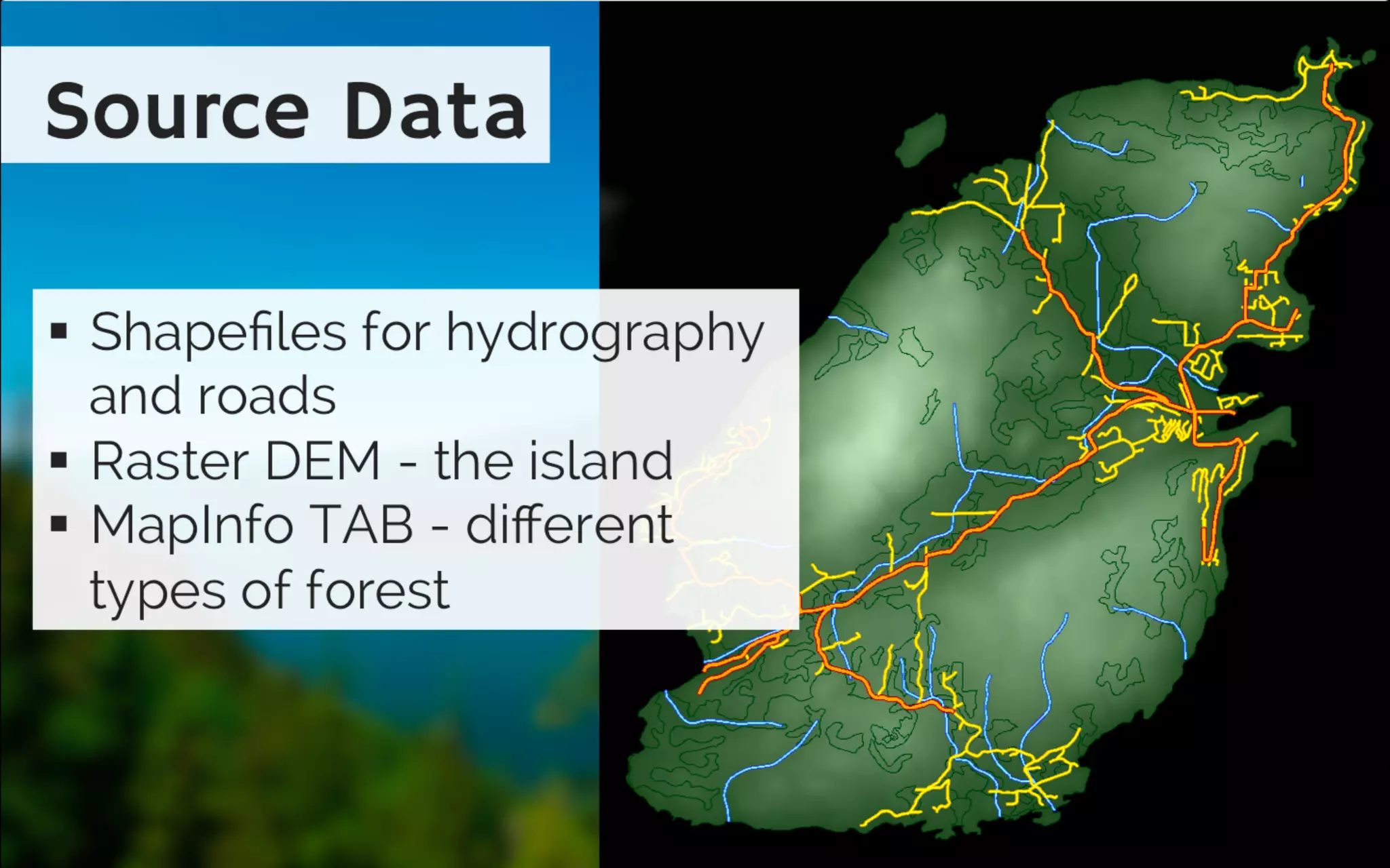
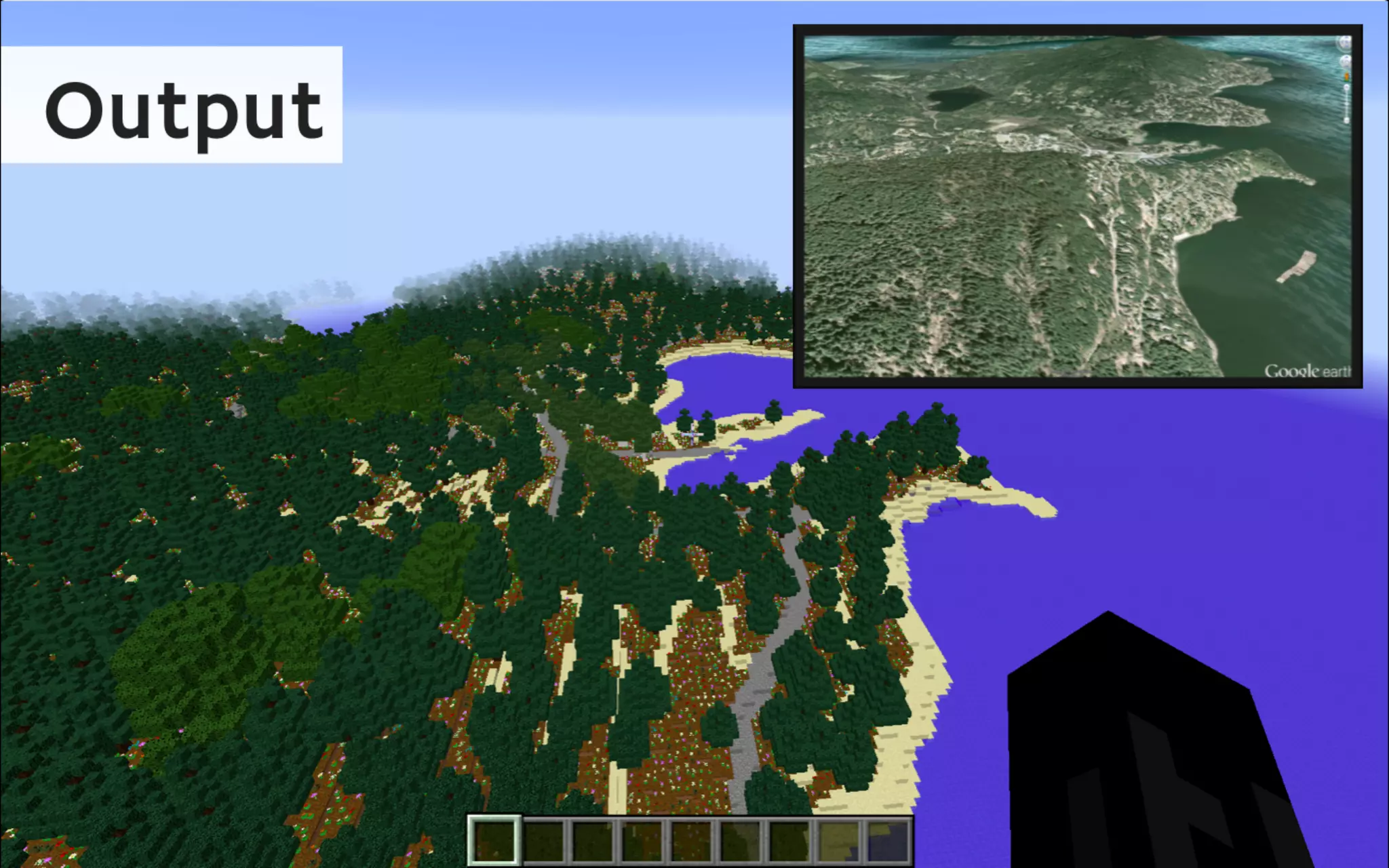
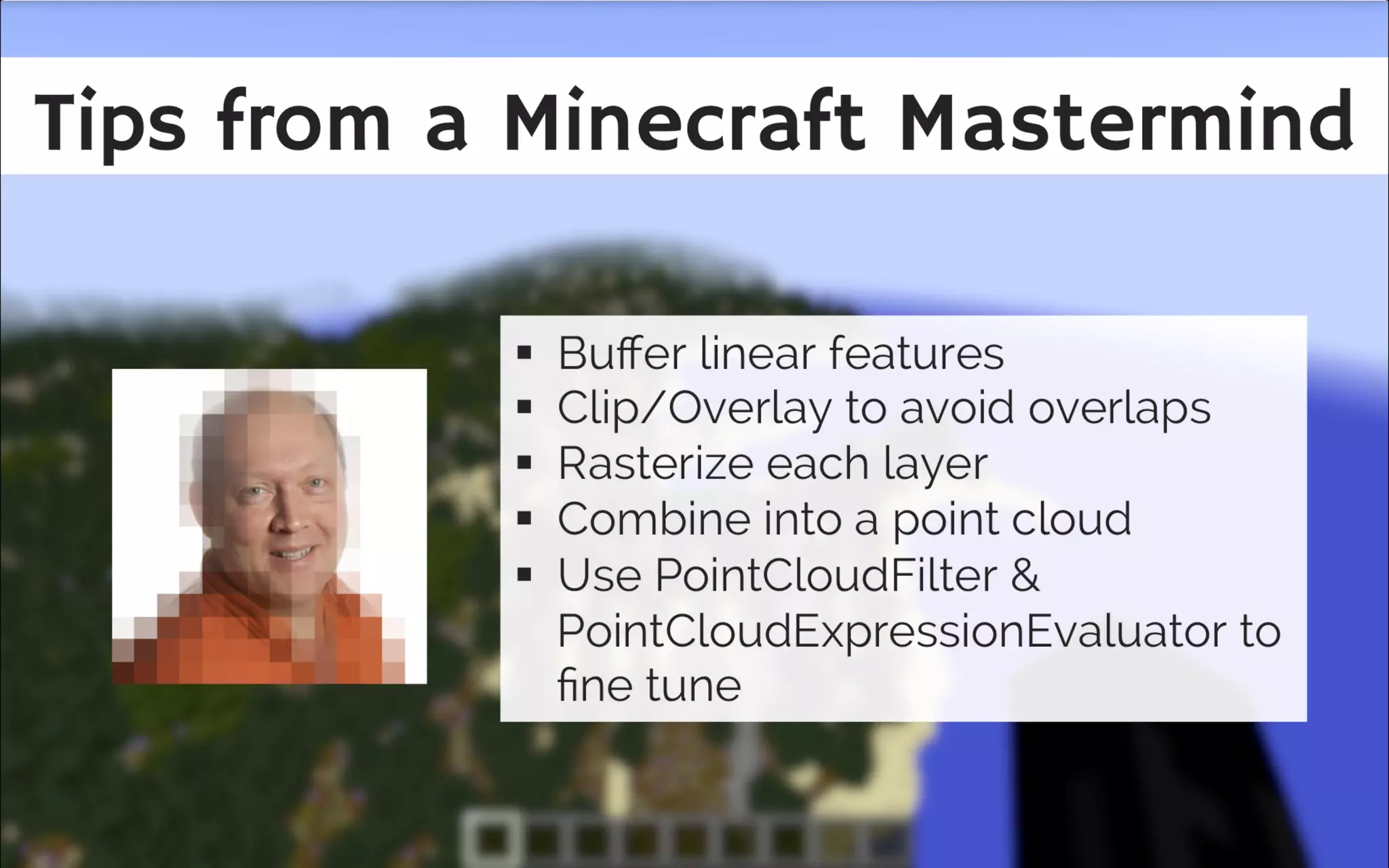
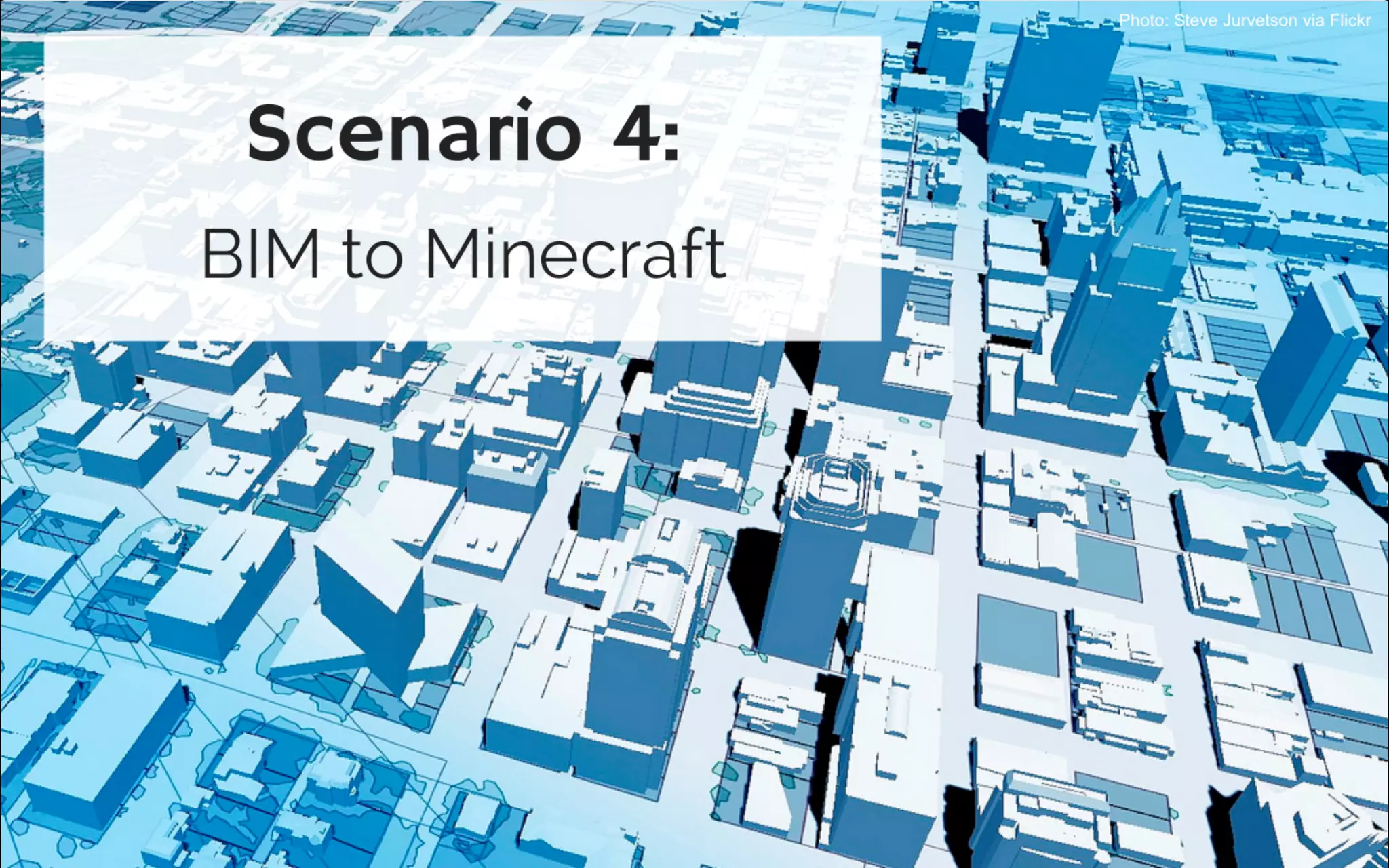
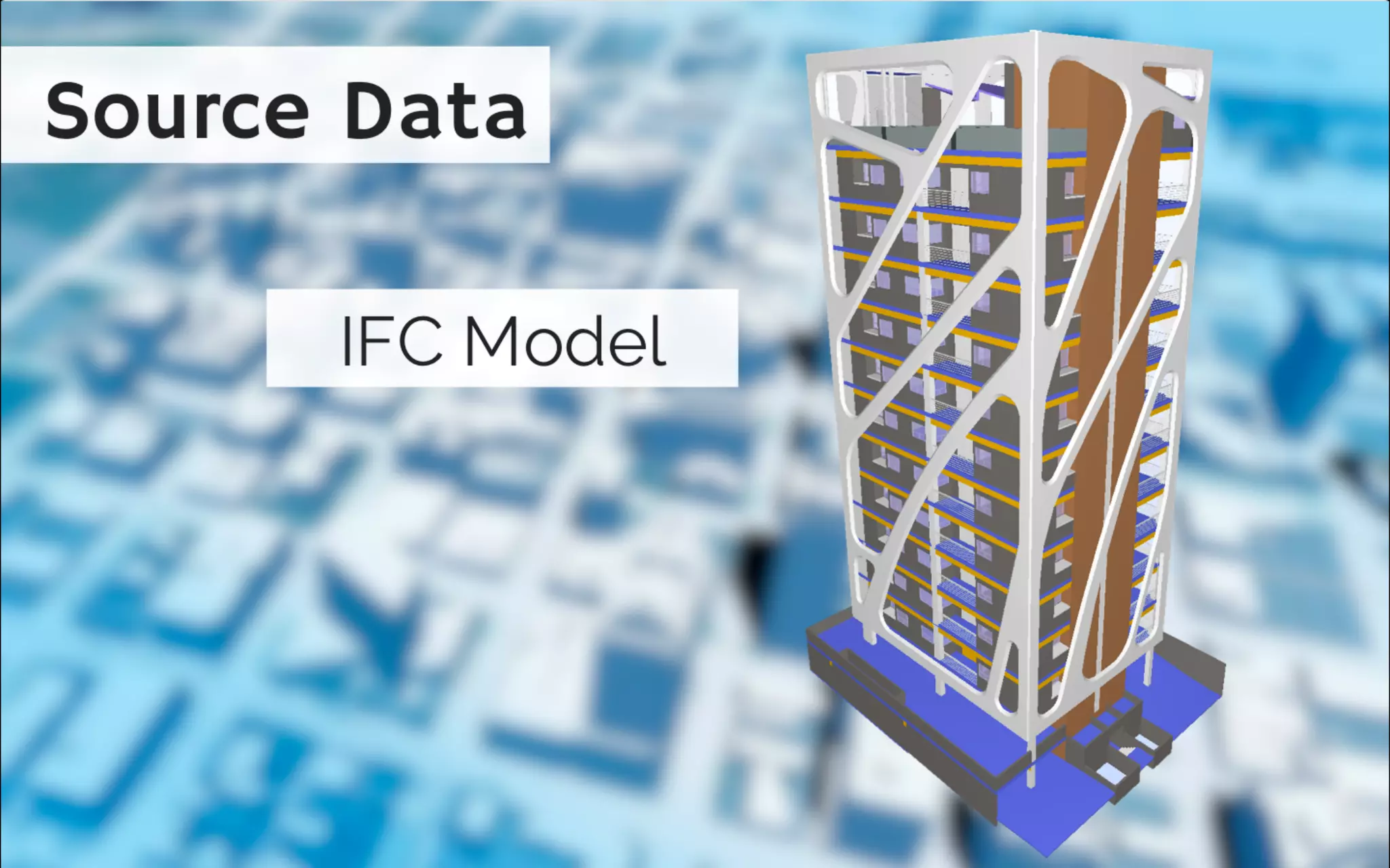
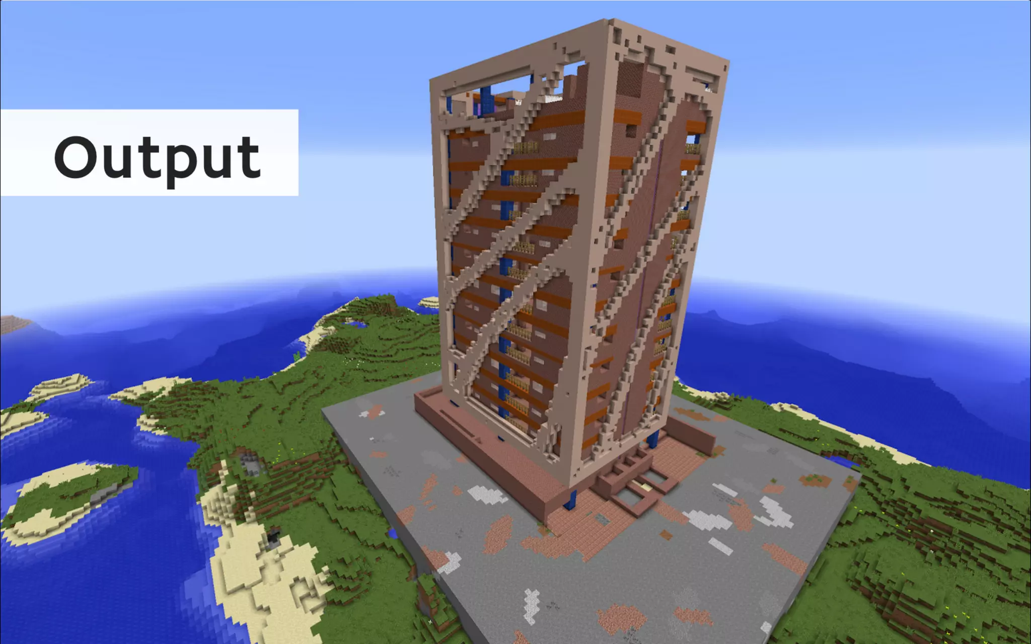
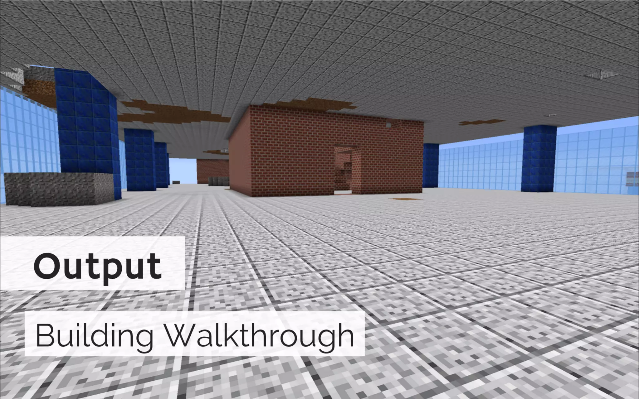
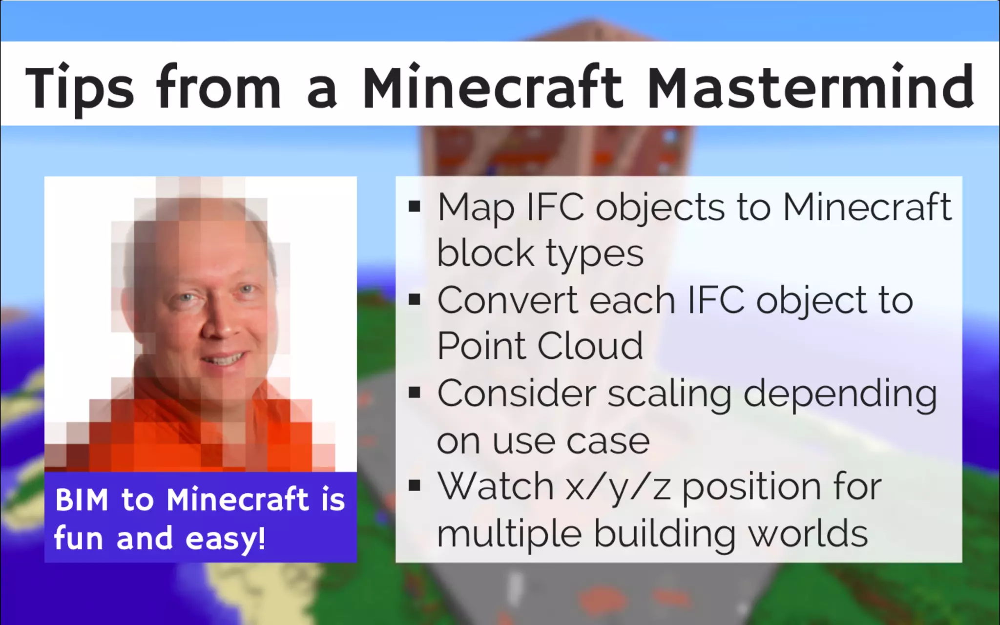
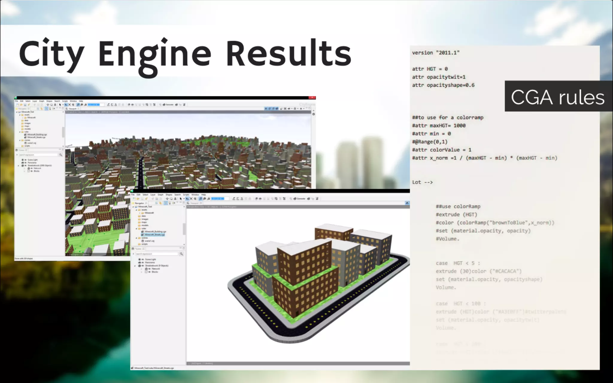
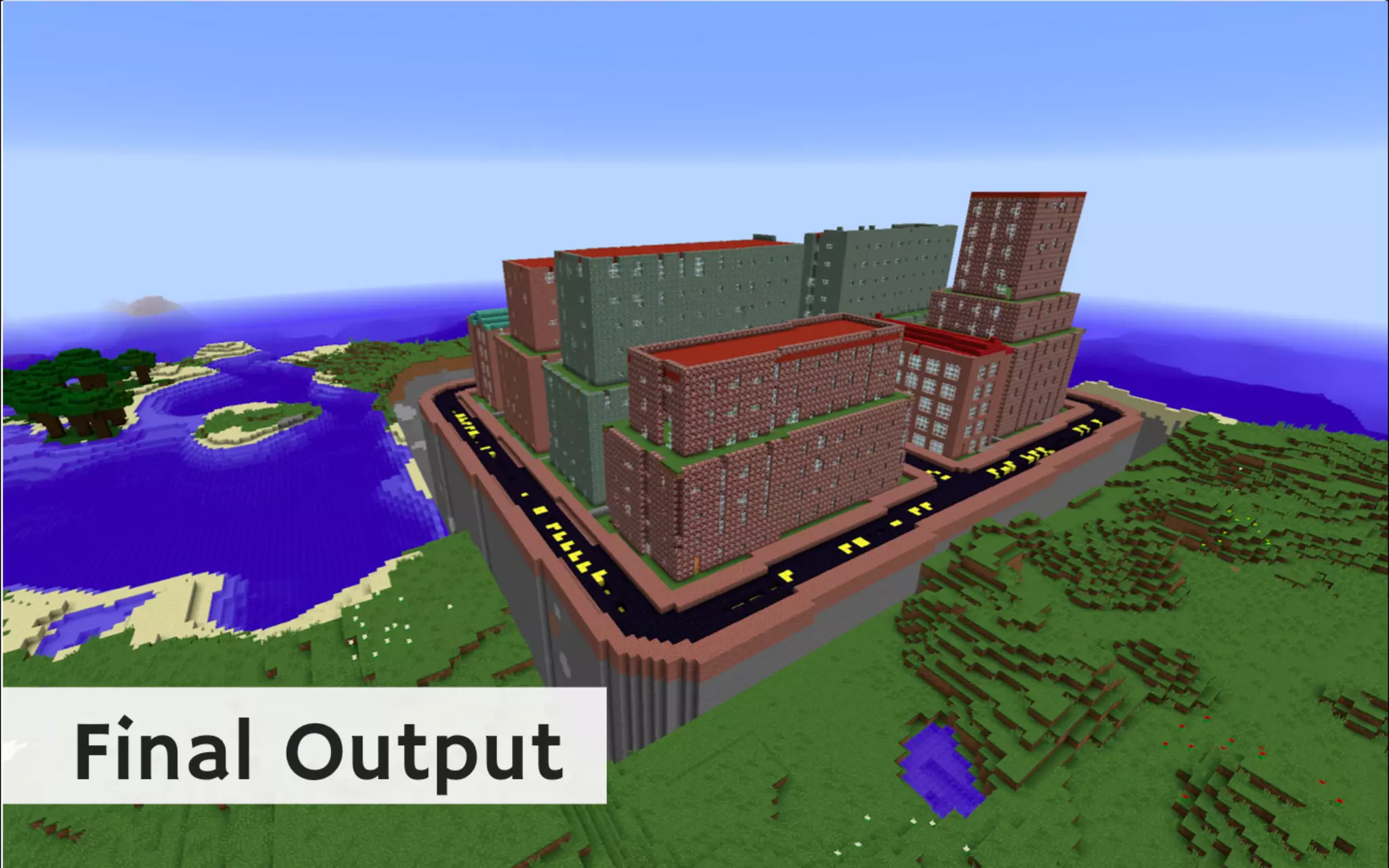
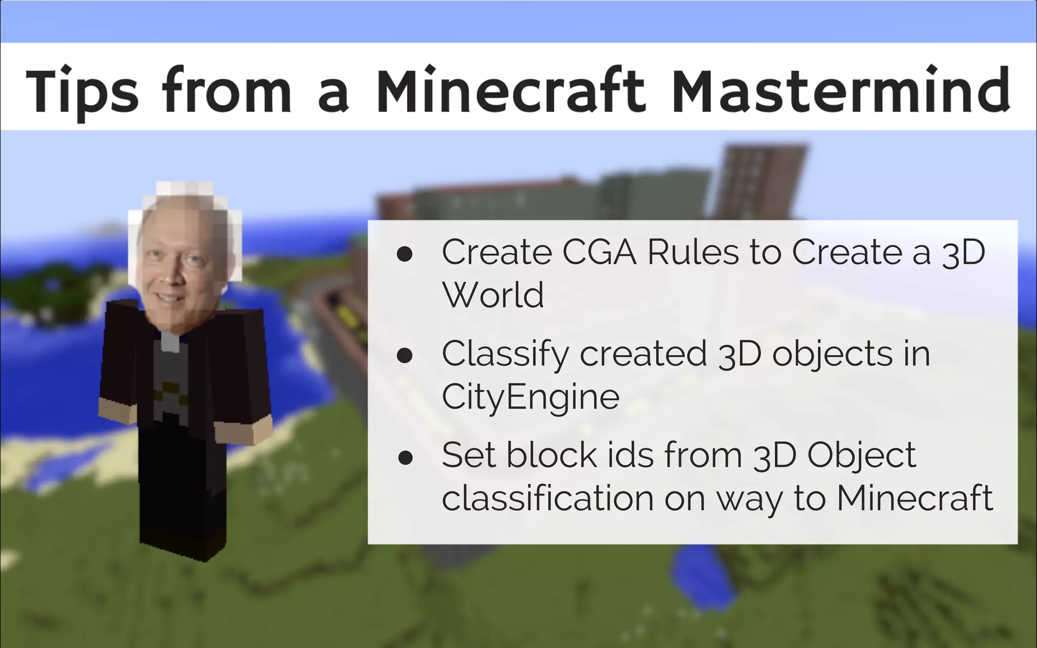

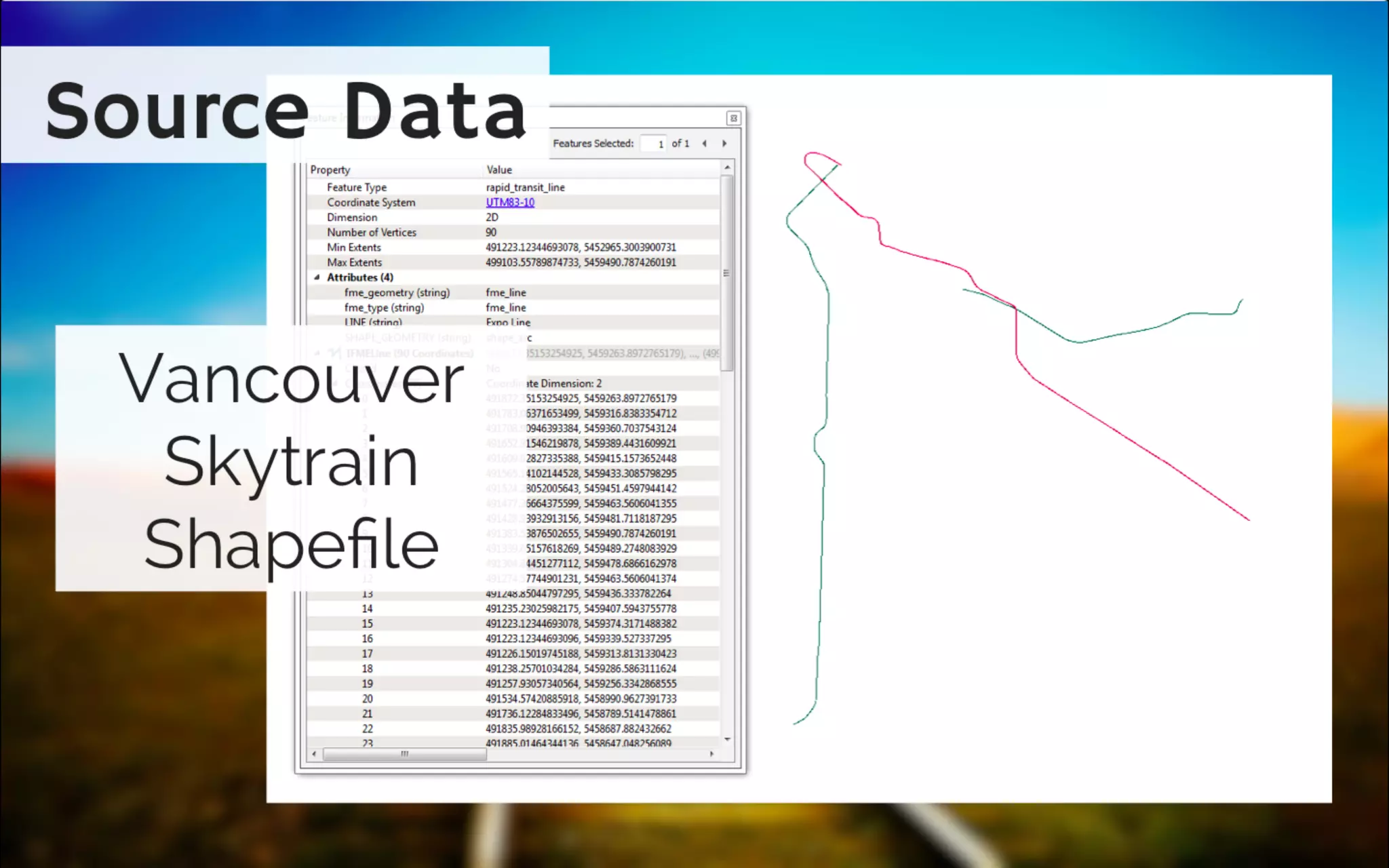
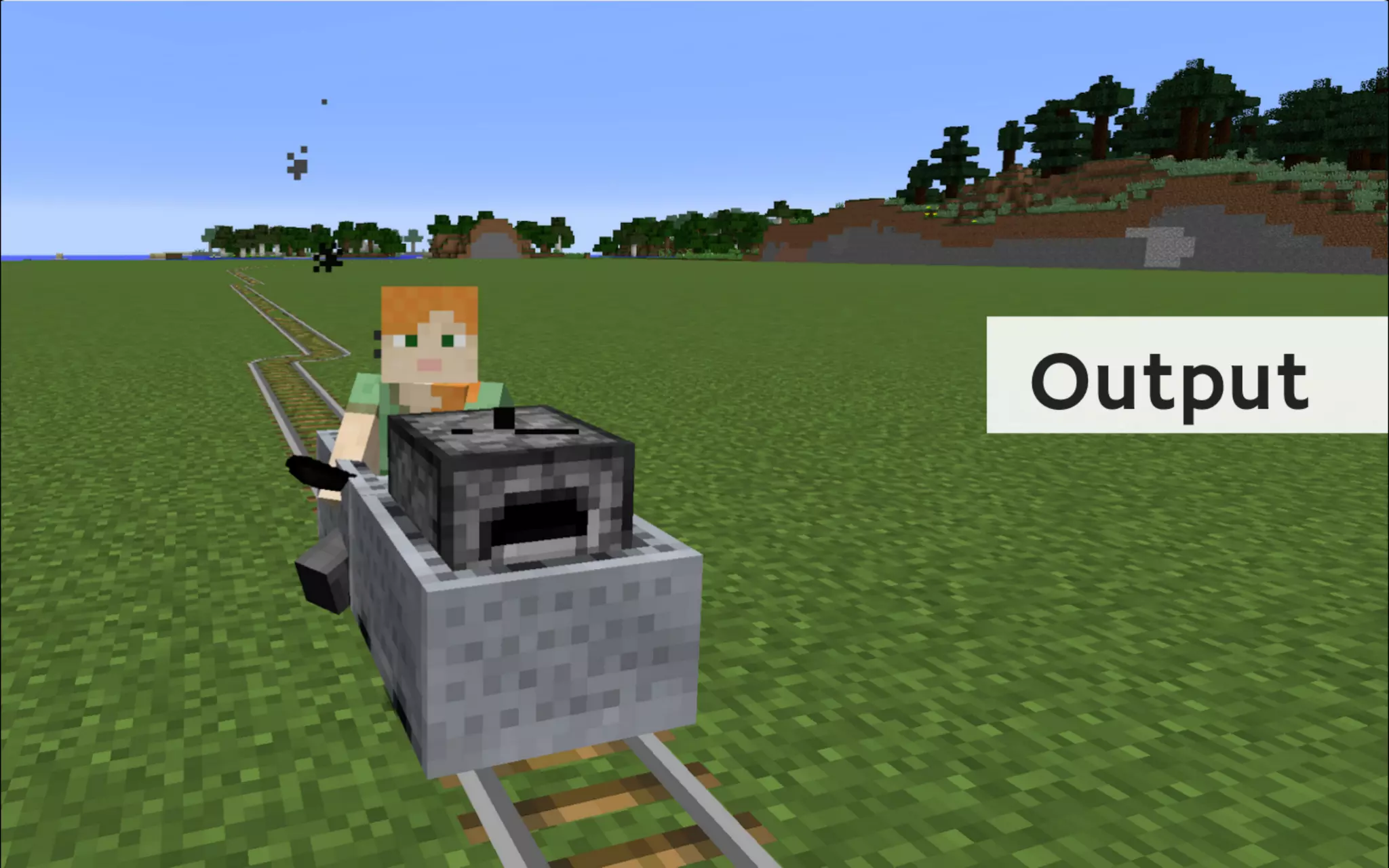
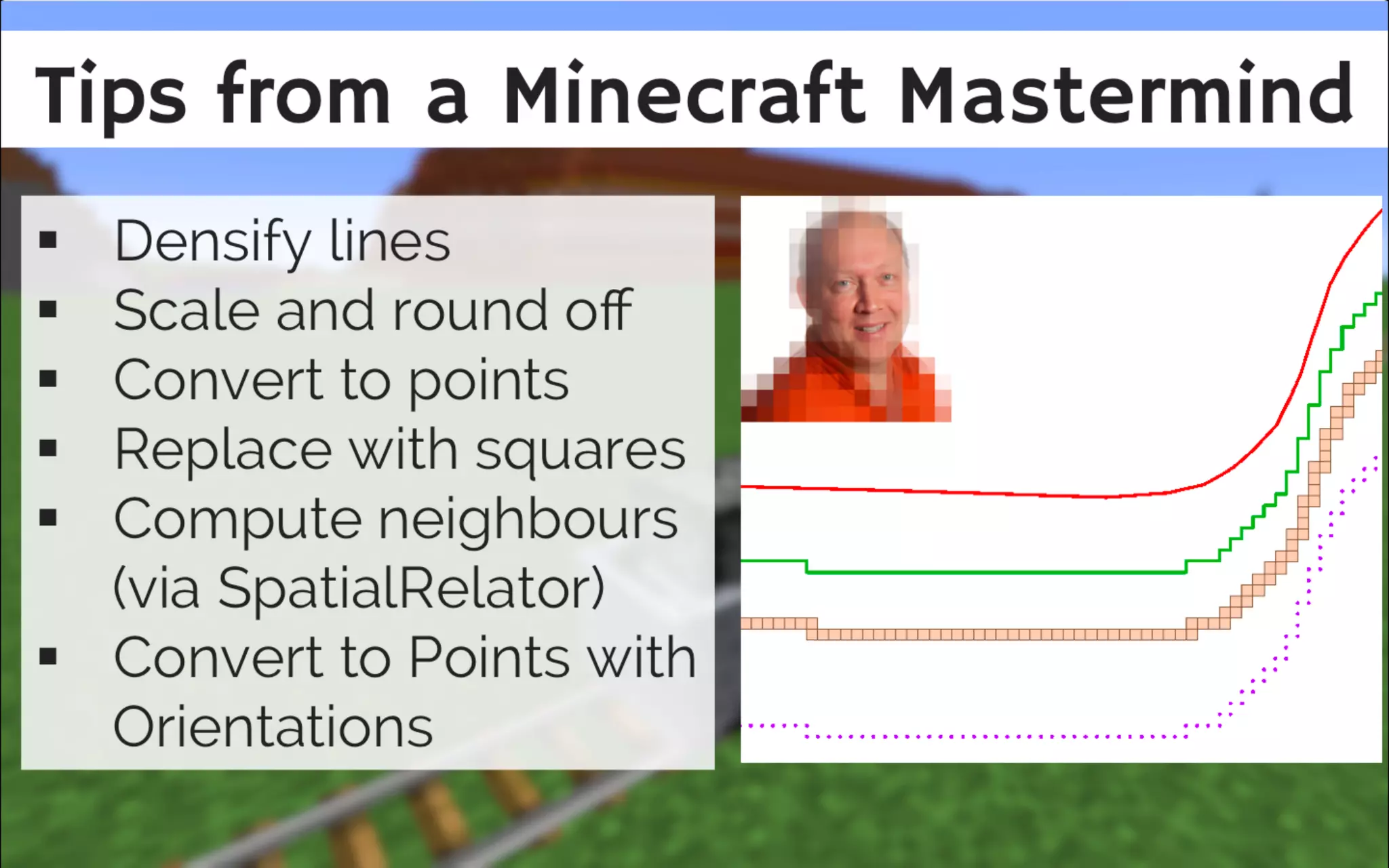
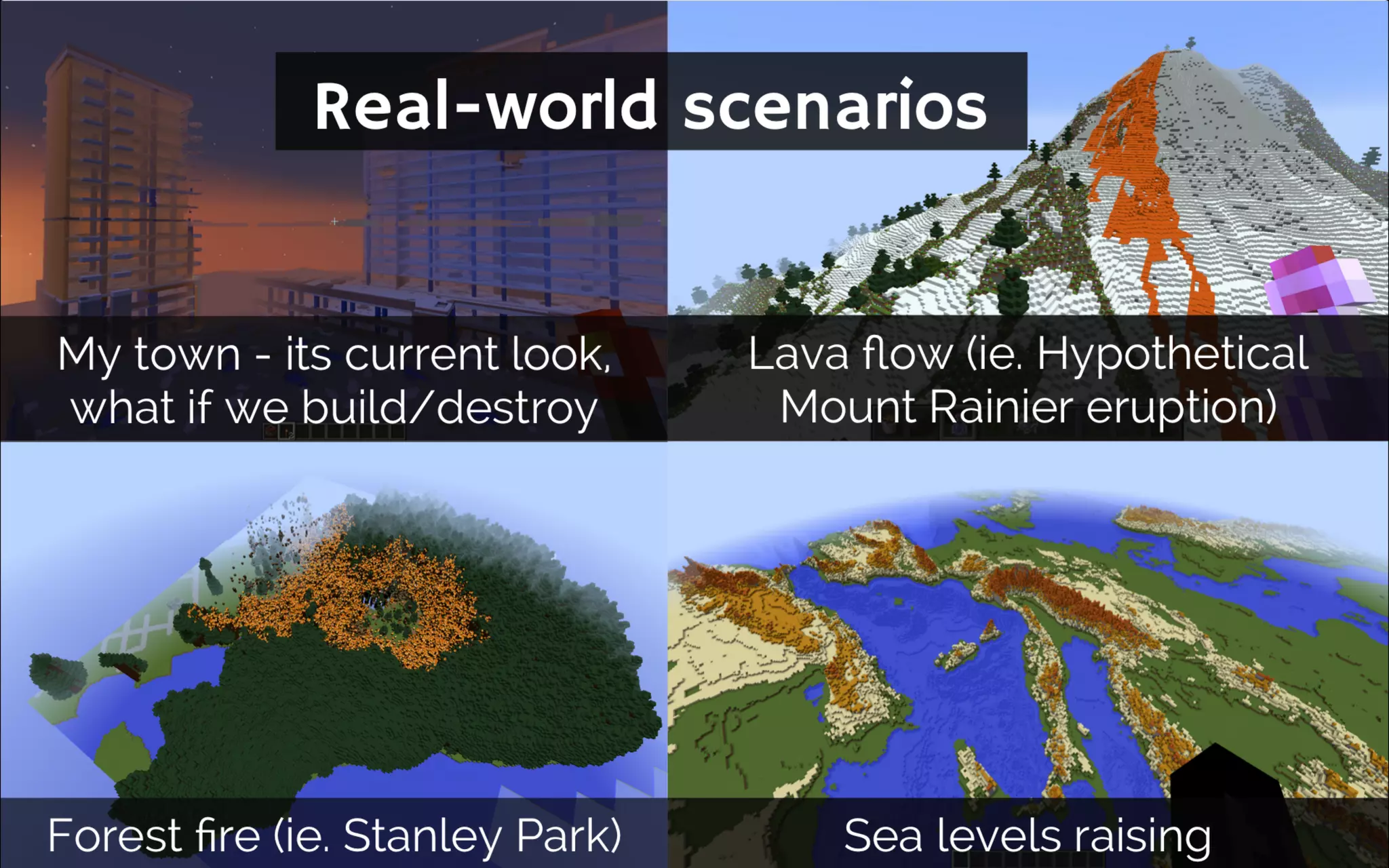
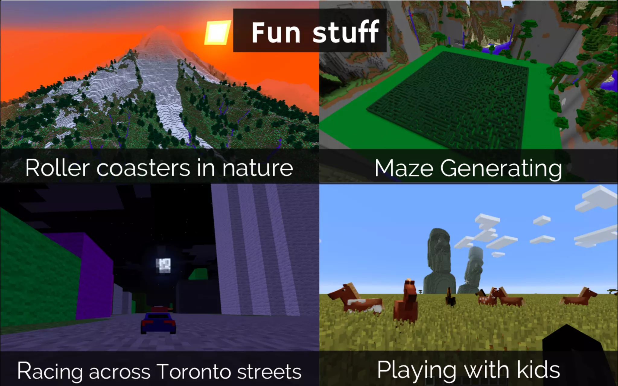
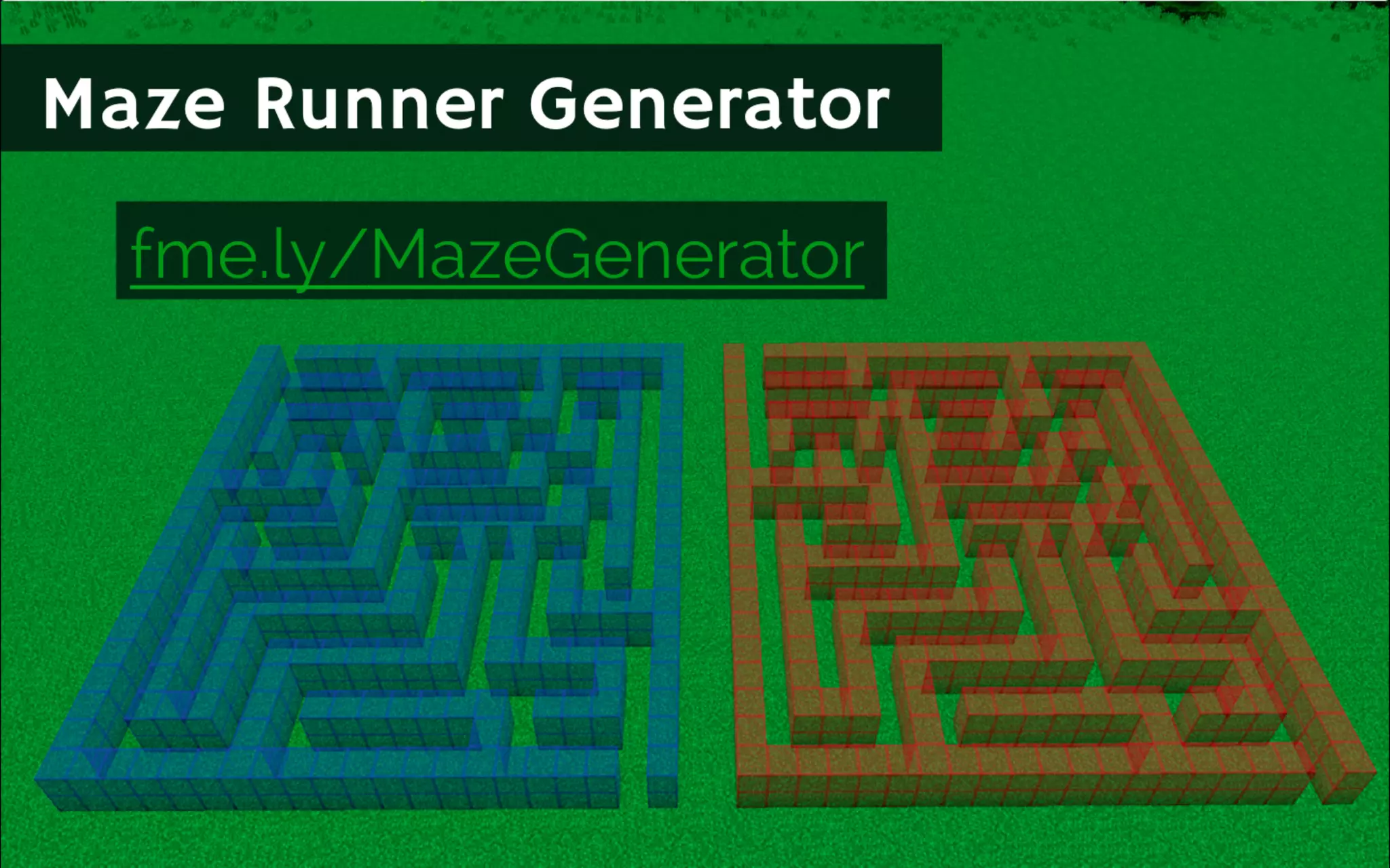
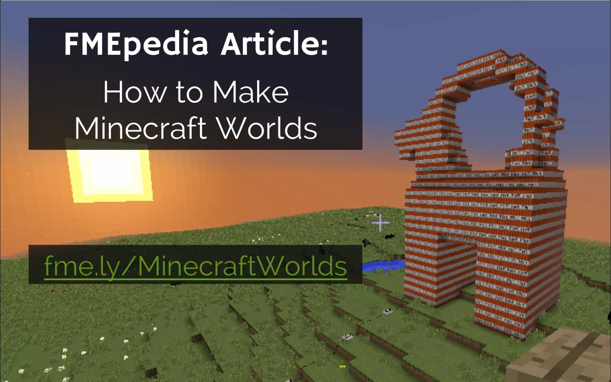


The document discusses various scenarios for integrating geospatial data into Minecraft, including examples from Easter Island, Norway, Bowen Island, and BIM models. It provides insights on processing different data types like raster DEMs and shapefiles, along with tips for effectively using these data in Minecraft, such as rasterizing point clouds and applying spatial analysis. Additionally, it encourages participation in future webinars and includes resources for further learning.


![mosaci Caching Maps and Vector Tile Layers Best Practices tw_1765-371[1] .pptx](https://cdn.slidesharecdn.com/ss_thumbnails/mosacicachingmapsandvectortilelayersbestpracticestw1765-3711-240715032039-75c41496-thumbnail.jpg?width=640&height=640&fit=bounds)


![Vibe Coding vs. Spec-Driven Development [Free Meetup]](https://cdn.slidesharecdn.com/ss_thumbnails/vibecodingvsspecdrivendevelopment-251209105622-43f455e7-thumbnail.jpg?width=640&height=640&fit=bounds)


