GeoSolutions has been involved into a number of projects, ranging from local administrations to global institutions, involving GeoNode deployments, customizations and enhancements. A gallery of projects and use cases will showcase the versatility and effectiveness of GeoNode, both as a standalone application and as a service component, for building secured geodata catalogs and web mapping services. Lastly, ongoing and future developments will be presented ranging from the upcoming integration with MapStore to the monitoring and analytics dashboard or the support for time series data.
MapStore 2, modern mashups with OL3, Leaflet and ReactGeoSolutions
MapStore 2 is an overhaul of the existing MapStore with the goal of creating a webmapping framework which is more lightweight but still modular and easy to work with. It can leverage both OpenLayers 3 or Leaflet as the mapping engine and uses ReactJS and Redux as the core JavaScript libraries. Moreover a 3D viewer based on CesiumJS is available.
MapStore 2 is both a framework and a standalone application. You can use it as a framework to develop your custom WebGis application composing MapStore ReactJS components and components from other libraries (like React Bootstrap), choosing the best mapping library for your purposes. You can also use the MapStore2 application directly, to create, save, and share in a simple and intuitive way maps and mashups created by selecting content from the server such as Google Maps, OpenStreetMap or WMS and WMTS.
The MapStore 2 application consists of two main components MapManager and GeoStore, respectively front-end and back-end. MapManager allows through a unique interface to create, modify, delete and search on maps definition as well as generate a univoque link to embed a map in an external website, share your own maps with the others. GeoStore implements a flexible Java Enterprise infrastructure to manage and search maps with proper management of authentication and authorization.
The presentation will give the audience an extensive overview of the MapStore 2 functionalities for the creation of mapping portals. Eventually, a range of GeoSolutions case studies of MapStore 2 will be presented.
Webinar: DataStax Enterprise 5.0 What’s New and How It’ll Make Your Life EasierDataStax
Want help building applications with real-time value at epic scale? How about solving your database performance and availability issues? Then, you want to hear more about DataStax Enterprise 5.0. Join this webinar to learn what’s new in DSE 5.0 ‒ the largest software release to date at DataStax. DSE 5.0 introduces multi-model support including Graph and JSON data models along with a ton of new and enhanced enterprise database capabilities.
View webinar recording here: https://youtu.be/3pfm4ntASJ0
Enable Scalable, Intelligent
File Access and Management. Like most organizations today, yours is required to search millions of electronic records for audit and legal discovery. However, sprawling infrastructure and decentralized control with separate management tools make it difficult to search across the enterprise. Now, more than ever, powerful search engines are a must for your increasing unstructured data and content repositories.
DevOps implementation for a leading global consulting CompanyAspire Systems
The customer was designing their services in creating digital strategies, laying out the road map and helping organizations by working toward their digital transformation. As an essential component of the plan, they wanted a thorough DevOps implementation with complete automation of their processes and a rigorous Continuous Integration and Continuous Delivery (CI/CD) system in place.
Best Practices for Cloud Native Applications using Hybrid AzureCapgemini
Learn how Sogeti is using HPE Proliant for Microsoft Azure to distribute new workloads across public/private environments. The presentation shares best practices to distribute applications across Azure environments and accelerate innovation. We also discuss customer roadmaps that emphasize “cloud first” applications, while maintaining specific on-premises concerns or needs for flexibility by addressing data sovereignty, regulations, latency or disconnected environments.
Unveiling Five Best Node JS Frameworks that Are Rocking 2022 StageDit_India
Top 5 Best Node JS frameworks to know for Web and App Development. Have a walkthrough the post and explore each in details to get a 360 idea of the frameworks.
SDS, is a global IT company providing broad range of Technology Consulting, Professional and Outsourcing Services & Solutions to Fortune500 and mid-size companies. SDS, shares over two decades of expertise in successful deployment of IT projects and meeting the talent needs for companies for high quality IT resources through staff augmentation, contractual staffing and managed services program.
SDS, business model of ‘Global Services’ provides clients with the flexibility of time, cost and resources to execute their business needs to fulfilment. SDS’s ability to service from multiple locations coupled with distinct personalization to our clients creates and fosters long term relationships.
Teaming with SDS, helps companies capitalize on the new market opportunities by providing the right mix of services, products, and programs. SDS, puts the client and its employees at the centre of all the business operations and processes.
And…SDS, a Minority Woman owned Small Business Enterprise (MBE/WBE/SBE).’
In diesem OC|Webcast (deutschsprachig) erwartet Sie ein spannender Einblick in die Arbeitsweise der DevOps-Entwicklungsumgebung OpenDevStack. Die Open-Source-Plattform basiert auf Red Hat OpenShift und Atlassian. Die Idee dazu entstand in einer innovativen Projektarbeit von OPITZ CONSULTING und Boehringer Ingelheim. Seitdem wird die Plattform aus der Praxis für die Praxis stetig weiterentwickelt.
Mithilfe von OpenDevStack können Ihre Entwickler Innovationsprojekte schnell aufsetzen, testen und betreuen. Mit der kompletten Projekt-Delivery-Pipeline, auf Knopfdruck in weniger als drei Minuten. So ist ein schneller Projektstart möglich. Dabei werden alle Compliance-Vorgaben komplett berücksichtigt. Die Verankerung in der Unternehmens-IT erfolgt so später völlig reibungslos. Und last but not least werden die Entwickler entlastet und können den Freiraum für die Softwareentwicklung nutzen.
In diesem Webcast schauen wir hinter die Kulissen und zeigen Ihnen, wie der OpenDevStack arbeitet:
* Wie läuft die saubere Integration von der Projektprovisionierung bis zur Auslieferung verschiedene Werkzeuge konkret ab?
* Wie managt die Plattform die notwendigen Prozesse – vom Aufsetzen der Projekte im Atlassian Stack, über die Erzeugung der Projektumgebung in OpenShift und Einrichtung einer Build Pipeline unter Integration von Jenkins, Sonarqube und anderen CI/CD Tools?
Im Anschluss erwartet Sie ein spannender Praxisbericht:
* Boehringer Ingelheim gewährt einen Einblick in fast 2,5 Jahre produktiven Einsatz von OpenShift und OpenDevStack.
- - - -
DIE REFERENTEN
Richard Attermeyer, OPITZ CONSULTING Deutschland GmbH
Clemens Utschig-Utschig, Boehringer Ingelheim RCV GmbH & Co KG
MapStore 2 is an Open Source webmapping framework which uses ReactJS, Redux, OpenLayers, Leaflet and Cesium.
It supports various OGC Protocols like CSW, WMS, WFS and WMTS and allows end users to create charts and dashboards thanks to its integration with GeoServer.
This presentation has been prepared with the objective to give readers a quick introduction to the Open Source GeoNode platform and its functionalities for the creation of a Spatial Data Infrastructure completely based on open Source components.
Serving earth observation data with GeoServer: addressing real world requirem...GeoSolutions
Information on the latest developments in GeoServer for the support for Earth Observation data with support for the various OGC services and OpenSearch.
This presentation goes over the most important features of GeoServer in order to give the reader an intro about what is good and what is super-good about GeoServer!
The current version reflects the presentation given at FOSS4G 2017 in Boston.
State of GeoServer provides an update on our community and reviews the new and noteworthy features for the Project. The community keeps an aggressive six month release cycle with GeoServer 2.11 and 2.12 being released this year. Each releases bring together exciting new features. This year a lot of work has been done on startup times, large catalogs, REST configuration upgrades, styling languages, styling interface, security,just to name a few. We will also take a look at community research into satellite imagery search and delivery, multi-resolution raster support and more. Attend this talk for a cheerful update on what is happening with this popular OSGeo project. Whether you are an expert user, a developer, or simply curious what these projects can do for you, this talk is for you.
State of GeoServer provides an update on our community and reviews the new and noteworthy features for the Project. The community keeps an aggressive six month release cycle with GeoServer 2.8 and 2.9 being released this year.
Each releases bring together exciting new features. This year a lot of work has been done on the user interface, clustering, security and compatibility with the latest Java platform. We will also take a look at community research into vector tiles, multi-resolution raster support and more.
Attend this talk for a cheerful update on what is happening with this popular OSGeo project. Whether you are an expert user, a developer, or simply curious what these projects can do for you, this talk is for you.
Creating Stunning Maps in GeoServer: mastering SLD and CSS stylesGeoSolutions
Various software can style maps and generate a proper SLD document for OGC compliant WMS like GeoServer to use. However, in most occasions, the styling allowed by the graphical tools is pretty limited and not good enough to achieve good looking, readable and efficient cartographic output. For those that like to write their own styles CSS also represents a nice alternatives thanks to its compactness and expressiveness.
Several topics will be covered, providing examples in both SLD and CSS for each, including: mastering multi-scale styling, using GeoServer extensions to build common hatch patterns, line styling beyond the basics, such as cased lines, controlling symbols along a line and the way they repeat, leveraging TTF symbol fonts and SVGs to generate good looking point thematic maps, using the full power of GeoServer label lay-outing tools to build pleasant, informative maps on both point, polygon and line layers, including adding road plates around labels, leverage the labeling subsystem conflict resolution engine to avoid overlaps in stand alone point symbology, blending charts into a map, dynamically transform data during rendering to get more explicative maps without the need to pre-process a large amount of views.
The presentation aims to provide the attendees with enough information to master SLD/CSS documents and most of GeoServer extensions to generate appealing, informative, readable maps that can be quickly rendered on screen.
Serving earth observation data with GeoServer: addressing real world requirem...GeoSolutions
The presentation will cover GeoSolutions experience in setting up GeoServer based production systems providing access to earth observation products, with indications of technical challenges, solutions, and deployment suggestion. The presentations will cover topics such as setting up a single unified mosaic from all the available data sources, tailoring access to it to different users, determining the most appropriate stacking order, dealing with multiresolution, different coordinate systems, multiband data, SAR integration, searching for the most appropriate products using a mix of WFS, CSW and so on, serving imagery with high performance WMS and WMTS, performing small and large data extractions with WCS and WPS, closing up with deployment examples and suggestions.
Mastering Security with GeoServer and GeoFence - FOSS4G EU 2017GeoSolutions
The presentation will provide an introduction to GeoServer own authentication and authorization subsystems. We’ll cover the supported authentication protocols, such as from basic/digest authentication and CAS support, check through the various identity providers, such as local config files, database tables and LDAP servers, and how it’s possible to combine the various bits in a single comprehensive authentication tool, as well as providing examples of custom authentication plugins for GeoServer, integrating it in a home grown security architecture. We’ll then move on to authorization, describing the GeoServer pluggable authorization mechanism and comparing it with proxy based solution, and check the built in service and data security system, reviewing its benefits and limitations. Finally we’ll explore the advanced authentication provider, GeoFence, explore the levels on integration with GeoServer, from the simple and seamless direct integration to the more sophisticated external setup, and see how it can provide GeoServer with complex authorization rules over data and OGC services, taking into account the current user, OGC request and requested layers to enforce spatial filters and alphanumeric filters, attribute selection as well as cropping raster data to areas of interest.
GeoServer in Production: we do it, here is how!GeoSolutions
The presentation will describe how to setup a production system based on GeoServer from the points of view of performance, availability and security. The suggestions will start covering how a single node GeoServer should be prepared for internet usage, tuning logging, connection pools, security, data and JVM preparation, keeping disk, memory and CPU usage in check within the limits of the available resources. We’ll then move to tools used to monitor the production instances, ranging from probes to request auditing and watch-dogs. Finally the presentation will cover setting up a cluster of server and the strategies for keeping them in synch, from the traditional multi-tier setup (testing vs production) to the systems that need to keep an ever evolving catalog of layers constantly on-line and in synch.
Crunching Data In GeoServer: Mastering Rendering Transformations, WPS Process...GeoSolutions
This presentation will provide the attendee with an introduction to data processing in GeoServer by means of WPS, rendering transformations and SQL views, describing real applications and how these facilities were used in them.
We'll start with the basic WPS capabilities, showing how to build processing request based on existing processes and how to build new processes leveraging scripting languages, and introducing unique GeoServer integration features, showing how processing can seamlessly integrate directly in the GeoServer data sources and complement existing services.
We'll also discuss how to integrate on the fly processing in WMS requests, achieving high performance data displays without having to pre-process the data in advance, and allowing the caller to interactively choose processing parameters.
While the above shows how to make GeoServer perform the work, the processing abilities of spatial databases should not be forgotten, so we’ll show how certain classes of processing can be achieved directly in the database.
At the end the attendee will be able to easily issue WPS requests both for Vectors and Rasters to GeoServer through the WPS Demo Builder, enrich SLDs with on-the-fly rendering transformations and play with SQL views in order to create dynamic layers.
Advanced Security with GeoServer - FOSS4G 2015GeoSolutions
The presentation will provide an introduction to GeoServer own authentication and authorization subsystems. We’ll cover the supported authentication protocols, such as from basic/digest authentication and CAS support, check through the various identity providers, such as local config files, database tables and LDAP servers, and how it’s possible to combine the various bits in a single comprehensive authentication tool, as well as providing examples of custom authentication plugins for GeoServer, integrating it in a home grown security architecture.
We’ll then move on to authorization, describing the GeoServer pluggable authorization mechanism and comparing it with proxy based solution, and check the built in service and data security system, reviewing its benefits and limitations.
Finally we’ll explore the advanced authentication provider, GeoFence, explore the levels on integration with GeoSErver, from the simple and seamless direct integration to the more sophisticated external setup, and see how it can provide GeoServer with complex authorization rules over data and OGC services, taking into account the current user, OGC request and requested layers to enforce spatial filters and alphanumeric filters, attribute selection as well as cropping raster data to areas of interest.
Raster Data In GeoServer and GeoTools: Achievements, Issues And Future Develo...GeoSolutions
The purpose of this presentation is, on a side, to dissect the developments performed during last year as far as raster data support in GeoTools and GeoServer is concerned, while on the other side to introduce and discuss the future development directions.
Advancements and improvements for the management of multidimensional raster data (NetCDF, GRIB, HDF) and mosaic thereof will be introduced, as well as the available ways to manage sliding windows of data via the REST API and importer.
Extensive details will be provided on the latest updates for the management of multidimensional raster data used in the Remote Sensing and MetOc fields, including support for WCS EO and WMS EO, and some considerations on the WCS MetOc extensions.
The presentation will also introduce and provide updates on jai-ext, imageio-ext, and JAITools. jai-ext provides extended JAI operators that correctly handle NODATA and regione of interests (masks), JAITools provides a number of new raster data analysis operators, including powerful and fast raster algebra support, while ImageIO-Ext bridges the gap across the Java world and native raster data access libraries providing high performance access to GDAL, Kakadu and other libraries.
The presentation will wrap up providing an overview of unresolved issues and challenges that still need to be addressed, suggesting tips and workarounds allowing to leverage the full potential of the systems.
Mapping the world beyond web mercator - FOSS4G 2015GeoSolutions
Most popular mapping presentations today, ranging from clients to servers, show and discuss only maps in EPSG:3857, the popular Mercator derived projection used by OSM as well as
most commercial tiles providers.
There is however an interesting, exciting world of map projections out there, that are still being used in a variety of context. This presentation will introduce the advancement made in GeoTools and GeoServer to handle those use cases, where users have a worldwide data set, and need to view all or part of it in multiple projections, some of which valid in a limited area, and requiring the software to perform a proper display of it on the fly, without any preparation.
We’ll discuss GeoTools/GeoServer “advanced projection handling” manages to deal with these cases, wrapping data, dealing with the poles and the dateline, cutting on the fly excess data, densifying on the fly long lines as needed to ensure a smooth reprojection, for a variety of cases, ranging from seemingly innocuous datum shifts, maps having the prime meridian over the pacific, and the various tricks to properly handle stereographic, transverse mercator, Lambert conic and other limited area projections against world wide source data sets.
Setting up a GeoServer can sometimes be deceptively simple. However, going from proof of concept to production requires a number of steps to be taken in order to optimize the server in terms of availability, performance and scalability. The presentation will show how to get from a basic set up to a battle ready, rock solid installation by showing the ropes an advanced user already mastered.
GeoServer for Spatio-temporal Data Handling With Examples For MetOc And Remot...GeoSolutions
This presentation will provide detailed information on how to ingest and configure SpatioTemporal in GeoServer to be served using OGC services, with examples from WMS and WCS services.
Topics covered are as follows:
- Discussion over existing data formats and how to preprocess them for best serving with GeoServer
- Configuring SpatioTemporal raster and vector data in GeoServer
- Serving SpatioTemporal raster and vector data with OGC Services
- Tips and techniques to optimize performance and allow maximum exploitation of the available data
The attendees will be provided with the basic knowledge needed to preprocess and ingest the most common spatiotemporal data from the MetOc and Remote Sensing field for serving via GeoServer.
Advanced Cartographic Map Rendering in GeoServerGeoSolutions
Various software can style maps and generate a proper SLD document for OGC compliant WMS like GeoServer to use. However, in most occasions, the styling allowed by the graphical tools is pretty limited and not good enough to achieve good looking, readable and efficient cartographic output. For those that like to write their own styles CSS also represents a nice alternatives thanks to its compact-ness and expressiveness.
Several topics will be covered, providing examples in both SLD and CSS for each, including: mastering multi-scale styling, using GeoServer extensions to build common hatch patterns, line styling beyond the basics, such as cased lines, controlling symbols along a line and the way they repeat, leveraging TTF symbol fonts and SVGs to generate good looking point thematic maps, using the full power of GeoServer label lay-outing tools to build pleasant, informative maps on both point, polygon and line layers, including adding road plates around labels, leverage the labelling subsystem conflict resolution engine to avoid overlaps in stand alone point symbology, blending charts into a map, dynamically transform data during rendering to get more explicative maps without the need to pre-process a large amount of views. The presentation aims to provide the attendees with enough information to master SLD/CSS documents and most of GeoServer extensions to generate appealing, informative, readable maps that can be quickly rendered on screen.
Spatio-temporal Data Handling With GeoServer for MetOc And Remote SensingGeoSolutions
This presentation will provide detailed information on how to handle SpatioTemporal metadata in GeoServer for serving with OGC Services, with a particular focus on WMS and WCS.
Enterprise class deployment for GeoServer and GeoWebcache Optimizing perform...GeoSolutions
Setting up a GeoServer can sometimes be deceptively simple. However, going from proof of concept to production requires a number of steps to be taken in order to optimize the server in terms of availability, performance and scalability. This presentation will show how to get from a basic set up to a battle ready, rock solid installation by showing the ropes an advanced user already mastered.
The following presentation was held by GeoSolutions founder and managing director Simone Giannecchini at GeoSpatial World Forum INSPIRE Conference in Lisbon, 2015.
The workshop will provide a hands on introduction to the basic GeoServer concepts, as well as usage and configuration, with particular attention to the setup of INSPIRE compliant view services with a demonstration set of data in various formats, both raster and vector.
Enchancing adoption of Open Source Libraries. A case study on Albumentations.AIVladimir Iglovikov, Ph.D.
Presented by Vladimir Iglovikov:
- https://www.linkedin.com/in/iglovikov/
- https://x.com/viglovikov
- https://www.instagram.com/ternaus/
This presentation delves into the journey of Albumentations.ai, a highly successful open-source library for data augmentation.
Created out of a necessity for superior performance in Kaggle competitions, Albumentations has grown to become a widely used tool among data scientists and machine learning practitioners.
This case study covers various aspects, including:
People: The contributors and community that have supported Albumentations.
Metrics: The success indicators such as downloads, daily active users, GitHub stars, and financial contributions.
Challenges: The hurdles in monetizing open-source projects and measuring user engagement.
Development Practices: Best practices for creating, maintaining, and scaling open-source libraries, including code hygiene, CI/CD, and fast iteration.
Community Building: Strategies for making adoption easy, iterating quickly, and fostering a vibrant, engaged community.
Marketing: Both online and offline marketing tactics, focusing on real, impactful interactions and collaborations.
Mental Health: Maintaining balance and not feeling pressured by user demands.
Key insights include the importance of automation, making the adoption process seamless, and leveraging offline interactions for marketing. The presentation also emphasizes the need for continuous small improvements and building a friendly, inclusive community that contributes to the project's growth.
Vladimir Iglovikov brings his extensive experience as a Kaggle Grandmaster, ex-Staff ML Engineer at Lyft, sharing valuable lessons and practical advice for anyone looking to enhance the adoption of their open-source projects.
Explore more about Albumentations and join the community at:
GitHub: https://github.com/albumentations-team/albumentations
Website: https://albumentations.ai/
LinkedIn: https://www.linkedin.com/company/100504475
Twitter: https://x.com/albumentations
Why You Should Replace Windows 11 with Nitrux Linux 3.5.0 for enhanced perfor...SOFTTECHHUB
The choice of an operating system plays a pivotal role in shaping our computing experience. For decades, Microsoft's Windows has dominated the market, offering a familiar and widely adopted platform for personal and professional use. However, as technological advancements continue to push the boundaries of innovation, alternative operating systems have emerged, challenging the status quo and offering users a fresh perspective on computing.
One such alternative that has garnered significant attention and acclaim is Nitrux Linux 3.5.0, a sleek, powerful, and user-friendly Linux distribution that promises to redefine the way we interact with our devices. With its focus on performance, security, and customization, Nitrux Linux presents a compelling case for those seeking to break free from the constraints of proprietary software and embrace the freedom and flexibility of open-source computing.
The Art of the Pitch: WordPress Relationships and SalesLaura Byrne
Clients don’t know what they don’t know. What web solutions are right for them? How does WordPress come into the picture? How do you make sure you understand scope and timeline? What do you do if sometime changes?
All these questions and more will be explored as we talk about matching clients’ needs with what your agency offers without pulling teeth or pulling your hair out. Practical tips, and strategies for successful relationship building that leads to closing the deal.
zkStudyClub - Reef: Fast Succinct Non-Interactive Zero-Knowledge Regex ProofsAlex Pruden
This paper presents Reef, a system for generating publicly verifiable succinct non-interactive zero-knowledge proofs that a committed document matches or does not match a regular expression. We describe applications such as proving the strength of passwords, the provenance of email despite redactions, the validity of oblivious DNS queries, and the existence of mutations in DNA. Reef supports the Perl Compatible Regular Expression syntax, including wildcards, alternation, ranges, capture groups, Kleene star, negations, and lookarounds. Reef introduces a new type of automata, Skipping Alternating Finite Automata (SAFA), that skips irrelevant parts of a document when producing proofs without undermining soundness, and instantiates SAFA with a lookup argument. Our experimental evaluation confirms that Reef can generate proofs for documents with 32M characters; the proofs are small and cheap to verify (under a second).
Paper: https://eprint.iacr.org/2023/1886
Communications Mining Series - Zero to Hero - Session 1DianaGray10
This session provides introduction to UiPath Communication Mining, importance and platform overview. You will acquire a good understand of the phases in Communication Mining as we go over the platform with you. Topics covered:
• Communication Mining Overview
• Why is it important?
• How can it help today’s business and the benefits
• Phases in Communication Mining
• Demo on Platform overview
• Q/A
Dr. Sean Tan, Head of Data Science, Changi Airport Group
Discover how Changi Airport Group (CAG) leverages graph technologies and generative AI to revolutionize their search capabilities. This session delves into the unique search needs of CAG’s diverse passengers and customers, showcasing how graph data structures enhance the accuracy and relevance of AI-generated search results, mitigating the risk of “hallucinations” and improving the overall customer journey.
Unlocking Productivity: Leveraging the Potential of Copilot in Microsoft 365, a presentation by Christoforos Vlachos, Senior Solutions Manager – Modern Workplace, Uni Systems
How to Get CNIC Information System with Paksim Ga.pptxdanishmna97
Pakdata Cf is a groundbreaking system designed to streamline and facilitate access to CNIC information. This innovative platform leverages advanced technology to provide users with efficient and secure access to their CNIC details.
In his public lecture, Christian Timmerer provides insights into the fascinating history of video streaming, starting from its humble beginnings before YouTube to the groundbreaking technologies that now dominate platforms like Netflix and ORF ON. Timmerer also presents provocative contributions of his own that have significantly influenced the industry. He concludes by looking at future challenges and invites the audience to join in a discussion.
Epistemic Interaction - tuning interfaces to provide information for AI supportAlan Dix
Paper presented at SYNERGY workshop at AVI 2024, Genoa, Italy. 3rd June 2024
https://alandix.com/academic/papers/synergy2024-epistemic/
As machine learning integrates deeper into human-computer interactions, the concept of epistemic interaction emerges, aiming to refine these interactions to enhance system adaptability. This approach encourages minor, intentional adjustments in user behaviour to enrich the data available for system learning. This paper introduces epistemic interaction within the context of human-system communication, illustrating how deliberate interaction design can improve system understanding and adaptation. Through concrete examples, we demonstrate the potential of epistemic interaction to significantly advance human-computer interaction by leveraging intuitive human communication strategies to inform system design and functionality, offering a novel pathway for enriching user-system engagements.
Observability Concepts EVERY Developer Should Know -- DeveloperWeek Europe.pdfPaige Cruz
Monitoring and observability aren’t traditionally found in software curriculums and many of us cobble this knowledge together from whatever vendor or ecosystem we were first introduced to and whatever is a part of your current company’s observability stack.
While the dev and ops silo continues to crumble….many organizations still relegate monitoring & observability as the purview of ops, infra and SRE teams. This is a mistake - achieving a highly observable system requires collaboration up and down the stack.
I, a former op, would like to extend an invitation to all application developers to join the observability party will share these foundational concepts to build on:
LF Energy Webinar: Electrical Grid Modelling and Simulation Through PowSyBl -...DanBrown980551
Do you want to learn how to model and simulate an electrical network from scratch in under an hour?
Then welcome to this PowSyBl workshop, hosted by Rte, the French Transmission System Operator (TSO)!
During the webinar, you will discover the PowSyBl ecosystem as well as handle and study an electrical network through an interactive Python notebook.
PowSyBl is an open source project hosted by LF Energy, which offers a comprehensive set of features for electrical grid modelling and simulation. Among other advanced features, PowSyBl provides:
- A fully editable and extendable library for grid component modelling;
- Visualization tools to display your network;
- Grid simulation tools, such as power flows, security analyses (with or without remedial actions) and sensitivity analyses;
The framework is mostly written in Java, with a Python binding so that Python developers can access PowSyBl functionalities as well.
What you will learn during the webinar:
- For beginners: discover PowSyBl's functionalities through a quick general presentation and the notebook, without needing any expert coding skills;
- For advanced developers: master the skills to efficiently apply PowSyBl functionalities to your real-world scenarios.
Removing Uninteresting Bytes in Software FuzzingAftab Hussain
Imagine a world where software fuzzing, the process of mutating bytes in test seeds to uncover hidden and erroneous program behaviors, becomes faster and more effective. A lot depends on the initial seeds, which can significantly dictate the trajectory of a fuzzing campaign, particularly in terms of how long it takes to uncover interesting behaviour in your code. We introduce DIAR, a technique designed to speedup fuzzing campaigns by pinpointing and eliminating those uninteresting bytes in the seeds. Picture this: instead of wasting valuable resources on meaningless mutations in large, bloated seeds, DIAR removes the unnecessary bytes, streamlining the entire process.
In this work, we equipped AFL, a popular fuzzer, with DIAR and examined two critical Linux libraries -- Libxml's xmllint, a tool for parsing xml documents, and Binutil's readelf, an essential debugging and security analysis command-line tool used to display detailed information about ELF (Executable and Linkable Format). Our preliminary results show that AFL+DIAR does not only discover new paths more quickly but also achieves higher coverage overall. This work thus showcases how starting with lean and optimized seeds can lead to faster, more comprehensive fuzzing campaigns -- and DIAR helps you find such seeds.
- These are slides of the talk given at IEEE International Conference on Software Testing Verification and Validation Workshop, ICSTW 2022.
Maruthi Prithivirajan, Head of ASEAN & IN Solution Architecture, Neo4j
Get an inside look at the latest Neo4j innovations that enable relationship-driven intelligence at scale. Learn more about the newest cloud integrations and product enhancements that make Neo4j an essential choice for developers building apps with interconnected data and generative AI.
Free Complete Python - A step towards Data Science
GeoSolutions Enterprise Services
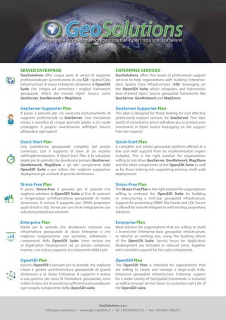
1. GeoSolutions s.a.s
info@geo-solutions.it • www.geo-solutions.it • Tel. +39 0584962313 • Fax +39 0584 1660272
SERVIZI ENTERPRISE
GeoSolutions offre cinque piani di servizi di supporto
professionale per la costruzione di una SDI ( Spatial Data
Infrastructure) di classe Enterprise attraverso la OpenSDI
Suite che integra ed armonizza i migliori framework
geospaziali offerti dal mondo Open Source come
GeoServer, GeoNetwork e MapStore.
GeoServer Supporter Plan
Il piano è pensato per chi necessita esclusivamente di
supporto professionale su GeoServer. Una consulenza
mirata e specifica di cinque giornate adatta a chi vuole
proteggere il proprio investimento nell’Open Source
affidandosi agli esperti!
Quick-Start Plan
Una piattaforma geospaziale completa dal prezzo
contenuto, con il supporto di base di un esperto
nell’implementazione. Il Quick-Start Plan è la soluzione
ideale per le aziende che desiderano provare GeoServer,
GeoNetwork, MapStore e gli altri componenti della
OpenSDI Suite e per coloro che vogliono supportare
deployment già esistenti di piccole dimensioni.
Stress-Free Plan
Il piano Stress-Free è pensato per le aziende che
vogliono adottare la OpenSDI Suite al fine di costruire
o riorganizzare un’infrastruttura geospaziale di medie
dimensioni. È incluso il supporto per DBMS proprietari
quali Oracle e SQL Server per una facile integrazione con
soluzioni proprietarie esistenti.
Enterprise Plan
Ideale per le aziende che desiderano costruire una
infrastruttura geospaziale di classe Enterprise o che
vogliono riorganizzarne una esistente, utilizzando i
componenti della OpenSDI Suite. Sono incluse ore
di Application Development ad un prezzo contenuto,
insieme a un esteso supporto ai componenti della suite.
OpenSDI Plan
Il piano OpenSDI è pensato per le aziende che vogliono
creare e gestire un’infrastruttura geospaziale di grandi
dimensioni e di classe Enterprise. Il supporto è esteso
a una gamma più vasta di framework geospaziali, sono
inoltre incluse ore di assistenza sufficienti a personalizzare
ogni singolo componente della OpenSDI suite.
enterprise services
GeoSolutions offers five levels of professional support
services to help organizations with building Enterprise-
class Spatial Data Infrastructures (SDI) leveraging on
the OpenSDI Suite which integrates and harmonizes
best-of-breed Open Source geospatial frameworks like
GeoServer, GeoNetwork and MapStore.
GeoServer Supporter Plan
This plan is designed for those looking for cost effective
professional support services for GeoServer. Five days
worth of consultancy which will allow you to protect your
investment in Open Source leveraging on the support
from the experts!
Quick-Start Plan
A complete and tested geospatial platform offered at a
low cost with support from an implementation expert
included. This is the right solution for organizations
willing to test-drive GeoServer, GeoNetwork, MapStore
and the other components of the OpenSDI Suite as well
as for those looking into supporting existing small scale
deployments.
Stress-Free Plan
TheStress-FreePlanistherightsolutionfororganizations
willing to embrace the OpenSDI Suite for building
or restructuring a mid-size geospatial infrastructure.
Support for proprietary DBMS like Oracle and SQL Server
is offered for smooth integration with existing proprietary
solutions.
Enterprise Plan
Ideal solution for organizations that are willing to build
a brand-new Enterprise-class geospatial infrastructure,
or refactor an existing one, using the building blocks
of the OpenSDI Suite. Service hours for Application
Development are included at reduced price, together
with extended support for the suite components.
OpenSDI Plan
The OpenSDI Plan is intended for organizations that
are willing to create and manage a large-scale truly-
Enterprise geospatial infrastructure. Extensive support
for a wider variety of GeoSpatial frameworks is included
as well as enough service hours to customize every bit of
the OpenSDI suite.
!!!
2. GeoServer
Supporter
Quick-Start Stress-Free Enterprise OpenSDI
Servizi inclusi nel contratto / Contract Management & Administration
GitHub Repository
Ticketing Portal
Maximum Response TIme
Dedicated Mailing List
Contact Hours
Phone Support
24x7 support
-
Yes
2 days
Yes
Business hours
-
-
Yes
Yes
2 days
Yes
Business hours
-
-
Yes
Yes
2 days
Yes
Business hours
-
-
Yes
Yes
1 days
Yes
Business hours
Yes
-
Yes
Yes
1 days
Yes
Business hours
Yes
Additional Fee
Ore di supporto / Service Hours
Implementation Expert Hours
Priority Bug Fixing Hours
Application Development Hours
Total
-
40
-
40
80
-
-
80
80
80
-
160
80
80
160
320 600
Supporto Raster Avanzato / Advanced Raster Support
JPEG2000 with KAKADU SDK
GDAL support
JAI/ImageIO customization
MetOc/Remote Sensing data support
Oracle GeoRaster
Yes
Yes
Yes
Yes
-
Yes
Yes
-
-
-
Yes
Yes
-
-
-
Yes
Yes
Yes
Yes
-
Yes
Yes
Yes
Yes
Yes
Supporto Enterprise / Enterprise Support Plan Plan Plan Plan Plan
Clustering
Performance Tuning
Enterprise Security
Unlimited
-
Yes
2
Yes
-
4
Yes
Yes
8
Yes
Yes
Unlimited
Yes
Yes
# geoserver istances
Additional Supported
GeoSpatial Frameworks
DBMS
Funzioni Supportate / Distinguished Supported Features
Yes
-
Yes
Yes
-
-
-
Yes
Yes
Yes
Yes
Yes
Yes
Yes
Yes
-
-
Yes
-
-
Yes
Yes
Yes
Yes
Yes
Yes
Yes
Yes
Yes
Yes
Yes
Yes
Yes
Yes
Yes
Yes
Yes
Yes
Yes
Yes
Yes
Yes
Yes
Yes
Yes
Yes
Yes
Yes
Yes
Yes
GeoServer
MapStore
GeoWebCache
GeoTools
GeoNetwork
GeoFence
GeoBatch
PostGIS
Oracle
SQL Server
!!!