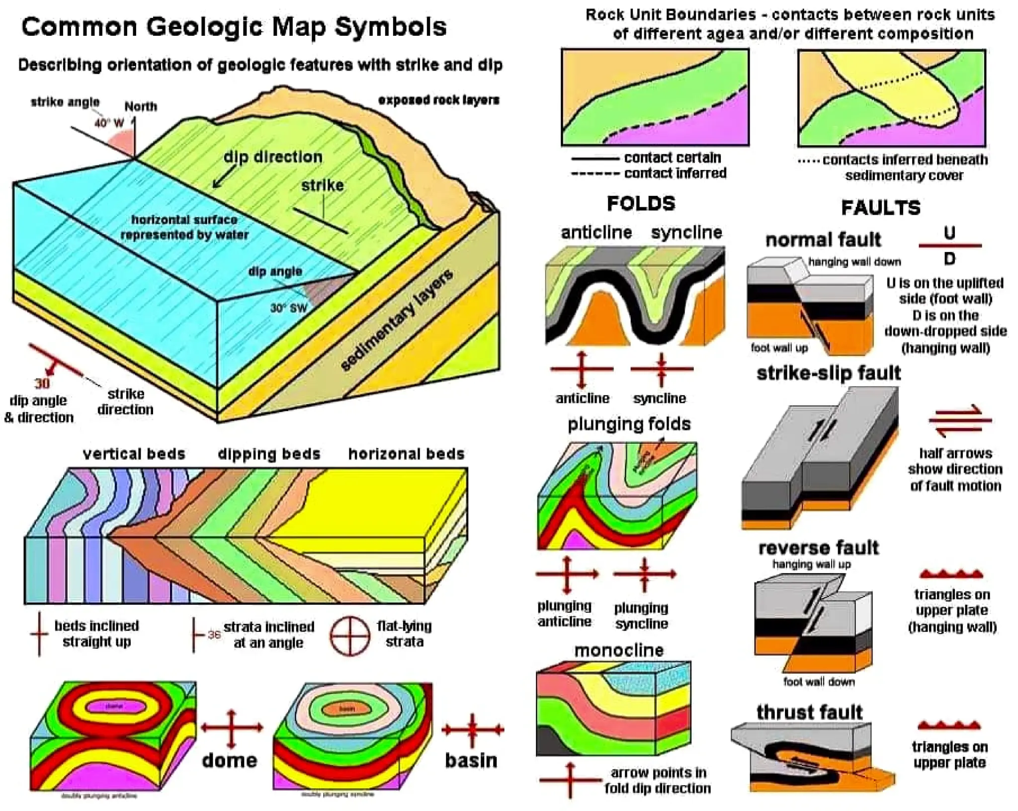
This document provides common symbols used on geologic maps to describe features such as the orientation of rock layers, boundaries between different rock units, folds, and faults. Key symbols include strike and dip symbols to show the angle and direction of inclined rock strata, lines and patterns to represent contacts between rock units, hachure patterns for the shape and plunge of folds, and various fault symbols indicating normal, strike-slip, and reverse faults.