This document summarizes research on the geologic history of the Wyoming Province. Key points include:
- Ancient Archean crust between 3.2-3.5 billion years old is exposed in the Madison, Tobacco Root, and Ruby Ranges, containing detrital zircons up to 4 billion years old. This indicates a Paleoarchean and Eoarchean origin for the northwestern Wyoming Province.
- The central Wyoming Province contains Paleoarchean gneisses and granulites dated to 3.45-3.33 billion years, as well as an Eoarchean zircon dated to 3.82 billion years, suggesting derivation from H
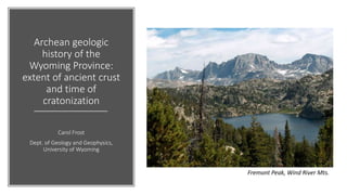
1. Archean geologic
history of the
Wyoming Province:
extent of ancient crust
and time of
cratonization
Carol Frost
Dept. of Geology and Geophysics,
University of Wyoming
Fremont Peak, Wind River Mts.
3. 3.2-3.5 Ga TTG gneisses, Madison,
Tobacco Root, and Ruby Ranges
Detrital zircons from quartzites,
4.0, 3.9, 3.7, 3.5 Ga populations.
Northwestern Wyoming province:
Paleoarchean and Eoarchean origins
NW Wyoming province
207Pb/204Pb
206Pb/204Pb
E. Beartooth whole rock and fsp Pb
with 2.8 Ga regression line.
• Regression does not intersect
mantle evolution line (green)
• Requires high m source. Blue is
evolution of m = 10.75 separated
from depleted mantle at 3.9 Ga
• Dilution with juvenile Pb pushes
separation back in time.
Paleoarchean
crystallization ages
Paleoarchean/Eoarchean
detrital ages
Paleoarchean/Eoarchean
high-m source
Kamber (2015)
Mueller, pers.comm.
Mueller, pers.comm.
4. Central Wyoming province:
Paleoarchean gneiss
Layered gneisses (3.45-3.33 Ga) ~3.30 Ga massive gneisses
Granite Mts
Paleoarchean
crystallization ages
Eoarchean model ages
Frost et al. (2017)
5. 3200
3400
3600
3800
0.55
0.65
0.75
0.85
20 25 30 35 40 45
207Pb/235U
206Pb
238U
data-point error ellipses are 68.3% conf.
Central Wyoming province:
Eoarchean inherited zircon
Granite Mts
3822 ± 4 Ma zircon
in 3.4 Ga gneiss
Low U, 3.82 Ga core
Frost et al. (2017)
6. Central Wyoming province:
Hf isotopes: Hadean precursors
-25
-20
-15
-10
-5
0
5
10
2500 2700 2900 3100 3300 3500 3700 3900 4100 4300 4500
eHf
Age (Ma)
Layered gneiss 00SR01
Massive gneiss 00BG05
Layered gneiss 10GR02
Massive gneiss 10SM10
Bighorn gneiss
Bighorn granite
Jack Hills "least disturbed"
Acasta
CHUR
Granite Mts
3.82 Ga zircons
Hadean source
for Eoarchean crust
(similar to Acasta)
Frost et al. (2017)
7. Granites
Extent of high-m crust in the Wyoming craton
207Pb/204Pb
206Pb/204Pb
Feldspar and WR data from Stuckless et al. (1985), Fischer and Stacey
(1986), Wooden and Mueller (1988), Cornia (2003), and Frost et al.
(1998, 2006). Model evolution lines from Kamber (2015).
Tetons
Owl Ck.
Winds
EBT
9. Black RockRadio Tower Hill
2.65-2.63 Ga accretion produced
consistent NE-SW foliation
Tin Cup Mt
Structure data from Meredith, McLaughlin, Vincent
2635 Ma foliated granite gneiss with
Wyoming batholith leucogranite dikes
McLaughlin (2016)
10. 2. Time of cratonization: last major magmatism
calc-alkalic
alkali-calcic
80706050
-8
-4
0
4
8
Wt. % SiO2
MALI
calcic
alkalic
Wyoming batholith
2625 Ma
Louis Lake batholith
2629 Ma
Bridger batholith
2639 Ma
80706050
-8
-4
Wt. % SiO2
cal
alkali-calcic
calc-alkalic
Wind River Mt
Granite Mt
Undeformed 2625 Ma Wyoming and
2629 Ma Louis Lake Batholiths
11. • 2.60 Ga monazite-Granite Mt.
• 2.55 Ga Mt Owen granite-Tetons
• 2.51 Ga hydrothermal alt.-GM
• 2.47 Ga metamorphism-SW MT
• 2.45 Ga Farmington Canyon UT
• 2.43 Ga Baggott Rocks-Med Bow
• 2.42 Ga gneiss-Little Rocky Mt.
Granite Mt monazite: 2602±6 Ma
2300
2500
2700
2900
0.35
0.45
0.55
0.65
0.75
7 9 11 13 15 17
206Pb/238U
207Pb/235U
data-point error ellipses are 2s
2.43 Ga Baggott Rocks
(Premo & Van Schmus, 1989)
2.51 Ga Granite Mt alteration 2.42 Ga Little Rocky Mts. (Gifford et al., 2018)
2. Time of cratonization:
magmatism and deformation around the edges
Bagdonas(2014)
Vincent (2017)
13. Conclusions and Questions
• Oldest Wyoming gneisses (BBMZ and MMP)
are 3.5 Ga
• 3.83 Ga zircons crystallized by internal
differentiation of a (mafic?) high-m Hadean-
Eoarchean crust
• Wyoming “cratonized” by 2.62 Ga after last
major deformation and magmatism
• Subsequent magmatism and deformation
occurred around the edgesTeton Range
14. Conclusions and Questions
• What is the definition of a craton?
• How far east and west does the Wyoming
craton extend? Idaho? Black Hills?
• What is the age of the high-velocity lower
crust beneath MMP and BBMZ?
• Did a southern part of the craton rift away
prior to accretion of the southern accreted
terranes (SAT)? If so, where is it? Slave?
• What is the origin of the SAT? How were they
assembled along the southern margin of the
craton?
Teton Range