SlideShare a Scribd company logo
19.09.13
Modelling 3D Underground Data
in a webbased 3D-Client
Till Adams (terrestris GmbH & Co Kg)
Emmanuel Belo (Camptocamp SA)
www.terrestris.de
16.07.20133D Data in a 2D & 3D WebGIS
We talk about....
Us first
What do we mean with „3D Underground Data“ … ?
2D WebGIS and 3D Data
Architecture and Setup
3D WebGIS and 3D Data
Preview on the System
Problems, Problems, Problems ....
Introduction
16.07.20133D Data in a 2D & 3D WebGIS
We talk about....
Us first
What do we mean with „3D Underground Data“ … ?
2D WebGIS and 3D Data
Architecture and Setup
3D WebGIS and 3D Data
Preview on the System
Problems, Problems, Problems ....
Introduction
16.07.20133D Data in a 2D & 3D WebGIS
Team of terrestris:
Geoinformatics since 2002Geoinformatics since 2002
13 people, mainly Geographers13 people, mainly Geographers
and computer scientistsand computer scientists
Consulting, Projects, 100% OpenSourceConsulting, Projects, 100% OpenSource
Core development in OpenLayers, GeoExt and several ownCore development in OpenLayers, GeoExt and several own
projects, e.g. SHOGun, our Middlewareprojects, e.g. SHOGun, our Middleware
Partner of OpenGeo, OGC-Member, very active in german localPartner of OpenGeo, OGC-Member, very active in german local
chapter of OsGeo (DACH)chapter of OsGeo (DACH)
Introduction
16.07.20133D Data in a 2D & 3D WebGIS
Till Adams
Geoinformatics since 1998
Shareholder of terrestris
Project-Coordinator
Geographer (know much but nothing really)
FOSSGIS e.V. (DACH local chapter of OsGeo)
Introduction
16.07.20133D Data in a 2D & 3D WebGIS
We talk about....
Us first
What do we mean with „3D Underground Data“ … ?
2D WebGIS and 3D Data
Architecture and Setup
3D WebGIS and 3D Data
Problems, Problems, Problems ....
Preview on the System
3D Underground Data
16.07.20133D Data in a 2D & 3D WebGIS
Geological Data:
2D Geological Map
3D Underground Data
16.07.20133D Data in a 2D & 3D WebGIS
3D Underground Data
Geological Data:
2D Geological Map + Geological Drilling
16.07.20133D Data in a 2D & 3D WebGIS
3D Underground Data
Geological Data:
2D Geological Map + Geological Drilling
x,y,z,attribute
x,y,z,attribute
x,y,z,attribute
x,y,z,attribute
...
16.07.20133D Data in a 2D & 3D WebGIS
3D Underground Data
Geological Data:
2D Geological Map + Geological Profile
16.07.20133D Data in a 2D & 3D WebGIS
3D Underground Data
Geological Data:
2D Geological Map + Geological Profile
16.07.20133D Data in a 2D & 3D WebGIS
3D Underground Data
Geological Data:
Brandenburg/Germany
16.07.20133D Data in a 2D & 3D WebGIS
3D Underground Data
Geological Data:
Brandenburg/Germany:
Top of Permian Layers
16.07.20133D Data in a 2D & 3D WebGIS
We talk about....
Us first
What do we mean with „3D Underground Data“ … ?
2D WebGIS and 3D Data
Architecture and Setup
3D WebGIS and 3D Data
Preview on the System
Problems, Problems, Problems ....
2D GIS and 3D Data
16.07.20133D Data in a 2D & 3D WebGIS
2D GIS and 3D Data
Presenting this Data:
Points
16.07.20133D Data in a 2D & 3D WebGIS
2D GIS and 3D Data
Presenting this Data:
Points
Lines
16.07.20133D Data in a 2D & 3D WebGIS
2D GIS and 3D Data
Presenting this Data:
Points
Lines
Polygons
16.07.20133D Data in a 2D & 3D WebGIS
2D GIS and 3D Data
Presenting this Data:
Points
Lines
Polys
WebGIS !
16.07.20133D Data in a 2D & 3D WebGIS
2D GIS and 3D Data
Presenting this Data:
2D - WebGIS !
16.07.20133D Data in a 2D & 3D WebGIS
2D GIS and 3D Data
Presenting this Data:
2D - WebGIS !
16.07.20133D Data in a 2D & 3D WebGIS
2D GIS and 3D Data
Presenting this Data:
2D - WebGIS !
16.07.20133D Data in a 2D & 3D WebGIS
2D GIS and 3D Data
Put this Data into ….
…. PostGIS 2.0 !!
16.07.20133D Data in a 2D & 3D WebGIS
WKT imported to
PostGIS
2D GIS and 3D Data
Put this Data into PostGIS
… enables us to request it!
3D Model data in GST
(proprietary) exported
As WKT
Data1:
ST_GeomFromEWKT()
Points (x,y,z)
Data2:
ST_AsX3d()
Polyhedralsurface
16.07.20133D Data in a 2D & 3D WebGIS
2D GIS and 3D Data
ST_GeomFromEWKT():
Points(x,y,z,attribute)
Image from: http://www.gomatlab.de/flaeche-aus-punkten-erzeugen-t3607.html
16.07.20133D Data in a 2D & 3D WebGIS
2D GIS and 3D Data
Geological Data:
2D Geological Map + Geological Drilling
16.07.20133D Data in a 2D & 3D WebGIS
2D GIS and 3D Data
16.07.20133D Data in a 2D & 3D WebGIS
2D GIS and 3D Data
Geological Data:
2D Geological Map + Geological Profile
16.07.20133D Data in a 2D & 3D WebGIS
2D GIS and 3D Data
16.07.20133D Data in a 2D & 3D WebGIS
2D GIS and 3D Data
ST_3DClosestPoint(geometry g1, geometry g2);
X
X
X
X
X X
- strategy is known
(max. 12 surfaces)
- defined max-distance
(less surfaces possible)
- 1 query per surface
16.07.20133D Data in a 2D & 3D WebGIS
2D GIS and 3D Data
ST_3DClosestPoint(geometry g1, geometry g2);
X
X
X
X
X XXXXXX
16.07.20133D Data in a 2D & 3D WebGIS
We talk about....
Us first
What do we mean with „3D Underground Data“ … ?
2D WebGIS and 3D Data
Architecture and Setup
3D WebGIS and 3D Data
Preview on the System
Problems, Problems, Problems ....
2D GIS and 3D Data
16.07.20133D Data in a 2D & 3D WebGIS
Architecture and Setup
Architecture 2D Client
Geo-
DB
Tomcat
WebGIS
4
2
16.07.20133D Data in a 2D & 3D WebGIS
We talk about....
Us first
What do we mean with „3D Underground Data“ … ?
2D WebGIS and 3D Data
Architecture and Setup
3D WebGIS and 3D Data
Preview on the System
Problems, Problems, Problems ....
3D GIS and 3D Data
16.07.20133D Data in a 2D & 3D WebGIS
WKT imported to
PostGIS
Put this Data into PostGIS
… enables us to request it!
3D Model data in GST
(proprietary) exported
As WKT
Data1:
ST_GeomFromEWKT()
Points (x,y,z)
Data2:
ST_AsX3d()
Polyhedralsurface
3D GIS and 3D Data
16.07.20133D Data in a 2D & 3D WebGIS
3D GIS and 3D Data
ST_AsX3d():
Polyhedralsurfaces
Surfaces!
Image from: http://eslab.bu.edu/publications/publications.php
16.07.20133D Data in a 2D & 3D WebGIS
Geological Data:
Brandenburg/Germany:
Top of Permian Layers
3D GIS and 3D Data
16.07.20133D Data in a 2D & 3D WebGIS
3D GIS and 3D Data
Geological Data:
Brandenburg/Germany:
Base of Tertiary Layers
+ Top of Permian Layers
16.07.20133D Data in a 2D & 3D WebGIS
3D GIS and 3D Data
Geological Data:
We need s.th.
Like this:
16.07.20133D Data in a 2D & 3D WebGIS
We talk about....
Us first
What do we mean with „3D Underground Data“ … ?
2D WebGIS and 3D Data
Architecture and Setup
3D WebGIS and 3D Data
Problems, Problems, Problems ....
Preview on the System
3D GIS and 3D Data
16.07.20133D Data in a 2D & 3D WebGIS
Architecture and Setup
Architecture 2D Client
Geo-
DB
Tomcat
WebGIS
4
2
16.07.20133D Data in a 2D & 3D WebGIS
Architecture and Setup
Architecture 3D Client
Geo-
DB
Tomcat
WebGIS
4
„3D“
W3DS
16.07.20133D Data in a 2D & 3D WebGIS
Architecture 2D Client 3D Client
X3Dom-Viewer
GeoServer X3DomW3DS
Architecture and Setup
16.07.20133D Data in a 2D & 3D WebGIS
„GeoExt 3D“ combines ExtJS with X3Dom
- uses API on top of X3DOM
- uses ExtJS 4 elements such as Viewport, Panels, etc.
X3DOMAPI
4
Architecture and Setup
16.07.20133D Data in a 2D & 3D WebGIS
„GeoExt 3D“ combines ExtJS with X3Dom
- API methods such as
- setScaleZ(scale)
- setLayerVisibility(layerID, visibility)
- setLayerColor(layer, color)
- getState(); // setState(state)
- Navigation with Mouse/Keys
Architecture and Setup
16.07.20133D Data in a 2D & 3D WebGIS
Architecture and Setup
WebGIS
W3DS Service:
- data sent to client in X3D format
- data rendered in the client
16.07.20133D Data in a 2D & 3D WebGIS
We talk about....
Us first
What do we mean with „3D Underground Data“ … ?
2D WebGIS and 3D Data
Architecture and Setup
3D WebGIS and 3D Data
Preview on the System
Problems, Problems, Problems ....
Preview on the System
16.07.20133D Data in a 2D & 3D WebGIS
We talk about....
Us first
What do we mean with „3D Underground Data“ … ?
2D WebGIS and 3D Data
Architecture and Setup
3D WebGIS and 3D Data
Preview on the System
Problems, Problems, Problems ....
Problems, Problems, Problems
16.07.20133D Data in a 2D & 3D WebGIS
Problems, Problems, Problems
Problems we had to catch up ….
- … Performance
- reduce data density
- enhance hardware
- wait ….
- … W3DS is not officially supported by GeoServer, so had to
use GeoServer UX
- … no API in X3Dom, so created one
- …
16.07.20133D Data in a 2D & 3D WebGIS
Many thanks!
Many thanks for listening !!!
terrestris GmbH & Co. KG
Pützchens Chaussee 56
53227 Bonn
Germany
Dipl.-Geogr. Till Adams
Tel. +49 - 228 – 962 899 52
adams@terrestris.de

More Related Content

Similar to FOSS4G 2013: Modelling 3D underground data in a webbased 3D-Client

Design and Development of BIM on GIS Interoperability Open Platform
Design and Development of BIM on GIS Interoperability Open PlatformDesign and Development of BIM on GIS Interoperability Open Platform
Design and Development of BIM on GIS Interoperability Open Platform
slhead1
 
EU SatCen Workflow Automation for Data
EU SatCen Workflow Automation for DataEU SatCen Workflow Automation for Data
EU SatCen Workflow Automation for Data
Safe Software
 
3D Web Services And Models For The Web: Where Do We Stand?
3D Web Services And Models For The Web: Where Do We Stand?3D Web Services And Models For The Web: Where Do We Stand?
3D Web Services And Models For The Web: Where Do We Stand?
Camptocamp
 
Learn How to use Free Lidar Data from Norway (hoydedata.no)
Learn How to use Free Lidar Data from Norway (hoydedata.no)Learn How to use Free Lidar Data from Norway (hoydedata.no)
Learn How to use Free Lidar Data from Norway (hoydedata.no)
Safe Software
 
Civil3 d in engineering survey
Civil3 d in engineering surveyCivil3 d in engineering survey
Civil3 d in engineering survey
noah kertich
 
High-Quality Server Side Rendering using the OGC’s 3D Portrayal Service – App...
High-Quality Server Side Rendering using the OGC’s 3D Portrayal Service – App...High-Quality Server Side Rendering using the OGC’s 3D Portrayal Service – App...
High-Quality Server Side Rendering using the OGC’s 3D Portrayal Service – App...
Martin Christen
 
Real-Time 3D Data Visualization and Analysis of Unlimited Detail
Real-Time 3D Data Visualization and Analysis of Unlimited DetailReal-Time 3D Data Visualization and Analysis of Unlimited Detail
Real-Time 3D Data Visualization and Analysis of Unlimited Detail
Merrick & Company
 
Introduction to mago3D: A web based GeoBIM platform on top of FOSS4G
Introduction to mago3D:  A web based GeoBIM platform on top of FOSS4GIntroduction to mago3D:  A web based GeoBIM platform on top of FOSS4G
Introduction to mago3D: A web based GeoBIM platform on top of FOSS4G
SANGHEE SHIN
 
Introduction to 3D Mapping with X3D
Introduction to 3D Mapping with X3DIntroduction to 3D Mapping with X3D
Introduction to 3D Mapping with X3D
Ian Panganiban
 
OpenWebGlobe - GeoSharing Bern
OpenWebGlobe - GeoSharing BernOpenWebGlobe - GeoSharing Bern
OpenWebGlobe - GeoSharing Bern
Martin Christen
 
What we've done so far with mago3D, an open source based 'Digital Twin' platf...
What we've done so far with mago3D, an open source based 'Digital Twin' platf...What we've done so far with mago3D, an open source based 'Digital Twin' platf...
What we've done so far with mago3D, an open source based 'Digital Twin' platf...
SANGHEE SHIN
 
Introduction of MAGO3D
Introduction of MAGO3DIntroduction of MAGO3D
Introduction of MAGO3D
SANGHEE SHIN
 
mago3D - A Brand-New Live 3D Geo-Platform
mago3D - A Brand-New Live 3D Geo-Platform mago3D - A Brand-New Live 3D Geo-Platform
mago3D - A Brand-New Live 3D Geo-Platform
SANGHEE SHIN
 
Tackling "BIG Data": Mobile LiDAR Transportation Project Use Case
Tackling "BIG Data": Mobile LiDAR Transportation Project Use CaseTackling "BIG Data": Mobile LiDAR Transportation Project Use Case
Tackling "BIG Data": Mobile LiDAR Transportation Project Use Case
Merrick & Company
 
Local Government Presentation
Local Government PresentationLocal Government Presentation
Local Government Presentation
guestd70a6d
 
mago3D: A brand new Geo-BIM platform on top of Cesium & World Wind
mago3D: A brand new Geo-BIM platform on top of Cesium & World Wind mago3D: A brand new Geo-BIM platform on top of Cesium & World Wind
mago3D: A brand new Geo-BIM platform on top of Cesium & World Wind
SANGHEE SHIN
 
mago3D FOSS4G NA 2018
mago3D FOSS4G NA 2018mago3D FOSS4G NA 2018
mago3D FOSS4G NA 2018
정대 천
 
Let's integrate CAD/BIM/GIS on the same platform: A practical approach in rea...
Let's integrate CAD/BIM/GIS on the same platform: A practical approach in rea...Let's integrate CAD/BIM/GIS on the same platform: A practical approach in rea...
Let's integrate CAD/BIM/GIS on the same platform: A practical approach in rea...
SANGHEE SHIN
 
Synthetic Data and Graphics Techniques in Robotics
Synthetic Data and Graphics Techniques in RoboticsSynthetic Data and Graphics Techniques in Robotics
Synthetic Data and Graphics Techniques in Robotics
Prabindh Sundareson
 
mago3D, a web based BIM/GIS integration platform on top of open source
mago3D, a web based BIM/GIS integration platform on top of open sourcemago3D, a web based BIM/GIS integration platform on top of open source
mago3D, a web based BIM/GIS integration platform on top of open source
SANGHEE SHIN
 

Similar to FOSS4G 2013: Modelling 3D underground data in a webbased 3D-Client (20)

Design and Development of BIM on GIS Interoperability Open Platform
Design and Development of BIM on GIS Interoperability Open PlatformDesign and Development of BIM on GIS Interoperability Open Platform
Design and Development of BIM on GIS Interoperability Open Platform
 
EU SatCen Workflow Automation for Data
EU SatCen Workflow Automation for DataEU SatCen Workflow Automation for Data
EU SatCen Workflow Automation for Data
 
3D Web Services And Models For The Web: Where Do We Stand?
3D Web Services And Models For The Web: Where Do We Stand?3D Web Services And Models For The Web: Where Do We Stand?
3D Web Services And Models For The Web: Where Do We Stand?
 
Learn How to use Free Lidar Data from Norway (hoydedata.no)
Learn How to use Free Lidar Data from Norway (hoydedata.no)Learn How to use Free Lidar Data from Norway (hoydedata.no)
Learn How to use Free Lidar Data from Norway (hoydedata.no)
 
Civil3 d in engineering survey
Civil3 d in engineering surveyCivil3 d in engineering survey
Civil3 d in engineering survey
 
High-Quality Server Side Rendering using the OGC’s 3D Portrayal Service – App...
High-Quality Server Side Rendering using the OGC’s 3D Portrayal Service – App...High-Quality Server Side Rendering using the OGC’s 3D Portrayal Service – App...
High-Quality Server Side Rendering using the OGC’s 3D Portrayal Service – App...
 
Real-Time 3D Data Visualization and Analysis of Unlimited Detail
Real-Time 3D Data Visualization and Analysis of Unlimited DetailReal-Time 3D Data Visualization and Analysis of Unlimited Detail
Real-Time 3D Data Visualization and Analysis of Unlimited Detail
 
Introduction to mago3D: A web based GeoBIM platform on top of FOSS4G
Introduction to mago3D:  A web based GeoBIM platform on top of FOSS4GIntroduction to mago3D:  A web based GeoBIM platform on top of FOSS4G
Introduction to mago3D: A web based GeoBIM platform on top of FOSS4G
 
Introduction to 3D Mapping with X3D
Introduction to 3D Mapping with X3DIntroduction to 3D Mapping with X3D
Introduction to 3D Mapping with X3D
 
OpenWebGlobe - GeoSharing Bern
OpenWebGlobe - GeoSharing BernOpenWebGlobe - GeoSharing Bern
OpenWebGlobe - GeoSharing Bern
 
What we've done so far with mago3D, an open source based 'Digital Twin' platf...
What we've done so far with mago3D, an open source based 'Digital Twin' platf...What we've done so far with mago3D, an open source based 'Digital Twin' platf...
What we've done so far with mago3D, an open source based 'Digital Twin' platf...
 
Introduction of MAGO3D
Introduction of MAGO3DIntroduction of MAGO3D
Introduction of MAGO3D
 
mago3D - A Brand-New Live 3D Geo-Platform
mago3D - A Brand-New Live 3D Geo-Platform mago3D - A Brand-New Live 3D Geo-Platform
mago3D - A Brand-New Live 3D Geo-Platform
 
Tackling "BIG Data": Mobile LiDAR Transportation Project Use Case
Tackling "BIG Data": Mobile LiDAR Transportation Project Use CaseTackling "BIG Data": Mobile LiDAR Transportation Project Use Case
Tackling "BIG Data": Mobile LiDAR Transportation Project Use Case
 
Local Government Presentation
Local Government PresentationLocal Government Presentation
Local Government Presentation
 
mago3D: A brand new Geo-BIM platform on top of Cesium & World Wind
mago3D: A brand new Geo-BIM platform on top of Cesium & World Wind mago3D: A brand new Geo-BIM platform on top of Cesium & World Wind
mago3D: A brand new Geo-BIM platform on top of Cesium & World Wind
 
mago3D FOSS4G NA 2018
mago3D FOSS4G NA 2018mago3D FOSS4G NA 2018
mago3D FOSS4G NA 2018
 
Let's integrate CAD/BIM/GIS on the same platform: A practical approach in rea...
Let's integrate CAD/BIM/GIS on the same platform: A practical approach in rea...Let's integrate CAD/BIM/GIS on the same platform: A practical approach in rea...
Let's integrate CAD/BIM/GIS on the same platform: A practical approach in rea...
 
Synthetic Data and Graphics Techniques in Robotics
Synthetic Data and Graphics Techniques in RoboticsSynthetic Data and Graphics Techniques in Robotics
Synthetic Data and Graphics Techniques in Robotics
 
mago3D, a web based BIM/GIS integration platform on top of open source
mago3D, a web based BIM/GIS integration platform on top of open sourcemago3D, a web based BIM/GIS integration platform on top of open source
mago3D, a web based BIM/GIS integration platform on top of open source
 

Recently uploaded

PRODUCT LISTING OPTIMIZATION PRESENTATION.pptx
PRODUCT LISTING OPTIMIZATION PRESENTATION.pptxPRODUCT LISTING OPTIMIZATION PRESENTATION.pptx
PRODUCT LISTING OPTIMIZATION PRESENTATION.pptx
christinelarrosa
 
Harnessing the Power of NLP and Knowledge Graphs for Opioid Research
Harnessing the Power of NLP and Knowledge Graphs for Opioid ResearchHarnessing the Power of NLP and Knowledge Graphs for Opioid Research
Harnessing the Power of NLP and Knowledge Graphs for Opioid Research
Neo4j
 
"Frontline Battles with DDoS: Best practices and Lessons Learned", Igor Ivaniuk
"Frontline Battles with DDoS: Best practices and Lessons Learned",  Igor Ivaniuk"Frontline Battles with DDoS: Best practices and Lessons Learned",  Igor Ivaniuk
"Frontline Battles with DDoS: Best practices and Lessons Learned", Igor Ivaniuk
Fwdays
 
QA or the Highway - Component Testing: Bridging the gap between frontend appl...
QA or the Highway - Component Testing: Bridging the gap between frontend appl...QA or the Highway - Component Testing: Bridging the gap between frontend appl...
QA or the Highway - Component Testing: Bridging the gap between frontend appl...
zjhamm304
 
Poznań ACE event - 19.06.2024 Team 24 Wrapup slidedeck
Poznań ACE event - 19.06.2024 Team 24 Wrapup slidedeckPoznań ACE event - 19.06.2024 Team 24 Wrapup slidedeck
Poznań ACE event - 19.06.2024 Team 24 Wrapup slidedeck
FilipTomaszewski5
 
Session 1 - Intro to Robotic Process Automation.pdf
Session 1 - Intro to Robotic Process Automation.pdfSession 1 - Intro to Robotic Process Automation.pdf
Session 1 - Intro to Robotic Process Automation.pdf
UiPathCommunity
 
LF Energy Webinar: Carbon Data Specifications: Mechanisms to Improve Data Acc...
LF Energy Webinar: Carbon Data Specifications: Mechanisms to Improve Data Acc...LF Energy Webinar: Carbon Data Specifications: Mechanisms to Improve Data Acc...
LF Energy Webinar: Carbon Data Specifications: Mechanisms to Improve Data Acc...
DanBrown980551
 
JavaLand 2024: Application Development Green Masterplan
JavaLand 2024: Application Development Green MasterplanJavaLand 2024: Application Development Green Masterplan
JavaLand 2024: Application Development Green Masterplan
Miro Wengner
 
"Choosing proper type of scaling", Olena Syrota
"Choosing proper type of scaling", Olena Syrota"Choosing proper type of scaling", Olena Syrota
"Choosing proper type of scaling", Olena Syrota
Fwdays
 
What is an RPA CoE? Session 1 – CoE Vision
What is an RPA CoE?  Session 1 – CoE VisionWhat is an RPA CoE?  Session 1 – CoE Vision
What is an RPA CoE? Session 1 – CoE Vision
DianaGray10
 
Essentials of Automations: Exploring Attributes & Automation Parameters
Essentials of Automations: Exploring Attributes & Automation ParametersEssentials of Automations: Exploring Attributes & Automation Parameters
Essentials of Automations: Exploring Attributes & Automation Parameters
Safe Software
 
ScyllaDB Tablets: Rethinking Replication
ScyllaDB Tablets: Rethinking ReplicationScyllaDB Tablets: Rethinking Replication
ScyllaDB Tablets: Rethinking Replication
ScyllaDB
 
From Natural Language to Structured Solr Queries using LLMs
From Natural Language to Structured Solr Queries using LLMsFrom Natural Language to Structured Solr Queries using LLMs
From Natural Language to Structured Solr Queries using LLMs
Sease
 
Christine's Supplier Sourcing Presentaion.pptx
Christine's Supplier Sourcing Presentaion.pptxChristine's Supplier Sourcing Presentaion.pptx
Christine's Supplier Sourcing Presentaion.pptx
christinelarrosa
 
A Deep Dive into ScyllaDB's Architecture
A Deep Dive into ScyllaDB's ArchitectureA Deep Dive into ScyllaDB's Architecture
A Deep Dive into ScyllaDB's Architecture
ScyllaDB
 
Northern Engraving | Modern Metal Trim, Nameplates and Appliance Panels
Northern Engraving | Modern Metal Trim, Nameplates and Appliance PanelsNorthern Engraving | Modern Metal Trim, Nameplates and Appliance Panels
Northern Engraving | Modern Metal Trim, Nameplates and Appliance Panels
Northern Engraving
 
Discover the Unseen: Tailored Recommendation of Unwatched Content
Discover the Unseen: Tailored Recommendation of Unwatched ContentDiscover the Unseen: Tailored Recommendation of Unwatched Content
Discover the Unseen: Tailored Recommendation of Unwatched Content
ScyllaDB
 
Astute Business Solutions | Oracle Cloud Partner |
Astute Business Solutions | Oracle Cloud Partner |Astute Business Solutions | Oracle Cloud Partner |
Astute Business Solutions | Oracle Cloud Partner |
AstuteBusiness
 
Introducing BoxLang : A new JVM language for productivity and modularity!
Introducing BoxLang : A new JVM language for productivity and modularity!Introducing BoxLang : A new JVM language for productivity and modularity!
Introducing BoxLang : A new JVM language for productivity and modularity!
Ortus Solutions, Corp
 
"NATO Hackathon Winner: AI-Powered Drug Search", Taras Kloba
"NATO Hackathon Winner: AI-Powered Drug Search",  Taras Kloba"NATO Hackathon Winner: AI-Powered Drug Search",  Taras Kloba
"NATO Hackathon Winner: AI-Powered Drug Search", Taras Kloba
Fwdays
 

Recently uploaded (20)

PRODUCT LISTING OPTIMIZATION PRESENTATION.pptx
PRODUCT LISTING OPTIMIZATION PRESENTATION.pptxPRODUCT LISTING OPTIMIZATION PRESENTATION.pptx
PRODUCT LISTING OPTIMIZATION PRESENTATION.pptx
 
Harnessing the Power of NLP and Knowledge Graphs for Opioid Research
Harnessing the Power of NLP and Knowledge Graphs for Opioid ResearchHarnessing the Power of NLP and Knowledge Graphs for Opioid Research
Harnessing the Power of NLP and Knowledge Graphs for Opioid Research
 
"Frontline Battles with DDoS: Best practices and Lessons Learned", Igor Ivaniuk
"Frontline Battles with DDoS: Best practices and Lessons Learned",  Igor Ivaniuk"Frontline Battles with DDoS: Best practices and Lessons Learned",  Igor Ivaniuk
"Frontline Battles with DDoS: Best practices and Lessons Learned", Igor Ivaniuk
 
QA or the Highway - Component Testing: Bridging the gap between frontend appl...
QA or the Highway - Component Testing: Bridging the gap between frontend appl...QA or the Highway - Component Testing: Bridging the gap between frontend appl...
QA or the Highway - Component Testing: Bridging the gap between frontend appl...
 
Poznań ACE event - 19.06.2024 Team 24 Wrapup slidedeck
Poznań ACE event - 19.06.2024 Team 24 Wrapup slidedeckPoznań ACE event - 19.06.2024 Team 24 Wrapup slidedeck
Poznań ACE event - 19.06.2024 Team 24 Wrapup slidedeck
 
Session 1 - Intro to Robotic Process Automation.pdf
Session 1 - Intro to Robotic Process Automation.pdfSession 1 - Intro to Robotic Process Automation.pdf
Session 1 - Intro to Robotic Process Automation.pdf
 
LF Energy Webinar: Carbon Data Specifications: Mechanisms to Improve Data Acc...
LF Energy Webinar: Carbon Data Specifications: Mechanisms to Improve Data Acc...LF Energy Webinar: Carbon Data Specifications: Mechanisms to Improve Data Acc...
LF Energy Webinar: Carbon Data Specifications: Mechanisms to Improve Data Acc...
 
JavaLand 2024: Application Development Green Masterplan
JavaLand 2024: Application Development Green MasterplanJavaLand 2024: Application Development Green Masterplan
JavaLand 2024: Application Development Green Masterplan
 
"Choosing proper type of scaling", Olena Syrota
"Choosing proper type of scaling", Olena Syrota"Choosing proper type of scaling", Olena Syrota
"Choosing proper type of scaling", Olena Syrota
 
What is an RPA CoE? Session 1 – CoE Vision
What is an RPA CoE?  Session 1 – CoE VisionWhat is an RPA CoE?  Session 1 – CoE Vision
What is an RPA CoE? Session 1 – CoE Vision
 
Essentials of Automations: Exploring Attributes & Automation Parameters
Essentials of Automations: Exploring Attributes & Automation ParametersEssentials of Automations: Exploring Attributes & Automation Parameters
Essentials of Automations: Exploring Attributes & Automation Parameters
 
ScyllaDB Tablets: Rethinking Replication
ScyllaDB Tablets: Rethinking ReplicationScyllaDB Tablets: Rethinking Replication
ScyllaDB Tablets: Rethinking Replication
 
From Natural Language to Structured Solr Queries using LLMs
From Natural Language to Structured Solr Queries using LLMsFrom Natural Language to Structured Solr Queries using LLMs
From Natural Language to Structured Solr Queries using LLMs
 
Christine's Supplier Sourcing Presentaion.pptx
Christine's Supplier Sourcing Presentaion.pptxChristine's Supplier Sourcing Presentaion.pptx
Christine's Supplier Sourcing Presentaion.pptx
 
A Deep Dive into ScyllaDB's Architecture
A Deep Dive into ScyllaDB's ArchitectureA Deep Dive into ScyllaDB's Architecture
A Deep Dive into ScyllaDB's Architecture
 
Northern Engraving | Modern Metal Trim, Nameplates and Appliance Panels
Northern Engraving | Modern Metal Trim, Nameplates and Appliance PanelsNorthern Engraving | Modern Metal Trim, Nameplates and Appliance Panels
Northern Engraving | Modern Metal Trim, Nameplates and Appliance Panels
 
Discover the Unseen: Tailored Recommendation of Unwatched Content
Discover the Unseen: Tailored Recommendation of Unwatched ContentDiscover the Unseen: Tailored Recommendation of Unwatched Content
Discover the Unseen: Tailored Recommendation of Unwatched Content
 
Astute Business Solutions | Oracle Cloud Partner |
Astute Business Solutions | Oracle Cloud Partner |Astute Business Solutions | Oracle Cloud Partner |
Astute Business Solutions | Oracle Cloud Partner |
 
Introducing BoxLang : A new JVM language for productivity and modularity!
Introducing BoxLang : A new JVM language for productivity and modularity!Introducing BoxLang : A new JVM language for productivity and modularity!
Introducing BoxLang : A new JVM language for productivity and modularity!
 
"NATO Hackathon Winner: AI-Powered Drug Search", Taras Kloba
"NATO Hackathon Winner: AI-Powered Drug Search",  Taras Kloba"NATO Hackathon Winner: AI-Powered Drug Search",  Taras Kloba
"NATO Hackathon Winner: AI-Powered Drug Search", Taras Kloba
 

FOSS4G 2013: Modelling 3D underground data in a webbased 3D-Client

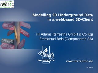
  • 1. 19.09.13 Modelling 3D Underground Data in a webbased 3D-Client Till Adams (terrestris GmbH & Co Kg) Emmanuel Belo (Camptocamp SA) www.terrestris.de
  • 2. 16.07.20133D Data in a 2D & 3D WebGIS We talk about.... Us first What do we mean with „3D Underground Data“ … ? 2D WebGIS and 3D Data Architecture and Setup 3D WebGIS and 3D Data Preview on the System Problems, Problems, Problems .... Introduction
  • 3. 16.07.20133D Data in a 2D & 3D WebGIS We talk about.... Us first What do we mean with „3D Underground Data“ … ? 2D WebGIS and 3D Data Architecture and Setup 3D WebGIS and 3D Data Preview on the System Problems, Problems, Problems .... Introduction
  • 4. 16.07.20133D Data in a 2D & 3D WebGIS Team of terrestris: Geoinformatics since 2002Geoinformatics since 2002 13 people, mainly Geographers13 people, mainly Geographers and computer scientistsand computer scientists Consulting, Projects, 100% OpenSourceConsulting, Projects, 100% OpenSource Core development in OpenLayers, GeoExt and several ownCore development in OpenLayers, GeoExt and several own projects, e.g. SHOGun, our Middlewareprojects, e.g. SHOGun, our Middleware Partner of OpenGeo, OGC-Member, very active in german localPartner of OpenGeo, OGC-Member, very active in german local chapter of OsGeo (DACH)chapter of OsGeo (DACH) Introduction
  • 5. 16.07.20133D Data in a 2D & 3D WebGIS Till Adams Geoinformatics since 1998 Shareholder of terrestris Project-Coordinator Geographer (know much but nothing really) FOSSGIS e.V. (DACH local chapter of OsGeo) Introduction
  • 6. 16.07.20133D Data in a 2D & 3D WebGIS We talk about.... Us first What do we mean with „3D Underground Data“ … ? 2D WebGIS and 3D Data Architecture and Setup 3D WebGIS and 3D Data Problems, Problems, Problems .... Preview on the System 3D Underground Data
  • 7. 16.07.20133D Data in a 2D & 3D WebGIS Geological Data: 2D Geological Map 3D Underground Data
  • 8. 16.07.20133D Data in a 2D & 3D WebGIS 3D Underground Data Geological Data: 2D Geological Map + Geological Drilling
  • 9. 16.07.20133D Data in a 2D & 3D WebGIS 3D Underground Data Geological Data: 2D Geological Map + Geological Drilling x,y,z,attribute x,y,z,attribute x,y,z,attribute x,y,z,attribute ...
  • 10. 16.07.20133D Data in a 2D & 3D WebGIS 3D Underground Data Geological Data: 2D Geological Map + Geological Profile
  • 11. 16.07.20133D Data in a 2D & 3D WebGIS 3D Underground Data Geological Data: 2D Geological Map + Geological Profile
  • 12. 16.07.20133D Data in a 2D & 3D WebGIS 3D Underground Data Geological Data: Brandenburg/Germany
  • 13. 16.07.20133D Data in a 2D & 3D WebGIS 3D Underground Data Geological Data: Brandenburg/Germany: Top of Permian Layers
  • 14. 16.07.20133D Data in a 2D & 3D WebGIS We talk about.... Us first What do we mean with „3D Underground Data“ … ? 2D WebGIS and 3D Data Architecture and Setup 3D WebGIS and 3D Data Preview on the System Problems, Problems, Problems .... 2D GIS and 3D Data
  • 15. 16.07.20133D Data in a 2D & 3D WebGIS 2D GIS and 3D Data Presenting this Data: Points
  • 16. 16.07.20133D Data in a 2D & 3D WebGIS 2D GIS and 3D Data Presenting this Data: Points Lines
  • 17. 16.07.20133D Data in a 2D & 3D WebGIS 2D GIS and 3D Data Presenting this Data: Points Lines Polygons
  • 18. 16.07.20133D Data in a 2D & 3D WebGIS 2D GIS and 3D Data Presenting this Data: Points Lines Polys WebGIS !
  • 19. 16.07.20133D Data in a 2D & 3D WebGIS 2D GIS and 3D Data Presenting this Data: 2D - WebGIS !
  • 20. 16.07.20133D Data in a 2D & 3D WebGIS 2D GIS and 3D Data Presenting this Data: 2D - WebGIS !
  • 21. 16.07.20133D Data in a 2D & 3D WebGIS 2D GIS and 3D Data Presenting this Data: 2D - WebGIS !
  • 22. 16.07.20133D Data in a 2D & 3D WebGIS 2D GIS and 3D Data Put this Data into …. …. PostGIS 2.0 !!
  • 23. 16.07.20133D Data in a 2D & 3D WebGIS WKT imported to PostGIS 2D GIS and 3D Data Put this Data into PostGIS … enables us to request it! 3D Model data in GST (proprietary) exported As WKT Data1: ST_GeomFromEWKT() Points (x,y,z) Data2: ST_AsX3d() Polyhedralsurface
  • 24. 16.07.20133D Data in a 2D & 3D WebGIS 2D GIS and 3D Data ST_GeomFromEWKT(): Points(x,y,z,attribute) Image from: http://www.gomatlab.de/flaeche-aus-punkten-erzeugen-t3607.html
  • 25. 16.07.20133D Data in a 2D & 3D WebGIS 2D GIS and 3D Data Geological Data: 2D Geological Map + Geological Drilling
  • 26. 16.07.20133D Data in a 2D & 3D WebGIS 2D GIS and 3D Data
  • 27. 16.07.20133D Data in a 2D & 3D WebGIS 2D GIS and 3D Data Geological Data: 2D Geological Map + Geological Profile
  • 28. 16.07.20133D Data in a 2D & 3D WebGIS 2D GIS and 3D Data
  • 29. 16.07.20133D Data in a 2D & 3D WebGIS 2D GIS and 3D Data ST_3DClosestPoint(geometry g1, geometry g2); X X X X X X - strategy is known (max. 12 surfaces) - defined max-distance (less surfaces possible) - 1 query per surface
  • 30. 16.07.20133D Data in a 2D & 3D WebGIS 2D GIS and 3D Data ST_3DClosestPoint(geometry g1, geometry g2); X X X X X XXXXXX
  • 31. 16.07.20133D Data in a 2D & 3D WebGIS We talk about.... Us first What do we mean with „3D Underground Data“ … ? 2D WebGIS and 3D Data Architecture and Setup 3D WebGIS and 3D Data Preview on the System Problems, Problems, Problems .... 2D GIS and 3D Data
  • 32. 16.07.20133D Data in a 2D & 3D WebGIS Architecture and Setup Architecture 2D Client Geo- DB Tomcat WebGIS 4 2
  • 33. 16.07.20133D Data in a 2D & 3D WebGIS We talk about.... Us first What do we mean with „3D Underground Data“ … ? 2D WebGIS and 3D Data Architecture and Setup 3D WebGIS and 3D Data Preview on the System Problems, Problems, Problems .... 3D GIS and 3D Data
  • 34. 16.07.20133D Data in a 2D & 3D WebGIS WKT imported to PostGIS Put this Data into PostGIS … enables us to request it! 3D Model data in GST (proprietary) exported As WKT Data1: ST_GeomFromEWKT() Points (x,y,z) Data2: ST_AsX3d() Polyhedralsurface 3D GIS and 3D Data
  • 35. 16.07.20133D Data in a 2D & 3D WebGIS 3D GIS and 3D Data ST_AsX3d(): Polyhedralsurfaces Surfaces! Image from: http://eslab.bu.edu/publications/publications.php
  • 36. 16.07.20133D Data in a 2D & 3D WebGIS Geological Data: Brandenburg/Germany: Top of Permian Layers 3D GIS and 3D Data
  • 37. 16.07.20133D Data in a 2D & 3D WebGIS 3D GIS and 3D Data Geological Data: Brandenburg/Germany: Base of Tertiary Layers + Top of Permian Layers
  • 38. 16.07.20133D Data in a 2D & 3D WebGIS 3D GIS and 3D Data Geological Data: We need s.th. Like this:
  • 39. 16.07.20133D Data in a 2D & 3D WebGIS We talk about.... Us first What do we mean with „3D Underground Data“ … ? 2D WebGIS and 3D Data Architecture and Setup 3D WebGIS and 3D Data Problems, Problems, Problems .... Preview on the System 3D GIS and 3D Data
  • 40. 16.07.20133D Data in a 2D & 3D WebGIS Architecture and Setup Architecture 2D Client Geo- DB Tomcat WebGIS 4 2
  • 41. 16.07.20133D Data in a 2D & 3D WebGIS Architecture and Setup Architecture 3D Client Geo- DB Tomcat WebGIS 4 „3D“ W3DS
  • 42. 16.07.20133D Data in a 2D & 3D WebGIS Architecture 2D Client 3D Client X3Dom-Viewer GeoServer X3DomW3DS Architecture and Setup
  • 43. 16.07.20133D Data in a 2D & 3D WebGIS „GeoExt 3D“ combines ExtJS with X3Dom - uses API on top of X3DOM - uses ExtJS 4 elements such as Viewport, Panels, etc. X3DOMAPI 4 Architecture and Setup
  • 44. 16.07.20133D Data in a 2D & 3D WebGIS „GeoExt 3D“ combines ExtJS with X3Dom - API methods such as - setScaleZ(scale) - setLayerVisibility(layerID, visibility) - setLayerColor(layer, color) - getState(); // setState(state) - Navigation with Mouse/Keys Architecture and Setup
  • 45. 16.07.20133D Data in a 2D & 3D WebGIS Architecture and Setup WebGIS W3DS Service: - data sent to client in X3D format - data rendered in the client
  • 46. 16.07.20133D Data in a 2D & 3D WebGIS We talk about.... Us first What do we mean with „3D Underground Data“ … ? 2D WebGIS and 3D Data Architecture and Setup 3D WebGIS and 3D Data Preview on the System Problems, Problems, Problems .... Preview on the System
  • 47. 16.07.20133D Data in a 2D & 3D WebGIS We talk about.... Us first What do we mean with „3D Underground Data“ … ? 2D WebGIS and 3D Data Architecture and Setup 3D WebGIS and 3D Data Preview on the System Problems, Problems, Problems .... Problems, Problems, Problems
  • 48. 16.07.20133D Data in a 2D & 3D WebGIS Problems, Problems, Problems Problems we had to catch up …. - … Performance - reduce data density - enhance hardware - wait …. - … W3DS is not officially supported by GeoServer, so had to use GeoServer UX - … no API in X3Dom, so created one - …
  • 49. 16.07.20133D Data in a 2D & 3D WebGIS Many thanks! Many thanks for listening !!! terrestris GmbH & Co. KG Pützchens Chaussee 56 53227 Bonn Germany Dipl.-Geogr. Till Adams Tel. +49 - 228 – 962 899 52 adams@terrestris.de