On June 18 2014 we convened over 50 people to talk about rangelands and dealing with challenges across jurisdictional lines. More about it on our blog: openspacecouncil.org/blog/swgjune2014/
The document summarizes the qualifications and experience of Alexander Healy for a position. He has experience conducting field work sampling soils and vegetation, including endangered species. He has written management reports analyzing field data using GIS software and statistics. He has experience with invasive species control and habitat restoration projects using various techniques. His thesis focused on evaluating the success of an ecological restoration project over three years to reestablish a sedge/grass meadow wetland. Following graduation, he helped manage open water and riparian habitats at a national wildlife refuge conducting surveys to assess management efforts. He has also assisted with developing educational programs to promote conservation.
This document discusses efforts to integrate conservation across the Mississippi River Basin through Landscape Conservation Cooperatives (LCCs). It describes how the LCCs are working with dozens of agencies and organizations across seven states to leverage wildlife conservation to also benefit water quality, agriculture, and other sectors. The goal is to provide tools to target conservation investments that benefit both the environment and local economies. Examples of high-impact conservation practices are described, and spatial analysis is being used to identify key locations for implementing practices to maximize benefits. Local pilot projects in Indiana aim to demonstrate wildlife, water quality, and agricultural benefits at a smaller scale.
MAPFORGEN is an online atlas that aims to promote the conservation of 100 native woody perennials that are socially and economically important to Latin America and the Caribbean. Its principal goals are to establish a knowledge base of forest genetic resources at the continental level, promote collaboration between researchers, support conservation actions, and increase visibility of forest genetic resources. The atlas contains information on the basic characteristics, distributions, conservation statuses, threats, and genetic diversity of species. It allows users to browse data by country or ecological zone.
Collaborative Strategies - Denise Defreese - Stewardship Working GroupOpenSpaceCouncil
On June 18 2014 we convened over 50 people to talk about rangelands and dealing with challenges across jurisdictional lines. More about it on our blog: openspacecouncil.org/blog/swgjune2014/
Marc Landgraf - Ballot measures, conservation and changing demographicsOpenSpaceCouncil
On January 22, 2015 we convened our Rainy Season Gathering (without rain unfortunately) about how ballot measures serve as a catalyst for public agencies and nonprofits to change who they engage with. More about it on our website: http://openspacecouncil.org/upload/page.php?pageid=62
Google Maps & Earth aims to organize the world's geographic information and make it universally accessible and useful by providing over 20 petabytes of high resolution imagery covering 40% of the world's landmass and 80% of its population, as well as Street View coverage of over 3,000 cities across 40 countries. The document also notes that Earth serves as a platform.
Partnerships and CA State Parks - Danita RodriguezOpenSpaceCouncil
This document lists California state parks and open spaces, along with the operators and donors for each location. It shows that there is no single model and that partnerships take many forms, from outright donations to operational agreements. These collaborations between state agencies and nonprofit organizations are what allow for the conservation of natural lands and public access across California.
On January 16, 2014 we convened a Gathering to discuss partnerships and the future of California State Parks. More about it can be seen here: http://openspacecouncil.org/upload/page.php?pageid=62
Connecting people with nature through art - Kate Bickert on 11/20/14OpenSpaceCouncil
On November 20, 2014 we held our Harvest Gathering focused on connecting people to nature in a variety of ways. Kate Bickert from the Golden Gate National Parks Conservancy spoke about the Ai Wei Wei exhibit on Alcatraz. More about the Gathering on our website.
Yoriko Kishimoto - Ballot measures, conservation and changing demographicsOpenSpaceCouncil
On January 22, 2015 we convened our Rainy Season Gathering (without rain unfortunately) about how ballot measures serve as a catalyst for public agencies and nonprofits to change who they engage with. More about it on our website: http://openspacecouncil.org/upload/page.php?pageid=62
Phil Ginsburg - Ballot measures, conservation and changing demographicsOpenSpaceCouncil
On January 22, 2015 we convened our Rainy Season Gathering (without rain unfortunately) about how ballot measures serve as a catalyst for public agencies and nonprofits to change who they engage with. More about it on our website: http://openspacecouncil.org/upload/page.php?pageid=62
Connecting people to nature through personal health - Carol Johnson on 11/20OpenSpaceCouncil
On November 20, 2014 we held our Harvest Gathering in partnership with ChangeScale. Carol Johnson from East Bay Regional Park District spoke about Healthy Parks Healthy People.
On January 16, 2014 we convened a Gathering to discuss partnerships and the future of California State Parks. More about it can be seen here: http://openspacecouncil.org/upload/page.php?pageid=62
Connecting People to Nature through Science - Alison Young on 11/20/14OpenSpaceCouncil
On November 20, 2014 we held our Harvest Gathering in partnership with ChangeScale. Alison Young spoke about citizen science. More about the day here: http://openspacecouncil.org/upload/page.php?pageid=62
Grazing and Conservation - Justin Fields - January 2016OpenSpaceCouncil
We held a 160-person event on January 28, 2016 to talk about grazing and conservation on public and private lands in the Bay Area. Here's one presentation. More on our website.
Grazing and Conservation - Nancy Schaefer - January 2016OpenSpaceCouncil
We held a 160-person event on January 28, 2016 to talk about grazing and conservation on public and private lands in the Bay Area. Here's one presentation. More on our website.
Where Land and Water Meet - Richard Sykes from East Bay Municipal Utility Dis...OpenSpaceCouncil
On March 17, 2016 (St Patty's Day!) we convened a Gathering with 4 water agencies to talk about land stewardship, drought, and partnerships. More info over at: http://openspacecouncil.org/community-events/gatherings/
Where Land and Water Meet - Tim Ramirez from SF Public Utilities CommissionOpenSpaceCouncil
On March 17, 2016 (St Patty's Day!) we convened a Gathering with 4 water agencies to talk about land stewardship, drought, and partnerships. More info over at: http://openspacecouncil.org/community-events/gatherings/
Where Land and Water Meet - Mike Swezy from Marin Municipal Water DistrictOpenSpaceCouncil
This document summarizes Mike Swezy's presentation on watershed management by the Marin Municipal Water District (MMWD) in the face of climate change. Some key points:
1) MMWD provides water to over 186,000 people in Marin County and manages around 22,000 acres of watershed lands, including 150+ miles of trails on Mt. Tamalpais which see 1.8 million annual visitors.
2) MMWD has undertaken efforts like the Resilient Forest Project to protect wildlife habitat like coho salmon in Lagunitas Creek and undertake restoration projects, as climate change has increased drought and affected stream levels.
3) MMWD works with groups like One
On 1/26/17 the Bay Area Open Space Council convened its Winter Gathering on the topic of projects, issues, and opportunities for protecting wildlife corridors in the Bay Area. More about it at #OSCwildlife on Twitter, and http://openspacecouncil.org/community-events/gatherings/
Where Land and Water Meet - Norma Camacho from Santa Clara Valley Water DistrictOpenSpaceCouncil
On March 17, 2016 (St Patty's Day!) we convened a Gathering with 4 water agencies to talk about land stewardship, drought, and partnerships. More info over at: http://openspacecouncil.org/community-events/gatherings/
Balancing Public Access and Wildlife Conservation: Current Knowledge & Manage...OpenSpaceCouncil
On 1/26/17 the Bay Area Open Space Council convened its Winter Gathering on the topic of projects, issues, and opportunities for protecting wildlife corridors in the Bay Area. More about it at #OSCwildlife on Twitter, and http://openspacecouncil.org/community-events/gatherings/
Seeking Safe Passage: Integrating Fish and Wildlife Considerations into Caltr...OpenSpaceCouncil
On 1/26/17 the Bay Area Open Space Council convened its Winter Gathering on the topic of projects, issues, and opportunities for protecting wildlife corridors in the Bay Area. More about it at #OSCwildlife on Twitter, and http://openspacecouncil.org/community-events/gatherings/
This document provides an overview of conservation of biodiversity and efforts to preserve species and habitats. It discusses the arguments for conservation, including ethical, aesthetic, commercial, and life support reasons. It compares the species-based and ecosystem-based approaches to conservation and outlines some of the strengths and weaknesses of each. It also describes some of the major governmental and non-governmental organizations involved in conservation efforts, such as the World Wildlife Fund (WWF) and Greenpeace, and their roles and activities.
Puerto Rico Joint Chief Landscapes Restoration Partnership Initiative Presentation by Southwestern Soil and Water Conservation PR District, NRCS, USFS and USFWS.
micro reserves and priority species report 2014Scott Roe
The project aimed to identify priority species and create micro reserves to improve habitat connectivity within a 5km radius area in Ceredigion, Wales. Over 700 hours of fieldwork and 3,000 hours of desk research were conducted. A target list of 49 priority species was identified based on habitat requirements and potential for small-scale habitat improvements. Fourteen sites totaling 119 hectares were enrolled as micro reserves to provide increased habitat opportunities and connectivity for target species. While fully achieving all objectives will require ongoing efforts, initial results were promising, with 12% of reserves already implementing habitat improvements benefiting priority species. The project advanced understanding of target species distributions and micro-reserve landowners' recognition of local biodiversity value.
This document provides information and guidance for selecting plant species for landscape design along Colorado roadways. It discusses developing a geographic plant selection dataset based on route mile markers and associated land attributes. A 10-step process is outlined for utilizing the database to select appropriate plant species for a specific site in Saguache County, focusing on meeting project goals of establishing a healthy and self-sustaining groundcover that shows limited evidence of past disturbance over time. A list of recommended plant species is provided based on the site's location and characteristics.
AP Environmental Science Ch 10. part 2 Grasslands and Parks Miller LITEStephanie Beck
The document discusses various topics relating to grasslands, parks, nature reserves, habitat corridors, and wilderness areas. It notes that only 5% of land has been set aside as nature reserves, but conservation biologists believe 20% is needed to maintain biodiversity. National parks face threats like invasive species, overuse by visitors, pollution, and lack of funding. The document also discusses the controversy over protecting wilderness areas in the US.
So you want to go 4D: Planting Trees into your Farmscapeacornorganic
The document discusses introducing 4D planning and agroforestry into farms. It provides an overview of agroforestry aspects and functions like windbreaks, hedgerows, and increasing biodiversity. It discusses starting an agroforestry system, including goals, budget, tree selection, spacing, and propagation guides. Practical tips are provided for developing hedgerows and windbreaks for market gardens.
The World Agroforestry Centre operates in 5 southern African countries - Malawi, Mozambique, Zambia, and Zimbabwe. The core staff of 20 scientific and 10 non-scientific full-time staff are based in Lilongwe. The goals are to generate agroforestry knowledge and foster its use and impact on smallholder farmer livelihoods and the environment. Key activities include developing methodologies for carbon estimation and drought mitigation, testing models for germplasm supply, building capacity of over 33,000 farmers, and increasing adoption of agroforestry technologies in the region. Looking ahead, research will continue on fertilizer trees and Evergreen Agriculture, and there are increasing opportunities for funding and engagement with climate
This document discusses research on cover crops, riparian buffers, and native pollinator species being conducted by researchers at the University of Missouri. The research aims to demonstrate the environmental benefits of these practices and conduct outreach. Studies show cover crops improving soil quality and reducing erosion. Demonstration plots are evaluating the effects of planting methods and cover crop types on subsequent crop yields. Additional work involves assessing the impacts of these practices on soil properties, water quality, and riparian buffer plant survival. Outreach activities include field days and workshops to educate farmers on using cover crops.
Biodiversity informatics and the agricultural data landscapeCyndy Parr
Introductory talk of a symposium on Agrobiodiversity informatics at the 2016 annual meeting of the Biodiversity Information Standards. Begins with an overview of the symposium and its speakers, and then launches into my talk.
Implementing Land Husbandry Best Management Practices in Hillside Areas ACDI/VOCA
The document discusses land husbandry best practices for hillside areas in Jamaica. It notes that agriculture is an important sector but has faced losses from climate events. RADA aims to support sustainable agricultural production through several initiatives:
RADA's Land Husbandry Unit provides training and tools to promote sound land husbandry. They use farmer field schools and demonstrations of techniques like agroforestry. Unsustainable practices that degrade land are identified, along with recommended crops and stabilization methods for different slopes. RADA collaborates with other groups and uses various communication methods to disseminate this information. The overall goal is to minimize environmental damage and losses to agriculture through adoption of sustainable land management.
The document discusses challenges related to agrobiodiversity research, specifically sustainable intensification, landscape buffers and filters, and land sharing versus land sparing. It notes divergent models of territorial configuration and examines landscape variability, climate variability, and human vulnerability. Adaptation strategies are discussed in relation to reducing vulnerability and increasing resilience through filters, buffers, and building adaptive capacity. Different landscape intensification pathways are presented ranging from fully intensified to extensively used landscapes. Key research challenges are identified around quantifying buffer and filter functions under different intensification approaches and climate variability, as well as supporting social and economic institutions to achieve sustainable weighting of economy-ecology tradeoffs.
This document discusses developing maps of landscape restoration potential in Kenya, specifically for bamboo. It outlines the Restoration Opportunity Assessment Method (ROAM) process, which involves identifying land use challenges and landscape restoration options through stakeholder consultation. National land use challenges and restoration options are identified, including regulating soil quality, erosion control, and carbon sequestration. Priority restoration options for mapping include afforestation, rehabilitation, farm forestry/woodlots, and bamboo plantations. Maps are presented showing opportunities to scale up farm forestry/woodlots and lowland bamboo based on criteria like crop intensity, tree cover, altitude and temperature ranges.
http://www.fao.org/giahs/en/
This presentation was presented during the Joint Meeting of Steering and Scientific Commitee that took place at FAO headquarters 28-29 April 2015. The presentation was made by Prof. Mauro Agnoletti, University of Florence, Italy
Lindsay Carman STRINGER "Combating land degradation and desertification and ...Global Risk Forum GRFDavos
Land degradation and desertification contribute to food insecurity by reducing the productivity of croplands and pasture. Addressing land degradation through sustainable land management practices such as crop rotation and soil fertility management can improve food security by increasing food production. However, fully solving food insecurity requires addressing both supply-side issues like land degradation as well as demand-side issues like reducing post-harvest food waste and unequal food consumption. Integrated solutions that blend supply-side and demand-side approaches across multiple stakeholders are needed.
The Important Bird Areas Program seeks to identify and conserve important bird habitat sites across North America. It uses standardized criteria to identify IBAs of global and continental significance. Once identified, IBAs are assessed to understand bird populations, habitat quality, threats, and conservation actions. Local adoption groups are formed to develop conservation plans and take actions like habitat restoration to protect IBAs. Over 2,300 IBAs have been identified across North America so far, with many prioritized and assessed, and over 800 local groups working on conservation.
This document discusses the challenges of adopting a landscape management approach (LSM) for implementing India's Greening India Mission (GIM). It outlines some key challenges, including limited guidance in the GIM guidelines on achieving multiple objectives and managing trade-offs. There are also methodological challenges in selecting appropriate scales, integrating diverse data, addressing complexity and uncertainty, and defining and measuring landscape indicators. Integrating economic analysis and linking projects to decision-making are also challenges. Overall, while LSM is seen as important for GIM, there remain significant challenges to adopting this approach that need to be addressed.
State and transition models (STMs) are tools that integrate ecosystem dynamics into management by defining alternative ecosystem states and the transitions between them. Climate relates to STMs by influencing ecological sites and the potential vegetation communities. As climate changes, STMs may need to consider shifting reference states and allow for novel communities. Applying STMs across mixed land uses adds complexity but can help assess conservation value under different land use states.
This document discusses how agroforestry can be mainstreamed in biodiversity conservation efforts. It outlines several ways that agroforestry contributes to biodiversity conservation by reducing pressure on natural forests, providing habitat, and serving as a benign land use matrix. The document argues that landscape-scale approaches that integrate protected areas, agroforestry, and other land uses are needed. It provides examples of agroforestry practices that embody conservation principles like maintaining genetic diversity and enhancing ecological processes. Finally, it proposes several options for mainstreaming agroforestry, such as linking it to conservation planning, expanding agroforestry options, and strategic alliances between agroforestry and conservation organizations.
Similar to Resilience on Rangelands - Larry Ford - Stewardship Working Group (20)
This report explores the significance of border towns and spaces for strengthening responses to young people on the move. In particular it explores the linkages of young people to local service centres with the aim of further developing service, protection, and support strategies for migrant children in border areas across the region. The report is based on a small-scale fieldwork study in the border towns of Chipata and Katete in Zambia conducted in July 2023. Border towns and spaces provide a rich source of information about issues related to the informal or irregular movement of young people across borders, including smuggling and trafficking. They can help build a picture of the nature and scope of the type of movement young migrants undertake and also the forms of protection available to them. Border towns and spaces also provide a lens through which we can better understand the vulnerabilities of young people on the move and, critically, the strategies they use to navigate challenges and access support.
The findings in this report highlight some of the key factors shaping the experiences and vulnerabilities of young people on the move – particularly their proximity to border spaces and how this affects the risks that they face. The report describes strategies that young people on the move employ to remain below the radar of visibility to state and non-state actors due to fear of arrest, detention, and deportation while also trying to keep themselves safe and access support in border towns. These strategies of (in)visibility provide a way to protect themselves yet at the same time also heighten some of the risks young people face as their vulnerabilities are not always recognised by those who could offer support.
In this report we show that the realities and challenges of life and migration in this region and in Zambia need to be better understood for support to be strengthened and tuned to meet the specific needs of young people on the move. This includes understanding the role of state and non-state stakeholders, the impact of laws and policies and, critically, the experiences of the young people themselves. We provide recommendations for immediate action, recommendations for programming to support young people on the move in the two towns that would reduce risk for young people in this area, and recommendations for longer term policy advocacy.
The Antyodaya Saral Haryana Portal is a pioneering initiative by the Government of Haryana aimed at providing citizens with seamless access to a wide range of government services
Preliminary findings _OECD field visits to ten regions in the TSI EU mining r...OECDregions
Preliminary findings from OECD field visits for the project: Enhancing EU Mining Regional Ecosystems to Support the Green Transition and Secure Mineral Raw Materials Supply.
Jennifer Schaus and Associates hosts a complimentary webinar series on The FAR in 2024. Join the webinars on Wednesdays and Fridays at noon, eastern.
Recordings are on YouTube and the company website.
https://www.youtube.com/@jenniferschaus/videos
Jennifer Schaus and Associates hosts a complimentary webinar series on The FAR in 2024. Join the webinars on Wednesdays and Fridays at noon, eastern.
Recordings are on YouTube and the company website.
https://www.youtube.com/@jenniferschaus/videos
About Potato, The scientific name of the plant is Solanum tuberosum (L).Christina Parmionova
The potato is a starchy root vegetable native to the Americas that is consumed as a staple food in many parts of the world. Potatoes are tubers of the plant Solanum tuberosum, a perennial in the nightshade family Solanaceae. Wild potato species can be found from the southern United States to southern Chile
Synopsis (short abstract) In December 2023, the UN General Assembly proclaimed 30 May as the International Day of Potato.
AHMR is an interdisciplinary peer-reviewed online journal created to encourage and facilitate the study of all aspects (socio-economic, political, legislative and developmental) of Human Mobility in Africa. Through the publication of original research, policy discussions and evidence research papers AHMR provides a comprehensive forum devoted exclusively to the analysis of contemporaneous trends, migration patterns and some of the most important migration-related issues.
Contributi dei parlamentari del PD - Contributi L. 3/2019Partito democratico
DI SEGUITO SONO PUBBLICATI, AI SENSI DELL'ART. 11 DELLA LEGGE N. 3/2019, GLI IMPORTI RICEVUTI DALL'ENTRATA IN VIGORE DELLA SUDDETTA NORMA (31/01/2019) E FINO AL MESE SOLARE ANTECEDENTE QUELLO DELLA PUBBLICAZIONE SUL PRESENTE SITO
Jennifer Schaus and Associates hosts a complimentary webinar series on The FAR in 2024. Join the webinars on Wednesdays and Fridays at noon, eastern.
Recordings are on YouTube and the company website.
https://www.youtube.com/@jenniferschaus/videos
Resilience on Rangelands - Larry Ford - Stewardship Working Group
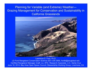
1. Planning for Variable (and Extreme) Weather—
Grazing Management for Conservation and Sustainability in
California Grasslands
Lawrence D. Ford, Ph.D.
LD Ford Rangeland Conservation Science (831-335-3959, fordld@sbcglobal.net)
Certified Rangeland Manager (Calif. Lic. #70) Research Associate, U.C. Santa Cruz
June 18, 2014, Bay Area Open Space Council, Stewardship Working Group, Livermore, CA
2. Outline:
1. Introduction
2. Risks and Challenges Due
to Extreme Weather for
Conservation of Working
Rangelands in California
3. Planning Framework to
Prepare for Extreme
Weather
4. Public-Private
Collaboration for
Resilience to Variable (and
Extreme) Weather
3. Introduction
1. When extreme weather occurs, what alternatives
to excluding livestock are available?
2. How can we achieve both conservation and a
sustainable livestock community?
3. How can we provide flexibility to minimize impacts
on special resources and the livestock operator?
4. Risks and Challenges
(Refer to Handout #1)
1. Soil Integrity (erosion
and compaction)
2. Grassland Condition
and Grazing Capacity
3. Special Habitat Areas
4. Pest Plants
5. Risks and Challenges
(Refer to Handout #1)
5. Woody Plants
6. Surface and Ground
Water
7. Grazing Operations Costs
8. Livestock Availability to
Perform Conservation
Services
6. Planning Framework
(Refer to Handout #2)
1. Grazing Management Plan
a. Resource conditions and
vulnerabilities
c. Predicted effects
d. Guidance for flexibility
e. Sustainability of the livestock
operation
2. Monitoring Reports
3. Adaptation of Management
Actions
7. Public-Private Collaboration for Resilience
Informal and semi-formal mechanisms for flexibility:
1. Private Networks Off-Site
2. Non-Habitat Flexible Use Fields On-Site
3. Regional Grass-Banks
4. Program for Temporary Emergency Grazing
Access
9. Grass-Banking
1. Uses and values
a) Replacement grazing land when forage is lost
b) Temporary alternative forage for displaced livestock
c) Supports sustainability of rancher-partners
d) Expedite exchange of forage when needed for
conservation practices
2. Membership and access
a) Members make long-term agreement
b) Members get access when needed or as planned
10. Grass-Banking
3. Pros & Cons for California (mostly cons…)
a) Too small size of properties to support enough
livestock
b) Unexpected high costs to operate (taxes, insurance,
fences, monitoring, and operation, administration)
c) Un-grazed or under-grazed grasslands can suffer
reduced quality of forage, pest plant invasions,
increased conditions for disease (pink-eye), and thus
lower livestock performance, when grazed
d) Degraded infrastructure, requiring expensive rebuilding
e) Reluctance to mix herds