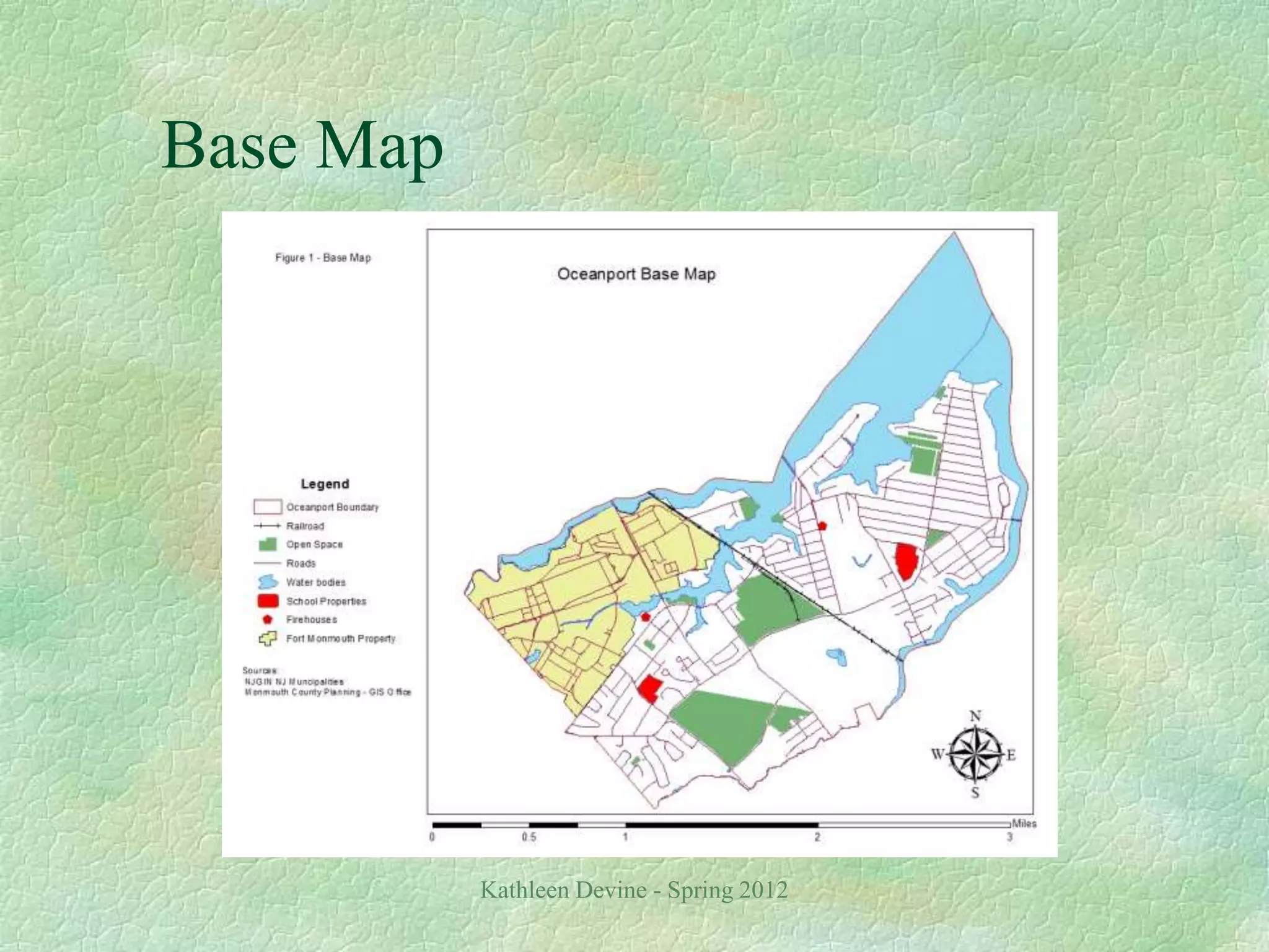
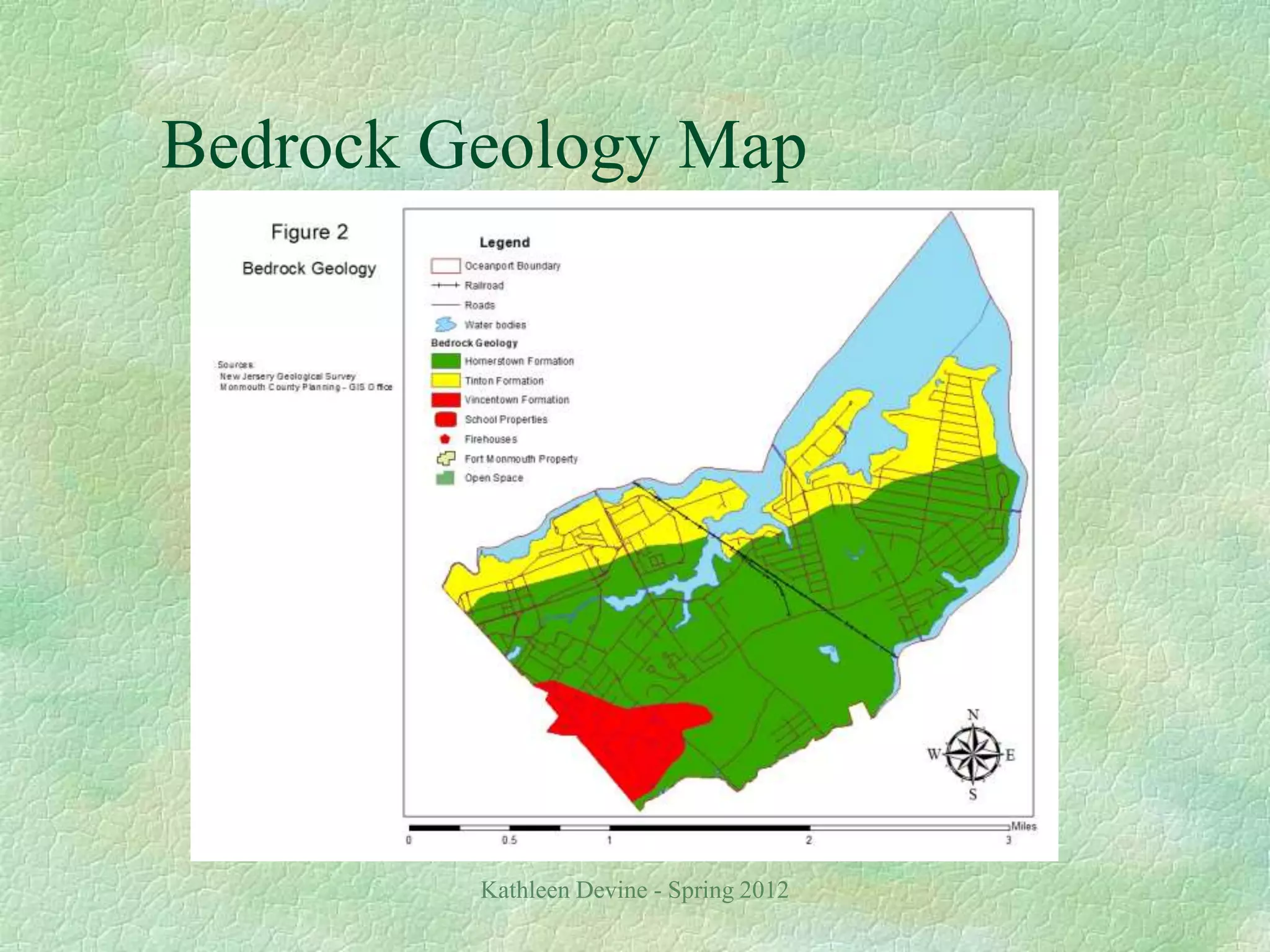
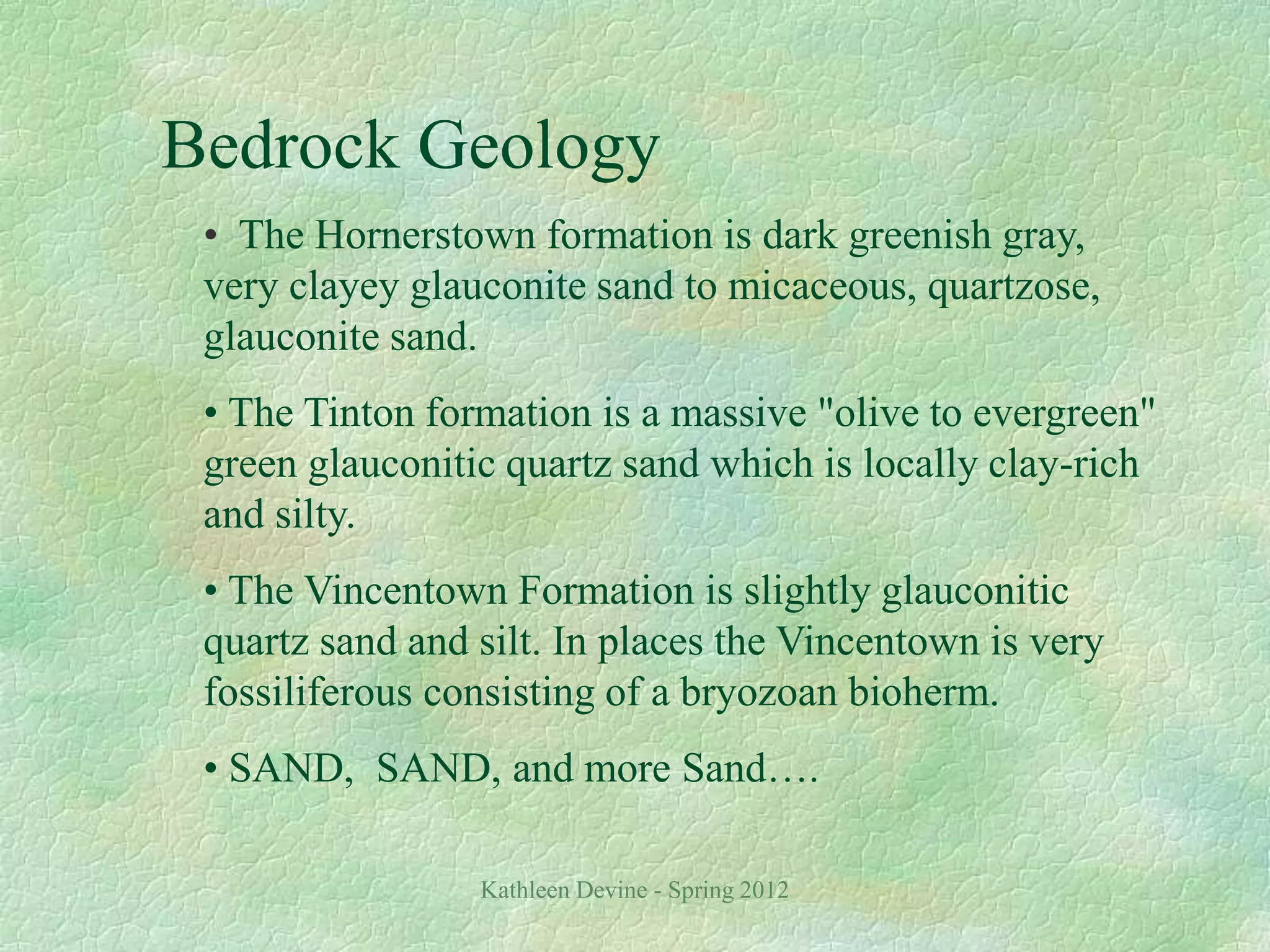
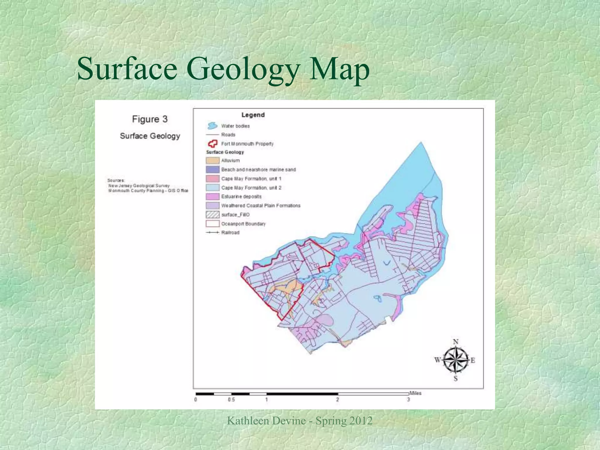
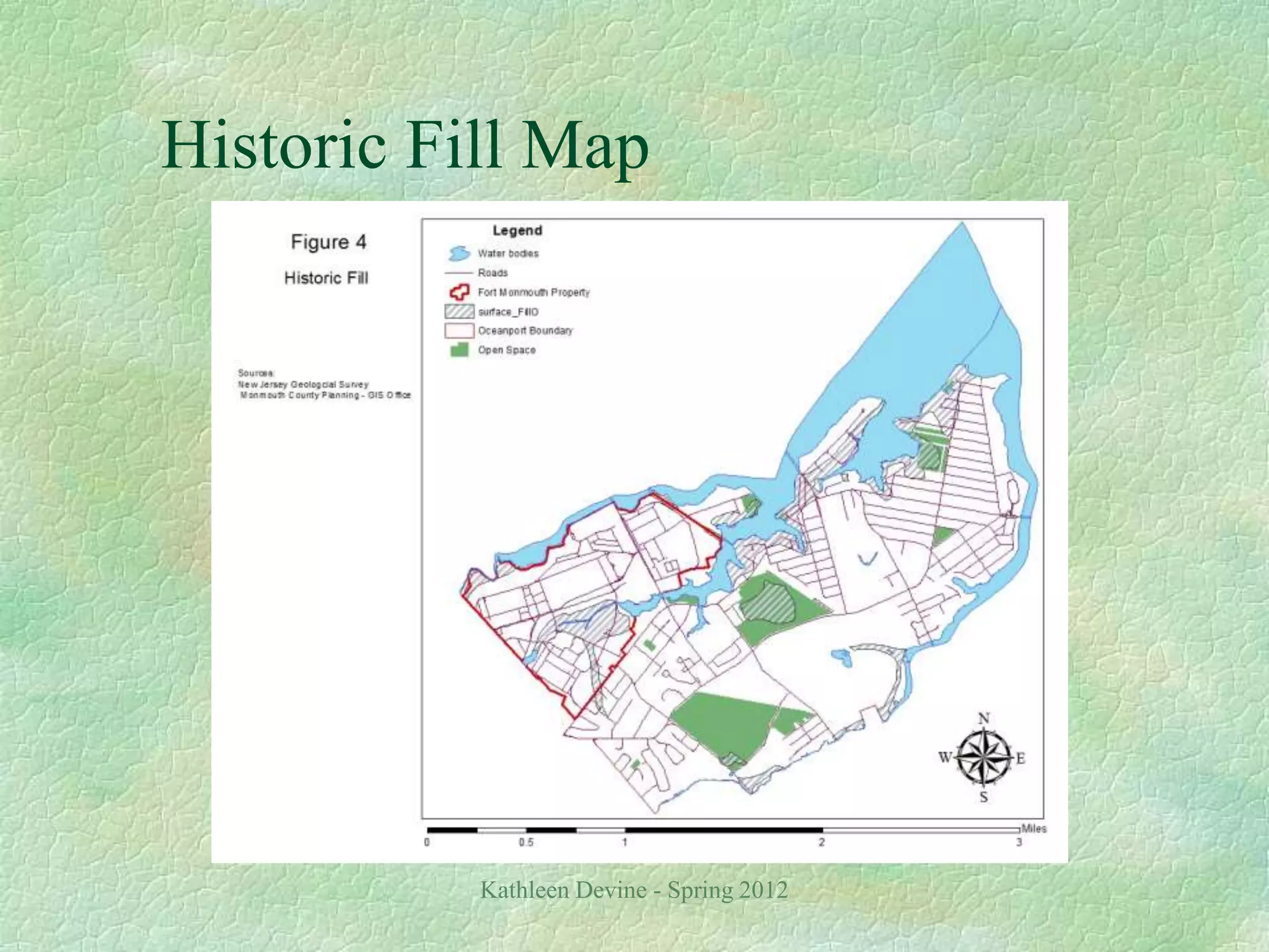
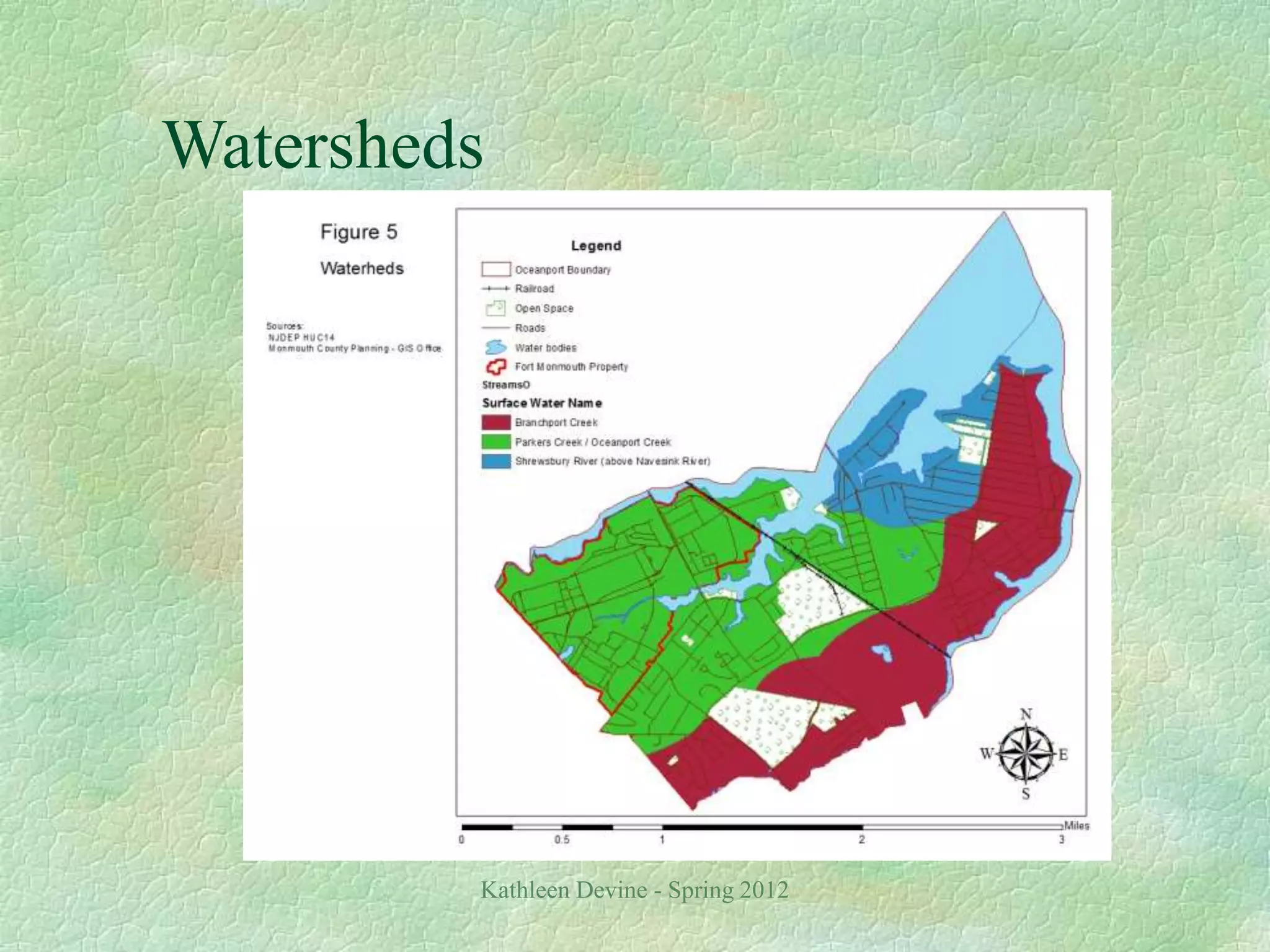
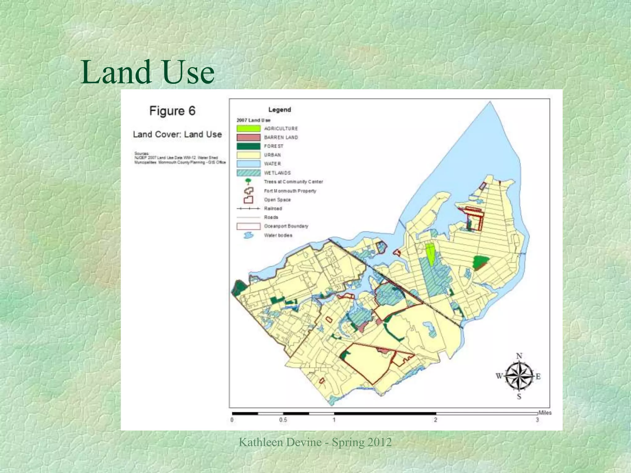
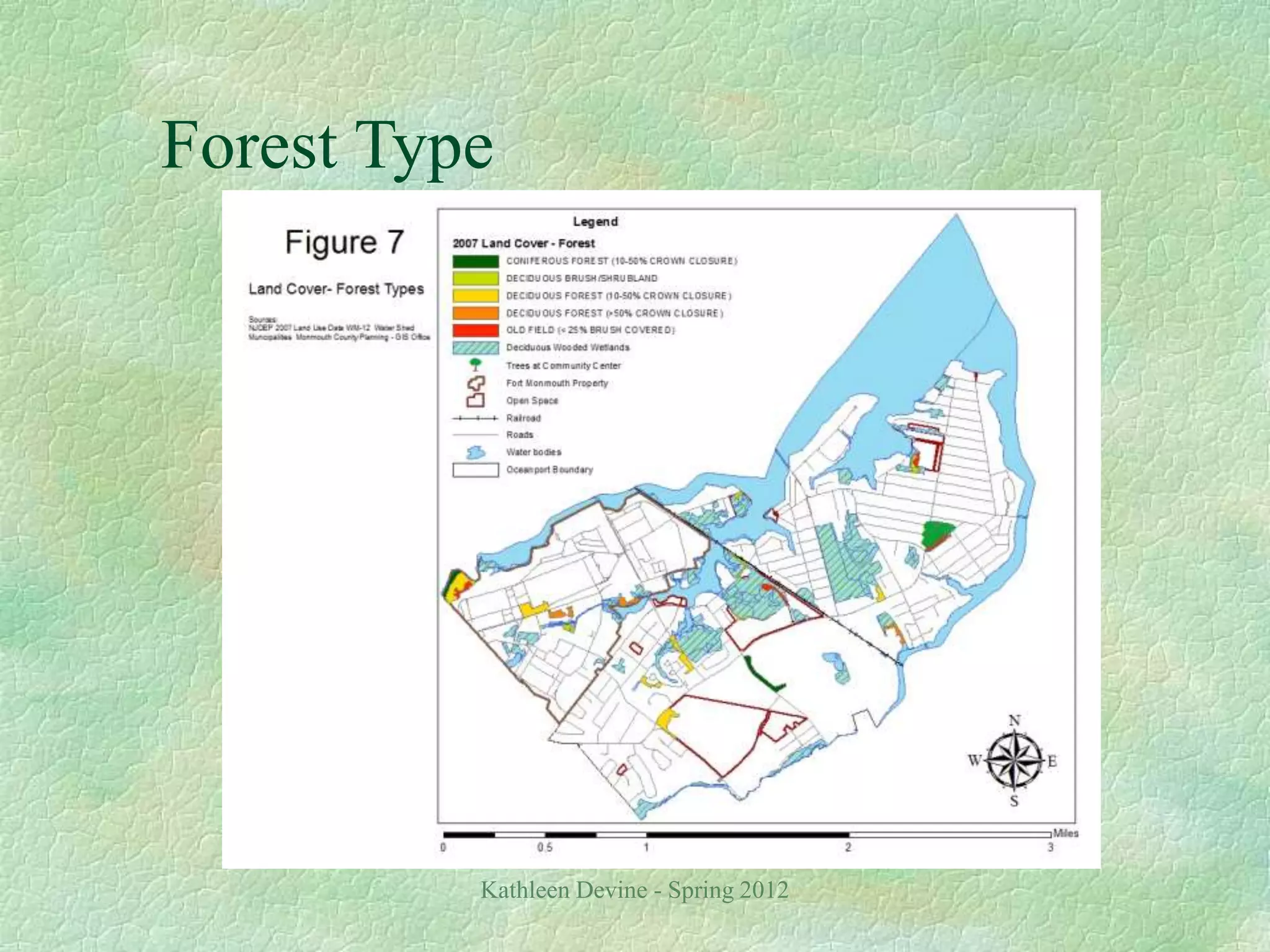
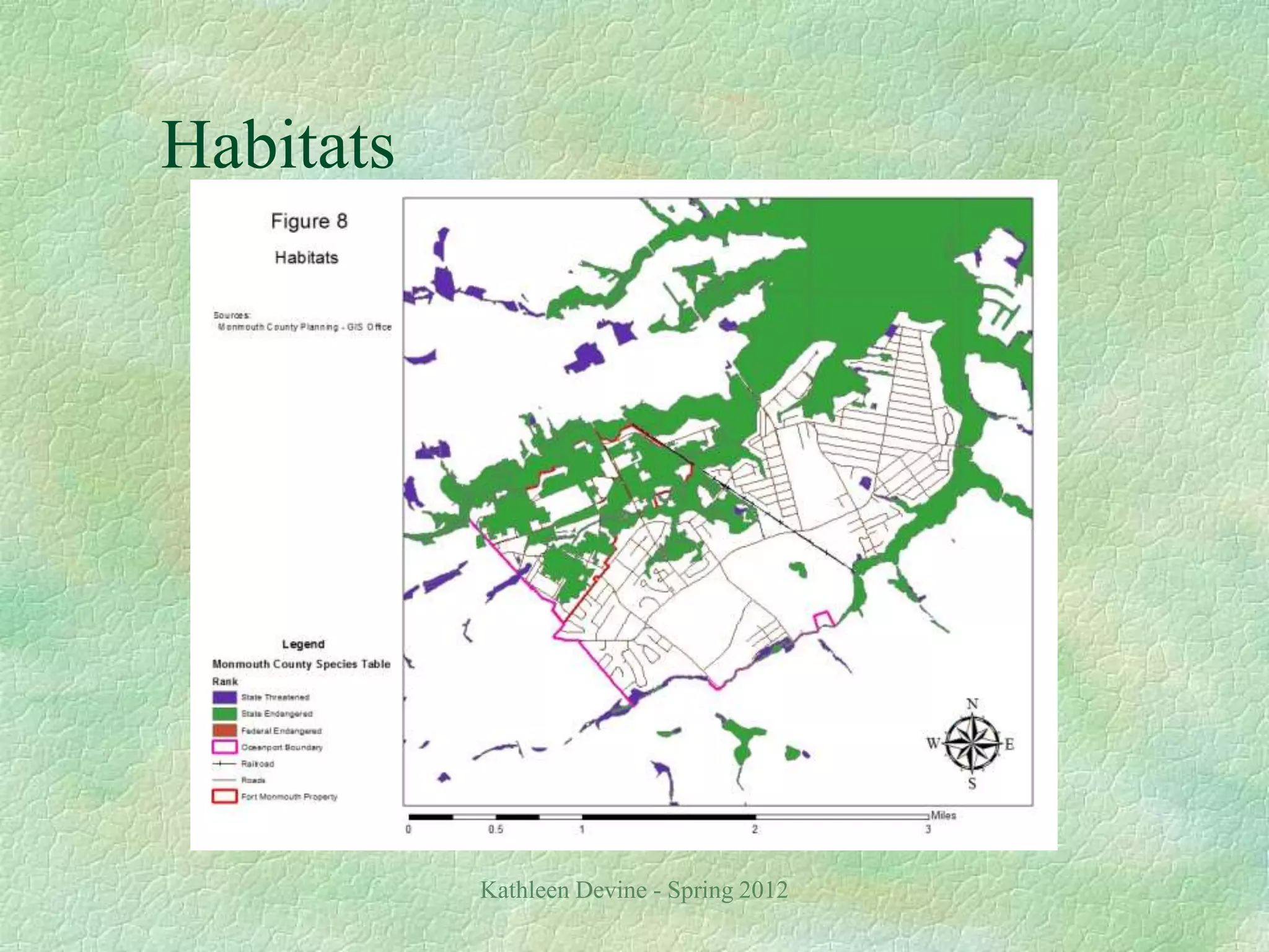
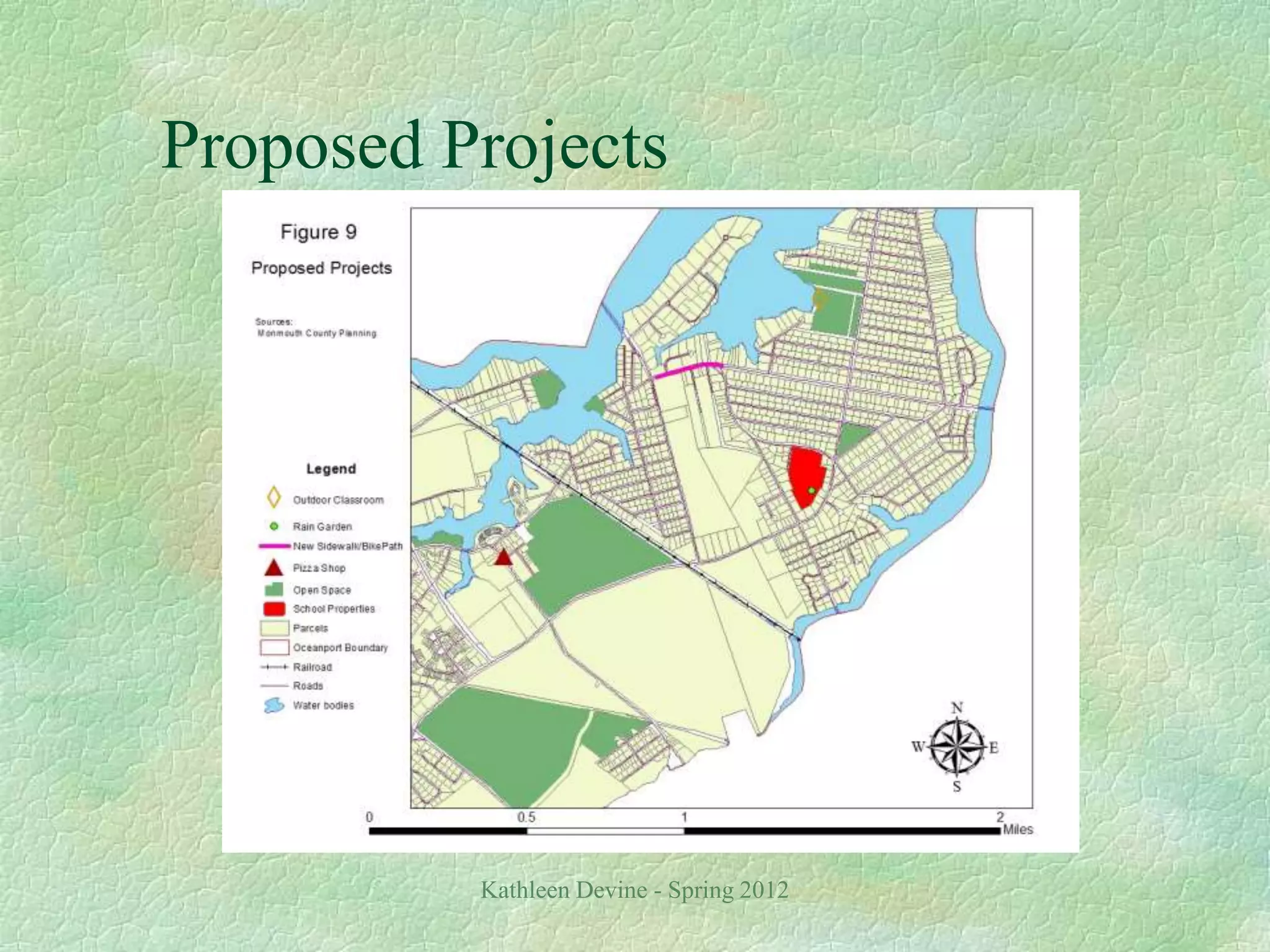
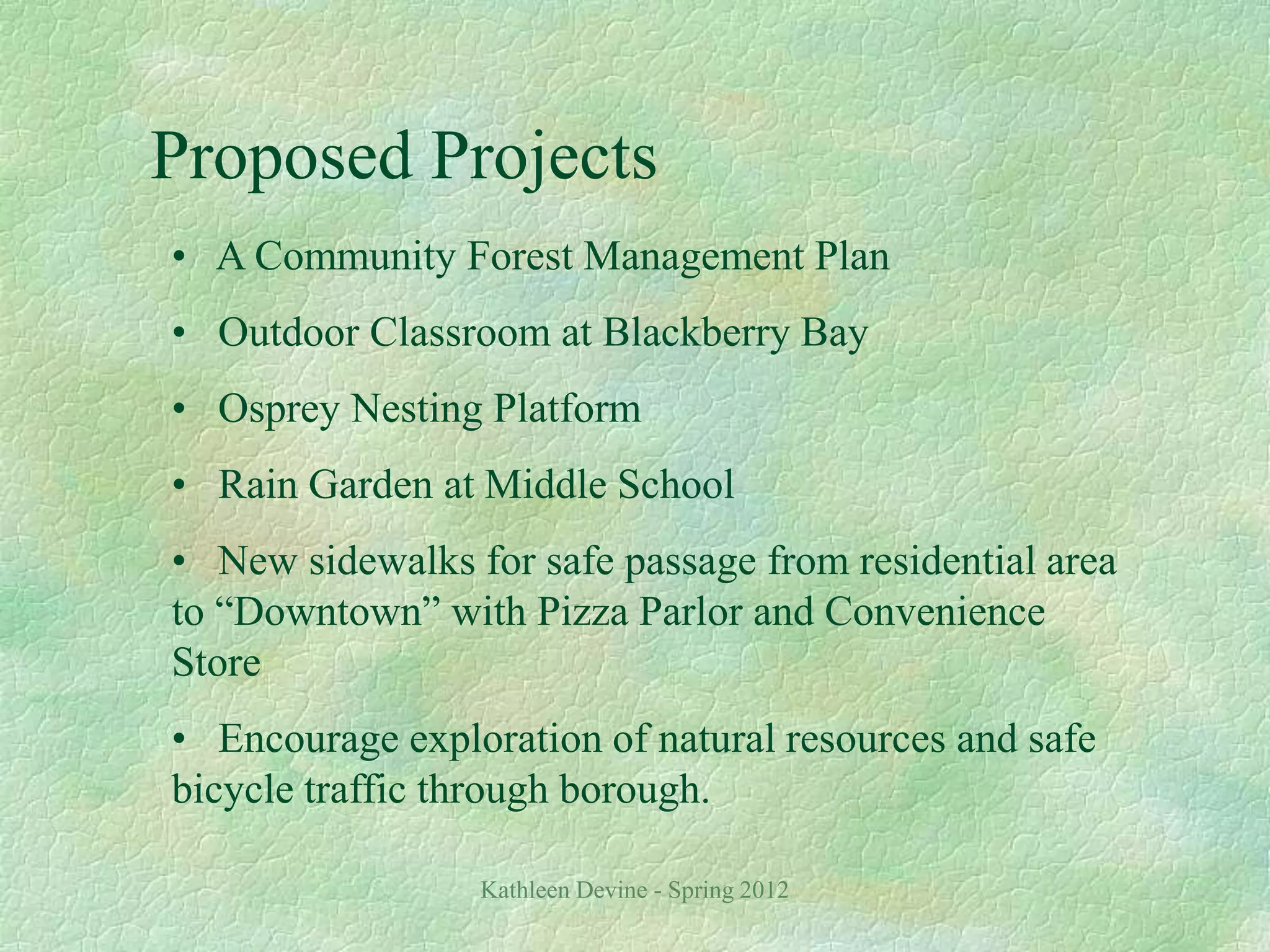
The document summarizes an environmental resource inventory (ERI) created by the Oceanport Environmental Commission in GIS format. It includes base maps of Oceanport along with maps of geology, watersheds, land cover, forests, and habitats. It also identifies some proposed projects like a community forest management plan and expanding safe walking paths. The ERI was created using existing data from NJDEP and the county to compile required natural resource information for the municipality's master plan as mandated by law.