1) Researchers at Macquarie University's Marine Climate Risk Group are studying how the predicted southward expansion of the tropics will impact storm activity, wave patterns, and beach erosion along Australia's coastline.
2) The group combines paleoclimatology research on past climates with coastal modeling to understand how coastal systems responded to previous periods of climate change in order to inform planning for current warming trends.
3) Their research suggests that as the tropics expand south, storms forming in the tropics may cause more frequent north-easterly swells along the New South Wales coast, bringing greater beach erosion and property damage than typical south-south-easterly swells.
The document discusses the causes and impacts of the 2004 Indian Ocean tsunami. It describes how the tsunami was triggered by a 9.3 magnitude earthquake caused by subduction along the Sumatra fault line. It also discusses the ecological impacts of the tsunami, including increased chlorophyll and phytoplankton blooming before the event, decreased marine life and fish populations after, and damage to coastal morphology and deterioration of water quality in affected areas. Prevention and mitigation efforts implemented since include warning systems, education campaigns, and coastal protection measures like mangrove preservation and breakwaters.
Introduction to AS Edexcel crowded coasts with lots of info on things like mangroves, salt marshes, reefs, population amonst other stuff with some extras in it, I have altered this from one I got from the NING site
Climate Change and Maritime Sector Essay Sampleessayprime
Climate change is affecting the maritime sector in several ways. Rising sea levels and changes in erosion and sedimentation patterns are impacting ports and shipping channels. Melting polar ice caps are opening new shipping routes but also increasing risks in polar regions for inadequately prepared vessels. Climate change is also negatively impacting marine ecosystems and fish stocks, posing challenges for fisheries managers and the fishing industry. While some new opportunities may arise for the maritime sector through activities like Arctic shipping lanes and mineral exploitation, the sector will also face risks and need to make infrastructure changes to adapt.
CAMBRIDGE GEOGRAPHY A2 REVISION - SUSTAINABLE MANAGEMENT OF HAZARDOUS ENVIRONMENTS. Presentation suitable for Cambridge A2 students. It contains: key terms and definitions, topic summary, additional work and suggested websites.
This document summarizes the relationship between global warming, sea level rise, and the melting of sea ice and continental ice sheets. It first discusses how increasing greenhouse gas emissions are causing global warming, which is melting both sea ice and continental ice reserves. However, it notes there is ambiguity about the rate of ice melting compared to the rate of sea level rise. The document then presents a conceptual model that differentiates the roles of sea ice, continental glaciers, and ice sheets in causing global or eustatic sea level rise. It concludes that while melting of continental ice sheets and glaciers, along with thermal expansion of the oceans, are responsible for recent sea level increases, melting of sea ice alone does not contribute to changes in global
The Slope of Our Beaches and How it Affects Sea Turtle NestginBHIConservancy
This document discusses a study measuring the slope of beaches on Bald Head Island and sea turtle nests to determine if slope affects nesting preferences. The study measured slope in four beach areas every two weeks and of sea turtle nests. Slope varied over time in most areas but not between locations. Nest slope did not match a preferred slope. Most nests were similar to slopes of less developed beaches. The study suggests slope changes do not affect nesting but provides nesting opportunities throughout the summer.
The document defines key coastal landforms and zones. It classifies Bangladesh's coast into 3 regions - eastern, central, and western - based on geomorphology, sediment composition, and economic activities. The central zone has high sediment deposition from river systems. The western zone has stable mangrove forests. Coasts can also be classified based on factors like river discharge, wave/tide forces, and sediment type. Sea level rise is caused by thermal expansion and melting ice, and impacts coasts through saltwater intrusion, wetland and agricultural land loss, and threats to fisheries and food security.
GEOGRAPHY IGCSE: DUNE FORMATION - MURIWAI BEACH NEW ZEALANDGeorge Dumitrache
This document discusses dune formation and examples of eroded and vegetated dunes at Muriwai Beach in New Zealand. It provides details on:
- How dunes are formed by wind transporting sand and depositing it in sheltered areas behind obstacles.
- Examples of eroded dunes at Muriwai Beach that have been exposed by erosion of dunes in front of them.
- The role of vegetation like pingao sedge in trapping sand and building/stabilizing dunes at Muriwai Beach.
- How the interaction between aeolian sand transport processes and vegetative growth shapes the dunes at Muriwai Beach.
The document discusses various coastal economic resources in Bangladesh, including heavy mineral deposits found along beaches, offshore petroleum exploration in the Bay of Bengal, marine fisheries resources, agriculture in coastal regions, salt production, forestry including mangrove forests, and tourism attractions along the coast. Seventeen placer deposits of heavy minerals have been found along beaches, while offshore petroleum exploration has identified gas reserves but continued challenges. Coastal economic activities also include marine fisheries, agriculture, salt production, forestry, and developing tourism.
Oregon Shores Conservation Coalition works to protect and restore Oregon's coastal areas. The document includes photos showing invasive species arriving from Japanese tsunami debris, coastal landslides affecting habitats, and sites being considered for liquified natural gas facilities and renewable energy projects. Oregon Shores represents coastal communities in state planning processes to help guide sustainable use and conservation of ocean resources.
1) The document discusses various geological features and processes in the Pensacola, Florida region, including faults, weathering, mass wasting, erosion, and sedimentary environments.
2) It provides examples of oxidation, chemical weathering, slumping, beach erosion, and how knowledge of geology is applied to construction.
3) The region faces challenges from hurricanes and coastal erosion but utilizes geological insights for building resilient infrastructure like hotels and bridges.
The document discusses the key geographic features of the ocean shore zone, including beaches, barrier islands, estuaries, and inlets. It also mentions some natural processes that affect these features such as waves, currents, tides, and storms.
This document summarizes projections of future Arctic climate from the research of Zachary Labe. Sea ice extent is declining at a rate of 0.8 million km2 per decade as Arctic temperatures rise more than twice as fast as the global average. This warming amplifies in the Arctic (Arctic amplification) and is influencing weather patterns in northern mid-latitudes. Research indicates that continued sea ice loss will cause significant warming over the Arctic Ocean and a shift in the jet stream, with impacts on weather extremes. Understanding Arctic climate variability is important for assessing future local and remote responses to changes in the region.
The document discusses the biosphere and the threats facing it. It defines the biosphere as the regions of Earth inhabited by living organisms, and notes there are 5 major biomes - aquatic, desert, forest, grassland, and tundra - which are further divided. It explains how the biosphere acts as a life support system and provides goods for humans. The major threats to the biosphere are deforestation, pollution, and climate change. Sustainable management of the biosphere's resources is important but faces economic, social, and environmental tensions.
A2 CAMBRIDGE GEOGRAPHY: COASTAL ENVIRONMENTS - WAVE, MARINE AND SUB-AERIAL PROCESSES. An overall presentation of the first sub-chapter of Coastal Environments chapter.
1) Accelerated climate change is impacting coasts through multiple interacting factors like changing weather patterns, wave energy spectra, and sea level rise.
2) A potentially significant threat is the increase in long wave energy, which is difficult to measure and analyze due to limitations in coastal monitoring instruments.
3) To better manage these climate change impacts, coastal resilience strategies need to take a holistic, system-wide approach focusing on the balanced interaction between incoming conditions and natural coastal dynamics, rather than traditional approaches like raising sea defenses.
This document summarizes research on climate change impacts along the coast of India. It finds that ocean heat content and sea levels are rising significantly due to climate change. Sea level rise poses major risks for India's coastal areas, which are densely populated and include important ecosystems. Studies show sea levels rising 1.3 mm/year along India's coasts. This could result in 13 cm of sea level rise by 2100. Coastal vulnerability assessments identify areas that are most at risk, incorporating factors like geomorphology, tides, waves and sea level trends. Multi-hazard maps combine sea level rise projections with storm surge and tsunami inundation maps to identify high risk zones. 3D modeling of coastal areas helps assess risks
The document discusses shoreline armoring along the Puget Sound region and its negative ecological effects. Upwards of 30% of Puget Sound shorelines are currently armored, disrupting the natural sediment cycle and reducing habitat. Studies have shown armoring leads to higher beach temperatures, less vegetation and insects, and decreased fish and invertebrate diversity and viability. Efforts are underway to limit new armoring, remove existing armoring from public lands, and educate the public on more natural shoreline protection methods.
This document provides an overview of continental margins. It begins with introducing the objectives of understanding the importance and characteristics of continental margins in the context of earth and oceanographic studies. It then discusses various topics relevant to continental margins, including the earth's crust, plate tectonics, sea floor spreading, types of plate boundaries and movement, and features of convergent and divergent plate boundaries. The key aspects of continental margins are that they are the submerged zones separating thick continental crust from thin oceanic crust, and form the outer edges of continents.
Antarctic climate history and global climate changesPontus Lurcock
Antarctic climate changes have been reconstructed from ice and sediment cores and numerical models (which also predict future changes). Major ice sheets first appeared 34 million years ago (Ma) and fluctuated throughout the Oligocene, with an overall cooling trend. Ice volume more than doubled at the Oligocene-Miocene boundary. Fluctuating Miocene temperatures peaked at 17–14 Ma, followed by dramatic cooling. Cooling continued through the Pliocene and Pleistocene, with another major glacial expansion at 3–2 Ma. Several interacting drivers control Antarctic climate. On timescales of 10,000–100,000 years, insolation varies with orbital cycles, causing periodic climate variations. Opening of Southern Ocean gateways produced a circumpolar current that thermally isolated Antarctica. Declining atmospheric CO2 triggered Cenozoic glaciation. Antarctic glaciations affect global climate by lowering sea level, intensifying atmospheric circulation, and increasing planetary albedo. Ice sheets interact with ocean water, forming water masses that play a key role in global ocean circulation.
The document discusses the difficulty of convincing Americans about the impending environmental crisis due to the US being the world's largest consumer and polluter. It will take US leadership to build international consensus on addressing this issue. The document also provides background on the El Nino phenomenon and its worldwide climatic effects.
The document discusses three types of evolution: geologic, biologic, and technologic. It focuses on geologic evolution, explaining how rocks, fossils, and ice cores provide evidence of changes to the Earth's surface and climate over time, as well as changes to life forms. The law of superposition and use of index fossils allow scientists to determine the relative ages of rock layers. Studying this geologic evidence has helped scientists develop an understanding of how the Earth and life have evolved over millions of years.
The document analyzes tide gauge data from five locations in the UK to determine historical sea level rise. It finds an average rise of 1.56mm per year over the period of available data for each location. However, sea level rise varies locally due to land movement. GPS data shows southern England is subsiding by up to 1.2mm/year while Scotland rises by 1-2mm/year, influencing relative sea level changes. Accounting for these land movements, sea levels have risen by 0.9-1.1mm/year independently of land movement effects. Rising sea levels are a concern for coastal areas due to potential flooding impacts.
Hello! I've created this PowerPoint presentation as a requisite in Disaster Readiness and Risk Reduction subject during SY 2019–2020.
Other Geological Hazards
- Bolide Impact
- Ground Subsidence
- Coastal Erosion
Should you need a .pptx file, kindly email me at rd.chrxlr@gmail.com.
The document provides information about various geographic concepts. It defines key terms related to rivers such as erosion, transportation, and landforms. It also discusses flooding, tropical storms, earthquakes, volcanoes, population, and settlement patterns. Specifically, it explains river erosion and transportation processes, landforms in the upper, middle and lower courses of rivers, physical and human causes of flooding, storm surge definition, effects of tropical storms, differences between Richter and Mercalli scales, earthquake focus and epicenter, volcano types, and population distribution, density, and models.
Climate, unlike weather, is measured over long periods of time and wide areas, and is influenced by both abiotic factors like ocean currents and volcanic activity as well as biotic processes like decomposition and photosynthesis. Evidence of climate change comes from many sources and greenhouse gases are essential to our climate, though climate change poses a threat if levels become too high as seen on Mars and Venus; therefore, efforts to reduce greenhouse gas emissions can help preserve Earth's habitability.
The reason for the occurrence of such a huge mass of water on the globe, is still a myth and reality. The reason goes back to the Origin of Earth itself. The exact mode of origin is not precisely known. Scientists assume, both Primary and secondary sources would have given rise to all both air and water on the earth. Two possible sources as internal source (or) external source have been proposed so far. Some of them are attributed towards the theories of origin of the earth.
This document discusses various coastal landforms and processes, their impacts on people, and methods for managing the coastline and tourist activities. It specifically describes rotational landsliding, longshore drift, and different hard and soft engineering options for reducing coastal erosion, including beach nourishment, groynes, riprap, and planting vegetation. It also addresses managing tourist access through designating protected areas, limiting visitor numbers, and building infrastructure like footpaths, fences, and visitors centers.
comparación de flecha obtenida por medio de la elástica para viga simplemente apoyada en sus extremos, con el resultado obtenido por medio del segundo teorema Castigliano
This document provides an orientation for an elementary gifted program called Target. It introduces communication methods like an education blog and Remind app. It outlines units of study by grade level and novels. It details that grades 2-5 receive bell-to-bell instruction in Target and discusses allowing optional BYOD for grades 3-5. The document promotes developing an independent, intelligent mindset and asks for any final questions.
The document discusses key parameters to consider when selecting a vacuum oil purifier:
1) Types of contaminants in the oil such as moisture, gases, solids, and acidity determine the purifier's design.
2) Flow rate depends on contamination entry rate and budget. Higher flow requires more efficient purification.
3) Efficiency is influenced by temperature, vacuum depth, and residence time - deeper vacuum and higher heat improve efficiency.
4) Cost depends on required flow rate, efficiency, vacuum pump type, and controls - higher performance means higher cost.
Mohnish Tak, a 3rd year BCA student at Dezyne E'cole College, developed an application in Visual Basic for stock maintenance. He thanks his mentors and college for their support and assistance during the project. The application includes windows for login, home, stock entry, sale entry, modifying and deleting stock and sales, and checking stock availability. Mohnish submitted details and screenshots of the application's various windows.
This document provides information about purchasing a 3Com JXAC894S-5K cable extension. It includes the product details, payment and shipping options, warranty information, and services offered by Launch 3 Telecom such as repair, maintenance contracts, de-installation, and recycling. Customers can purchase the product by phone, email, or online form and will receive same day shipping with tracking once their order is placed before 3pm EST.
Negative interest rate policy (NIRP) has been adopted by several central banks to stimulate economic growth and combat deflation. While NIRP aims to increase lending by making it costly for banks to hold reserves, there are also risks like encouraging risky behavior and reducing confidence. Economists disagree on whether NIRP's benefits outweigh the costs. For the large and complex US economy, most experts argue that monetary policy tools other than NIRP should be used before considering negative rates due to the policy's uncertainties.
This document discusses regulations for human subject research and the IRB review process. It provides an overview of the ethical principles from the Belmont Report including respect for persons, beneficence, and justice. It also reviews key events in research ethics history. The document outlines the steps for developing a research study including distinguishing research from quality improvement. It discusses the MSU reliance process and IRB submission requirements such as elements of a consent form and HIPAA authorization documentation.
The document discusses the concept of resiliency and provides information on developing resilience. It defines resiliency as the ability to overcome challenges and adversity and emerge stronger. Protective factors that can help build resilience are discussed, such as social support systems and personal characteristics like a sense of humor and self-efficacy. Risk factors that undermine resilience are also outlined. The document then provides several "keys" to building resilience, like maintaining perspective, being adaptable, and accepting oneself. It concludes by discussing strategies for coping with daily problems, life-altering adversity, and how to avoid cognitive "sink holes" that can hamper one's resilience.
Este documento resume los derechos legales que tienen los padres de estudiantes de educación especial según la ley IDEA. Entre estos derechos se incluyen el derecho a participar en reuniones sobre la educación de su hijo, dar su consentimiento antes de cualquier evaluación o cambio educativo, recibir copias de los resultados de las evaluaciones, solicitar evaluaciones independientes y participar en la preparación del Programa Educativo Individualizado de su hijo. También cubre el derecho al acceso de los expedientes del estudiante, el proceso para presentar querellas
This document summarizes key announcements from re:Invent 2016 related to serverless technologies on AWS. It discusses new features for AWS Lambda including environment variables, dead letter queues, and upcoming support for Go and Node.js 6.9. It also introduces AWS Step Functions for orchestrating microservices, Serverless Application Model (SAM) for describing serverless apps, and Amazon CodeBuild for continuous integration/delivery of serverless projects. Other new services highlighted include AWS Greengrass, Lambda@Edge, Amazon Rekognition, and Amazon Lex.
Social Media Strategies for Special Event SuccessJosh Hirsch
Want to leverage the full potential of social media to build on the success of your special events? Learn key strategies to integrate, before during, and after events to maximize communication potential and build buzz. #sm4events
This document analyzes the design elements of a magazine contents page, including the images, colors, text, fonts, and layout. It notes that the large black and white band image takes up most of the page to draw attention. The faded colors give a vintage feel. The serif fonts aim for an older readership. Hierarchy is shown by positioning the most popular band member at the front. Details are kept vague to encourage reading the full articles.
According to a report by the Pacific Institute, sea level rise of 1-1.4 meters by 2100 could cause $100 billion in property damage along California's coast, flooding areas where over 450,000 people live. Waves play a major role in coastal erosion, which is exacerbated by sea level rise and threatens over 30 million Californians. Oceanographer Tim Janssen studies wave modeling to better understand wave behavior and its effects on coastal erosion, though predictions are challenging given the complex physics involved. Improving such predictions will help inform policies around protecting California's coastlines from damage and flooding due to sea level rise and erosion.
EOS presentation at Interdisciplinary graduate school, April 2012EarthObsSingapore
The document discusses several areas of science studied at the Earth Observatory of Singapore including volcanology, earthquake science, climate change, sea level change, and tsunamis. The EOS works to improve understanding of volcanic activity in Southeast Asia, increase knowledge of earthquakes to enable better forecasting, study the effects of climate change, assess local impacts of sea level rise, and conduct research on tsunamis to help mitigate risks.
Abstract
South Biscay coastally trapped disturbances known as gales (galernas, enbatak, galarrenak, bruilartak) are adverse phenomena that send along the Cantabrian and Basque Coast a narrow jet of sudden and violent gusts of wind that do not follow a hydrostatic balance parameterization, being faster, stronger and of a Western-North-Westerly component, and accelerate as they rush Eastward enduring their speed and intensity. These gales run the coast line from West to East strengthening in Eastern Cantabrian Seashore line from May to October.
The document discusses the relationship between regional weather changes in Australia and subsequent earthquakes in surrounding regions. It argues that regional weather changes can reliably predict earthquakes, acting as precursors by occurring 15-30 days before quakes. Specific weather events like cyclones and flooding are claimed to originate from geological processes and heat generation that also cause earthquakes. Methodology discusses how friction between tectonic plates generates heat, warming the ocean and forming weather systems like tropical cyclones, which then precede quakes in surrounding regions.
Coastal erosion is a natural process that shapes shorelines through the wearing away of coastal land and beaches by the impact of waves. It involves the redistribution of sediments by waves, currents, tides, wind, and water. Coastal erosion is exacerbated by both natural processes like storms and sea level rise, as well as human activities such as coastal development and sand mining. This can lead to property damage, loss of tourism, harm to infrastructure and the environment, and the destruction of historical landmarks. Preventing and managing coastal erosion requires careful land use planning, limiting development in high-risk areas, and using structural measures selectively.
The document describes a thesis submitted to the Cochin University of Science and Technology for the degree of Doctor of Philosophy. The thesis, authored by K.V. Thomas, examines the beach-surf zone morphodynamics along a wave-dominated coast. It includes 7 chapters that study topics such as nearshore waves and processes, beach and surf zone morphological features, and the morphodynamic response of the beach-surf zone system to changing wave conditions.
Beach surf zone morphodynamics muy buenoEdgar Bernabe
The document discusses beach and nearshore zone morphodynamics along a wave-dominated coast. It presents a thesis submitted to the Cochin University of Science and Technology for the degree of Doctor of Philosophy. The thesis examines beach-surf zone processes at Valiathura on the southwest coast of India through field observations and analysis of nearshore waves, beach profiles, currents, and sediment characteristics.
Coastal processes shape coastal landscapes through erosion, deposition, and transportation of materials. Waves, wind, and tides are the main drivers of coastal processes, with waves providing over half the energy. Coastal processes form landforms like dunes, beaches, and barrier islands within 5 km of the coast through erosion of some areas and building up of sediments in others. Constructive waves deposit materials while destructive waves erode coastlines. Tides and wave types affect whether coastal areas experience erosion or deposition.
A2 Geography Revision for Coastal Environments, subchapter 8.1 Waves Marine and Subaerial Processes. It is suitable for Year 13 Geography, Cambridge Examination in November 2016. It contains: key terms and definitions, a topic summary, sketches and descriptions, additional work (6 questions for testing your knowledge) and some suggested websites.
Global climate change is affecting coastal environments in several ways:
1) Sea-level rise is leading to inundation and erosion of coastal areas and saline intrusion into waterways.
2) Low-lying coastal deltas, floodplains, and estuaries are particularly vulnerable to sea-level rise.
3) Changes in ocean currents are also impacting coastal environments.
The document summarizes the formation and types of coastlines. It defines a coastline as the boundary where land meets the sea. Coastlines are formed through the erosion and deposition actions of waves, tides, currents and other marine processes on sediments and rocks. Major coastal landforms include beaches formed from sediment deposition, as well as erosional features like sea cliffs, wave-cut platforms, sea stacks and sea arches formed through wave erosion. Coastlines are classified based on their dominant formation processes into primary coastlines formed through terrestrial processes and secondary coastlines formed through marine erosion and deposition.
The document is a 17-page geography SBA report by Okay-Lia Buchanan investigating how wave processes contribute to coastal landform formation in Hellshire, St. Catherine, Jamaica. The study was conducted along 500 meters of coastline near Cliff Boulevard on October 3rd, 2022. Various coastal features were observed including two headlands, a bay, a cliff, and two berms. Data on wave types and frequencies were collected through observation and using a stopwatch. Spilling and surging waves were found to be most effective at sediment deposition. In conclusion, the fieldwork provided insight into how erosion and deposition by wave activity influenced the coastal landforms in the study area.
3.ocean, geothermal, hydro and biomass energy resourcesDrPriteeRaotole
Ocean Energy: Ocean Energy Potential against Wind and Solar, Wave Characteristics
and Statistics, Wave Energy Devices.
Tidal energy,Tide characteristics and Statistics, Tide Energy Technologies, Ocean
Thermal Energy, Osmotic Power.
b. Geothermal Energy: Geothermal Resources, Geothermal Technologies.
c. Hydro Energy: Hydropower resources, hydropower technologies, environmental impact
of hydro power sources.
d. Biomass energy: biomass, biochemical conversion, biogas generation, Ocean biomass
International Journal of Engineering and Science Invention (IJESI)inventionjournals
International Journal of Engineering and Science Invention (IJESI) is an international journal intended for professionals and researchers in all fields of computer science and electronics. IJESI publishes research articles and reviews within the whole field Engineering Science and Technology, new teaching methods, assessment, validation and the impact of new technologies and it will continue to provide information on the latest trends and developments in this ever-expanding subject. The publications of papers are selected through double peer reviewed to ensure originality, relevance, and readability. The articles published in our journal can be accessed online.
3 luc debontridder climate change and its effects on transport flowsbdm2012
- The document discusses the increasing frequency of extreme weather events like rogue waves and winter storms due to climate change. It may soon be possible to sail directly over the North Pole as Arctic sea ice is rapidly disappearing.
- Rogue waves, which can be over twice the size of surrounding waves, are still not well understood but may result from wave interference or focusing. The Draupner wave in 1995 measured 26 meters high.
- Winter storms in Europe are projected to increase slightly in frequency, while hurricanes in the Atlantic could become more intense with higher rainfall amounts due to warming oceans, though the link remains uncertain.
- As Arctic sea ice reaches record lows, shipping
1. The document summarizes research on the direct and indirect causes of beach erosion in Negril, Jamaica and the role of climate change. 2. Direct causes include hurricanes, storm surges, and sea level rise exacerbated by climate change, which are expected to increase in frequency and intensity. 3. Indirect causes include degradation of coral reefs and shoreline vegetation from climate change impacts and human activities, which reduce natural protections against erosion.
The document discusses the Sethusamudram shipping canal project in India. It mentions that Tuticorin Port Trust was appointed as the nodal agency for the project in 1997. An initial environmental examination was conducted that found the project would have negligible environmental impact. However, some researchers have since raised concerns about potential impacts like increased soil erosion and tsunamis affecting the southern India coastline. The document also discusses issues around the project's environmental impact assessment and gaps in studying topics like sedimentation patterns and subsurface geology.
The document contains a geography exam paper with multiple choice and structured questions on various topics:
1. Plate tectonics - describing the processes and landforms at a convergent plate boundary.
2. Volcanoes - explaining the differences in shape between a shield volcano and stratovolcano.
3. Earthquakes - identifying two factors that affect earthquake damage.
4. Mangroves - describing their global distribution and how mangrove tree roots adapt to their environment.
5. Coasts - comparing characteristics of constructive and destructive waves, identifying a coastal landform, and describing opinions on the effectiveness of different coastal management strategies.
What is oceanography and what are its role in Science Olympiad.pdfSSSI .
Oceanography is a very crucial topic of the science Olympiad. It is a logical discipline that digs into the exhaustive investigation of the World's seas.
The document discusses the relationship between climate change and the ocean. It notes that the ocean absorbs over 30% of carbon dioxide emissions, which is causing the ocean to warm and become more acidic. This is negatively impacting ocean ecosystems and species. Species are migrating to new areas as the climate changes, which could create international issues. Addressing climate change will require significant reductions in greenhouse gas emissions globally through policies like the Paris Agreement. Protecting coastal ecosystems like mangroves and seagrasses can also help mitigate climate change by storing carbon.
Similar to Final MQMarine_Forge Article_HIGHRES (20)
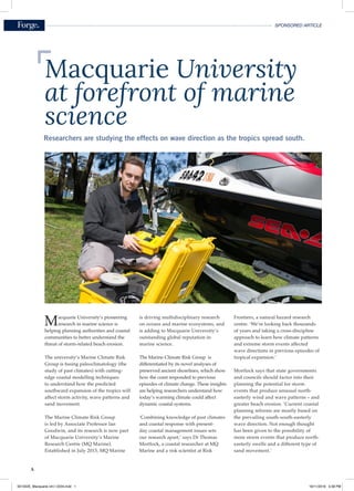
1. A
SPONSORED ARTICLE
Researchers are studying the effects on wave direction as the tropics spread south.
Macquarie University’s pioneering
research in marine science is
helping planning authorities and coastal
communities to better understand the
threat of storm-related beach erosion.
The university’s Marine Climate Risk
Group is fusing paleoclimatology (the
study of past climates) with cutting-
edge coastal modelling techniques
to understand how the predicted
southward expansion of the tropics will
affect storm activity, wave patterns and
sand movement.
The Marine Climate Risk Group
is led by Associate Professor Ian
Goodwin, and its research is now part
of Macquarie University’s Marine
Research Centre (MQ Marine).
Established in July 2015, MQ Marine
is driving multidisciplinary research
on oceans and marine ecosystems, and
is adding to Macquarie University’s
outstanding global reputation in
marine science.
The Marine Climate Risk Group is
differentiated by its novel analyses of
preserved ancient shorelines, which show
how the coast responded to previous
episodes of climate change. These insights
are helping researchers understand how
today’s warming climate could affect
dynamic coastal systems.
‘Combining knowledge of past climates
and coastal response with present-
day coastal management issues sets
our research apart,’ says Dr Thomas
Mortlock, a coastal researcher at MQ
Marine and a risk scientist at Risk
Frontiers, a natural hazard research
centre. ‘We’re looking back thousands
of years and taking a cross-discipline
approach to learn how climate patterns
and extreme storm events affected
wave directions in previous episodes of
tropical expansion.’
Mortlock says that state governments
and councils should factor into their
planning the potential for storm
events that produce unusual north-
easterly wind and wave patterns – and
greater beach erosion. ‘Current coastal
planning reforms are mostly based on
the prevailing south-south-easterly
wave direction. Not enough thought
has been given to the possibility of
more storm events that produce north-
easterly swells and a different type of
sand movement.’
Macquarie University
at forefront of marine
science
501352E_Macquarie Uni I 2234.indd 1 16/11/2016 5:58 PM
2. B
SPONSORED ARTICLE
He adds: ‘We can help planning
authorities incorporate the kind of
sensitivity analyses we do with wave
direction into their coastal management
strategies to better prepare for climate
change impacts.’
Safeguarding Australia’s coastline
MQ Marine’s work is timely. More
than eight in 10 Australians live
within 50 kilometres of the coastline.
Overdevelopment in some coastal areas
that began in the 1970s has left a legacy
of too much building within the active
beach profile – the part of the beach that
is always changing.
A fierce east-coast storm in early June
2016 that damaged beach properties
in the Collaroy-Narrabeen strip of
Sydney’s Northern Beaches could be a
harbinger of things to come as tropical
climates extend south. MQ Marine
researchers are closely studying the
storm and comparing it to similar events
that occurred hundreds of years ago.
The storm, dubbed a Black Nor’ easter,
had an uncommon combination of large
wave heights from the north-east, strong
onshore winds and some of the year’s
highest tides. The result was significant
beach erosion and structural damage at
the southern end of Collaroy Beach.
North-easterly swells during three
consecutive days were rare. These wave
patterns have occurred for less than
one per cent of the time during the past
30 years. South-south-easterly swells
usually dominate Australia’s eastern
coastline.
The north-easterly wave pattern has
historically caused higher-than-normal
wave power along the New South
Wales shelf and coast. The result has
been energetic inshore wave conditions
focused on the southern ends of exposed
beaches, and large quantities of sand
movement and beach erosion.
Shifting sands as tropics expand
Goodwin, Mortlock and Dr Stuart
Browning of Macquarie University
published an important paper in
June 2016 on tropical storms and
sand movement. Their research was
published in the prestigious Journal of
Geophysical Research: Oceans.
The authors projected that tropical
expansion would reduce coastal stability
through directional wave-climate shifts
and lead to a significant reduction in
northward sand flow.
They predicted a reduction of around
30 per cent over the next decade in
longshore sand transport during
dominant extratropical-origin storm
events – a finding that was reported
in several New South Wales and
Queensland newspapers in August, and
featured on the ABC program Catalyst.
Simply put, the authors found that
storms that form in the tropics, similar
to the Black Nor’ easter, may become
more common for the Sydney area as
the tropics expand. Storms that form in
the Tasman Sea’s southern reaches may
be less common as a result. This means
potentially more north-easterly swells,
which in turn have potential for greater
beach erosion and property damage,
and fewer south-south-easterly swells.
This development could affect sand
flow along Australia’s east coast. The
southerly swells that currently dominate
the wave climate move sand from the
south to the north. As these swells
reduce in frequency, there will be less
energy transporting sand in a northerly
direction, which would affect beaches in
northern New South Wales and South
East Queensland.
This trend has implications for state
governments, local councils, the tourism
industry, coastal property owners and
beachgoers. As less sand is replenished
from down south, the southern ends
of exposed beaches could face greater
property damage during tropical
storms.
‘Our research suggests that the type of
storm that damaged parts of Collaroy
beach in June could become a more
frequent feature along the New
South Wales coast in the future,’ says
Mortlock. ‘The general consensus
among wave-research climate modelling
is that we are going to see more north-
easterly and easterly swells in coming
years.’
The authors’ theory is based on an
observed poleward expansion (by other
researchers) of the tropics in coming
years. The tropics are expected to extend
south by 2.5 degrees on Australia’s east
coast over the next 100 years. That,
Professor Simon George, Director of MQ Marine, headspace gas sampling
from drill cores on board the Joides Resolution research vessel
501352E_Macquarie Uni I 2234.indd 2 16/11/2016 6:02 PM
3. C
SPONSORED ARTICLE
in turn, suggests that tropical-origin
storms will track further south, affecting
the direction of swells and, ultimately,
northward sand movement.
Goodwin’s research shows that such
wave climate change and reduced sand
transport has shaped and reshaped the
eastern Australian coast over the past
few thousand years.
Mortlock stresses that sand taken from
Sydney beaches during a north-easterly
swell sits close to the shore, before
working its way back up the beach. ‘The
sand is not lost from the system and will
eventually build the beach up again. But
it won’t build up a sand dune again, and
damage to property will have already
been done.’
The risk, says Mortlock, is of a cluster
of storms, such as the Black Nor’
easter, appearing in quick succession
and not giving the affected beaches a
chance to recover.
Macquarie helping coastal
communities through marine research
The study of tropical storm wave
patterns is one of several exciting
projects within Macquarie University’s
MQ Marine.
MQ Marine hosts biannual workshops
that bring together some of the world’s
leading international and Australian
marine science researchers at Macquarie
University’s Sydney campus and at
international conferences. The goal
is to foster interdisciplinary research
collaborations that identify topical new
research directions.
MQ Marine has an active PhD program
and a mentoring program for early-
career researchers that exposes younger
researchers to key projects. Associate
Professor Goodwin, one of Australia’s
leading marine scientists, supervised
Mortlock’s PhD. Goodwin has been
developing an interdisciplinary
approach to solving coastal problems for
the past 30 years.
Mortlock, also a chartered engineer, says
that MQ Marine’s capacity to explore
coastal engineering problems from a
scientific perspective is a key strength.
‘The engineering profession, for
example, tends to look at a single-storm
event and focuses on a construction
response, such as building a buried sea
wall. We’re looking at storms as part
of the bigger picture of coastal change:
literally, over thousands of years.
‘History gives us clues as to how the
coast reacted to similar storm events.
By combining a paleo perspective with
the latest technology, and drawing on
research perspectives from different
fields, MQ Marine at Macquarie
University is making marine science
discoveries that can have a real impact
in the community – discoveries that will
help Australia’s precious coastline and
those who rely on it.’
Macquarie Lighthouse, Sydney
WE’RE LOOKING BACK
THOUSANDS OF YEARS
AND TAKING A CROSS-
DISCIPLINE APPROACH
TO LEARN HOW
CLIMATE PATTERNS
AND EXTREME STORM
EVENTS AFFECTED
WAVE DIRECTIONS IN
PREVIOUS EPISODES
OF TROPICAL
EXPANSION
To learn more about the Macquarie
University MQ Marine Research Centre,
visit www.mq.edu.au/mqmarine.
501352E_Macquarie Uni I 2234.indd 3 16/11/2016 5:37 PM
4. Enhancing marine
science collaboration
MARINE RESEACH CENTRE
MQ Marine is a Research Centre at Macquarie University in Sydney, Australia. MQ Marine
aims to enhance innovative and interdisciplinary research in marine science by:
• Understanding the fate of our oceans and marine ecosystems given the unparalleled rate
of change towards warm conditions last experienced more than 50 million years ago.
• Assessing the rate and magnitude of change using the Earth’s geological record and novel
ancient DNA analyses to assess sustainability and reconstruct changing marine communities.
• Linking the fate of ecological communities with sedimentological and hydrodynamic
processes in dynamic coastal ecosystems.
• Increasing the sustainability of coastal communities by understanding how the
predicted southward expansion of the tropics will affect storm activity, wave patterns
and sand movement.
mq.edu.au/mqmarine
E: marinescience@mq.edu.au
501352A_Macquarie Uni I 2234