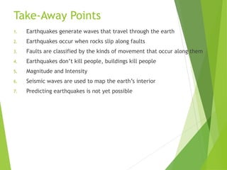
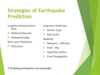
Take-Away Points
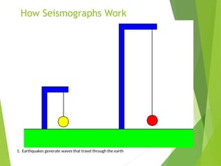
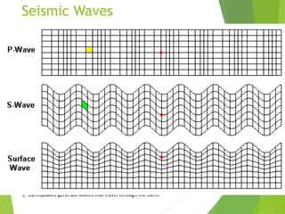
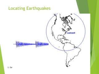
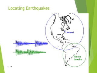
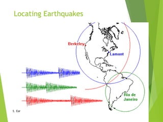
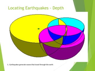
1. Earthquakesgenerate waves that travel through the earth
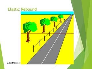
2. Earthquakes occur when rocks slip along faults
3. Faults are classified by the kinds of movement that occur along them
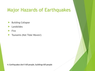
4. Earthquakes don’t kill people, buildings kill people
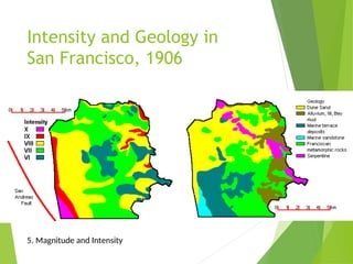
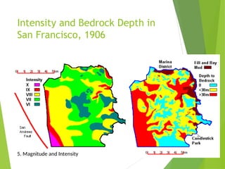
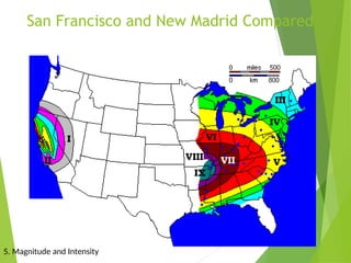
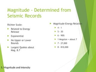
5. Magnitude and Intensity
6. Seismic waves are used to map the earth’s interior
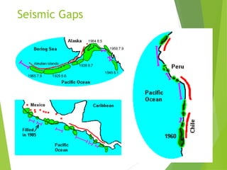
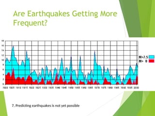
7. Predicting earthquakes is not yet possible
3.
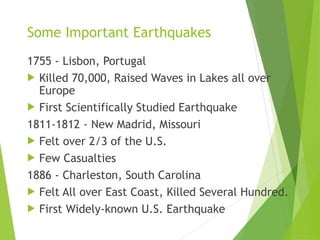
Some Important Earthquakes
1755- Lisbon, Portugal
Killed 70,000, Raised Waves in Lakes all over
Europe
First Scientifically Studied Earthquake
1811-1812 - New Madrid, Missouri
Felt over 2/3 of the U.S.
Few Casualties
1886 - Charleston, South Carolina
Felt All over East Coast, Killed Several Hundred.
First Widely-known U.S. Earthquake
4.
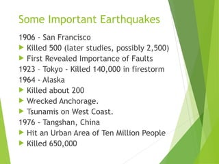
Some Important Earthquakes
1906- San Francisco
Killed 500 (later studies, possibly 2,500)
First Revealed Importance of Faults
1923 – Tokyo - Killed 140,000 in firestorm
1964 - Alaska
Killed about 200
Wrecked Anchorage.
Tsunamis on West Coast.
1976 - Tangshan, China
Hit an Urban Area of Ten Million People
Killed 650,000
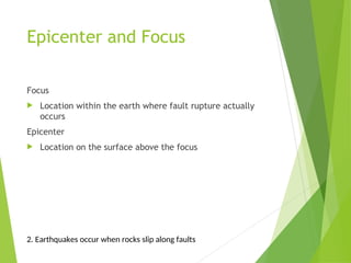
Epicenter and Focus
Focus
Location within the earth where fault rupture actually
occurs
Epicenter
Location on the surface above the focus
2. Earthquakes occur when rocks slip along faults
13.
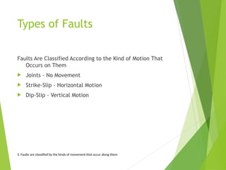
Types of Faults
FaultsAre Classified According to the Kind of Motion That
Occurs on Them
Joints - No Movement
Strike-Slip - Horizontal Motion
Dip-Slip - Vertical Motion
3. Faults are classified by the kinds of movement that occur along them
14.
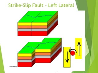
Strike-Slip Fault –Left Lateral
3. Faults are classified by the kinds of movement that occur along them
15.
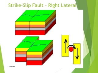
Strike-Slip Fault –Right Lateral
3. Faults are classified by the kinds of movement that occur along them
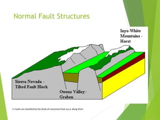
16.
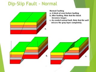
Dip-Slip Fault -Normal
3. Faults are classified by the kinds of movement that occur along them
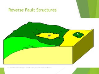
17.
Dip-Slip Fault -Reverse
3. Faults are classified by the kinds of movement that occur along them
18.
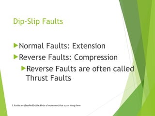
Dip-Slip Faults
Normal Faults:Extension
Reverse Faults: Compression
Reverse Faults are often called
Thrust Faults
3. Faults are classified by the kinds of movement that occur along them
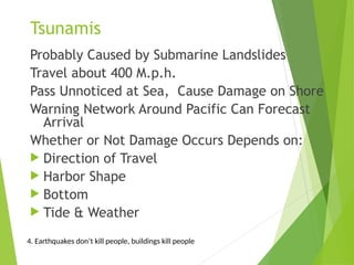
Tsunamis
Probably Caused bySubmarine Landslides
Travel about 400 M.p.h.
Pass Unnoticed at Sea, Cause Damage on Shore
Warning Network Around Pacific Can Forecast
Arrival
Whether or Not Damage Occurs Depends on:
Direction of Travel
Harbor Shape
Bottom
Tide & Weather
4. Earthquakes don’t kill people, buildings kill people
24.
Magnitude and Intensity
Intensity
How Strong Earthquake Feels to Observer
Magnitude
Related to Energy Release
Determined from Seismic Records
Rough correlation between the two for shallow earthquakes
5. Magnitude and Intensity
25.
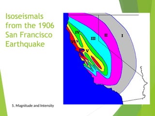
Intensity
How Strong EarthquakeFeels to Observer
Depends On:
Distance to Quake
Geology
Type of Building
Observer!
Varies from Place to Place
Mercalli Scale- 1 to 12
5. Magnitude and Intensity
Magnitude - Determinedfrom
Seismic Records
Richter Scale:
Related to Energy
Release
Exponential
No Upper or Lower
Bounds
Largest Quakes about
Mag. 8.7
Magnitude-Energy Relation
4 - 1
5 - 30
6 - 900:
1 Megaton = about 7
7 - 27,000
8 - 810,000
5. Magnitude and Intensity
31.
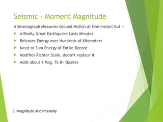
Seismic - MomentMagnitude
A Seismograph Measures Ground Motion at One Instant But --
A Really Great Earthquake Lasts Minutes
Releases Energy over Hundreds of Kilometers
Need to Sum Energy of Entire Record
Modifies Richter Scale, doesn't replace it
Adds about 1 Mag. To 8+ Quakes
5. Magnitude and Intensity
32.
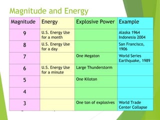
Magnitude and Energy
5.Magnitude and Intensity
Magnitude Energy Explosive Power Example
9 U.S. Energy Use
for a month
Alaska 1964
Indonesia 2004
8 U.S. Energy Use
for a day
San Francisco,
1906
7 One Megaton World Series
Earthquake, 1989
6 U.S. Energy Use
for a minute
Large Thunderstorm
5 One Kiloton
4
3 One ton of explosives World Trade
Center Collapse
33.
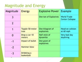
Magnitude and Energy
5.Magnitude and Intensity
Magnitude Energy Explosive Power Example
3 One ton of Explosives World Trade
Center Collapse
2
1 Topple 50-meter
tree
One kilogram of
explosives
Head-on colision
at 60 mph
0 Drop a car 10
meters
Half stick of
dynamite
Very bad day
skydiving
-1 Impact of bullet One gram of
explosives
-2 Hammer blow
-3 Dribbling a
basketball
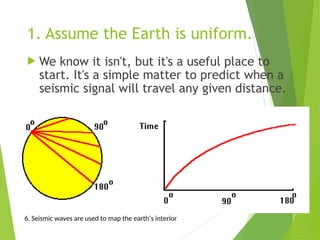
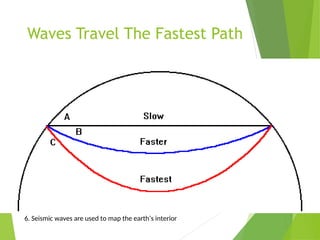
1. Assume theEarth is uniform.
We know it isn't, but it's a useful place to
start. It's a simple matter to predict when a
seismic signal will travel any given distance.
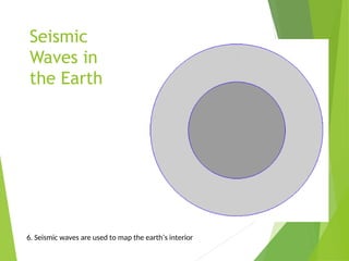
6. Seismic waves are used to map the earth’s interior
36.
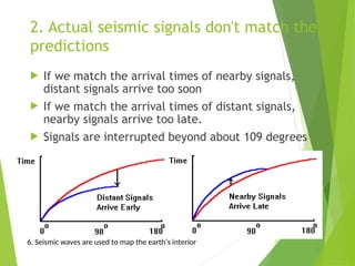
2. Actual seismicsignals don't match the
predictions
If we match the arrival times of nearby signals,
distant signals arrive too soon
If we match the arrival times of distant signals,
nearby signals arrive too late.
Signals are interrupted beyond about 109 degrees
6. Seismic waves are used to map the earth’s interior
37.
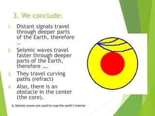
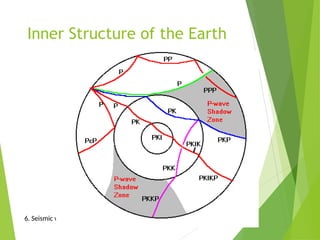
3. We conclude:
1.Distant signals travel
through deeper parts
of the Earth, therefore
..
2. Seismic waves travel
faster through deeper
parts of the Earth,
therefore ….
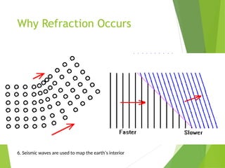
3. They travel curving
paths (refract)
4. Also, there is an
obstacle in the center
(the core).
6. Seismic waves are used to map the earth’s interior