This document provides information about three cities - Cardinal City, Acoma Pueblo, and Tokyo:
Cardinal City is a proposed floating city designed with 8 magnetic platforms arranged in a compass formation. It would be able to suspend itself above Earth's surface using magnetic technology.
Acoma Pueblo, also known as Sky City, is an ancient city built atop a sandstone mesa in New Mexico for defensive purposes. It has been continuously inhabited since 1100-1250 AD but was almost destroyed by Spanish forces in 1598.
Tokyo is the capital city of Japan, located on Honshu island. As a metropolis, it encompasses multiple cities, towns and villages across its administrative area of over 13
The Incas started as a small tribe in Peru but built a vast empire through strong central government and control of the population. The Sapa Inca was the all-powerful ruler who put relatives in positions of power. Common people had no freedom and were tightly controlled, paying taxes through required labor. Harsh laws and inspections kept people compliant with government demands over their lives and labor. The empire expanded due to geographical barriers like mountains and jungle that the Incas traversed using an extensive network of well-built roads connecting their realm.
This document provides an overview of Latin America, including:
- Climate zones ranging from tropical rainforests to dry deserts.
- Environmental problems like natural hazards, deforestation, and pollution.
- Cultural history from pre-European civilizations like the Maya, Aztec, and Inca to European colonization led by Spain and Portugal.
- Ongoing regional organizations and differences within countries from low to high incomes and rural to urban areas.
The Incas were a small tribe in Peru that grew into a large empire from 1400-1532 CE. They had a strong central government that tightly controlled the lives of common people. Laws dictated where people lived and worked, and violations were punished by death. The Incas' empire was protected by natural barriers like the Andes mountains, Amazon jungle, and coastal desert. Within these barriers, the Incas built extensive road networks and bridges to connect their territories.
The Inca civilization originated in Peru and grew to cover over 2,500 miles across western South America by the 15th century, comprising around 12 million people. Ruled by a divine king called the Sapa Inca, the Inca built infrastructure like the 2,000 mile Royal Road and suspension bridges. They developed advanced agricultural techniques using terracing. The Inca had no written language but used knotted string records and a messenger system to efficiently govern their vast empire.
The document discusses the key elements of better livable towns through examining ancient, modern, and future towns. It analyzes the ancient town of Machu Picchu for its sustainable construction adapted to the natural landscape and agriculture. The modern city of Bogota is examined for its transport infrastructure and socioeconomic divisions. For future towns, the document proposes they will be more self-sufficient through vertical farms, renewable energy production, and improved water management to address issues of resource dependence. It then presents a proposal for a floating, self-sustaining future town called Midori Town to showcase environmental friendliness.
The document summarizes the later peoples who invaded and ruled over Mesopotamia after the Sumerians. It describes how Babylon became a powerful kingdom under the rule of Hammurabi in the 18th century BC, who established one of the first written law codes. It then discusses how other groups like the Hittites, Assyrians, and Chaldeans also came to dominate Mesopotamia at different points in time, adopting Sumerian innovations and ruling large empires through organized armies and administration of subject territories.
The document provides information about the Aztec civilization. It begins with instructions for a map activity labeling the territories of the Maya, Inca, and Aztec empires. It then summarizes that the Aztecs founded Tenochtitlan in 1325, which by the early 1500s had expanded to control around 400-500 city-states across present-day Mexico, with over 5 million people under the rule of the Aztec emperor. The document also mentions the Aztec practices of human sacrifice on temples and pyramids, believing it would prevent the gods from destroying the earth. It provides some vocabulary and additional details on Tenochtitlan and the Aztec emperor Montezuma II.
The document discusses the later peoples who invaded and ruled Mesopotamia after the Sumerians, including the Babylonians led by Hammurabi who established one of the first legal codes, as well as later invaders like the Hittites, Assyrians, and Chaldeans who all contributed to Mesopotamian civilization through military conquests, governance innovations, and cultural developments. King Hammurabi of Babylon expanded his empire through military conquest, established irrigation improvements and a tax system, and codified 282 laws covering many aspects of life that influenced later legal systems.
The document summarizes events related to the demolition and forced resettlement of slum communities (Yamuna Pushta bastis) in Delhi by the government. It details a timeline of demolitions between February and April that destroyed thousands of homes and left many residents homeless. The summary also notes that the resettlement process involved gross violations of people's rights, including illegal arrests of protesters, suspicious fires that killed residents, and the likely disenfranchisement of over 24,000 voters from the area.
The Incas civilization arose around 1438 in present-day Peru. Led by the ruler Pachacuti, the Incas expanded their territory through military campaigns and alliances to become a large empire. They developed impressive architecture, roads, and agricultural systems without the use of wheels or writing. Inca society was organized hierarchically with the Sapa Inca as ruler. Disease brought by Europeans in the 1500s and a civil war between two rulers weakened the empire, allowing the Spanish conquistadors to eventually take control of the region in 1532.
The Incas existed between 1438 and 1525 in the rugged Andes Mountains of modern-day Peru, where they built a vast empire. They adapted well to the terrain by developing advanced agricultural techniques like terracing and irrigation. The Incas had a hierarchical society divided into nobles and commoners and a moneyless economy controlled by the government. Their empire was weakened by civil war in the 1520s and then conquered by Spanish invaders led by Francisco Pizarro in the 1530s, bringing an end to the Inca civilization.
The Incas ruled a large empire in western South America in the 15th and early 16th centuries. They originated in the Andes mountains of Peru, with their capital at Cuzco. Under leaders like Pachacuti, the Incas expanded their territory through conquest. At its height, the Inca Empire stretched along the Andes from Ecuador to Chile and included over 12 million people. The Incas developed an elaborate bureaucracy to govern their diverse territories and subjects. Francisco Pizarro and the Spanish conquistadors were ultimately able to defeat the Incas and take control of the empire in the 1530s, due in part to their superior weapons and the diseases they unwittingly introduced.
The Inca civilization originated in Peru and grew to cover over 2,500 miles across western South America by the 15th century, comprising the largest empire in the pre-Columbian Americas with over 12 million subjects. Ruled by a divine king known as the Sapa Inca, the Inca engineered impressive infrastructure like a vast road system and developed innovative techniques for record keeping without writing. At its height, the Inca empire was a highly organized society that could relay messages across its territories faster than any system in the world at that time.
The Inca civilization originated in Peru in the 13th century and grew into a large empire under the rule of Pachacuti in the 15th century. The Incas built an extensive network of roads and aqueducts, developed advanced agricultural techniques, and created impressive stone architecture. However, the smallpox virus and the Spanish conquistador Francisco Pizarro weakened and defeated the Inca in the 1530s. Pizarro captured and executed the Inca emperor Atahualpa, claiming control of the former Inca territory for Spain.
The Incas began as a small tribe in Peru that formed a powerful empire between 1400-1532 CE. They developed a strong central government led by the Sapa Inca, an absolute ruler who controlled all land and resources. Common people had no freedoms and were strictly governed, paying taxes through required public service. The Incas' empire expanded through the Andes Mountains, using the geography as natural barriers and building sophisticated infrastructure like roads and bridges to control their large territory.
Ms La Earlycivilizations 1232205745967328 2guest2d1642
The Aztec civilization arrived in central Mexico in the 1100s and settled on an island in Lake Texcoco, where they built the magnificent city of Tenochtitlan. In the 1400s, Aztec warriors began conquering neighboring peoples and extracting taxes. Tenochtitlan was built on floating islands and became the center of the powerful Aztec Empire. The Aztecs had many achievements in medicine, astronomy, record keeping, and schooling for boys and girls. Their religion involved worship of gods and human sacrifice. The Inca settled in Peru in 1200 AD and built an empire that stretched 2500 miles by 1438. They had excellent farming techniques, built extensive road networks, and recorded information using knotted string
The Inca civilization flourished in ancient Peru between c. 1400 and 1533 CE, and their empire eventually extended across western South America from Quito in the north to Santiago in the south, making it the largest empire ever seen in the Americas and the largest in the world at that time.
The Inca Empire spanned much of western South America from Colombia to central Chile. It was divided into four regions each governed by appointees who oversaw productive valleys, cities, and mines. Inca society was strictly stratified with the Sapa Inca as ruler and nobility, common people, and servants comprising other classes. The Incas developed advanced infrastructure including roads, architecture, agriculture, and education systems, but the empire disintegrated after the death of Huayna Capac due to a war between his two sons over succession to the throne.
The document summarizes the major Mesoamerican civilizations - Olmec, Teotihuacan, Maya, Aztec, and Inca. It describes their origins, locations, political and social structures, economies, religions, and achievements. It also discusses their eventual declines, including the conquest by the Spanish for the Aztec and Inca. The Olmec, Teotihuacan, and Maya flourished in Mesoamerica before the rise of the powerful Aztec Empire in central Mexico and the Inca Empire in the Andes Mountains of South America.
Inca Civilization PPT made on our 3rd year History class. There are videos in the PPT and they will just automatically play (download file for best viewing)
The Inca Civilization spanned from 1438 to 1572 and originated from a pastoral tribe in Cusco, Peru. They expanded through conquest to create the largest empire in the 16th century, spanning 2000 square miles across modern day Peru, Bolivia, Argentina, and Chile. Inca society was organized as a religious monarchy with a class system. Their empire was conquered by Spanish forces in the 1530s due to plagues, internal conflicts, and military advantages including steel weapons and horses.
Between 600 BC and 300 AD:
- Many towns sprang up across India as agriculture intensified, though most people still lived in villages and cooperated on local projects.
- Notable towns included Kushinagar and Rajgir. The Chola and Pandya dynasties ruled parts of Tamil Nadu and neighboring Kerala.
- The Chola kingdom was centered around the Cholamandalam region, with its capital at Uraiyur, known for cotton trade. A 2nd century BC Chola ruler conquered Sri Lanka.
- The Pandya kingdom covered parts of modern Tamil Nadu, with its capital at Madurai. Most Tamils were farmers living in villages or crafts
The Inca civilization was a pre-Columbian empire located in western South America, with its capital at Cusco, Peru. The Inca ruled along the western coast of South America from the 12th century to the 16th century CE, when the Spanish invaded and conquered the empire. At its height, the Inca Empire stretched over 2 million square kilometers and had an estimated population of 10 million people. It featured advanced architecture, road systems, agriculture, and a complex bureaucracy centered on the Sapa Inca ruler.
Inca Civilization: It's Socio-Political and Cultural AspectsSabikun Shethi
The Incas originated in Cuzco, Peru and began expanding their empire around 1400 CE. Within 100 years, the Inca Empire had expanded across modern day Ecuador, Peru, Bolivia, Chile and Argentina. The Incas developed an efficient centralized government and strong system of laws and taxation that helped their empire grow rapidly. Their civilization was based around agriculture in the Andes mountains, with staple crops like potatoes and corn. The Incas had no written language but used knotted strings called quipus to record information.
The Inca civilization was formed in 1300 and ended in 1537, occupying territories in modern-day Peru, Bolivia, Argentina, Ecuador, and Colombia. They had a stratified social organization consisting of high and low nobility, craftspeople, peasants, and serfs. Agriculture was central to their society, with crops including potatoes, corn, cocoa beans, and cotton cultivated to both feed people and produce materials for construction.
The Inca Empire originated in the Andes Mountains of South America. They had a complex society with the Sapa Inca as their ruler and a strict social hierarchy. The Incas built an extensive road network for transportation and communication across their empire. However, internal conflict weakened the Incas, allowing the Spanish to conquer the empire in the 1500s.
Cheok was a member of St. John Ambulance Malaysia who collected donations every year. She suggested collecting at Taylor's University because she stereotyped the students as wealthy. However, most students rejected her requests. Cheok became frustrated and broke down from the disappointment. Her friend Yin Ji then comforted her and provided social support, helping lift Cheok's spirits.
This project examines smartphone usage patterns between males and females through a survey of 20 questions. The group members are Benny Tan, Cassandra Wong, Haziq Zariful, Syafiq Zariful, James Moy, and Parham. The survey was distributed to collect information on respondents' age, most used apps, and how often and in what situations phones are used. The goal is to analyze differences in male and female smartphone habits and present the findings through statistical analysis, charts, and an infographic poster.
1. The document analyzed smartphone usage statistics from 200 participants (106 male, 94 female).
2. It found that most male and female participants were between 16-20 years old. Slightly more males (47%) than females (53%) participated.
3. Most participants, both male and female, had smartphones and checked them immediately after waking up. They spent 1-3 minutes on average using their phones at a time.
4. Both genders predominantly used social media apps beyond calling and messaging, with males using more than 3 apps on average and females using both less than and more than 3 apps. Most also played games on their phones.
5. Checking phones after notifications and using phones while waiting
The document is a survey report on HIV awareness among male and female students at Taylor's University Lakeside Campus. A group of six students conducted a survey using a 15 question form distributed to 150 male and 150 female students over three days. The collected data was compiled and statistically analyzed to identify the level of HIV awareness between genders. The results showed that male students displayed a higher level of awareness compared to female students.
This document outlines the requirements for Project 1 of the Elements of Natural Built Environment course. The project involves students visiting a nature site in groups to observe and document the natural elements and habitat. They must then create an info graphic pop-up poster and 5-7 minute documentary video to share their findings. The poster must display the site layout and details on natural elements, while the video should reflect the student experience. Students must also create an individual scrapbook journal of their observations and understanding of the ecosystem. The work will be assessed based on meeting requirements, quality of content, creativity, and team collaboration.
FNBE0814 Mathematics Project 01 Survey and StatisticCindy Ying
This survey report summarizes the results of a survey conducted among 150 male and female students at Taylor's University to assess their level of awareness of HIV/AIDS. The survey consisted of 15 multiple choice questions distributed equally among the students. The collected data was compiled and analyzed statistically based on gender. Overall, the analysis found that male students displayed a higher level of awareness of HIV than female students, with many more males correctly answering questions related to transmission methods, treatments, and symptoms. The survey provided valuable insights into students' existing knowledge of HIV/AIDS.
The document discusses the benefits of exercise for mental health. Regular physical activity can help reduce anxiety and depression and improve mood and cognitive function. Exercise causes chemical changes in the brain that may help protect against mental illness and improve symptoms for those who already suffer from conditions like depression and anxiety.
This document outlines the requirements for a group project on representing nature through an info graphic exhibition booth and documentary video. Students will visit a natural habitat site to observe and document the ecosystem. They must then create an info graphic booth showcasing key elements of the habitat and a 5 minute documentary video reflecting their experiences and raising awareness. The project aims to help students appreciate nature and inspire others. Students must also submit an individual scrapbook journal detailing their observations, understanding of the habitat, and reflections. The group will be assessed on the info graphic booth, video, and individual components.
The document discusses the history of New York City from its founding by the Dutch in the early 1600s. It describes how New York grew to become the largest city in the world by the late 19th century due to immigration, industrialization, and rapid urban expansion. It also discusses Robert Moses' impact on the city's infrastructure and development in the 1920s-1950s through projects like highways and bridges.
Late 19th and early 20th century business leaders like John Rockefeller, Henry Ford, and Andrew Carnegie established operations in New York City due to its central location between states and Europe. However, with the rise of e-commerce, which allows geographic flexibility, New York may lose its stronghold as the economic capital of America. While New York dominated the 20th century, it is unclear which city will emerge as the new powerhouse. Unless major companies band together to promote a new location, New York risks losing its title to another country.
Tokyo started as a small fishing village called Edo in 1639, and grew into one of the largest cities in the world by the mid-18th century with over 1 million people. Edo later became known as Tokyo when it became the capital of Japan. Throughout its history, Tokyo grew enormously from a humble beginning as a small coastal community into one of the largest and most populated cities globally today.
The document discusses different types of floods and provides examples of devastating floods around the world. It notes that some of the earliest civilizations developed along fertile floodplains of rivers like the Indus, Nile, Yellow River, Tigris and Euphrates. However, floods can also be extremely destructive, like the 1887 Yellow River flood in China that killed around 900,000 people. Other examples mentioned include the 1889 Johnstown flood in Pennsylvania that was caused by a dam failure during heavy rain. Tsunamis caused by earthquakes or volcanic eruptions can also lead to catastrophic coastal flooding over long distances.
The document provides instructions for requesting and completing an assignment writing request on the HelpWriting.net website. It outlines a 5-step process: 1) Create an account with an email and password. 2) Complete a 10-minute order form providing instructions, sources, and deadline. 3) Review bids from writers and select one based on qualifications. 4) Review the completed paper and authorize payment if satisfied. 5) Request revisions to ensure satisfaction, and the company offers refunds for plagiarized work.
The document provides information on the geography, population patterns, and history of Japan. It notes that traditional and modern aspects co-exist in Japanese culture. Most of Japan's 127 million people live in urban areas along the coasts and valleys, with 86% concentrated in the Tokyo area. The history section outlines Japan's early unification under the Yamato dynasty, the rise of shoguns and samurai, isolation from the West followed by forced opening of trade, and its transformation into a modern imperial power in the late 1800s which led to military expansion until its defeat in World War 2.
Worlds ApartAbdulrahman AlbasariDr. Dana M. ReemesHistory .docxambersalomon88660
Worlds Apart
Abdulrahman Albasari
Dr. Dana M. Reemes
History 110A-04
05/13/16
In the ninth and early tenth centuries, after the collapse of Teotihuacan, the central valley of Mexico was divided between many powers. It was only the emergence of Toltecs and Mexica that delivered unification in the area again. The Toltecs started migrating in Mexico at around eight century. They came from an arid land and settled in a new area called Tula. Tula is an important place for the Toltec’s development of their weaving poetry, and obsidian work. The place served as their center of trade between Toltecs and the other places in Mesoamerica. By the end of twelfth century, many civil conflict and nomadic incursion destroyed Tula and eventually caused the destruction of the Toltecs.
One of the migrating groups that entered Tula is Mexica. Its people are also often called Aztecs for being part of the alliance that built the Aztec empire. In 1345, the group settled in a “marshy region of Lake Texcoco and found that city that would become their capital –Tenochtitlan.” The Mexica defeated many of its opposing tribes and started its empire. It conquered nearby cities including those in the gulf coast. The group then formed an alliance with Texcoco and Tlacopan creating a powerful empire called Aztec empire.
The Mexica society was formal and “rigidly hierarchical.” The power division is so defined that they were able to establish good warriors who strictly follow orders. The same goes with the priests of the group. They have defined roles and power structure. Having a strong sense of spirituality, the Mexica society put utmost importance to their priests. They bear many rituals which includes bloodletting and sacrificial killing. Also, women in their society do not hold big power and are only limited for child-bearing.
On the other part of the globe, North American societies developed “rich variety of political, social, and cultural tradition.” They depended so much in agriculture and fishing making their people mastered the craft of cultivating and fish catching. Through woodlands and mound of earth they created infrastructures meant for dwelling and burial. The trade system in the region is also well-developed through rivers. Through these rivers, they also developed communication between nearby areas.
There are also empires in South America that developed their own social system. After the twelfth century, the “kingdom of Chucuito dominated the highlands region around Lake Titicaca. The group depended on the cultivation of potatoes and herding of llamas and alpacas. Another group is the Kingdom of Chimu which is a powerful society. Both the Chucuito and Chimu ruled Andean South America. Yet, the two kingdoms eventually fall under the domination of the societies of Incas.
The Incas started to be one of the many people inhabiting the region around Lake Titicaca. In 1438, the group launched military campaigns and expanded its authority. Under the Inca admin.
This document provides an overview of key characteristics that define cities according to experts. It discusses how cities are dense population centers that create social hierarchies and specialization of labor. Cities exist within networks and rely on surrounding agricultural regions for resources. They also have physical or legal boundaries and are characterized by monumental architecture and public buildings that establish a shared identity for citizens.
The Tokugawa Shogunate established traditions in Japan during the 1600-1868 period that still influence Japanese society today. Education focused on Confucian philosophy and the Japanese language. Women were taught to serve their father, husband, and son, while warriors like samurai followed the Bushido code of honor. This period saw the rise of a strict social hierarchy and isolationist policies that defined Japanese culture for centuries.
The document discusses the geological history that formed Manhattan island, including glaciers carving the land and depositing materials. It then summarizes the development of New York City over time, from the Dutch colony of New Amsterdam in 1609 to the establishment of the grid plan in 1811. The document also briefly mentions the 1863 Draft Riots during the Civil War and the growth of New York City in the late 19th/early 20th century enabled by infrastructure like the Erie Canal and electric lighting.
The document summarizes different historical periods from prehistory to modern times. During prehistory, humans lived in small nomadic groups and painted on cave walls. The Ancient period saw the rise of early civilizations and writing systems, particularly the influential Roman civilization. The Middle Ages began approximately 500,000 years ago and the Muslims later conquered parts of Spain. The Modern era started 500 years ago with European exploration and colonization of other continents. The Contemporary period began 200 years ago with industrialization and technological advances that have transformed society.
Kingston, Jamaica is the capital and largest city, located on the southeast coast. It has the 7th largest natural harbor in the world and is a center for government, commerce, and culture. The city faces issues with unemployment, poverty, and overcrowding. Wealthier residents live uptown near the mountains, while poorer residents live in shantytowns below the Torrington Bridge in the inner city. Kingston provides major economic and administrative functions for Jamaica.
This presentation will provides you how the garden cities by Ebenezer were planned and designed how important the environment is and also the ideas of Ebenezer Howard.
During Japan's Edo period between the 12th and 17th centuries, the conditions were set for Japan's later economic success. The ruling bakufu government had absolute political power but lacked a consistent economic policy, so local governments called han were able to decide policies for taxation, administration, industry and currency. Most peasants worked on farms and paid taxes in rice, though many relocated to escape high taxes, leading to unrest. The economy grew through rice taxes, mining monopolies, trade monopolies and financial contributions from merchants seeking rights, though this required currency inflation that further increased taxes. By the late Edo period, foreign trade was banned, isolating Japan prior to reopening in the 1850s.
This document provides a compare and contrast essay analyzing the films Spirited Away and Princess Mononoke directed by Japanese animator Hayao Miyazaki. Both films showcase character development through maturation, are set in ancient Japan, and feature Miyazaki's signature beautiful and unique artistic styles. The essay discusses how the main characters Chihiro in Spirited Away and San in Princess Mononoke grow in maturity through overcoming challenges. It also describes the ancient Japanese settings and influences in the films, as well as Miyazaki's imaginative and eccentric character designs.
This document outlines an assignment for a group research project comparing two similar businesses in different geographical locations. Students will form groups to conduct primary and secondary research on their chosen businesses. They must visit the business locations, interview owners/managers, and incorporate at least 10 sources in their 2,500-3,000 word written report. Students will also present their findings to the class. The report will be assessed based on topic content, format, and the in-class presentation. Detailed guidelines are provided on the research methodology, report structure, and assessment criteria.
This document outlines an assignment for an English class to write a compare and contrast essay about two movie genres. Students must choose between action-comedy films or animated films, research the genre, view example movies, and write a 6 paragraph essay comparing or contrasting the two genres. The essay must be 600-1000 words and follow APA style for citations and referencing. Students must submit a draft for feedback and submit the final version digitally by September 28th. The assignment aims to help students understand film genres, analyze and synthesize information to compare or contrast movies, and communicate ideas in clear academic English.
Producing an attractive art piece requires finding inspiration, preparing properly, and executing the work. Inspiration can come from observing nature, browsing art online, or listening to music. Preparation involves planning the concept, gathering necessary materials like paints and canvas, and choosing a suitable workspace. When painting, use references to learn techniques, outline the piece first, apply paint carefully, and periodically step back to view from a distance and ensure proper proportions. Following these steps of inspiration, preparation, and production can help artists overcome blocks and create a fine work of art.
The document discusses the benefits of exercise for mental health. Regular physical activity can help reduce anxiety and depression and improve mood and cognitive function. Exercise causes chemical changes in the brain that may help protect against mental illness and improve symptoms.
CL New and improved cl project 7 sept 2014 copyJonathan Lim
This document compares and contrasts two urban parks - Vondelpark in Amsterdam, Netherlands and Taman Wetlands in Putrajaya, Malaysia. Vondelpark is a 47 hectare park established in 1865 that hosts over 1 million visitors annually, while Taman Wetlands is a larger 2,115 hectare man-made wetland built in 1997 that aims to preserve natural wildlife habitats. Both parks offer passive recreational activities like walking and picnicking, but Taman Wetlands also supports active activities like kayaking and birdwatching due to its wetland environment.
ICI Introduction to construction industry portfolioJonathan Lim
The document proposes constructing the "Taman Desa Garden Park" on a vacant 1200m2 plot of land in Taman Bukit Desa, Kuala Lumpur, Malaysia. The park will include features like gazebos, promenades, sitting areas, a pond, and a playground to serve as a recreational area for local residents. A site analysis found the land is suitable due to its location between residences, fertile soil, and lack of existing structures. The proposed design concepts for the park include gazebos, promenades, sitting areas, a pond, and a playground to provide shade, walking paths, places to rest, a water feature, and play space for children.
HMSK Architecture is a Malaysian design consultancy firm established in 2000 that offers interior design and architectural services. The firm is headed by three directors - Ar. Micheal Chong, Ar. Hiew Hong Wai, and Ar. Ravi - who have extensive international experience. Kameel Ispha is the Head of Interior Design at HMSK and has over 10 years of experience. He led the design of the Hard Rock Cafe in Melaka, which blended international and local Malaysian influences, and TGV Indulge cinema in One Utama, which offers a luxurious movie-going experience.
ICI Introduction to construction industry (1)Jonathan Lim
Product design is the process of creating new business items to sell to customers. It involves generating and developing ideas through a process that leads to new products. Designing a chair requires three stages of sketches: process sketching for ideation and concepts, presentation sketching of the final design, and construction sketches with details for manufacturing. The chair design process involves identifying customer needs, research, concept development through multiple sketches, selecting a final design, and testing before full-scale production.
International Upcycling Research Network advisory board meeting 4Kyungeun Sung
Slides used for the International Upcycling Research Network advisory board 4 (last one). The project is based at De Montfort University in Leicester, UK, and funded by the Arts and Humanities Research Council.
Connect Conference 2022: Passive House - Economic and Environmental Solution...TE Studio
Passive House: The Economic and Environmental Solution for Sustainable Real Estate. Lecture by Tim Eian of TE Studio Passive House Design in November 2022 in Minneapolis.
- The Built Environment
- Let's imagine the perfect building
- The Passive House standard
- Why Passive House targets
- Clean Energy Plans?!
- How does Passive House compare and fit in?
- The business case for Passive House real estate
- Tools to quantify the value of Passive House
- What can I do?
- Resources
PDF SubmissionDigital Marketing Institute in NoidaPoojaSaini954651
https://www.safalta.com/online-digital-marketing/advance-digital-marketing-training-in-noidaTop Digital Marketing Institute in Noida: Boost Your Career Fast
[3:29 am, 30/05/2024] +91 83818 43552: Safalta Digital Marketing Institute in Noida also provides advanced classes for individuals seeking to develop their expertise and skills in this field. These classes, led by industry experts with vast experience, focus on specific aspects of digital marketing such as advanced SEO strategies, sophisticated content creation techniques, and data-driven analytics.
Revolutionizing the Digital Landscape: Web Development Companies in Indiaamrsoftec1
Discover unparalleled creativity and technical prowess with India's leading web development companies. From custom solutions to e-commerce platforms, harness the expertise of skilled developers at competitive prices. Transform your digital presence, enhance the user experience, and propel your business to new heights with innovative solutions tailored to your needs, all from the heart of India's tech industry.
Architectural and constructions management experience since 2003 including 18 years located in UAE.
Coordinate and oversee all technical activities relating to architectural and construction projects,
including directing the design team, reviewing drafts and computer models, and approving design
changes.
Organize and typically develop, and review building plans, ensuring that a project meets all safety and
environmental standards.
Prepare feasibility studies, construction contracts, and tender documents with specifications and
tender analyses.
Consulting with clients, work on formulating equipment and labor cost estimates, ensuring a project
meets environmental, safety, structural, zoning, and aesthetic standards.
Monitoring the progress of a project to assess whether or not it is in compliance with building plans
and project deadlines.
Attention to detail, exceptional time management, and strong problem-solving and communication
skills are required for this role.
EASY TUTORIAL OF HOW TO USE CAPCUT BY: FEBLESS HERNANEFebless Hernane
CapCut is an easy-to-use video editing app perfect for beginners. To start, download and open CapCut on your phone. Tap "New Project" and select the videos or photos you want to edit. You can trim clips by dragging the edges, add text by tapping "Text," and include music by selecting "Audio." Enhance your video with filters and effects from the "Effects" menu. When you're happy with your video, tap the export button to save and share it. CapCut makes video editing simple and fun for everyone!
Storytelling For The Web: Integrate Storytelling in your Design ProcessChiara Aliotta
In this slides I explain how I have used storytelling techniques to elevate websites and brands and create memorable user experiences. You can discover practical tips as I showcase the elements of good storytelling and its applied to some examples of diverse brands/projects..
Maximize Your Content with Beautiful Assets : Content & Asset for Landing Page pmgdscunsri
Figma is a cloud-based design tool widely used by designers for prototyping, UI/UX design, and real-time collaboration. With features such as precision pen tools, grid system, and reusable components, Figma makes it easy for teams to work together on design projects. Its flexibility and accessibility make Figma a top choice in the digital age.
Practical eLearning Makeovers for EveryoneBianca Woods
Welcome to Practical eLearning Makeovers for Everyone. In this presentation, we’ll take a look at a bunch of easy-to-use visual design tips and tricks. And we’ll do this by using them to spruce up some eLearning screens that are in dire need of a new look.
Explore the essential graphic design tools and software that can elevate your creative projects. Discover industry favorites and innovative solutions for stunning design results.
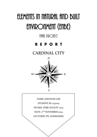
1. ELEMENTS IN NATURAL AND BUILT
ENVIRONMENT (ENBE)
FINAL PROJECT
R E P O R T
CARDINAL CITY
NAME: JONTHAN LIM
STUDENT ID: 0321119
INTAKE: FNBE AUGUST 2014
DATE: 7TH
NOVEMBER 2014
LECTURER: PN. HASMANIRA
2. INTRODUCTION
20 years in the future, Earth’s magnetic fields have become distorted and has tipped the
balance of magnetic properties on the surface of Earth. Theories behind the cause such as
global warming, mass pollution, and destruction of Mother Nature have been suggested as the
reasons behind the phenomena. However, there has been no consensus behind the true reason
of the phenomenon. Life on the surface of Earth has become almost impossible to live on.
Mankind, sought on to take opportunity of this phenomenon by building a floating city. This
city has a radial design split into 8 platforms with a central magnetic stem that holds them in
place. Built with a magnetic foundation, this city has the ability to suspend itself above
Earth’s surface and rotate its platforms when commanded to. The latest eco-friendly and
green technology has provided a self-sustaining environment and a more intricately organised
plan for this city. This city also offers accurate on-time public transportation services and a
whole new means of personal transportation based on the use of magnetism. When viewed
from its plan, the city takes form of a giant compass. And as compasses rely on magnetism,
this city is built with the ability to fully adapt and utilize the power of magnetism. Its 8
platforms that point in the 8 cardinal directions (North, North-East, East, South-East, South,
South-West, West and North-West) has given itself the name, Cardinal City.
3. PRECEDENT STUDY
ANCIENT CITY
ACOMA PUEBLO
“THE SKY CITY”
Strategically built atop a 357-foot sandstone mesa for defensive purposes, the Acoma Pueblo
is more familiarly known as Sky City. Believed to be the oldest continuously inhabited city in
the United States, the pueblo was built sometime between 1100 and 1250 A.D.
The name "Acoma" means "People of the White Rock" in the Puebloan Kersan dialect.
The pueblo, covering some 70 acres, is actually comprised of several villages including
Acomita, McCarty’s, Anzac and Sky Line.
The site was chosen, in part, because it provided a defensive position for the tribe against
raiders. Access to the pueblo was difficult as the faces of the mesa are sheer and before
modern times, it could only be accessed by a hand-cut staircase carved into the sandstone.
For centuries the Acoma people have farmed the valley below the Acoma Pueblo using
irrigation canals in the villages closer to the Rio San Jose River. They were also actively
involved in trading, not only with neighbouring pueblos, but, also over long distances with
the Aztec and Mayan peoples.
4. The pueblo was already well established when Francisco Vasquez de Coronadowas the first
European to lay eyes on it in 1540, describing it as: "One of the strongest ever seen, because
the city was built on a high rock. The ascent was so difficult that we repented climbing to the
top."
Almost fifty years later, Sky City was almost destroyed in 1598 when Governor Juan de
Oñate, under orders from the King of Spain, invaded New Mexico, and began staging raids
on Native American pueblosin the area, taking anything of value. When the Spanish soldiers
arrived in the area, they made their headquarters at the Ohkay Owingeh Pueblo, formerly
called the San Juan Pueblo, located about 25 miles north of Santa Fe. Upon their arrival, they
removed the Tewa Indians who lived there and used it as a base to stage more raids on
other Native American pueblos in the area.
In December, 1898, a party of Spanish soldiers seeking food arrived at Acoma. Initially, they
were welcomed and treated in a friendly manner until the soldiers turned aggressive and
began to demand grain from the Acoma storehouses, which was needed for the tribe to
survive the winter. Provoking a furious reaction, the Acoma attacked the soldiers, killing 13
of them, including their commander, Juan de Zaldivar, who was a nephew of Juan de Oñate.
In response, Oñate resolved to make an example of Acoma, and dispatched 70 of his best
men, under the command of Vicente de Zaldivar, to attack the Acoma Pueblo. On January 21,
1599, the Spanish troops came into view of the pueblo and the tribe fanned out from their
village to guard the edge of the mesa. As the Spaniards drew closer, the defenders unleashed
a barrage of rocks and arrows down on them. Despite the defensive barrage coming from atop
the mesa, the soldiers fought their way to the top over the next three days. During the battle,
the Spaniards brought a small cannon up the back of the mesa and began firing into the
village. The battle then became a massacre and when it was over, as many as 800 Acoma
people were dead and theirpueblo in ruins.
Afterwards, the survivors were marched to the Santo Domingo Pueblo (now known as
the Kewa Pueblo), where all males over the age of 12 were condemned to 20 years' servitude.
Of the few dozen Acoma men of fighting age who were still alive after the battle, they were
sentenced to have one foot cut off. The surviving children under the age of 12 were taken
from their parents, and given to Spanish missionaries to raise. However, most of them, as
well as the women were sold into slavery. Oñate was later tried, convicted of cruelty
to Indians and colonists, and was banished from New Mexico. However, he appealed the
ruling and was later cleared of all charges. He lived out the rest of his life in Spain.
In the end, the approximate population of the 2,000 people who had lived at the Acoma
Pueblo was reduced to approximately 250 survivors. In time, some of the Acoma people
managed to escape and made their way home, where they began the long process of
rebuilding. Since that time, it has been continuously inhabited and never again fell to an
invader.
5. PRESENT CITY
TOKYO CITY
JAPAN
The mainland portion of Tokyo lies northwest of Tokyo Bay and measures about 90 km
(56 mi) east to west and 25 km (16 mi) north to south. The average elevation in Tokyo is
40 m (131 ft). Chiba Prefecture borders it to the east, Yamanashi to the west, Kanagawa to
the south, and Saitama to the north. Mainland Tokyo is further subdivided into the special
wards (occupying the eastern half) and the Tama area stretching westwards.
Also within the administrative boundaries of Tokyo Metropolis are two island chains in
the Pacific Ocean directly south: the Izu Islands, and the Ogasawara Islands, which stretch
more than 1,000 km (620 mi) away from the mainland. Because of these islands and
mountainous regions to the west, Tokyo's overall population density figures far
underrepresent the real figures for urban and suburban regions of Tokyo.
Under Japanese law, Tokyo is designated as a to, translated as metropolis. Its administrative
structure is similar to that of Japan's other prefectures. Within Tokyo lie dozens of smaller
entities, including many cities, the 23 special wards, districts, towns, villages, a quasi-
national park, and a national park. The 23 special wards, which until 1943 constituted the city
6. of Tokyo, are now separate, self-governing municipalities, each having a mayor, a council,
and the status of a city.
In addition to these 23 special wards, Tokyo also includes 26 more cities, five towns, and
eight villages, each of which has a local government. The Tokyo Metropolitan Government is
headed by a publicly elected governor and metropolitan assembly. Its headquarters are in the
ward of Shinjuku. They govern all of Tokyo, including lakes, rivers, dams, farms, remote
islands, and national parks in addition to its neon jungles, skyscrapers and crowded
underground.
Tokyo Metropolis, is one of the 47 prefectures of Japan. Tokyo is the capital of Japan, the
center of the Greater, and the most populous metropolitan area in the world. It is the seat of
the Japanese government and the Imperial Palace, and the home of the Japanese Imperial
Family. Tokyo is in the Kantō region on the south-eastern side of the main island Honshu and
includes the Izu Islands and Ogasawara Islands. Tokyo Metropolis was formed in 1943 from
the merger of the former Tokyo Prefecture and the city of Tokyo.
Tokyo is often referred to and thought of as a city, but is officially known and governed as a
"metropolitan prefecture", which differs from and combines elements of both a city and a
prefecture; a characteristic unique to Tokyo. The Tokyo metropolitan government
administers the 23 Special Wards of Tokyo (each governed as an individual city), which
cover the area that was formerly the City of Tokyo before it merged and became the
subsequent metropolitan prefecture in 1943. The metropolitan government also administers
39 municipalities in the western part of the prefecture and the two outlying island chains. The
population of the special wards is over 9 million people, with the total population of the
prefecture exceeding 13 million. The prefecture is part of the world's most populous
metropolitan area with upwards of 37.8 million people and the world's largest urban
economy. The city hosts 51 of the Fortune Global 500 companies, the highest number of any
city. The city is also home of various television networks like Fuji TV and the Tokyo
Broadcasting System.
The city is considered an alpha+ world city—as listed by the GaWC's 2008 inventory—and
in 2014, Tokyo was ranked first in the "Best overall experience" category of TripAdvisor's
World City Survey (the city also ranked first in the following categories: "Helpfulness of
locals", "Nightlife", "Shopping", "Local public transportation" and "Cleanliness of streets").
In 2013, Tokyo was named the third most expensive city for expatriates, according to the
Mercer consulting firm, and the world's most expensive city, according to the Economist's
cost-of-living survey. In 2009 Tokyo was named the third Most Liveable City by the
magazine Monocle. The Michelin Guide has awarded Tokyo by far the most Michelin stars
of any city in the world.
7. FURTHER RESEARCH
BETTER TOWN PLANNING
“CITELUM”
The modern city
Today cities are changing faster than ever before—presenting local governments with
unprecedented challenges. At Citelum, our mission is to bring innovative responses to new
public service management needs. We offer urban electrical equipment systems that can cope
with the often conflicting demands resulting from:
Rapid city expansion
An increasingly individualized society
Pressing environmental concerns
Urban electrical equipment
At Citelum, we have develop substantial expertise in the management of public electricity
grids. Recognized specialists in the management of urban electrical equipment, we now also
offer market-leading urban lighting and traffic management solutions and services:
Street lighting
Lighting for heritage buildings and monuments
Traffic signals
Access control
Traffic-light radars
Electric vehicle charging terminals and stations
Video surveillance
8. Business lines
Citelum brings users smart urban electrical equipment that contributes to tomorrow’s
environmentally-friendly, communicating city
At Citelum, we have developed substantial expertise in the management of public electricity
grids. Recognized specialists in the management of urban electrical equipment, we now also
offer market-leading urban lighting and traffic management solutions and services. We use
cities’ existing infrastructure to roll out the broad range of new electrical equipment today’s
urban development projects require.
Building on our historic core business, we have expanded into new business lines to help
cities get more than just functional performance out of their lighting systems. We can
leverage existing lighting systems to install and operate new and emerging electrical
equipment including:
Video surveillance
Electric vehicle charging terminals and stations
Access control
Electronic signage
Wi-Fi hotspots connected directly to the lighting grid
Our traffic management services also take a big-picture view, going beyond traffic lights to
consider cities’ overall traffic needs, such as:
Traffic-light radars
Illuminated bollards
Illuminated directional signs
Taxi call boxes
Traffic measurement systems
Our responsiveness, flexibility, and capacity for innovation allow us to offer comprehensive
management services designed to cover cities’ urban electrical equipment needs from design
to operation.
10. STRUCTURE
The plan view of Cardinal City was inspired by the cardinal points of a compass. This idea
was inspired by the integration of the lotus shape flower viewed from the plan view of the
Burj Khalifa.
There are 8 separate platforms according to the 8 cardinal points in a compass. There are 4
major cardinals and 4 minor cardinals all together. Each platform is shaped in the form of an
arrow tip with a quarter circle cut from at the rear end of the arrow tip. These 8 platforms are
suspended around the central stem by magnetism. They are arranged around the stem in a
spiracle manner.
PLAN
11. HOW DOES THE CITY WORK?
Cardinal City uses the concept and principles of a solenoid to generate its magnetic fields.
SOLENOID:
A solenoid is a coil of wire in a corkscrew shape wrapped around
a piston, often made of iron. As in all electromagnets, a magnetic
field is created when an electric current passes through the wire.
Electromagnets have an advantage over permanent
magnets in that they can be switched on and off by the
application or removal of the electric current, which is what
makes them useful as switches and valves and allows them to be
entirely automated.
Like all magnets, the magnetic field of an activated solenoid has
positive and negative poles that will attract or repel material
sensitive to magnets. In a solenoid, the electromagnetic
field causes the piston to either move backward or forward, which is how motion is created
by a solenoid coil.
WORKING PRINCIPLE:
Cardinal City’s central stem is constructed out of iron core material with necessary building
elements built in such as piping, wiring, and etc. that will be connected to the each individual
platform. Wrapped around the central stem is a large low resistant coil coiled from the
lightning conductor at the tip of the city’s central stem to the end of the stem. When lightning
strikes the lightning conductor, the energy produced by the lightning will be converted into
electric current (I) to be sent down the coil. However when lightning is not present, a large
magnet is oscillated up and down the central stem that will induce current in the coil based on
the physics concept of Lenz Law and Faraday’s Law. Together, the stem and the coil
becomes a solenoid making it possible for the city to produce its own magnetic fields. Having
the ability to alternate its poles and strength of magnetism, Cardinal City floats and
manoeuvres above the Earth’s surface with no difficulties (Diagram 1). The platforms are
constructed out of composite material (mixture of metallic and silicate compounds) with
magnetic based properties. *platforms are mainly suspended by magnetism. Suspended by
magnetism, the 8 cardinal platforms have the ability to rotate around its axis (Diagram 2).
This ability serves as a tool for the agricultural platform to provide maximum sunlight for all
greenery to produce goods at an optimum level according to the demand of the people on the
city.
13. ZONING
Government
buildings
Education
areas
Industrial areas Forests and Green
areas
Business areas Religious and
Cultural areas
Residential Agricultural
areas
Commercial
areas
Hospitals Community
areas
Hospitality and
Tourism areas
Recreational
areas
Service areas Port and
Shipping area
Police
14. FEATURES
SOURCES OF POWER
Cardinal City is an eco-friendly and green city. Hence, many green features and technology
have been implanted into the city’s building structure. Cardinal City takes advantage of its
natural surroundings to convert it into energy for the use of the city and its people.
SOLAR ENERGY:
Solar power is the most viable power sources to be used in Cardinal City. The reason is
simple, Cardinal City receives more sunlight than there is on the Earth’s surface. Modern
solar panels have been modified to fully absorb sunlight radiation at its maximum capacity
and convert its energy into any type of useable energy for the public to use. Infrastructure and
residential structures will have solar panels integrated into its building. Besides, solar energy
will also be used for everyday energy consumption such as converting solar energy into
electrical energy to recharge your electric car as shown in the picture above and etc.
Solar Panels will bring benefits such as:
Reduce – or even eliminate – your power bills
Avoid future energy price hikes
Help reduce your carbon footprint as it is a clean energy alternative
Eliminate any contribution to global warming, acid rain or smog - solar power
actively contributes to the decrease of harmful greenhouse gas emissions
Solar energy produces no waste and no pollution
Increase the value of your property
Sell electricity back to the grid
Cut your carbon footprint
15. WIND ENERGY:
Cardinal City is in no short
supply of wind energy as
wind is directed into the city’s
wind turbines. A similar
design from the image on the
left of wind turbines will be
built in at the sides of the
platforms. The motion
generated by the turbines will
then be converted into the
required type of energy used
by the city and its people.
LIGHTNING ENERGY:
Lighting energy is converted into a large electric current
that is used to generate magnetic fields as it passes
through the coil when lightning strikes the lightning
conductor at the tip of the city.
MAGNETIC ENERGY:
(BASED ON LENZ LAW AND FARADAY’S LAW)
An electric
current induced
by a changing
magnetic field
will flow such
that it will create
its own magnetic
field that opposes
the magnetic field
that created
it. These opposing fields occupying the same space at the same time result in a pair of
forces. These forces are felt when you turn a generator and generate electricity. The more
current you generate, the greater the force opposing you. ~The induced current generated by
the magnets is then used to power the coil when lightning is not present and it is also used to
provide power to the city and its people.
16. MAGNETIC TRANSPORTATION
CONCEPTUAL IDEAS
Cardinal City provides extremely fast and clean transportation systems with promises of zero-
carbon dioxide emissions. This promise is accomplished by the means of MAG-LEV
(magnetic levitation) integrated in the city’s’ transportation layout including the central stem.
In this accident-free, computer-controlled system, vehicles move at speeds of 80 to 100 miles
per hour. All personal, public and service transportations all negotiate the MAG-LEV system.
PERSONAL TRANSPORTATION:
VEHICLES
The discussion gravitated from traveling in
personal cabins, into the direction of a futuristic
car which works on a MAG-LEV system –
something between a capsule and a car.
The result is a car which travels up an apartment
building, for example, to "dock" at a person's
residence. Once there, a door slides open that
doubles as a living room window; at that point, the car’s seats can even provide additional
seating in the living room. While parked, the car performs maintenance checks, auto-repairs,
recharges and self-cleans.
When residents enter their car to depart back onto the system, they are essentially stepping
from the living room into another room of the house. In fact, inside the car, the seats and
furnishings bear more relation to a room environment than a car. Highly-styled, comfortable
seats conform to individual bodies; seating configurations can be changed so passengers can
face forward or each other. The entire environment lends itself to a video screen which allows
the "driver" to perform a multitude of functions…none of which has to do with driving.
17. PUBLIC TRANSPORTATION:
TRAINS (USED ON CENTRAL STEM ONLY)
Train stations, while critical for sustainable transportation, take up a lot of room in a city with
their long platforms and tracks. Flip it vertically though and place the station, platforms and
tracks in a tower and you've just freed up a ton of space. That's the concept behind
this Hyper-Speed Vertical Train Hub, which could literally flip high speed rail on its head.
The high speed rail runs on magnetic tracks that continue up the side of the tower station.
Inside the train are modular passenger compartments that can swivel and rotate like a Ferris
Wheel, but the compartments remain in position to keep the passengers upright.
~The Hyper Speed Vertical Train Hub is the ideal train for Cardinal City as it can travel
along the city’s central stem. The train floats momentarily to reach the station on the
platforms.
BUSES
The Magnaline 3000 was
fourteen meters long, and
had a maximum speed of
200 kph. The airbus was
propelled by a powerful
rear thruster, though also
operated on
six repulsorlift drives
(magnetic). Within, the
airbus could accommodate thirty-two passengers, with information screens allowing them to
view travel times and routes through “Galactic City”, as well as various forms of
entertainment. The control cabin was located at the rear of the airbus, with the pilot riding
high above the passengers.
18. PUBLIC/PERSONAL TRANSPORTATION:
BICYCLE (USED ON PLATFORMS ONLY)
A concept bike that literally levitates
to reduce friction. By using the
impetus of the bicycle, power is
generated and magnetism brings the
rear of the bike up until the gear is in
the center of the back wheel,
connected only by the power of the
magnets. As the speed increases,
kinetic energy takes over and the rear
of bike starts to climb upwards,
which decreases wind resistance and
absorbs the impact from stones and
bumps. The gear mechanism on the
back wheel also separates once the bike goes fast enough to lift off the ground. When you
slow down, the bike is just like any other rolling on the streets.
DEFENSIVE SYSTEMS
FORCE FIELDS (DEFENSIVE)
In fictional works, a force field, sometimes known as
an energy shield, force shield, or deflector shield, is a
barrier made up of energy or particles. It protects a
person, area or object from attacks or intrusions. This
technology is created as a field of energy without mass
that acts as a wall, so that objects affected by the
particular force relating to the field are unable to pass
through the field and reach the other side. The city’s force fields is generated by the magnetic
core in its central stem, creating powerful fields of energy. The force field protects the city
from all harm and danger be it nature or foreign enemy.
19. TURRETS (OFFENSIVE)
Hidden turrets are retracted in the city’s platforms at strategic locations and is kept away
from sight. However, whenever needed to, the turrets will automatically target any hostile
enemies and shoot them down if necessary. The turrets can rotate 360 degrees on its
horizontal axis and 180 degrees on its vertical axis.
MILITARY (OFFENSIVE / DEFENSIVE)
Cardinal City also relies on its own military might to counter any hostile enemies. The
military is more airborne trained and has more jet fighters than foot soldiers as the city floats
in the sky. The military will fight in the air to make sure that the city stays floating and safe.
20. EMERGENCY SYSTEMS
Within each platform are emergency escape shuttle in an event of the City’s destruction or
collapse. In the 4 major cardinal platforms carry 2 shuttles each, whereas in the other 4 minor
cardinals carry only 1 shuttle each. Citizens access the shuttles from a surface entrance on the
platform that will funnel them into the shuttles. Once boarded, the bottom of the platforms
will fold in and the shuttles will be released.
The shuttles will either carry its passengers to Cardinal City’s sister city in Earth’s orbit or at
a survivable location on Earth’s surface.
EXPLORATION
TERRESTIAL SCAVENGER SPACE EXPLORER
The Terrestrial Scavenger and the Space Explorer are modern aged vehicles designed for
scientific and survival purposes and is docked in Cardinal City’s port. The terrestrial
scavenger has the ability to levitate itself but not beyond Earth’s orbit by the means of
magnetism. Its primary purpose is to scavenge Earth’s surface for minerals and other useful
items and then deliver its findings to the City. There are several Terrestrial Scavenger’s used
by the city to increase efficiency in their findings. The Space Explorer on the other hand,
travels at light speed to discover other planets and solar systems. It also collects samples and
records where ever it has travelled to. There are only a few of these ships docked at the City’s
port.
21. SCENERY
Scenic view from the edge of any
platform at night. The moon can be
clearly seen over the horizon of
clouds.
Vista: Sitting in a café at the edge of the
city’s platform with a full view of the
cloud horizon and tips of mountains.
Conceptual: Walk way along the
city’s edge. Bringing a very scenic
and warm ambiance to the City.
Within the City are beautifully designed
gardens filled with a diverse choice of
plants.
22. Conceptual: Promenades,
monuments and squares can also
be found on City grounds.
RESIDENTIAL HOUSING
Conceptual: Residential
housing structures have been
specifically modified to
withstand sudden changes in
climate and other occurring
phenomenon in the sky.
Eco-friendly technology also
have been integrated into
every housing building. E.g.
Solar panels, rain water
filters and etc.
23. COMMAND TOWER
The command tower is located beneath the lightning conductor at the tip of the City’s central
stem. It is a halo shaped structure with a garden and water features on top of it where it is
open for public viewing. The command tower is protected by extremely thick glass that is
used in space shuttle cockpits and can withstand any shock or impact against it. The
command tower is the brains of the city as it controls the rotation of the city, the speed of the
magnet in the stem, primary communications, computer-controlled transportation system, the
mobility of the city, energy distribution, city systems and its defensive mechanisms.
TOURISM
Cardinal City also provides a unique tourist feature through
a VI (Virtual Intelligence) program console that can be
located at attractive locations and places of history or
interest. The VI is an interactable program that answers
users’ questions promptly and politely.
24. UTILITIES DISTRIBUTION
WATER AND ELECTRICITY
Above Cardinal City’s command tower is a reservoir for rainwater collection, the rain water
is then filtered through a water filter then through water pipes built in the central stem. 8
pipes flow from the reservoir to each platform through water piping along the platforms
attachment to the central stem. Water is then evenly distributed in a pipe network
underground to any tap on the platform.
Electricity is generated by the induction of current from the magnet and solenoid. Electricity
is also briefly provided by lightning strikes. Electricity is distributed from the coil itself
wrapped with heavy duty insulation connected to each individual platform. Under each
platform, the coil splits into optic fibre wires to be distributed to any electrical required
appliance.
INDUSTRIAL AND DISPOSALS
All industrial buildings are located on the last platform along with the smart disposal
processor. All industrial buildings are built with eco-friendly designs such as a catalytic filter
so that no black carbon smoke emissions will be released, its machine powered by green
energy, and with the smart disposal processor, no release of toxic substances. The smart
disposal processor is modern technology that can separate recyclable and non-recyclable
material. Recycle material is converted back into usable forms of the material while
converting the non-recyclable material into clean energy by processing it through an infinite
amount of filters until it is diminished.
Conclusion
Cardinal City is a self-sustaining city that will provide for its inhabitants. The city itself will
always stay true to its function as engineers and specialist are always monitoring the city’s
structure and its systems. Selected individuals are elected to become a democratic
government to always to take care and to fulfil the people’s needs. Cardinal City’s police
force is of the best breed and will always take care of the safety of the people in the city. The
city earns its income through its intricately designed port that is a trading port for all other
cities around the world as it can place itself at strategic locations for trading. *like the country
Singapore as it is located at strategic location for trading… This city also focuses on its
scientific research, academic excellence and business trades. Recreational and entertainment
facilities are also blooming industries that provide limitless entertainment for the people.
Clean, efficient, modern and entertaining are what makes Cardinal City the city that it is…