Download to read offline

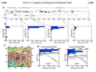
![Regional earthquake distributions in this study and those of the Hi Climb project [Liang et‐
al.
, 2008].
(a) Crosssection of seismicity across (left) the southern Tibet [Liang et al., 2008]) and (right)
the northern Tibet.(b) Statistics of the focal depths in the (first panel) Himalayan orogen [Liang et al., 2008],
(second panel) the southern Tibet [Liang et al.,2008], and (third and fourth panels) the northern
Tibet.
(c) Distributions of the events located in this study (black dots)and the events recorded by Hi
‐CLIMB project (cyan dots). The white lines show the profiles in Figure. The events in the
white dashed rectangles are projected to the cross profiles.
(d) Statistics of the focal depths and the crustal strength envelope.(left) For southern Tibet,
the strength envelope of the wet quartz (the green curve), the wet anorthite (the red curve),
the
southern Tibetan crust (the black curve), and the Byerlee’s Law (the black line) were
produced with the thermal gradient of34 °C/km. (right) For northern Tibet, the strength
envelope of the wet quartz (the green curve), the dry anorthite (the bluecurve), the northern
Tibetan crust (the black curve), and the Byerlee’s Law (the black line) were produced with
the thermal gradient of 32 °C/km.](https://image.slidesharecdn.com/earthquakepresentation-170519150216/85/Earthquake-presentation-13-320.jpg)
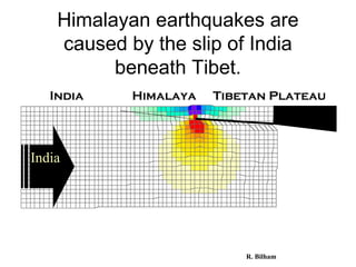
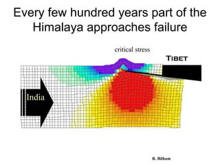
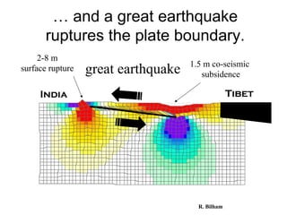
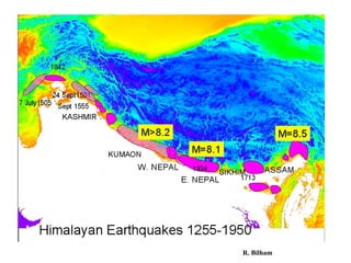
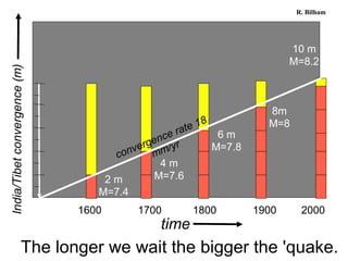
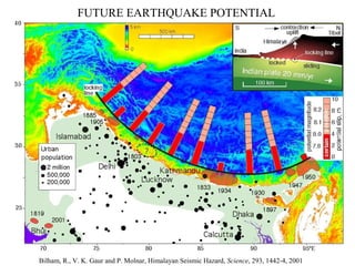


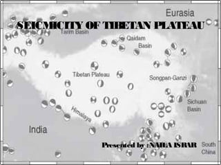
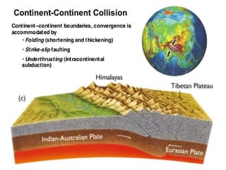
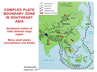
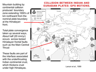
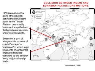
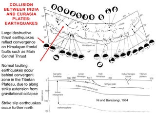
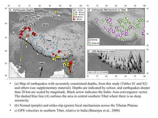
The document discusses seismicity in the Tibetan Plateau region resulting from the collision between the Indian and Eurasian tectonic plates. It describes how approximately half the plate convergence occurs along locked faults in the Himalayas, while the rest is accommodated by extension in the Tibetan Plateau as the thickened crust spreads under its own weight. Large earthquakes reflect movement on the Himalayan frontal thrust faults, while normal faulting earthquakes in the plateau and strike-slip quakes further north result from the eastward extrusion of crustal material. Seismicity data indicate a weak and hot lower-middle crust in the northern plateau, with earthquakes generally occurring above 30km depth, in contrast to sh


