Download to read offline
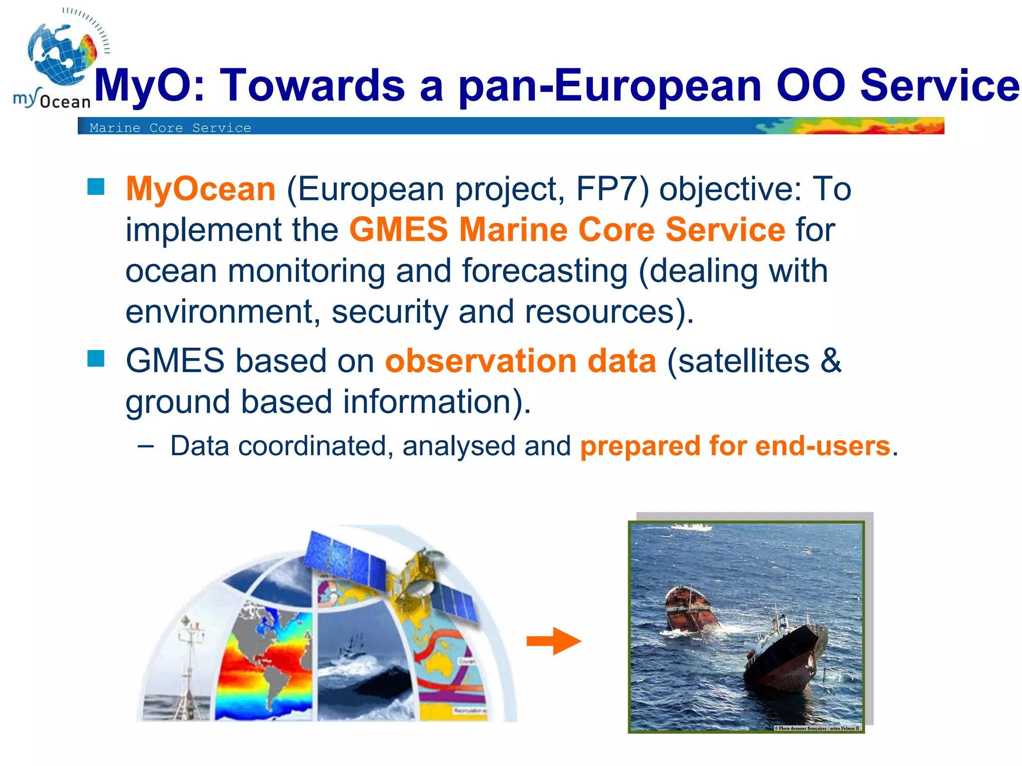
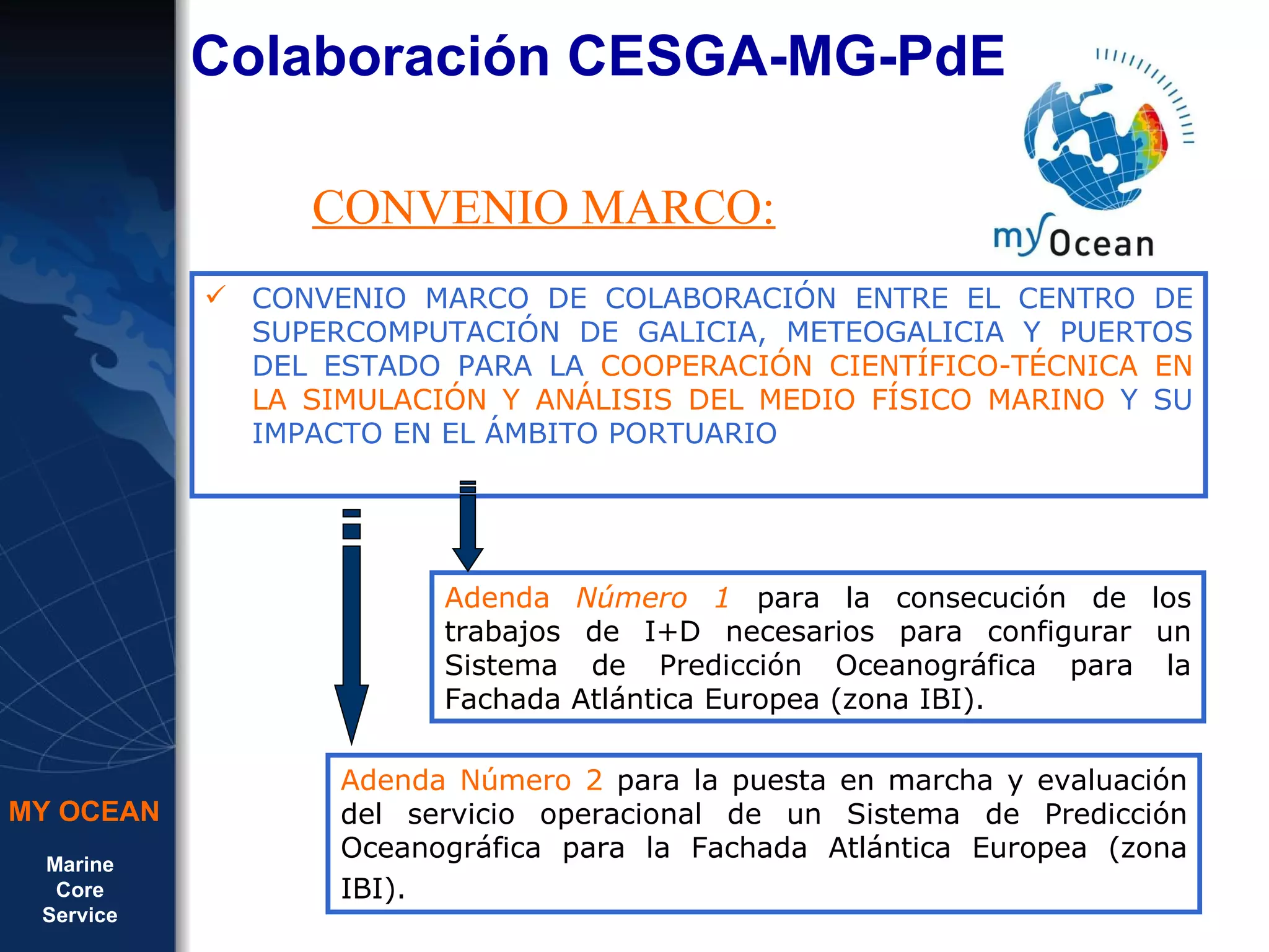
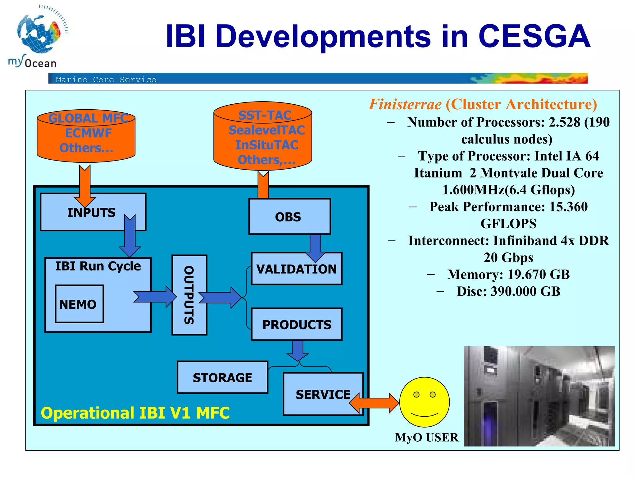
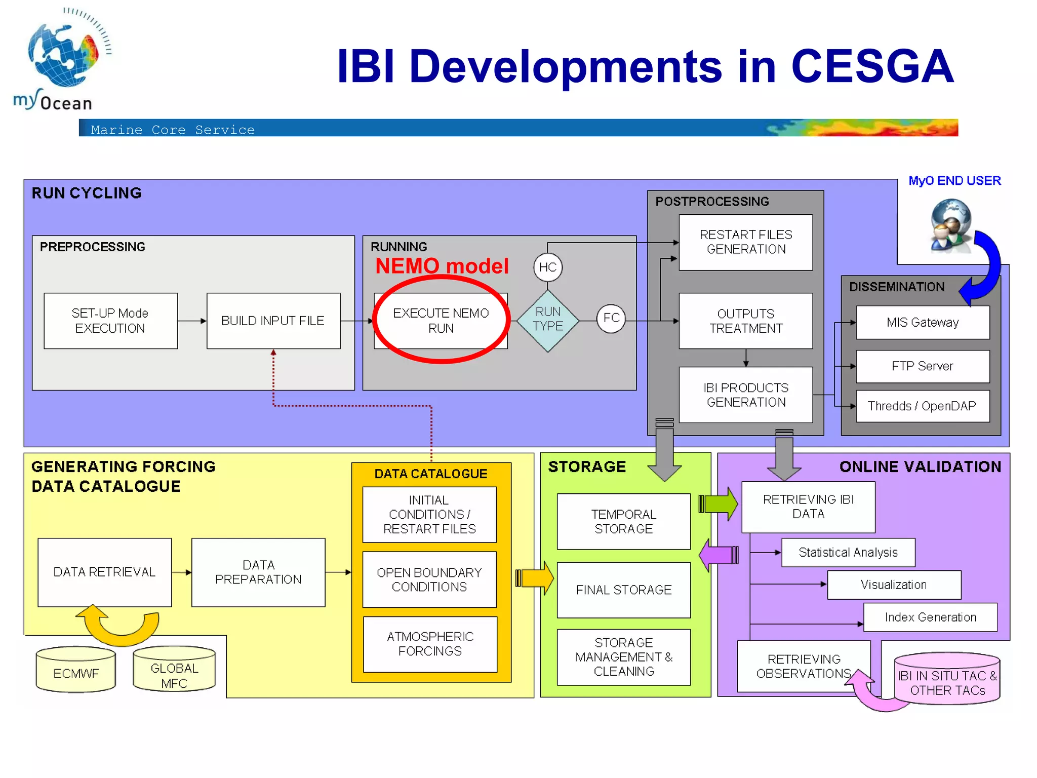
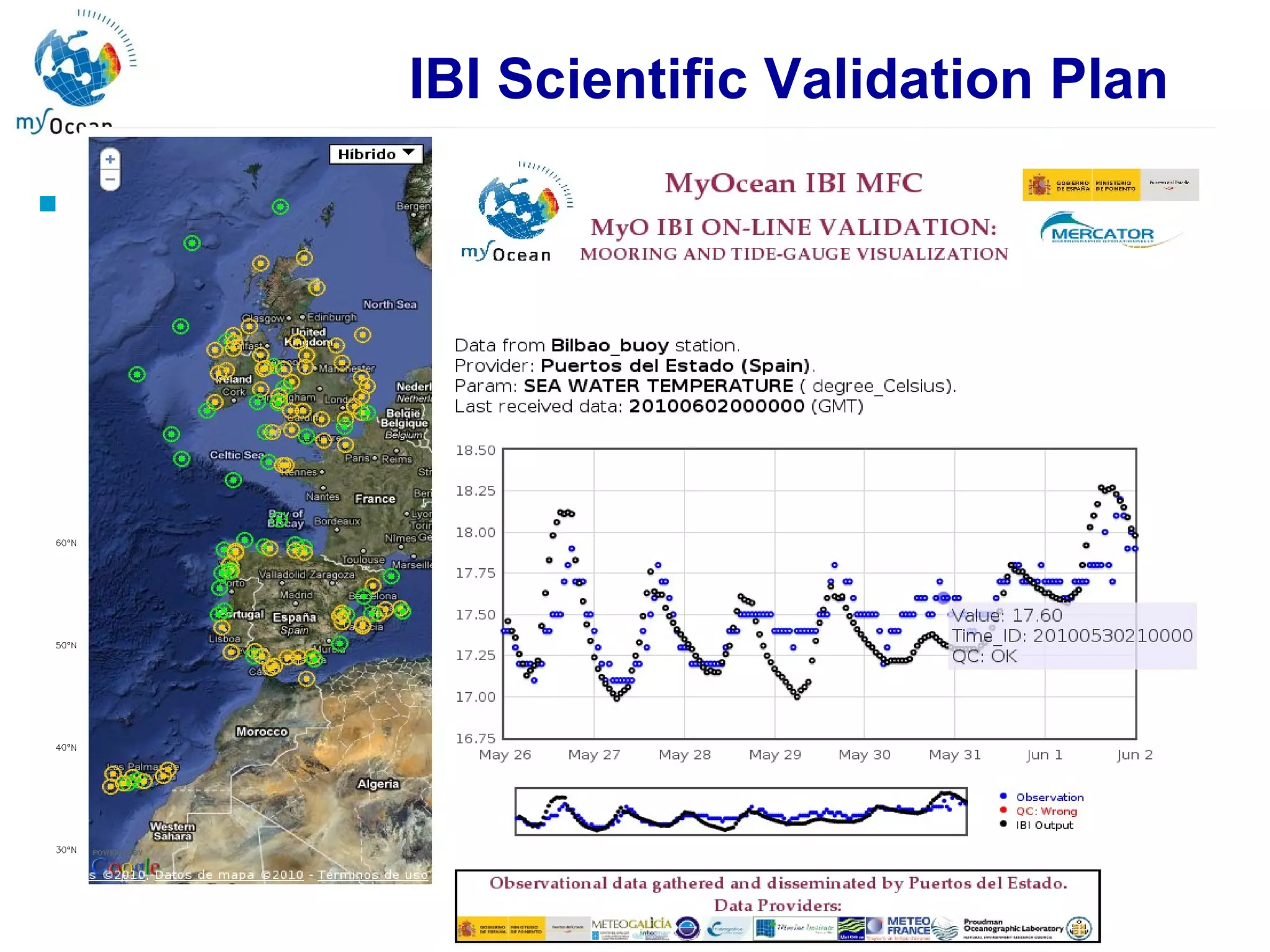
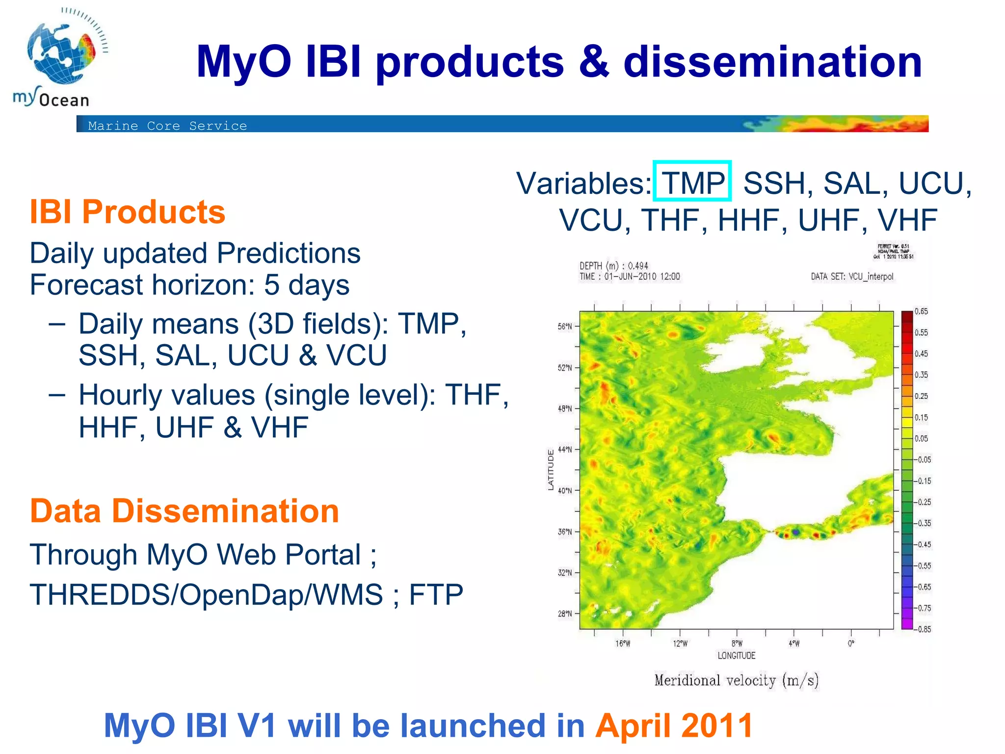

The document outlines the development of oceanographic operational models by Puertos del Estado, focusing on regional and local forecasting systems for harbor applications, facilitated through the MyOcean European project. It describes a comprehensive integrated system comprising various data sources, computational models, and collaborative agreements with institutions for improved ocean monitoring. The anticipated benefits include enhanced marine safety, environmental monitoring, and support for marine resources management.


![[DSC Europe 24] Marina Ivasic Kos - AI in maritime - Autonomous ships](https://cdn.slidesharecdn.com/ss_thumbnails/marinaivasickos-aiinmaritime-autonomousshipsv3-241220214742-9065ed9d-thumbnail.jpg?width=640&height=640&fit=bounds)


