Early warning and coordination sytem of Malaysia
•Download as PPT, PDF•
0 likes•1,170 views

The document discusses Malaysia's national meteorological early warning and coordination system. It outlines several natural hazards that affect Malaysia, including floods, strong winds, drought, and earthquakes. It notes an increase in extreme weather events and more intense tropical cyclones since the 1980s. The system includes over 400 observational stations, radar stations, weather cameras and marine monitoring to issue warnings. Challenges include inadequate coverage, forecasting small storms, and disseminating warnings during peak events. Strategies to improve include expanding observational networks, advanced models, better warning dissemination, and increasing public awareness.

Recommended
More Related Content
What's hot
What's hot (20)
Similar to Early warning and coordination sytem of Malaysia
Similar to Early warning and coordination sytem of Malaysia (20)
More from ABU_DRRGroup
More from ABU_DRRGroup (6)
Early warning and coordination sytem of Malaysia
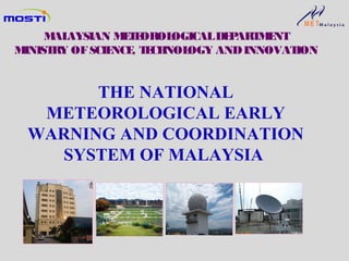
- 1. THE NATIONAL METEOROLOGICAL EARLY WARNING AND COORDINATION SYSTEM OF MALAYSIA MALAYSIAN METEOROLOGICALDEPARTMENT MINISTRY OFSCIENCE, TECHNOLOGY ANDINNOVATION
- 2. SCOPE Natural Hazards in Malaysia Monitoring and Early Warning System Issues and Challenges Strategies for Improvement Conclusion
- 3. Natural Hazards in MalaysiaNatural Hazards in Malaysia Weather-related Hazards Flood / Flash Flood Strong Winds,Rough Seas & Storm Surge Thunderstorms/ Lightning Tropical Cyclone/ Typhoon Forest Fire/Haze Agricultural Drought Geophysical Hazards Earthquake Local and Regional Tsunami Landslide Volcanic Eruption
- 4. Northeast Monsoon (Nov – Mar) Southwest Monsoon (Jun–Aug) Intermonsoon (Apr-May & Sep- Oct) Flood Haze Flash Flood Strong Winds & Rough Seas Typhoon (May – Nov) Severe Weather in Malaysia
- 5. Increase in Natural Hazards Increase in Extreme Weather Events in Malaysia since the 80s Severe dry weather in 1998 caused serious water disruptions especially in the Klang Valley. In December 2005, heavy moonsonal rains brought about major floods in Perlis, Kedah, Kelantan and Terengganu. In February 2006, heavy moonsonal rains caused widespread floods in Kelantan, Terengganu and Pahang. During the 2006 / 2007 Northeast Monsoon, the southern states of Peninsular Malaysia especially Johor experienced major floods resulting in damages to infrastructure and properties of more than one billion RM. In January and February 2011, more than 50,000 people in Johor were evacuated when severe flood hit the state.
- 6. Tropical Cyclones Intensity Increasing (Winds and Rainfall) In December 1996, Tropical Storm Greg hit Sabah. Typhoon Vamei landed on southwest Johor in December 2001 Tropical Depression crossed Malaysian waters and southern Thailand causing floods in Perlis and Kedah on 1-2 Nov 2010
- 7. METEOROLOGICAL STATION (45) UPPER AIR STATION (8) RADAR STATION (13) GROUND RECEIVING STATION (1) WEATHER CAMERA STATION (17) DATA ACQUISITION AUXILIARY STATIONS(339) • AWS (141) • Climatological Station (39) • Rainfall Station (159)
- 8. METEOROLOGICAL STATION (45) UPPER AIR STATION (8) RADAR STATION (13) GROUND RECEIVING STATION (1) WEATHER CAMERA STATION (17) DATA ACQUISITION AUXILIARY STATIONS(339) • AWS (141) • Climatological Station (39) • Rainfall Station (159)
- 9. RMAF Butterworth Bayan Lepas RMAF Gong Kedak Kota Kinabalu Kuching RMAF Kuantan Subang KLIA Central Forecast Office Petaling Jaya Main Meteorological Offices (10) KLIA Meteorological Office Central Forecasting Office Gong Kedak Meteorological Office Labuan
- 10. Surface Observational Stations Network Alor Star Bayan Lepas Gong Kedak Kota Kinabalu Kuching Kuantan Subang KLIA Petaling Jaya Chuping P. Langkawi Labuan Sandakan Kudat Limbang Tawau Kapit Mulu Bintulu Miri Keningau Sibu Seri Aman Batu Embun Muadzam Shah Batu Pahat Kluang Mersing Senai Temerloh Cameron Highlands Kota Bharu K. Trengganu Sitiawan Melaka Lubuk Merbau Ipoh Kuala Pilah Tioman Butterworth Prai Cameron Highlands Subang Sitiawan Alor Star Kuala Krai Ranau Kerteh
- 11. Bayan Lepas Kota Kinabalu Kuching Kuantan KLIA Tawau Bintulu Kota Bharu UpperAirStations (8) KLIA Upper Air Station
- 13. Marine Observational Network • 4 Acoustic Doppler Current Profiler (ADCP) and 2 Recording Doppler Current Profiler (RDCP) -real time • Data from various agencies : Royal Navy, Marine Dept, Oil & Gas, Scientific Expedition etc • Voluntary Observing Ship (VOS) Bintulu RDCP VOS Sandakan RDCP
- 14. KLUANG SETAR KUANTAN BINTULU Omar BUTTERWORTH SANDAKAN SUBANG KOTA BHARU KUCHING KOTA KINABALU KLIA P. JAYA Satellite And RadarStations (Doppler) DOPPLER RADAR STATION 12 fixed 1 mobile SATELLITE STATION (5 systems) MIRI
- 15. RadarEchoes KLIA DOPPLER RADAR MMD RADAR
- 16. NOAA GEO-STATIONARY Hotspot & Haze Monitoring Weather Monitoring MODIS Research & Analyses: Chlorophyll, SST & Vegetation Index Satellite Products
- 18. Marine Models MMD-JMA MRI III Wave Model MMD-WAM Wave Model MMD-JMA Storm Surge Model MMD-JMA Oil Spill Model
- 19. MMD- JMA Oil Spill Model Oil Spill
- 21. Fire DangerRating System Fine Fuel Moisture Code Fire Weather Index Drought Code DUFF Moisture Code Initial Spread Index Build Up Index
- 22. Marine Regions
- 23. Forecasts forPort and Ferry Operators Kuantan PTP Bintulu Miri K. Kinabalu South China Sea Sulu Sea Penang Kuching P. Klang Johor Bahru Sandakan
- 24. Warning Stages Criteria YellowYellow Possibility of a monsoonal rain in the next 3 – 5 days Possibility of heavy rains and strong winds/tropical depression in the next 3 – 5 days OrangeOrange Moderate monsoonal rainfall is occurring/will occur in the next couple of hours. Possibility of flood. Tropical depression with speeds of 50-60 kmph accompanied with moderate rains becoming heavy. RedRed Widespread heavy monsoonal rainfall is occurring/will occur in the next couple of hours. Possibility of major flood. Tropical storm/typhoon with speeds from 60 kmph accompanied with moderate rains becoming heavy. Criteria for Heavy Monsoonal Rain and Tropical Cyclones
- 25. Categor y Criteria FirstFirst Strong winds 40-50 kmph and rough seasStrong winds 40-50 kmph and rough seas with wave height up to 3.5 metres.with wave height up to 3.5 metres. SecondSecond Strong winds 50 – 60 kmph and roughStrong winds 50 – 60 kmph and rough seas with wave height up to 4.5 metres.seas with wave height up to 4.5 metres. ThirdThird Strong winds from 60 kmph and roughStrong winds from 60 kmph and rough seas with wave height from 4.5 metres.seas with wave height from 4.5 metres. Criteria for Strong Winds & Rough Seas Warning
- 26. Dissemination of Advisories/Warnings on Heavy Monsoonal Rain, Tropical Cyclone, Strong Winds & Rough Seas SMS(VIP, disaster management agencies)SMS(VIP, disaster management agencies) TV BroadcastTV Broadcast RTM1 - Selamat Pagi 1Malaysia, 1 pm &RTM1 - Selamat Pagi 1Malaysia, 1 pm & 5 pm Regional News5 pm Regional News TV CrawlerTV Crawler Radio Broadcast(Light FM, Radio 24 etc.)Radio Broadcast(Light FM, Radio 24 etc.) Facsimile(All disaster managementFacsimile(All disaster management agencies)agencies) Mass Media (Print and Electronic)Mass Media (Print and Electronic) Web page:Web page: www.met.gov.my Social Media NetworkSocial Media Network Facebook:Facebook: www.facebook.com/malaysiamet Twitter:Twitter: twitter.com/#!/malaysianmet
- 27. Visual Strong Wind Warning System Red Flag (5) Getting Fishery Complex Stesen Meteorologi K. Trengganu P. Chendering Fishery Complex K. Pahang Fishermen Association Nenasi Fishermen Association K. Rompin Fishermen Association LKIM Mersing Mukah Fishermen Association Bintulu Fishermen Association Miri Fishermen Association n South China Sea StraitsofM alacca Sulu Sea Celebes Sea Notice Board (7) MK Kuah Langkawi Pangkor
- 28. Dissemination(additional) Whenever necessary, additional channels are used especially for Tsunami Advisory/Warning: - Siren(certain locations only) -Fixed Line Alert System (FLAS) (ensure the warnings to evacuate reach the communities) This mode of dissemination may be extended to cover meteorological hazards.
- 29. EXHIBITIONS DIALOGUES MEDIA SESSIONS Severe Weather and Tsunami Awareness Programs COMMUNITY PARTICIPATION
- 30. PENGETAHUAN RISIKO PEOPLE-CENTRED EARLY WARNING SYSTEM FORPEOPLE-CENTRED EARLY WARNING SYSTEM FOR WEATHER, SEA & TSUNAMIWEATHER, SEA & TSUNAMI OBSERVATION & WARNING SYSTEM DISSEMINATION & COMMUNICATION RESPONSE CAPACITY
- 31. Inadequate coverage of observational stations: siren, seismic, automatic weather stations and radar. Lack of scientific understanding on tropical meteorology: accuracy and lead time of forecast/warning could not be improved. Small- scaled weather systems such as thunderstorms & squall-line could produce substantial damages but are extremely hard to predict. Rapid urbanization led to increased localised convection due to the heat island effect. CHALLENGESCHALLENGES
- 32. Lead Time and Forecast Skill
- 33. Disruption in information dissemination system particularly SMS and Internet during peak season/hours. For example: The MMD’s webpage hit could rise from 600,000 to 5 millions per day. Huge cost of acquiring and maintaining observational instruments and systems. Low level of awareness on disaster due to limited capacity and resources to educate the public. CHALLENGESCHALLENGES
- 34. Establishing observational stations at strategic locations and upgrading existing ones. Operationalization of advanced weather and marine numerical models. Enhancing the dissemination of warnings through various telecommunication channels. STRATEGIES FOR IMPROVEMENT
- 35. Colloboration with local authority involved in disaster management on data sharing(Blue Ocean Strategy). Conducting regular awareness programs. Forging cooperation with local and international research agencies. STRATEGIES FOR IMPROVEMENT
- 36. Thank You