
Recommended
Recommended
More Related Content
Similar to Listo Manual.ppt
Similar to Listo Manual.ppt (20)
Recently uploaded
Recently uploaded (20)
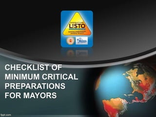
Listo Manual.ppt
- 2. Quick Notes The MAYOR leads the Disaster Risk Reduction Management as the Chairperson for the Local DRRM Council. Before the issuance of any Public Storm Warning Signal (1,2, and 3...), the LCE will receive a new set of advisories that will be called Bravo
- 3. The Process NDRRMC and DOST-PAGASA will give a set of advisories to the DILG-CODIX DILG-CODIX communicate to DILG Regional and Field Offices DILG Regional and Field Office will give information to LCEs
- 4. How to identify the Critical Preparedness Action of the LGU? 1 2 3 4 5 Typhoon enters the Philippine Area of Responsibility DOST and NDRRMC identifies LGUs under Alpha, Bravo and Charlie DOST and NDRRMC communicates CPA State of LGUs to DILG DILG transmits information to LGUs Mayors undertake preparedness actions based on the manuals and flowcharts
- 5. How to use the Disaster Preparedness Manual? Step 1: It is important to check the accompanying condition of each Critical Preparedness Action as illustrated below:
- 6. How to use the Disaster Preparedness Manual? Step 1(Sample)
- 7. 8 AM March 16, 2015 POTENTIAL RISK AREAS FOR TROPICAL STORM W/ INTNATIONAL NAME “BAVI” AREAS AFFECTED PROVINCES POTENTIAL IMPACTS DUE TO SEVERE WIND ALERT LEVEL “50KM Diameter from the forecast track” AURORA IFUGAO ISABELA NUEVA VIZCAYA QUIRINO Storm Surge of about 3 to 4 meters high Heavy damage to agriculture Some large trees uprooted Majority of nipa and cogon houses unroofed or destroyed considerable damage to structures of light to medium construction Moderate to heavy disruption of electrical power and communication services Travel by land, sea and air is dangerous Some large trees may be uprooted Moderate to heavy disruption of electrical power
- 8. 8 AM March 16, 2015 POTENTIAL RISK AREAS FOR TROPICAL STORM W/ INTNATIONAL NAME “BAVI” AREAS AFFECTED PROVINCES POTENTIAL IMPACTS DUE TO SEVERE WIND ALERT LEVEL “100KM Diameter from the forecast track” ABRA APAYAO BENGUET CAGAYAN ILOCOS SUR KALINGA MOUNTAIN PROVINCE NUEVA ECIJA PANGASINAN Storm Surge of about 1.5meters high Moderate damage to agriculture Rice and corn adversely affected Few large trees uprooted Large number of nipa and cogon houses partially or totally unroofed Some old galvanized iron roofing may roll off Travel by all types of sea vessels is risky Some large trees may be uprooted Moderate to heavy disruption of electrical power
- 9. 8 AM March 16, 2015 POTENTIAL RISK AREAS FOR TROPICAL STORM W/ INTNATIONAL NAME “BAVI” AREAS AFFECTED PROVINCES POTENTIAL IMPACTS DUE TO SEVERE WIND ALERT LEVEL “150KM Diameter from the forecast track” BULACAN CAMARINES NORTE CAMARINES SUR CATANDUANES ILOCOS NORTE ISABELA KALINGA LA UNION LAGUNA MASBATE METRO MANILA PAMPANGA QUEZON RIZAL TARLAC ZAMBALES Twigs and branches of trees may be broken Some banana plants may tilt or land flat on the ground Rice in flowering stage may suffer significant damage Some nipa and cogon houses may be partially unroofed Some large trees may be uprooted Moderate to heavy disruption of electrical power
- 10. How to use the Disaster Preparedness Manual? Step 2: Use corresponding flowcharts (Alpha, Bravo, Charlie) to guide LGU actions. Flowcharts can be posted in the DRRM/ Mayor’s offices of the city/municipality. It is divided into three (3) timeframes and different set of progressive actions that are categorized into 3 general action areas.
- 11. How to use the Disaster Preparedness Manual? • Issuing directives • Convening LDRRMC • Other Administrative and Managerial Actions (Administrator, Finance Officer, GSO) Prepare Action • Security, Lifeline, SRR (PNP, BFP, Engineering, Public Safety Offices) • Humanitarian (MHO, MSWDO) • Information and Awareness (Information Officer/Media Relations Response Action • Gathering of reports • Monitoring alerts • Coordinating operations Monitor Action General Progressive Action Area Response Actions
- 12. How to use the Disaster Preparedness Manual? Step 3: There are reference boxes in the progressive response actions that can be seen in the flowcharts. The flowcharts (in tarpaulin banners) can be used in DRR meetings or outdoor activities, while the manual can be used as a handy guide for LCEs.
- 13. How to use the Disaster Preparedness Manual? Step 3: In the banners, LCEs have 3 flowcharts (ALPHA, BRAVO, and CHARLIE), one (1) Reference Boxes and Checklists
- 14. How to use the Disaster Preparedness Manual? Step 3: ... And one (1) Tropical Cyclone Information Board
- 15. Reference Boxes (CHARLIE) A B C D E F K I J J G G K A B C C C D D D E E E I J J K H H G K A B C D E E E C C D D I J J F K
- 16. Reference Boxes (CHARLIE) A B C D E F K I J J G G K A B C C C D D D E E E I J J K H H G K A B C D E E E C C D D I J J F H H G K
- 17. Reference Boxes (BRAVO) A B C D E F K I J J G G K A B C C C D D D E E E I J J K F
- 18. Reference Boxes (BRAVO) A B C D E F K I J J G G K A B C C C D D D E E E I J J K H H G K
- 19. Reference Boxes (ALPHA) A B C D E F K I J
- 20. Reference Boxes (ALPHA) A B C D E F K I J J G G K
- 21. MY LGU Sample of LGU Tropical Cyclone Information Board
- 22. VULNERABLE COMMUNITIES IN MY LGU Sample Sheet...
- 23. How to use the Disaster Preparedness Manual? Step 4: The Disaster Preparedness Manual only provides a set of minimum actions to be undertaken by the LCEs and his/her teams. Hence, it encourages LCEs to do more and customize it depending on the local context and conditions. Careful planning and preparation based on local hazard and risk maps and regular monitoring are highly advised.