Data usability aspects in children’s geospatial learning
•
0 likes•519 views

Johannes Schlüter's presentation in the 2nd Workdshop on usability of geographic information, 23rd March 2010 at UCL, London. See details at http://www.virart.nottingham.ac.uk/GI%20Usability/index.html
Report
Share
Report
Share

Recommended
Re thinkpsu thorne_locativelearning
This document proposes developing multilingual augmented reality (AR) and mobile learning resources focused on sustainability projects near Portland State University. These include AR games that teach language through narratives and role-playing. Students would create games around course content using GPS-enabled phones. The games would push location-based texts, media, and quests to players as they navigate the city. Players could annotate their experiences by taking photos, writing notes, and recording audio/video in a notebook feature. The goal is to distribute language, communication, and cognition across social and material landscapes using ubiquitous mobile devices.
Print Portfolio
Terence Eduarte
Mobile: 0917-8547123
Email: terenceeduarte@gmail.com
FB: /terenceeduarte
ADDRESS:
Unit 201, 20 Shaw Blvd cor.
Mindanao Ave, Mandaluyong City
HOURS:
Mon-Fri: 9AM - 6PM
Sat: 9AM - 3PM
Thank you and God bless!
Ad Club Presentation
Boost Media Entertainment is a digital marketing agency that specializes in creating mobile applications. They offer full creative and technical development services to design apps. They have developed over 100 apps across many industries. Apps are a huge opportunity because 88% of local advertising will be on mobile devices by 2016. Apps can reduce costs for guides and increase customer engagement and visits for restaurants. App development budgets can range from $1,500-$20,000 depending on features, and development time ranges from weeks to months. Apps can make money through sponsorship of the full app or parts of it, advertising networks, premium apps with set prices, and in-app purchases.
Instalación de Turnkey con Drupal 7 en una máquina virtual
Instalación / Despliegue en una máquina virtual de Turnkey con Drupal 7
Servidor Web con CMS Drupal 7
Knut-Inge Klepp, Directorate of Health, Norway
This document discusses marketing of unhealthy foods to children and efforts to reduce this practice. It notes that children's diets high in fat, sugar and salt put them at risk for health issues. Food marketing to children promotes these unhealthy foods and influences children's food preferences. Several countries and organizations, including WHO, have issued recommendations to restrict unhealthy food marketing to children. Norway is considering implementing statutory regulations after testing voluntary industry restrictions. Overall, the marketing of unhealthy foods to children is a global issue that requires international action and consistent monitoring to be effectively addressed.
Kundenbindung mit mobilen Diensten
QR-CODES und NFC
Mobile Dienste verzeichnen rasante Zuwachsraten. Immer leistungsfähigere mobile Endgeräte (Smartphones oder Handheld Devices) ermöglichen es, jederzeit und überall auf relevante Informationen und Dienste zuzugreifen. Unter dem Schlagwort Real World Connection werden Dinge aus der realen Welt mit virtuellen Informationen oder Diensten verbunden, die über mobile Endgeräte jederzeit abgerufen werden können.
Im Fokus der Veranstaltung stehen mobile Dienste mit QR-Codes und NFC. QR-Codes sind eine Technik, um physische Objekte mit weiterführenden Informationen bzw. mobilen Diensten zu verknüpfen. Der QR-Code (Quick Response Codes) ist eine kleine Matrix, die über das Smartphone eingelesen wird. Artikel im Verkaufsregal können so mit detaillierten Beschreibungen verknüpft werden, Werbeträger mit einem Online-Shop oder der mobilen Internetpräsenz des Unternehmens (Mobile Tagging). Der Vortrag zeigt vor allem kleinen und mittleren Unternehmen, wie QR-Codes die Bereitstellung mobiler Dienste ermöglichen und welche neuen Einsatzszenarien sich daraus ergeben.
NFC (Near Field Communication) ist eine neuartige Funktechnologie, die den Informationsaustausch über sehr kurze Entfernungen ermöglicht (wenige Zentimeter). Informationen auf einem Mikrochip können so durch ein NFC-fähiges Endgerät (z.B. ein Smartphone) ausgelesen bzw. modifiziert werden, oder zwei Smartphones können miteinander kommunizieren. Wie die QR-Codes ermöglicht auch NFC ganz neue Geschäftsmodelle, die im Rahmen des Vortrags vorgestellt werden.
Bertha Legorreta
El graffiti surgió a finales de los años 1960 en el metro de Nueva York y forma parte del movimiento hip-hop. Se expresa a través de la pintura en paredes, el rap, el breakdance y comunica ideas, pensamientos y sentimientos. Aunque originalmente era ilegal, el graffiti ahora se considera un arte público.
Apresentação spatialthinkingi cologne_26ag09-12
This document discusses a research project that aims to promote and assess students' critical spatial thinking skills through the use of geospatial technologies. The project seeks to determine if geospatial technologies can effectively develop and evaluate critical spatial thinking in the context of education for sustainable development. The methodology involves a literature review on spatial and critical thinking, focus groups with specialists and students, developing learning goals involving geospatial technologies, and assessing critical spatial thinking through fieldwork activities. Preliminary findings from focus groups with students indicate that geospatial technologies help promote competencies like environmental responsibility and allow students to explore places they have never been to before. Students also felt they had fun while learning through this approach. The researchers conclude that further focus should be placed on the "
IET Technology Coffee Morning - Location-based learning: education in the Wild
Slides presented at the IET Technology Coffee Morning at the Open University.
Abstract and further details available at http://cloudworks.ac.uk/cloudscape/view/2350.
Geolocation lesson slide show
This document discusses geolocation technology and its applications. It begins with definitions of key terms like geolocation, GPS, satellites, waypoints and geocaching. It then demonstrates how to use a GPS receiver to find locations, mark waypoints and view coordinate data. The document discusses using geotagged photos and sharing locations online. It emphasizes that geolocation provides new ways to organize and search information, with implications for research and learning like observing patterns and gaining deeper insights when location data is incorporated.
Sustainable Development Goals Challenges in mapping our world with geography ...
A presentation given at the Bilingual Geography teacher training course examining the Sustainable Development Goals. The presentation examines approaches and methods suited to innovative learning and teaching.
Gold Rush (Inquiry-Based Learning)
This document describes a pilot inquiry-based learning course on the Gold Rush using GIS. It discusses how geomatics initiatives in Nova Scotia found that increasing awareness of the field in education is key to its growth. The course uses authentic learning experiences and student choice to teach 21st century skills. Students do a simulated gold exploration using old and new technologies, like compasses, maps, and GIS software. The goal is to engage students and transfer spatial skills needed for careers using location-based information.
Geocaching densi2012
This document provides background information on geocaching and examples of classroom activities that utilize geocaching and GPS technology. It discusses what geocaching is and different types of caches. It then describes several classroom activities across various subjects that get students outside using GPS devices to locate coordinates and complete tasks. These activities engage students in history, science, language arts and support developing skills outlined in the Big6 model of information problem-solving. The document also provides many online resources for teachers interested in incorporating geocaching into lessons.
Mobile, Playful and Collaborative Learning with TellYourTown: Empirical Resul...
The document summarizes research on using a mobile app called TellYourTown for location-based learning in Trier and Esch, Germany. Field studies involved students exploring the cities to answer historical questions at waypoints using the app. Observations found that students were engaged with minigames but interaction between students and with content was limited. The app showed potential to enhance learning through mobility and context but better support is needed for meaningful discussion and extended learning beyond the game. Recommendations included improving GPS, adding directional guidance, and facilitating more interaction between students.
Geography with a Diferent View Through GIS
Presentation by Mary Fargher from Institute of Education, University of London. Esri European User Conference.
2012 06 19 (upm) emadrid fdevries ounl mobile learning opportunities pitfalls
This document discusses mobile learning and augmented reality applications. It describes a project called ARLearn that uses augmented reality for cultural heritage field trips. Students use smartphones to navigate locations, take notes, and receive assignments from tutors in real-time. An evaluation of a field trip to Florence found that the application was effective for situated learning, but faced challenges with GPS accuracy and battery life. The document also discusses a similar project called Streetlearn focused on the Amsterdam canal district cultural heritage site.
GIS and OFSTED
Geographical information systems (GIS) were revolutionizing some students' experiences by providing visual images and satellite technology that brought landscapes to life. Higher attaining pupils were challenged by using GIS to overlay data and explore interactive maps to interpret patterns and solve problems. The document describes a good practice sixth form geography lesson that effectively used satellite technology through GIS for data interpretation to engage students in discussing urbanization. As a result of a well-planned curriculum incorporating GIS, the students gained a good understanding of accessing different types of satellite images and maps.
M-Assessment in situ: QuesTInSitu and cases from multiple contexts
Presented in 'Towards sustainable mobile learning scenarios, Wednesday 9th October, 2013' - http://cloudworks.ac.uk/cloud/view/8434
See you @ GI_Forum
The Map Your World project uses GPS data logging and web applications to help students learn about map navigation and spatial analysis. Students carry GPS loggers or use smartphones to record their daily movements over a week. The data is uploaded and analyzed using tools that generate heatmaps, hotspots, and animations of their routes. This helps students learn about privacy issues related to location data and see patterns in their own and classmates' movements. The project has been successfully piloted with secondary school classes, generating interesting discussions about using spatial data analysis to understand behaviors and optimize infrastructure planning.
Goetagging & Geocaching
The document discusses the educational potential of geotagging and geocaching using handheld devices. It defines geotagging as adding location metadata like coordinates to media like images. Geocaching is described as an outdoor treasure hunting game where people use GPS to hide and find containers around the world. The document proposes some ways these technologies could be used for educational purposes, such as managing fieldwork images, developing geocaching materials to teach others, and assigning travel bugs to follow long distances.
From the Earth: Explore, Collaborate, and Share with Google Earth
1) The document discusses how Geo Apps like Google Earth, Maps, and SketchUp can be used to inspire students to discover, engage with their surroundings, explore, analyze information, collaborate, understand history, raise global awareness, and become engaged.
2) It provides examples of lesson plans and student projects using Geo Apps across different grade levels and subjects like science, social studies, language arts, and math.
3) The document encourages educators to contribute their own lesson ideas and projects using Geo Apps to an online community forum.
GI Learner: A project to develop geospatial thinking learning lines in second...
Almost all aspects of our economy and society are based on geoinformation and geotechnologies. People are tracking, mapping and communicating geographically on an unprecedented scale. Citizens can be empowered by geospatial technologies and open geodata. The sector is booming, however there has been a clear mismatch between workforce demand and supply. Study programmes focus more on informatics than on the scientific background of spatial thinking.
This presentation seeks to introduce a newly EU funded project titled, GI-Learner: Developing a learning line on GIScience in school education. This project aims to support the introduction of GI Science in secondary (high school) education, by addressing policy developments and deliver materials with the capacity and capability to raise awareness of the GI sector, create a geospatially literate workforce and citizens who can benefit from these developments.
Learning lines for geoSpatial thinking: GI Learner Project
Almost all aspects of our economy and society are based on geoinformation and geotechnologies. People are tracking, mapping and communicating geographically on an unprecedented scale. Citizens can be empowered by geospatial technologies and open geodata. The sector is booming, however there has been a clear mismatch between workforce demand and supply. Study programmes focus more on informatics than on the scientific background of spatial thinking.
This presentation seeks to introduce a newly EU funded project titled, GI-Learner: Developing a learning line on GIScience in school education. This project aims to support the introduction of GI Science in secondary (high school) education, by addressing policy developments and deliver materials with the capacity and capability to raise awareness of the GI sector, create a geospatially literate workforce and citizens who can benefit from these developments.
Curricular Connections to Geocaching
Learn how GPS devices work and how to connect Geocaching with any curricular unit of study to motivate and excite student learning.
Group Powerpoint
This document discusses various ways that technology can be used in social studies education, including simulations, digital storytelling, geospatial technologies, and GPS. It provides examples of using devices and software for activities, communication, word processing, multimedia tools, and instructional software. Guidelines are presented for adaptive learning, responsible work, copyright, assessment rubrics, telecommunications, and sample lesson plans. Overall, the document explores how technology can enhance social studies instruction in many areas.
Maps and the Geospatial Revolution: Lesson 1, Lecture 1
These are the slides to accompany the video lecture for lesson 1 of Maps and the Geospatial Revolution on Coursera.
Brighton GIS for JPPD
This document provides a summary of various geography-related activities and projects over the last three months and five days. It discusses using GIS and spatial visualization tools to engage students in problem-based learning. It also touches on curriculum making and including GIS in the geography curriculum. New resources on the GA website are mentioned, including vocational resources and a "Landscape in a Box" teaching tool.
Devising a citizen science monitoring programme for tree regeneration the upl...
Presentation by Chris Andrews from a participatory virtual workshop June 2020 on citizen science in the Cairngorms national park. Aims of presentation: To provide a background information as to what's going on ecologically in the uplands; To explore why some upland habitats might be changing; Example of what could be done through a case study at the ECN Cairngorm long-term monitoring site; Provide a framework in which to think about what variables might be useful to citizen science project on monitoring regeneration.
The value of citizen science for environmental monitoring in Scotland
Presentation by Nadia Dewhurst Richman from a participatory virtual workshop in June 2020. This presentation gives an overview of the benefits of citizen science using examples of existing projects in Scotland, along with an introduction to Scotland’s Environment Web.
More Related Content
Similar to Data usability aspects in children’s geospatial learning
Apresentação spatialthinkingi cologne_26ag09-12
This document discusses a research project that aims to promote and assess students' critical spatial thinking skills through the use of geospatial technologies. The project seeks to determine if geospatial technologies can effectively develop and evaluate critical spatial thinking in the context of education for sustainable development. The methodology involves a literature review on spatial and critical thinking, focus groups with specialists and students, developing learning goals involving geospatial technologies, and assessing critical spatial thinking through fieldwork activities. Preliminary findings from focus groups with students indicate that geospatial technologies help promote competencies like environmental responsibility and allow students to explore places they have never been to before. Students also felt they had fun while learning through this approach. The researchers conclude that further focus should be placed on the "
IET Technology Coffee Morning - Location-based learning: education in the Wild
Slides presented at the IET Technology Coffee Morning at the Open University.
Abstract and further details available at http://cloudworks.ac.uk/cloudscape/view/2350.
Geolocation lesson slide show
This document discusses geolocation technology and its applications. It begins with definitions of key terms like geolocation, GPS, satellites, waypoints and geocaching. It then demonstrates how to use a GPS receiver to find locations, mark waypoints and view coordinate data. The document discusses using geotagged photos and sharing locations online. It emphasizes that geolocation provides new ways to organize and search information, with implications for research and learning like observing patterns and gaining deeper insights when location data is incorporated.
Sustainable Development Goals Challenges in mapping our world with geography ...
A presentation given at the Bilingual Geography teacher training course examining the Sustainable Development Goals. The presentation examines approaches and methods suited to innovative learning and teaching.
Gold Rush (Inquiry-Based Learning)
This document describes a pilot inquiry-based learning course on the Gold Rush using GIS. It discusses how geomatics initiatives in Nova Scotia found that increasing awareness of the field in education is key to its growth. The course uses authentic learning experiences and student choice to teach 21st century skills. Students do a simulated gold exploration using old and new technologies, like compasses, maps, and GIS software. The goal is to engage students and transfer spatial skills needed for careers using location-based information.
Geocaching densi2012
This document provides background information on geocaching and examples of classroom activities that utilize geocaching and GPS technology. It discusses what geocaching is and different types of caches. It then describes several classroom activities across various subjects that get students outside using GPS devices to locate coordinates and complete tasks. These activities engage students in history, science, language arts and support developing skills outlined in the Big6 model of information problem-solving. The document also provides many online resources for teachers interested in incorporating geocaching into lessons.
Mobile, Playful and Collaborative Learning with TellYourTown: Empirical Resul...
The document summarizes research on using a mobile app called TellYourTown for location-based learning in Trier and Esch, Germany. Field studies involved students exploring the cities to answer historical questions at waypoints using the app. Observations found that students were engaged with minigames but interaction between students and with content was limited. The app showed potential to enhance learning through mobility and context but better support is needed for meaningful discussion and extended learning beyond the game. Recommendations included improving GPS, adding directional guidance, and facilitating more interaction between students.
Geography with a Diferent View Through GIS
Presentation by Mary Fargher from Institute of Education, University of London. Esri European User Conference.
2012 06 19 (upm) emadrid fdevries ounl mobile learning opportunities pitfalls
This document discusses mobile learning and augmented reality applications. It describes a project called ARLearn that uses augmented reality for cultural heritage field trips. Students use smartphones to navigate locations, take notes, and receive assignments from tutors in real-time. An evaluation of a field trip to Florence found that the application was effective for situated learning, but faced challenges with GPS accuracy and battery life. The document also discusses a similar project called Streetlearn focused on the Amsterdam canal district cultural heritage site.
GIS and OFSTED
Geographical information systems (GIS) were revolutionizing some students' experiences by providing visual images and satellite technology that brought landscapes to life. Higher attaining pupils were challenged by using GIS to overlay data and explore interactive maps to interpret patterns and solve problems. The document describes a good practice sixth form geography lesson that effectively used satellite technology through GIS for data interpretation to engage students in discussing urbanization. As a result of a well-planned curriculum incorporating GIS, the students gained a good understanding of accessing different types of satellite images and maps.
M-Assessment in situ: QuesTInSitu and cases from multiple contexts
Presented in 'Towards sustainable mobile learning scenarios, Wednesday 9th October, 2013' - http://cloudworks.ac.uk/cloud/view/8434
See you @ GI_Forum
The Map Your World project uses GPS data logging and web applications to help students learn about map navigation and spatial analysis. Students carry GPS loggers or use smartphones to record their daily movements over a week. The data is uploaded and analyzed using tools that generate heatmaps, hotspots, and animations of their routes. This helps students learn about privacy issues related to location data and see patterns in their own and classmates' movements. The project has been successfully piloted with secondary school classes, generating interesting discussions about using spatial data analysis to understand behaviors and optimize infrastructure planning.
Goetagging & Geocaching
The document discusses the educational potential of geotagging and geocaching using handheld devices. It defines geotagging as adding location metadata like coordinates to media like images. Geocaching is described as an outdoor treasure hunting game where people use GPS to hide and find containers around the world. The document proposes some ways these technologies could be used for educational purposes, such as managing fieldwork images, developing geocaching materials to teach others, and assigning travel bugs to follow long distances.
From the Earth: Explore, Collaborate, and Share with Google Earth
1) The document discusses how Geo Apps like Google Earth, Maps, and SketchUp can be used to inspire students to discover, engage with their surroundings, explore, analyze information, collaborate, understand history, raise global awareness, and become engaged.
2) It provides examples of lesson plans and student projects using Geo Apps across different grade levels and subjects like science, social studies, language arts, and math.
3) The document encourages educators to contribute their own lesson ideas and projects using Geo Apps to an online community forum.
GI Learner: A project to develop geospatial thinking learning lines in second...
Almost all aspects of our economy and society are based on geoinformation and geotechnologies. People are tracking, mapping and communicating geographically on an unprecedented scale. Citizens can be empowered by geospatial technologies and open geodata. The sector is booming, however there has been a clear mismatch between workforce demand and supply. Study programmes focus more on informatics than on the scientific background of spatial thinking.
This presentation seeks to introduce a newly EU funded project titled, GI-Learner: Developing a learning line on GIScience in school education. This project aims to support the introduction of GI Science in secondary (high school) education, by addressing policy developments and deliver materials with the capacity and capability to raise awareness of the GI sector, create a geospatially literate workforce and citizens who can benefit from these developments.
Learning lines for geoSpatial thinking: GI Learner Project
Almost all aspects of our economy and society are based on geoinformation and geotechnologies. People are tracking, mapping and communicating geographically on an unprecedented scale. Citizens can be empowered by geospatial technologies and open geodata. The sector is booming, however there has been a clear mismatch between workforce demand and supply. Study programmes focus more on informatics than on the scientific background of spatial thinking.
This presentation seeks to introduce a newly EU funded project titled, GI-Learner: Developing a learning line on GIScience in school education. This project aims to support the introduction of GI Science in secondary (high school) education, by addressing policy developments and deliver materials with the capacity and capability to raise awareness of the GI sector, create a geospatially literate workforce and citizens who can benefit from these developments.
Curricular Connections to Geocaching
Learn how GPS devices work and how to connect Geocaching with any curricular unit of study to motivate and excite student learning.
Group Powerpoint
This document discusses various ways that technology can be used in social studies education, including simulations, digital storytelling, geospatial technologies, and GPS. It provides examples of using devices and software for activities, communication, word processing, multimedia tools, and instructional software. Guidelines are presented for adaptive learning, responsible work, copyright, assessment rubrics, telecommunications, and sample lesson plans. Overall, the document explores how technology can enhance social studies instruction in many areas.
Maps and the Geospatial Revolution: Lesson 1, Lecture 1
These are the slides to accompany the video lecture for lesson 1 of Maps and the Geospatial Revolution on Coursera.
Brighton GIS for JPPD
This document provides a summary of various geography-related activities and projects over the last three months and five days. It discusses using GIS and spatial visualization tools to engage students in problem-based learning. It also touches on curriculum making and including GIS in the geography curriculum. New resources on the GA website are mentioned, including vocational resources and a "Landscape in a Box" teaching tool.
Similar to Data usability aspects in children’s geospatial learning (20)
IET Technology Coffee Morning - Location-based learning: education in the Wild
IET Technology Coffee Morning - Location-based learning: education in the Wild
Sustainable Development Goals Challenges in mapping our world with geography ...
Sustainable Development Goals Challenges in mapping our world with geography ...
Mobile, Playful and Collaborative Learning with TellYourTown: Empirical Resul...
Mobile, Playful and Collaborative Learning with TellYourTown: Empirical Resul...
2012 06 19 (upm) emadrid fdevries ounl mobile learning opportunities pitfalls
2012 06 19 (upm) emadrid fdevries ounl mobile learning opportunities pitfalls
M-Assessment in situ: QuesTInSitu and cases from multiple contexts
M-Assessment in situ: QuesTInSitu and cases from multiple contexts
From the Earth: Explore, Collaborate, and Share with Google Earth
From the Earth: Explore, Collaborate, and Share with Google Earth
GI Learner: A project to develop geospatial thinking learning lines in second...
GI Learner: A project to develop geospatial thinking learning lines in second...
Learning lines for geoSpatial thinking: GI Learner Project
Learning lines for geoSpatial thinking: GI Learner Project
Maps and the Geospatial Revolution: Lesson 1, Lecture 1
Maps and the Geospatial Revolution: Lesson 1, Lecture 1
More from Muki Haklay
Devising a citizen science monitoring programme for tree regeneration the upl...
Presentation by Chris Andrews from a participatory virtual workshop June 2020 on citizen science in the Cairngorms national park. Aims of presentation: To provide a background information as to what's going on ecologically in the uplands; To explore why some upland habitats might be changing; Example of what could be done through a case study at the ECN Cairngorm long-term monitoring site; Provide a framework in which to think about what variables might be useful to citizen science project on monitoring regeneration.
The value of citizen science for environmental monitoring in Scotland
Presentation by Nadia Dewhurst Richman from a participatory virtual workshop in June 2020. This presentation gives an overview of the benefits of citizen science using examples of existing projects in Scotland, along with an introduction to Scotland’s Environment Web.
citizen science - a brief introduction
Presentation by Muki Haklay in a participatory virtual workshop June 2020. The presentation provided an overview of the types of activities that fall under the umbrella term citizen science - from activities that people do at home using the computers and the internet (volunteer computing or volunteer thinking) to ecological monitoring of landscape change in an opportunistic way. The presentation also pointed out to the multiple goals of citizen science projects - from engaging people in environmental issues, to providing opportunities to disadvantaged groups in society. The level of participation across projects was also highlighted, indicating that as requirements and knowledge increase, the number of people that are currently engaged in citizen science project decreases.
Citizen Science as a tool to support land management in the Cairngorms Nation...
Presentation by Jan Dick from the participatory virtual workshop in June 2020. Part of UKRI project to explore the suitability of citizen science for Long-Term Scoio-Ecological Research (LTSER)
Citizen science characteristics webinar
Slides from Susanne Hecker and Muki Haklay talk in an ECSA webinar about the ECSA Characteristics of Citizen science https://zenodo.org/communities/citscicharacteristics/ - covering the methodology and the main features of the document. The webinar is available here https://zenodo.org/record/3859970
Platforms for Citizen Science - ExCiteS experience
Muki Haklay has experience developing several citizen science mapping platforms over the past 20 years, including Community Maps, GeoKey, and Sapelli. These platforms have evolved from early desktop GIS systems to modern web-based and mobile apps that allow collaborative mapping. Some key insights are that infrastructure systems have a longevity of around 5 years before needing redesign, engaging communities requires both digital and paper tools, and balancing research goals with reliable software can be challenging. Maintaining these types of platforms requires ongoing development and technical support.
Citizen science in different project
This document discusses citizen science projects across different domains and levels of participation. It provides an overview of citizen science activities and the relationship between scientists and the public. It also positions citizen science within the context of public engagement, using an example from the DITOs project. Finally, it introduces the next step of the EU-Citizen.Science project.
Citizen Science in Open Science context: measuring & understanding impacts of...
Citizen science has grown rapidly in recent decades due to societal and technological trends. It includes a wide range of activities across disciplines. While not all participants want deep engagement, citizen science can involve fully participatory research processes. It is gaining recognition from the public and policymakers. Evaluation of citizen science projects requires sensitivity, as rigid criteria may exclude some activities or newcomers. Overall, citizen science shows potential for increasing scientific literacy and knowledge while achieving important research goals.
Extreme Citizen Science technologies: attempting to embed values in code
Extreme Citizen Science (ExCiteS) is a situated, bottom-up practice that takes into account local needs, practices and culture and works with broad networks of people to design and build new devices and knowledge creation processes that can transform the world. The ExCiteS group at UCL was set up to support the implementation of this concept through the development of theories, methodologies, processes, and technologies that allow any community, regardless of (technical) literacy, to engage in citizen science projects that produce results that are meaningful and useful for them. Stemming from theoretical foundations in participatory action research and public participation geographic information systems (PPGIS), our technologies are designed to carry values with them. Once we visit these values, we can see how they turn into code, and ask how successful these efforts are, using cases in the Amazon, Congo-basin, Namibia, UK, and Malta.
The role of learning in community science and citizen science
This are slides from the talk on 12 Oct, Joint workshop of the Teaching and Learning and Citizen Science Special Interest Groups of the British Ecological Society, which was held on 12th October 2018 at the University of Reading. The talk explores links between learning and citizen science - contributory and collegial in particular. This is an improved version of the Citizen Inquiry slides
The persistent environmental digital divide(s) -RGS-IBG 2018
Over 25 years ago, as the web was emerging as a medium for distributing public information, it was promoted as a tool for increased democratisation. From the age of dial-up modem and PCs to the use of mobile phones and smartphones, concerns about digital divides and how they impact the ability of local participation in environmental decision making never resolved. These digital divides are creating a tapestry of marginalisation through different devices, skills, and communication potentials, and it is valuable to reflect on their dimensions – both technical and social, and consider how we can consider them in a systematic way. The talk will attempt to reflect on technological and social changes and the attempts to address them.
Digital Geographies Working Group - citizen science - passive and assertive i...
This document discusses citizen science and inclusiveness. It outlines a spectrum of citizen science projects from volunteer computing and thinking to DIY science. It discusses the educational attainment levels of participants in different projects, noting gender and education imbalances. The document contrasts passive inclusiveness, where projects do not intentionally create obstacles to participation, with assertive inclusiveness, where outreach is done to underrepresented groups. Passive inclusiveness has lower costs but may focus on more educated groups, while assertive inclusiveness aims for more social benefits through greater engagement and empowerment of marginalized communities. Citizen science offers opportunities to study inclusion, but tensions exist regarding participation and what inclusiveness means.
Pecha Kucha session: multi country science programs Ecsite 2018
Doing It Together Science (DITOs) is a 3-year project, funded by the EU Horizon 2020 programme, that is aimed to increase awareness of and participation in citizen science across Europe and beyond. It is focused on communication, coordination, and support of citizen science activities. Therefore, the project promotes the sharing of best practices among existing networks for a greater public and policy engagement with citizen science through a wide range of events and activities.
Open Science and Citizen Science - researcher, participants, and institutiona...
Presentation from the OECD workshop on 9th April 2018, GSF-NESTI Workshop on "Reconciling Scientific Excellence and Open Science" asked the question "What do we want out of science and how can we incentivise and monitor these outputs?". The talk covers the personal experience as a researcher, the experience of participants in citizen science projects, and the institutional aspects.
Introduction to Citizen Science and Scientific Crowdsourcing - Data Quality s...
This is part of the course "introduction to citizen science and scientific crowdsourcing", which you can find at https://extendstore.ucl.ac.uk/product?catalog=UCLXICSSCJan17 . The lecture is dedicated to data management in citizen science, and this part is focusing on data quality
The role of learning in citizen science
This is a presentation from the citizen science impact event at the Open University http://www.open.ac.uk/blogs/opentel/citizen-science-impact-event-at-the-open-university/
Citizen science offer different levels of engagement to participants, which have been captured in typologies of the field (contributory, collaborative, co-created, collegial / crowdsourcing, distributed intelligence, participatory science, extreme citizen science). These typologies do no explicitly examine learning. At the same time, projects and activities striving to fulfil multiple goals (excellent scientific output, satisfying engagement, good recruitment, learning …). Within ythe range of citizen science project, we can consider different aspects of learning that are occurring in them, Projects and use examples from a range of project, and raise some aspects that can help those who are designing co-created projects.
The Willing Volunteer – Incorporating Voluntary Data into National Databases
At present few mapping databases contain crowd sourced or voluntary data. Consider how, in the future, this will be a valuable source of data for national geospatial, cadastral and mapping agencies
Examining the values that are embedded in the processes and technologies of p...
A persistent question about participatory methodologies that rely on technologies, such as public participation geographic information systems (PPGIS), is how to integrate values, such as inclusiveness of all the people that are impacted by a decision, or identifying options that are popular by the majority but acceptable to the minority, within technologically focused projects. Moreover, technologies do not operate by themselves – they are embedded in organizational, political, and social processes that set how they are used, who can use them, and in what context. Therefore, we should explore where the values reside?
Two factors obscure our view: The misleading conceptualisation that technologies are value free, and can be used for good or for bad – which put all the weight on the process, and ignores the way in which any technology allow only certain actions to be taken. Another popular view of technology conceptualisation is to emphasise their advantages (upside) and ignore their limitations. If we move beyond these, and other “common sense” views of technologies, we can notice how process and technology intertwine.
We can therefore look at the way the process/technology reinforce and limit each other, and the way that the values are integrated and influence them. With this analysis, we can also consider how technological development can explicitly include considerations of values, and be philosophically, politically, and social-theory informed. We need to consider the roles, skills, and knowledge of the people that are involved in each part of the process – from community facilitation to software development.
The paper will draw on the experience of developing participatory geographic information technologies over the past 20 years, and will suggest future directions for values-based participatory technology development.
Into the Night - Technology for citizen science
Current citizen science seems effortless...just download an app and start using it. However, there are many technical aspects that are necessary to make a citizen science project work. In this session, we will provide an overview of all the technical elements that are required - from the process of designing an app., to designing and managing a back-end system, to testing the system end to end before deployment. Participants will have the opportunity to engage in a short exercise to consider the design of an app for a citizen science project that addresses light pollution.
Into the Night - Citizen Science Training day - introduction to citizen science
This document provides an introduction to environmental citizen science projects. It discusses different types of citizen science, including contributory projects where the public contributes data designed by scientists, collaborative projects where the public helps design the project, and co-created projects designed by scientists and the public together. The document outlines considerations for setting up a citizen science project, such as balancing goals of increasing awareness, collecting data, and education. It also discusses recruiting and retaining participants, as well as evaluating projects for their scientific and societal impacts.
More from Muki Haklay (20)
Devising a citizen science monitoring programme for tree regeneration the upl...
Devising a citizen science monitoring programme for tree regeneration the upl...
The value of citizen science for environmental monitoring in Scotland
The value of citizen science for environmental monitoring in Scotland
Citizen Science as a tool to support land management in the Cairngorms Nation...
Citizen Science as a tool to support land management in the Cairngorms Nation...
Platforms for Citizen Science - ExCiteS experience
Platforms for Citizen Science - ExCiteS experience
Citizen Science in Open Science context: measuring & understanding impacts of...
Citizen Science in Open Science context: measuring & understanding impacts of...
Extreme Citizen Science technologies: attempting to embed values in code
Extreme Citizen Science technologies: attempting to embed values in code
The role of learning in community science and citizen science
The role of learning in community science and citizen science
The persistent environmental digital divide(s) -RGS-IBG 2018
The persistent environmental digital divide(s) -RGS-IBG 2018
Digital Geographies Working Group - citizen science - passive and assertive i...
Digital Geographies Working Group - citizen science - passive and assertive i...
Pecha Kucha session: multi country science programs Ecsite 2018
Pecha Kucha session: multi country science programs Ecsite 2018
Open Science and Citizen Science - researcher, participants, and institutiona...
Open Science and Citizen Science - researcher, participants, and institutiona...
Introduction to Citizen Science and Scientific Crowdsourcing - Data Quality s...
Introduction to Citizen Science and Scientific Crowdsourcing - Data Quality s...
The Willing Volunteer – Incorporating Voluntary Data into National Databases
The Willing Volunteer – Incorporating Voluntary Data into National Databases
Examining the values that are embedded in the processes and technologies of p...
Examining the values that are embedded in the processes and technologies of p...
Into the Night - Citizen Science Training day - introduction to citizen science
Into the Night - Citizen Science Training day - introduction to citizen science
Recently uploaded
June Patch Tuesday
Ivanti’s Patch Tuesday breakdown goes beyond patching your applications and brings you the intelligence and guidance needed to prioritize where to focus your attention first. Catch early analysis on our Ivanti blog, then join industry expert Chris Goettl for the Patch Tuesday Webinar Event. There we’ll do a deep dive into each of the bulletins and give guidance on the risks associated with the newly-identified vulnerabilities.
zkStudyClub - LatticeFold: A Lattice-based Folding Scheme and its Application...
Folding is a recent technique for building efficient recursive SNARKs. Several elegant folding protocols have been proposed, such as Nova, Supernova, Hypernova, Protostar, and others. However, all of them rely on an additively homomorphic commitment scheme based on discrete log, and are therefore not post-quantum secure. In this work we present LatticeFold, the first lattice-based folding protocol based on the Module SIS problem. This folding protocol naturally leads to an efficient recursive lattice-based SNARK and an efficient PCD scheme. LatticeFold supports folding low-degree relations, such as R1CS, as well as high-degree relations, such as CCS. The key challenge is to construct a secure folding protocol that works with the Ajtai commitment scheme. The difficulty, is ensuring that extracted witnesses are low norm through many rounds of folding. We present a novel technique using the sumcheck protocol to ensure that extracted witnesses are always low norm no matter how many rounds of folding are used. Our evaluation of the final proof system suggests that it is as performant as Hypernova, while providing post-quantum security.
Paper Link: https://eprint.iacr.org/2024/257
A Comprehensive Guide to DeFi Development Services in 2024
DeFi represents a paradigm shift in the financial industry. Instead of relying on traditional, centralized institutions like banks, DeFi leverages blockchain technology to create a decentralized network of financial services. This means that financial transactions can occur directly between parties, without intermediaries, using smart contracts on platforms like Ethereum.
In 2024, we are witnessing an explosion of new DeFi projects and protocols, each pushing the boundaries of what’s possible in finance.
In summary, DeFi in 2024 is not just a trend; it’s a revolution that democratizes finance, enhances security and transparency, and fosters continuous innovation. As we proceed through this presentation, we'll explore the various components and services of DeFi in detail, shedding light on how they are transforming the financial landscape.
At Intelisync, we specialize in providing comprehensive DeFi development services tailored to meet the unique needs of our clients. From smart contract development to dApp creation and security audits, we ensure that your DeFi project is built with innovation, security, and scalability in mind. Trust Intelisync to guide you through the intricate landscape of decentralized finance and unlock the full potential of blockchain technology.
Ready to take your DeFi project to the next level? Partner with Intelisync for expert DeFi development services today!
Driving Business Innovation: Latest Generative AI Advancements & Success Story
Are you ready to revolutionize how you handle data? Join us for a webinar where we’ll bring you up to speed with the latest advancements in Generative AI technology and discover how leveraging FME with tools from giants like Google Gemini, Amazon, and Microsoft OpenAI can supercharge your workflow efficiency.
During the hour, we’ll take you through:
Guest Speaker Segment with Hannah Barrington: Dive into the world of dynamic real estate marketing with Hannah, the Marketing Manager at Workspace Group. Hear firsthand how their team generates engaging descriptions for thousands of office units by integrating diverse data sources—from PDF floorplans to web pages—using FME transformers, like OpenAIVisionConnector and AnthropicVisionConnector. This use case will show you how GenAI can streamline content creation for marketing across the board.
Ollama Use Case: Learn how Scenario Specialist Dmitri Bagh has utilized Ollama within FME to input data, create custom models, and enhance security protocols. This segment will include demos to illustrate the full capabilities of FME in AI-driven processes.
Custom AI Models: Discover how to leverage FME to build personalized AI models using your data. Whether it’s populating a model with local data for added security or integrating public AI tools, find out how FME facilitates a versatile and secure approach to AI.
We’ll wrap up with a live Q&A session where you can engage with our experts on your specific use cases, and learn more about optimizing your data workflows with AI.
This webinar is ideal for professionals seeking to harness the power of AI within their data management systems while ensuring high levels of customization and security. Whether you're a novice or an expert, gain actionable insights and strategies to elevate your data processes. Join us to see how FME and AI can revolutionize how you work with data!
Salesforce Integration for Bonterra Impact Management (fka Social Solutions A...
Sidekick Solutions uses Bonterra Impact Management (fka Social Solutions Apricot) and automation solutions to integrate data for business workflows.
We believe integration and automation are essential to user experience and the promise of efficient work through technology. Automation is the critical ingredient to realizing that full vision. We develop integration products and services for Bonterra Case Management software to support the deployment of automations for a variety of use cases.
This video focuses on integration of Salesforce with Bonterra Impact Management.
Interested in deploying an integration with Salesforce for Bonterra Impact Management? Contact us at sales@sidekicksolutionsllc.com to discuss next steps.
Building Production Ready Search Pipelines with Spark and Milvus
Spark is the widely used ETL tool for processing, indexing and ingesting data to serving stack for search. Milvus is the production-ready open-source vector database. In this talk we will show how to use Spark to process unstructured data to extract vector representations, and push the vectors to Milvus vector database for search serving.
Dandelion Hashtable: beyond billion requests per second on a commodity server
This slide deck presents DLHT, a concurrent in-memory hashtable. Despite efforts to optimize hashtables, that go as far as sacrificing core functionality, state-of-the-art designs still incur multiple memory accesses per request and block request processing in three cases. First, most hashtables block while waiting for data to be retrieved from memory. Second, open-addressing designs, which represent the current state-of-the-art, either cannot free index slots on deletes or must block all requests to do so. Third, index resizes block every request until all objects are copied to the new index. Defying folklore wisdom, DLHT forgoes open-addressing and adopts a fully-featured and memory-aware closed-addressing design based on bounded cache-line-chaining. This design offers lock-free index operations and deletes that free slots instantly, (2) completes most requests with a single memory access, (3) utilizes software prefetching to hide memory latencies, and (4) employs a novel non-blocking and parallel resizing. In a commodity server and a memory-resident workload, DLHT surpasses 1.6B requests per second and provides 3.5x (12x) the throughput of the state-of-the-art closed-addressing (open-addressing) resizable hashtable on Gets (Deletes).
Public CyberSecurity Awareness Presentation 2024.pptx
Cyber security awareness slides for a busisness by TreeTop Security
GraphRAG for Life Science to increase LLM accuracy
GraphRAG for life science domain, where you retriever information from biomedical knowledge graphs using LLMs to increase the accuracy and performance of generated answers
Programming Foundation Models with DSPy - Meetup Slides
Prompting language models is hard, while programming language models is easy. In this talk, I will discuss the state-of-the-art framework DSPy for programming foundation models with its powerful optimizers and runtime constraint system.
HCL Notes und Domino Lizenzkostenreduzierung in der Welt von DLAU
Webinar Recording: https://www.panagenda.com/webinars/hcl-notes-und-domino-lizenzkostenreduzierung-in-der-welt-von-dlau/
DLAU und die Lizenzen nach dem CCB- und CCX-Modell sind für viele in der HCL-Community seit letztem Jahr ein heißes Thema. Als Notes- oder Domino-Kunde haben Sie vielleicht mit unerwartet hohen Benutzerzahlen und Lizenzgebühren zu kämpfen. Sie fragen sich vielleicht, wie diese neue Art der Lizenzierung funktioniert und welchen Nutzen sie Ihnen bringt. Vor allem wollen Sie sicherlich Ihr Budget einhalten und Kosten sparen, wo immer möglich. Das verstehen wir und wir möchten Ihnen dabei helfen!
Wir erklären Ihnen, wie Sie häufige Konfigurationsprobleme lösen können, die dazu führen können, dass mehr Benutzer gezählt werden als nötig, und wie Sie überflüssige oder ungenutzte Konten identifizieren und entfernen können, um Geld zu sparen. Es gibt auch einige Ansätze, die zu unnötigen Ausgaben führen können, z. B. wenn ein Personendokument anstelle eines Mail-Ins für geteilte Mailboxen verwendet wird. Wir zeigen Ihnen solche Fälle und deren Lösungen. Und natürlich erklären wir Ihnen das neue Lizenzmodell.
Nehmen Sie an diesem Webinar teil, bei dem HCL-Ambassador Marc Thomas und Gastredner Franz Walder Ihnen diese neue Welt näherbringen. Es vermittelt Ihnen die Tools und das Know-how, um den Überblick zu bewahren. Sie werden in der Lage sein, Ihre Kosten durch eine optimierte Domino-Konfiguration zu reduzieren und auch in Zukunft gering zu halten.
Diese Themen werden behandelt
- Reduzierung der Lizenzkosten durch Auffinden und Beheben von Fehlkonfigurationen und überflüssigen Konten
- Wie funktionieren CCB- und CCX-Lizenzen wirklich?
- Verstehen des DLAU-Tools und wie man es am besten nutzt
- Tipps für häufige Problembereiche, wie z. B. Team-Postfächer, Funktions-/Testbenutzer usw.
- Praxisbeispiele und Best Practices zum sofortigen Umsetzen
Presentation of the OECD Artificial Intelligence Review of Germany
Consult the full report at https://www.oecd.org/digital/oecd-artificial-intelligence-review-of-germany-609808d6-en.htm
Generating privacy-protected synthetic data using Secludy and Milvus
During this demo, the founders of Secludy will demonstrate how their system utilizes Milvus to store and manipulate embeddings for generating privacy-protected synthetic data. Their approach not only maintains the confidentiality of the original data but also enhances the utility and scalability of LLMs under privacy constraints. Attendees, including machine learning engineers, data scientists, and data managers, will witness first-hand how Secludy's integration with Milvus empowers organizations to harness the power of LLMs securely and efficiently.
Azure API Management to expose backend services securely
How to use Azure API Management to expose backend service securely
Trusted Execution Environment for Decentralized Process Mining
Presentation of the paper "Trusted Execution Environment for Decentralized Process Mining" given during the CAiSE 2024 Conference in Cyprus on June 7, 2024.
JavaLand 2024: Application Development Green Masterplan
My presentation slides I used at JavaLand 2024
Let's Integrate MuleSoft RPA, COMPOSER, APM with AWS IDP along with Slack
Discover the seamless integration of RPA (Robotic Process Automation), COMPOSER, and APM with AWS IDP enhanced with Slack notifications. Explore how these technologies converge to streamline workflows, optimize performance, and ensure secure access, all while leveraging the power of AWS IDP and real-time communication via Slack notifications.
5th LF Energy Power Grid Model Meet-up Slides
5th Power Grid Model Meet-up
It is with great pleasure that we extend to you an invitation to the 5th Power Grid Model Meet-up, scheduled for 6th June 2024. This event will adopt a hybrid format, allowing participants to join us either through an online Mircosoft Teams session or in person at TU/e located at Den Dolech 2, Eindhoven, Netherlands. The meet-up will be hosted by Eindhoven University of Technology (TU/e), a research university specializing in engineering science & technology.
Power Grid Model
The global energy transition is placing new and unprecedented demands on Distribution System Operators (DSOs). Alongside upgrades to grid capacity, processes such as digitization, capacity optimization, and congestion management are becoming vital for delivering reliable services.
Power Grid Model is an open source project from Linux Foundation Energy and provides a calculation engine that is increasingly essential for DSOs. It offers a standards-based foundation enabling real-time power systems analysis, simulations of electrical power grids, and sophisticated what-if analysis. In addition, it enables in-depth studies and analysis of the electrical power grid’s behavior and performance. This comprehensive model incorporates essential factors such as power generation capacity, electrical losses, voltage levels, power flows, and system stability.
Power Grid Model is currently being applied in a wide variety of use cases, including grid planning, expansion, reliability, and congestion studies. It can also help in analyzing the impact of renewable energy integration, assessing the effects of disturbances or faults, and developing strategies for grid control and optimization.
What to expect
For the upcoming meetup we are organizing, we have an exciting lineup of activities planned:
-Insightful presentations covering two practical applications of the Power Grid Model.
-An update on the latest advancements in Power Grid -Model technology during the first and second quarters of 2024.
-An interactive brainstorming session to discuss and propose new feature requests.
-An opportunity to connect with fellow Power Grid Model enthusiasts and users.
Taking AI to the Next Level in Manufacturing.pdf
Read Taking AI to the Next Level in Manufacturing to gain insights on AI adoption in the manufacturing industry, such as:
1. How quickly AI is being implemented in manufacturing.
2. Which barriers stand in the way of AI adoption.
3. How data quality and governance form the backbone of AI.
4. Organizational processes and structures that may inhibit effective AI adoption.
6. Ideas and approaches to help build your organization's AI strategy.
Recently uploaded (20)
zkStudyClub - LatticeFold: A Lattice-based Folding Scheme and its Application...
zkStudyClub - LatticeFold: A Lattice-based Folding Scheme and its Application...
A Comprehensive Guide to DeFi Development Services in 2024
A Comprehensive Guide to DeFi Development Services in 2024
Driving Business Innovation: Latest Generative AI Advancements & Success Story
Driving Business Innovation: Latest Generative AI Advancements & Success Story
Salesforce Integration for Bonterra Impact Management (fka Social Solutions A...
Salesforce Integration for Bonterra Impact Management (fka Social Solutions A...
Building Production Ready Search Pipelines with Spark and Milvus
Building Production Ready Search Pipelines with Spark and Milvus
Dandelion Hashtable: beyond billion requests per second on a commodity server
Dandelion Hashtable: beyond billion requests per second on a commodity server
Public CyberSecurity Awareness Presentation 2024.pptx
Public CyberSecurity Awareness Presentation 2024.pptx
GraphRAG for Life Science to increase LLM accuracy
GraphRAG for Life Science to increase LLM accuracy
Programming Foundation Models with DSPy - Meetup Slides
Programming Foundation Models with DSPy - Meetup Slides
HCL Notes und Domino Lizenzkostenreduzierung in der Welt von DLAU
HCL Notes und Domino Lizenzkostenreduzierung in der Welt von DLAU
Presentation of the OECD Artificial Intelligence Review of Germany
Presentation of the OECD Artificial Intelligence Review of Germany
Generating privacy-protected synthetic data using Secludy and Milvus
Generating privacy-protected synthetic data using Secludy and Milvus
Azure API Management to expose backend services securely
Azure API Management to expose backend services securely
Trusted Execution Environment for Decentralized Process Mining
Trusted Execution Environment for Decentralized Process Mining
JavaLand 2024: Application Development Green Masterplan
JavaLand 2024: Application Development Green Masterplan
Overcoming the PLG Trap: Lessons from Canva's Head of Sales & Head of EMEA Da...
Overcoming the PLG Trap: Lessons from Canva's Head of Sales & Head of EMEA Da...
Let's Integrate MuleSoft RPA, COMPOSER, APM with AWS IDP along with Slack
Let's Integrate MuleSoft RPA, COMPOSER, APM with AWS IDP along with Slack
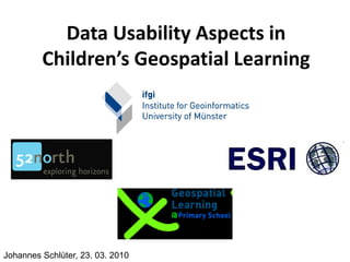
Data usability aspects in children’s geospatial learning
- 1. Data Usability Aspects in Children’s Geospatial Learning Johannes Schlüter, 23. 03. 2010
- 2. GeospatialLearning@PrimarySchool Motivation: • GI science and geographic information in general public • MIT One Laptop Per Child “It’s an education project, not a laptop project” - Nicholas Negroponte Johannes Schlüter, 23. 03. 2010
- 3. GeospatialLearning@PrimarySchool • Application for the XO-Laptop to foster – Spatial Thinking – Spatial Orientation – and to improve the geography classes • Framework with plugins – Geocaching – Geotagging Johannes Schlüter, 23. 03. 2010
- 4. Geocaching with the XO-Laptop Johannes Schlüter, 23. 03. 2010
- 5. Challenge for the software – limited attention span of the children – limited experience with computers, especially laptops – no experience with geospatial applications – it should not be necessary to know GI concepts in order to use the application – cross-cultural use without specific localization of texts, symbols – restrictive design rules of the XO make it difficult to design a proper interaction Johannes Schlüter, 23. 03. 2010
- 6. GI usability aspects • Player position – symbology – data accuracy (GPS, continious) • Treasure position – symbology – data accuracy (GPS, acquired once) • Base map (OSM) – symbology (predefined symboles) – data quality (VGI) Johannes Schlüter, 23. 03. 2010
- 7. Test Results • most children had prior experience with GI • Level of detail • OSM data do not provide enough detail • symbology wasn`t always self-explanatory • children had orientation problems they assumed the north on the map is straight ahead • all children had fun!!! Johannes Schlüter, 23. 03. 2010
- 8. Thanks for your attention! Question? Blog: http://52north.org/GeospatialLearning/