This document discusses requirements for solar resource data used in energy projects. It compares ground-measured and satellite-derived solar radiation data, noting that satellite data provides more accurate and spatially consistent estimates but with lower temporal resolution. For early project assessment, satellite data with 10+ years of monthly averages at high resolution is sufficient, but bankable projects require site-specific time series validated by local measurements to reduce uncertainty to below 15% for DNI and 7% for GHI.
The document describes the Mission Planning Center (MPC), which is responsible for routine operations including backup data, software installation and upgrades, and enhancing the current system. The MPC interfaces with the Satellite Control Center and Image Ground Segment. It receives requests and sends plans and schedules to these centers. Key activities of the MPC include checking images, tracking acquisitions, summarizing daily reports, and reprogramming images with issues. The MPC also describes the characteristics of multispectral and panchromatic photography from satellites.
IrSOLaV provides solar energy consulting services including solar radiation estimation from satellite images, analysis of power plant production, auditing of solar plants, and meteorological data quality reports. The company's team of experts has experience in over 500 MW of CSP and PV projects. Key products and services include long-term solar irradiance estimation from satellite images, analysis of thermal and electrical production for solar energy systems, and quality assurance of radiometric data and plant performance.
IRJET- Geological Boundary Detection for Satellite Images using AI TechniqueIRJET Journal
This document summarizes a research paper that proposes a method for detecting geological boundaries in satellite images using artificial intelligence techniques. The method involves pre-processing images, generating histograms to analyze pixel values, performing 2D convolution on image planes, applying a particle swarm optimization algorithm to identify boundaries, and testing the approach on pre-flood and post-flood satellite images of Kerala, India. The results show differences in detected geological boundaries between the two images, allowing changes from flooding to be identified. The method provides a way to automatically analyze satellite imagery and extract geological boundary information.
Landmap provides geospatial datasets and resources for education. It aims to increase awareness of geospatial data and provide learning materials structured into courses, units, and topics. The learning zone covers topics from basic to advanced levels and includes software, data, theory, and workflows. It has a technological framework based on Joomla and a pedagogical framework following a six-part educational model. Future plans include making some resources openly available and developing new content areas and engagement with researchers.
This document provides information about the Environmental Remote Sensing course GEOG 2021. It introduces the structure and content of the course, including lectures, practical sessions, assessment, and reading materials. The course is split into two halves, with the first introducing remote sensing concepts and the second focusing on a practical example. Lectures are on Mondays and practical sessions on Thursdays. Assessment consists of an exam and a coursework write-up. Relevant reading materials and online resources are also listed.
application of remote sensing in defence forcesNEERAJSHARMA814
The military uses remote sensing and GIS technologies to gain strategic advantages. Satellite imagery provides crucial intelligence for terrain evaluation, target analysis, and naval and air operations. Real-time weather data is also important for mission planning and battle success. India has launched several remote sensing satellites like Cartosat, Risat, and GSAT that support surveillance and communication needs of its armed forces.
Mapping the Tohoku 2011 Tsunami event with a remote sensing satellite constel...Peter Löwe
1) The document discusses how tsunami early warning systems could provide information to remote sensing satellite operators to help speed up the production of crisis maps following tsunami events. By informing satellite operators early about what coastal areas may be affected, satellite imaging and map production could begin sooner. This could help search and rescue efforts and potentially save more lives.
2) The International Charter for Space and Major Disasters coordinates satellite-based imaging and crisis map production for disasters like the 2011 Tohoku tsunami. Integrating tsunami warnings into the planning and tasking processes of satellite constellations like RapidEye could allow imaging and mapping to start earlier.
3) Standard message formats like CAP could be used to disseminate
Mapping the Tohoku 2011 Tsunami event with a remote sensing satellite constel...Peter Löwe
This document discusses how tsunami early warning systems could provide information to satellite operators to help speed up crisis mapping after disasters. It describes a project called TRIDEC that aims to integrate tsunami warnings with satellite tasking to allow imaging of affected areas sooner. During the 2011 Tohoku tsunami, satellite imagery through the International Charter helped create maps for rescue efforts. Faster coordination between warnings and satellite tasking could produce maps even sooner to further aid response. Standard messaging formats may help disseminate early warnings to satellite operators for quicker crisis mapping following disasters.
This document provides an overview of the NPOESS Program. NPOESS is a tri-agency program between NOAA, NASA, and the Department of Defense to develop the next generation of US polar-orbiting environmental satellites. The goal is to converge the DoD and NOAA satellite programs to achieve cost savings while incorporating new technologies. NPOESS will provide global environmental data for weather forecasting, climate monitoring, and other applications. The first NPOESS satellite is scheduled for launch in 2013 and the system is expected to operate through 2026. The NPP satellite launching in 2011 will help reduce risks for NPOESS.
PCI Geomatics is a leading geospatial software and solutions company with over 70 employees and 25,000 licenses installed worldwide. They provide powerful and scalable image processing solutions to extract information from satellite imagery such as SAR (Synthetic Aperture Radar) and LIDAR. Their capabilities include orthorectification, image classification, change detection, and digital elevation model extraction. They support a variety of sensors and applications in areas such as maritime surveillance, disaster response, and natural resource monitoring.
Poster "Global Soil Information Facilities"Tomislav Hengl
Global Soil Information Facilities (GSIF) is an initiative by ISRIC to build open-source tools to collate, harmonize, and provide up-to-date global soil data at high resolution. GSIF aims to serve global land use planning and environmental risk assessment. It is based on key principles of crowd-sourcing data collection, maintaining original ownership of contributed data, using open-source software, following international standards, and making outputs reproducible and publicly accessible. The main users of GSIF will be international agencies, research organizations, and national environmental and soil survey agencies, as well as private individuals and farmers.
MEGAJOULE provides solar energy consulting services including technical due diligence, resource mapping, and feasibility studies. Their services help investors, promoters, and financial institutions make informed decisions. MEGAJOULE uses satellite data and algorithms to map solar resources across areas from 10km to 100m in resolution. Feasibility studies provide a comprehensive analysis of location-specific parameters to evaluate sites. MEGAJOULE aims to help settle economically viable renewable energy projects through independent analysis and tailoring services to client needs.
- Established in 1990, the company has 57 employees including scientists and engineers across various disciplines. They have offices in Australia, Japan, and the US.
- They have substantial investments in innovation, developing world-leading technologies for smart sensor systems in aquaculture, fisheries acoustics analysis software, and 4D environmental data analysis software.
- Their flagship product, Eonfusion, is a universal software solution for integrating, visualizing, and analyzing diverse environmental data sets in 4D.
Underground surveying requires different techniques than surface surveying due to challenging conditions like heat, moisture, darkness and danger. Key points covered:
- Underground control networks must be connected and oriented to surface networks by obtaining coordinates of underground stations and bearings of underground lines relative to surface lines.
- Modern surveying tools like Leica fieldPro software integrate 3D CAD with data collection to enable one-person face mapping and daily mine survey updates for accurate planning.
- Leica GeoMoS provides automatic deformation monitoring systems for underground asset protection.
1. The document discusses using AI planning techniques like deep reinforcement learning to optimize image collection for mapping small celestial bodies.
2. Benchmark tests on asteroid models show the AI approach can decrease data collection while increasing mapping quality and speeding up the mapping process compared to current methods.
3. Additional validation tests demonstrate the AI approach is robust to uncertainties and can generalize to unseen celestial bodies, achieving near ideal mapping results with fewer images than other techniques.
1. Collisions are fundamental to planet formation but current simulation models are inaccurate and computationally expensive, limiting study of the process.
2. Machine learning techniques can accurately predict collision outcomes and enable faster simulations by replacing computationally expensive hydrodynamic simulations with emulation models.
3. The AEGIS framework uses neural networks, gradient boosted trees, Gaussian processes and other machine learning methods to generate highly accurate surrogate models of collision outcomes from datasets of hydrocode simulations. These surrogate models can then be used within N-body simulations to study planet formation at higher resolution.
GPS uses measurements from 4 or more satellites to determine precise location using calculations of distance based on travel time of signals and the speed of light. It can locate objects within 10-20 meters for autonomous use, and within 2-5 meters or even centimeters when using differential or phase differential processing techniques. Remote sensing uses data from satellites and aircraft to detect and classify objects on Earth through digital processing of imagery and sensor data. Common uses of remote sensing include monitoring land cover, infrastructure changes, and natural phenomena like deforestation. Satellites can be geostationary, located over the equator, or polar-orbiting, circling above the poles.
Application of Remote Sensing in Civil EngineeringIEI GSC
Presentation cum talk delivered by Dr Anjana Vyas, Dean CEPT University, Ahmedabad during 31st National Convention of Civil Engineering organized by The Institution of Engineers (India) Gujarat State Center, Ahmedabad
This document discusses building 3rd generation AI inspired by insect brains. Researchers at the University of Sussex are working on projects to build smarter robots by modeling the brain and learning abilities of bees. The projects combine neuroscience, robotics, and AI to decipher the "brain algorithms" of insects like bees and ants. They are using neural simulations, novel lightweight robots, and machine learning on specialized hardware like GPUs. The goal is to understand how small insect brains can efficiently navigate and learn routes despite having few neurons and low visual resolution. Researchers hope to learn tricks from insects to build AI that learns routes through familiarity rather than precise recognition. They are testing models where neural networks learn to associate views with actions instead of locations.
This document discusses GPS data processing methods and a GPS receiver software simulator for precise relative positioning of formation flying satellites. It describes the simulator's capabilities like simulating orbital mechanics, GPS signal degradations, and receiver measurements. Test results show the simulator can achieve meter-level position and sub-meter baseline accuracy between simulated receivers, meeting requirements for formation flying satellite missions.
This document provides an overview of geoinformatics, which involves the use of information technology for geospatial data. It discusses key components of geoinformatics like geography, remote sensing, GPS, GIS, cartography, geodesy, and photogrammetry. These components are used for collecting, analyzing, storing, and disseminating spatial information about the Earth. The document also outlines some applications of geoinformatics in fields like emergency services, public health, transportation, and military. Overall, geoinformatics allows for analyzing and visualizing geospatial data to better understand and make decisions about the Earth.
The document provides an overview of the preliminary design study of the Telescope Structure System (STR) for the Thirty Meter Telescope (TMT) project. Some key points of the design study include:
1) Adopting a 6-legged top end configuration to support the secondary mirror and reduce deformation while maintaining the same aperture blockage as the previous design.
2) Introducing a "Double Lower Tube" design to reduce the required stroke of primary mirror actuators to compensate for deformation during elevation changes.
3) Designing the primary mirror segment handling system to remove and install 10 segments per day safely in the difficult access area around the primary mirror.
Remote sensing plays a large role in enhancing geographic information systems (GIS) by providing large amounts of data needed for GIS. It reduces the need for manual field work and allows the retrieval of data from difficult to access areas. Remote sensing imagery can directly serve as a visual aid in GIS and can indirectly provide information about land use, vegetation, and other features through analysis. As remote sensing technologies advance, they continue to increase the resolution and coverage of data available to integrate within GIS. This leads to more accurate and detailed geographic information systems.
The document describes a competition called the Global Trajectory Optimization Competition (GTOC) to design interplanetary trajectories. The 6th edition of GTOC posed the problem of designing a trajectory to map as many faces of Jupiter's four Galilean moons (Io, Europa, Ganymede, Callisto) as possible with a spacecraft. The author's team used an evolutionary algorithm-based approach to optimize moon flyby sequences and trajectory arcs, running over 500 million evolutionary simulations in parallel. Their best trajectory mapped 120 moon faces out of 128 and scored 316 points, exceeding the competition winner's score of 311 points and solving a problem acknowledged as very difficult in trajectory design for solar system exploration.
This document discusses remote sensing and geographical information systems. It defines remote sensing as obtaining information about the Earth's surface without direct contact using sensors. Applications of remote sensing include urban planning, agriculture, and environmental monitoring. Geographical information systems integrate spatial data to analyze and visualize patterns. The document outlines how remote sensing from satellites provides a global perspective and both technologies are useful for civil engineering tasks like infrastructure planning, site analysis, and structural health monitoring.
International Journal of Engineering and Science Invention (IJESI)inventionjournals
International Journal of Engineering and Science Invention (IJESI) is an international journal intended for professionals and researchers in all fields of computer science and electronics. IJESI publishes research articles and reviews within the whole field Engineering Science and Technology, new teaching methods, assessment, validation and the impact of new technologies and it will continue to provide information on the latest trends and developments in this ever-expanding subject. The publications of papers are selected through double peer reviewed to ensure originality, relevance, and readability. The articles published in our journal can be accessed online.
1) The document discusses the potential for generating renewable energy from desert regions in the Middle East and North Africa (MENA) region and exporting it to meet growing electricity demand in both MENA and Europe.
2) It notes that electricity demand in MENA and Europe is projected to more than double by 2050, but the renewable energy potential from deserts is more than sufficient to meet this growing demand.
3) The organization Dii is working to create an integrated renewable energy market connecting MENA and Europe, with the goal of over 90% of the combined region's electricity coming from renewable sources like solar and wind by 2050.
The document discusses the Mediterranean Solar Plan (MSP), which aims to develop significant renewable electricity generation capacities in Southern Mediterranean countries by 2020 to supply domestic and export markets, particularly the EU. Key points:
1) The MSP seeks to establish new solar and renewable energy generation capacity of 20 GW in MENA countries by 2020, with transmission capacity to export a substantial portion to Europe.
2) Realizing the MSP requires investment and cooperation between utilities, manufacturers, financiers, regulators and other stakeholders across MENA countries and Europe within an appropriate policy framework.
3) Enabling conditions like capacity building, technology transfer, private sector participation and financing schemes also need developing to make the system successful.
Desertec stands for the overall vision of supplying a large part of the world with sustainable power, by tapping the energy potential of the desert. Dii (launched as "Desertec Industrial Initiative") is a private industry consortium working towards enabling this vision in Europe, the Middle East and North Africa (EUMENA).
Our initiative was founded under German law as a GmbH (limited liability company) in Munich on the 30th October 2009 by 13 signatories from North Africa and Europe. Dii expanded as further companies worldwide joined as shareholders or associated partners. Currently we consist of more than 55 companies and institutions, including the non-profit DESERTEC Foundation, and the Frauenhofer and Max-Planck research institutes.
Today, more than 30 people work at the Dii head office in Munich, Germany.
Dii also has branches in Rabat, Morocco and Tunis, Tunisia.
We seek and welcome all forms of collaboration with leading or complementary international political and institutional initiatives who, like us, are devoted to developing the markets for largescale sustainable energy production and transmission.
Day 2 Setting up national Energy Efficiency Agencies RCREEE
The document discusses the establishment of national Energy Efficiency Agencies in several European and Mediterranean countries as part of the Euro-Mediterranean Energy Market Integration Project funded by the European Union. It provides an overview of the general mandate of such agencies, including enforcing energy efficiency acts, promoting and monitoring recommendations, and reporting on energy efficiency activities and impacts. The document also includes examples of target consumers, marketing challenges, specific agency tasks, and options for financing the operations of an energy efficiency agency.
Strategic Management Presentation - Apple Inc.Colby Nelson
The presentation slides for a Strategic Management class at Biola University. We presented on Apple Inc. and through a semester long study came up with recommendations for Apple to implement to create more sustainable competitive advantage.
The Research Center for Renewable Energy Mapping and Assessment at Masdar Institute aims to develop regional knowledge and leadership in renewable energy assessment and mapping for arid environments. The Center has over 26 staff members and has succeeded in developing the UAE Solar Atlas and playing a key role in the Global Solar and Wind Atlas initiative. Some of the Center's facilities and capabilities include a satellite ground station, 200TB storage system, and tools for solar resource forecasting and performance modeling of solar power technologies.
This document discusses how geographic information systems (GIS) can be used to plan and site solar energy projects. It describes Eolfi, a company that develops solar and wind projects. GIS tools like spatial analysis and elevation data are used to identify optimal locations based on slope, aspect, shadows, environmental constraints, and grid connectivity. The GIS model enables evaluation of potential sites and informs siting decisions to reduce costs and environmental impacts. In conclusion, the document states that GIS provides a practical and reliable way to map suitable areas and make more efficient siting decisions.
Recent observed environmental changes as well as projections in the fourth assessment report of the Intergovernmental Panel on Climate Change shed light on likely dramatic consequences of a changing mountain cryosphere following climate change. Some very destructive geological processes are triggered or intensified, influencing the stability of slopes and possibly inducing landslides. Unfortunately, the interaction between these complex processes is poorly understood. This project addresses the key issues in response to such changing conditons: monitoring and warning systems for the spatial and temporal detection of newly forming hazards, as well as extending the quantitative understanding of these changing natural systems and our predictive capabilities.
As global warming intensifies, learning how to adapt to climate changes and consequent extreme weather events is gaining urgency. More accurate weather models and intelligent warning systems enable the improvement of the resilience of the local areas and production activities. One way of achieving this is through obtaining more accurate short term weather forecasts tailored for specific applications by analyzing large amounts of publicly available data such as localized meteorological measurements obtained from IoT sensors, open-source forecasts and even Earth observation data. In this talk we will show how we apply machine learning algorithms to efficiently improve and transform weather forecasts obtained from meteorological services and implement them in various decision-making use-cases such as precision agriculture, heating and cooling in buildings, urban infrastructure optimization (water distribution, urban lighting, traffic), logistics optimization and many more.
The document proposes the GOAL&GO architecture, which would provide global observations from Lagrange point, pole-sitter, and geosynchronous orbits using small, low-cost spacecraft. This revolutionary concept could monitor Earth's response to climate change and meet needs for disaster monitoring and relief through frequent imaging of the entire globe. The system is designed to evolve over 10-20 years using simple, proven technologies on multiple spacecraft to provide flexible, low-cost Earth observations.
Il seminario presenta un approccio innovativo al trattamento dei dati sismici mediante la combinazione di software di processing open source allo stato dell'arte con tecnologie informatiche di grid computing, rendendo possibile ed efficiente l'utilizzo di risorse distribuite e amministrate in remoto per il calcolo e la gestione dei dati. Inoltre illustra i risultati ottenuti per tre diversi tipi di dati (onde di compressione, onde di taglio e multi-offset Ground-Penetrating Radar), tratti da studi idrogeofisici condotti in Sardegna e a Larreule (Francia).
This document discusses uncertainty in satellite-based solar resource data and its importance for photovoltaic applications. It notes that while satellite data provides continuous global coverage, the accuracy of estimates can be limited. Older satellite models and ground measurements often had low spatial/temporal resolution and accuracy that could lead to uncertainty of over 10-15% in long-term solar resource assessments. Modern satellite models have improved but rely on inputs like meteorological data that can change over time. Ground measurements provide higher accuracy but are limited in scope. The document emphasizes the need for validated high quality data to support solar energy applications.
From gigapixel timelapse cameras to unmanned aerial vehicles to smartphones: ...TimeScience
This document discusses emerging remote sensing technologies that can help address limitations in ecosystem monitoring. It describes technologies like phenocam networks, gigapixel timelapse cameras, unmanned aerial vehicles, kite and balloon photography, and harnessing citizen science photos. These near remote sensing tools can capture data at intermediate scales between satellite imagery and ground-based sampling to improve spatial and temporal resolution. They have the potential to exponentially increase rates of data collection and enable new types of collaborative, data-driven ecosystem science.
Geospatial Analysis and Internet of Things in Environmental InformaticsAndreas Kamilaris
Geospatial analysis offers large potential for better understanding, modelling and visualizing our natural and artificial ecosystems, using Internet of Things as a pervasive sensing infrastructure. This presentation performs a review of research work based on the IoT, in which geospatial analysis has been employed in environmental informatics. Six different geospatial analysis methods have been identified, presented together with 26 relevant IoT initiatives adopting some of these techniques. Analysis is performed in relation to the type of IoT devices used, their deployment status and data transmission standards, data types employed, and reliability of measurements. This paper scratches the surface of this combination of technologies and techniques, providing indications of how IoT, together with geospatial analysis, are currently being used in the domain of environmental research.
Presented at EnviroInfo 2018 at Munich, Germany.
Exascale Challenges: Space, Time, Experimental Science and Self Driving Cars Joel Saltz
This document discusses challenges related to exascale computing, including analyzing large spatial-temporal datasets from various sensors and simulations. It proposes a "sensor data mini-app" to address common patterns in integrating and analyzing correlated data from multiple sources. Key transformations like segmentation, feature extraction, and classification are discussed. Supporting exascale applications will require efficient mapping of data and computation, hierarchical task scheduling, and interoperability across systems. Representing and querying complex scientific data models across storage hierarchies is also addressed.
La presentazione del Progetto SmartGeo a cura di Guido Satta, in occasione dell'evento "Bonifiche ambientali e potenzialità delle imprese" che si è tenuto a Cagliari il 7 novembre 2014.
A Review of Change Detection Techniques of LandCover Using Remote Sensing Dataiosrjce
IOSR Journal of Computer Engineering (IOSR-JCE) is a double blind peer reviewed International Journal that provides rapid publication (within a month) of articles in all areas of computer engineering and its applications. The journal welcomes publications of high quality papers on theoretical developments and practical applications in computer technology. Original research papers, state-of-the-art reviews, and high quality technical notes are invited for publications.
This document provides an overview of change detection techniques for landcover using remote sensing data. It begins by discussing issues that can impact change detection accuracy, such as image acquisition parameters, viewing geometry, and radiometric correction. It then categorizes change detection techniques as either pre-classification or post-classification. Pre-classification techniques extract minimal change information, while post-classification techniques separate changes in more detail but may miss subtle within-class changes. Object-based techniques that segment images into objects before analysis are also discussed as a recent development.
A presentation given by Peter McKeague (Historic Environment Scotland), Anthony Corns (Discovery Programme, Ireland) and Axel Posluschny (University of Bamberg, Germany) at the European Archaeological Consilium annual meeting in Brighton, March 2015.
This document provides an update on Solargis' uncertainty map for its solar radiation database. It summarizes Solargis' methodology for developing the map, which considers various uncertainty drivers like clouds, aerosols, water vapor, terrain variability and more. Preliminary results estimate the total GHI uncertainty to be within ±4% to ±8% for a long-term yearly value, representing an 80% probability of occurrence. Next steps include further refining the uncertainty model with new empirical evidence and developing an uncertainty map for DNI values.
This document discusses remote sensing and geographic information systems (GIS). Remote sensing involves collecting data about objects from a distance using electromagnetic energy and sensors. It works through various stages including energy source, interaction with the target, sensor recording, processing, and interpretation. Remote sensing has applications in resource exploration, environmental monitoring, and land use analysis. GIS integrates spatial data using computer hardware, software, and trained personnel. It has advantages like visualization and modeling capabilities, and disadvantages like high costs and data errors. The future of remote sensing and GIS is promising as more industries adopt these technologies.
Unmanned aerial vehicles (UAVs) have potential for environmental mapping applications. This study tested a hexacopter UAV equipped with a calibrated digital camera to acquire aerial images of simulation models, including a coastal area and archaeological site. Digital photos were processed to generate orthophotos and digital elevation models. The hexacopter was able to autonomously capture images with sufficient accuracy. The results demonstrate that UAVs are a low-cost alternative to manned aircraft for small-area environmental mapping projects with limited budgets and timeframes. Future work involves using UAVs to map real coastal and archaeological sites.
This document discusses research integrating atmospheric sensors onto unmanned aerial vehicles (UAVs) at the University of Wisconsin-Eau Claire. The goal is to monitor temperature, humidity, wind, and ozone in real-time using sensors on the UAV. Challenges include power, weight restrictions, data acquisition, and storage. Researchers are working to implement a microcontroller for onboard data collection and storage, and to output data in real-time through the autopilot for adjusted flight based on conditions. Integration of sensors and real-time data transmission pose engineering hurdles to overcome.
This document discusses the uncertainty of solar radiation data from the Solargis database. It describes how Solargis determines uncertainty ranges of ±4-8% for yearly global horizontal irradiation (GHI) and ±8-15% for direct normal irradiation (DNI). The total uncertainty is calculated based on contributions from various uncertainty drivers in the satellite input data and solar radiation models, including clouds, aerosols, water vapor, and terrain variability. Long-term GHI uncertainty can be reduced to ±2.5% by combining satellite data with ground measurements from monitoring stations.
Gender challenges in clean energy sector can networkRCREEE
Women play an important role in the clean energy sector but face challenges. Case studies from Yemen, Lebanon, the UAE, and Palestine show successful women entrepreneurs and leaders in solar energy. However, women face barriers to securing funding, building partnerships, and educating stakeholders. Actions to address the gender gap include strengthening international cooperation, providing targeted funding, improving access to networks, and supportive policies to promote gender equality in clean energy.
Climate and energy policies advocacy of youth in the arab worldRCREEE
The document summarizes a regional project aimed at strengthening the advocacy capacities of youth in the Arab world on climate and energy policies. It discusses objectives to build skills in energy and climate fields and integrate societal aspects like gender disparities. A key output is a policy paper presenting recommendations from 12 young professionals and activists from 10 Arab countries (majority women) to regional decision-makers on energy visions and policies. The project also aims to empower women in sustainable energy and give them a platform to influence decision-making processes.
Women in energy a world full of opportunities lcecRCREEE
Ms. Patil Mesrobian, Program Development Officer, LCEC presentation at Sustainable Energy Field: A Step towards Sustainable Communities - Workshop on the side of International Beirut Energy Forum on 25 September 2019.
Green Mind is a Lebanese non-profit founded in 2012 primarily by women seeking to promote sustainable practices. Led by a woman, Green Mind hopes to inspire other women to take on environmental challenges. It recognizes leadership in sustainability through various awards and organizes projects in areas like education, energy, water, transport, and waste. Green Mind also created mobile apps like GreenMiles for carpooling and one for reforestation efforts to promote environmental causes through technology.
Many initiatives are currently blossoming across the region facilitating a stronger engagement of females in clean energy.
Salma El Shiekh, The Sudanese Artik Energy Start up founder shared her journey at Sustainable Energy Field: A Step towards Sustainable Communities - Workshop on the side of International Beirut Energy Forum on 25 September 2019.
Many initiatives are currently blossoming across the region facilitating a stronger engagement of females in clean energy.
Eng. Zainab Garashi, Founder & CEO, Engineers without Boarders- Kuwait presented EWB projects at Sustainable Energy Field: A Step towards Sustainable Communities - Workshop on the side of International Beirut Energy Forum on 25 September 2019.
Women in Energy in Jordan Challenges, Opportunities and the Way Forward JREEE...RCREEE
Many initiatives are currently blossoming across the region facilitating a stronger engagement of females in clean energy.
Eng. Lina AL-Mubaideen presented JREEEF programs and Initiatives in Sustainable Energy Field: A Step towards Sustainable Communities - Workshop on the side of International Beirut Energy Forum on 25 September 2019.
Women in energy sector in the mena region rcreeeRCREEE
Introducing the latest perspectives on gender engagement in the workforce with specific focus on clean energy by Eng. Sara Ibrahim, RCREEE Senior Expert at Enabling Women in Sustainable Energy Field: A Step towards Sustainable Communities - Workshop on the side of
International Beirut Energy Forum on 25 September 2019.
Awakening diversity in the clean energy sector a key point to achieve sustai...RCREEE
Introducing the latest perspectives on gender engagement in the workforce with specific focus on clean energy by Ms. Fatma M'Selmi Baklouti, CEO & Founder Laur' us Consulting at Enabling Women in Sustainable Energy Field: A Step towards Sustainable Communities - Workshop on the side of
International Beirut Energy Forum on 25 September 2019.
Mitigating environmental impact in non renewable energy the role of womenRCREEE
Introducing the latest perspectives on gender engagement in the workforce with specific focus on clean energy by Ms. Diana Kaissy, Executive Director, The Lebanese Oil and Gas Initiative-LOGI at Enabling Women in Sustainable Energy Field: A Step towards Sustainable Communities - Workshop on the side of
International Beirut Energy Forum on 25 September 2019.
These are the key messages of the first High Level Policy Dialogue to promote RE and EE in the Mediterranean region. The messages were delivered by Dr. Badr
The presentation is prepared as an introduction for the first High Level Policy Dialogue to promote RE and EE in the Mediterranean region by Eng. Kraidy
EU-Egypt Energy Cooperation: A successful modelRCREEE
This document discusses EU-Egypt energy cooperation and outlines key energy challenges in Egypt. It summarizes achievements in EU-Egypt energy cooperation including projects supporting renewable energy, energy efficiency, and regulatory capacity. It presents the Second Memorandum of Understanding between Egypt and EU for 2018-2022 focusing on gas and electricity sector reforms, renewable energy projects, and technological cooperation. The European Investment Plan is introduced as a three-pillar structure to mobilize investment through technical assistance, improved investment climate, and financing from the European Fund for Sustainable Development. Potential energy investment projects are listed in renewable energy, energy efficiency, and grid infrastructure totaling over 1.7 billion Euros.
Global Energy Interconnection Enhances Renewable Energy Development & Regiona...RCREEE
The document discusses global energy interconnection (GEI) and the Global Energy Interconnection Development and Cooperation Organization (GEIDCO). It summarizes GEIDCO's view of GEI as an infrastructure platform to massively develop, transmit, and utilize clean energy worldwide using ultra-high voltage grids and smart grid technology. The document outlines GEIDCO's management structure, membership, and regional offices. It provides examples of cooperation projects between countries to interconnect power grids and develop clean energy. Finally, it presents GEIDCO's proposed roadmap and backbone network for the development of GEI over domestic, intra-continental, and intercontinental phases by 2050.
Report summary on Intended Nationnally determined contributions -Comprehensiv...RCREEE
This document provides a summary of Intended Nationally Determined Contributions (INDCs) and Nationally Determined Contributions (NDCs) from 20 Arab countries. It finds that these plans outline both unconditional and higher conditional emission reduction targets. Cost estimates total over $109 billion, with 71% of costs listed as conditional on international support. Adaptation actions are generally lower cost than mitigation and focus on sectors beyond energy. Countries' plans emphasize renewable energy development as well as energy efficiency across sectors. Water desalination and carbon capture storage are mentioned in relation to these areas. Overall, the plans indicate ambitions to increase clean energy and jobs while reducing emissions, though voluntary targets may need to become mandatory with regional coordination.
Energy productivity as a new paradigm for sustainable energy transitionsRCREEE
1. Energy productivity is a new policy paradigm that focuses on improving the value obtained from energy consumption through greater energy efficiency, structural economic reforms, and other energy and climate policies.
2. A report by KAPSARC and UNESCWA examined energy productivity in Saudi Arabia and found that diversification efforts and energy efficiency are transitioning the country to a lower energy intensity pathway in line with its Vision 2030 goals.
3. The report discusses how industrial strategy and policy can further increase Saudi Arabia's energy productivity by developing higher value added industries and strengthening local supply chains.
Arab Region Progress in Sustainable Energy Challenges and OpportunitiesRCREEE
The document summarizes the current status of sustainable energy in the Arab region and key challenges. Near-universal electricity access has been achieved in cities, but rural access remains around 80%. Energy consumption has more than doubled since 1990, with renewables playing a marginal role at 4% of energy. Barriers to expanding renewable energy and energy efficiency include high costs, lack of incentives, and insufficient policies. Universal access to electricity and clean cooking fuels has not been achieved. Water scarcity and dependence on fossil fuels are significant regional challenges. Promoting investments, technology, capacity building, and data are priorities to meet development and climate goals.
Arab Region Progress in Sustainable Energy Challenges and Opportunities
Data requirements
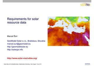
1. Requirements for solar
resource data
Marcel Šúri
GeoModel Solar s.r.o., Bratislava, Slovakia
marcel.suri@geomodel.eu
http://geomodelsolar.eu
http://solargis.info
http://www.solar-med-atlas.org/
Solar Atlas for the Mediterranean, Stakeholders Workshop, Cairo, Egypt, 1 Nov 2011
2. About GeoModel Solar
Expert consultancy:
• Solar resource assessment and PV yield prediction
• Performance characterization in PV
• Country optimization potential
• Grid integration studies
SolarGIS online services:
Real-time solar and meteo data services for:
• Site selection and prefeasibility
• Planning and project design
• Monitoring and forecasting of solar power
• Solar data infrastructure
http://geomodelsolar.eu
http://solargis.info
Solar Atlas for the Mediterranean, Stakeholders Workshop, Cairo, Egypt, 1 Nov 2011
3. Timeline
2001 2002 2003 2004 2005 2006 2007 2008 2009 2010 2011
PVGIS SolarGIS
Research and demonstration project Commercial database,
Promotion of PV Professional software
Public awareness in Europe Industrial applications
by European Commission, by GeoModel Solar
Joint Research Centre
Solar Atlas for the Mediterranean, Stakeholders Workshop, Cairo, Egypt, 1 Nov 2011
26th European Photovoltaics Solar Energy Conference and Exhibition, 5-9 September 2011, Hamburg -3-
4. Contents
Solar Resource Data for Energy Projects:
1. Requirements
2. Ground measured and satellite-derived data
3. Accuracy and interannual variability
4. Data for prefeasibility and smaller projects
5. Bankable data
• For design optimization and financing
• For performance assessment
Solar Atlas for the Mediterranean, Stakeholders Workshop, Cairo, Egypt, 1 Nov 2011
5. Solar resource information - REQUIREMENTS
• Data available at any location (global coverage)
• Long climate record - up to 15-20 years (harmonized and without gaps)
• High accuracy, low uncertainty (validated)
• High level of detail (temporal, spatial)
• Modern data products (long-term averages, TMY, time series)
• Real-time data supply (online):
• historical data
• monitoring, nowcasting
• forecasting
This is available with satellite-based data,
supported by high-quality ground measurements
+ Meteo and other geographic data for energy modeling
Solar Atlas for the Mediterranean, Stakeholders Workshop, Cairo, Egypt, 1 Nov 2011
6. Contents
Solar Resource Data for Energy Projects:
1. Requirements
2. Ground measured and satellite-derived data
3. Accuracy and interannual variability
4. Data for prefeasibility and smaller projects
5. Bankable data
• For design optimization and financing
• For performance assessment
Solar Atlas for the Mediterranean, Stakeholders Workshop, Cairo, Egypt, 1 Nov 2011
7. Solar resource – how to obtain site-specific information
Ground instruments Solar radiation models
(interpolation/extrapolation) (satellite & atmospheric data)
WRDC network (~1200 archive stations)
sources: Gueymard 2010, WRDC, BSRN-AWI sources: NASA, EUMETSAT, Stoffel et al. 2010
Solar Atlas for the Mediterranean, Stakeholders Workshop, Cairo, Egypt, 1 Nov 2011
8. Ground-measured solar data
What determines quality:
1. Quality and accuracy of instruments
(pyranometer, photocell, RSR, pyrheliometer)
2. Operation and maintenance routines
3. Calibration
4. Quality control and post processing
High-quality data are available only for a limited number of sites
Photo: sourtesy of NREL and C. Gueymard
Solar Atlas for the Mediterranean, Stakeholders Workshop, Cairo, Egypt, 1 Nov 2011
9. Ground observations
ADVANTAGES LIMITATIONS
High accuracy at the point of measurement Accessing historical data:
High frequency measurements (sec. to min.) Limited geographical coverage
High-quality data - if strictly controlled and Limited access
managed Missing time series and metadata
No standard data formats
Different time reference
Operation of a ground station:
Regular maintenance and calibration
Data management
Issues of aggregation statistics
High costs for acquisition and operation
Extrapolation/interpolation needed
to get site-specific info
Solar Atlas for the Mediterranean, Stakeholders Workshop, Cairo, Egypt, 1 Nov 2011
10. Ground observations Inconsistency between GHI and DNI
Before any use – ground data have
to be quality assessed
Quality validation procedures:
• Physical limits
• GHI - DNI consistency, time drift
• Missing data
• Time shifts
• Shading, reflections, …
DNI from meteo service - 50% of data missing It needs lot of effort, dedication and resources
to have reliable ground measurements
Solar Atlas for the Mediterranean, Stakeholders Workshop, Cairo, Egypt, 1 Nov 2011
11. Satellite-based solar resource data
How satellite-based solar radiation is calculated:
1. Clear-sky model, DNI model
• Aerosol Optical Depth (AOD)
• Water vapour (WV)
• Elevation
2. Cloud transmission (satellite) model
• Data from geostationary satellites
3. Terrain enhancement model
• High-resolution elevation data
Data are available globally
Solar Atlas for the Mediterranean, Stakeholders Workshop, Cairo, Egypt, 1 Nov 2011
12. Solar radiation models: satellite-derived data
ADVANTAGES LIMITATIONS
More accurate for distances Lower accuracy for the point estimate
higher than 15-30 km from Lower time frequency of measurements
the nearest ground observation (15 , 30 , hourly, 3-hourly data)
Spatial and temporal consistency
High signal stability
Availability ~99.5%
Data can be disaggregated
Direct link to other models
History of up to 25 years
Continuous geographical
coverage
Data sources: EUMETSAT, ECMWF
Source: SolarGIS
Solar Atlas for the Mediterranean, Stakeholders Workshop, Cairo, Egypt, 1 Nov 2011
13. Ground-measured vs. satellite-derived solar resource data
Source: SolarGIS
Resolution of the input data used in
Distance to the nearest meteo
the solar model:
stations – interpolation gives only AOD: Atmospheric Optical Depth
approximate estimate WV: Water Vapour
MFG/MSG: Meteosat satellite
Solar Atlas for the Mediterranean, Stakeholders Workshop, Cairo, Egypt, 1 Nov 2011
14. SUMMARY: Ground vs. satellite-based solar data
• Solar data are site specific
• High variability and intermittency
• Ground data are not able to represent
geographical and time diversity of solar climate
• It is important to use high-quality satellite
combined with ground data
Annual DNI average in India
source: SolarGIS
Solar Atlas for the Mediterranean, Stakeholders Workshop, Cairo, Egypt, 1 Nov 2011
15. Contents
Solar Resource Data for Energy Projects:
1. Requirements
2. Ground measured and satellite-derived data
3. Accuracy and interannual variability
4. Data for prefeasibility and smaller projects
5. Bankable data
• For design optimization and financing
• For performance assessment
Solar Atlas for the Mediterranean, Stakeholders Workshop, Cairo, Egypt, 1 Nov 2011
16. Achievable uncertainty of ground-measured
and satellite-derived solar data
GHI Thermopile pyranometer Satellite
ISO Classification Secondary Standard First Class Second Class
WMO Classification High Quality Good Quality Mod. Quality RMSD Bias
Hourly uncertainty 3% 8% 20% 9-20% ±2-7%
Daily uncertainty 2% 5% 10% 4-12%
bias depends on the calibration and maintenance
DNI Thermopile pyrheliometer RSR Satellite
WMO Classification High quality Good quality RMSD Bias
Hourly uncertainty 0.7% 1.5% 2-4% 24-60% ±4-12%
Daily uncertainty 0.5% 1.0% 1.5% 15-25%
GHI:
• satellite already competitive in RMSD with good-quality sensors
Solar Atlas for the Mediterranean, Stakeholders Workshop, Cairo, Egypt, 1 Nov 2011
17. Achievable uncertainty of ground-measured
and satellite-derived solar data
GHI Thermopile pyranometer Satellite
ISO Classification Secondary Standard First Class Second Class
WMO Classification High Quality Good Quality Mod. Quality RMSD Bias
Hourly uncertainty 3% 8% 20% 9-20% ±2-7%
Daily uncertainty 2% 5% 10% 4-12%
bias depends on the calibration and maintenance
DNI Thermopile pyrheliometer RSR Satellite
WMO Classification High quality Good quality RMSD Bias
Hourly uncertainty 0.7% 1.5% 2-4% 24-35% ±4-12%
Daily uncertainty 0.5% 1.0% 1.5% 15-25%
DNI:
• It is challenging to keep high standard of DNI ground measurements
• Satellite data correlated with ground measurements can improve site statistics
Solar Atlas for the Mediterranean, Stakeholders Workshop, Cairo, Egypt, 1 Nov 2011
18. Achievable uncertainty of ground-measured
and satellite-derived solar data Bias = systematic
deviation: clouds
+ aerosols
GHI Thermopile pyranometer Satellite
ISO Classification Secondary Standard First Class Second Class
WMO Classification High Quality Good Quality Mod. Quality RMSD Bias
Hourly uncertainty 3% 8% 20% 9-20% ±2-7%
Daily uncertainty 2% 5% 10% 4-12%
bias depends on the calibration and maintenance
DNI Thermopile pyrheliometer RSR Satellite
WMO Classification High quality Good quality RMSD Bias
Hourly uncertainty 0.7% 1.5% 2-4% 24-60% ±4-12%
Daily uncertainty 0.5% 1.0% 1.5% 15-25%
Bias:
• Bias is natural for satellite-derived data and can be reduced/removed
• For ground-measured data it is challenging and costly to keep bias close to 0
Solar Atlas for the Mediterranean, Stakeholders Workshop, Cairo, Egypt, 1 Nov 2011
19. Interannual variability: Gujarat, India
Assuming years 1999-2010:
Interannual variability is driven by:
Average Minimum
• Natural climate cycles GHI: 2035 1964 (-4.5%)
• Change of aerosols (human factor) DNI: 1764 1621 (-8.1%)
• Climate change (long-term trends)
• Extreme volcanic eruptions!
Solar Atlas for the Mediterranean, Stakeholders Workshop, Cairo, Egypt, 1 Nov 2011
20. Contents
Solar Resource Data for Energy Projects:
1. Requirements
2. Ground measured and satellite-derived data
3. Interannual variability
4. Data for prefeasibility and smaller projects
5. Bankable data
• For design optimization and financing
• For performance assessment
Solar Atlas for the Mediterranean, Stakeholders Workshop, Cairo, Egypt, 1 Nov 2011
21. Prospecting, prefeasibility and site assessment
Data needed:
• Representative and homogeneous annual long-term averages
and monthly statistics of satellite-based data at high spatial resolution
• At least 10 years of data are needed to represent climate reliably
• Other meteo and GIS data (terrain, infrastructure, population, etc.) are useful for context
Uncertainty (bias) for long-term annual values - to be typically expected in semiarid zones:
• DNI ±4 to 15%
• GHI ±2 to 7%
Uncertainty depends on geography - is higher in:
• Complex land cover (land/sea/desert/islands)
• Mountains (snow/ice)
• Regions with extreme aerosols/humidity
• High latitudes
Solar Atlas for the Mediterranean, Stakeholders Workshop, Cairo, Egypt, 1 Nov 2011
22. Prospecting, prefeasibility and site assessment
Services needed:
• Fast interactive access: on-the-click information
• Monthly data
• GIS analysis - resource potential of the region
• Digital maps
• Paper maps
Solar Atlas for the Mediterranean, Stakeholders Workshop, Cairo, Egypt, 1 Nov 2011
23. Contents
Solar Resource Data for Energy Projects:
1. Requirements
2. Ground measured and satellite-derived data
3. Interannual variability
4. Data for prefeasibility and smaller projects
5. Bankable data
• For design optimization and financing
• For performance assessment
Solar Atlas for the Mediterranean, Stakeholders Workshop, Cairo, Egypt, 1 Nov 2011
24. Feasibility, design optimization, financing and due diligence
Data needed:
• Site-specific solar data representing long-term data record:
• Time series
• Typical Meteorological Year (TMY)
• + Ancillary meteo data (air temperature, relative humidity, wind speed and direction)
Services needed:
• Site adaptation of satellite-based data by correlating them to local solar
measurements especially for CSP asnd CPV projects
• Generation of Typical Meteorological Year
• Bankable reports: Site analysis of solar resource
Solar Atlas for the Mediterranean, Stakeholders Workshop, Cairo, Egypt, 1 Nov 2011
25. Feasibility, design optimization, financing and due diligence
Time series
• Full climate statistics: average, median, percentiles, P(50), P(90) probability
expectances:
• Uncertainty of the estimate
• Uncertainty due to interannual variability
• 12 to 20+ years of high quality data are available worldwide at primary
resolution of 3 to 5 km
Quality parameters:
• Minimum bias, low RMSD
• Representative distribution statistics
OPTIMALLY, bankable satellite-based time series should be:
• Validated by ground measurements representing the climate
• Site adapted (correlated) with the local measurements (especially for CSP and
CPV)
Solar Atlas for the Mediterranean, Stakeholders Workshop, Cairo, Egypt, 1 Nov 2011
26. Site adaptation of satellite-based time series
Ground measurements available for a short time period (optimally 12 months)
They are correlated with time series of satellite-derived irradiance to:
• Correct systematic errors (reduce bias)
• Match data frequency distribution
Conditions to be fulfilled for successful adaptation:
• Systematic deviation in satellite data should exist
• Magnitude of deviation is
invariant in time
• High quality hourly (or more
detailed) ground measurements
are available
Solar Atlas for the Mediterranean, Stakeholders Workshop, Cairo, Egypt, 1 Nov 2011
27. Site adaptation of satellite-based time series
Example: Tamanrasset (Algeria)
Original DNI “ground – satellite” data scatterplot:
Bias: -4.2% Correction of bias and frequency distribution
Solar Atlas for the Mediterranean, Stakeholders Workshop, Cairo, Egypt, 1 Nov 2011
28. Site adaptation of DNI satellite-based time series
Example: Tamanrasset (Algeria)
Results:
• Reduced BIAS
• Reduced RMSD
• Improved statistical distribution
(KSI indicator)
Bias can be reduced to the accuracy limits of the ground sensor
=> Quality of ground measurements is important
!
Solar Atlas for the Mediterranean, Stakeholders Workshop, Cairo, Egypt, 1 Nov 2011
30. Typical Meteorological Year (TMY)
• P(50) TMY data set represents, for each month, the average climate conditions and
the most representative cumulative distribution function; extreme weather situations
are missing.
• P(90) TMY data set represents a year with the “lowest” identified solar resource –
annual DNI after summarization results in the value close to P(90).
The P(90) annual value is derived from time series, considering:
• Uncertainty of the estimate
• Interannual variability
• Solar resource data in TMY can be supplemented by air temperature, relative
humidity, wind speed, and wind direction
Solar Atlas for the Mediterranean, Stakeholders Workshop, Cairo, Egypt, 1 Nov 2011
31. Site assessment report
• Based on time series of solar and meteo data
• Includes
• Quality control and validation:
• Satellite-based data (using representative ground measurements)
• On-site measurements
• Monthly and annual probability statistics
• Interannual variability
• Combined uncertainty:
• (i) estimate
• (ii) interannual variability
• P(50) and P(90) values
• Description of the methods and discussion of the results
Solar Atlas for the Mediterranean, Stakeholders Workshop, Cairo, Egypt, 1 Nov 2011
32. Contents
Solar Resource Data for Energy Projects:
1. Requirements
2. Ground measured and satellite-derived data
3. Interannual variability
4. Data for prefeasibility and smaller projects
5. Bankable data
• For design optimization and financing
• For performance assessment
Solar Atlas for the Mediterranean, Stakeholders Workshop, Cairo, Egypt, 1 Nov 2011
33. Performance assessment
Satellite-derived time series have numerous advantages (compared to ground sensors):
• Good quality, stable radiometry
• Available for any location
• Time availability 99.5%, just few gaps have to be filled by intelligent algorithms
• Known quality and uncertainty over large areas
• No problems with pollution, misalignment, data cleaning, calculation of time-
integrated statistics
=> Satellite-based solar resource is used for validation and gap filling of the on-site
measurements
Comparing on-site and satellite-based solar data
Solar Atlas for the Mediterranean, Stakeholders Workshop, Cairo, Egypt, 1 Nov 2011
34. Conclusions
Combination of satellite and ground measured data is optimum for achieving
high quality solar resource
Solar Mediterranean Atlas (public domain)
• Prefeasibility tools, public awareness, policy support
• Small PV and hot water projects
Bankable data (commercial services)
• Medium size and large solar power plants
• Time series – satellite data optimally correlated with local measurements
• TMY data are often used in engineering software
• Probability statistics, variability and uncertainty needed for banks and insurance
• Historical data for new projects
• Operational data for performance assessment and monitoring
Solar Atlas for the Mediterranean, Stakeholders Workshop, Cairo, Egypt, 1 Nov 2011
35. Thank you
for your attention!
Marcel Šúri
GeoModel Solar s.r.o., Bratislava
Slovakia
marcel.suri@geomodel.eu
http://gemodelsolar.eu
http://solargis.info
http://www.solar-med-atlas.org/
Solar Atlas for the Mediterranean, Stakeholders Workshop, Cairo, Egypt, 1 Nov 2011