Download to read offline
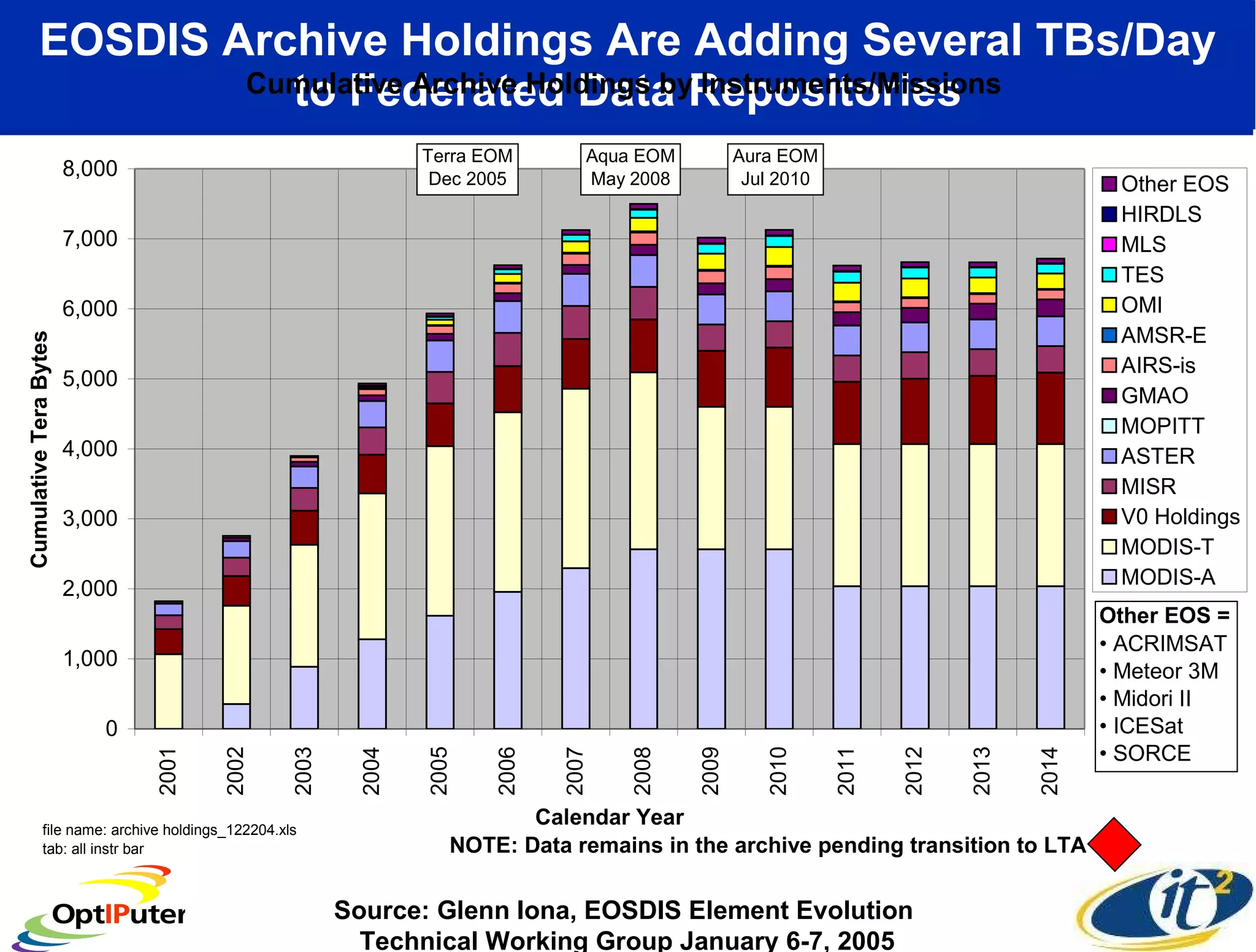
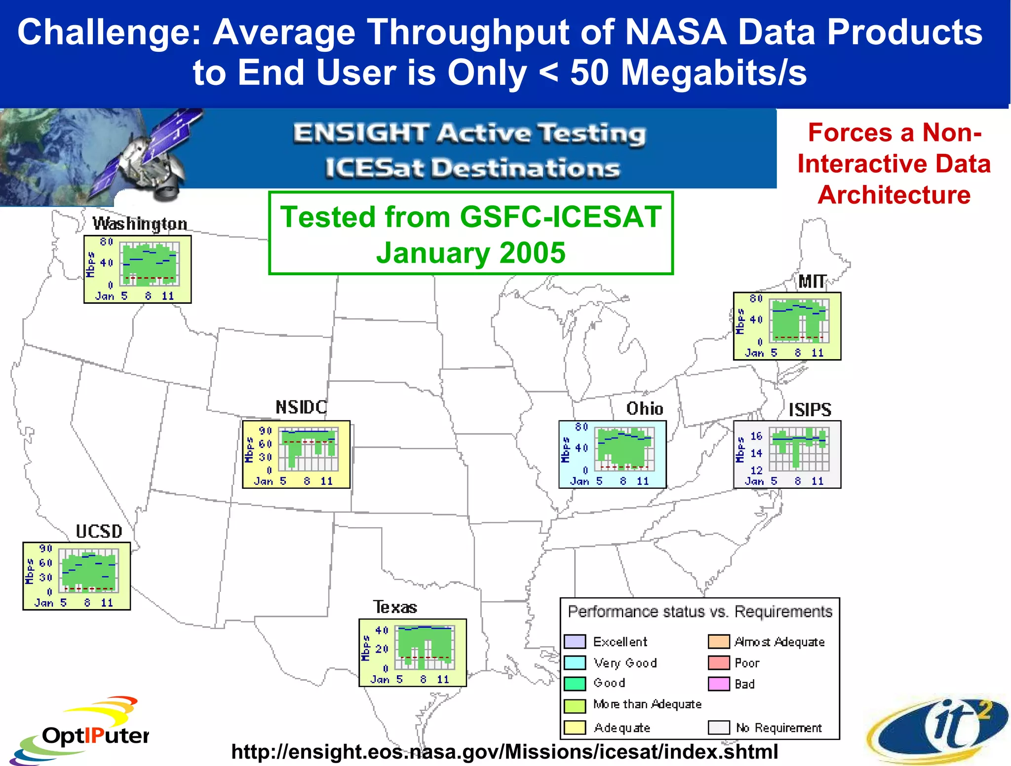
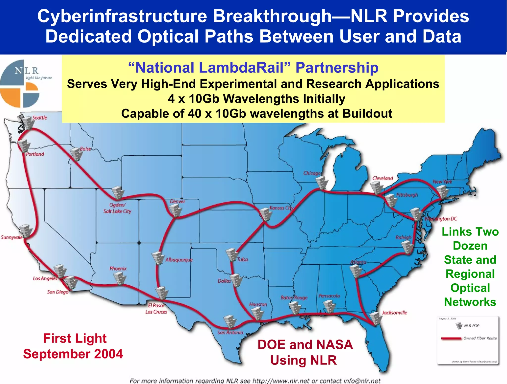
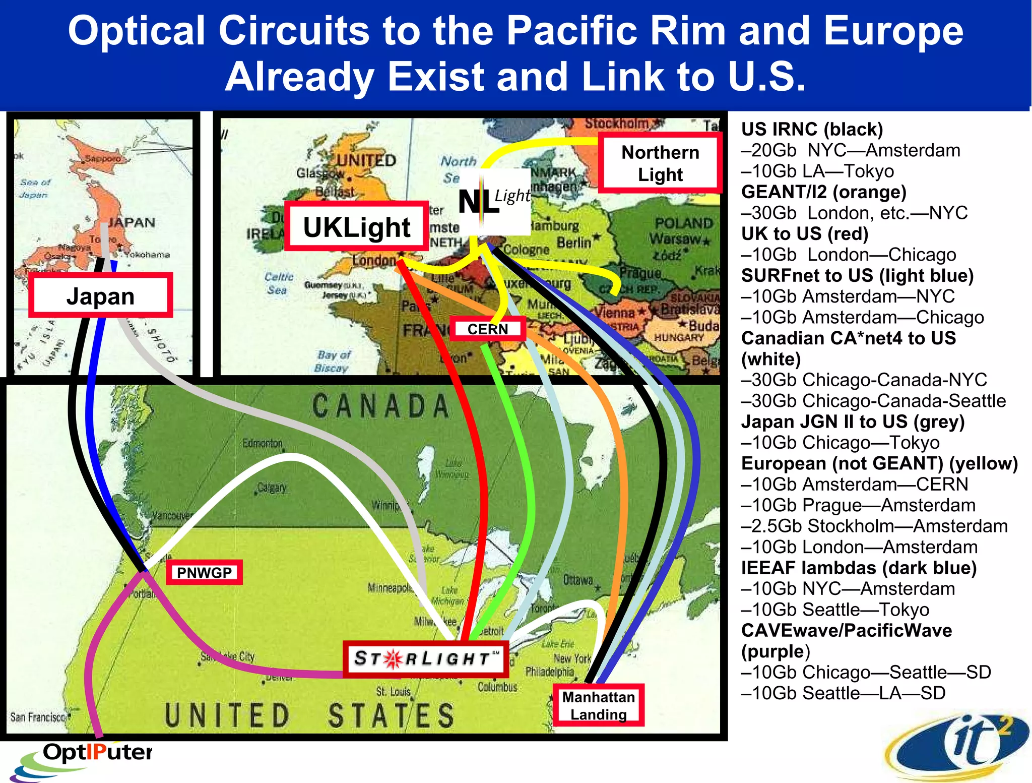
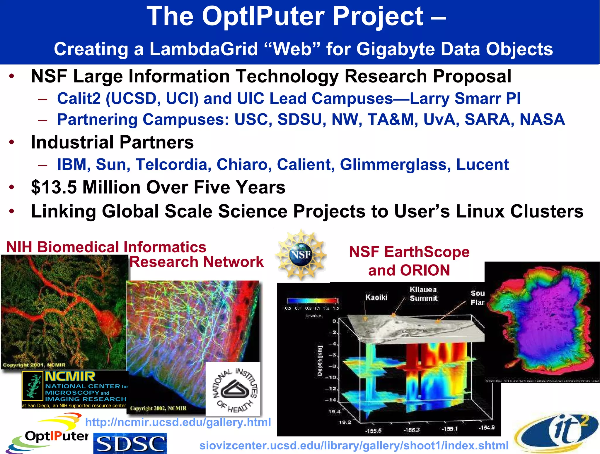
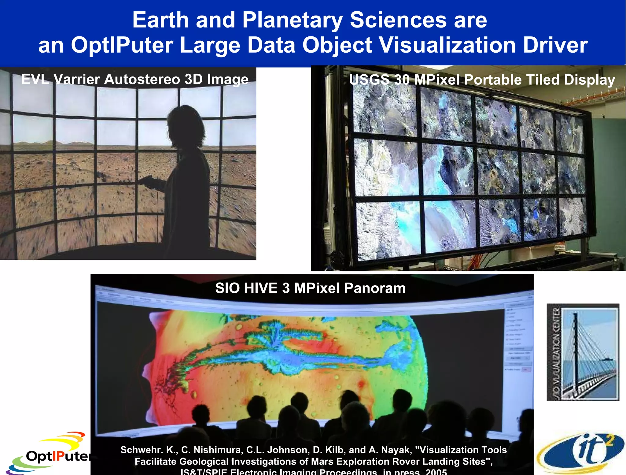
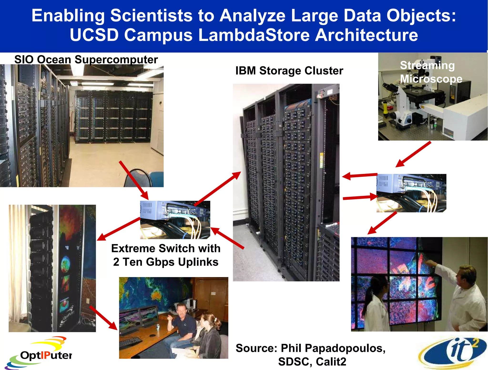
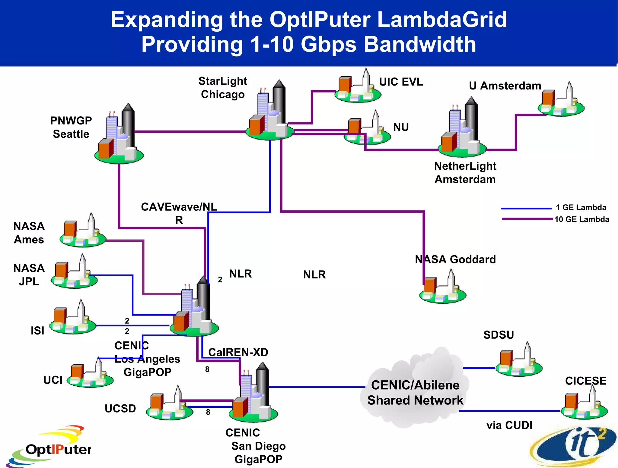
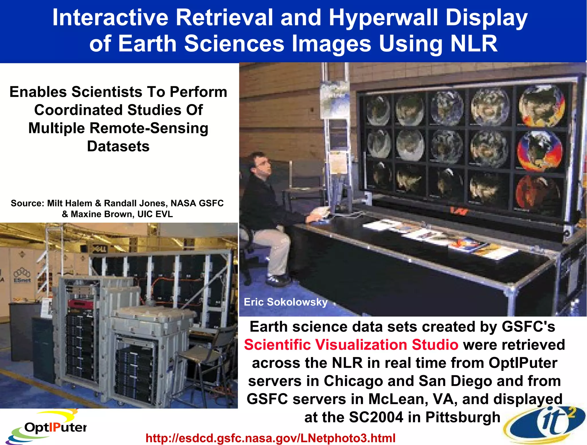
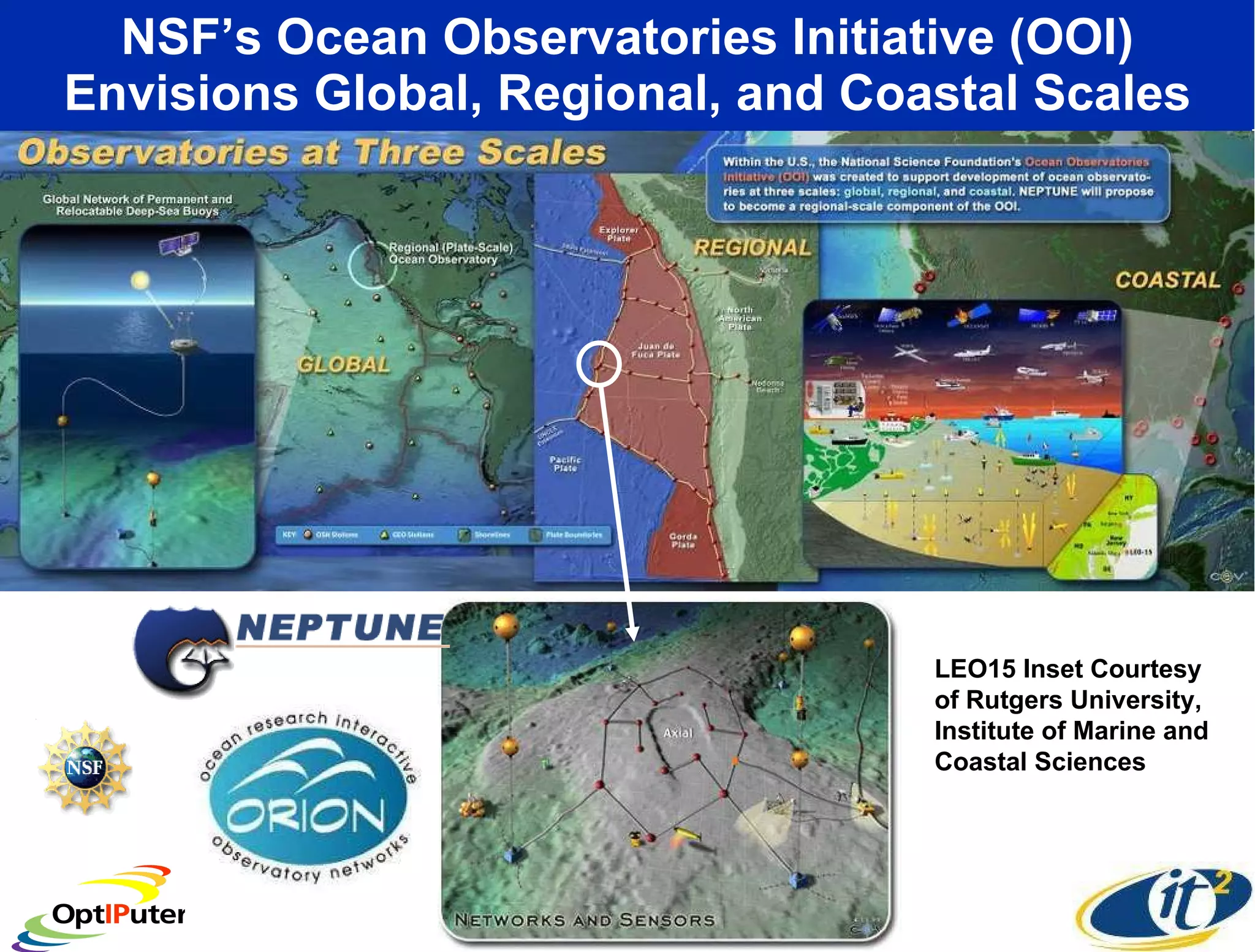
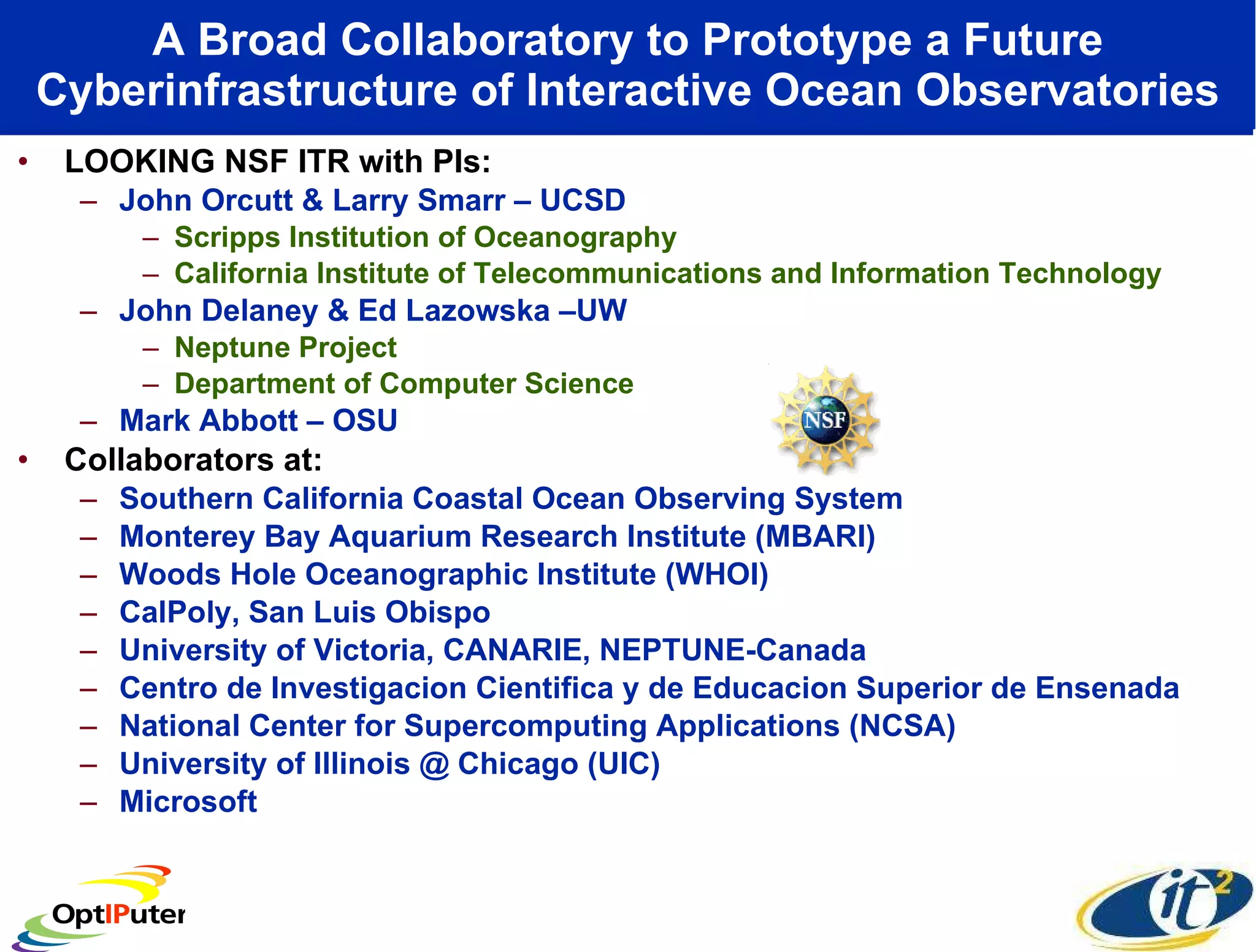
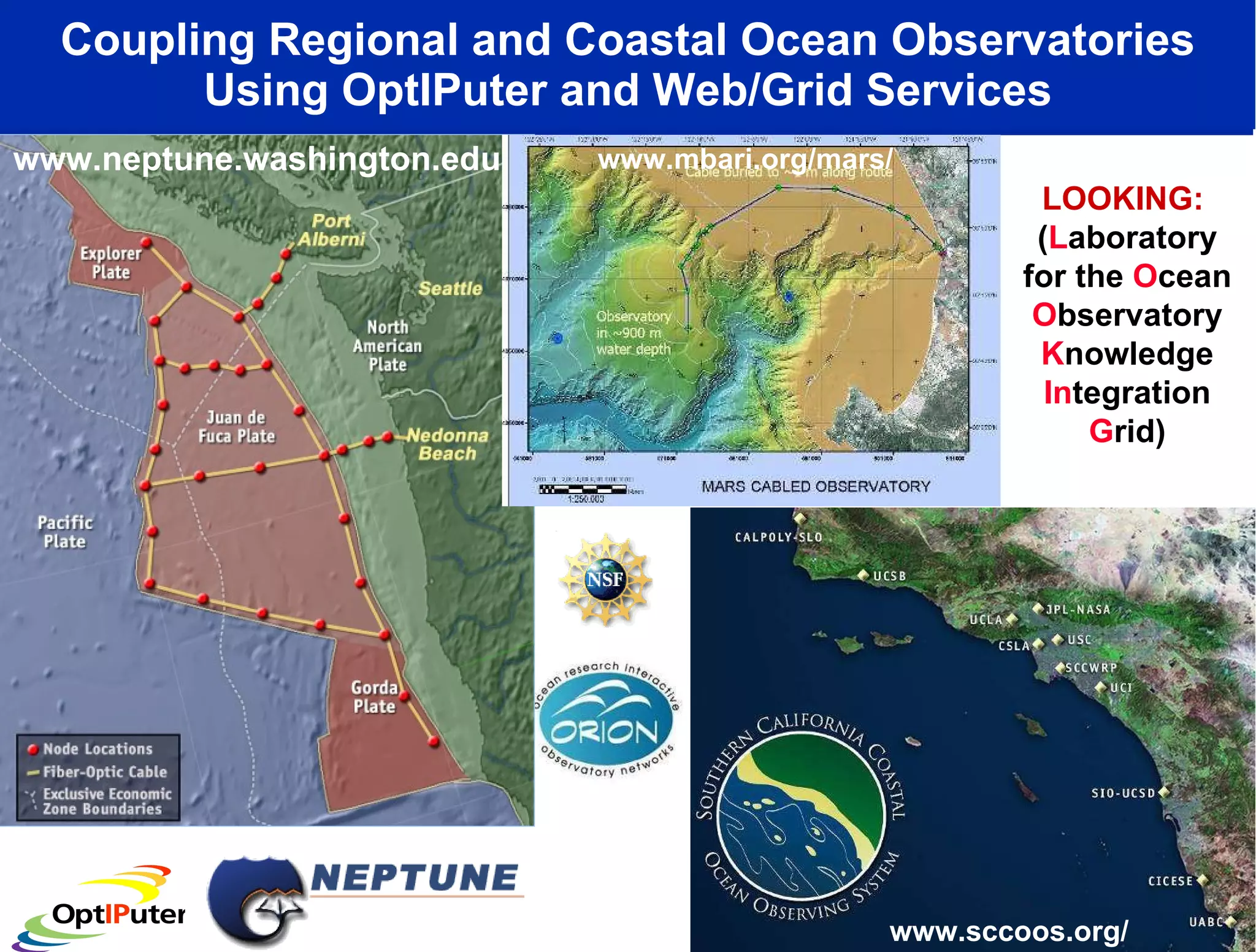
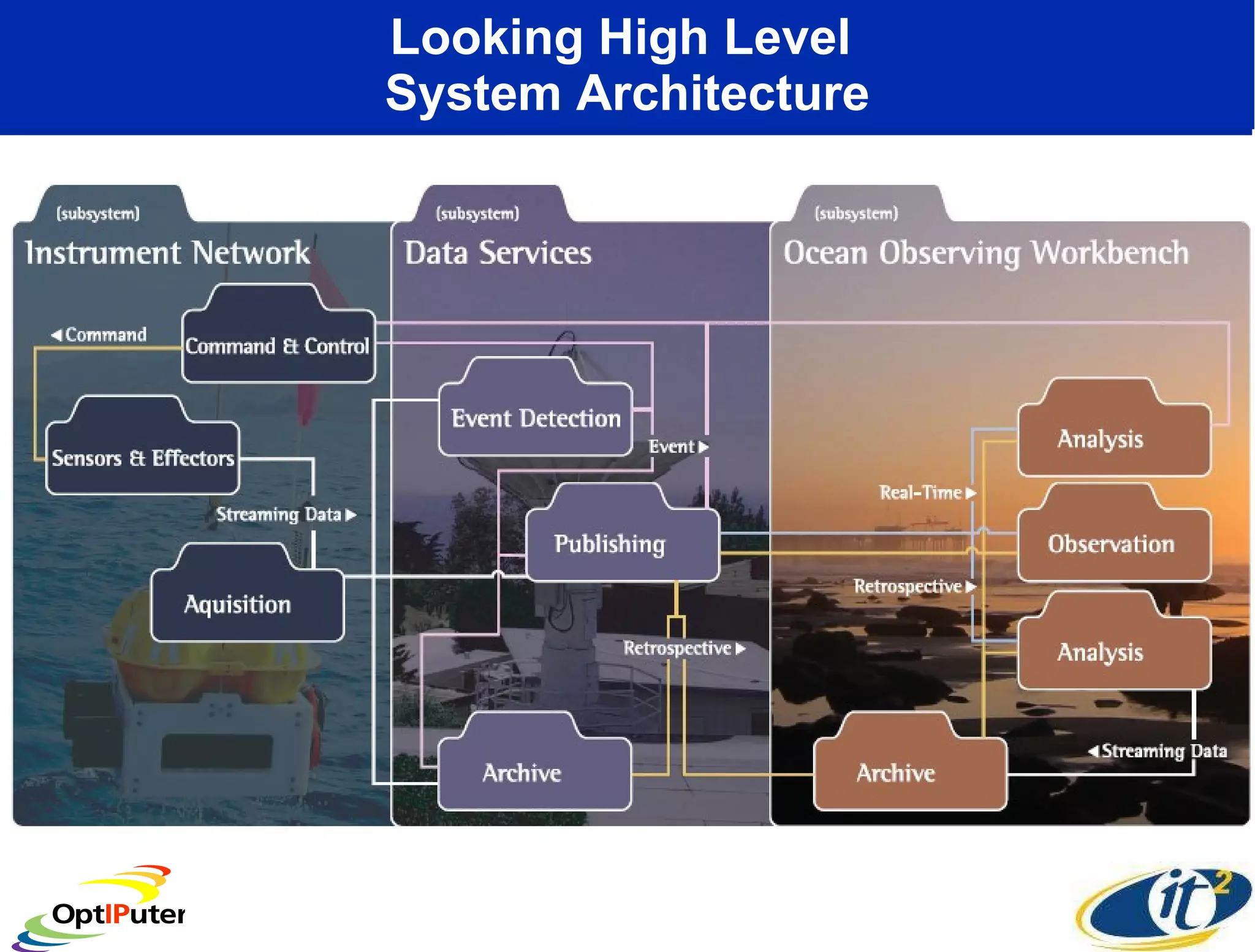
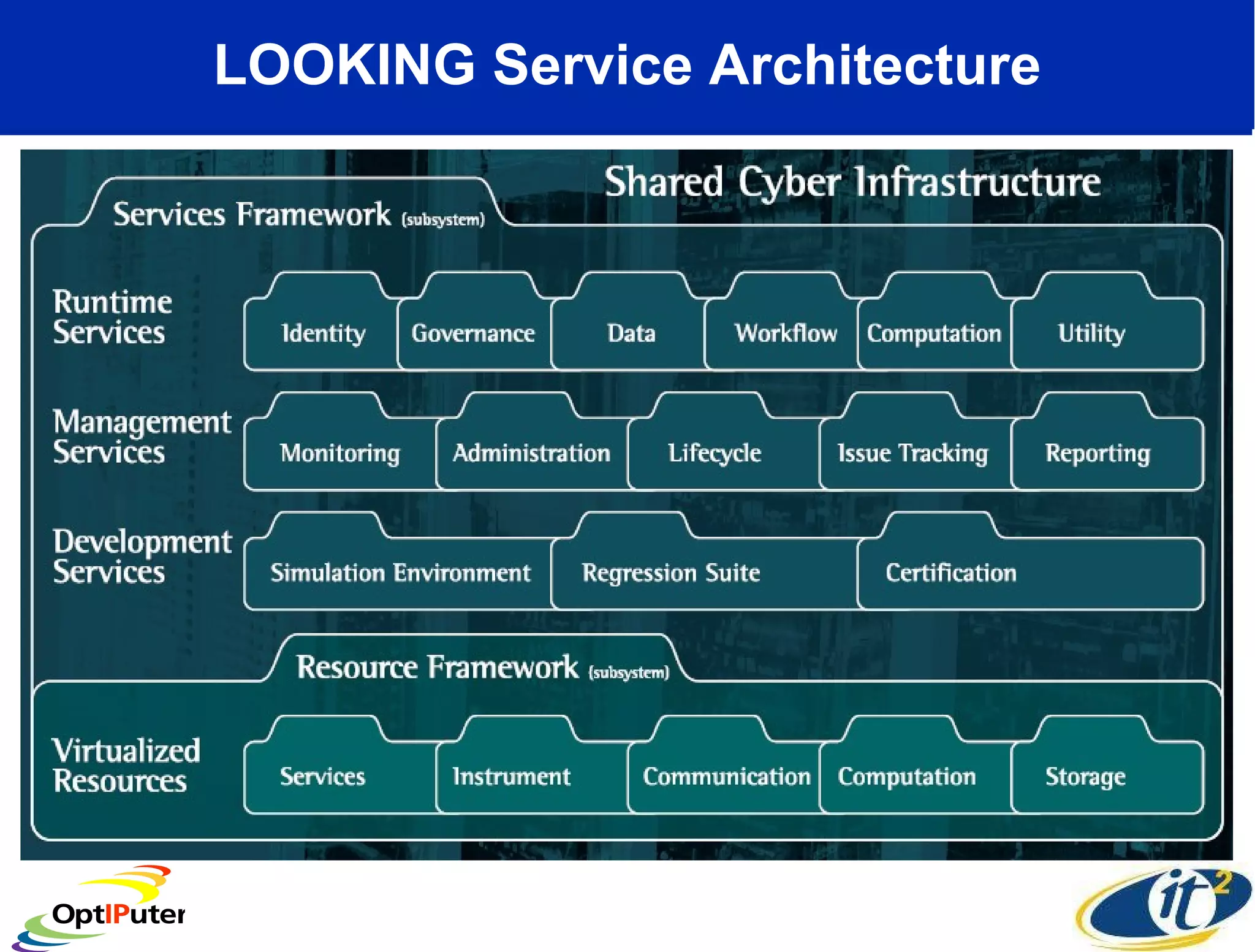
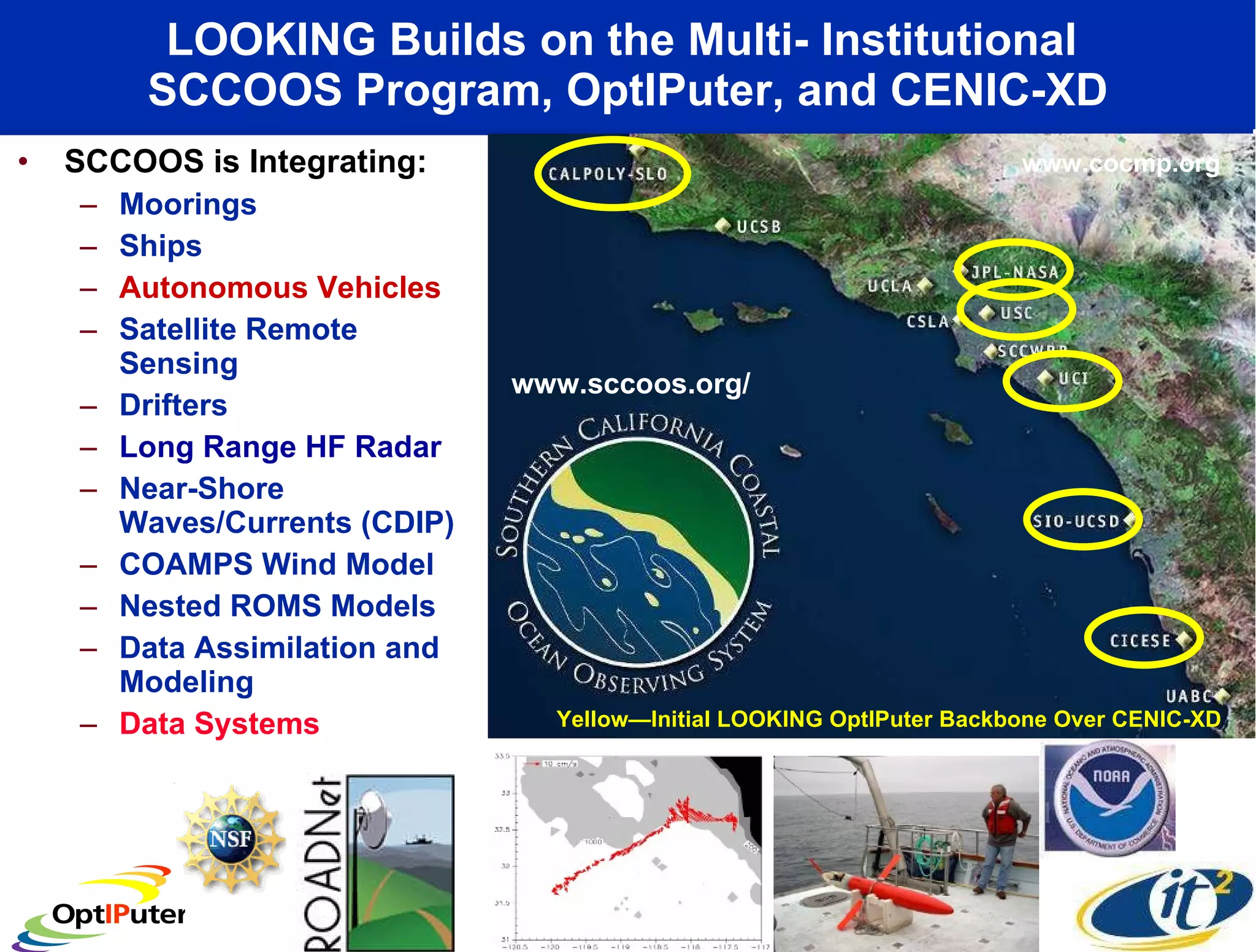
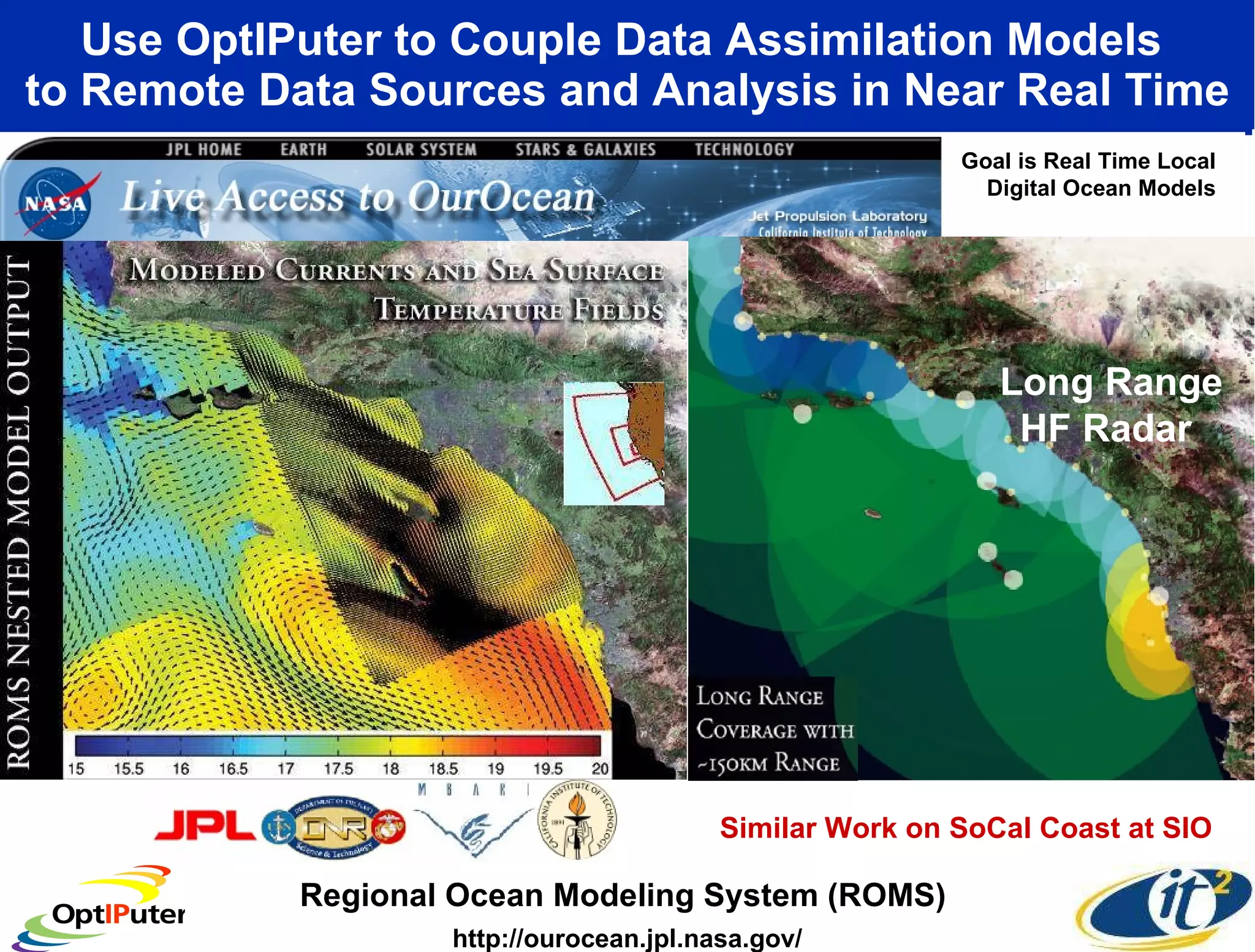
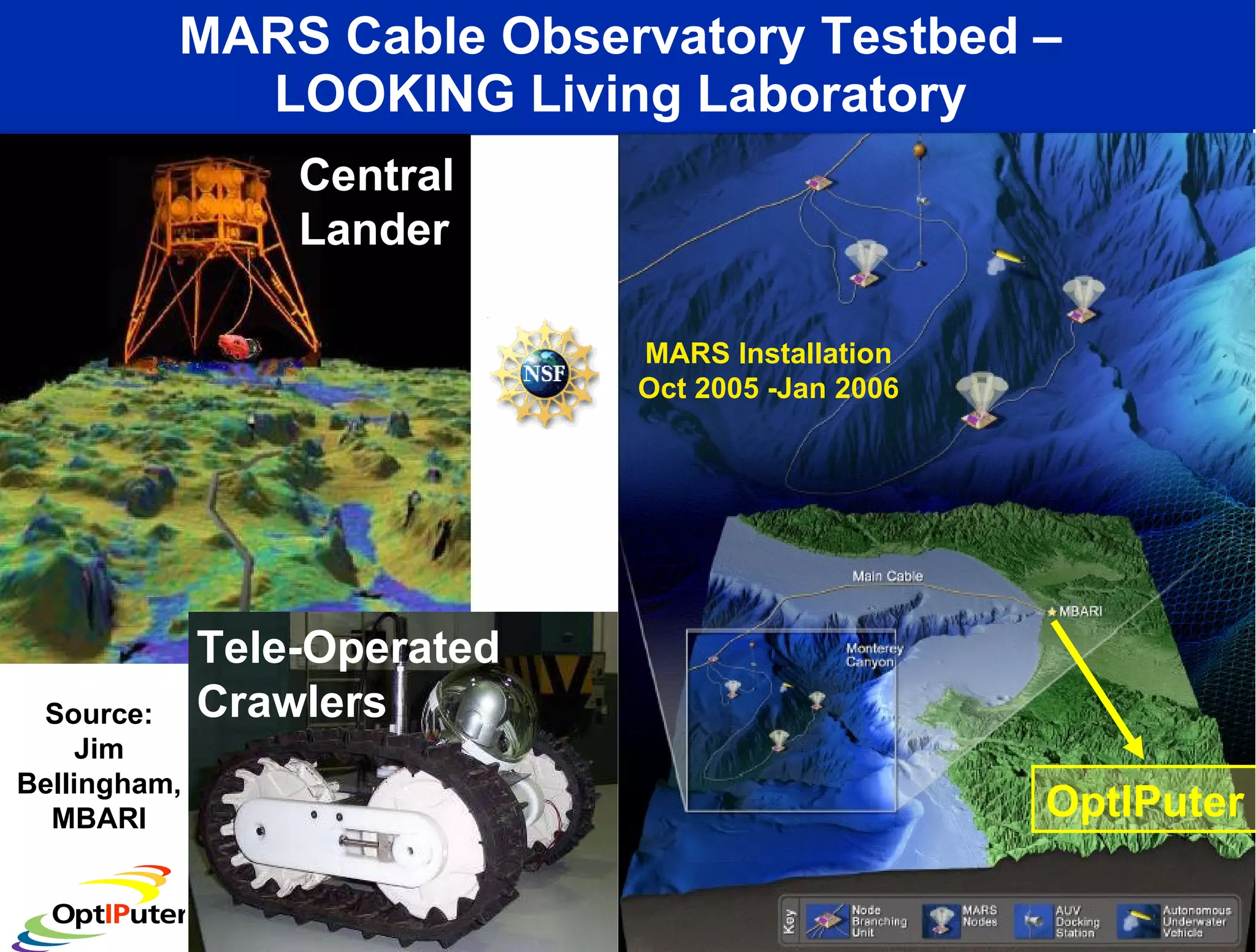
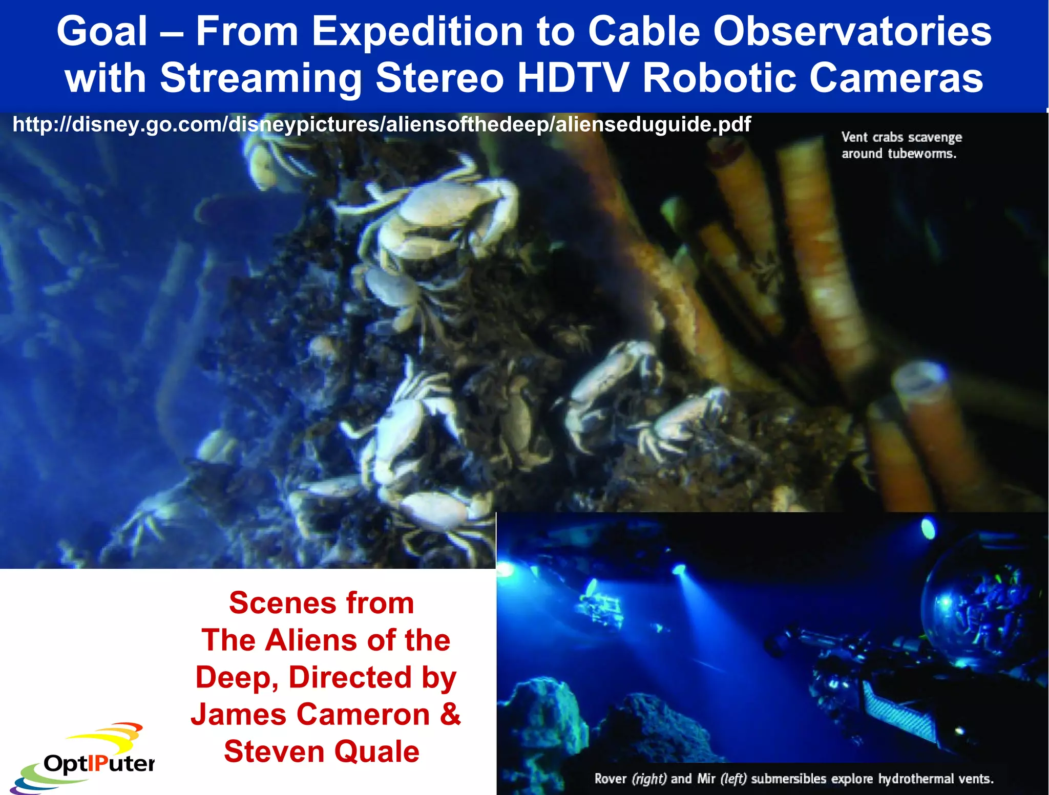
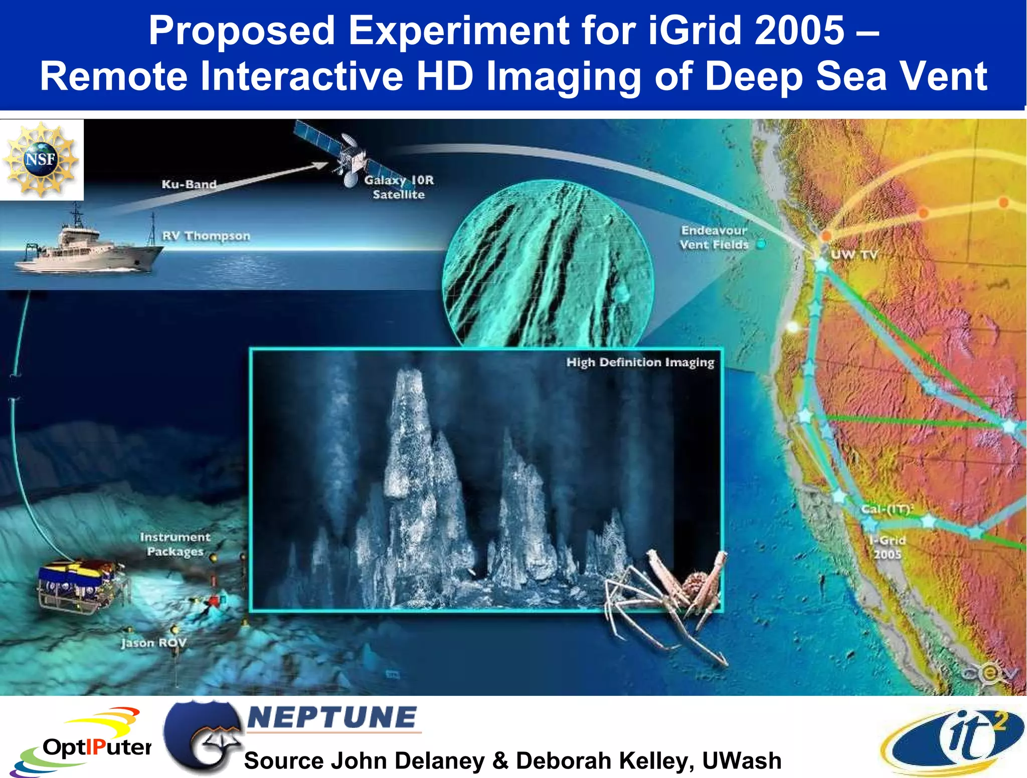

The document discusses advancements in cyberinfrastructure to support ocean observatories, highlighting the National LambdaRail's role in improving data transfer speeds necessary for research. It outlines projects aimed at creating a Lambdagrid for visualizing large data objects and facilitating collaborative studies across various institutions. The focus extends to integrating remote sensing datasets and real-time ocean modeling to enhance our understanding of various oceanic and atmospheric phenomena.


![Vibe Coding vs. Spec-Driven Development [Free Meetup]](https://cdn.slidesharecdn.com/ss_thumbnails/vibecodingvsspecdrivendevelopment-251209105622-43f455e7-thumbnail.jpg?width=640&height=640&fit=bounds)


