The Sustainable Communities Grants made a great deal of good work possible for the Metropolitan Area Planning Council (MAPC) and its partners -- all to improve the quality of live for the people who live, work, and play in the 101 cities and towns in its region. See the stories of five of those projects in five very different Massachusetts communities.
Nuovo presentazione di microsoft power pointgenerali06
This document outlines two possible futures for cities - one that is polluted, crowded, and chaotic due to unsustainable practices like overreliance on cars and waste buildup, and another that is sustainable, smart, and organized through policies and practices like renewable energy focus, smart city planning to reduce traffic, and CO2 reduction.
Andrew Gruber, Executive Director of the Wasatch Front Regional Council, presented on building effective partnerships. His presentation discussed the Wasatch Choice for 2040 Consortium and Toolbox, which provides strategies and tools to address issues like transportation, housing, zoning, and financing. The presentation also highlighted the need for partnerships between different levels of government, businesses, developers, lenders, communities, and universities to address the region's projected 41 million mile increase in annual driving and implement the Wasatch Choice vision.
This document provides an agenda and overview for a community meeting on transportation. It discusses goals of improving mobility, health, safety, accessibility and affordability. Challenges mentioned include limited road space, overcrowded transit, health costs of inactivity, and climate change. The document outlines directions and targets for various topics like land use, goods movement, walking, cycling, transit and motor vehicles. It aims to make the majority of trips by foot, bike and transit and eliminate dependence on fossil fuels.
According to data from the U.S. Census and Department of Commerce, bicycling as a mode of commuting in Portland has increased 275% since 1996 while driving has slowly declined. Public transportation and walking have also increased, rising 25% and 15% respectively. The document then discusses Portland's land use plans and policies that have directed growth into the urban core and conserved rural lands, promoting compact development, housing choice, and alternative transportation options.
- Amsterdam is a highly compact and walkable city with a dense street system composed of narrow, winding streets and canals.
- The city focuses on sustainability through initiatives like widespread cycling infrastructure, electric public transportation, increasing sustainable energy sources, and improving the environmental impact of schools and businesses.
- Neighborhood parks were an important part of the city's design, with over 860 being built after World War II to serve local communities.
The document discusses infrastructure projects undertaken by engineers and the stresses these place on society and cities. It focuses on transportation infrastructure and argues that current policies prioritize economic growth over sustainability and fail to adequately consider costs to society such as delays, accidents, pollution, and health issues. The document advocates for smarter, healthier cities with evidence-based policies that consider benefits, budgets, and public voices to improve transportation systems.
This document discusses compact cities and urban sprawl. It defines a compact city as having high residential density, mixed land uses, and an efficient transportation system to reduce energy consumption and pollution. Benefits include lower costs, less resource use, and more social interaction. Examples given are Melbourne, Toyama, Vancouver, and Curitiba. Urban sprawl is defined as uncontrolled urban growth into rural areas, characterized by low densities and car dependency, which increases infrastructure costs. The document suggests limiting sprawl to better manage expenses and control population growth.
The document summarizes trends in urbanization and discusses strategies for more sustainable urban development. It notes that about half the world's population lives in cities, which are growing rapidly especially in developing countries. Issues caused by urban sprawl like air and water pollution, loss of open space, and longer travel times are discussed. The document then presents tools for urban planning like zoning, growth boundaries, and public transit to promote compact development and limit environmental impacts.
Building Sustainable Communities: Urban Planning in the Portland Metro Regi...South Fraser Blog
Presentation by Oregon Metro Councilor Collette in which she give a general overview of the Metro Portland region and the role of the elected Oregon Metro Council. She gives information on Metro’s role in land-use planning, the urban growth boundary, and the region’s long-term planning document: Region 2040. She focuses on the link between land-use planning and transportation plan, and how Portland is in the business of designing multi-modal transportation corridors today. She also outlines the region’s priorities for high-capacity transport or light rail, and other orders of public and active transit. There is a case study on Tigard.
Contribution of compact city to urban sustainabilityNaina Gupta
This document discusses the relevance of compact cities in today's context. Compact cities are characterized by dense and proximate development patterns, urban areas linked by public transportation systems, and accessibility to local services and jobs. Compact city development can contribute to urban sustainability through environmental, social, and economic benefits such as reduced CO2 emissions from less automobile dependency, greater accessibility, and higher productivity due to shorter travel times. The document outlines indicators for measuring the compactness and impact of compact city policies and discusses how compact cities can help address challenges of continuing urbanization, global warming, rising energy prices, changing demographics, and local government finances.
The document envisions cities of the future to be smart, sustainable, and inclusive. Key aspects include green, energy-efficient architecture; sensor-based infrastructure management; autonomous transportation options; and innovative urban planning like Medellin's libraries and cable cars that connect communities and promote social development. The goal is for cities to use technology to manage resources efficiently while enhancing quality of life for all residents.
The document outlines plans for a proposed future sustainable eco-city in Malaysia called SMCity. It will focus on limiting environmental impact through public transportation, renewable energy, and waste reduction. The city aims to be walkable and place parks within two minutes of every home. SMCity will also have its own power plant using renewable resources and promote social integration through community design. The proposal discusses zoning areas, transportation hubs, and creating a modular grid framework to allow flexibility and expansion for the future eco-friendly city.
RV 2015: Sinking in a Sea of Green? Anti-Government Crusaders Get Their Way b...Rail~Volution
While other cities sprawled, expanding suburbs and highways, Metro Vancouver, BC, invested in transit, complete communities and compact development to create "Cities in a Sea of Green." After two decades of progress, voters rejected a referendum to expand the region's transit system. How was a community convinced to vote against a funding measure that supported the sustainable ethos they'd embraced for so long? Was it really the successful work of anti-government crusaders? Join in a discussion of the Vancouver experience and see what lessons you can take home.
Moderator: Ron Stewart, AIA, Principal, ZGF Architects, LLP, Portland, Oregon
Gordon Price, Program Director, The City Program, Simon Fraser University at Harbour Centre, Vancouver, British Columbia
IE admission - Express yourself - How do you envision the city of the future?Salvatore Gatto
The document discusses how cities of the future may develop and change. It predicts that by 2050, 66% of the world's population will live in urban areas, with many mega-cities having over 10 million inhabitants. Future cities will be characterized by technology and sustainability, with smart connectivity and renewable energy enabling more efficient transportation and connected public spaces. As populations grow, there will be increasing demands for green spaces, both at ground level and through new vertical park designs in high-rise buildings. City administrations will also focus on preserving historical aspects of the urban landscape.
The lecture presented at the Institute for Science, Innovation and Society at Oxford University, in June 2013, arguing the case for a 'clean, green, and smart' strategy of technological development, and a 'long and flat' strategy of physical development, for New Zealand's largest metropolitan area, Auckland.
This document outlines Ramin Seifi's presentation on sustainability initiatives in the Township of Langley, British Columbia. It discusses the township's history and growth, policy framework to guide development, and focus on smart growth principles like compact neighborhoods, mixed uses, and diverse housing and transportation options. The township aims to build a legacy for future generations through socially, culturally, economically and environmentally balanced development.
This document discusses how smart growth principles can help address challenges facing rural communities. It provides examples of rural towns that have successfully implemented smart growth, preserving rural character while allowing growth. The EPA and other organizations have published guides on applying smart growth in rural areas, focusing on supporting agriculture and natural lands, investing in existing communities, and creating neighborhoods that attract residents. The EPA works directly with rural communities and partners to provide technical assistance on smart growth.
This document summarizes a study on sustainable mobility planning for township developments in Bangalore, India. It finds that current developments are heavily car-dependent with poor access to public transit and retail. It then proposes a 7-step process for sustainable mobility planning covering context analysis, traffic projections, target-setting, master planning, review and implementation. Key recommendations include connecting developments to the city/region, providing shared amenities within and between developments, and designing complete streets that accommodate all modes of transportation. The benefits of sustainable mobility practices are highlighted.
The document discusses problems facing current Indian cities like water and sanitation issues, pollution, congestion, and lack of infrastructure. It proposes solutions for future cities like compact urban cells connected by efficient public transport, green buildings, renewable energy, and e-governance systems. Specific solutions addressed include compact housing, transport networks utilizing metros, bicycles, and autonomous vehicles, as well as desalination, telemedicine, and groundwater protection. The document advocates for an integrated platform and single window system to coordinate stakeholders and track issues in developing future smart cities.
The Union Minister Venkaiah Naidu announced the first 20 cities selected to receive funding to develop smart city projects on January 29, 2016. The selected cities are Bhubaneshwar, Pune, Jaipur, Surat, Kochi, NDMC, Ahmedabad, Jabalpur, Vizag, Solapur, Devangere, Indore, Coimbatore, Kakinada, Belgaum, Udaipur, Guwahati, Chennai, Ludhiana, and Bhopal. Each city will receive Rs. 100 crore per year for five years from the central government, totaling Rs. 50,000 crore in funding. The smart cities program aims
Arup smart cities. An overview regarding the impact smart cities will have on economic development, resource efficiency and great places to live and work.
Greater Vancouver Urban Futures Survey: PlaceSpeak BoardPlaceSpeak
The document summarizes key findings from the 2012 Greater Vancouver Urban Futures Opinion Survey. The survey polled over 1400 residents across 22 municipalities on issues like transportation, housing, the environment, and diversity. Top concerns included healthcare, traffic, and homelessness. Support was strong for expanding public transit over building new roads. Respondents prioritized issues like transportation, housing affordability, and preserving green spaces. Views varied by age, gender, and location within the region. The survey was conducted by PlaceSpeak and researchers from SFU and KDCameron & Associates.
Item # 1a October 28, 2021 City Council Work Session Minutesahcitycouncil
City officials and project partners discussed plans to improve the lower Broadway/Austin Highway corridor in Alamo Heights. The corridor was divided into four zones, each with challenges such as large parking lots interrupting sidewalks. Proposals included adding 129 trees to provide shade and landscaping, widening sidewalks, and reducing on-street parking. Officials discussed establishing a Public Improvement District or dedicating funds to maintain new landscaping. Creative landscaping ideas were suggested to enhance the area. Next steps include finalizing design details and material costs for the improvement project.
The document summarizes feedback from poor urban residents about problems requiring assistance. It reports that residents identified water supply and sanitation facilities as key issues, but did not view housing or construction as problems requiring assistance. It also notes that sustainable solutions depend on bottom-up community perspectives influencing top-down strategies.
Every one in the world wants to live in a compact environment. like in olden days the peoples they were used telephone, telegram, etc. for communication. but in the current scenario every one have smart phones for better communication. Because smartphones are compact and convenient to them.This presentation about Compact City planning and also it dealt how various compact cities in the developed and developing countries manage themselves. This presentation just gives an outline of the compact city planning.
Sunnyvale began as a small agricultural settlement in the 1800s and was incorporated in 1912. It grew with the arrival of Moffett Field naval air station in 1931 and Lockheed Martin in 1956, becoming at the heart of Silicon Valley. The city has a council-manager form of government and provides services like public safety, libraries, utilities, and community development to its population of over 75,000 residents across 24 square miles.
Urban consolidation aims to make more efficient use of existing urban land through increased density and maintaining population densities. This helps limit urban sprawl and the associated environmental and economic costs. Compact cities are more sustainable by reducing reliance on cars, enabling efficient infrastructure and public services, and fostering active communities through higher density living. Developing countries face challenges in compact city development like insufficient social infrastructure to match rapid population growth and weak public transportation systems. Policies promote sustainability through efficient infrastructure, balanced urban activities considering rural links, social equity, and other goals.
The Town of Ashland has a thriving community with engaged residents, businesses, and leaders who work together towards common goals of sustainability, regional collaboration, and excellence in education. Ashland maintains a strong infrastructure and economy to support its diverse population with various housing, transportation, employment, and environmental opportunities. The community aims to be sustainable, vibrant, and welcoming to all ages through coordinated efforts outlined in the Ashland Comprehensive Plan.
The document outlines draft land use, housing, economic development, and transportation goals for Ashland. For land use, the top three priorities should be GOAL 1 (accommodate development/preservation through zoning), GOAL 2 (support mixed-use development), and GOAL 3 (consider form-based code). For housing, the top three are GOAL 1 (preserve affordability), GOAL 3 (ensure affordability throughout town), and GOAL 6 (promote diverse/affordable housing). For economic development, the top three are GOAL 1 (vibrant development along corridors/downtown), GOAL 2 (provide planning/technical assistance), and GOAL 3 (implement public facilities/utilities
The Town of Ashland has a thriving community with engaged residents, businesses, and leaders who work together toward common goals of sustainability, regional collaboration, and excellence in schools. Ashland maintains a strong infrastructure and economy with diverse housing, retail, work, and community spaces. The town is committed to environmental stewardship and transportation options while supporting a vibrant downtown, neighborhoods, and quality of life for all ages and backgrounds.
Draft recommendations presented by Chris Kuschel of the Metropolitan Area Planning Council at the second public forum of the Natick Center Plan, February 10, 2016, Natick, MA.
The document provides information about micro-housing and the need for smaller housing units in the Greater Boston area. It notes that housing costs have risen significantly while incomes have stagnated, leading to affordability issues. Many residents are single or older adults who would benefit from compact housing options. The document outlines examples of micro-housing projects in Boston consisting of studios and small one-bedroom units ranging from 300-700 square feet to address this need. It suggests ways city planning could support increasing the supply of smaller affordable units.
The document discusses municipal IT collaboration between local governments and school departments. It provides examples of how the Town of Foxborough, MA and Foxborough Public Schools have collaborated on their joint IT operations. They have formed a technology steering committee with stakeholders to identify common needs, prioritize projects, and oversee the shared IT department. The collaboration has allowed them to hire additional IT staff and achieve cost savings while improving services. Overcoming barriers involves managing expectations, communication, and planning for the future.
The document outlines Arlington's IT strategic planning process, including putting together a team, engaging stakeholders, and setting benchmarks. It discusses the core components of the plan, including establishing a vision and mission, inventorying existing IT systems, and defining action steps and measurable outcomes. The plan aims to define the role of the IT department, improve relationships with stakeholders, manage the IT workload, and analyze the network.
Project posters describing some of the projects completed under the MAPC's Sustainable Communities Regional Planning Grant. The posters were displayed at the final meeting of the Sustainable Communities Consortium on May 21, 2014, Boston, Massachusetts.
This presentation discusses what the Vibrant NEO 2040 project is, what has happened so far, where we are today in its creation, and what the proposed vision for the Northeast Ohio region is-- drawing on input from citizens over the course of the last 6 months.
Rural and Small Urban Mobility Mobility Overview RPO America
Overview presentation on mobility in rural America and examples of transportation innovations for smaller areas from September 20, 2021 Rural and Small Urban Mobility Innovations Workshop hosted by NADO Research Foundation, Montana State University Western Transportation Institute, and National Rural Transit Assistance Program (National RTAP).
Connecting Trail to Town for Maximum Impact
This session will discuss ways communities can capture the economic impacts of trail tourism through improved connections between trails and towns.
Presenters:
Presenter: William Prince The Progress Fund/Trail Town Program®
Co-Presenter: Miriam Parson Student Conservation Association
The document discusses strategies that municipalities have used to become more sustainable and environmentally friendly. It provides examples of eco-municipalities in Sweden that have dramatically reduced their fossil fuel usage and increased recycling rates. It also discusses how municipalities can develop strategic plans and engage stakeholders to transition to more sustainable practices in areas like transportation, energy usage, land use, and resource management.
The document outlines a centers-and-corridors strategy for the Kansas City region to create more sustainable places. The region spans two states and nine counties with a population of 1.9 million across 4,400 square miles. The strategy aims to connect people to jobs through urban and commuter transit corridors, and bring jobs to people through development along six corridor plans. The goal is to make the region more vibrant, connected, and green.
- Laura Brown gave a presentation reviewing her work as the Community Resource Development Educator for Crawford County over the past 3 years.
- Her work focused on three main program areas: community economic development, community and comprehensive planning, and sustainability initiatives around local foods and energy independence.
- She conducted various programs and initiatives within each area, including developing an economic development preparedness survey, facilitating county planning processes, and establishing entrepreneurship clubs.
- Significant impacts included 18 communities completing comprehensive plans, the formation of a community fund, and businesses receiving support after severe flooding in 2008.
This document discusses the Wasatch Front Regional Planning Grant which aims to address challenges from large population growth in the Wasatch Front region of Utah through 2040. It will promote a quality growth strategy of developing walkable, mixed-use centers connected by transit to enhance mobility and quality of life while reducing infrastructure costs, traffic congestion, and improving air quality. Key programs under the grant will include creating planning tools, housing choices, transportation plans, outreach, and helping local implementation through a consortium.
The document is a report from the Blue Ribbon Citizens Visioning Committee presenting the results of a statistically valid survey of Mequon residents and businesses on their vision for the future of the city. Key findings from the survey include:
- Most residents prefer the city population remain around its current level of 24,000-25,000.
- Residents want more housing options for seniors and empty nesters, as well as more trails, parks and recreational amenities.
- Maintaining low taxes, crime rates, and the city's small town character are top priorities.
- There is support for controlled commercial and residential development that does not significantly increase population size or tax rates.
The document discusses how to plan regionally while respecting local identity. It presents case studies of the towns of Stoughton and communities along the Boston Post Road as examples. For Stoughton, it explores how regional transportation like expanded commuter rail could influence local development patterns. For the Boston Post Road towns, it examines challenges of seasonal tourism and proposes transportation and land use strategies to support local economies while addressing regional issues like traffic and resilience. Key lessons include collaborating regionally while allowing varied local visions, and recognizing how small local changes can have regional impacts.
The document summarizes the work of the Southeast Tennessee Valley SDAT team that was assembled by the AIA's Center for Communities by Design. The team conducted a design assessment of the region to address challenges related to population growth, the environment, and the economy. They developed recommendations focused on areas like regional cooperation, environmental protection, education, and land use planning to help create a more sustainable future for the region.
2012 Urban Futures Survey Presentation: Mayors' Council April 25. 2014PlaceSpeak
The 2012 Urban Futures Survey found that:
1) Transportation issues like traffic congestion were ranked as the top concern in the region by residents.
2) Residents were generally receptive to user-pay transportation funding options like increased transit fares and gas taxes but strongly opposed increases to property taxes.
3) Key to gaining public support for transportation investments will be demonstrating the value or benefits residents will receive for the costs to them.
This document discusses tools and strategies for promoting active living through community planning and design. It outlines how land use, transportation, parks and recreation can encourage walking, biking and physical activity. Specific policies and projects are mentioned, including complete streets, traffic calming, safe routes to school and compact development. Resources for additional information on active living and community design are provided.
The document discusses planning and the role of the Chattanooga-Hamilton County Regional Planning Agency. It defines planning as creating a vision for the future and making strategic choices to achieve goals. The Regional Planning Agency develops comprehensive plans, area plans, and regulatory tools to guide growth and development. It provides planning services to local municipalities. The agency staff works to achieve community goals around quality of life, economic vitality, and transportation/land use through planning, analysis, facilitation, and review.
This document discusses governance and public participation in Provincetown. It notes that the traditional Town Meeting process is seen as dysfunctional, inefficient, and unpredictable. It recommends reforming the process to be more efficient, collaborative, and informed through facilitated dialogues, community visioning, and establishing a civic organization to guide reform and community projects. The goal is a process that builds common understanding and reinforces community values rather than emphasizing differences. An example from Oregon uses a community information model to engage the public on the front end of decision-making.
This document summarizes a presentation about regional visioning for the Greater Tucson area. It discusses gathering input on shared regional values, analyzing a trend scenario if current growth patterns continue, and developing alternative scenarios to compare. The goal is to create a sustainable vision that balances growth while preserving what the community values like open spaces, the environment, and a high quality of life. Upcoming public workshops will gather more input to help shape alternative scenarios to evaluate and select the best path forward for the region.
The document summarizes a panel discussion on building vibrant neighborhoods around SMART train stations in Sonoma County. The SMART line will begin service in 2014. The city received funding to create a vision for neighborhoods around two SMART stations, one in Downtown Railroad Square and another in North Santa Rosa. The panel discussed affordable housing needs, the relationship between transportation and public health, examples of transit-oriented development, and site plans for the North Santa Rosa SMART station.
This document summarizes a session that discussed plans to redesign the intersections and streetscape in Marstons Mills, Massachusetts to improve pedestrian safety, traffic flow, and sense of place. The project focused on the Cash Market intersection and surrounding village areas. Attendees broke into groups to develop preferred concept designs, considering tools like traffic calming, complete streets elements, and green infrastructure. Recommendations included a realigned intersection, platform crossing, bump-outs, bollards, signs, and on-street parking. Extensive community engagement and partnership with local groups was cited as critical to the project's success.
Metro Vancouver presentation on the 2012 Urban Futures SurveyPlaceSpeak
The 2012 Urban Futures Opinion Survey found that residents of Greater Vancouver ranked healthcare and traffic congestion as the top challenges requiring government action. Support for expanding public transit and making more efficient use of existing transportation infrastructure increased significantly compared to 1990. Residents also prioritized preserving natural areas, increasing affordable housing, and supporting density and diversity in urban planning. Younger respondents expressed greater acceptance of urban living and desire for transit-oriented communities. The survey provides insights into evolving public opinions to help guide regional planning in Metro Vancouver.
Similar to Sustainable Communities Results Quick Presentations (20)
An MIT spinoff called Optimus Ride is developing self-driving vehicle technology. The company was founded by Ryan Chin, a PhD from MIT who worked on several autonomous vehicle projects there. Optimus Ride aims to provide safe, sustainable, and equitable mobility solutions through their technology, which could unlock over $1 trillion in annual savings according to a Morgan Stanley report.
The Mass Drive Clean campaign was created in 2015 using funding from the John Merck Fund to promote electric vehicles (EVs) through test drive events. The campaign was piloted in Massachusetts and San Diego in 2015 and continued in 2016 with local funding. In 2016, the John Merck Fund provided seed funding to expand the campaign into Connecticut and Rhode Island. According to post-test drive surveys, over 70% of participants were more favorably inclined towards EVs and 70% said they were more likely to purchase one after the test drive experience. The next steps of the Mass Drive Clean campaign are to reach a larger, more diverse group of state residents, continue educating about incentives and models, and provide more experiential events
This document summarizes Boston's efforts to research and test autonomous vehicles. It discusses the city's goals of improving safety, access, and mobility. The mayor's office has formed research partnerships and begun testing AVs on city streets. Testing has involved different vehicles and conditions. The document also examines potential AV business models and their impacts. It outlines Boston's work in areas like workforce development and governance to help guide the integration of this new technology.
Electric vehicles (EVs) provide environmental benefits by reducing emissions even when powered by coal-based electricity. EVs also offer lower fuel and maintenance costs compared to gas vehicles. Massachusetts currently has hundreds of EV charging stations and provides incentives for purchasing EVs and installing chargers. Upcoming events will give people test drives to experience EVs firsthand and help more drivers switch to these cleaner vehicles.
The document summarizes an innovative mobility panel at a MAPC Fall Council meeting. The panel discussed the rise of electric vehicles and autonomous vehicles, and how transportation is the largest source of greenhouse gases in Massachusetts. They also addressed critical areas for state and local governments to consider regarding regulatory frameworks, data, land use impacts, infrastructure and parking for new mobility technologies. The panelists represented organizations working on these issues like MAPC, DOER, Optimus Rides, the City of Boston and Reach Strategies.
This document summarizes a presentation on equity in the Metro Boston region. It discusses goals for increasing equity, including reducing segregation, improving access to affordable housing and food, and increasing opportunities for advancement for workers of color. It then reviews trends related to equity across different life stages and demographics since 2011. Key metrics like income inequality, low birth weight, test scores, incarceration rates, labor force participation, and housing cost burden show both improvements in some disparities but also growing inequities in other areas. The presentation concludes that inequity remains significant and is growing, but that policy interventions can help advance equity, though continued work is still needed.
The document provides an overview of Massachusetts' Regulation and Taxation of Marijuana Act, which legalized recreational marijuana use and sales. It discusses the history of medical marijuana in MA, the passage of ballot question 4 in 2016, and outlines the key components of the new law, including allowing personal possession and home cultivation, establishing a regulatory system under the Cannabis Control Commission, implementing licensing for marijuana establishments, and levying a state and local excise tax. A timeline is also presented detailing implementation of the new law between 2017-2019.
1) The document reviews local control options for regulating recreational marijuana establishments under Massachusetts law. It can adopt time, place and manner restrictions or limit numbers through a regulatory referendum.
2) A regulatory referendum requires a ballot question voted on by residents to prohibit establishments, limit retailers to 20% of liquor licenses, or limit numbers to fewer than medical marijuana facilities. However, a consumption referendum can be forced onto the ballot with 10% of voter signatures.
3) Interpretation of some provisions is unclear, such as what constitutes an "area" where medical marijuana facilities operate. Overall municipalities have some local control but face limitations, especially the risk of consumption referendums beyond their direct control.
The document summarizes the state of IT in Massachusetts government and outlines MassIT's priorities and initiatives to improve digital services. MassIT aims to drive digital transformation across state agencies and support local governments. It discusses findings from an IT review that found low citizen satisfaction with digital services and immature security practices. MassIT plans to invest in core infrastructure, partner with local governments, and facilitate regional collaboration on IT projects and shared services.
We have hired 1 person for IT, saving $25,000 while strengthening our dedicated fiber and adding 24/7 support. IT regionalization has allowed us to hire more staff and save money by sharing resources, making our technology infrastructure more robust with around-the-clock assistance.
The document summarizes a community forum held in Ashland, Massachusetts to discuss updating the town's comprehensive plan. It provides an overview of the comprehensive planning process and progress made so far in developing Ashland's plan, including outreach activities and draft goals in key areas like land use, housing, economic development, and transportation. The forum included a presentation of the draft community vision statement and goals, followed by small group discussions for residents to provide input and prioritize goals to guide future growth. The next steps in the planning process were also outlined.
The document summarizes a plan for Natick Center that incorporates previous planning efforts and public input. Some key points:
- Previous plans from 1980-2000s addressed facilities, parking, and design issues.
- Natick's population is growing and its households are shrinking, increasing demand for multi-family and smaller housing units.
- New developments have contributed students to schools, though less than single-family homes typically.
- Most people walk to the commuter rail station, and ridership has increased in recent years.
- The plan gathers public input on housing, retail, transportation, and parking preferences to develop a vision for Natick Center's future.
The document provides information from MAPC's Fall 2015 Council meeting. It includes summaries and data from several MAPC projects:
- An inventory of 169 MAPC projects from the past year that advance MetroFuture goals such as sustainable growth, housing, and transportation. Transportation and healthy environment were the most common project categories.
- A discussion of regional ballot initiatives to raise funds for transportation projects and how Massachusetts municipalities can pursue similar initiatives.
- A project to engage immigrant small business owners in downtown Framingham through outreach efforts and a business owner story tour.
- Planning work in Chelsea around housing, jobs, and health through the lens of equity and quality of life near transit infrastructure.
- A project in Quin
Tim Reardon, Assistant Director of Data Services of the Metropolitan Area Planning Council testifies at a hearing of the Massachusetts Joint Housing Committee.
This document contains a map of New England showing the states of Connecticut, New Hampshire, New York, Rhode Island, and Vermont. The map also shows various highways and interstates in the region and contains data on average adult asthma rates by municipality from 2008-2010, with Chelsea, Massachusetts highlighted as having among the highest rates.
This document contains a map of Chelsea, MA showing the percentage of cost burdened households in each census tract, proposed locations for new Silver Line commuter rail stations, existing commuter rail and bus routes, study area boundaries, and proposed bike infrastructure improvements. The census tracts are categorized by percentages ranging from less than 40% of households that are cost burdened up to more than 65%. Several proposed station locations and routes for new bike lanes, cycle tracks, and shared use paths are also illustrated on the map.
The document summarizes a strategic economic development action plan project kickoff meeting for the Town of Reading. It discusses the project goal of producing an action plan focused on four priority development areas to support local housing and economic goals. An agenda, scope, process, and overview of upcoming market analyses were presented. The market analyses will estimate development potential for each site to inform zoning and strategies.
The document summarizes a public meeting held in Reading, MA on April 1, 2015 to discuss the town's strategic economic development action planning. The meeting covered market potential analyses for retail, office, and residential development, as well as design preferences. Key points included:
- Retail market analyses found opportunities for filling vacancies downtown and adding restaurants, with potential for more retail with greater residential density.
- Office market analyses indicated potential for small professional offices downtown and in other areas, with some opportunity for larger office buildings.
- Residential analyses projected growing demand from seniors and young professionals, finding opportunities for over 400 new units within priority development areas over 5-10 years.
- The four priority development areas identified were
The document summarizes findings from a market analysis conducted for a strategic economic development action plan in Reading, MA. It provides information on the housing, retail, office, and residential markets in Reading and the surrounding area. For housing, it notes growing demand for rental units and condominiums as well as rising home prices. The retail market analysis found opportunities to fill vacancies downtown and concentrate new retail and restaurants there. The office market in the area is improving but faces strong competition for jobs. Feedback from residents supported mixed-use development, retail on the ground floor, and residential to support local businesses.
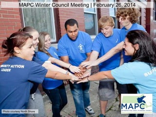
1. MAPC Winter Council Meeting | February 26, 2014
Photo courtesy North Shore
CDC
2. LYNN DUNCAN
Director of Planning & Community
Development, City of Salem
Salem Point
Neighborhood Vision and
Action Plan
A Sustainable Communities
Grant Project
CITY of SALEM
6. Job Training + Placement,
Education and Career
Pathways
Organizations, city departments,
businesses, citizen groups
Environment, Open Space, +
Recreation
Organizations, parks,
community spaces, activities
Housing + Economic
Development
Tenant groups, real estate
agents, city departments,
landlords, property
owners, organizations,
businesses
Neighborhood Pride +
Civic Engagement
Organizations, city
departments and
boards, citizen groups,
media, service learning
programs
Safety + Security
Organizations, city
departments and
boards, citizen
groups
Point
Neighborhoo
d Vision
Infrastructure
City departments,
transportation
resources, housing,
parking
12. Streetlights Replaced
3,000
Kilowatt-hours Saved
703 K
Annual Energy Cost Savings
$105 K
Annual Maintenance Savings
$40 K
Total Cost of LED Streetlights
$1.04 M
Town of Arlington Funds
$714 K
Green Communities Grant
Funds
$160 K
NSTAR Incentive Funds
$165 K
Payback to Arlington Taxpayers
4.9
Years
19. Affordable,
Protected
Land for Lease
Build
Community
Support (Farm
Friendly
Neighbor)
Zoning
Amendments:
Accessory
Uses
Local &
Flexible
APR/CR
Recommendations
for a Strong
Agricultural System
Agriculture
Commission
Powers
Infrastructure
Investment
Farm Viability:
Supplemental
Revenue
Streams
21. Measurable Change
Littleton:
Google Maps
image
• Established Agricultural Commission
• Amended Zoning for Expanded Agricultural Uses
• Best Management Practices for Town-Owned Agricultural
Land
23. KRISTINA JOHNSON,
Director of Transportation Planning
RE-ENVISIONING
WOLLASTON:
A Station Area Plan for Wollaston
Center
A Sustainable Communities
Grant Project.
30. DANA LeWINTER
Director of Housing, City of Somerville
MERIDITH LEVY
Deputy Director, Somerville Community Corporation
The Dimensions of Displacement
A Sustainable Communities Grant Project
31.
32.
33. Tracking
Neighborhood
Change
• Tenure
• Household Size and
Type
• Bedroom Count
• Cost Burden
• Mortgage Status
• Overcrowding
• Geographic Mobility
• Race and Ethnicity
• Education
• Citizenship Status
• Income and Poverty
Status
34. How much could rents increase?
Rents along the GLX
could rise
25% to 67%
700 to 800 renters
could become
newly cost-burdened
35. How much housing is needed?
Net Housing Unit Demand by Age,
City of S
omerville, 2010 - 2020, S
tronger Region S
cenario
Net Housing Unit Demand, 2010 - 2020
7,000
Single Family
Multifamily
6,000
5,000
4,000
3,000
2,000
1,000
(1,000)
(2,000)
(3,000)
10 14
15 19
20 24
25 29
30 34
35 39
40 44
45 49
Age in 2010
50 54
55 59
60 64
65 69
70 74
75
plus
Source: MAPC Population Projections 2013
6,300 to 9,000 new units needed to accommodate new
36.
37.
38. Dana LeWinter
Director of Housing, City of Somerville
dlewinter@somervillema.gov
@SomervilleCity
Meridith Levy
Deputy Director, Somerville Community
Corporation
mlevy@somervilledc.org
@SCC_Somerville
Editor's Notes
Static slide to preceded Lynn Duncan.
Lynn Duncan title slideHow this process was a departure from how the city has undertaken city and neighborhood planning in the past- New engagement methods- An action plan created through collaborationA more diverse demographic engaged, by age, ethnicity
Why the project was desirable:- Destination for new immigrants, including Dominicans- Home to over 100 businesses: professional services, retail, education and health services- Four parks and access to acres of Salem Waterfront, within walkingdistance of the downtown- One of the densest neighborhoods in the city: est. 40-50 people per acreBUT- larger percent of 16-25 and 23-65 actively looking for work in the Point vs other neighborhoods Majority of housing units are renter-occupied (64%) compared to the rest of the city perception that it has highest number of crimes compared to other neighborhoods (untrue)- Infrastructure and cleanliness problems – very dense neighborhood (top issues: trash, sidewalk quality, noise, and illegal activities at night)
EXAMPLE of innovation in engagement:- Game created a new entry point into city planning processes- Provided younger generations with a way to learn about community issues and engage in dialogue with othersStrengthened relationships between City and communityGame also generated donations to local causes – money for the CDC to repair murals, money to Salem Cyberspace to purchase new equipment, and resources to local shelter serving homeless youthMention the focus groups and interviews with 20 people from the community that informed the development of the game questions
The result of the project. - Our vision and action planning workshop – Mayor actively participated in every meeting; brainstorming for working cities began at one of the public meetings (the first meeting)- Participants in both public meetings mirrored demographics of community; interpretation provided and translation of meeting materials
- commitment to developing a practical, implementable action plan that clearly names responsible partners-strong community partner – CDC with relationships with local officials and grassroots neighborhood groups and other nonprofits; connected us to youth leaders, who were integral to the development of the game MAPC offered facilitative and technical expertise – helped innovate the planning process
Grant funding set aside for infrastructure improvements (parks, trees, housing rehabilitation)Latino Affairs Coordinator hired by City$100,000 Working Cities Challenge Grant to fund workforce and leadership development activities$25,000 for a Commercial Corridor Plan strengthening corridor between the Point and downtown Salem
Adam Chapdelaine title slide
Arlington had approx. 3000 High Pressure Sodium Streetlights using almost 1.2M kwh of electricity per year.The Town’s energy reduction plan called for a 20% reduction in usage. One significant means of achieving this reduction was a streetlight retrofit.Reference to Clean Energy Toolkit
Starting with Arlington’s Energy Working Group, the Town created a strategy and identified funding sources.The next hurdle was procurement. This is where the MAPC stepped and helped make the project happen.
With the guidance of the MAPC, Arlington was able to cooperate with Chelsea, Natick, and Woburn on a joint procurement that resulted in a contract with Siemens.Once under contract, Siemens worked with the DPW to begin installation.
Results
Another result for MAPC was the development of the Clean Energy Toolkit
Smart growth means different things in different places. In MAGIC, which is hope to many developing suburbs northwest of Boston, open space and vibrant agricultural systems are essential to our communities.
In MAGIC, agriculture represents economic development opportunities consistent with community character.
However, agriculture in the subregion, and the entire MAPC Region, faces many challenges such as municipal knowledge of practice, development pressures, land access and tenure for farmers/ranchers, and incompatible regulations – to name a few.
The MAGIC Ag Project brought together an unprecedented and nontraditional collection of stakeholders: farmers/ranchers, municipal officials, agricultural non profits, and state and federal agencies; to identify ways to strengthen and sustain agriculture.
The results of the project have come together into the project report that summarized the challenges, opportunities, and recommendations for action items that partners should implement.
Through an inclusive planning process, MAPC and its partners developed recommendations for strengthening the agricultural system in the MAGIC subregion, such as (cite items on left).
Many of these strategies have been highlighted in MAPC’s companion project: A Food Systems Guide for Municipal Officials, overseen by CLF-Ventures. The Guide will explain the critical role municipalities play in supporting and strengthening the local food system.
An example of a community that has taken these recommendation and guidance and put them to use is Littleton. We have…
This work has lead to the awarding of a contract to MAPC and its partners: Franklin Regional Council of Governments, Pioneer Valley Planning Commission, and MA Workforce Alliance; to develop a statewide Food Systems Plan for the Commonwealth.
Challenges in Wollaston which include the existing zoning that is producing/allowing development like this KFC and Friendly’s. Wollaston Center lacks an identity with inconsistent signage, streetscape, and development pattern. The challenge here being how do we create zoning and a transportation network/public realm that brings more people/activity to Wollaston and creates a place that people want to live/work/shop/play in.
Early implementation of the projectThis is the vision map that was created from the input of the City and our community engagement process with the community. It shows the potential development parcels (mostly surface parking lots), and how the area could be better connected by bike, pedestrian connections and by a consistent streetscape treatment. Very important to draw residents from the surrounding neighborhoods to the Center to use the T and to shop in local businesses. Making the pedestrian infrastructure safer and more pleasant is important to bringing people into Wollaston Center from surrounding areas.
Implementation of the recommendations. zoning recommendations focused on creating development envelopes that allowed for taller buildings, a mix of uses, buildings that meet the street with reduced setbacks, and heavily reduced parking requirements for residential development. The plan also recommended improved crosswalks, bike lanes, and streetscape improvements as is illustrated in the rendering.
A chance to mention that MAPC just completed the bike plan for the City, which ties in bike infrastructure from Wollaston area to the rest of the City.
Immediate successes of the project: - 68 Beale Street – cited our study as impetus for building, set stage for .5 spaces per unit - City is working on rezoning the area based on study recommendations - MAPC is doing a follow-up parking study to help inform the zoning - MBTA is investing in Wollaston Station – new pedal and park bike cage, ADA compliancy at the station
The Green Line Extension will…Improve mobility for Somerville residentsAttract new industry to the cityStimulate new housing productionReduce greenhouse gas emissions
It could also bring…Higher income residentsIncreased rentsMore condominium conversionsExpired affordability restrictionsHigher property taxesMore auto ownershipFewer transit-dependent householdsThe community needs to know…How will GLX change the housing market?What are the biggest risks for displacement?What strategies can keep Somerville affordable?What metrics can trackneighborhood change over time?
Our approach: MAPC, SCC, City over last 2 years created Dimensions of Displacement StudyGoal is to use this to understand baseline data and projections, and to track data over time with close monitoring of indicators
Also looked at potential displacement via condo conversions, expiring use property turnover and property tax increases.
A range of housing types are needed affordable at different price points, not just for lower and higher-income households, but also for middle-income households.
Housing workshopsFamily housing, displacement, and the third will be to come up with strategies
Chance for people to interact with data and set next stepsHow many :SomerVision goal of increasing housing stock to 6000, with 1200 affordableWhat tools:Revising Inclusionary Zoning and other zoning reformFocus on family housing, elderly housing, low income and moderate incomeJust increased Linkage FeeJust passed CPAClose tracking of indicators over time
How will we get this done:Working with nonprofit affordable housing developersWorking with private, small property ownersExploring shared-equity and other options to extend affordability terms and create share ownership