

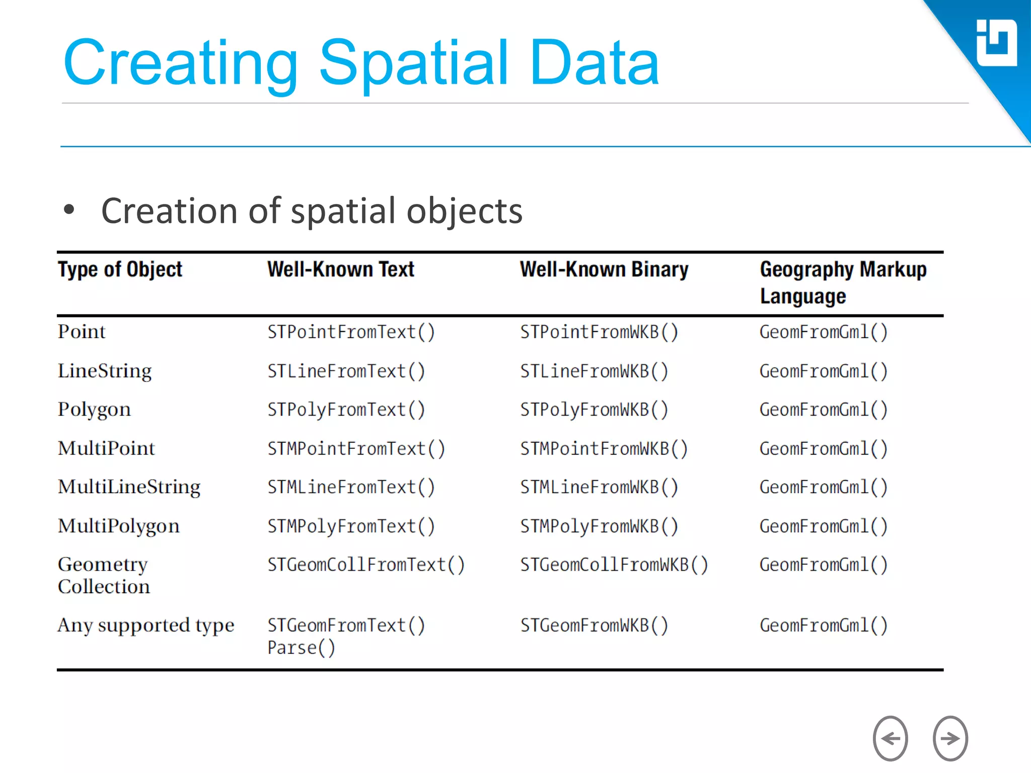
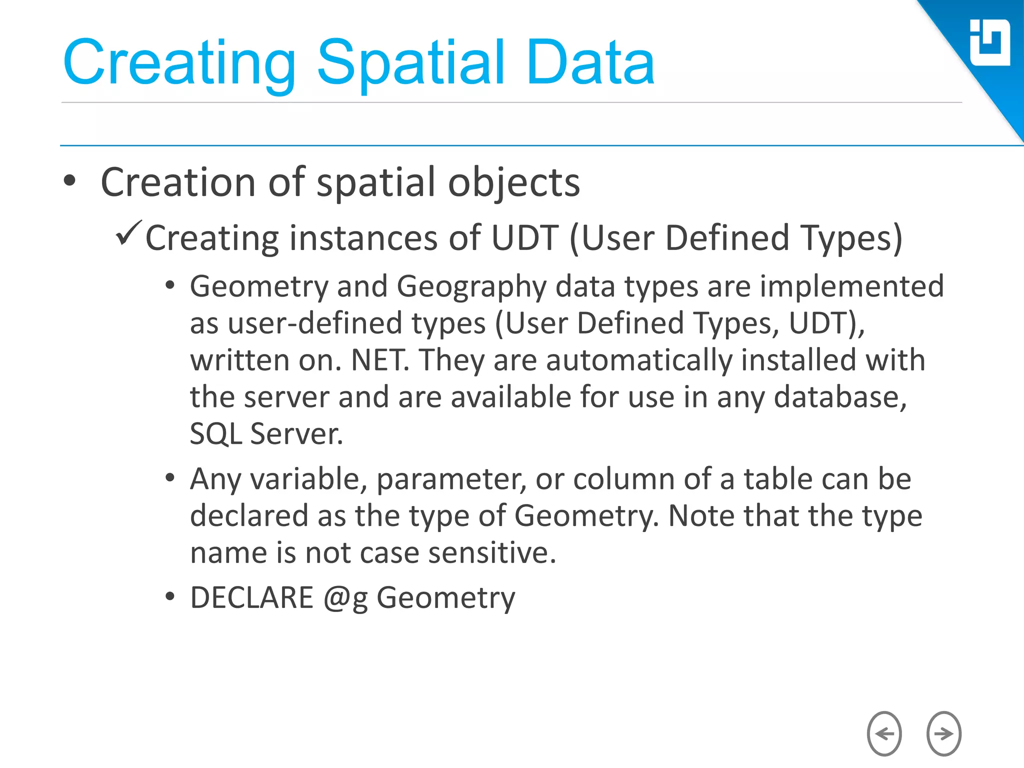
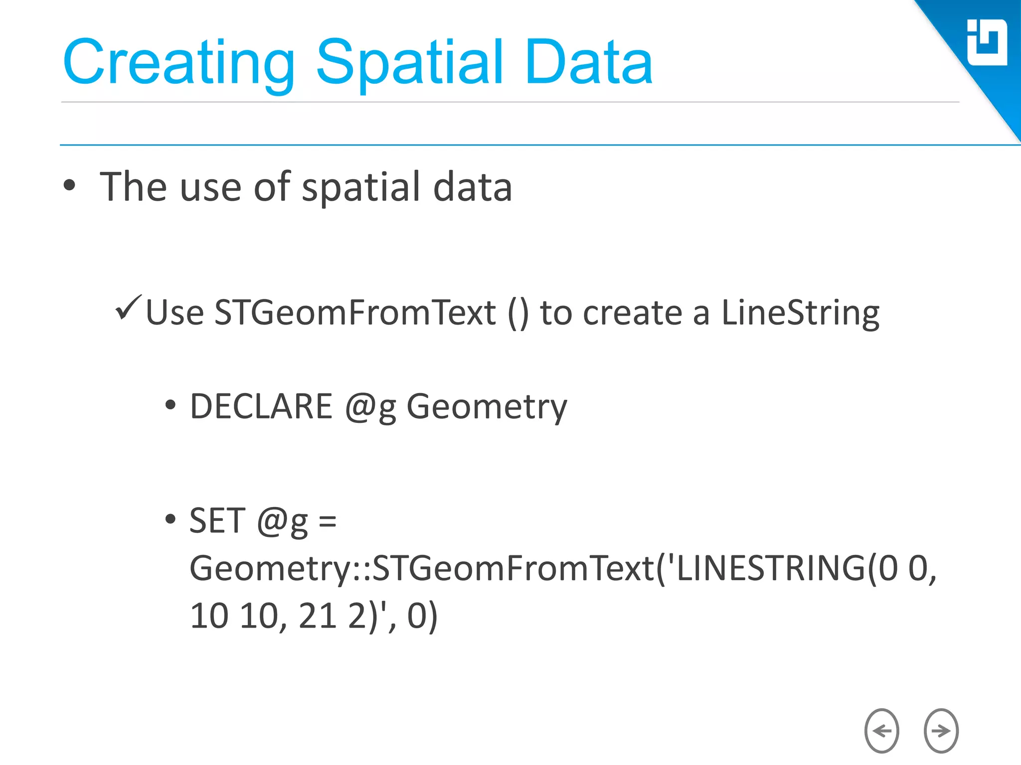
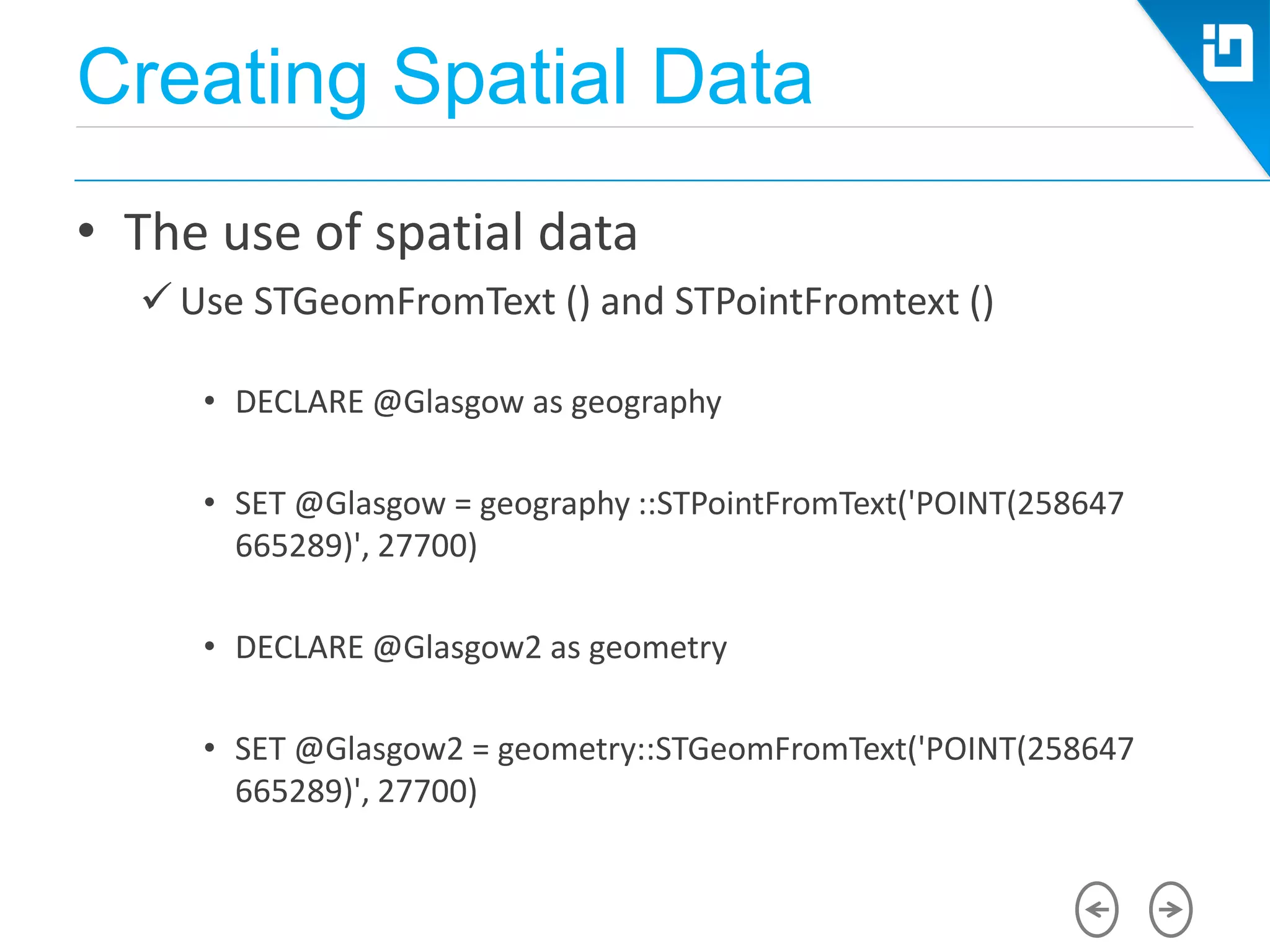
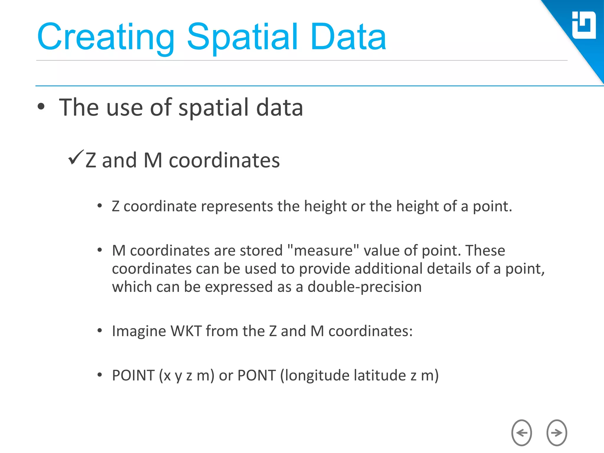
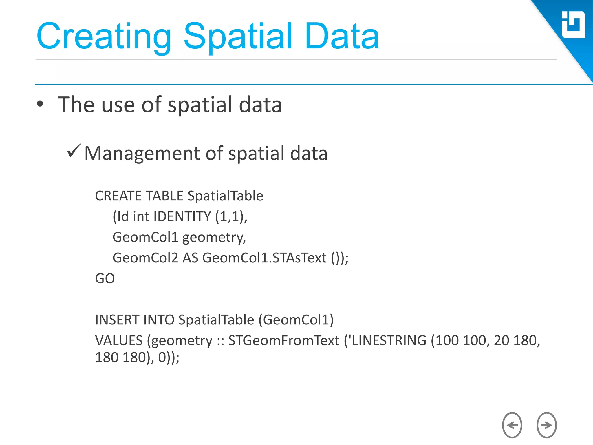
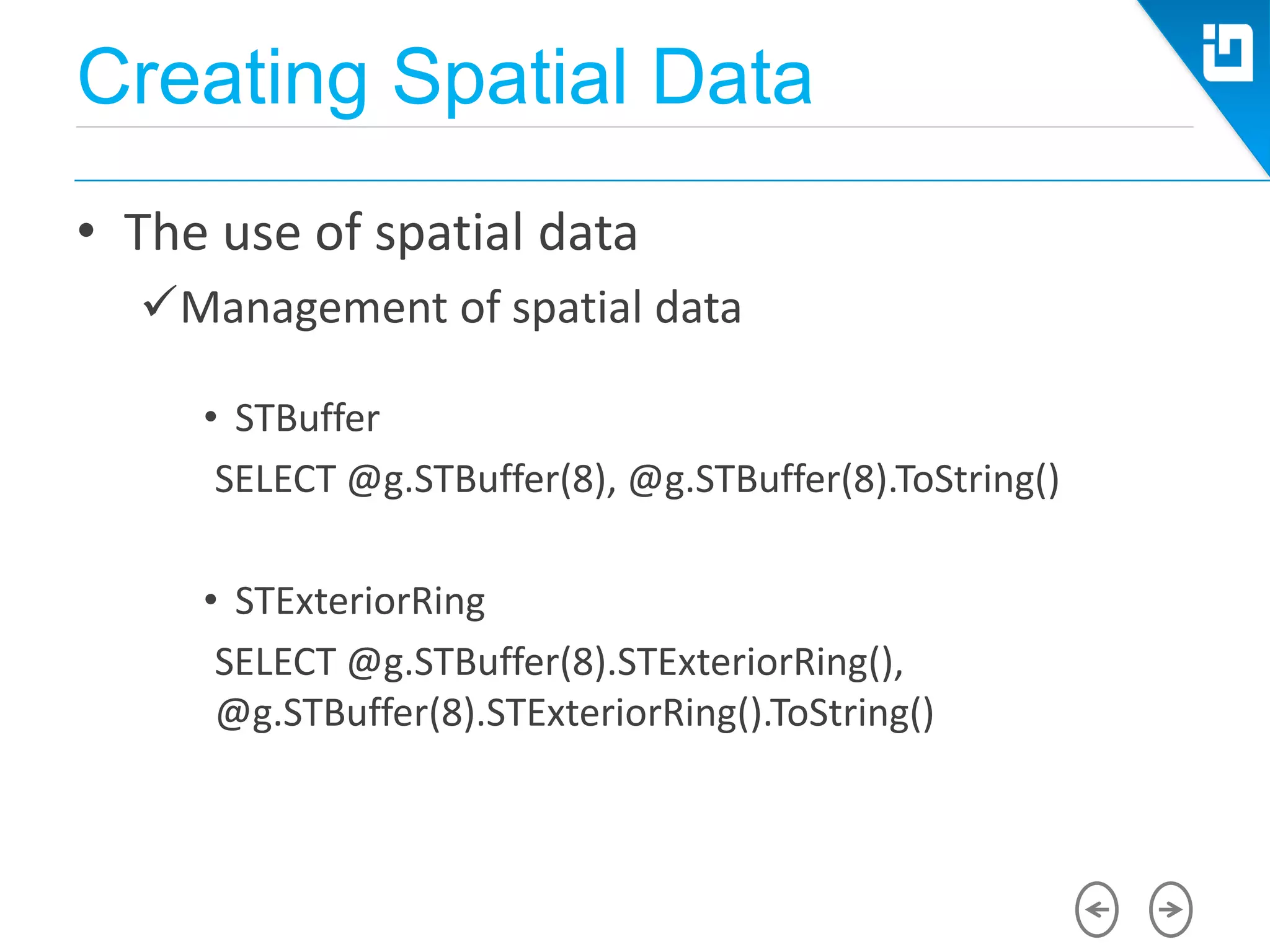
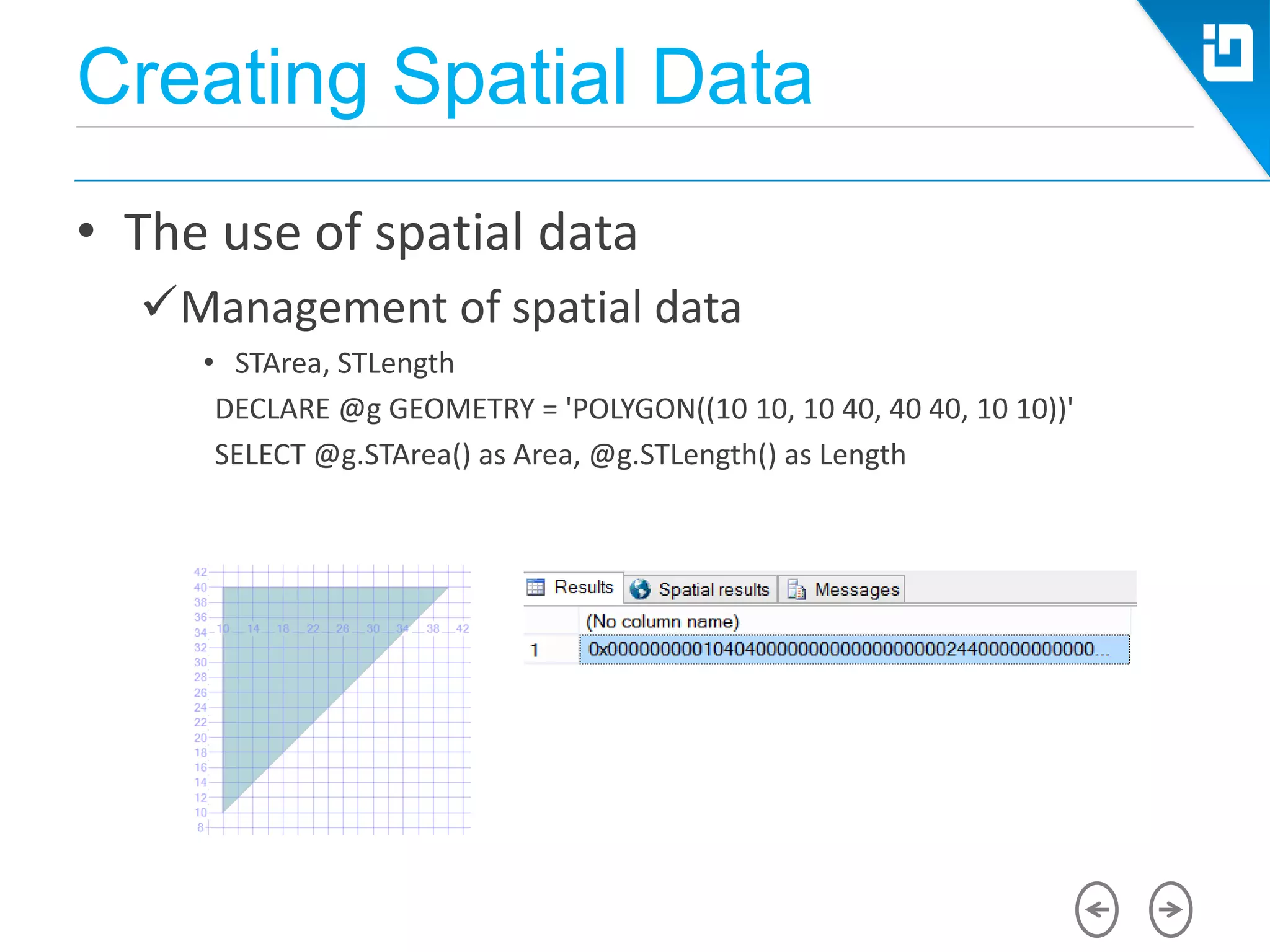
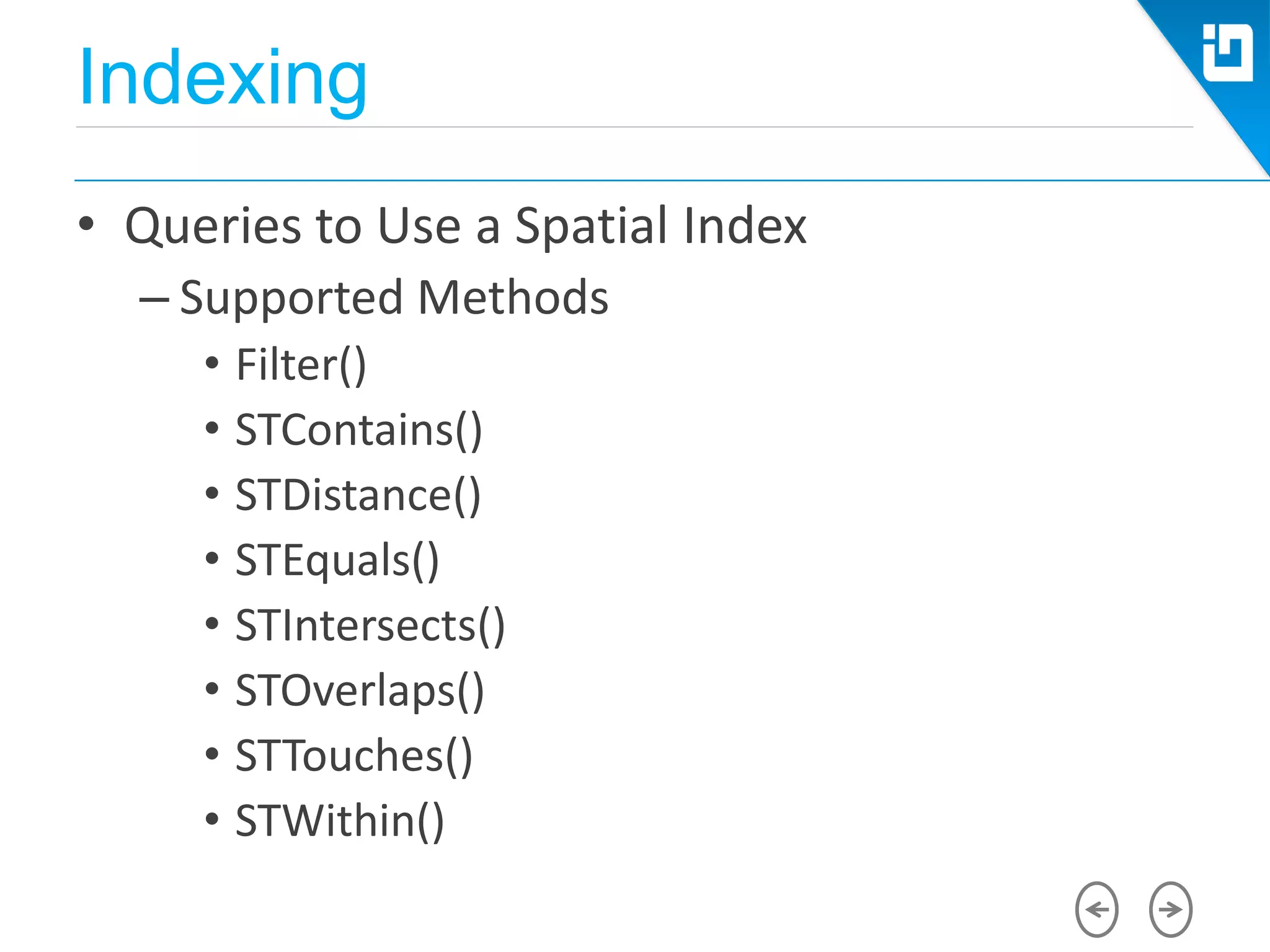
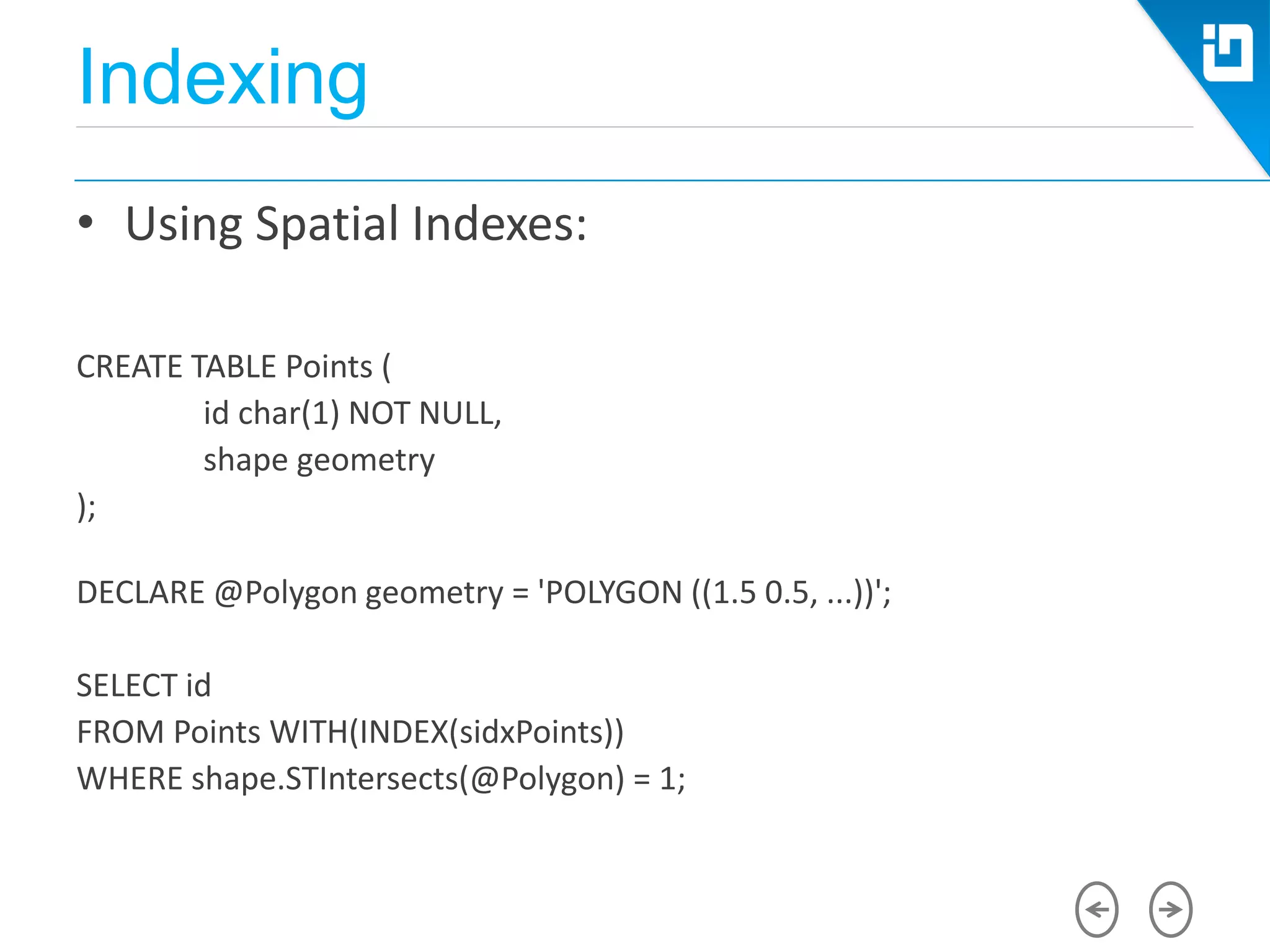
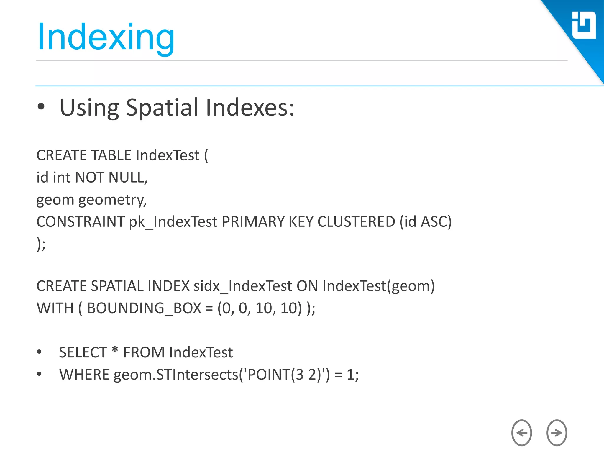
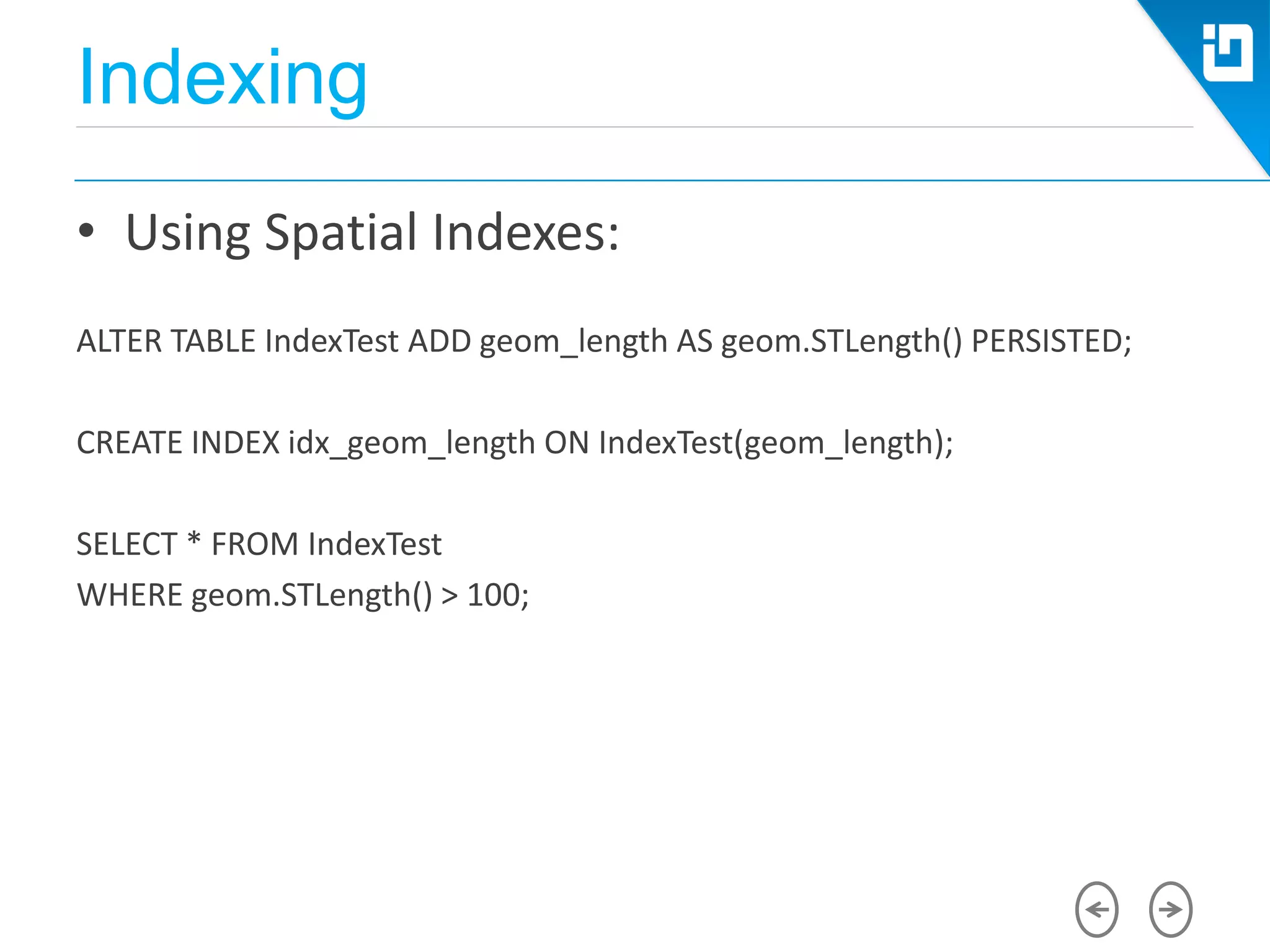
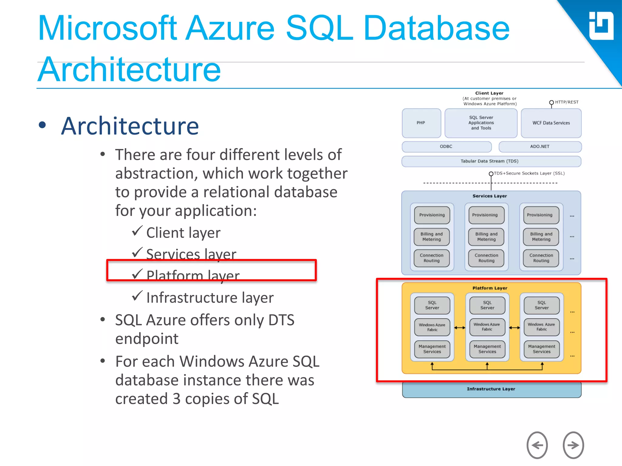
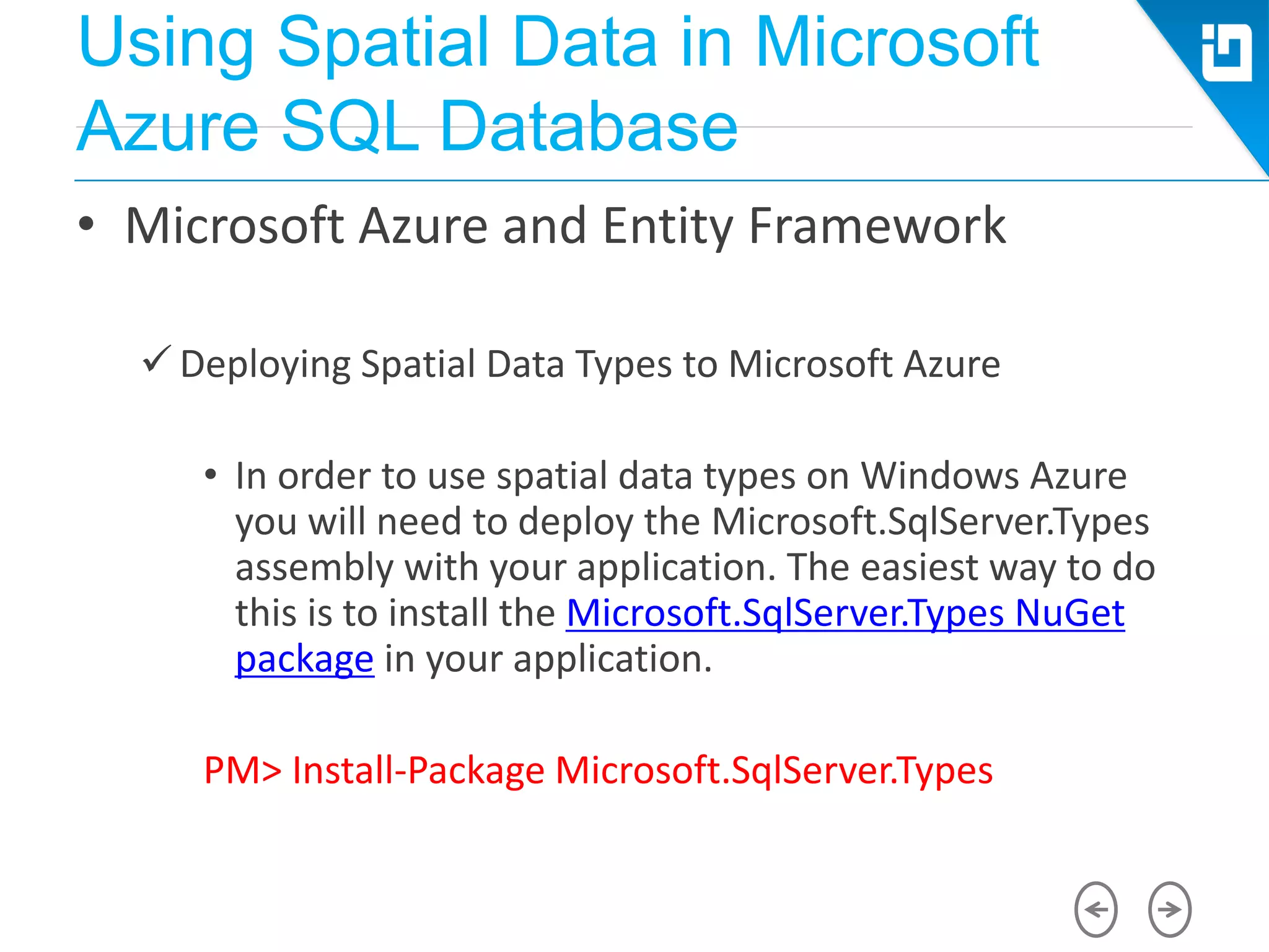
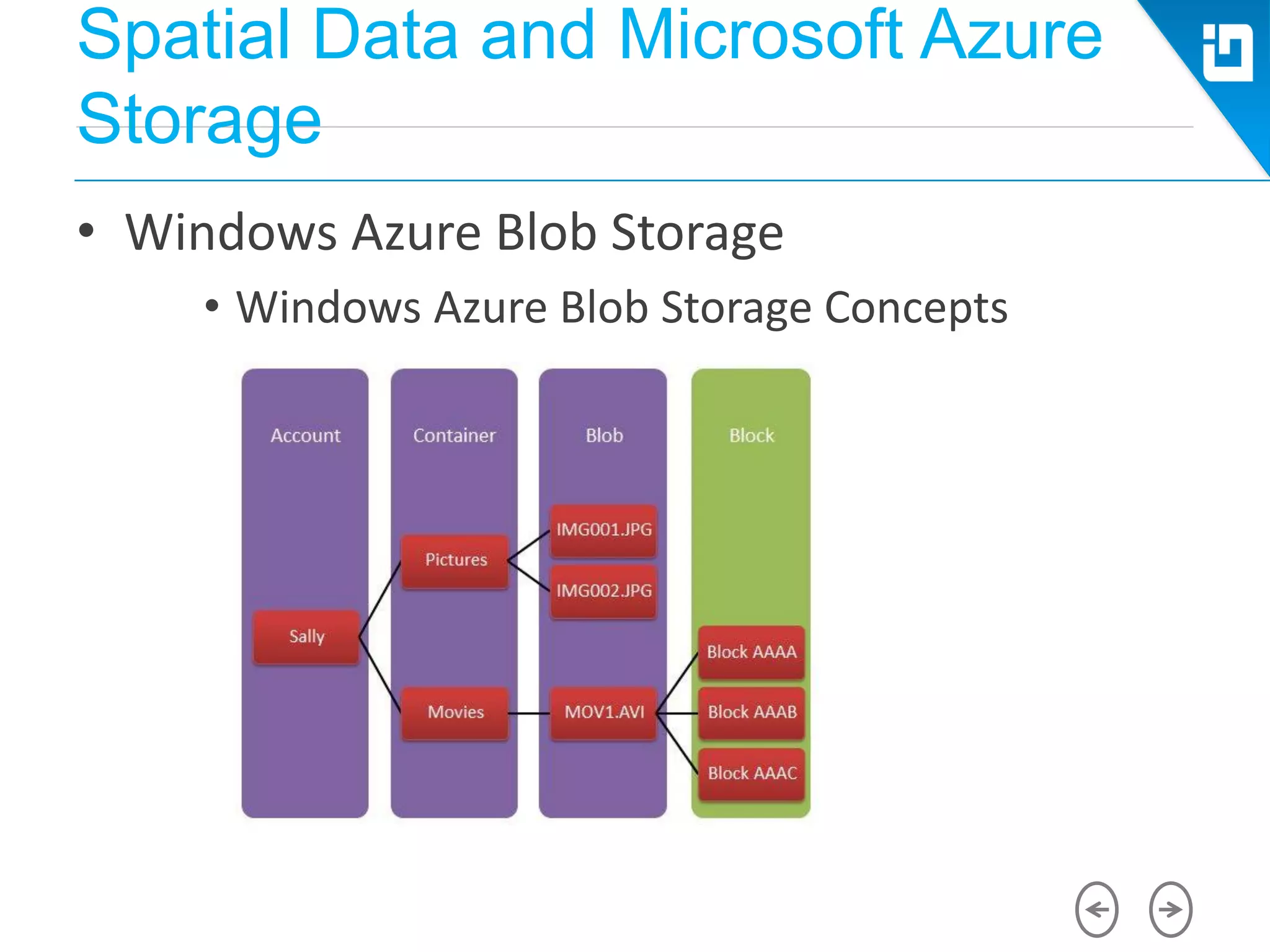
![Creating Spatial Data
• Using Stored Procedures
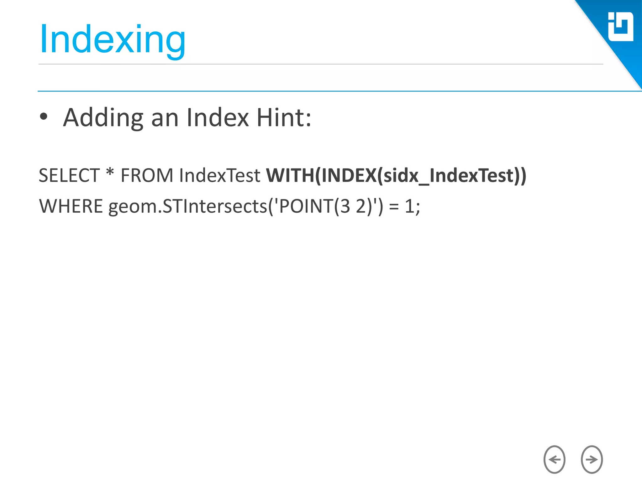
CREATE PROCEDURE [dbo].[get_SelectedData] @pCntrNameValue
nvarchar(255)
BEGIN
SET NOCOUNT ON;
SELECT geom.STBuffer(2) as geom, CNTRY_NAME, POP_CNTRY
FROM world WHERE CNTRY_NAME = @pCntrNameValue
END](https://image.slidesharecdn.com/cloud-conf-varna-2014-mihailmateev-spatial-data-and-microsoft-azure-sql-database-140727014137-phpapp01/75/Cloud-conf-varna-2014-mihail-mateev-spatial-data-and-microsoft-azure-sql-database-25-2048.jpg)
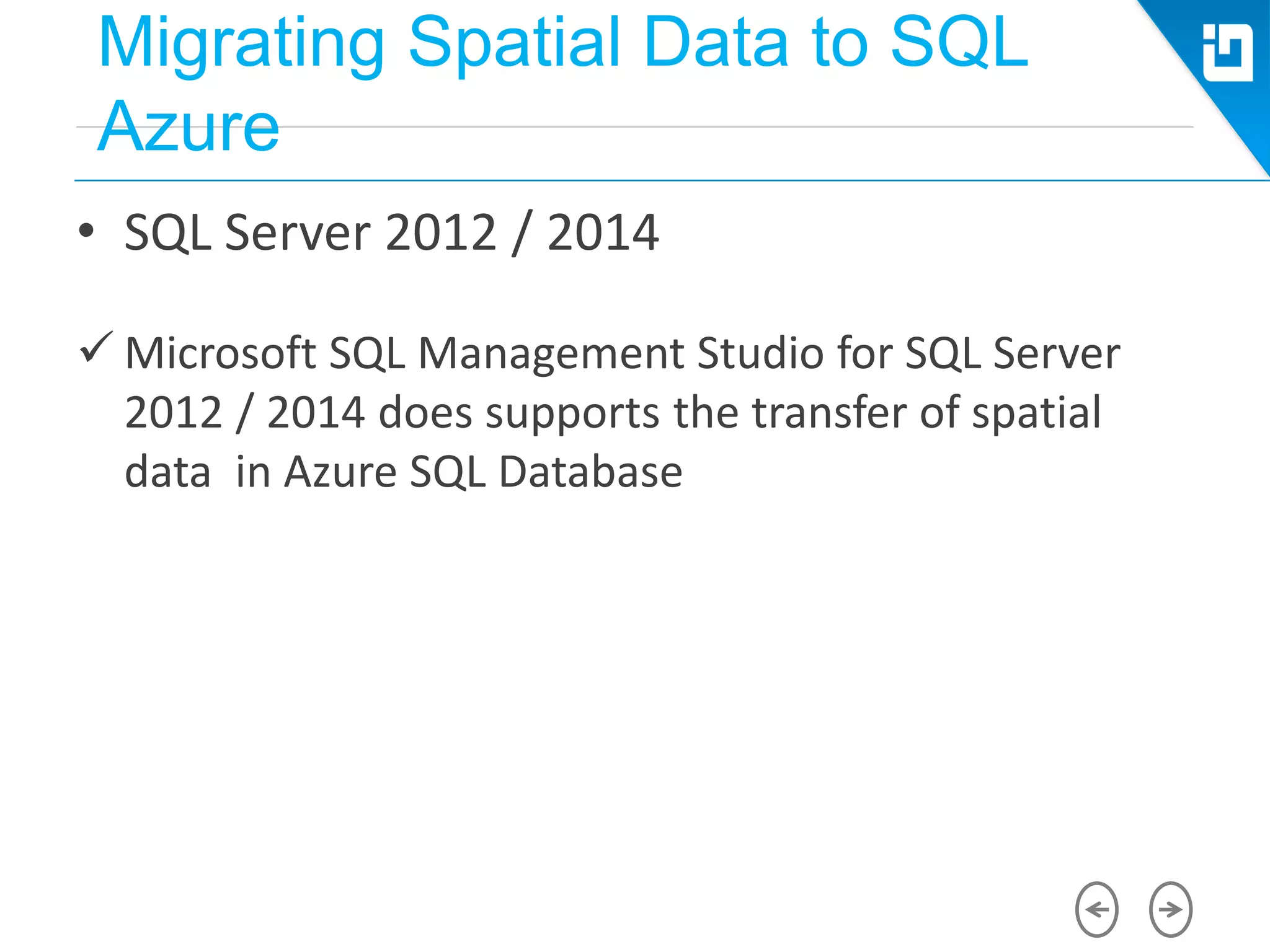
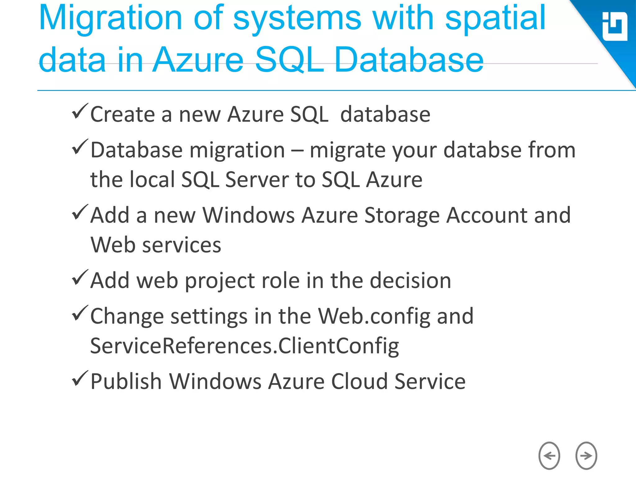
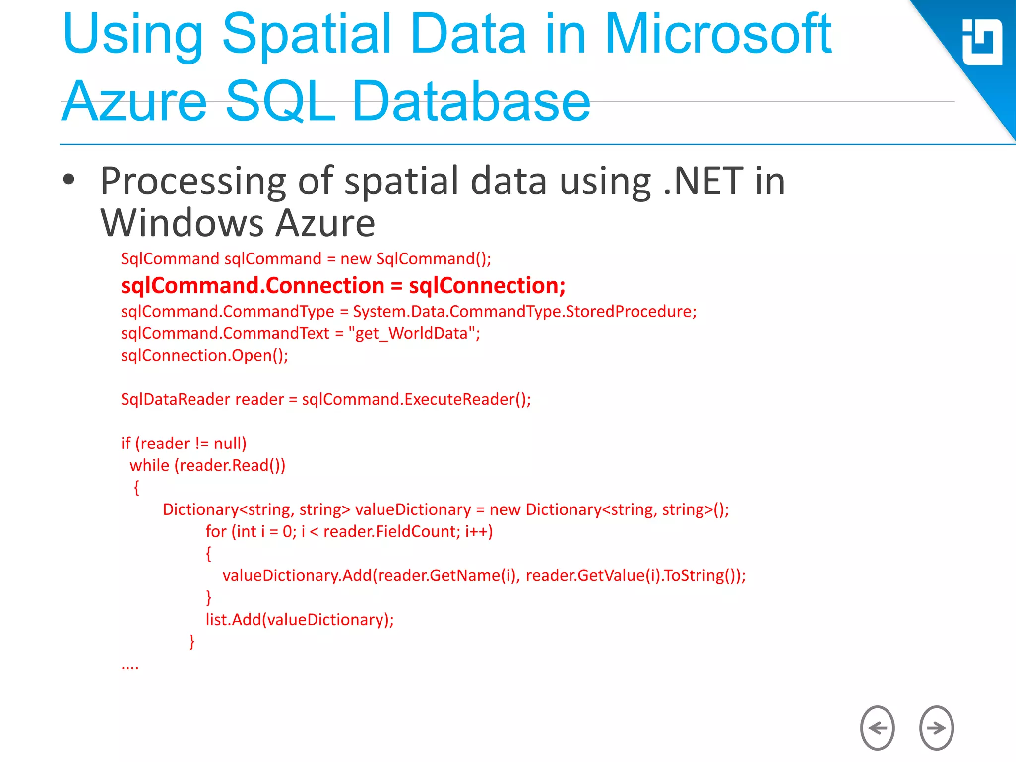
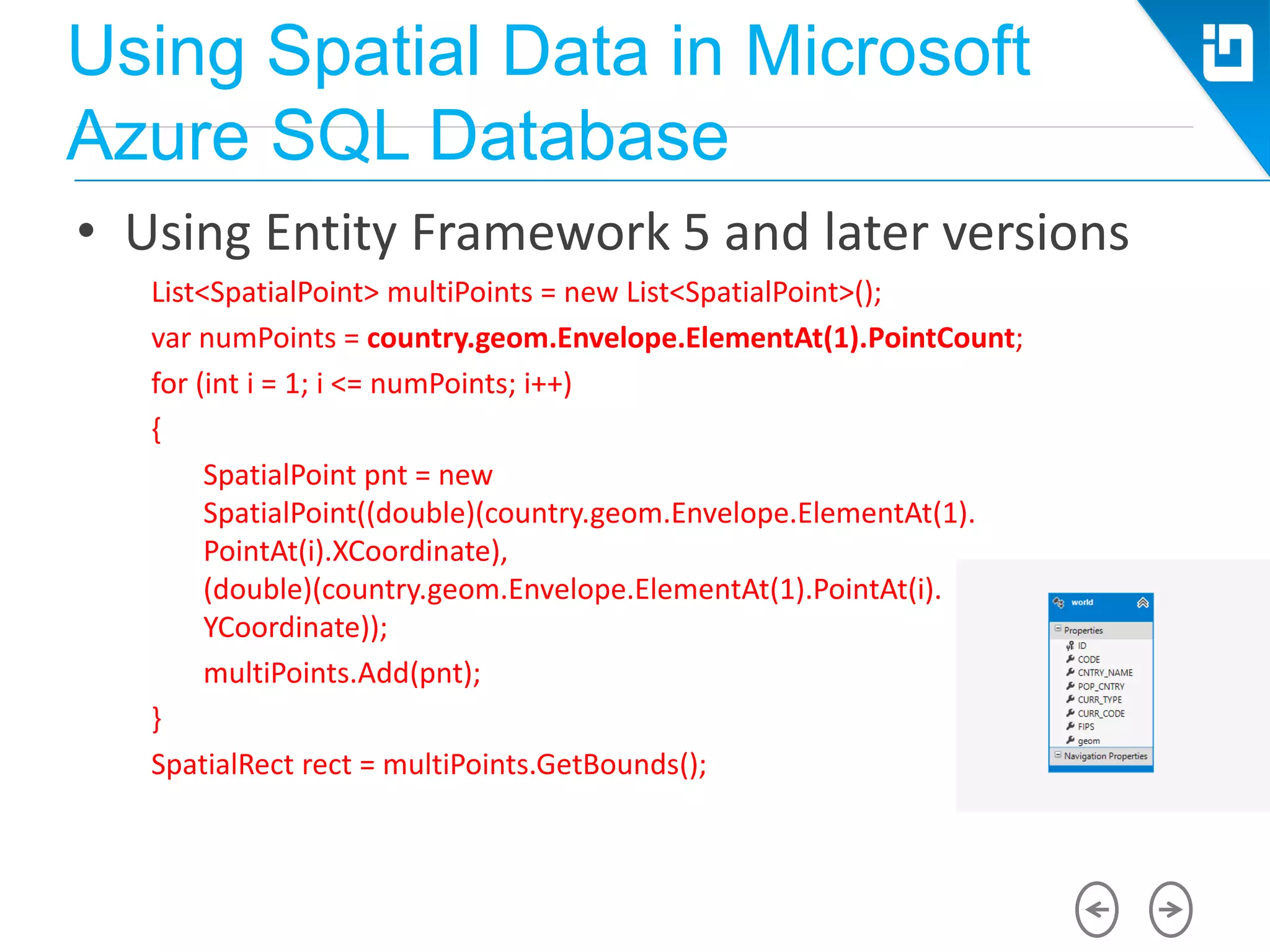


The document discusses the integration of spatial data with Microsoft Azure SQL Database, detailing concepts such as spatial references, data types, and their creation and management. It highlights the architecture of Azure SQL, its spatial support, and covers the migration of spatial data across SQL Server versions. Additionally, it outlines methods for utilizing spatial data in applications, including entity frameworks and Azure blob storage.


![Varna conf nodejs-oss-microsoft-azure[final]](https://cdn.slidesharecdn.com/ss_thumbnails/varnaconf-nodejs-oss-microsoft-azurefinal-140715005714-phpapp01-thumbnail.jpg?width=640&height=640&fit=bounds)