cf. city flows - A comparative visualization of bike sharing systems
•
6 likes•87,515 views

cf. city flows is a comparative visualization environment of urban bike mobility designed to help citizens casually analyze three bike-sharing systems in the context of a public exhibition space. By Till Nagel and Christopher Pietsch. Urban Complexity Lab, FH Potsdam <a>http://uclab.fh-potsdam.de/</a> This talk introduces the project and some of its goals and visualizations, and shows our design process in analyzing the data and designing the visualizations. cf. city flows was exhibited at the Streams and Traces in November 2015 in Berlin. Find more information at http://streamsandtraces.com/ More information coming soon.

Recommended
Recommended
More Related Content
What's hot
What's hot (20)
Similar to cf. city flows - A comparative visualization of bike sharing systems
Similar to cf. city flows - A comparative visualization of bike sharing systems (20)
More from Till Nagel
More from Till Nagel (20)
Recently uploaded
Recently uploaded (20)
cf. city flows - A comparative visualization of bike sharing systems
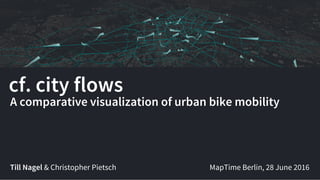
- 1. cf. city flows Till Nagel & Christopher Pietsch A comparative visualization of urban bike mobility MapTime Berlin, 28 June 2016
- 3. Urban data visualizations Our previous work
- 4. Touching Transport Shanghai Metro Flow Isoscope LiquiData
- 9. Concept General idea of the project
- 10. cf. city flows is a visualization of urban bike mobility.
- 11. cf. city flows is a visualization of urban bike mobility designed to help citizens analyze bike-sharing system.
- 12. cf. city flows is a visualization of urban bike mobility designed to help citizens casually analyze bike-sharing systems in the context of a public exhibition space.
- 13. cf. city flows is a visualization environment of urban bike mobility designed to help citizens casually analyze bike- sharing systems in the context of a public exhibition space. Large screens show the space of flows in bike sharing.
- 14. cf. city flows is a comparative visualization environment of urban bike mobility designed to help citizens casually analyze three bike-sharing systems in the context of a public exhibition space. Multiple large screens show the space of flows in bike sharing for three selected cities: New York, Berlin, and London.
- 15. cf. city flows is a comparative visualization environment of urban bike mobility designed to help citizens casually analyze three bike-sharing systems in the context of a public exhibition space. Multiple large screens show the space of flows in bike sharing for three selected cities: New York, Berlin, and London. Bike journeys are represented in three geospatial visualizations.
- 16. cf. city flows is a comparative visualization environment of urban bike mobility designed to help citizens casually analyze three bike-sharing systems in the context of a public exhibition space. Multiple large screens show the space of flows in bike sharing for three selected cities: New York, Berlin, and London. Bike journeys are represented in three geospatial visualizations designed to be progressively more analytical, from animated trails to small-multiple glyphs.
- 18. Bike Sharing Data Collecting, processing, and analyzing data sets
- 19. London Santander Cycles Berlin Call a Bike New York Citibike alanlevin RudolfSimon Nick-D
- 20. London Santander Cycles Berlin Call a Bike New York Citibike 20° C 3 June 2015 21° C 21° C alanlevin RudolfSimon Nick-D
- 25. Raw data
- 26. Visual Experiments Digging into the data
- 35. HERERoutingAPI
- 42. Design Considerations Comparing vastly different cities
- 46. Scaling maps
- 49. Three viewing modes Different levels of spatial and temporal granularity
- 50. • City-wide view • Station view • Small-multiple view Three viewing modes
- 51. City-wide view
- 52. Station view
- 54. Staged Analysis From Evocative to Comparative Visualizations
- 57. Transitions
- 70. Photo:StephanieNeumann Comparisons as conversation starters
- 73. Thank you. http://tillnagel.com – twitter: @tillnm Dr. Till Nagel & Christopher Pietsch Urban Complexity Lab, FH Potsdam