
More Related Content
Similar to CADERNO DE CAMPO-ríos22.pdf
Similar to CADERNO DE CAMPO-ríos22.pdf (20)
More from IES Primeiro de Marzo-Xunta de Galicia
More from IES Primeiro de Marzo-Xunta de Galicia (19)
Recently uploaded
Recently uploaded (20)
CADERNO DE CAMPO-ríos22.pdf
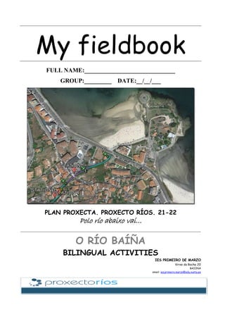
- 1. My fieldbook FULL NAME:______________________________ GROUP:_________ DATE:__/__/___ PLAN PROXECTA. PROXECTO RÍOS. 21-22 Polo río abaixo vai... O RÍO BAÍÑA BILINGUAL ACTIVITIES IES PRIMEIRO DE MARZO Virxe da Rocha 20 BAIONA email: ies.primeiro.marzo@edu.xunta.es
- 2. A.Label every structure you know HOMEWORK B. RIVER COURSES.Put each word on the suitable arrow STATION 1 lower, delta-estuary, river mouth, oxbow lake, tributary, middle, flood plain, waterfall, marsh, upper, meander,
- 3. LIST OF COMPULSORY AND RECOMMENDED EQUIPMENT AND CLOTHING.CLASS TIME Complete these two lists below. The first is the clothing and equipment that is compulsory (minimum) for all outdoor activities. Please consider your own specific needs and bring additional items if you will need them. The second list is recommended equipment (not compulsory but useful) -Compulsory clothing and equipment. ________________________________________________ ________________________________________________ ________________________________________________ ________________________________________________ ________________________________________________ ________________________________________________ ________________________________________________ ________________________________________________ ________________________________________________ ________________________________________________ ________________________________________________ ________________________________________________ ________________________________________________ -Recommended equipment (bring if you can) ________________________________________________ ________________________________________________ ________________________________________________ ________________________________________________ ________________________________________________ ________________________________________________ ________________________________________________ ________________________________________________ ________________________________________________ ________________________________________________ ________________________________________________ ________________________________________________ ________________________________________________
- 4. C.MAP WITH LOCATIONS D.CROSS RIVER SECTION. Label every structure STATION 1 Put each word on the suitable place: river bed, river bank, river channel, river level
- 5. RIVER PROJECT 21-22 TIMETABLE 2022 STATION 1 STATION 2 STATION 3 STATION 4 STATION 5 STATION 6 1st shift All groups 2nd shift Group 1 Group 2 Group 3 Group 5 3rd shift Group 5 Group 1 Group 2 Group 3 4th shift Group 3 Group 5 Group 1 Group 2 5th shift Group 2 Group 3 Group 5 Group 1 6th shift All groups Groups (underline the group you belong to) • Group 1. [participant1:……..…., participant2:…………, participant3:…………..] • Group 2 [participant1:……..…., participant2:…………, participant3:…………..] • Group 3. [participant1:……..…., participant2:…………, participant3:……...…..] • Group 4. [participant1:……..…., participant2:…………, participant3:……...…..] Stations Write the members of the station • STATION 1: ……………………………………. • STATION 2: ……………………………………. • STATION 3: ……………………………………. • STATION 4: ……………………………………. • STATION 5: ……………………………………. • STATION 5: …………………………………….
- 6. KEY VOCABULARY HOMEWORK Write down the new words you have learnt with Galician translations. • …………………………………………………………………………………………………………………………… • …………………………………………………………………………………………………………………………… • …………………………………………………………………………………………………………………………… • …………………………………………………………………………………………………………………………… • …………………………………………………………………………………………………………………………… • …………………………………………………………………………………………………………………………… • …………………………………………………………………………………………………………………………… • …………………………………………………………………………………………………………………………… • …………………………………………………………………………………………………………………………… • …………………………………………………………………………………………………………………………… • …………………………………………………………………………………………………………………………… • …………………………………………………………………………………………………………………………… • …………………………………………………………………………………………………………………………… • …………………………………………………………………………………………………………………………… • …………………………………………………………………………………………………………………………… • …………………………………………………………………………………………………………………………… • …………………………………………………………………………………………………………………………… • …………………………………………………………………………………………………………………………… • …………………………………………………………………………………………………………………………… • …………………………………………………………………………………………………………………………… • …………………………………………………………………………………………………………………………… • …………………………………………………………………………………………………………………………… • …………………………………………………………………………………………………………………………… • …………………………………………………………………………………………………………………………… • …………………………………………………………………………………………………………………………… • …………………………………………………………………………………………………………………………… • …………………………………………………………………………………………………………………………… • …………………………………………………………………………………………………………………………… • …………………………………………………………………………………………………………………………… • …………………………………………………………………………………………………………………………… • …………………………………………………………………………………………………………………………… • …………………………………………………………………………………………………………………………… • …………………………………………………………………………………………………………………………… • …………………………………………………………………………………………………………………………… • …………………………………………………………………………………………………………………………… • …………………………………………………………………………………………………………………………… • …………………………………………………………………………………………………………………………… • …………………………………………………………………………………………………………………………… • …………………………………………………………………………………………………………………………… • …………………………………………………………………………………………………………………………… • …………………………………………………………………………………………………………………………… • …………………………………………………………………………………………………………………………… • …………………………………………………………………………………………………………………………… • …………………………………………………………………………………………………………………………… • …………………………………………………………………………………………………………………………… • …………………………………………………………………………………………………………………………… • …………………………………………………………………………………………………………………………… • …………………………………………………………………………………………………………………………… • …………………………………………………………………………………………………………………………… • …………………………………………………………………………………………………………………………… • …………………………………………………………………………………………………………………………… • …………………………………………………………………………………………………………………………… • …………………………………………………………………………………………………………………………… • ……………………………………………………………………………………………………………………………
- 7. 7 E.GALICIAN RIVERS AND DRAINAGE BASINS. STATION 1 Where are you? Write our situation and draw our river at the right place on the map. • Our river is________________ and it is located on________ of Galicia and leads to_____________ocean.
- 8. 8 F.PARTS OF A WATERSHED. STATION 1 Put each word on the suitable arrow:main river channel, watershed, mouth, source of the river, tributary, tributary, confluence G.STREAM SECTIONS: MEASUREMENTS STATION 3 Group 1 Group 2 Group 3 Group 4 H.STREAM VELOCITY: THE FLOATING LEMON. STATION 3 • Time 1: • Time 2: • Time 3:
- 9. 9 10. Fieldsheet to study the river STATION 1 Date:____/______/_______ Time: :_________________ River: :__Baíña____ Basin: :_________________ Council: :_________________ Inspectors: :____________________________________________________________ Today’s weather: :_________________last 48-hour-weather: :___________________ UTM coordinates (x) start: 513322 UTM coordinates (y) start: 4662429 UTM coordinates (x) end: : 513045 UTM coordinates (y) end: 4661978 UTM coordinates (x) sample: 513133 UTM coordinates (y) sample: 466267 10.1. HYDROMORPHOLOGICAL QUALITY. STATION 2 A. Habitat • Is the water flowing? Yes No • Is the water level at the average of the season? Yes No • Frequency of rapids in the sample unit High 10 points Medium 8 points Occasional 6 points Water flowing, without rapids 4 points Stagnant 2 points • Number of categories (see the chart below) CATEGORIES IN THE SECTION • Rough and shallow water • Rough and deep water • Gentle and shallow water • Gentle and deep water 1 4 points 2 6 points 3 8 points all 10 points • Riverbed substrate Blocks and rocks % <10% 2 points >10% 5 points Cobble and gravel % <10% 2 points >10% 5 points Sand % <10% 2 points >10% 5 points Mud and clay % <10% 2 points >10% 5 points • Shade on the river Completely shaded 7 points Shaded with openings 10 points Many openings 5 points Unshaded 3 points • Heterogeneity Canopy scarce 2 points moderate 4 points excessive 6 points Logs/branches 2 points Exposed roots 2 points Natural dams 2 points • Aquatic vegetation coverage scarce <10% moderate>10% high>50% Moss and filamentous algae 5 points 10 points 5 points Algae attached to rocks 5 points 10 points 5 points Aquatic plants 5 points 10 points 5 points Final value:_____ Symbol IHF value Interpretation dry > 60 Healthy habitat. Excellent for development of macroinvertebrate communities. Total applicability of biological indexes. 40-60 Habitat can cope with a good macroinvertebrate community, but due to man or natural reasons, some elements are non-represented. Some restrictions in applicability of biological indexes will be found. < 40 Poor habitat. Very likely to obtain low values in biological indexes. Careful interpretation of biological values should be made.
- 10. 10 B. Riparian forest (river forest) STATION 3 • Write down the riparian forest quality given by QRISI index L (left riverbed)* R (right riverbed) * Good Moderate Poor *Downwards view C. Flow rate (volume of water) STATION 3 Stream width (m) _______ stream section (m2 ) _________ stream flow rate (m3 /s) _______ Steam depth (m) ________ stream velocity (m/s) _______ D. Disturbances STATION 4 • Water colour transparent murky muddy others ______ • Detected disturbances erosion oil foam legal effluent discharge illegal effluent discharge extractions water treatment plant vegetation removal material dumping canals weirs dams hydroelectric station irrigation canals sewage pipes others ______ • Water smell no smell rotten eggs sewage smell petrol smell others ______ • Field uses L* R* With trees Riparian forest bush land beaches reforestation wetland Rock field Crops Plantation Poplar plantation Abandoned crops Man-disturbed areas Fires Lumbering Urban areas Leisure areas Roads Mining Others _______ *Downwards view • Sewage pipe Number of pipes in the section_______ Colour of the effluent______________ Smell of the effluent_______________ • Rubbish/ garbage plastics paper tins/cans glass tyres metals electrical appliances Others______ • Acoustic pollution punctual noise continuous noise origin/type___________ • Luminic pollution low medium high origin/type___________
- 11. 11 10.2. PHYSICO-CHEMICAL WATER QUALITY STATION 4 10.3. BIOLOGICAL QUALITY. AT THE LAB STATION 5 A. Macroinvertebrates • Trichoptera caddishfly larvae Brachycentridae Leptoceridade Philopotamidae Rhyacophilidae Hydropsychidae Limnephilidae Polycentropodidae Sericostomatidae Others________________ • Plecoptera stonefly larvae Leuctridae Perlidae Nemouridae Perlodidae Others________________ • Ephemeroptera mayfly larvae Baetidae Ephemerellidae Heptageniidae Caenidae Ephemeridae Leptophlebiidae Others________________ • Diptera Blephariceridae Culicidae Syrphida Chironomidae Simuliidae Tipulidae Others________________ • Coleoptera beetle larvae Dryopidae Elmidae Haliplidae Dytiscidae Gyrinidae Hydrophilidae Others________________ • Heteroptera Corixidae Hydrometridae Notonectidae Veliidae Gerridae Nepidae Pleidae Others________________ • Planaria flatworm • Oligochaeta earthworm • Arachnida (Hydracarina) water mite • Megaloptera (Sialidae) earthworm • Hirudinea Erpobdellidae leech Glossiphoniidae Others________________ • Crustacea Asellidae Cladocera water flea Gammaridae scud Astacidae Copepoda copepod Others________________ • Mollusca snails and mussels Ancylidae Lymnaeidae Planorbidae Unionidae Hydrobiidae Physidae Sphaeriidae mussel Others________________ • Odonata dragonfly and damselfy larvae Aeshnidae Coenagrionidae Lestidae Calopterygidae Gomphidae Libellulidae Others________________ MACROINVERTEBRATE INDEX Very good Good Moderate Deficient Bad B. Biodiversity STATION 5 Aquatic plants.............................................................................................................. Berro Buño Callistriche stagnalis Carrizo común Cercodiana Espiga de auga • Nitrates 0 mg/l 5 mg/l 20 mg/l > 40 mg/l • Oxygen dissolved 0 mg/l 4 mg/l 8 mg/l Transparency/turbidity none sector 1 sector 2 sector 3 sector 4 • pH 4 5 6 7 8 9 10 Saturation % (see the chart below) Temperature__ ºC
- 12. 12 Fento real Fontinalis antypyretica Glicerapio Lentella de auga Lirio amarelo Pé de boi Platanaria Ranúnculo acúatico Others______________ Trees.............................................................................................................. Abelaira Ailanto Ameneiro Bidueiro Carballo Chopo branco Chopo negro Eucalipto Falsa acacia Freixo Lamiagueiro Loureiro Plátano Pradairo Sabugueiro Sanguiño Salgueiro Salgueiro branco Salgueiro común Ulmeiro Vimbieira Others______________ Reptiles.............................................................................................................. Cobra de colar Cobra sapeira Lagarto das silveiras Sapoconcho común Tartaruga de Florida Others______________ Mammals.............................................................................................................. Auganeiro Lontra Musgaño acuático Rata de auga Visón americano Others______________ Amphibian.............................................................................................................. Limpafontes común Limpafontes palmado Larvas de limpafontes Ovos de sapo Ovos de ra Píntega Píntega verde Ra patilonga Ra de San Antón Ra verde Ra vermella Sapiño comadrón Sapo corriqueiro Sapo de esporóns Sapiño pintoxo Sapo das veigas Saramaganta Others______________ Fish.............................................................................................................. Anguía Eel Barbo Bermelliña Boga Carpa Escalo Espiñento Gambusia Gobio Gubgeon Lamprea Lamprey Perca americana Reo Sábalo Salmón Salmon Troita Trout Zamborca Others______________ Birds.............................................................................................................. Alvanco real Bilurico bailón Cerceta común Corvo mariño Gaivota Galiñola negra Garza real Lavandeira branca Lavandeira real Martiño peixeiro Merlo rieiro Parrulo cristado Pita de auga Porrón común Reiseñor de auga Others______________ Invasive species.............................................................................................................. • Fauna Ameixa asiática Caranguexo sinal americano Caranguexo vermello americano Carpa Gambusia Mexillón de Nova Zelandia Perca americana Sapoconcho de Florida Troita arco-iris Visón americano Others______________ • Flora Acacia negra Ailanto Cala Campaíña Cana Egeria densa Elodea canadensis Eucalipto Falsa acacia Fento de auga Herba da pampa Herba tintureira Mimosa Pasto mel Sebes Tradescantia Tritonia Others______________ NOTES:______________________________________________________________________
- 13. 13 At the lab: macroinvertebrates STATION 5 Check the main groups of macroinvertebrates you watch with the aid of lab identification sheets and lens. Choose the more appropriated drawing and write I or N if they are insects or not. INSECTS OR NON-INSECT GROUPS An insect is an invertebrate (an animal with no spine) that has three-pairs of legs and three body divisions: the head is where the mouth, antenna and eyes are located; the thorax is the attachment site for the legs and wing pads; and the abdomen, which often has a variety of structures attached including filaments gills and tails. Gills are usually leaf-like, plate-like, or thin filaments. Non-insect groups are a big variety of different invertebrates without these characteristics. ❑ ❑ ❑ ❑ ❑ ❑ ❑ ❑ ❑ ❑ ❑ ❑ ❑ ❑ ❑ ❑ ❑ ❑ ❑ ❑ ❑ ❑ ❑
- 14. 14 TYPES OF LEAVES STATION 5 Paste or draw here the leaves that you picked and write the name of the tree/bush/weed in Galician with its scientific name. (At least 5 species) e.g. Galician name Ameneiro Scientific name (Alnus glutinosa) Galician name:__________________ Scientific name: _________________ Galician name:__________________ Scientific name: _________________ Galician name:__________________ Scientific name: _________________
- 15. 15 TYPES OF LEAVES STATION 5 Guess who game STATION 5 Write a short description of the living organism you role-played in this game. The description should include the main characteristics you need to identify it. I am a _____________________________________________________________________ ____________________________________________________________________________ ____________________________________________________________________________ ____________________________________________________________________________ ____________________________________________________________________________ ____________________________________________________________________________ ____________________________________________________________________________ Galician name:__________________ Scientific name: _________________ Galician name:__________________ Scientific name: _________________
- 16. 16 The Alphabetical Game “Pasapalabra” STATION 6 -Write down the correct word to each letter. e.g. river A B C D E F G H I J K L M N Ñ O P Q R S T U V W X Y Z
- 17. 17 Final Reflections HOMEWORK Answer the following questions when you finished all the activities. 1. What is River-project? ____________________________________________________________________ ____________________________________________________________________ ____________________________________________________________________ ____________________________________________________________________ ____________________________________________________________________ 2. Which rivers are studied at our school? ____________________________________________________________________ ____________________________________________________________________ ____________________________________________________________________ 3. What is the main objective of this project? ____________________________________________________________________ ____________________________________________________________________ ____________________________________________________________________ 4. Which activity did you like the most? Why? ____________________________________________________________________ ____________________________________________________________________ ____________________________________________________________________ 5. Which activity did you like the least? Why? ____________________________________________________________________ ____________________________________________________________________ ____________________________________________________________________
- 18. 18 CHECK WHAT YOU HAVE LEARNT . HOMEWORK Paint these two pictures and label as many structures as you can!