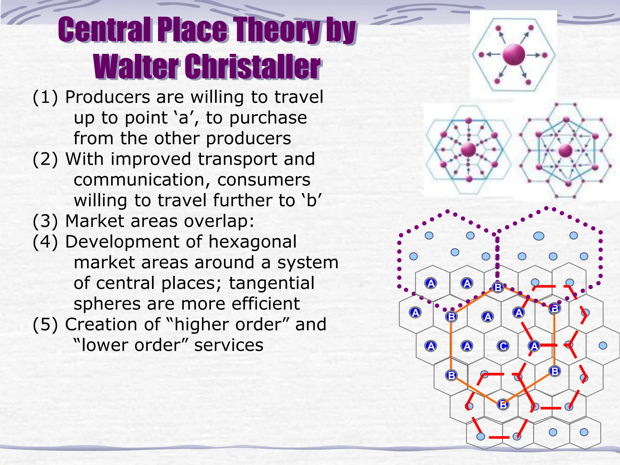
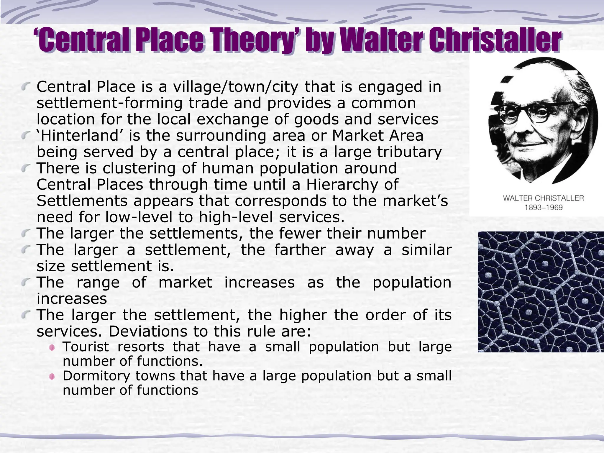
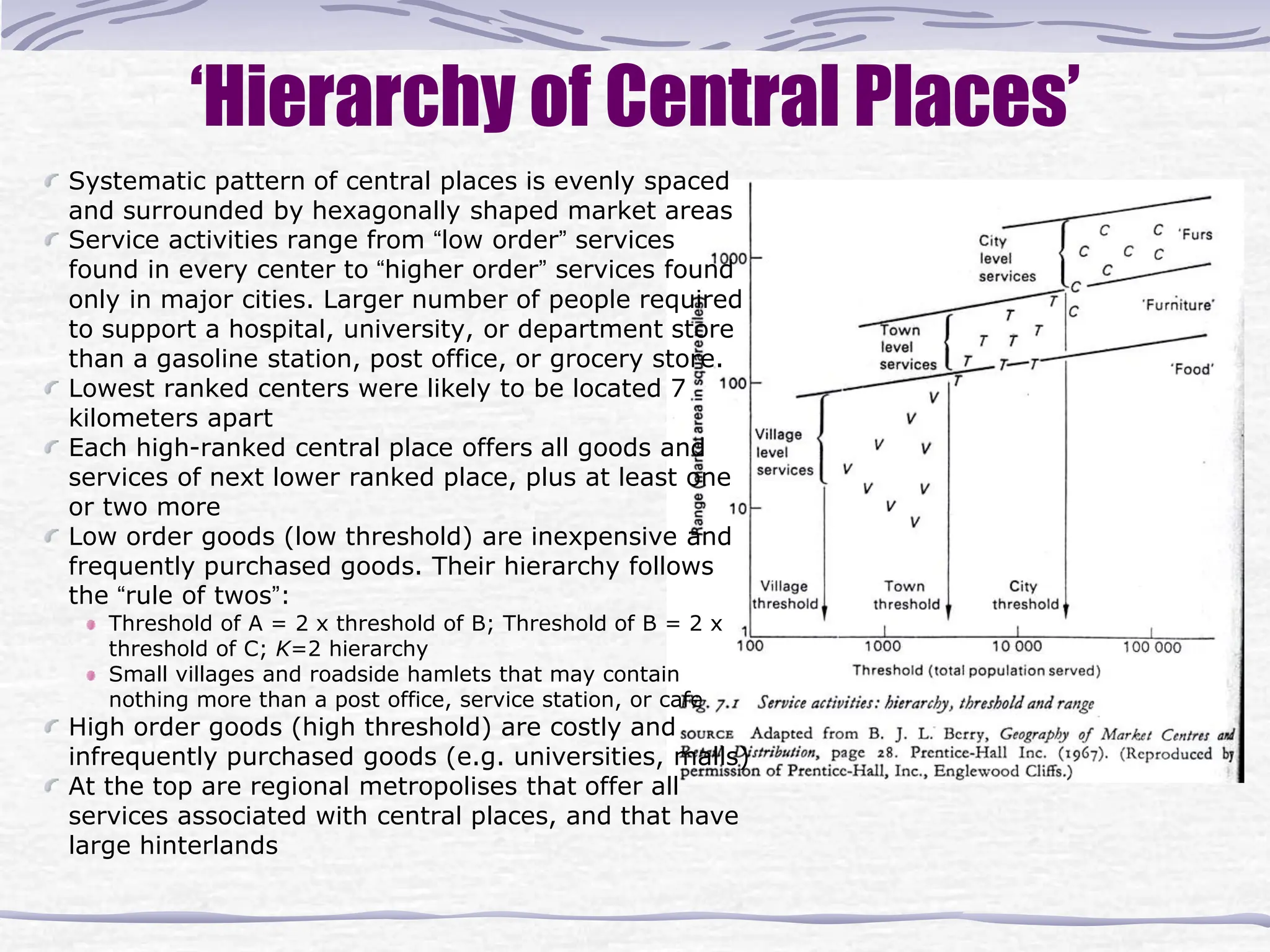
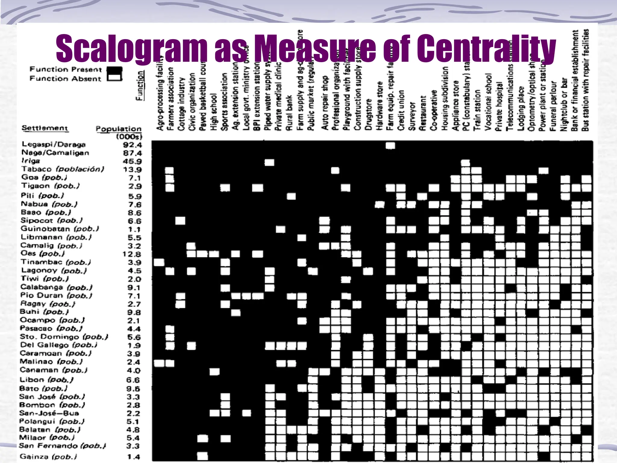
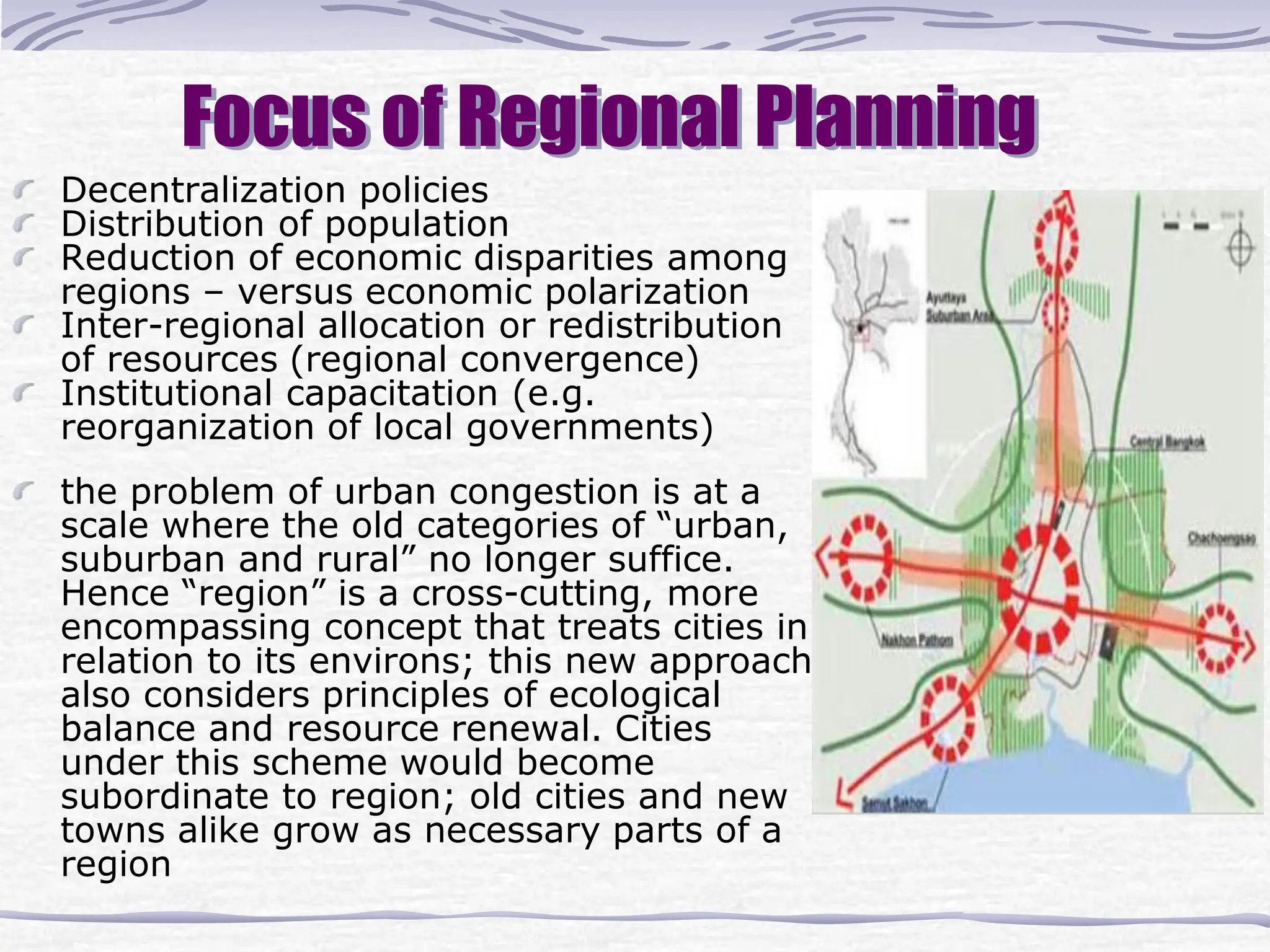
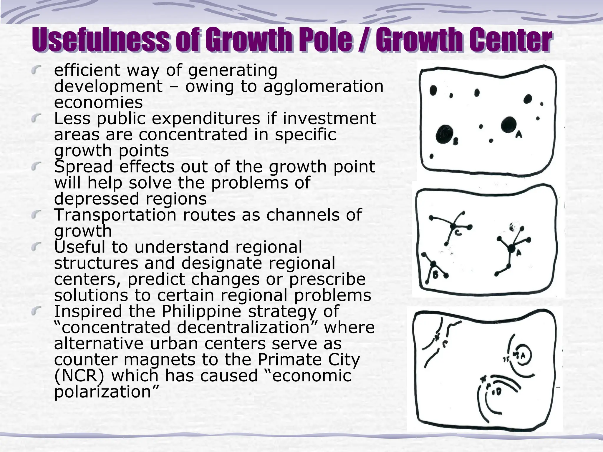
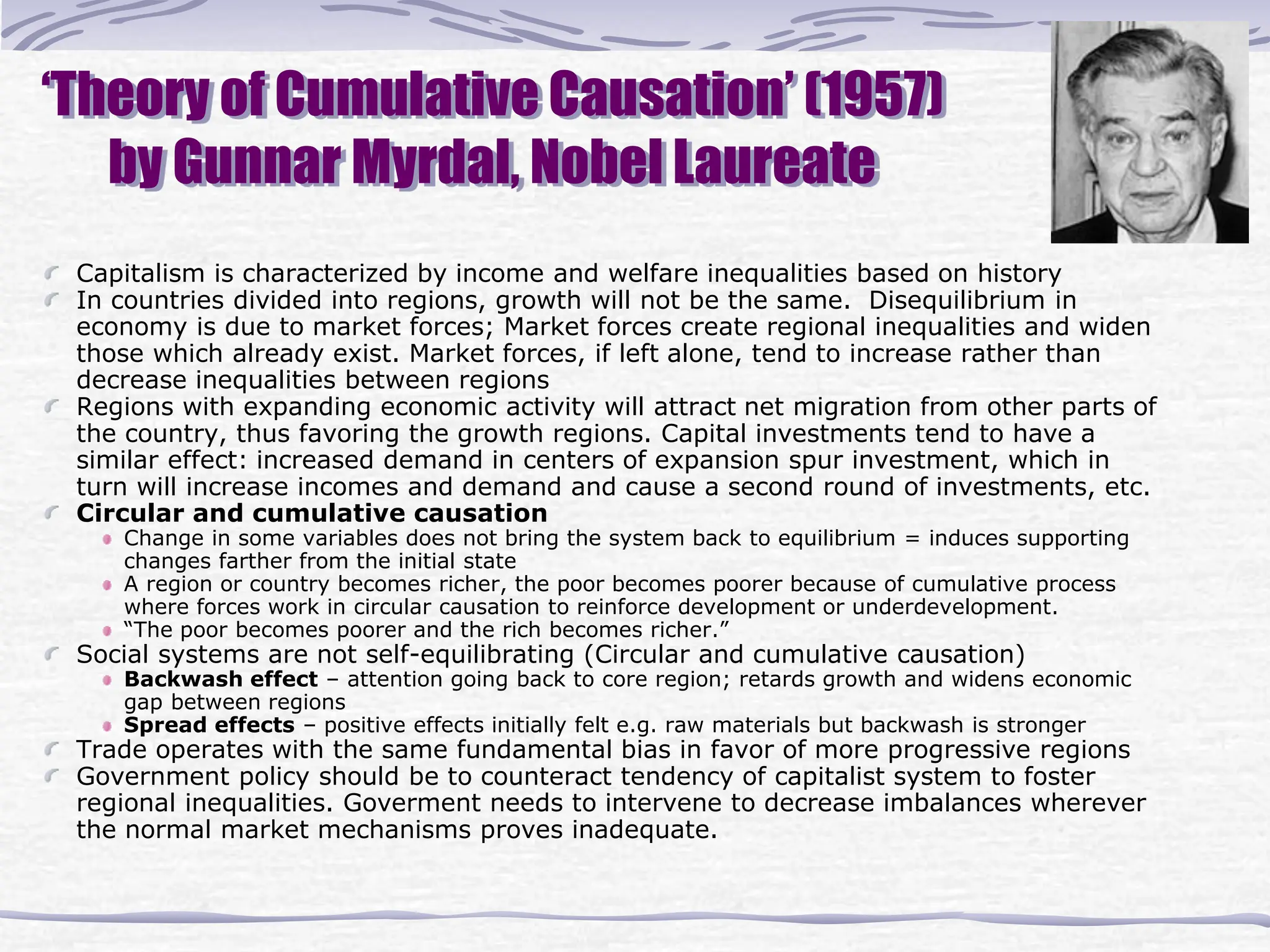
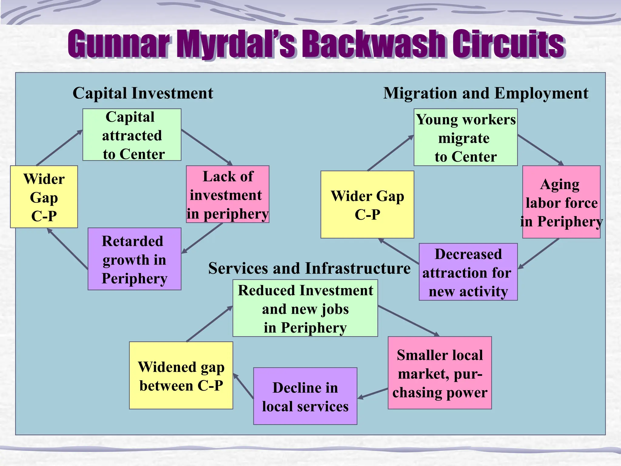
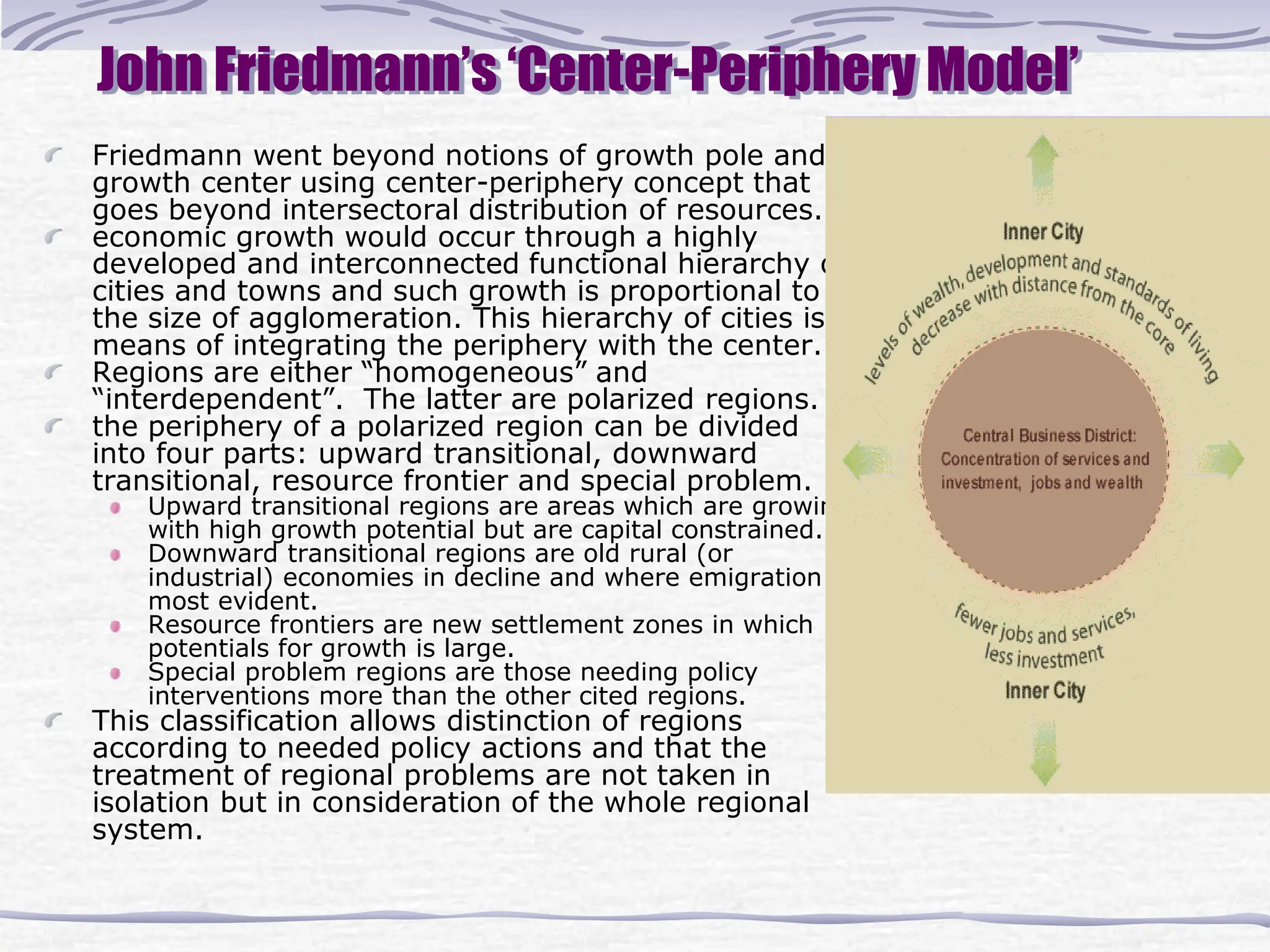
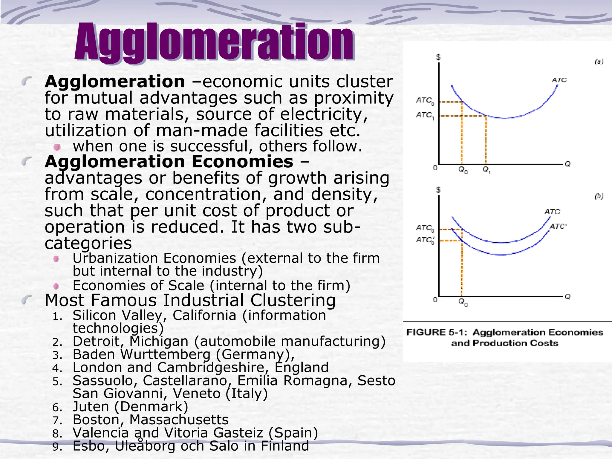
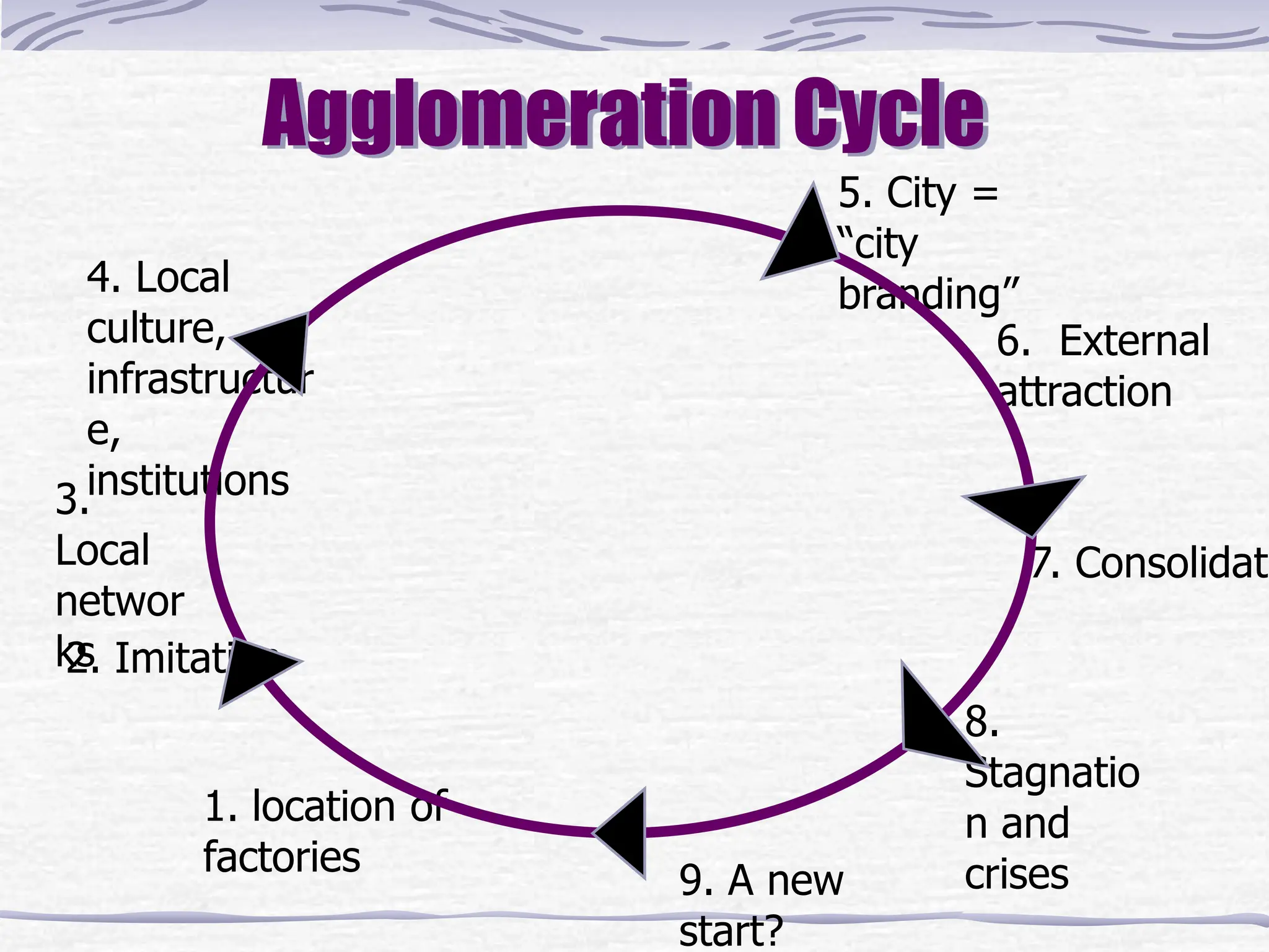
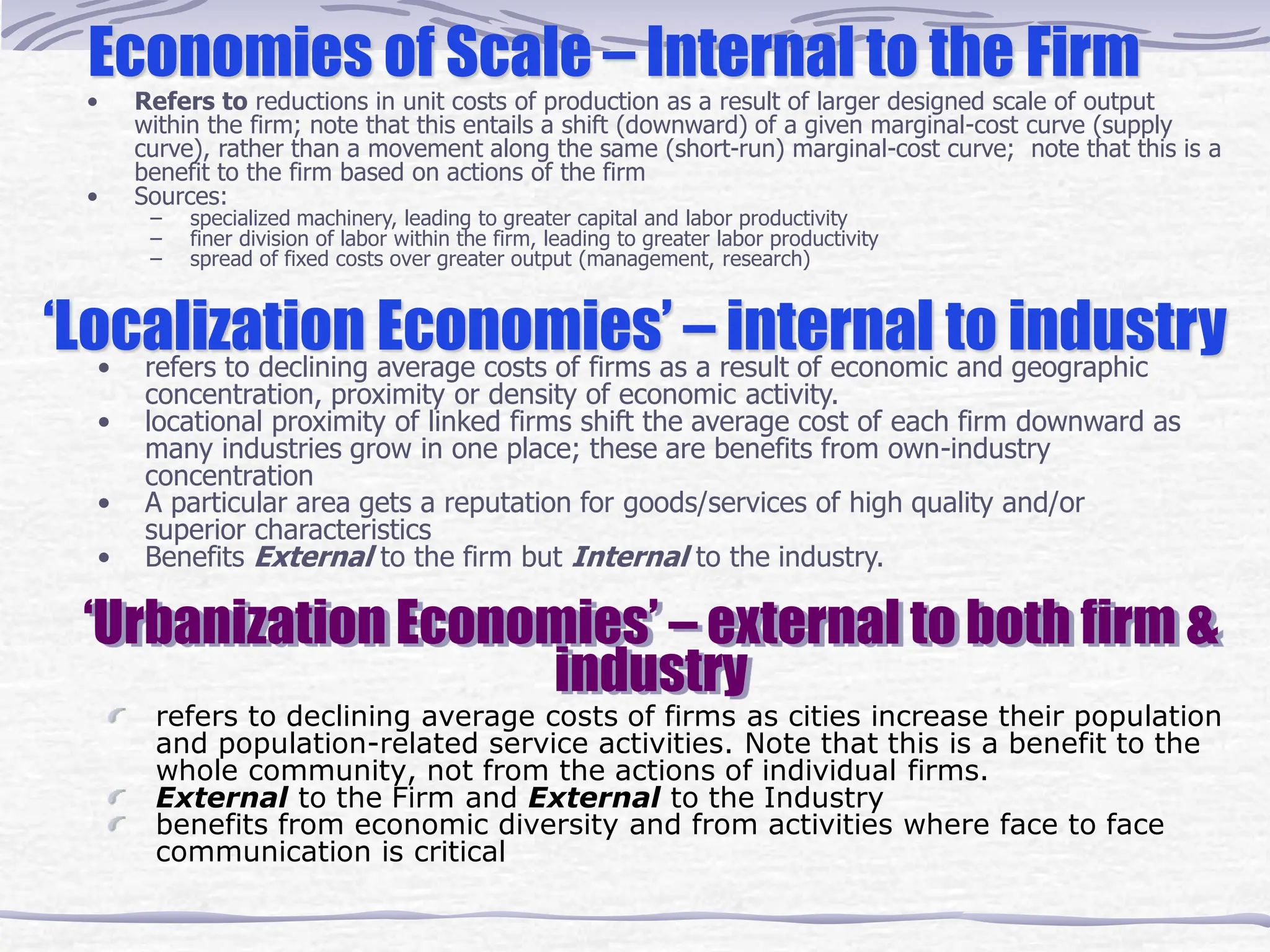
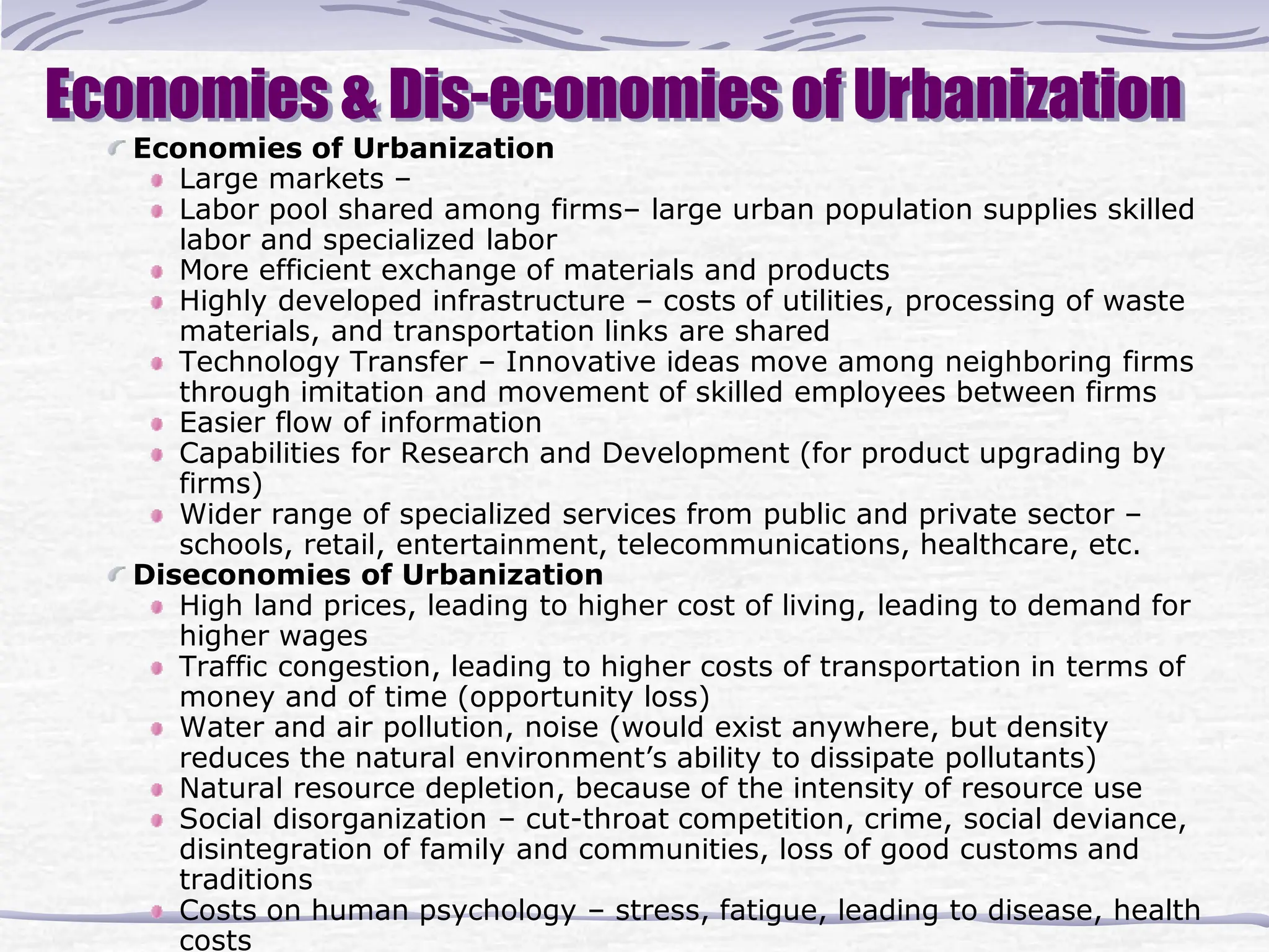
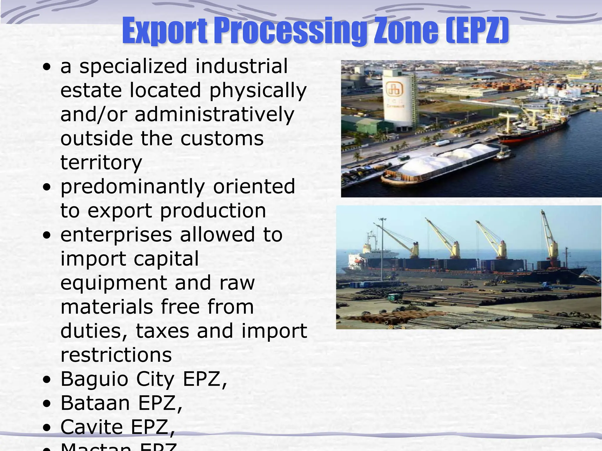
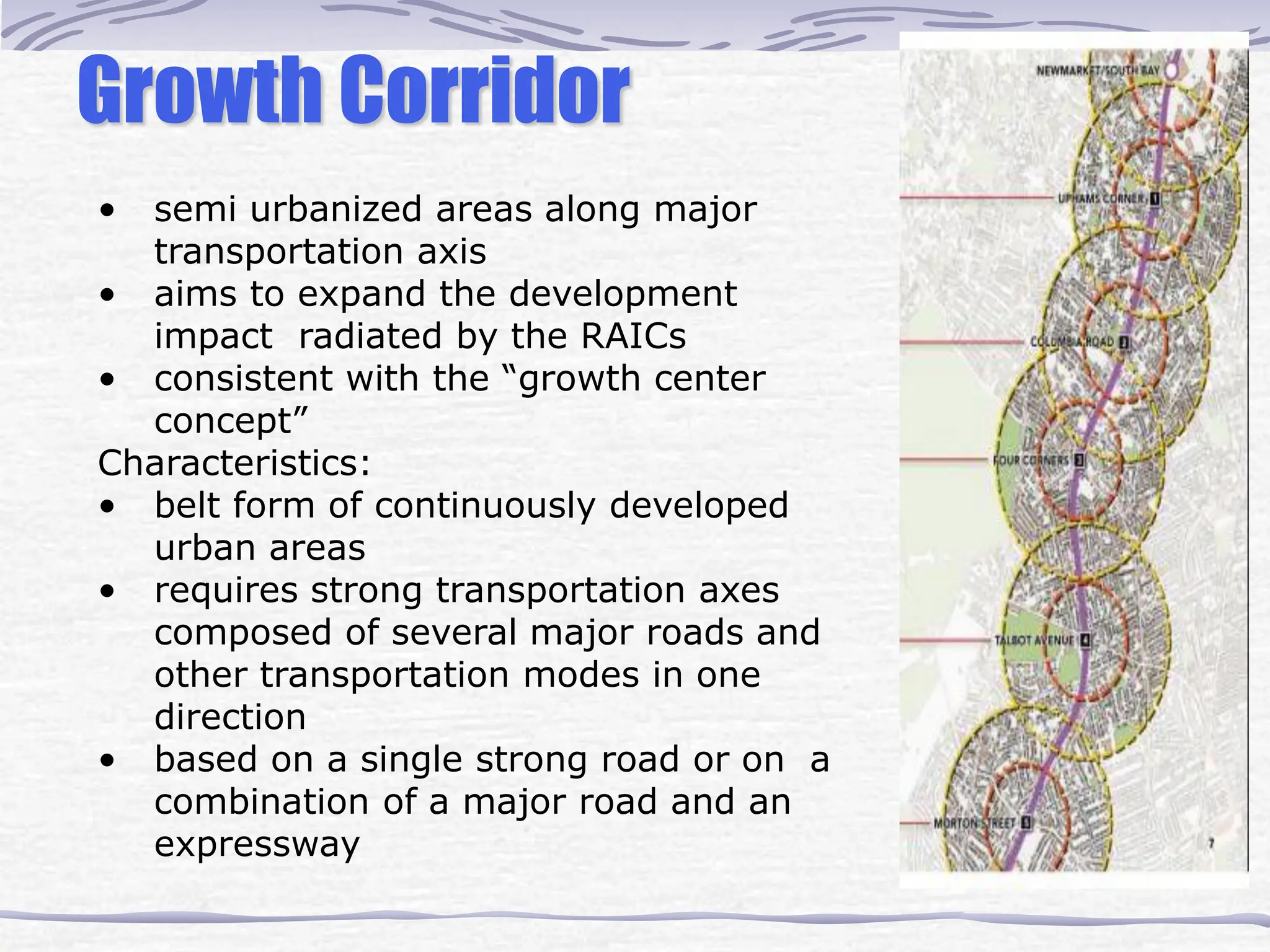
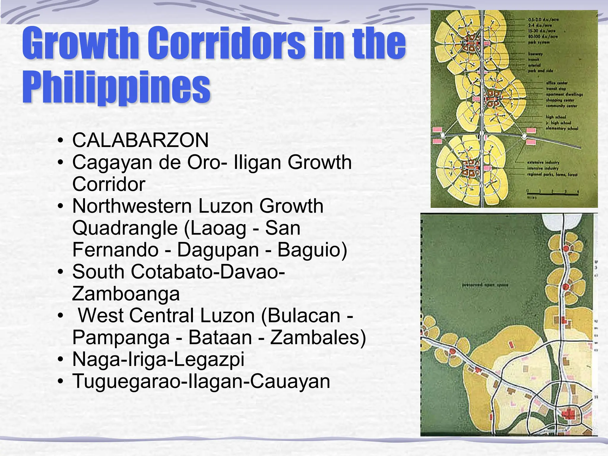
The document discusses the central place theory by Walter Christaller, which explains the hierarchical organization of settlements and their market areas, highlighting the relationship between the size of a settlement and the services it offers. It also explores concepts of regional planning, emphasizing the importance of economic, social, and environmental factors, as well as historical influences on urban development. The text concludes by summarizing various theories around regional growth and cumulative causation, underscoring the need for government intervention to address regional disparities.


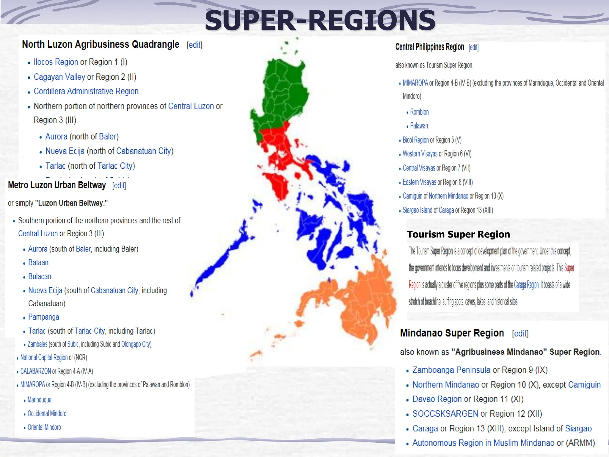
![SUPER-REGIONS
The "super" regions of the Philippines are an informal, and de facto
defunct, grouping of parts of regions and provinces of the Philippines
based on their economic strengths.
According to Executive Order No. 561, which establishes these regions,
"[These] groupings neither supersede current political boundaries nor alter
the regional development councils as established by existing laws and
issuances."
The creation of "super" regions was first proposed by the President Gloria
Macapagal-Arroyo in her sixth State of the Nation Address to group the
selected regions/provinces by their economic strengths.
Each "super" region is headed by a Development Champion.](https://image.slidesharecdn.com/09basicsofregionalplanning-241202010304-b10227b2/75/Basics-of-Regional-Planning-and-the-general-spatial-planning-51-2048.jpg)