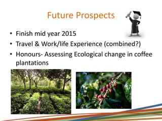
The document summarizes an internship with TERN's AusPlots and ATN programs involving ecological monitoring, data collection and management. The internship involved preparing for and conducting fieldwork to survey plant and soil samples, managing resulting genetic and vegetation data and samples, collaborating on various projects including creating maps and protocols, and acquiring skills in teamwork, research, and GIS. The intern gained valuable work experience relating to their degree while contributing to TERN's long-term ecological monitoring programs.
Marches Energy Agency Bham Uni Social Enterprise In Action 6th November 2008 IMarches Energy Agency
The document appears to be from a conference on social enterprise and low carbon communities. It discusses climate change, energy security, finite fossil fuels, and population growth driving increased energy demand. It highlights case studies of low carbon community initiatives in the West Midlands and Nigeria and quotes calling for individual and collective action to reform behavior and leave future generations a sustainable world.
The document is a children's story that uses themes and characters from Alice's Adventures in Wonderland to introduce concepts from string theory and quantum mechanics. Alice falls through a black hole into a fantastical world called the "Sea of Relativity" where she encounters strange phenomena like length contraction and particles behaving as both waves and particles. She shrinks to a microscopic size and learns more from a caterpillar. Alice's journey exposes her to bizarre concepts from modern physics in an effort to inspire curiosity about science in young readers.
Diversiteit
Heijmans wil over 5 jaar het toonaangevende bouwbedrijf van Nederland zijn. Op het
gebied van kwaliteit, duurzaamheid en winstgevendheid. Diversiteit kan op verschillende
manieren een belangrijke bijdrage aan deze ambitie leveren.
Andere achtergronden, competenties en visies
De creativiteit wordt gestimuleerd door een verscheidenheid aan kennis, visies en inzichten. Dit levert
creatieve en innovatie producten op waarmee Heijmans zich kan onderscheiden.
Groter arbeidspotentieel
In de toekomst zal het aantal opgeleide technici afnemen. Door onze aandacht te richten op een
bredere doelgroep (studie en achtergrond) wordt de kans om topkandidaten te bereiken veel groter.
Midden in de maatschappij
Heijmans heeft veel verschillende soorten klanten. Van ziekenhuizen, woningcorporaties, particulieren
tot Rijkswaterstaat. Een divers personeelsbestand zorgt ervoor dat Heijmans weet wat deze klanten
willen en de klant optimaal kan bedienen.
Daarnaast leveren vrouwen in het Bestuur en in topposities geld op en zorgt diversiteit voor een
positief imago. De correlatie tussen vrouwen in het Bestuur en het rendement op eigen vermogen is
gemiddeld 23% hoger. (Catalyst, 2004, 2007; McKinsey ‘WomenMatter II & III’)
Heijmans heeft het onderwerp diversiteit hoog op de agenda staan.
We zijn ons er van bewust dat een divers personeelsbestand ons maakt tot een flexibel, open bedrijf. Daarnaast zijn we met meer diversiteit beter in staat om op andere, innovatieve manieren naar bestaande problemen te kijken. De cultuur wordt meer open, creatief en kritisch. Dit maakt ons weer een aantrekkelijke partij voor opdrachtgevers en (nieuwe) medewerkers.
Innovatie | Innovatiekracht - case Heijmans
Spreker: Robert Koolen, directeur Strategie & Beleid Heijmans
De huidige markt verandert in een hoog tempo van een vraaggestuurde in aanbodgerichte economie. Het Nederlandse bedrijfsleven zal zich de komende jaren zeer innovatief en internationaal georiënteerd moeten opstellen.
De toekomst vraagt om wendbare organisaties die snel kunnen inspelen op de permanent veranderende vraag. Bestaande businessmodellen zullen dus veranderen en de rol en positie van spelers in de markt ook. Het is een kans voor diegenen die in staat zijn koploper te zijn en leiderschap te claimen.
Heijmans
Heijmans is een van de toonaangevende bouwbedrijven als het gaat om innovaties in de woningbouw. Doelstelling van Heijmans is het om de kwaliteit van de gebouwde omgeving sterk te verhogen door producten te ontwikkelen die zorgen voor verbetering van veiligheid, gezondheid en duurzaamheid.
Tijdens de bijeenkomst zal Robert Koolen, directeur Strategie & Beleid van Heijmans u inzicht geven in de noodzaak tot innoveren en de wijze waarop het innovatieproces intern wordt gestimuleerd. Dit zal hij concretiseren aan de hand van verschillende, gerealiseerde innovaties.
TERN AusPlots ATN summer intern presentation LPTERN Australia
This internship with AusPlots & ATN provided opportunities for fieldwork, data and sample collection and management, collaboration, and skills development. The intern established monitoring plots, collected vegetation and soil samples, and ensured samples were properly stored and linked through barcoding. Data was published online for researchers. Collaborations included mapping for ranger training and biodiversity research. The intern gained experience in areas like data management, GIS, research, and teamwork.
TERN Surveillance Training 2019 - Day 1, Session 1bensparrowau
The document discusses stratification and site selection for TERN's Ecosystem Surveillance program. It describes a four step process:
1) Bioregional stratification - Stratifying Australia into bioregions based on climate, vegetation, landform and other factors.
2) Selecting representative bioregions - Choosing priority bioregions to sample based on data deficiency, location of other TERN sites, and environmental gradients covered.
3) Within-bioregion stratification - Further stratifying bioregions based on additional factors like land systems, distance from water, and regional ecosystems.
4) Pragmatic site selection - Choosing actual plot locations considering
WP1 - Distribution, diversity and management of Phytophthora in UK plant nurs...Forest Research
This document summarizes objectives and methods for a project studying Phytophthora distribution in UK plant nurseries. The project aims to (1) analyze Phytophthora community structure in nurseries using metabarcoding and (2) model factors influencing community richness. Methods include surveying nurseries, sampling plants/water from 10 partner nurseries and 50 broader nurseries, detecting and sequencing Phytophthora DNA, and analyzing results to advise nurseries. Initial sampling of 4 nurseries yielded 316 samples and 40 positive PCR results, showing variability between replicates and hosts. Future plans include continued sampling and sequencing to provide feedback to nurseries.
This document provides an overview of the AusPlots survey method training session. It includes details on the training structure, presenters, and topics that will be covered each day. The training will involve both classroom sessions and fieldwork, and will cover the full AusPlots survey method over multiple modules. Context for the method and its development will be provided.
TERN Surveillance Training 2019 - Day 1, Session 2bensparrowau
The document summarizes the agenda and presentations for an AusPlots training session before lunch. Topics that will be covered in the morning include current stratification techniques, site selection, permitting, pre-survey planning, engaging volunteers, needed survey equipment, and OH&S considerations. The afternoon will include a quantitative review of the AusPlots sampling scheme, including how sampling has performed, identifying gaps, determining re-sampling strategy, and analyzing the network's change detection capacity. An iterative process will ensure gaps and representation are regularly updated as new sites are surveyed.
This document summarizes work from Project WP1 which aims to analyze the community structure of Phytophthora in UK plant nurseries and associated ecosystems. The objectives are to provide insights into Phytophthora problems to improve disease management using metabarcoding, and to model factors influencing Phytophthora richness between nurseries. Methods described include sampling plants and water from nurseries, detecting and sequencing Phytophthora DNA, and using the data for modeling. Preliminary results found various Phytophthora species in water sources, puddles, and plant roots from sampled nurseries. Ongoing work includes validating analysis methods and sequencing more samples to better understand relationships between management practices and Phytop
WP1 - Distribution, diversity and management of Phytophthora in UK plant nurs...Forest Research
This document summarizes the objectives, methods, and progress of a project studying Phytophthora in UK plant nurseries. The project aims to (1) analyze Phytophthora communities in nurseries using metabarcoding and (2) model factors influencing community variation. Methods include sampling plants, water, and soil from 15 partner nurseries and 200 additional nurseries. Over 1700 samples have been collected and over 400 tested for Phytophthora so far. Preliminary results suggest differences in nursery practices and sample types influence Phytophthora findings. Next steps include accelerating testing, reporting species identifications to nurseries, and interpreting data in relation to management.
Garrett Golke has experience working in labs extracting DNA from plant tissues and operating automated equipment. He has also worked in environmental field positions performing aquatic vegetation surveys, implementing biological controls on lakes, and constructing wildlife habitats. Golke obtained a Bachelor's degree in Environmental Science from Concordia University with a GPA of 3.54 and relevant coursework in ecology, biology, chemistry, and geographic information systems.
Bioacoustic Monitoring of Biodiversity - our first presentation of bioacoustic monitoring in cooperation with the Global Canopy Initiative (Andrew Mitchell?), in 2002
A presentation on the AusPlots program detailing it's aims and objectives, what and how data is collected, how it is delivered along with information on collaborations, data use, analysis and future opportunities
The document discusses comparing the Pennsylvania Phosphorus Index to the TopoSWAT model. It summarizes research objectives to establish watershed networks for evaluating nutrient management tools, identify priority concerns within physiographic provinces, and use water quality data to refine the P Index. It then describes challenges with the P Index, experimental versus modeling approaches, and initial results comparing TopoSWAT and P Index outputs for an agricultural watershed in Pennsylvania. Next steps focus on determining appropriate comparison methods to improve the P Index.
The DART project aims to improve the detection of archaeological residues using remote sensing techniques. It will analyze factors that influence contrasts between residues and surrounding soil over time and space. Through data collection, modeling, and tool development, DART seeks to determine optimal conditions and sensors for detecting residues. The consortium includes academic, heritage, and industry partners who will work on data analysis, decision support tools, and project evaluation over 3 years with a budget of £800k. The goal is to strengthen remote sensing approaches and heritage management.
Kasper Johansen_Field and airborne data collection by AusCover: a tropical ra...TERN Australia
The document describes a field and airborne data collection campaign conducted by AusCover in a tropical rainforest site called Robson Creek. The campaign involved collecting field data through measurements of vegetation structure, leaf area index, hemispherical photos, and more. Airborne data was also collected through LiDAR and hyperspectral imaging from aircraft. The data collection was designed to validate satellite data and the various data sets would be made available through an online portal and shared with collaborators for research on topics like biomass estimation and vegetation mapping.
This document provides a summary of Maksat Zhazbayev's work history, education, skills, honors and awards. It details his experience as an Operations Geologist Intern and Geophysics Intern at Tengizchevroil LLP where he analyzed gas measurements, assisted primary geoscientists, and interpreted 3D seismic data. It also outlines his internship as a Petrophysics Intern at North Caspian Operating Company where he updated well log files and investigated porosity measurements. Additional experiences include undergraduate research assisting in extracting channel structures from seismic volumes and processing seismic data.
TERN Surveillance Training 2019 - Day 1, Session 4bensparrowau
This training session covers soil sampling and characterization to 1 meter depth, collecting 9 soil samples throughout a plot for metagenomic analysis, measuring bulk density, and using a leaf area index meter. The week involves daily field training from 8:30am to 5pm, including soil profiling, sample collection, and practice with field equipment. Trainees will learn plot description, soil sampling methods, and protocols for vegetation, fauna, and other site measurements.
Andrew White_A nationally-accepted method for assessing rangelands condition:...TERN Australia
This document provides an update on the AusPlots Rangelands project which aims to establish permanent vegetation and soil monitoring plots across Australian rangelands bioregions. The project has established collaborations with various organizations for tasks such as sample storage, analysis and identification. Over 100 plots have been established across 11 bioregions, collecting various data including soil samples, plant specimens and isotopes. Standardized survey methods and tools such as a field app have been developed to collect and manage plot data. Several publications have resulted from the project.
Ecosystem data and TERN: Genes to geosciences workshop 19 May 2014TERN Australia
Powerpoint presentation used to support the 'Ecosystem data and TERN' workshop on 19 May 2014, held at Macquarie University in Sydney as part of the Genes to Geosciences seminar series.
Item 7. Establishment of the Regional Soil Laboratory Network for the PacificExternalEvents
Mr. Rob De Hayr is the Pillar 5 Chair for the Pacific region of the Regional Soil Laboratory Network for the Pacific (SPACNET). The summary discusses:
1) SPACNET and the Australasian Soil & Plant Analysis Council (ASPAC) were previous networks that supported soil laboratories in the region but ASPAC is now the active network.
2) ASPAC works to promote excellence in soil and plant analysis through training, research, and sharing best practices. It also coordinates proficiency testing and publishing guidance documents.
3) Reforming SPACNET is an option being considered to better support Pacific region laboratories, which could work with ASPAC for quality assurance/control. Determining
This publication was endorsed by the National Soils Advocate, The Hon. Penny Wensley AC, on the 8th of December 2022 during the launch of the TERN Australia Soil & Herbarium Collection.
The publication contains the results of 33 interviews with people who, in 2022, have jobs relevant to soils. It is intended for use by secondary and tertiary students who are perhaps wondering what to study or which career might be satisfying - or maybe they have already chosen a soils-related career and are keen to learn something about others who they may meet as lecturers, coworkers or employers.
The booklet will also hopefully be a useful resource for those that assist students with such decisions, including teachers, careers counsellors, guidance officers, librarians, and parents.
TERN Australia Soil & Herbarium Collection BrochureTERN Australia
The TERN Australia Soil and Herbarium Collection contains over 150,000 vegetation and soil samples collected from over 900 sites across Australia, representing every major ecosystem. It has supported the identification of 11 golden everlasting paper daisy species, discovery of new medicines from soil compounds, and improved models of carbon sinks and forests. The collection is unique in linking samples to detailed environmental data and is used by scientists worldwide in fields like agriculture, environmental science and pharmaceutical development.
More Related Content
Similar to Aus plots atn_interpresentaion_ashleighburke
TERN AusPlots ATN summer intern presentation LPTERN Australia
This internship with AusPlots & ATN provided opportunities for fieldwork, data and sample collection and management, collaboration, and skills development. The intern established monitoring plots, collected vegetation and soil samples, and ensured samples were properly stored and linked through barcoding. Data was published online for researchers. Collaborations included mapping for ranger training and biodiversity research. The intern gained experience in areas like data management, GIS, research, and teamwork.
TERN Surveillance Training 2019 - Day 1, Session 1bensparrowau
The document discusses stratification and site selection for TERN's Ecosystem Surveillance program. It describes a four step process:
1) Bioregional stratification - Stratifying Australia into bioregions based on climate, vegetation, landform and other factors.
2) Selecting representative bioregions - Choosing priority bioregions to sample based on data deficiency, location of other TERN sites, and environmental gradients covered.
3) Within-bioregion stratification - Further stratifying bioregions based on additional factors like land systems, distance from water, and regional ecosystems.
4) Pragmatic site selection - Choosing actual plot locations considering
WP1 - Distribution, diversity and management of Phytophthora in UK plant nurs...Forest Research
This document summarizes objectives and methods for a project studying Phytophthora distribution in UK plant nurseries. The project aims to (1) analyze Phytophthora community structure in nurseries using metabarcoding and (2) model factors influencing community richness. Methods include surveying nurseries, sampling plants/water from 10 partner nurseries and 50 broader nurseries, detecting and sequencing Phytophthora DNA, and analyzing results to advise nurseries. Initial sampling of 4 nurseries yielded 316 samples and 40 positive PCR results, showing variability between replicates and hosts. Future plans include continued sampling and sequencing to provide feedback to nurseries.
This document provides an overview of the AusPlots survey method training session. It includes details on the training structure, presenters, and topics that will be covered each day. The training will involve both classroom sessions and fieldwork, and will cover the full AusPlots survey method over multiple modules. Context for the method and its development will be provided.
TERN Surveillance Training 2019 - Day 1, Session 2bensparrowau
The document summarizes the agenda and presentations for an AusPlots training session before lunch. Topics that will be covered in the morning include current stratification techniques, site selection, permitting, pre-survey planning, engaging volunteers, needed survey equipment, and OH&S considerations. The afternoon will include a quantitative review of the AusPlots sampling scheme, including how sampling has performed, identifying gaps, determining re-sampling strategy, and analyzing the network's change detection capacity. An iterative process will ensure gaps and representation are regularly updated as new sites are surveyed.
This document summarizes work from Project WP1 which aims to analyze the community structure of Phytophthora in UK plant nurseries and associated ecosystems. The objectives are to provide insights into Phytophthora problems to improve disease management using metabarcoding, and to model factors influencing Phytophthora richness between nurseries. Methods described include sampling plants and water from nurseries, detecting and sequencing Phytophthora DNA, and using the data for modeling. Preliminary results found various Phytophthora species in water sources, puddles, and plant roots from sampled nurseries. Ongoing work includes validating analysis methods and sequencing more samples to better understand relationships between management practices and Phytop
WP1 - Distribution, diversity and management of Phytophthora in UK plant nurs...Forest Research
This document summarizes the objectives, methods, and progress of a project studying Phytophthora in UK plant nurseries. The project aims to (1) analyze Phytophthora communities in nurseries using metabarcoding and (2) model factors influencing community variation. Methods include sampling plants, water, and soil from 15 partner nurseries and 200 additional nurseries. Over 1700 samples have been collected and over 400 tested for Phytophthora so far. Preliminary results suggest differences in nursery practices and sample types influence Phytophthora findings. Next steps include accelerating testing, reporting species identifications to nurseries, and interpreting data in relation to management.
Garrett Golke has experience working in labs extracting DNA from plant tissues and operating automated equipment. He has also worked in environmental field positions performing aquatic vegetation surveys, implementing biological controls on lakes, and constructing wildlife habitats. Golke obtained a Bachelor's degree in Environmental Science from Concordia University with a GPA of 3.54 and relevant coursework in ecology, biology, chemistry, and geographic information systems.
Bioacoustic Monitoring of Biodiversity - our first presentation of bioacoustic monitoring in cooperation with the Global Canopy Initiative (Andrew Mitchell?), in 2002
A presentation on the AusPlots program detailing it's aims and objectives, what and how data is collected, how it is delivered along with information on collaborations, data use, analysis and future opportunities
The document discusses comparing the Pennsylvania Phosphorus Index to the TopoSWAT model. It summarizes research objectives to establish watershed networks for evaluating nutrient management tools, identify priority concerns within physiographic provinces, and use water quality data to refine the P Index. It then describes challenges with the P Index, experimental versus modeling approaches, and initial results comparing TopoSWAT and P Index outputs for an agricultural watershed in Pennsylvania. Next steps focus on determining appropriate comparison methods to improve the P Index.
The DART project aims to improve the detection of archaeological residues using remote sensing techniques. It will analyze factors that influence contrasts between residues and surrounding soil over time and space. Through data collection, modeling, and tool development, DART seeks to determine optimal conditions and sensors for detecting residues. The consortium includes academic, heritage, and industry partners who will work on data analysis, decision support tools, and project evaluation over 3 years with a budget of £800k. The goal is to strengthen remote sensing approaches and heritage management.
Kasper Johansen_Field and airborne data collection by AusCover: a tropical ra...TERN Australia
The document describes a field and airborne data collection campaign conducted by AusCover in a tropical rainforest site called Robson Creek. The campaign involved collecting field data through measurements of vegetation structure, leaf area index, hemispherical photos, and more. Airborne data was also collected through LiDAR and hyperspectral imaging from aircraft. The data collection was designed to validate satellite data and the various data sets would be made available through an online portal and shared with collaborators for research on topics like biomass estimation and vegetation mapping.
This document provides a summary of Maksat Zhazbayev's work history, education, skills, honors and awards. It details his experience as an Operations Geologist Intern and Geophysics Intern at Tengizchevroil LLP where he analyzed gas measurements, assisted primary geoscientists, and interpreted 3D seismic data. It also outlines his internship as a Petrophysics Intern at North Caspian Operating Company where he updated well log files and investigated porosity measurements. Additional experiences include undergraduate research assisting in extracting channel structures from seismic volumes and processing seismic data.
TERN Surveillance Training 2019 - Day 1, Session 4bensparrowau
This training session covers soil sampling and characterization to 1 meter depth, collecting 9 soil samples throughout a plot for metagenomic analysis, measuring bulk density, and using a leaf area index meter. The week involves daily field training from 8:30am to 5pm, including soil profiling, sample collection, and practice with field equipment. Trainees will learn plot description, soil sampling methods, and protocols for vegetation, fauna, and other site measurements.
Andrew White_A nationally-accepted method for assessing rangelands condition:...TERN Australia
This document provides an update on the AusPlots Rangelands project which aims to establish permanent vegetation and soil monitoring plots across Australian rangelands bioregions. The project has established collaborations with various organizations for tasks such as sample storage, analysis and identification. Over 100 plots have been established across 11 bioregions, collecting various data including soil samples, plant specimens and isotopes. Standardized survey methods and tools such as a field app have been developed to collect and manage plot data. Several publications have resulted from the project.
Ecosystem data and TERN: Genes to geosciences workshop 19 May 2014TERN Australia
Powerpoint presentation used to support the 'Ecosystem data and TERN' workshop on 19 May 2014, held at Macquarie University in Sydney as part of the Genes to Geosciences seminar series.
Item 7. Establishment of the Regional Soil Laboratory Network for the PacificExternalEvents
Mr. Rob De Hayr is the Pillar 5 Chair for the Pacific region of the Regional Soil Laboratory Network for the Pacific (SPACNET). The summary discusses:
1) SPACNET and the Australasian Soil & Plant Analysis Council (ASPAC) were previous networks that supported soil laboratories in the region but ASPAC is now the active network.
2) ASPAC works to promote excellence in soil and plant analysis through training, research, and sharing best practices. It also coordinates proficiency testing and publishing guidance documents.
3) Reforming SPACNET is an option being considered to better support Pacific region laboratories, which could work with ASPAC for quality assurance/control. Determining
Similar to Aus plots atn_interpresentaion_ashleighburke (20)
This publication was endorsed by the National Soils Advocate, The Hon. Penny Wensley AC, on the 8th of December 2022 during the launch of the TERN Australia Soil & Herbarium Collection.
The publication contains the results of 33 interviews with people who, in 2022, have jobs relevant to soils. It is intended for use by secondary and tertiary students who are perhaps wondering what to study or which career might be satisfying - or maybe they have already chosen a soils-related career and are keen to learn something about others who they may meet as lecturers, coworkers or employers.
The booklet will also hopefully be a useful resource for those that assist students with such decisions, including teachers, careers counsellors, guidance officers, librarians, and parents.
TERN Australia Soil & Herbarium Collection BrochureTERN Australia
The TERN Australia Soil and Herbarium Collection contains over 150,000 vegetation and soil samples collected from over 900 sites across Australia, representing every major ecosystem. It has supported the identification of 11 golden everlasting paper daisy species, discovery of new medicines from soil compounds, and improved models of carbon sinks and forests. The collection is unique in linking samples to detailed environmental data and is used by scientists worldwide in fields like agriculture, environmental science and pharmaceutical development.
Summary of TERN monitoring plots in the Pilbara WA, Apr2015 - Jun2021TERN Australia
This report provides a snapshot of the data collected by TERN in the Pilbara, Western Australia. Also included in this report is how to access the data, descriptions of data types, panorama photos and examples of research using TERN data. Plots on the Pilbara were first surveyed by TERN from April 2015 to August 2016. The surveys collected vegetation and soil, data and samples following the AusPlots Rangelands methodology, with 37 plots completed. Some of the plots were revisted in 2021. An updated version of this report will be provided as this data becomes available.
Summary of TERN plots on Kangaroo Island, SA, Oct 2018 - Oct 2021TERN Australia
In October 2018, TERN undertook a survey on Kangaroo Island, South Australia. The survey involved vegetation and soils work following the AusPlots Rangelands methodology, with 13 plots completed. The plots are part of over 800 plots completed nationally. The plots were revisited following the fires in 2020
and again in 2021. This report will be updated as that data becomes available.
Evaluating ecological outcomes in the Regional Land Partnerships Program: A pilot monitoring, evaluation and research (MER) network.
This three-year project will trial Australia’s first MER network by implementing a pilot network – to promote national-scale learning about bushfire recovery across different ecosystem types, and the
ecological effectiveness of post-fire interventions.
Australia's Environmental Predictive CapabilityTERN Australia
Federating world-leading research, data and technical capabilities to create Australia’s National Environmental Prediction System (NEPS).
Community consultation presentation.
3-12 February 2020
Dr Michelle Barker (Facilitator)
(Presentation v5)
Biodiversity Management in Tasmania's Temperate Native ForestsTERN Australia
Sustainable Timber Tasmania's Dr Marie Yee's entry to the ILTER Most Striking Case competition on using the research from TERN's Warra Tall Eucalypt SuperSite to facilitate innovative biodiversity management in Tasmania's temperate native forests.
Observing Environmental Change in Australia: Conversations for SustainabilityTERN Australia
A comprehensive and engaging review of how the past decade of Australian Government research infrastructure investment has transformed our understanding of the environment.
Observing Environmental Change in Australia – Conversations for Sustainability covers the monitoring of environmental change, urbanisation and land-use changes, biodiversity, extreme events, climate, carbon and water.
Chapters detail the importance of Indigenous knowledge, the use of satellite remote sensing and drones, and managing ‘big data’. The book concludes with descriptions of visualising environmental information, emerging technologies, and the importance of engaging the community.
Dr Michael Mirtl (ILTER Chair) presenting at the AusLTER Forum 2018TERN Australia
The document discusses the International Long Term Ecological Research Network (ILTER). It provides an overview of ILTER's activities which include coordinating key elements of environmental systems research, developing a strategic framework, and facilitating partnerships. ILTER aims to fill critical gaps in multi-site, cross-disciplinary, and conceptual long-term ecological research. It also establishes scientific initiatives and works to develop a global research infrastructure to integrate terrestrial observation networks.
Prof Bob Scholes (Wits University, South Africa) presenting at the AusLTER Fo...TERN Australia
EFTEON is South Africa's Enhanced Freshwater and Terrestrial Ecological Observation Network, a new ecological research infrastructure announced in late 2016. It will have around 6 landscapes by 2020 and use a modular, nested design across landscapes to facilitate multi-user, long-term research on biogeochemistry, hydrology, biodiversity and human-ecosystem interactions. EFTEON will establish a tiered observation platform including satellites, highly instrumented core sites, and sparsely instrumented linked sites, along with experiments and social surveys. It aims to provide answers unavailable elsewhere and leverage South Africa's comparative advantages in international research, including existing long-term manipulative experiments. Establishing and sustaining such research infrastructures
Prof Phil Robertson (Michigan State University, USA) presenting at the AusLTE...TERN Australia
The document describes three long-term ecological research networks in the United States: 1) The Long Term Ecological Research network has 28 sites across different biomes that have been funded by the NSF for 6 years each since 1980 to address long-term ecological questions. 2) The Long-Term Agroecosystem Research network has 18 agricultural sites funded by the USDA since 2012 to study sustainable agriculture. 3) The National Ecological Observatory Network has 20 primary sites across climate regions in the US funded by the NSF since 2011 to detect environmental changes over decades.
Dr Manuel Maass (National Autonomous University of Mexico) presenting at the ...TERN Australia
The document discusses long-term socioecological research and the need for a transdisciplinary approach. It provides an overview of the International Long Term Ecological Research Network (ILTER) and its focus on long-term monitoring of sites, data sharing standards, and detecting global trends. The document argues that purely interdisciplinary research is not sufficient and a transdisciplinary approach is needed where researchers work directly with different knowledge sources, including local communities, to address sustainability challenges.
Yuxia Liu Phenology 2018 poster on tracking grass phenologyTERN Australia
University of Technology Sydney Yuxia Liu's Phenology 2018 conference poster on tracking grass phenology with phenocams and remote sensing over victorian pastures.
This document describes mapping ecological facets across Australia by analyzing the key drivers of ecosystem formation - macroclimate, lithology, landform, and vegetation structural formations. 59 homogeneous bioclimatic regions were mapped based on clustering uncorrelated bioclimatic variables. Lithology and weathering intensity were derived from existing Geoscience Australia data. Landform was characterized through land surface form and topographic moisture potential indicators. Combining these ecosystem drivers with vegetation structural formations data resulted in a continental dataset of 369,439 unique ecological facets at 90m resolution. This ecological facets mapping provides insight into biophysical variation across Australian ecosystems.
TERN Ecosystem Surveillance Plots Roy Hill StationTERN Australia
A summary of TERN ecosystem observing plots on Roy Hill Station. The report also contains a list of the data and soil and plant samples openly available via TERN.
TERN Ecosystem Surveillance Plots Kakadu National ParkTERN Australia
A summary of TERN ecosystem observing plots in Kakadu National Park. The report also contains a list of the data and soil and plant samples openly available via TERN.
4. About AusPlots & ATN
TERN- Research Infrastructure
• AusPlots (Forests and Rangelands)
- Plot Based Monitoring program
- For consistent ecological monitoring
• ATN (Australian Transect Network)
-Patterns and trends along environmental gradients
6. Field Preparation
• Permission to access land
• Field Equipment, Vehicles
and checklists in AusPlots
Rangelands Survey
protocols Manual
7. In the Field
• 3 plots. Maireana sedifolia, Acacia
papyrocarpa & Casuarina pauper
Tech- setting up plots with DGPS, photopoints,
LAI, Basal Wedge
Vegetation- Collection of all present species and
point intersect along transects
Soil- collection of soil and metageonomics,
assessing colour and texture, calculate EC & pH
8. Data and Sample Management of
Genetics
Tasks
• replacing old silica
• Catalog new barcodes
• Change teabags
Why
• Maintains good samples
• Barcoding quick identifier for research use
9. Data and Sample Management of
Vegetation
Tasks
- Replacing vegetation samples back to site boxes
- Choosing good samples to be sent to Canberra
Herbarium
- Database entering
Why
- Data location
11. Researcher Use
Tasks
• Herbarium to select vegetation samples
Why
• Readily Available for others
• Win-win- Researcher doesn't need to collect
samples and TERN is Acknowledged in a
publication
12. Collaboration- ATN
Tasks
• Prepare maps for ATN brochure
• Proof read and add publications to ‘Summary
of Achievements List’
Why
• To be presented
in ATN brochure
13. Collaboration-NERP
Tasks
• Research government websites
• Fauna Survey Protocols- permits required,
methods, hygiene and security, access
permission.
Why
• Collated information of each state to put into
presentation for NERP AusPlots Fauna Survey
Protocols Workshop
14. • Animal Ethics Sate Summary- general
responsibilities, permit costs, penalties
• Mostly standard across the Country
• Differences in pitfalls, bird surveys, active
searching and spotlighting and Camera traps
NERP…(cont)
15. Collaboration- AWNR
Alinytjara Wilurara Natural Resources
Tasks
• Create map showing previously established
plots
Why
• Ranger Training & how to modify methods
16. Challenges
• GIS- Definitely out of my comfort zone
• Balancing internship with summer school and
project work
Most memorable / Biggest achievements
• Field work
• Producing Final Maps
17. Skills Acquired
• Teamwork
• Flexibility
• Data and Sample Management
• GIS
• Research Skills
• Interviewing skills
• Understanding of the importance of
Collaboration
So, starting off, I’m in my third year of doing a Bachelor of science in Natural Resources.
I received an email for Finn asking for expressions of interest for this internship and though it would be a great way to get more experience in the field that I’m interested in, having done very little at university in undergrad so far.
I also applied because I attended the AusPlots Rangeland field training Camp at Owen Springs Station, in Alice springs of October last year. I learnt a lot and had a lot of fun, but I wanted to get more of an insight into what AusPlots does outside of field work. I also felt like there was so much more I could have learnt, so I was fairly eager.
(Primarily I would like to be a part of researching ecosystems and their dynamics, as my end goal would be to work within field of conservation and restoration while working toward a more sustainable future)
So just to introduce my presentation; the TERN is supported by the Australian Government through NCRIS, and the Super Science Initiative, and the University of Adelaide hosts the Australian Transect Network, AusPlots and NERP (the National Environmental Research Program) which are the groups I primarily worked with, but they also host EcoInformatics
TERN- so TERN delivers research infrastructure for others to use. It allows people within the science community to gather information and samples, whether it be online though the aekos data portal or collecting vegetation samples directly from TERN, to help contribute to the management and sustainable use of Australia.
AUSPLOTS- Plot based monitoring program that assessed ecosystem around the country. Its for consistent ecological assessment. When plots are set up, the aim would be to go back to that same plot years later and the previous information can tell researchers how the ecosystem has changed through out the years
Forests- carbon dymanics, and forest productivity
Rangelands- surveys of veg and soils in the rangeland bioregions of Australia
ATN- Studies the patterns and trends of vegetation and soils along environmental gradients. This is important as it can help scientist understand ecosystem changes of the land
So this is a nifty flow chart of how Ausplots and ATN infrastructure works. I’ll be basing my presentation around this flowchart. I’ll be talking about my specific tasks that I did with regards to the fieldwork, data and sample management, publication, researcher use and collaboration, and also why we do it.
So beginning with the flow chart for AusPlots and ATN is fieldwork. We didn’t do this component until last week, when we decided to do some plots at Myola Station for a few days.
I guess the first thing that was done was to make sure we had permission to use this area for sites. Lucily the station is owned Jacob, by one of the scholarship guys dad. And He seemed pretty keen to do a survey in the area.
Then the day before the trip, Finn and I went to Thebarton to make sure we had everything we needed in the 4WD vehicle. We used to the Ausplots Rangelands Survey protocols Manual to go through and check off the things we needed
So in Myola the first thing we did was choose 3 areas that had different vegetation to do sites on. The selected areas were chosen in terms of homogenity, logistical and access considerations. So the plots we ended up choosing to do sites on included a maeriana sedifolia low shrubland area, an acacia popyrocarpa (western myall) open woodland area, near the train line, and casurina pauper (or bellah) low woodland site. These were all pretty close to a dirt road where the cars were parked for easy access if we needed anything.
TECH
Set up the plot- using the DGPS. Which gives us 4 corner points, All the transect end points within the plot and a centre point.
Photopints- 3 photo-panoramas are taken in close to the centre point of the plot to give a panoramic view of the plot site. Photos are taken so the images can be processed to provide #D reconstructions of each plot, to monitor the change over time.
LAI- Which is calculating the Leaf Area Index. This compares the amount of light intercepted with an above canopy reference.
Basal Area- which determines the basal area of trees and shrubs and can provide information that can calculate carbon levels and biomass of the vegetation
VEGETATION
Point Intersect- densitometer is used to view the canopy above, which is recorded and the staff also has a lazer to record the substrate below
Collection of specimens to be pressed and take a sample of those for genetics. Placed in tea bags and barcoded
SOILS- Here we started off by digging a pit in the SW corner of the plot. This is where we did soil characterisation of Horizons by measuring the colour and texture. We also took samples for measuring the bulk density of the soil. Also from each horizon we took smaller samples to test the salinity and the pH, which is all important for soil monitoring
-We also took metagenomics samples from 9 subsites within the plot to take back to Thebarton fro researcher use
This was especially good for me because I actually got a feel for what it was like doing a whole plot with all the elements, which didnt happen at the training camp because we focused on one area each day. Especially doing the LAI along transect lines and setting up the points of the plot first.
Important to manage genetic samples of vegetation by barcoding because 1. it’s a quick identifier for people that want to use that sample. Some of the really old plot sites didn’t have barcodes and their curernt identifiers easily came off the old teabags, if they didn’t have identifier than essential that sample is “lost” maintaining these samples by replacing old silica also ensures that the samples are still viable for use
And 2. this is what people will use if they need to do genetic tests on plants to look at things like isotope analysis, adaptations in cellular structure. E.g Donna has borrowed some genetics samples to assess gene sequence of goodenia
So one of the things I had to do for sample management, apart from silica changes, for the genetics samples was to give them new barcodes and put that into a spreadsheet so it could be easily found if need be, I also changed over the old tea bags to new ones that are easier to store.
You might have noticed the wall of boxes I built in the past couple weeks aswell. This was to maintain pressed vegetation samples by replacing samples given back from the herbarium and putting them into the correct site boxes, which took a little while. After that was finished I started sorting through the boxes by picking out the samples which had good genetic material like flowers and fruit to be sent to the Canberra Herbarium. While picking out decent samples I also listed them as yes/no if I selected them to send to Canberra in a spreadsheet
This was done so we can be sure of which samples TERN still has and which the Herbarium have incase someone wants the sample but cant find it, we know where it is!
I didn’t do a lot of stuff to do with data publication but after the trip Finn did go through how the LAI worked and how it was entered into the system, which was pretty interesting (see picture)
So the last component of the flow chart is Research use.
This means the data collected from the plots can be used by other people. Whether they need soil or vegetation samples, or information this is readily available for them.
At the start of this week, we had the pleasure of checking out the State Herbarium to sift through 30 plot sites for specific vegetation samples a guy names Henrique needed for his PHD. From my understanding he will take the leaf samples he wants to use and send back what he doesn’t use. The end result being that TERN is acknowledged in his final thesis. Which is a win-win for him and TERN, because they appear in more publications and it means Henrique doesn’t have to go out into the field to collect all the samples.
So tying in the flow chart for AusPlots and ATN, all of this is done for collaboration with other organisations, groups and individuals. I found that its particularly important for educational organisations to maintain collaborative connections to help the group become more well known and to help them grow. I did have a really interesting conversation with Finn in my first week where he talked about maintaining friendships and connection with the state Herbariums. That conversation was one that has stuck with me because I didn’t know the full importance of maintaining these relationship.
Some of the collaborative work I did with the ATN include preparing maps in ArcGIS for the ATN brochure, which outlined the specific areas that there were plots. I also did a lot of publication proof reading to double check that these documents used or acknowledged TERN or ATN in some way.
I also did some collaborative work with Sally for NERP. NERP is a program that enhances long-term surveillance monitoring across Australia
So Mid way through the internship I did some work for Sally collecting information about Fauna Survey standards and animal ethics protocols in each states. All of the information I collected, which was primarily from government websites, was put into a big spreadsheet which Sally then Collated the information and put it into a presentation for the NERP Fauna Survey Protocols Workshop. This included getting information about the dimensions of permits required, trapping methods, hygiene and security protocols and specific information about doing surveys on private or crown land.
Animal Ethics information . We ended up finding that the general responsibilities were fairly standard across the country, with regards to respecting animals, using them only when justified, minimising harm to them and applying the 3 R’s (replacement of fauna, reduction in the number used and refinement of techniques. I also found some pretty good information on how much permits cost and the penalties if you weren't licenced.
Differences- There were some differences state by state though, I found some differences in pitfalls, primarily their dimensions, the number of them and the use of lids. There were also huge differences in when bird surveys should be done and active searching and spotlighting. When I could find information for camera trapping I found that they're all different in the methods. (happy to send summaries out)
Doing this was actually pretty interesting for because I’ve done a few fauna surveys in the past with the SAHG, which I really enjoyed doing but I had no idea of the requirements or consequences if you didn’t follow the right state protocols
So this week Lachie and I worked together to create a map for the AWNR Meeting. This involved Lachie gathering the coordinates and putting it into an excel spreadsheet which I then used to import into arcMap to create a map. I also got a lot of plot sites from Ben, which we then tailored to just show plot sites to the east side of the Stuart highway. The map showed previously established plot sites that had been done in traditional lands, plots that could potentially be used for ranger training and modification of plot methods.
Some challenges I faced in the internship include jumping out of my comfort zone to do some maps for ian. I did have some experience with GIS, while doing a two week intensive course, but even so, it definitely wasn’t long enough to take in all the information I needed. Luckily I like a bit of a challenge and got through this by producing quite a few maps. Of course with the help of Finn, Ian, Ben and Lachie for the last final map.
Another challenge I’ve found was balancing I guess “work life” with study. But this internship I feel actually improved my GIS skills and was helpful for my GIS project because I learnt how to use more tools in ArcMap by doing the maps for ATN and AusPlots. I even used some shape files from here in my project
So in the end producing these maps because one of my biggest achievements in this internship because I managed to be successful in something that is completely out of my comfort zone
Teamwork-
Flexibility-
Data and Sample Management-
GIS- Even though I did a 2 week intensive course, I still learnt a lot about entering data into ArcMap and how to create maps through out this internship.
Above everything, I learnt what its like to be in the real world. As generic as that sounds, but as an undergrad we don’t get a lot of experience in what it will really be like in an actual job. Turns out it’s not so bad
My future plans are flexible and not set in stone but after I finish my degree this year I want to spend some time (those 6 months before the new year) to Travel and gain some more work and life experience. If I could combine the two that’s even better.
Originally my plan was to just get the degree and get a job, but my goals have changed a bit since starting the internship. I’d now like to complete Honours, in hopefully the area that I want to go in. My ultimate dream honours project would be involving collecting information and data about the changes in the ecology in coffee and tea plantations with the current changes to previously shade grown coffee. I’ve done a lot of research and conservation and coffee are two things im passionate about. And working in a café for three years had me wanting to know other parts of the industry which include everything from the soil to the people involved in packaging and distributing it overseas
So to end, I just want to say thank you to everyone at TERN for making us feel welcome and bringing us into a relaxing environment. Importantly everyone with AusPlots and ATN for giving me this opportunity to work with you and for helping me out when I needed it.
Finn, for being an awesome supervisor and for helping me out a lot with the ArcMap stuff!
Then everyone else I directly worked with including Ian, Christina, Sally, Ben and Emyrs (when he was here)
Oh and thanks to Rick for the desk
So I hope to see you all around in the near future, I’ll be sure to keep in touch. And I’m more than happy to come along for future field trips if our offering the opportunity again