Summary of TERN plots on Kangaroo Island, SA, Oct 2018 - Oct 2021
•
0 likes•531 views

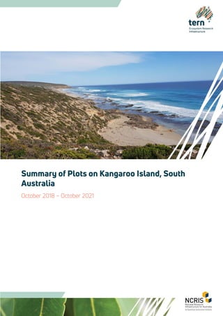
In October 2018, TERN undertook a survey on Kangaroo Island, South Australia. The survey involved vegetation and soils work following the AusPlots Rangelands methodology, with 13 plots completed. The plots are part of over 800 plots completed nationally. The plots were revisited following the fires in 2020 and again in 2021. This report will be updated as that data becomes available.

Recommended
Recommended
More Related Content
What's hot
What's hot (7)
Similar to Summary of TERN plots on Kangaroo Island, SA, Oct 2018 - Oct 2021
Similar to Summary of TERN plots on Kangaroo Island, SA, Oct 2018 - Oct 2021 (20)
More from TERN Australia
More from TERN Australia (20)
Recently uploaded
Recently uploaded (20)
Summary of TERN plots on Kangaroo Island, SA, Oct 2018 - Oct 2021
- 1. Summary of Plots on Kangaroo Island, South Australia October 2018 – October 2021
- 2. Citation TERN (2021) Summary of TERN Plots on Kangaroo Island, South Australia, October 2018 – October 2021. TERN, Adelaide. Version Last updated: 2 November 2021 Contributions This document was prepared by and with the support of the TERN Ecosystem Surveillance team based at The University of Adelaide, including: Associate Professor Ben Sparrow, Dr Andrew Tokmakoff, Caleb Coish, Christina Macdonald, Emrys Leitch, Dr Greg Guerin, Dr Katie Irvine, Dr Irene Martin, Lachlan Pink, Luke Finn, Michael Starkey, Dr Nick Gellie, Nikki Francis, Sally O’Neill, Dr Samantha Munroe, Tamara Potter, and Tom Saleeba. Photographs presented in this report were contributed by TERN Surveillance staff. Photographs may be available for use, please contact TERN tern@adelaide.edu.au Front cover photograph: Kangaroo Island coastline, South Australia (credit: TERN Surveillance). Creative Commons licence This work is licensed under a Creative Commons Attribution 4.0 Australia Licence For more information TERN provides researchers with access to field and sensor data representing key attributes of Australia’s terrestrial ecosystems. The data are gathered with the use of survey tools, remote sensing and sensors such as those for soil moisture, acoustics, flux and phenology. Related soil and vegetation samples are also collected by TERN for researcher use. For more information on TERN, visit tern.org.au. For more information regarding this document, please contact tern@adelaide.edu.au Key operating partners: Co-investment:
- 3. Acknowledgements TERN gratefully acknowledges the many landholders across Kangaroo Island for their assistance and support during the project and for allowing access to their respective properties. Thank you to Pat Hodgens for his invaluable support and advice. Thanks also to the many volunteers who helped to collect, curate and process the data and samples. Lastly, many thanks to staff from the South Australian Herbarium for undertaking the plant identifications. This work is jointly funded by TERN, an Australian Government National Collaborative Research Infrastructure Strategy (NCRIS) project, and the South Australian Government’s NCRIS co-investment funding. Field work was conducted by TERN personnel Nikki Francis, Emrys Leitch, Lachlan Pink, Tamara Potter, Luke Finn, Christina Macdonald and Michael Starkey, and volunteers Lachlan Pink and Max McQuillan under permit number: Y26200-9.
- 4. Contents Introduction ...........................................................................................................................................................................1 Accessing the Data.............................................................................................................................................................. 4 Point intercept data....................................................................................................................................................... 4 Plant collections............................................................................................................................................................. 4 Leaf tissue samples........................................................................................................................................................ 4 Plot description information....................................................................................................................................... 4 Structural summary....................................................................................................................................................... 4 Leaf Area Index................................................................................................................................................................5 Basal area..........................................................................................................................................................................5 Soil classification.............................................................................................................................................................5 Soil meta barcoding samples ......................................................................................................................................5 Soil bulk density ..............................................................................................................................................................5 3D Photo Panorama ......................................................................................................................................................5 Regional Context................................................................................................................................................................13 Uses for TERN AusPlots Data from Kangaroo Island ............................................................................................... 18 Example projects and collections ........................................................................................................................... 18 Other Potential Uses for TERN AusPlots Data ......................................................................................................21 For more information.......................................................................................................................................................22 Further Reading..................................................................................................................................................................22 Appendices..........................................................................................................................................................................23 Appendix 1. Summary of the TERN AusPlots data and samples from Kangaroo Island ........................... 23 Appendix 2. Plot locations.........................................................................................................................................24 Appendix 3. Point intercept data .............................................................................................................................25 Appendix 4. Substrate and growth form ...............................................................................................................30 Appendix 5. Structural summary..............................................................................................................................40 Appendix 6. Soil classification ..................................................................................................................................42 Appendix 7. Soil bulk density ....................................................................................................................................49 Appendix 8. Plant collection.....................................................................................................................................50
- 5. 1 Introduction TERN is an Australian Government NCRIS-funded environmental monitoring project. TERN is national research infrastructure, collecting long-term ecosystem data and samples from around Australia using highly instrumented monitoring sites, field surveys and remote-sensing techniques such as drones and satellites. TERN shares these data to enable Australia’s world-leading research on climate, biodiversity, and soil. Through its surveillance monitoring program, TERN aims to ensure every terrestrial ecosystem in Australia is represented in the sample and data libraries, so that environmental change across all systems can be monitored. Over the past 10 years, TERN’s Ecosystem Surveillance platform has been collecting soil and vegetation data and samples from over 835 monitoring plots across the Australian continent (Figure 1) using standardised field survey protocols. The protocols were co-created with the assistance of state and territory experts, representatives of the federal environment department and academic experts from across the country. The protocols were published in a step-by-step instructional manual in 2012 (White et al.), which provides the surveyor with all the information required to implement the protocol to the specified standard. The manual is readily available to download from the TERN website. Further information on the rationale for the method is available in Sparrow et al. (2020). In October 2018, TERN undertook a survey on Kangaroo Island, South Australia. The survey involved vegetation and soils work following the AusPlots Rangelands methodology, with 13 plots completed. The plots are part of over 800 plots completed nationally. The plots were revisited following the fires in 2020 and again in 2021. This report will be updated as that data becomes available. Figure 1 shows the TERN plot network nationally, and Figure 2 shows the location of the plots on Kangaroo Island.
- 6. 2 Figure 1. TERN plot network
- 7. 3 Figure 2. TERN plot locations on Kangaroo Island, South Australia
- 8. 4 Accessing the Data TERN surveillance monitoring data are available using the ausplotsR package for use in R Statistical software (https://github.com/ternaustralia/ausplotsR). ausplotsR provides a suite of tools to facilitate access and preliminary analysis of TERN plot-based data and samples, and provides the most up to date data stream. EcoPlots is TERN’s new plot-based ecological data repository which amalgamates data from different sources to enable integrated searches and access based on different jurisdictions, observation themes, observed properties, projects/programs and temporal extent - see https://ecoplots.tern.org.au/ Contact tern@uq.edu.au to discuss how TERN data could contribute to your ecological research or management. Point intercept data The point intercept method is a straightforward method that is repeatable and requires little instruction to produce reliable plot information. It provides accurate benchmark data at each plot including substrate type and cover; as well as species structural information. The latter includes growth form, height and cover with population vertical structure. The information produced at each plot can be compared spatially to indicate plot differences, and temporally to indicate change over time. Additionally, the cover data collected at each plot can be used to validate cover data obtained through remote sensing techniques. Plant collections Each species that is found within the plot has an herbarium grade sample taken. These voucher specimens have all been formally identified by the relevant regional Herbarium. This material is then lodged with either the applicable herbarium or at the TERN sample storage facility in Adelaide. Leaf tissue samples These herbarium samples also have leaf tissue samples taken. This involves placing leaf samples from each species into a synthetic bag and drying them on silica desiccant. All of the dominant species have an extra four replicate samples collected from different individuals of the same species located across the plot. These samples are available for use on application to TERN Surveillance at the University of Adelaide. Uses of samples include a range of genetic and isotopic applications. Plot description information Contextual information is also collected at each plot. This includes measures of slope and aspect, surface strew and lithology along with information on the grazing and fire history of the plot. The plot location is also recorded with a differential GPS and the plot corners and centres (with landholder permission) marked with a star picket. Structural summary Detailed structural summary information is also collected at each plot. When combined with the height and cover information from the point intercept data it enables the creation of a plot structural description compatible with a NVIS level 5 description.
- 9. 5 Leaf Area Index In plots where a mid and/or upper canopy is present a measure of leaf area is recorded. The tool used is an LAI-2200 and it captures LAI measurements in a range of canopies using one or two sensors attached to a single data logger (LI-COR 1990). The LAI data has a range of potential application such as studies of canopy growth, canopy productivity, woodland vigour, canopy fuel load, modelling insect defoliation, remote sensing, and the global carbon cycle. Basal area Basal area measurements are collected across plots where trees taller than 2m occur. Basal area measurements provide information useful for calculating biomass and carbon levels and for structural and productivity studies. Measurements utilise a tool called a basal wedge to obtain a rapid estimate of plot, and occasionally species basal area. Use of the basal wedge may be superseded by further improvements to the three-dimensional photo point method and development of algorithms to provide information on vegetation community structure. Soil classification Description and information on soil properties are sparse across the rangeland regions of Australia. The plot descriptions and soil characterisations collected using the TERN methods will contribute a great deal to providing information in this substantial gap. The data collected can also be used to increase the reliability of the Soil and Landscape Grid of Australia, produced by TERN and consistent with the Global Soil Map specifications. Analyses of the collected samples will greatly enhance the level of knowledge (e.g. nutrient and carbon levels) and hence understanding of rangelands soils and how they will respond to climate change and various management options. Soil meta barcoding samples Metagenomics is the study of genetic material recovered directly from environmental samples. Soil metagenomics provides the opportunity to understand what organisms are present at survey plots and provides an indication of their abundance. All of the TERN plots have soil meta barcoding samples collected at each visit, and these are available for researchers to utilise. Currently there is a project underway to determine if these samples are likely to be useful to detect fauna occurring at these plots. Soil bulk density The soil bulk density (BD) is the weight of dry soil divided by the total soil volume. The total soil volume is the combined volume of solids and pores which may contain air or water, or both. The average values of air, water and solids in the sample are easily measured and are a useful indication of a soils physical condition. Soil test results are most often presented either as a percentage of soil (e.g. % organic carbon) or as a weight per unit of soil (e.g. nitrogen, mg/kg). As bulk density is a measure of soil weight in a given volume, it provides a useful conversion from these units to volumetric measures (g/m3 ). This allows any soil properties obtained from physical, chemical or biological analysis to be converted to volumetric measures. 3D Photo Panorama The TERN survey method uses a three-dimensional method for photographing the plot. This involves taking three 360-degree panoramas in a triangular pattern. This allows the creation of a 3D model of the vegetation within the plot which can be used to monitor change over time, track plot condition as well as providing a unique, fast measurement of basal area and biomass. Photo panoramas for a selection of the plots are shown in Figures 3 to 27 below.
- 10. 6 Figure 3. Plot panorama SAAKAN0001 2018 Figure 4. Plot panorama SAAKAN0001 2020 Figure 5. Plot panorama SAAKAN0002 2018 Figure 6. Plot panorama SAAKAN0002 2020
- 11. 7 Figure 7. Plot panorama SAAKAN0003 2018 Figure 8. Plot panorama SAAKAN0003 2020 Figure 9. Plot panorama SAAKAN0004 2018 Figure 10. Plot panorama SAAKAN0004 2020
- 12. 8 Figure 11. Plot panorama SAAKAN0005 2018 Figure 12. Plot panorama SAAKAN0005 2020 Figure 13. Plot panorama SAAKAN0006 2018 Figure 14. Plot panorama SAAKAN0006 2020
- 13. 9 Figure 15. Plot panorama SAAKAN0007 2018 Figure 16. Plot panorama SAAKAN0007 2020 Figure 17. Plot panorama SAAKAN0008 2018 Figure 18. Plot panorama SAAKAN0008 2020
- 14. 10 Figure 19. Plot panorama SAAKAN0009 2018 Figure 20. Plot panorama SAAKAN0009 2020 Figure 21. Plot panorama SAAKAN0010 2018 Figure 22. Plot panorama SAAKAN0010 2020
- 15. 11 Figure 23. Plot panorama SAAKAN0011 2018 Figure 24. Plot panorama SAAKAN0011 2020 Figure 25. Plot panorama SAAKAN0012 2018 Figure 26. Plot panorama SAAKAN0012 2020
- 16. 12 Figure 27. Plot panorama SAAKAN0013 2020
- 17. 13 Regional Context The Australian continent is divided into 89 distinct bioregions. These regions are classified on the basis of landform, geology, climate and native vegetation characteristics. TERN operates within this regional framework and the plots on Kangaroo Island are within the Kanmantoo (KAN) bioregion. The nearest neighbouring plots are on the Fleurieu Peninsula in the Kanmantoo bioregion and also north on the Yorke Peninsula in the EyreYorke Block (EYB) (Figure 28). Additional information on mean annual temperature, rainfall and elevation within the region are also included (Figures 29, 30 and 31 respectively).
- 18. 14 Figure 28. TERN plot locations on, and adjacent to, Kangaroo Island, South Australia Topographic data copyright Geoscience Australia and South Australian Government
- 19. 15 Figure 29. Mean annual temperature, Kangaroo Island Data from: Xu and Hutchinson, 2011. ANUCLIM Version 6.1. Fenner School of Environment and Society, Australian National University, Australia.
- 20. 16 Figure 30. Mean annual precipitation, Kangaroo Island Data from: Xu and Hutchinson, 2011. ANUCLIM Version 6.1. Fenner School of Environment and Society, Australian National University, Australia.
- 21. 17 Figure 31. Elevation, Kangaroo Island Climate Data from: Xu and Hutchinson, 2011. ANUCLIM Version 6.1. Fenner School of Environment and Society, Australian National University, Australia.
- 22. 18 Uses for TERN AusPlots Data from Kangaroo Island The TERN AusPlots Ranglelands Survey Method was developed out of a need for consistent, national scale ecological data and surveillance monitoring. In October 2021, TERN has established over 835 survey plots across the nation. The data and samples collected from these surveys are being used in a range of ways to allow comparisons across the state and the continent. Some of the projects that have made use of the data and samples from Kangaroo Island are listed below. Example projects and collections Kangaroo Island Dunnart Project Lead researcher: Pat Hodgens The Kangaroo Island Dunnart (Sminthopsis aitkeni) is a critically endangered island mammal. It was previously thought to be a population of the Common Dunnart (Sminthopsis murina), but morphological and genetic studies revealed it to be a distinct species. The small (less than 25g) insectivorous marsupial has only been recorded from Kangaroo Island, although genetic studies have revealed it is very closely related with the Grey-bellied Dunnart (Sminthopsis griseoventer) from mainland South Australia and Western Australia. TERN worked with Land for Wildlife on Kangaroo Island to co-locate plots where there were known records of dunnarts. Evaluating the influence of soil colour on MODIS fractional cover estimation in Australia Lead researcher: Claire Fisk Soil colour is a significant factor that influences soil reflectance and is believed to negatively influence fractional ground cover estimates derived from MODIS imagery. MODIS fractional cover estimates of ground cover play an important role in ecosystem monitoring across Australia. This project used TERN data to compare fractional ground cover estimates from the Australian MODIS fractional ground cover product and the TERN field measurements, providing a baseline understanding of how the image-derived estimates compared to field estimates. It also examined if soil colour has any influence of the MODIS product using quantitative and qualitative methods. Overall, the MODIS and AusPlot fractional cover values for bare soil and photosynthetic vegetation were strongly correlated while non- photosynthetic vegetation displayed a weak relationship but was still statistically significant. It is hoped that understanding the effect of soil colour on MODIS fractional cover estimates will assist future calibration efforts to improve the product. Global Vegetation Project Lead researcher: Daniel Laughlin TERN supplied data to the Global Vegetation project run by the Biodiversity Institute and Department of Botany, University of Wyoming. Begun in 2020 the project aims to enable visual and interactive experiences that link vegetation and climate at the global scale. The goal is to host photos that represent all 800+ ecoregions across the globe. TERN has been able to supply detailed photographs and information on vegetation type, accurate location info, and dominant species names. The photos are set into a global context by linking it to biomes, ecoregions, and monthly climate diagrams.
- 23. 19 Impact of catastrophic Kangaroo Island bushfires on surface soil properties and soil condition. Lead researcher: Luke Mosely The project will analyse the TERN soil samples from Kangaroo Island from 2018 (pre-bushfire) and 2020 (post-bushfire) to determine the impact of catastrophic bushfires on soil chemical and physical properties. The project will focus on the impact fire has on nutrient and carbon cycling and gaining a better understanding of how these soil chemical properties are altered post bushfires. Phylogeography of Xanthorrhoea semiplana Lead researcher: Xiang Ning (Charlotte) Kok The research is using TERN leaf tissue samples for Xanthorrhoea (grass trees/yacca) from across South Australia. Understanding the phylogeography and population genetics of Xanthorrhoea semiplana will provide essential information for effective conservation of the species such as identification of distinct genetic units and populations with high genetic diversity. The genetic data will allow determining of the importance of refugia during the last glacial maximum and inferring their likely role under ongoing climate change, informing conservation planning for the species. The results will also be integrated with ongoing studies by the other researchers into genetic disjunctions between the Fleurieu Peninsula and Kangaroo Island populations of other South Australian taxa. Soil and Landscape Grid of Australia Lead research organisation: CSIRO The TERN Soil and Landscape Grid of Australia provides relevant, consistent, comprehensive, nation-wide data in an easily-accessible format. The datasets are a first approximation (version 1) of national scale maps designed to be updated and improved over time as resources, new data and improved methods and technologies become available. Soil chemistry and bulk density data from all of the Rangelands Method plots are helping to improve the mapping. TERN has now published a reliable Australian Soil Classification map using these data. Soil chemistry values from NIR Lead research organisation: CSIRO In collaboration with CSIRO, TERN recently completed vis-NIR (near infrared spectroscopy) scanning of all 22,500 soil samples from across the national plot network. This resulted in set of over 20 different parameters across a plot for analysis and will add to the currently collected wet chemistry data and, in the future, some further analyses using MIR (mid infrared spectrometry). These data can provide a measure of variation of the parameter being measured across a plot or it can also be bulked together to provide a mean value for a plot. Tracking changes in fire frequency over time Lead researcher: TERN Adelaide Using a multi-evidence-based approach consisting of historical aerial images, Sentinel-2, Landsat 7/8 and MODIS spectral imagery, as well as Normalised Difference Visualisation Index (NDVI) graphs this project has been recording fire history across the national network of TERN plots, including the determination of fire severity based on level of canopy burnt. Using the imagery available in Google Earth and Bing Maps, vegetation cover and disturbance over time are also being assessed based on abundance of trees versus shrubs, grass, and bare ground or other. In addition to tracking fire or drought recovery over time, the
- 24. 20 information provides an extra filtering tool to researchers and land managers looking to use TERN data and samples. It will also be a valuable supplement to TERN’s plot selection process for new plots and plot revisits. Traits from Australian Eucalyptus Lead researcher: Rhys Morgan Having access to a range of trait-based information for a genus will enable researchers to answer a range of ecological questions. This aim of this work was to undertake a pilot project using samples from TERN’s TREND transect in South Australia measuring a range of traits from Eucalypt species. These include seed mass, leaf area & leaf width ratio, specific leaf area and leaf thickness. It is anticipated that the data and the lessons learnt from this project will lead to its expansion to a continental scale and potentially extending to other important Australia genera. Using ecological understanding to guide the recovery planning process for the diverse woodlands of southern Australia Lead researcher: Megan Good There are 19 southern Australian eucalypt woodland communities listed as threatened under the Environment Protection and Biodiversity Conservation Act (EPBC Act; 14 Critically Endangered, 5 Endangered) but just four of these communities currently have national recovery plans. Under the EPBC Act, listed communities are not necessarily required to have recovery plans, but many have recommendations (in the ‘Conservation Advice’) that indicate they are required. This work used TERN data to document expert understanding of where it is possible to generalise and transfer understanding from one system to another to aid effective conservation management, without losing critical aspects of what defines each distinct woodland type. The research used State Transition Models (STMs) to articulate the different starting and end points for restoration, clarify the key threats impeding recovery, and explore and justify which interventions can be harnessed to best target threats. By providing a basis to transfer understanding from one woodland type to another, the outcomes from this project aim inform recovery planning for listed woodlands. Using generalised dissimilarity modelling and targeted field surveys to gap-fill an ecosystem surveillance network Lead researcher: Greg Guerin This research assessed the performance of adding new survey plots informed by predictive modelling in gap‐filling the ecological coverage the TERN plot network. It involved the construction of a generalised dissimilarity model (GDM) in which plant species composition in 531 plots was fitted to environmental parameters. It combined predicted nearest‐neighbour ecological distances for locations across Australia with practical considerations to select regions for gap‐filling surveys which resulted in 181 new plots across 18 expeditions. This process showed that increases in the representation of ecosystems included in surveillance networks can be achieved efficiently using these objective methods for plot selection and appraisal. Scaling of environmental variables through ecological models supports practical sampling decisions, while optimising putative survey locations via their ecological distance to a nearest neighbour is useful when the aim is to increase inclusion of habitats. Herbarium Collections The TERN plot surveillance program works very closely with state and national herbaria to help augment their collections to enable research and to better understand species distributions. Located in valuable areas of native vegetation, the plant collections from Kangaroo Island have been eagerly accepted by the
- 25. 21 South Australian Herbarium and National Herbarium in Canberra. These specimens are currently being professionally mounted and preserved and will form a permanent part of their collection, which is available to botanical researchers globally to support ongoing research. Other Potential Uses for TERN AusPlots Data • Assessing vegetation change using the AusPlots methodology as both a baseline and a continued surveillance monitoring tool • Detecting the impact of invasive species based on soil and vegetation data • Ground-truthing satellite derived vegetation and soil data • Soil carbon analysis using the soil bulk density samples • Mapping soil phosphorus, nitrogen and other nutrients using soil pit and sub-plot samples • Assessing fuel loading using the basal area and leaf area data • Use of the leaf tissue samples for genetic and isotopic analysis
- 26. 22 For more information More information on the AusPlots method can be found on the TERN website tern.org.au For more information regarding the ecosystem monitoring conducted by TERN presented in this report, contact the TERN Ecosystem Surveillance team directly via email tern@adelaide.edu.au Further Reading An extensive list of publications that have arisen from TERN data is available from the TERN website www.tern.org.au/research-publications/ Key documents listed: Sparrow, B.D., Foulkes, J.N., Wardle, G.M., Leitch, E.J., Caddy-Retalic, S., van Leeuwen, S.J., Tokmakoff, A., Thurgate, N.Y., Guerin, G.R., Lowe, A.J. (2020) A vegetation and soil survey method for surveillance monitoring of rangeland environments. Frontiers in Ecology and Evolution. DOI:10.3389/fevo.2020.00157 White A., Sparrow B., Leitch E., Foulkes J., Flitton R., Lowe A.J. and Caddy-Retalic S. (2012) AusPlots Rangelands Survey Protocols Manual. The University of Adelaide Press, Adelaide DOI:10.3389/fevo.2020.00157
- 27. 23 Appendices Appendix 1. Summary of the TERN AusPlots data and samples from Kangaroo Island TERN Data and Samples Count Total Collections 1243 Total Leaf Tissue Samples 1843 Total number of soil samples 597 Total weight of soil (kg) 299 Number of plots with Bulk Density data 10 Number of plots with LAI 12 Number of plots with Basal wedge 10 Total metagenomic samples 225 Total metagenomics weight (kg) 113
- 28. 24 Appendix 2. Plot locations Plot Name Established Date Location latitude longitude SAAKAN0001 19-Oct-18 13.1km north east of Pioneer Bend, 24.6km west of Kingscote. -35.64864444 137.3680278 SAAKAN0002 20-Oct-18 2.4km south south east of Stokes Bay Station, 38km west north west of Kingscote. -35.64326944 137.2173972 SAAKAN0003 21-Oct-18 7.1km east south east of Pioneer Bend, 29.3km west south west of Kingscote. -35.74408333 137.3340444 SAAKAN0004 22-Oct-18 6.2km east north east of Yakilo, 60.8km west south west of Kingscote. -35.722538 136.973175 SAAKAN0005 23-Oct-18 7.9km south of Yakilo, 70.5km south west of Kingscote. -35.810624 136.88294 SAAKAN0006 24-Oct-18 17.6km south of Yakilo 72.5km south west of Kingscote. -35.899691 136.897263 SAAKAN0007 25-Oct-18 Flinders Chase National Park, 28.1km west of Karatta. 62.1km south west of Parndana. -35.908982 136.586576 SAAKAN0008 26-Oct-18 8.8km east of Hawks Nest, 28.7km south south west of Kingscote. -35.904381 137.551283 SAAKAN0009 27-Oct-18 41.8km east of Riverdale, 42.7km south west of Kingscote. -35.943027 137.324832 SAAKAN0010 28-Oct-18 16km south of Penneshaw, 31.8km south west of Kingscote. -35.842017 137.906987 SAAKAN0011 29-Oct-18 13.6km south east of Penneshaw, 19.3km south of Cape Jervis. -35.783373 138.061671 SAAKAN0012 30-Oct-18 18.8km south south east of Penneshaw, 32.5km south south west of Cape Jervis. -35.884354 137.989879 SAAKAN0013 09-Oct-20 Kangaroo Beach Lodge. 11.1km south west of Snug Cove. 8.2km west north west of Yakilo. -35.723607 136.821049
- 29. 25 Appendix 3. Point intercept data Plot name Date Herbarium ID Common name Approx. % cover SAAKAN0001 19-Oct-18 Eucalyptus baxteri A Brown Stringybark 38.71 SAAKAN0001 19-Oct-18 Xanthorrhoea semiplana subsp. tateana Tate's Grass-tree 14.95 SAAKAN0001 19-Oct-18 Eucalyptus obliqua Australian Oak 14.65 SAAKAN0001 19-Oct-18 Allocasuarina striata Small Bull Oak 14.36 SAAKAN0001 19-Oct-18 Lepidosperma viscidum Sticky Sword-sedge 11.68 SAAKAN0001 19-Oct-18 Hibbertia devitata 11.39 SAAKAN0001 19-Oct-18 Lepidosperma semiteres Wire Rapier-sedge 9.21 SAAKAN0001 19-Oct-18 Eucalyptus baxteri (in canopy sky) A Brown Stringybark 4.36 SAAKAN0001 19-Oct-18 Petrophile multisecta 3.56 SAAKAN0001 19-Oct-18 Allocasuarina striata (dead) Small Bull Oak 3.17 SAAKAN0001 19-Oct-18 Eucalyptus cosmophylla Bog Gum 2.87 SAAKAN0001 19-Oct-18 Eucalyptus baxteri A Brown Stringybark 2.77 SAAKAN0001 19-Oct-18 Acrotriche depressa Wiry Ground-berry 2.28 SAAKAN0002 20-Oct-18 Melaleuca uncinata Broom Bush 57.62 SAAKAN0002 20-Oct-18 Xanthorrhoea semiplana subsp. tateana Tate's Grass-tree 21.78 SAAKAN0002 20-Oct-18 Eucalyptus odorata Mallee Box 12.08 SAAKAN0002 20-Oct-18 Allocasuarina verticillata Drooping Sheoak 9.60 SAAKAN0002 20-Oct-18 Allocasuarina verticillata Drooping Sheoak 8.32 SAAKAN0002 20-Oct-18 Eucalyptus cladocalyx Sugar Gum 5.74 SAAKAN0002 20-Oct-18 *Aira cupaniana Silvery Hair Grass 2.97 SAAKAN0002 20-Oct-18 Cheilanthes austrotenuifolia Rock Fern 2.77 SAAKAN0002 11-Oct-20 Melaleuca uncinata (dead) Broom Bush 48.71 SAAKAN0002 11-Oct-20 *Arctotheca calendula African Marigold 32.08 SAAKAN0002 11-Oct-20 Allocasuarina verticillata (dead) Drooping Sheoak 23.76 SAAKAN0002 11-Oct-20 Xanthorrhoea semiplana subsp. tateana Tate's Grass-tree 21.39 SAAKAN0002 11-Oct-20 Bulbine semibarbata Leek Lily 17.82 SAAKAN0002 11-Oct-20 Trifolium glomeratum Ball Clover 13.86 SAAKAN0002 11-Oct-20 Isolepis marginata Coarse Club-rush 9.90 SAAKAN0002 11-Oct-20 *Vulpia bromoides Brome Fescue 6.14 SAAKAN0002 11-Oct-20 *Galium murale Small Bedstraw. 5.94 SAAKAN0002 11-Oct-20 Melaleuca uncinata Broom Bush 5.74 SAAKAN0002 11-Oct-20 Eucalyptus odorata (dead) Mallee Box 5.54 SAAKAN0002 11-Oct-20 Cotula australis Bachelor's Buttons 5.35 SAAKAN0002 11-Oct-20 Hydrocotyle comocarpa Fringe-fruit Pennywort 4.16 SAAKAN0002 11-Oct-20 Astroloma humifusum Cranberry Heath 2.97 SAAKAN0002 11-Oct-20 Eucalyptus cladocalyx subsp. crassa (dead) Sugar Gum 2.77 SAAKAN0002 11-Oct-20 Hydrocotyle foveolata Yellow Pennywort 2.77 SAAKAN0002 11-Oct-20 Cheilanthes austrotenuifolia Rock Fern 2.57 SAAKAN0002 11-Oct-20 Erodium crinitum Blue Storkbill 2.18 SAAKAN0002 11-Oct-20 *Urtica urens Stinging Nettle 1.98 SAAKAN0002 11-Oct-20 Allocasuarina verticillata Drooping Sheoak 1.78 SAAKAN0002 11-Oct-20 Wahlenbergia gracilenta Annual Bluebell 1.39 SAAKAN0002 11-Oct-20 Eucalyptus cladocalyx subsp. crassa Sugar Gum 1.39 SAAKAN0002 11-Oct-20 *Cerastium glomeratum Sticky Mouse-ear Chickweed 1.19 SAAKAN0003 21-Oct-18 Eucalyptus cladocalyx Sugar Gum 51.68 SAAKAN0003 21-Oct-18 Allocasuarina verticillata Drooping Sheoak 14.46 SAAKAN0003 21-Oct-18 Xanthorrhoea semiplana subsp. tateana Tate's Grass-tree 11.29
- 30. 26 Plot name Date Herbarium ID Common name Approx. % cover SAAKAN0003 21-Oct-18 Rosulabryum capillare 8.22 SAAKAN0003 21-Oct-18 Prostanthera spinosa Spiny Mint-bush 6.93 SAAKAN0003 21-Oct-18 Eucalyptus cladocalyx (in canopy sky) Sugar Gum 6.24 SAAKAN0003 21-Oct-18 Allocasuarina verticillata Drooping Sheoak 5.05 SAAKAN0003 21-Oct-18 Lissanthe strigosa subsp. subulata 3.17 SAAKAN0003 21-Oct-18 Acacia paradoxa Acacia Hedge 2.67 SAAKAN0004 22-Oct-18 Leucopogon concurvus 43.07 SAAKAN0004 22-Oct-18 Xanthorrhoea semiplana subsp. tateana Tate's Grass-tree 27.62 SAAKAN0004 22-Oct-18 Eucalyptus baxteri A Brown Stringybark 13.56 SAAKAN0004 22-Oct-18 Eucalyptus baxteri A Brown Stringybark 6.93 SAAKAN0004 22-Oct-18 Banksia marginata Silver Banksia 6.24 SAAKAN0004 22-Oct-18 Acacia myrtifolia Myrtle Acacia 5.45 SAAKAN0004 22-Oct-18 Eucalyptus obliqua Australian Oak 5.05 SAAKAN0004 22-Oct-18 Dillwynia sericea Showy Parrot-pea 4.95 SAAKAN0004 22-Oct-18 Pultenaea viscidula 4.85 SAAKAN0004 22-Oct-18 Petrophile multisecta 4.75 SAAKAN0004 22-Oct-18 Hakea rostrata Beaked Hakea 3.96 SAAKAN0004 22-Oct-18 Boronia edwardsii Island Boronia 3.76 SAAKAN0004 22-Oct-18 Isopogon ceratophyllus Horny Cone-bush 3.07 SAAKAN0004 22-Oct-18 Allocasuarina striata Small Bull Oak 2.97 SAAKAN0004 22-Oct-18 Leptomeria aphylla Leafless Currant-bush 2.28 SAAKAN0004 22-Oct-18 Daviesia asperula subsp. asperula 2.18 SAAKAN0004 08-Oct-20 Xanthorrhoea semiplana subsp. tateana Tate's Grass-tree 14.75 SAAKAN0004 08-Oct-20 Eucalyptus baxteri A Brown Stringybark 3.86 SAAKAN0004 08-Oct-20 Eucalyptus baxteri (dead) A Brown Stringybark 3.17 SAAKAN0004 08-Oct-20 Banksia marginata (dead) Silver Banksia 1.78 SAAKAN0004 08-Oct-20 Eucalyptus obliqua Australian Oak 1.68 SAAKAN0004 08-Oct-20 Eucalyptus baxteri A Brown Stringybark 1.68 SAAKAN0004 08-Oct-20 Allocasuarina striata (dead) Small Bull Oak 1.58 SAAKAN0004 08-Oct-20 Leucopogon concurvus 1.49 SAAKAN0004 08-Oct-20 Leucopogon concurvus (dead) 1.19 SAAKAN0004 08-Oct-20 Banksia marginata Silver Banksia 1.09 SAAKAN0005 23-Oct-18 Banksia marginata Silver Banksia 25.15 SAAKAN0005 23-Oct-18 Eucalyptus remota Kangaroo Island Mallee Ash 18.32 SAAKAN0005 23-Oct-18 Leucopogon concurvus 18.02 SAAKAN0005 23-Oct-18 Platylobium obtusangulum Common Flat-pea 14.46 SAAKAN0005 23-Oct-18 Phyllota pleurandroides Heathy Phyllota 13.86 SAAKAN0005 23-Oct-18 Xanthorrhoea semiplana subsp. tateana Tate's Grass-tree 10.50 SAAKAN0005 23-Oct-18 Schoenus breviculmis Matted Bog-rush 10.40 SAAKAN0005 23-Oct-18 Allocasuarina striata Small Bull Oak 9.11 SAAKAN0005 23-Oct-18 Lepidosperma semiteres Wire Rapier-sedge 7.72 SAAKAN0005 23-Oct-18 Banksia ornata Desert Banksia 7.33 SAAKAN0005 23-Oct-18 Lepidosperma carphoides Black Rapier-sedge 7.13 SAAKAN0005 23-Oct-18 Hakea rostrata Beaked Hakea 6.04 SAAKAN0005 23-Oct-18 Dillwynia sericea Showy Parrot-pea 4.75 SAAKAN0005 23-Oct-18 Isopogon ceratophyllus Horny Cone-bush 4.75 SAAKAN0005 23-Oct-18 Petrophile multisecta 4.75 SAAKAN0005 23-Oct-18 Adenanthos macropodianus 4.36 SAAKAN0005 23-Oct-18 Tetratheca halmaturina Curly Pink-bells 3.86
- 31. 27 Plot name Date Herbarium ID Common name Approx. % cover SAAKAN0005 23-Oct-18 Caustis pentandra Thick Twig-rush 3.37 SAAKAN0005 23-Oct-18 Eucalyptus remota (in canopy sky) Kangaroo Island Mallee Ash 2.48 SAAKAN0005 23-Oct-18 Micrantheum demissum 2.48 SAAKAN0005 23-Oct-18 Daviesia brevifolia Leafless Bitter-pea 2.38 SAAKAN0005 23-Oct-18 Eucalyptus baxteri A Brown Stringybark 2.28 SAAKAN0005 23-Oct-18 Cassytha glabella f. dispar 2.28 SAAKAN0005 23-Oct-18 Calytrix tetragona Common Fringe-myrtle 2.18 SAAKAN0006 24-Oct-18 Eucalyptus remota Kangaroo Island Mallee Ash 20.30 SAAKAN0006 24-Oct-18 Caustis pentandra Thick Twig-rush 12.38 SAAKAN0006 24-Oct-18 Lepidosperma carphoides Black Rapier-sedge 9.90 SAAKAN0006 24-Oct-18 Cyperaceae sp. 9.60 SAAKAN0006 24-Oct-18 Banksia ornata Desert Banksia 9.50 SAAKAN0006 24-Oct-18 Allocasuarina striata Small Bull Oak 8.12 SAAKAN0006 24-Oct-18 Xanthorrhoea semiplana subsp. tateana Tate's Grass-tree 7.62 SAAKAN0006 24-Oct-18 Hakea rostrata Beaked Hakea 6.53 SAAKAN0006 24-Oct-18 Calytrix tetragona Common Fringe-myrtle 4.85 SAAKAN0006 24-Oct-18 Baeckea ericaea Mat Baeckea 4.26 SAAKAN0006 24-Oct-18 Lepidosperma sp. 2.67 SAAKAN0006 24-Oct-18 Allocasuarina striata Small Bull Oak 2.57 SAAKAN0006 24-Oct-18 Hibbertia devitata 2.57 SAAKAN0006 24-Oct-18 Eucalyptus remota (in canopy sky) Kangaroo Island Mallee Ash 2.48 SAAKAN0006 24-Oct-18 Banksia marginata Silver Banksia 2.48 SAAKAN0006 24-Oct-18 Petrophile multisecta 2.18 SAAKAN0007 25-Oct-18 Daviesia asperula subsp. asperula 20.20 SAAKAN0007 25-Oct-18 Choretrum glomeratum Berry Broombush 13.76 SAAKAN0007 25-Oct-18 Eucalyptus diversifolia Coast Mallee 13.66 SAAKAN0007 25-Oct-18 Olearia ramulosa Oily Bush 11.19 SAAKAN0007 25-Oct-18 Hibbertia sericea Silky Guinea-flower 10.69 SAAKAN0007 25-Oct-18 Annual Forb 9.70 SAAKAN0007 25-Oct-18 Acacia paradoxa Acacia Hedge 8.61 SAAKAN0007 25-Oct-18 Acacia myrtifolia Myrtle Acacia 7.03 SAAKAN0007 25-Oct-18 Eucalyptus cladocalyx Sugar Gum 7.03 SAAKAN0007 25-Oct-18 Spyridium waterhousei 6.14 SAAKAN0007 25-Oct-18 Xanthorrhoea semiplana subsp. tateana Tate's Grass-tree 5.35 SAAKAN0007 25-Oct-18 Prostanthera spinosa Spiny Mint-bush 4.95 SAAKAN0007 25-Oct-18 Eucalyptus cladocalyx Sugar Gum 4.75 SAAKAN0007 25-Oct-18 Leucopogon rufus 3.86 SAAKAN0007 25-Oct-18 Petrophile multisecta 3.27 SAAKAN0007 25-Oct-18 Boronia edwardsii Island Boronia 3.27 SAAKAN0007 25-Oct-18 Calytrix glaberrima 2.38 SAAKAN0007 25-Oct-18 Adenanthos macropodianus 2.28 SAAKAN0007 25-Oct-18 Ixodia achillaeoides subsp. alata 2.08 SAAKAN0007 07-Oct-20 Asteraceae sp. 28.71 SAAKAN0007 07-Oct-20 Isolepis marginata Coarse Club-rush 11.88 SAAKAN0007 07-Oct-20 Eucalyptus diversifolia subsp. diversifolia 7.52 SAAKAN0007 07-Oct-20 Eucalyptus cladocalyx subsp. crassa Sugar Gum 6.53 SAAKAN0007 07-Oct-20 Eucalyptus cladocalyx subsp. crassa (dead) Sugar Gum 4.75
- 32. 28 Plot name Date Herbarium ID Common name Approx. % cover SAAKAN0007 07-Oct-20 Xanthorrhoea semiplana subsp. tateana Tate's Grass-tree 4.75 SAAKAN0007 07-Oct-20 Eucalyptus diversifolia subsp. diversifolia (dead) 4.55 SAAKAN0007 07-Oct-20 Goodenia geniculata Bent Goodenia 3.56 SAAKAN0007 07-Oct-20 Daviesia asperula subsp. asperula 2.18 SAAKAN0007 07-Oct-20 Hydrocotyle crassiuscula Spreading Pennywort 1.78 SAAKAN0007 07-Oct-20 Kennedia prostrata Running Postman 1.19 SAAKAN0008 26-Oct-18 Calytrix tetragona Common Fringe-myrtle 28.71 SAAKAN0008 26-Oct-18 Hypolaena fastigiata Tassel Rope-rush 17.52 SAAKAN0008 26-Oct-18 Eucalyptus diversifolia Coast Mallee 15.74 SAAKAN0008 26-Oct-18 Thryptomene ericaea 13.86 SAAKAN0008 26-Oct-18 Leptospermum myrsinoides Heath Teatree 8.32 SAAKAN0008 26-Oct-18 Xanthorrhoea semiplana subsp. tateana Tate's Grass-tree 8.02 SAAKAN0008 26-Oct-18 Stenanthera conostephioides 7.62 SAAKAN0008 26-Oct-18 Eucalyptus albopurpurea Coffin Bay mallee 7.03 SAAKAN0008 26-Oct-18 Banksia marginata Silver Banksia 6.63 SAAKAN0008 26-Oct-18 Baeckea ericaea Mat Baeckea 5.05 SAAKAN0008 26-Oct-18 Adenanthos macropodianus 4.26 SAAKAN0008 26-Oct-18 Hibbertia devitata 4.26 SAAKAN0008 26-Oct-18 Petrophile multisecta 3.86 SAAKAN0008 26-Oct-18 Acrotriche depressa Wiry Ground-berry 3.86 SAAKAN0008 26-Oct-18 Melaleuca uncinata Broom Bush 2.77 SAAKAN0008 26-Oct-18 Eucalyptus cosmophylla Bog Gum 2.48 SAAKAN0009 27-Oct-18 Logania ovata Oval-leaf Logania 37.82 SAAKAN0009 27-Oct-18 Pultenaea acerosa Bristly Bush-pea 17.92 SAAKAN0009 27-Oct-18 Eucalyptus albopurpurea Coffin Bay mallee 11.58 SAAKAN0009 27-Oct-18 Eucalyptus diversifolia Coast Mallee 10.00 SAAKAN0009 27-Oct-18 Eucalyptus diversifolia Coast Mallee 7.33 SAAKAN0009 27-Oct-18 Pultenaea tenuifolia 6.44 SAAKAN0009 27-Oct-18 Eucalyptus albopurpurea Coffin Bay mallee 5.84 SAAKAN0009 27-Oct-18 Gahnia deusta Heathy Saw-sedge 4.26 SAAKAN0009 27-Oct-18 Acacia triquetra 3.76 SAAKAN0009 27-Oct-18 Spyridium nitidum Shining Spyridium 3.66 SAAKAN0009 27-Oct-18 Goodenia varia Sticky Goodenia 3.47 SAAKAN0009 27-Oct-18 Spyridium phylicoides 3.27 SAAKAN0009 27-Oct-18 Grevillea pauciflora 2.87 SAAKAN0009 27-Oct-18 Melaleuca lanceolata Moonah 2.67 SAAKAN0009 27-Oct-18 Choretrum glomeratum Berry Broombush 2.18 SAAKAN0010 28-Oct-18 Melaleuca lanceolata Moonah 23.27 SAAKAN0010 28-Oct-18 Melaleuca gibbosa Slender Honey-myrtle 11.88 SAAKAN0010 28-Oct-18 Eucalyptus diversifolia Coast Mallee 11.09 SAAKAN0010 28-Oct-18 Eucalyptus albopurpurea Coffin Bay mallee 9.01 SAAKAN0010 28-Oct-18 Acacia triquetra 8.71 SAAKAN0010 28-Oct-18 Eucalyptus diversifolia Coast Mallee 8.61 SAAKAN0010 28-Oct-18 Hibbertia pallidiflora Pale Guinea-flower 7.43 SAAKAN0010 28-Oct-18 Orthrosanthus multiflorus Many-flowered Orthrosanthus 7.03 SAAKAN0010 28-Oct-18 Eucalyptus rugosa Kingscote mallee 6.93 SAAKAN0010 28-Oct-18 Dodonaea humilis 5.35 SAAKAN0010 28-Oct-18 Eucalyptus rugosa Kingscote mallee 4.06
- 33. 29 *Denotes introduced species Plot name Date Herbarium ID Common name Approx. % cover SAAKAN0010 28-Oct-18 Logania ovata Oval-leaf Logania 3.76 SAAKAN0010 28-Oct-18 Annual Forb 2.87 SAAKAN0011 29-Oct-18 Eucalyptus cneorifolia Red Mallee 53.56 SAAKAN0011 29-Oct-18 Eucalyptus cneorifolia Red Mallee 25.25 SAAKAN0011 29-Oct-18 Lepidosperma viscidum Sticky Sword-sedge 13.56 SAAKAN0011 29-Oct-18 Eucalyptus cneorifolia (in canopy sky) Red Mallee 3.56 SAAKAN0011 29-Oct-18 *Aira cupaniana Silvery Hair Grass 3.37 SAAKAN0011 29-Oct-18 Acacia paradoxa Acacia Hedge 3.27 SAAKAN0011 29-Oct-18 Correa reflexa var. insularis 2.97 SAAKAN0011 29-Oct-18 *Asparagus asparagoides Bridal Creeper 2.18 SAAKAN0011 29-Oct-18 Eucalyptus cneorifolia (in canopy sky) Red Mallee 2.08 SAAKAN0012 30-Oct-18 Eucalyptus diversifolia Coast Mallee 30.30 SAAKAN0012 30-Oct-18 Melaleuca gibbosa Slender Honey-myrtle 18.71 SAAKAN0012 30-Oct-18 Acrotriche patula 13.27 SAAKAN0012 30-Oct-18 Lasiopetalum discolor Coast Velvetbush 11.09 SAAKAN0012 30-Oct-18 Melaleuca lanceolata Moonah 10.99 SAAKAN0012 30-Oct-18 Leucopogon parviflorus Coast Beard heath 6.34 SAAKAN0012 30-Oct-18 Acrotriche cordata Coast Ground Berry 5.64 SAAKAN0012 30-Oct-18 Acacia triquetra 4.46 SAAKAN0012 30-Oct-18 Correa sp. Australian fuchsia 3.27 SAAKAN0012 30-Oct-18 Pultenaea acerosa Bristly Bush-pea 2.97 SAAKAN0012 30-Oct-18 Beyeria lechenaultii Pale Turpentine Bush 2.18 SAAKAN0013 09-Oct-20 Xanthorrhoea semiplana subsp. tateana Tate's Grass-tree 41.19 SAAKAN0013 09-Oct-20 Eucalyptus baxteri A Brown Stringybark 32.18 SAAKAN0013 09-Oct-20 Eucalyptus cosmophylla Bog Gum 29.41 SAAKAN0013 09-Oct-20 Lepidosperma canescens Hoary Rapier-sedge 11.29 SAAKAN0013 09-Oct-20 Eucalyptus obliqua Australian Oak 9.01 SAAKAN0013 09-Oct-20 Eucalyptus baxteri (in canopy sky) A Brown Stringybark 5.84 SAAKAN0013 09-Oct-20 Hakea rostrata Beaked Hakea 5.54 SAAKAN0013 09-Oct-20 Eucalyptus cosmophylla (in canopy sky) Bog Gum 3.76 SAAKAN0013 09-Oct-20 Eucalyptus fasciculosa Hill Gum 3.76 SAAKAN0013 09-Oct-20 Orthrosanthus multiflorus Many-flowered Orthrosanthus 3.37 SAAKAN0013 09-Oct-20 Eucalyptus cosmophylla Bog Gum 3.17 SAAKAN0013 09-Oct-20 Eucalyptus obliqua (in canopy sky) Australian Oak 1.78 SAAKAN0013 09-Oct-20 Isopogon ceratophyllus Horny Cone-bush 1.39 SAAKAN0013 09-Oct-20 Isopogon ceratophyllus (dead) Horny Cone-bush 1.29
- 34. 30 Appendix 4. Substrate and growth form Plot Name Date Substrate Approx. % substrate Plot Name Date Growth Form Approx. % of Growth Forms SAAKAN0001 19-Oct-18 Leaf litter 86.93 SAAKAN0001 19-Oct-18 Tree Mallee 52.77 SAAKAN0001 19-Oct-18 Bare ground 8.91 SAAKAN0001 19-Oct-18 Shrub 26.83 SAAKAN0001 19-Oct-18 Coarse woody debris 3.76 SAAKAN0001 19-Oct-18 Sedge 20.89 SAAKAN0001 19-Oct-18 Cryptogam 0.40 SAAKAN0001 19-Oct-18 Grass-tree 14.95 SAAKAN0001 19-Oct-18 Forb 12.08 SAAKAN0001 19-Oct-18 Tree Mallee (in canopy sky) 6.34 SAAKAN0001 19-Oct-18 Shrub (dead) 4.26 SAAKAN0001 19-Oct-18 Tree/Palm 4.26 SAAKAN0001 19-Oct-18 Shrub Mallee 2.87 SAAKAN0001 19-Oct-18 Heath-shrub 2.38 SAAKAN0001 19-Oct-18 Tree Mallee (dead) 2.08 SAAKAN0001 19-Oct-18 Vine 0.79 SAAKAN0001 19-Oct-18 Tree/Palm (in canopy sky) 0.59 SAAKAN0001 19-Oct-18 Tree/Palm (dead) 0.30 SAAKAN0001 19-Oct-18 Shrub (in canopy sky) 0.10 SAAKAN0001 19-Oct-18 Shrub Mallee (in canopy sky) 0.10
- 35. 31 Plot Name Date Substrate Approx. % substrate Plot Name Date Growth Form Approx. % of Growth Forms SAAKAN0002 20-Oct-18 Leaf litter 79.80 SAAKAN0002 20-Oct-18 Shrub 65.15 SAAKAN0002 20-Oct-18 Bare ground 9.90 SAAKAN0002 20-Oct-18 Grass-tree 21.78 SAAKAN0002 20-Oct-18 Cryptogam 6.24 SAAKAN0002 20-Oct-18 Tree/Palm 14.06 SAAKAN0002 20-Oct-18 Gravel 2.38 SAAKAN0002 20-Oct-18 Tree Mallee 12.38 SAAKAN0002 20-Oct-18 Coarse woody debris 1.09 SAAKAN0002 20-Oct-18 Tussock grass 5.64 SAAKAN0002 20-Oct-18 Rock 0.50 SAAKAN0002 20-Oct-18 Forb 5.25 SAAKAN0002 20-Oct-18 Unknown 0.10 SAAKAN0002 20-Oct-18 Fern 2.77 SAAKAN0002 11-Oct-20 Leaf litter 42.77 SAAKAN0002 20-Oct-18 Tree Mallee (in canopy sky) 1.58 SAAKAN0002 11-Oct-20 Bare ground 35.05 SAAKAN0002 20-Oct-18 Shrub (dead) 1.39 SAAKAN0002 11-Oct-20 Cryptogam 9.80 SAAKAN0002 20-Oct-18 Tree/Palm (in canopy sky) 0.99 SAAKAN0002 11-Oct-20 Gravel 7.82 SAAKAN0002 20-Oct-18 Vine 0.69 SAAKAN0002 11-Oct-20 Unknown 3.76 SAAKAN0002 20-Oct-18 Shrub Mallee 0.69 SAAKAN0002 11-Oct-20 Rock 0.59 SAAKAN0002 20-Oct-18 Shrub (in canopy sky) 0.40 SAAKAN0002 11-Oct-20 Coarse woody debris 0.20 SAAKAN0002 20-Oct-18 Heath-shrub 0.40 SAAKAN0002 20-Oct-18 Shrub Mallee (in canopy sky) 0.10 SAAKAN0002 20-Oct-18 Grass-tree (dead) 0.10 SAAKAN0002 20-Oct-18 Tree Mallee (dead) 0.10 SAAKAN0002 11-Oct-20 Forb 39.31 SAAKAN0002 11-Oct-20 Shrub (dead) 24.36 SAAKAN0002 11-Oct-20 Tree/Palm (dead) 13.27 SAAKAN0002 11-Oct-20 Grass-tree 10.69 SAAKAN0002 11-Oct-20 Sedge 4.95 SAAKAN0002 11-Oct-20 Tussock grass 3.76 SAAKAN0002 11-Oct-20 Shrub 2.87 SAAKAN0002 11-Oct-20 Tree Mallee (dead) 2.77 SAAKAN0002 11-Oct-20 Tree/Palm 1.58 SAAKAN0002 11-Oct-20 Fern 1.29 SAAKAN0002 11-Oct-20 Tree Mallee 0.40 SAAKAN0002 11-Oct-20 Tree/Palm (in canopy sky) 0.10 SAAKAN0002 11-Oct-20 Forb (dead) 0.10
- 36. 32 Plot Name Date Substrate Approx. % substrate Plot Name Date Growth Form Approx. % of Growth Forms SAAKAN0003 21-Oct-18 Leaf litter 80.20 SAAKAN0003 21-Oct-18 Tree/Palm 55.45 SAAKAN0003 21-Oct-18 Bare ground 9.80 SAAKAN0003 21-Oct-18 Shrub 25.45 SAAKAN0003 21-Oct-18 Gravel 4.55 SAAKAN0003 21-Oct-18 Grass-tree 11.29 SAAKAN0003 21-Oct-18 Coarse woody debris 3.17 SAAKAN0003 21-Oct-18 Bryophyte 8.22 SAAKAN0003 21-Oct-18 Cryptogam 1.68 SAAKAN0003 21-Oct-18 Tree/Palm (in canopy sky) 7.03 SAAKAN0003 21-Oct-18 Rock 0.59 SAAKAN0003 21-Oct-18 Tussock grass 6.34 SAAKAN0003 21-Oct-18 Forb 5.15 SAAKAN0003 21-Oct-18 Heath-shrub 3.17 SAAKAN0003 21-Oct-18 Tree Mallee 1.98 SAAKAN0003 21-Oct-18 Shrub (dead) 1.09 SAAKAN0003 21-Oct-18 Shrub (in canopy sky) 0.79 SAAKAN0003 21-Oct-18 Tree Mallee (in canopy sky) 0.69 SAAKAN0003 21-Oct-18 Vine 0.59 SAAKAN0003 21-Oct-18 Tree/Palm (dead) 0.40 SAAKAN0003 21-Oct-18 Shrub Mallee 0.40 SAAKAN0003 21-Oct-18 Heath-shrub (dead) 0.30 SAAKAN0003 21-Oct-18 Tree Mallee (dead) 0.10 SAAKAN0003 21-Oct-18 Grass-tree (dead) 0.10
- 37. 33 Plot Name Date Substrate Approx. % substrate Plot Name Date Growth Form Approx. % of Growth Forms SAAKAN0004 22-Oct-18 Leaf litter 74.55 SAAKAN0004 22-Oct-18 Shrub 67.33 SAAKAN0004 22-Oct-18 Gravel 11.49 SAAKAN0004 22-Oct-18 Grass-tree 27.62 SAAKAN0004 22-Oct-18 Cryptogam 9.50 SAAKAN0004 22-Oct-18 Tree Mallee 15.54 SAAKAN0004 22-Oct-18 Bare ground 3.66 SAAKAN0004 22-Oct-18 Tree/Palm 14.26 SAAKAN0004 22-Oct-18 Coarse woody debris 0.79 SAAKAN0004 22-Oct-18 Heath-shrub 4.55 SAAKAN0004 08-Oct-20 Leaf litter 35.35 SAAKAN0004 22-Oct-18 Tree Mallee (in canopy sky) 1.58 SAAKAN0004 08-Oct-20 Bare ground 33.86 SAAKAN0004 22-Oct-18 Tree/Palm (in canopy sky) 1.39 SAAKAN0004 08-Oct-20 Gravel 23.76 SAAKAN0004 22-Oct-18 Shrub Mallee 0.99 SAAKAN0004 08-Oct-20 Cryptogam 5.05 SAAKAN0004 22-Oct-18 Forb 0.79 SAAKAN0004 08-Oct-20 Coarse woody debris 1.39 SAAKAN0004 22-Oct-18 Sedge 0.40 SAAKAN0004 08-Oct-20 Rock 0.50 SAAKAN0004 22-Oct-18 Shrub (dead) 0.30 SAAKAN0004 08-Oct-20 Unknown 0.10 SAAKAN0004 22-Oct-18 Tree Mallee (dead) 0.20 SAAKAN0004 22-Oct-18 Vine 0.20 SAAKAN0004 08-Oct-20 Grass-tree 14.75 SAAKAN0004 08-Oct-20 Shrub (dead) 7.43 SAAKAN0004 08-Oct-20 Tree Mallee 5.54 SAAKAN0004 08-Oct-20 Tree Mallee (dead) 4.16 SAAKAN0004 08-Oct-20 Shrub 3.76 SAAKAN0004 08-Oct-20 Heath-shrub 2.77 SAAKAN0004 08-Oct-20 Tree/Palm 1.88 SAAKAN0004 08-Oct-20 Shrub Mallee 1.68 SAAKAN0004 08-Oct-20 Heath-shrub (dead) 1.39 SAAKAN0004 08-Oct-20 Forb 1.09 SAAKAN0004 08-Oct-20 Shrub Mallee (dead) 0.99 SAAKAN0004 08-Oct-20 Tree Mallee (in canopy sky) 0.59 SAAKAN0004 08-Oct-20 Tree/Palm (dead) 0.50 SAAKAN0004 08-Oct-20 Tree/Palm (in canopy sky) 0.20
- 38. 34 Plot Name Date Substrate Approx. % substrate Plot Name Date Growth Form Approx. % of Growth Forms SAAKAN0005 23-Oct-18 Leaf litter 86.44 SAAKAN0005 23-Oct-18 Shrub 78.91 SAAKAN0005 23-Oct-18 Bare ground 4.46 SAAKAN0005 23-Oct-18 Sedge 27.03 SAAKAN0005 23-Oct-18 Gravel 4.36 SAAKAN0005 23-Oct-18 Tree Mallee 18.32 SAAKAN0005 23-Oct-18 Cryptogam 3.76 SAAKAN0005 23-Oct-18 Grass-tree 10.50 SAAKAN0005 23-Oct-18 Coarse woody debris 0.59 SAAKAN0005 23-Oct-18 Tree Mallee (in canopy sky) 2.48 SAAKAN0005 23-Oct-18 Unknown 0.30 SAAKAN0005 23-Oct-18 Shrub (dead) 2.28 SAAKAN0005 23-Oct-18 Outcrop 0.10 SAAKAN0005 23-Oct-18 Tree/Palm 2.28 SAAKAN0005 23-Oct-18 Vine 2.28 SAAKAN0005 23-Oct-18 Forb 1.19 SAAKAN0005 23-Oct-18 Heath-shrub 0.69 SAAKAN0005 23-Oct-18 Tree Mallee (dead) 0.40 SAAKAN0005 23-Oct-18 Tree/Palm (dead) 0.20 SAAKAN0005 23-Oct-18 Tree/Palm (in canopy sky) 0.10 Plot Name Date Substrate Approx. % substrate Plot Name Date Growth Form Approx. % of Growth Forms SAAKAN0006 24-Oct-18 Leaf litter 86.04 SAAKAN0006 24-Oct-18 Shrub 41.78 SAAKAN0006 24-Oct-18 Cryptogam 6.24 SAAKAN0006 24-Oct-18 Sedge 33.27 SAAKAN0006 24-Oct-18 Bare ground 5.15 SAAKAN0006 24-Oct-18 Tree Mallee 20.99 SAAKAN0006 24-Oct-18 Coarse woody debris 1.29 SAAKAN0006 24-Oct-18 Grass-tree 7.62 SAAKAN0006 24-Oct-18 Gravel 0.79 SAAKAN0006 24-Oct-18 Shrub (dead) 4.85 SAAKAN0006 24-Oct-18 Unknown 0.40 SAAKAN0006 24-Oct-18 Tree/Palm 2.77 SAAKAN0006 24-Oct-18 Rock 0.10 SAAKAN0006 24-Oct-18 Tree Mallee (in canopy sky) 2.48 SAAKAN0006 24-Oct-18 Forb 2.38 SAAKAN0006 24-Oct-18 Grass-tree (dead) 1.78 SAAKAN0006 24-Oct-18 Tussock grass 1.68 SAAKAN0006 24-Oct-18 Tree Mallee (dead) 0.79 SAAKAN0006 24-Oct-18 Vine 0.59 SAAKAN0006 24-Oct-18 Shrub (in canopy sky) 0.20 SAAKAN0006 24-Oct-18 Tree/Palm (dead) 0.20 SAAKAN0006 24-Oct-18 Heath-shrub 0.20 SAAKAN0006 24-Oct-18 Shrub Mallee 0.20 SAAKAN0006 24-Oct-18 Shrub Mallee (in canopy sky) 0.10
- 39. 35 lot Name Date Substrate Approx. % substrate Plot Name Date Growth Form Approx. % of Growth Forms SAAKAN0007 25-Oct-18 Leaf litter 79.50 SAAKAN0007 25-Oct-18 Shrub 74.75 SAAKAN0007 25-Oct-18 Bare ground 14.85 SAAKAN0007 25-Oct-18 Shrub Mallee 17.13 SAAKAN0007 25-Oct-18 Cryptogam 3.47 SAAKAN0007 25-Oct-18 Forb 9.70 SAAKAN0007 25-Oct-18 Coarse woody debris 1.98 SAAKAN0007 25-Oct-18 Tree Mallee 7.13 SAAKAN0007 25-Oct-18 Gravel 0.20 SAAKAN0007 25-Oct-18 Grass-tree 5.35 SAAKAN0007 07-Oct-20 Bare ground 63.56 SAAKAN0007 25-Oct-18 Tree/Palm 4.75 SAAKAN0007 07-Oct-20 Leaf litter 26.24 SAAKAN0007 25-Oct-18 Shrub Mallee (in canopy sky) 0.99 SAAKAN0007 07-Oct-20 Cryptogam 7.13 SAAKAN0007 25-Oct-18 Shrub (dead) 0.89 SAAKAN0007 07-Oct-20 Gravel 1.68 SAAKAN0007 25-Oct-18 Tree Mallee (in canopy sky) 0.79 SAAKAN0007 07-Oct-20 Coarse woody debris 1.09 SAAKAN0007 25-Oct-18 Sedge 0.79 SAAKAN0007 07-Oct-20 Unknown 0.30 SAAKAN0007 25-Oct-18 Tree/Palm (in canopy sky) 0.50 SAAKAN0007 25-Oct-18 Vine 0.40 SAAKAN0007 25-Oct-18 Tree/Palm (dead) 0.20 SAAKAN0007 25-Oct-18 Tree Mallee (dead) 0.10 SAAKAN0007 25-Oct-18 Heath-shrub 0.10 SAAKAN0007 07-Oct-20 Forb 21.49 SAAKAN0007 07-Oct-20 Sedge 6.14 SAAKAN0007 07-Oct-20 Shrub (dead) 4.26 SAAKAN0007 07-Oct-20 Shrub Mallee 4.26 SAAKAN0007 07-Oct-20 Tree/Palm 3.27 SAAKAN0007 07-Oct-20 Shrub Mallee (dead) 2.48 SAAKAN0007 07-Oct-20 Tree/Palm (dead) 2.38 SAAKAN0007 07-Oct-20 Grass-tree 2.38 SAAKAN0007 07-Oct-20 Shrub 1.29 SAAKAN0007 07-Oct-20 Tree/Palm (in canopy sky) 0.10 SAAKAN0007 07-Oct-20 Tree Mallee 0.10
- 40. 36 Plot Name Date Substrate Approx. % substrate Plot Name Date Growth Form Approx. % of Growth Forms SAAKAN0008 26-Oct-18 Leaf litter 89.31 SAAKAN0008 26-Oct-18 Shrub 67.72 SAAKAN0008 26-Oct-18 Bare ground 6.24 SAAKAN0008 26-Oct-18 Shrub Mallee 24.06 SAAKAN0008 26-Oct-18 Cryptogam 4.36 SAAKAN0008 26-Oct-18 Sedge 18.71 SAAKAN0008 26-Oct-18 Coarse woody debris 0.10 SAAKAN0008 26-Oct-18 Grass-tree 8.02 SAAKAN0008 26-Oct-18 Heath-shrub 7.62 SAAKAN0008 26-Oct-18 Tree Mallee 4.65 SAAKAN0008 26-Oct-18 Shrub Mallee (in canopy sky) 2.97 SAAKAN0008 26-Oct-18 Shrub (dead) 0.99 SAAKAN0008 26-Oct-18 Tree/Palm 0.79 SAAKAN0008 26-Oct-18 Vine 0.59 SAAKAN0008 26-Oct-18 Shrub Mallee (dead) 0.20 SAAKAN0008 26-Oct-18 Shrub (in canopy sky) 0.10 SAAKAN0008 26-Oct-18 Tree Mallee (in canopy sky) 0.10 SAAKAN0008 26-Oct-18 Tree/Palm (dead) 0.10 SAAKAN0008 26-Oct-18 Sedge (dead) 0.10 SAAKAN0008 26-Oct-18 Forb 0.10 Plot Name Date Substrate Approx. % substrate Plot Name Date Growth Form Approx. % of Growth Forms SAAKAN0009 27-Oct-18 Leaf litter 69.41 SAAKAN0009 27-Oct-18 Shrub 71.58 SAAKAN0009 27-Oct-18 Cryptogam 12.97 SAAKAN0009 27-Oct-18 Tree Mallee 20.20 SAAKAN0009 27-Oct-18 Bare ground 9.90 SAAKAN0009 27-Oct-18 Shrub Mallee 16.04 SAAKAN0009 27-Oct-18 Outcrop 3.07 SAAKAN0009 27-Oct-18 Sedge 5.94 SAAKAN0009 27-Oct-18 Rock 2.18 SAAKAN0009 27-Oct-18 Tree Mallee (in canopy sky) 1.58 SAAKAN0009 27-Oct-18 Coarse woody debris 1.29 SAAKAN0009 27-Oct-18 Shrub Mallee (in canopy sky) 1.49 SAAKAN0009 27-Oct-18 Gravel 1.19 SAAKAN0009 27-Oct-18 Forb 1.19 SAAKAN0009 27-Oct-18 Grass-tree 0.79 SAAKAN0009 27-Oct-18 Vine 0.50 SAAKAN0009 27-Oct-18 Shrub (dead) 0.40 SAAKAN0009 27-Oct-18 Tree Mallee (dead) 0.20
- 41. 37 Plot Name Date Substrate Approx. % substrate Plot Name Date Growth Form Approx. % of Growth Forms SAAKAN0010 28-Oct-18 Leaf litter 67.33 SAAKAN0010 28-Oct-18 Shrub 51.88 SAAKAN0010 28-Oct-18 Cryptogam 16.04 SAAKAN0010 28-Oct-18 Shrub Mallee 24.36 SAAKAN0010 28-Oct-18 Coarse woody debris 6.83 SAAKAN0010 28-Oct-18 Tree Mallee 15.94 SAAKAN0010 28-Oct-18 Bare ground 6.44 SAAKAN0010 28-Oct-18 Forb 10.20 SAAKAN0010 28-Oct-18 Outcrop 1.68 SAAKAN0010 28-Oct-18 Tree Mallee (in canopy sky) 1.78 SAAKAN0010 28-Oct-18 Unknown 0.89 SAAKAN0010 28-Oct-18 Heath-shrub 1.78 SAAKAN0010 28-Oct-18 Rock 0.59 SAAKAN0010 28-Oct-18 Shrub Mallee (in canopy sky) 1.49 SAAKAN0010 28-Oct-18 Gravel 0.20 SAAKAN0010 28-Oct-18 Shrub (dead) 0.69 SAAKAN0010 28-Oct-18 Tree/Palm 0.50 SAAKAN0010 28-Oct-18 Tussock grass 0.50 SAAKAN0010 28-Oct-18 Tree Mallee (dead) 0.40 SAAKAN0010 28-Oct-18 Shrub Mallee (dead) 0.30 SAAKAN0010 28-Oct-18 Shrub (in canopy sky) 0.20 SAAKAN0010 28-Oct-18 Vine 0.10
- 42. 38 Plot Name Date Substrate Approx. % substrate Plot Name Date Growth Form Approx. % of Growth Forms SAAKAN0011 29-Oct-18 Leaf litter 86.04 SAAKAN0011 29-Oct-18 Tree Mallee 53.47 SAAKAN0011 29-Oct-18 Cryptogam 4.36 SAAKAN0011 29-Oct-18 Shrub 32.28 SAAKAN0011 29-Oct-18 Rock 4.36 SAAKAN0011 29-Oct-18 Sedge 13.56 SAAKAN0011 29-Oct-18 Bare ground 2.08 SAAKAN0011 29-Oct-18 Tussock grass 6.53 SAAKAN0011 29-Oct-18 Coarse woody debris 1.09 SAAKAN0011 29-Oct-18 Tree Mallee (in canopy sky) 3.56 SAAKAN0011 29-Oct-18 Outcrop 1.09 SAAKAN0011 29-Oct-18 Shrub (dead) 3.17 SAAKAN0011 29-Oct-18 Unknown 0.79 SAAKAN0011 29-Oct-18 Vine 2.28 SAAKAN0011 29-Oct-18 Gravel 0.20 SAAKAN0011 29-Oct-18 Shrub (in canopy sky) 2.18 SAAKAN0011 15-Oct-20 Leaf litter 87.72 SAAKAN0011 29-Oct-18 Forb 2.18 SAAKAN0011 15-Oct-20 Bare ground 4.46 SAAKAN0011 29-Oct-18 Tree Mallee (dead) 1.19 SAAKAN0011 15-Oct-20 Rock 3.56 SAAKAN0011 29-Oct-18 Fern 0.10 SAAKAN0011 15-Oct-20 Cryptogam 2.67 SAAKAN0011 29-Oct-18 Tree/Palm 0.10 SAAKAN0011 15-Oct-20 Outcrop 0.79 SAAKAN0011 15-Oct-20 Tree/Palm 56.63 SAAKAN0011 15-Oct-20 Coarse woody debris 0.40 SAAKAN0011 15-Oct-20 Shrub 8.71 SAAKAN0011 15-Oct-20 Gravel 0.40 SAAKAN0011 15-Oct-20 Sedge 8.51 SAAKAN0011 15-Oct-20 Tree Mallee 8.22 SAAKAN0011 15-Oct-20 Tree/Palm (in canopy sky) 5.84 SAAKAN0011 15-Oct-20 Forb 5.74 SAAKAN0011 15-Oct-20 Tussock grass 3.47 SAAKAN0011 15-Oct-20 Shrub (dead) 1.58 SAAKAN0011 15-Oct-20 Vine 1.29 SAAKAN0011 15-Oct-20 Tree Mallee (in canopy sky) 0.69 SAAKAN0011 15-Oct-20 Tree/Palm (dead) 0.69 SAAKAN0011 15-Oct-20 Heath-shrub 0.40 SAAKAN0011 15-Oct-20 Shrub (in canopy sky) 0.20 SAAKAN0011 15-Oct-20 Vine (dead) 0.20 SAAKAN0011 15-Oct-20 Shrub Mallee 0.20 SAAKAN0011 15-Oct-20 Shrub Mallee (dead) 0.10 SAAKAN0011 15-Oct-20 Tree Mallee (dead) 0.10 SAAKAN0011 15-Oct-20 Fern 0.10
- 43. 39 Plot Name Date Substrate Approx. % substrate Plot Name Date Growth Form Approx. % of Growth Forms SAAKAN0012 30-Oct-18 Leaf litter 85.94 SAAKAN0012 30-Oct-18 Shrub 52.57 SAAKAN0012 30-Oct-18 Rock 4.36 SAAKAN0012 30-Oct-18 Shrub Mallee 30.30 SAAKAN0012 30-Oct-18 Cryptogam 3.66 SAAKAN0012 30-Oct-18 Heath-shrub 21.88 SAAKAN0012 30-Oct-18 Outcrop 2.67 SAAKAN0012 30-Oct-18 Shrub (dead) 2.97 SAAKAN0012 30-Oct-18 Bare ground 2.28 SAAKAN0012 30-Oct-18 Forb 2.08 SAAKAN0012 30-Oct-18 Gravel 1.09 SAAKAN0012 30-Oct-18 Vine 1.49 SAAKAN0012 30-Oct-18 Heath-shrub (dead) 0.69 SAAKAN0012 30-Oct-18 Shrub Mallee (dead) 0.40 SAAKAN0012 30-Oct-18 Forb (dead) 0.20 Plot Name Date Substrate Approx. % substrate Plot Name Date Growth Form Approx. % of Growth Forms SAAKAN0001 19-Oct-18 Leaf litter 86.93 SAAKAN0001 19-Oct-18 Tree Mallee 52.77 SAAKAN0013 09-Oct-20 Leaf litter 91.88 SAAKAN0013 09-Oct-20 Tree/Palm 64.75 SAAKAN0013 09-Oct-20 Bare ground 4.95 SAAKAN0013 09-Oct-20 Grass-tree 41.19 SAAKAN0013 09-Oct-20 Coarse woody debris 1.19 SAAKAN0013 09-Oct-20 Tree/Palm (in canopy sky) 11.68 SAAKAN0013 09-Oct-20 Gravel 1.09 SAAKAN0013 09-Oct-20 Sedge 11.29 SAAKAN0013 09-Oct-20 Cryptogam 0.89 SAAKAN0013 09-Oct-20 Shrub 6.24 SAAKAN0013 09-Oct-20 Forb 3.86 SAAKAN0013 09-Oct-20 Shrub Mallee 3.27 SAAKAN0013 09-Oct-20 Heath-shrub 1.39 SAAKAN0013 09-Oct-20 Heath-shrub (dead) 1.29 SAAKAN0013 09-Oct-20 Shrub (dead) 1.09 SAAKAN0013 09-Oct-20 Shrub Mallee (in canopy sky) 0.69 SAAKAN0013 09-Oct-20 Shrub Mallee (dead) 0.20 SAAKAN0013 09-Oct-20 Grass-tree (dead) 0.10 SAAKAN0013 09-Oct-20 Tree/Palm (dead) 0.10
- 44. 40 Appendix 5. Structural summary Plot name Date Structural description SAAKAN0001 19-Oct-18 Eucalyptus baxteri low open forest with Eucalyptus obliqua. A mid-storey is a mix of Xanthorrhoea semiplana subsp. tateana, Allocasuarina striata and Eucalyptus cosmophylla. Ground storey is dominated by Lepidosperma viscidum and Hibbertia devitata with Lepidosperma semiteres, and Acrotriche depressa. SAAKAN0001 19-Oct-18 Eucalyptus baxteri low open forest with Eucalyptus obliqua. A mid-storey is a mix of Xanthorrhoea semiplana subsp. tateana, Allocasuarina striata and Eucalyptus cosmophylla. Ground storey is dominated by Lepidosperma viscidum and Hibbertia devitata with Lepidosperma semiteres, and Acrotriche depressa. SAAKAN0002 11-Oct-20 Melaleuca uncinata (5m tall) shrubland with emergent Eucalyptus cladocalyx (7-8m) and scattered small-fruited eucalypt and emergent Allocasuarina striata (5-9m tall). The midstorey also contains Xanthorrhoea semiplana subps. tateana (1-2m) and a ground layer of mixed forb and grasses. The forbs are dominated by Arctotheca calendula, common asperula, Cotula sp., while some of the grasses include the Bromus sp., thinned leaved barley and Vulpia sp. (forbs and grasses <20cm high). SAAKAN0002 20-Oct-18 Melaleuca uncinata, Xanthorrhoea semiplana subsp. tateana, Allocasuarina verticillata, Eucalyptus odorata mixed tall shrubland with emergent Eucalyptus cladocalyx with some scattered Acacia paradoxa. Ground layer is sparse forbs, ferns and grasses - Cheilanthes austrotenuifolia, Ranunculus sessiliflorus var. sessiliflorus and Galium murale. SAAKAN0003 21-Oct-18 Eucalyptus cladocalyx mid open forest with Allocasuarina verticillata, Eucalyptus fasciculosa and some Eucalyptus cosmophylla. Open mid-storey dominated by Xanthorrhoea semiplana subsp. tateana with scattered Acacia paradoxa and Melaleuca uncinata. A ground layer dominated by Prostanthera spinosa, with Microlaena stipoides var. stipoides and Hydrocotyle foveolata and other scattered grasses and annual forbs. SAAKAN0004 08-Oct-20 Eucalyptus baxteri (7m tall) low woodland with a mid-storey of Xanthorrhoea semiplana subsp. tateana (1.5m tall) and other shrubs such as Allocasuarina striata, Hakea rostrate, Banksia marginata and Banksia ornata. The ground storey is sparse (~10cm high) with regenerating Drosera auriculate, Isopogon ceratophyllus, Leucopogon and other forbs. SAAKAN0004 22-Oct-18 Eucalyptus baxteri and Eucalyptus obliqua low woodland with mid-layer of Eucalyptus cosmophylla, Banksia marginata, Banksia ornata, Hakea rostrata, Xanthorrhoea semiplana subsp. tateana as well as Leptospermum myrsinoidesand ground shrub layer of Leucopogon concurvus, Isopogon ceratophyllus, Petrophila multisecta, Tetratheca insularis, Boronia edwardsii, Dillwynia sericea, Hibbertia devitata as well as Daviesia asperula subsp. asperula. SAAKAN0005 23-Oct-18 Eucalyptus baxteri and Eucalyptus remota low open woodland with mid-layer of Banksia ornata, Hakea rostrata, Xanthorrhoea semiplana subsp. tateana as well as Allocasuarina striata and a lower shrub layer of Pultenaea tenuifolia, Isopogon ceratophyllus, Petrophila multisecta,Leucopogon concurvus, Hibbertia platyphylla subsp. halmaturina, Dillwynia sericea, Daviesia brevifolia, Lepidosperma semiteres, Drosera macrantha subsp. planchonii. as well as grasses. SAAKAN0006 24-Oct-18 Eucalyptus remota and Banksia ornata low mallee woodland to tall shrubland with Allocasuarina striata and Hakea rostrata. Mid storey of Xanthorrhoea semiplana subsp. tateana, juvenile E. remota and Allocasuarina striata, Banksia spp., Pultenaea sp., Calytrix tetragona and Hibbertia devitata. Ground layer dominated by sedges- Caustis pentandra and Lepidosperma carphoides, Lepidosperma spp. and some Baeckea ericaea. SAAKAN0007 07-Oct-20 Burnt Eucalyptus cladocalyx (9-4m) woodland with Eucalyptus diversifolia (3-2m) and Eucalyptus rugosa. A burnt mid story of regenerating Eucalyptus spp., Hakea spp, Xanthorrhoea semiplana (2- 1m) and Eucalyptus cosmophylla. Spare open ground storey of Common daisy, Schoenus apogon (0.01m), Wahlenbergia sp., Goodenia sp., seedlings of Acacia continua, Daviesia asperula subsp. asperula, Spyridium waterhousei, Lasiopetalum sp., Petrophile multisecta and Olearia ramulosa. SAAKAN0007 25-Oct-18 Eucalyptus cladocalyx and Eucalytpus remota open low mallee woodland with an upper-mid story of Acacia paradoxa and Hakea carinata and a lower-mid story of Choretum gloeratum Leucopogon rufur, Daviesia asperula subsp. asperula, Spyridium waterhousei and Olearia ramulosa. The ground layer is dominated by a prostrate Astroloma sp., Prostanthera spinosa and Calytrix glaberrima. SAAKAN0007 07-Oct-20 Burnt Eucalyptus cladocalyx (9-4m) woodland with Eucalyptus diversifolia (3-2m) and Eucalyptus rugosa. A burnt mid story of regenerating Eucalyptus spp., Hakea spp, Xanthorrhoea semiplana (2- 1m) and Eucalyptus cosmophylla. Spare open ground storey of Common daisy, Schoenus apogon (0.01m), Wahlenbergia sp., Goodenia sp., seedlings of Acacia continua, Daviesia asperula subsp. asperula, Spyridium waterhousei, Lasiopetalum sp., Petrophile multisecta and Olearia ramulosa. SAAKAN0008 26-Oct-18 Eucalyptus diversifolia and Eucalyptus albopurpurea open mallee woodland with mid layer of Banksia marginata, Melaleuca uncinata, Leptospermum myrsinoides as well as Allocasuarina striata and a low shrub layer of Calytrix tetragona, Thryptomene ericaea, Stenanthera conostephioides, Hibbertia devitata, Petrophile multisecta and Boronia filifolia. The ground layer is patchily covered with litter and is dominated by Hypolaena fastigiata.
- 45. 41 Plot name Date Structural description SAAKAN0009 27-Oct-18 Eucalytpus albopurpurea, Eucalyptus diversifolia and Eucalyptus rugosa open mallee woodland with mid layer of Melaleuca lanceolata as well as juvenile Eucalyptus and low shrub layer of Logania ovata, Hakea vittata, Pultenaea acerosa, Spyridium nitidum Spyridium phylicoides as well as Gahnia deusta. SAAKAN0010 28-Oct-18 Eucalyptus albopurpurea, Eucalyptus diversifolia, Eucalyptus rugosa and Melaleuca lanceolata mixed woodland with mid-layer of Acacia triquetra, juvenile Eucalyptus and Choretrum glomeratum and a ground shrub layer of Dodonaea humilis, Correa sp. as well as Orthrosanthus multiflorus. SAAKAN0011 29-Oct-18 Eucalyptus cneorifolia tall mallee woodland with shrubby pockets of Acacia paradoxa, Correa reflexa var. insularis and Thryptomene ericaea. The woodland ground storey is composed of Asparagus asparagoides, Lepidosperma viscidum, Microlaena stipoides var. stipoides, Austrostipa hemipogon, Bromus hordeaceus, Cheilanthes austrotenuifolia as well as other grasses and forbs. SAAKAN0011 15-Oct-20 Eucalyptus cneorifolia mallee forest with scattered Acacia paradoxa throughout the mid-layer and broad lepidosperma in scattered clumps in the ground layer. SAAKAN0012 30-Oct-18 Eucalyptus diversifolia, Melaleuca gibbosa and Melaleuca lanceolata Heathland with an under- story of Lasiopetalum discolor, Leucopogon parviflorus and Acrotriche patula. SAAKAN0013 09-Oct-20 Eucalyptus baxteri/Eucalyptus cosmophylla/Eucalyptus obliqua (6-7m tall) mixed low woodland with a mid-storey of Xanthorrhoea semiplana subsp. tateana (2m tall) and other scattered shrubs but predominantly Hakea rostrata. The ground layer is dominated by Isopogon ceratophyllus, Patersonia fragilis and the thin lepidosperma (30cm tall).
- 46. 42 Appendix 6. Soil classification Plot name Date Upper depth (m) Lower depth (m) Horizon Texture Colour when wet pH EC (dS/m) Effervescence SAAKAN0001 19/10/2018 0 0.10 Not collected Sandy loam 10YR 4/3 6.96 0.059 Non- calcareous SAAKAN0001 19/10/2018 0.10 0.20 Not collected Sandy clay loam 10YR 5/6 6.21 0.048 Non- calcareous SAAKAN0001 19/10/2018 0.20 0.30 Not collected Sandy clay loam 10YR 5/6 6.18 0.04 Non- calcareous SAAKAN0001 19/10/2018 0.30 0.40 Not collected Sandy clay loam 10YR 5/8 6.07 0.057 Non- calcareous SAAKAN0001 19/10/2018 0.40 0.50 Not collected Clay loam 10YR 5/10 5.98 0.044 Non- calcareous SAAKAN0001 19/10/2018 0.50 0.60 Not collected Clay loam 10YR 6/8 6.01 0.053 Non- calcareous SAAKAN0001 19/10/2018 0.60 0.70 Not collected Clay loam 10YR 6/8 5.92 0.063 Non- calcareous SAAKAN0001 12/10/2020 0 0.03 A1 Sandy Loam 10YR32 6.9 0.096 Non- calcareous SAAKAN0001 12/10/2020 0.03 0.10 A3 Sandy Clay Loam 7.5YR44 6.9 0.048 Non- calcareous SAAKAN0001 12/10/2020 0.10 0.20 A3 Sandy Clay Loam 7.5YR44 7.0 0.041 Non- calcareous SAAKAN0001 12/10/2020 0.20 0.30 B11 Clay Loam Sandy 7.5YR56 6.4 0.042 Non- calcareous SAAKAN0001 12/10/2020 0.30 0.40 B12 Clay Loam Sandy 10YR56 6.4 0.052 Non- calcareous SAAKAN0001 12/10/2020 0.40 0.50 B12 Clay Loam Sandy 10YR56 6.4 0.051 Non- calcareous SAAKAN0001 12/10/2020 0.50 0.65 B21 Light Medium Clay 10YR66 6.3 0.088 Non- calcareous SAAKAN0001 12/10/2020 0.65 0.80 B22 Light Medium Clay 10YR66 5.8 0.094 Non- calcareous SAAKAN0001 12/10/2020 0.80 1.00 B23 Medium Clay 10YR68 5.7 0.093 Non- calcareous SAAKAN0002 20/10/2018 0 0.05 A Sandy loam 7.5YR 4/3 5.79 0.058 Non- calcareous SAAKAN0002 20/10/2018 0.05 0.30 B1 Loam 7.5YR 6/6 5.02 0.182 Non- calcareous SAAKAN0002 20/10/2018 0.30 0.50 B2 Clay loam 7.5YR 5/6 5.58 0.502 Non- calcareous SAAKAN0002 11/10/2020 0 0.05 A1 Sandy Loam 10YR32 5.9 0.096 Non- calcareous SAAKAN0002 11/10/2020 0.05 0.20 A2 Sandy Loam 10YR44 6.2 0.038 Non- calcareous SAAKAN0002 11/10/2020 0.20 0.30 B1 Clay Loam Sandy 10YR56 6.3 0.070 Non- calcareous SAAKAN0002 11/10/2020 0.30 0.40 B2 Light Clay 10YR56 6.4 0.097 Non- calcareous SAAKAN0002 11/10/2020 0.40 0.50 BC Medium Clay 10YR61 6.2 0.161 Non- calcareous SAAKAN0003 21/10/2018 0 0.05 A Sandy loam 7.5YR 2.5/2 5.17 0.032 Non- calcareous SAAKAN0003 21/10/2018 0.05 0.10 A Sandy loam 7.5YR 3/4 5.61 0.023 Non- calcareous SAAKAN0003 21/10/2018 0.10 0.20 A Sandy loam 7.5YR 3/4 5.39 0.025 Non- calcareous
- 47. 43 Plot name Date Upper depth (m) Lower depth (m) Horizon Texture Colour when wet pH EC (dS/m) Effervescence SAAKAN0003 21/10/2018 0.20 0.40 A Sandy loam 7.5YR 4/6 5.71 0.019 Non- calcareous SAAKAN0003 21/10/2018 0.40 0.50 A Sandy loam 5YR 3/8 5.51 0.024 Non- calcareous SAAKAN0003 21/10/2018 0.50 0.60 B Medium clay 2.5YR 4/8 5.57 0.018 Non- calcareous SAAKAN0003 21/10/2018 0.60 0.65 B Medium clay 2.5YR 4/8 5.6 0.04 Non- calcareous SAAKAN0003 10/10/2020 0 0.05 A11 Sandy Clay Loam 5YR33 5.8 0.024 Non- calcareous SAAKAN0003 10/10/2020 0.05 0.10 A31 Clay Loam 5YR34 5.8 0.030 Non- calcareous SAAKAN0003 10/10/2020 0.10 0.20 A32 Clay Loam 2.5YR56 5.6 0.030 Non- calcareous SAAKAN0003 10/10/2020 0.20 0.30 A32 Clay Loam 2.5YR56 6.0 0.023 Non- calcareous SAAKAN0003 10/10/2020 0.30 0.40 B21 Medium Heavy Clay 2.5YR48 6.2 0.030 Non- calcareous SAAKAN0003 10/10/2020 0.40 0.50 B21 Medium Heavy Clay 2.5YR48 5.8 0.048 Non- calcareous SAAKAN0003 10/10/2020 0.50 0.60 B22 Medium Heavy Clay 2.5YR48 6.0 0.036 Non- calcareous SAAKAN0003 10/10/2020 0.60 0.70 B22 Medium Heavy Clay 2.5YR48 5.9 0.037 Non- calcareous SAAKAN0003 10/10/2020 0.70 0.80 B22 Medium Heavy Clay 2.5YR48 5.8 0.050 Non- calcareous SAAKAN0003 10/10/2020 0.80 1.00 B23 Medium Heavy Clay 7.5YR46 5.6 0.051 Non- calcareous SAAKAN0004 22/10/2018 0 0.05 Not collected Sandy loam 10YR 5/4 6.14 0.011 Non- calcareous SAAKAN0004 22/10/2018 0.05 0.20 Not collected Loam 10YR 5/6 5.71 0.012 Non- calcareous SAAKAN0004 22/10/2018 0.20 0.30 Not collected Clay loam 10YR 6/6 5.89 0.014 Non- calcareous SAAKAN0004 22/10/2018 0.30 0.40 Not collected Clay loam 10YR 6/6 5.58 0.01 Non- calcareous SAAKAN0004 22/10/2018 0.40 0.50 Not collected Light clay 10YR 7/6 5.51 0.019 Non- calcareous SAAKAN0004 22/10/2018 0.50 0.60 Not collected Light clay 10YR 7/8 5.34 0.03 Non- calcareous SAAKAN0004 22/10/2018 0.60 0.70 Not collected Light clay 10YR 7/8 5.26 0.014 Non- calcareous SAAKAN0004 22/10/2018 0.70 0.80 Not collected Light clay 10YR 7/8 5.25 0.018 Non- calcareous SAAKAN0004 22/10/2018 0.80 0.90 Not collected Light clay 10YR 7/8 5.05 0.015 Non- calcareous SAAKAN0004 22/10/2018 0.90 1.00 Not collected Light clay 10YR 7/8 5.19 0.021 Non- calcareous SAAKAN0004 8/10/2020 0 0.05 A1 Sandy Clay Loam 10YR53 5.7 0.063 Non- calcareous SAAKAN0004 8/10/2020 0.05 0.10 A3 Clay Loam Sandy 10YR53 5.6 0.114 Non- calcareous SAAKAN0004 8/10/2020 0.10 0.20 B1 Light Clay 10YR56 5.6 0.066 Non- calcareous SAAKAN0004 8/10/2020 0.20 0.30 B21 Light Medium Clay 10YR76 5.7 0.038 Non- calcareous
- 48. 44 Plot name Date Upper depth (m) Lower depth (m) Horizon Texture Colour when wet pH EC (dS/m) Effervescence SAAKAN0004 8/10/2020 0.30 0.40 B22 Medium Clay 10YR78 5.9 0.032 Non- calcareous SAAKAN0004 8/10/2020 0.40 0.50 B22 Medium Clay 10YR78 5.8 0.027 Non- calcareous SAAKAN0004 8/10/2020 0.50 0.60 B3 Light Medium Clay 10YR76 5.9 0.033 Non- calcareous SAAKAN0004 8/10/2020 0.60 0.70 C 5.5 0.031 Non- calcareous SAAKAN0004 8/10/2020 0.70 0.90 C Non- calcareous SAAKAN0005 23/10/2018 0 0.05 A Sandy loam 10YR 4/3 6.35 0.017 Non- calcareous SAAKAN0005 23/10/2018 0.05 0.10 A Sandy loam 10YR 5/8 6.13 0.02 Non- calcareous SAAKAN0005 23/10/2018 0.10 0.20 B Clayey sand 10YR 6/6 5.84 0.01 Non- calcareous SAAKAN0005 23/10/2018 0.20 0.30 B Clayey sand 10YR 6/6 6.13 0.01 Non- calcareous SAAKAN0005 23/10/2018 0.30 0.40 B Clayey sand 10YR 6/6 6.11 0.009 Non- calcareous SAAKAN0005 23/10/2018 0.40 0.50 B Clayey sand 10YR 6/6 5.63 0.011 Non- calcareous SAAKAN0005 8/10/2020 0 0.01 O Sandy Loam 10YR21 6.7 0.053 SAAKAN0005 8/10/2020 0.01 0.05 A1 Sandy Loam 10YR42 6.1 0.022 SAAKAN0005 8/10/2020 0.05 0.20 A21 Sandy Loam 10YR54 6.1 0.023 SAAKAN0005 8/10/2020 0.20 0.40 A21 Sandy Loam 10YR66 6.1 0.018 SAAKAN0006 24/10/2018 0 0.10 Not collected Sandy loam 10YR 5/3 5.5 0.015 Non- calcareous SAAKAN0006 24/10/2018 0.10 0.20 Not collected Sandy loam 10YR 6/4 5.62 0.031 Non- calcareous SAAKAN0006 24/10/2018 0.20 0.30 Not collected Sandy clay loam 10YR 7/4 5.96 0.013 Non- calcareous SAAKAN0006 24/10/2018 0.30 0.40 Not collected Clay loam sandy 10YR 7/4 5.58 0.025 Non- calcareous SAAKAN0006 24/10/2018 0.40 0.50 Not collected Clay loam sandy 10YR 7/6 5.38 0.016 Non- calcareous SAAKAN0006 24/10/2018 0.50 0.60 Not collected Clay loam sandy 10YR 7/6 5.38 0.024 Non- calcareous SAAKAN0006 24/10/2018 0.60 0.70 Not collected Clay loam sandy 10YR 8/4 5.4 0.032 Non- calcareous SAAKAN0006 24/10/2018 0.70 0.80 Not collected Clay loam sandy 10YR 8/4 5.24 0.03 Non- calcareous SAAKAN0006 24/10/2018 0.80 0.90 Not collected Clay loam sandy 10YR 8/3 5.13 0.021 Non- calcareous SAAKAN0006 24/10/2018 0.90 1.00 Not collected Clay loam sandy 10YR 8/3 5.16 0.013 Non- calcareous SAAKAN0006 10/10/2020 0 0.05 A1 Sandy Clay Loam 10YR53 6.0 0.027 Non- calcareous SAAKAN0006 10/10/2020 0.05 0.15 A31 Clay Loam Sandy 10YR54 6.2 0.026 Non- calcareous SAAKAN0006 10/10/2020 0.15 0.30 A32 Clay Loam Sandy 10YR63 6.1 0.023 Non- calcareous SAAKAN0006 10/10/2020 0.30 0.50 B2 Light Medium Clay 10YR76 5.7 0.032 Non- calcareous SAAKAN0006 10/10/2020 0.50 0.60 C Sandy Clay Loam Non- calcareous
- 49. 45 Plot name Date Upper depth (m) Lower depth (m) Horizon Texture Colour when wet pH EC (dS/m) Effervescence SAAKAN0006 10/10/2020 0.60 0.70 C Sandy Clay Loam 5.4 0.021 Non- calcareous SAAKAN0006 10/10/2020 0.70 0.90 C Sandy Clay Loam Non- calcareous SAAKAN0007 25/10/2018 0 0.10 A Sand 10YR 5/3 6.82 0.028 Non- calcareous SAAKAN0007 25/10/2018 0.10 0.20 A Sand 10YR 5/3 7.08 0.015 Non- calcareous SAAKAN0007 25/10/2018 0.20 0.40 A Sand 10YR 5/4 6.63 0.014 Non- calcareous SAAKAN0007 25/10/2018 0.40 0.60 B Sand 10YR 5/4 6.17 0.036 Non- calcareous SAAKAN0007 25/10/2018 0.60 0.80 B Sand 10YR 5/6 6.39 0.014 Non- calcareous SAAKAN0007 25/10/2018 0.80 0.85 B Light medium clay 10YR 5/8 5.5 0.144 Non- calcareous SAAKAN0007 7/10/2020 0 0.10 A1 Sand 10YR41 6.2 0.032 Non- calcareous SAAKAN0007 7/10/2020 0.10 0.20 A21 Sand 10YR63 6.7 0.016 Non- calcareous SAAKAN0007 7/10/2020 0.20 0.30 A22 Sand 10YR74 6.5 0.019 Non- calcareous SAAKAN0007 7/10/2020 0.30 0.40 A22 Sand 10YR74 6.3 0.022 Non- calcareous SAAKAN0007 7/10/2020 0.40 0.50 A22 Sand 10YR74 6.4 0.024 Non- calcareous SAAKAN0007 7/10/2020 0.50 0.60 A22 Sand 10YR74 6.6 0.021 Non- calcareous SAAKAN0007 7/10/2020 0.60 0.70 2A1 Sand 10YR64 6.7 0.022 Non- calcareous SAAKAN0007 7/10/2020 0.70 0.80 2B1 Medium Clay 10YR66 6.2 0.086 Non- calcareous SAAKAN0007 7/10/2020 0.80 0.90 2B21 Medium Heavy Clay 10YR54 6.3 0.272 Non- calcareous SAAKAN0007 7/10/2020 0.90 1.00 2B21 Medium Heavy Clay 10YR54 6.2 0.314 Non- calcareous SAAKAN0008 26/10/2018 0 0.10 Not collected Sand 10YR 4/3 5.48 0.009 Non- calcareous SAAKAN0008 26/10/2018 0.10 0.20 Not collected Sand 10YR 4/3 5.82 0.004 Non- calcareous SAAKAN0008 26/10/2018 0.20 0.30 Not collected Sand 10YR 5/3 5.18 0.016 Non- calcareous SAAKAN0008 26/10/2018 0.30 0.40 Not collected Sand 10YR5/3 5.46 0.01 Non- calcareous SAAKAN0008 26/10/2018 0.40 0.50 Not collected Sand 10YR 6/3 5.8 0.012 Non- calcareous SAAKAN0008 26/10/2018 0.50 0.60 Not collected Sand 10YR 6/3 6.07 0.009 Non- calcareous SAAKAN0008 26/10/2018 0.60 0.70 Not collected Sand 10YR 6/6 5.99 0.015 Non- calcareous SAAKAN0008 26/10/2018 0.70 0.80 Not collected Sand 10YR 6/6 6.04 0.024 Non- calcareous SAAKAN0008 26/10/2018 0.80 0.90 Not collected Sand 10YR 6/8 6.22 0.009 Non- calcareous SAAKAN0008 26/10/2018 0.90 1.00 Not collected Sand 10YR 6/8 6.05 0.02 Non- calcareous
- 50. 46 Plot name Date Upper depth (m) Lower depth (m) Horizon Texture Colour when wet pH EC (dS/m) Effervescence SAAKAN0008 12/10/2020 0 0.10 A1 Sand 10YR41 6.2 0.021 Non- calcareous SAAKAN0008 12/10/2020 0.10 0.20 A1 Sand 10YR41 5.7 0.019 Non- calcareous SAAKAN0008 12/10/2020 0.20 0.30 A21e Sand 10YR52 5.8 0.019 Non- calcareous SAAKAN0008 12/10/2020 0.30 0.40 A21e Sand 10YR52 6.0 0.013 Non- calcareous SAAKAN0008 12/10/2020 0.40 0.50 A22e Sand 10YR62 5.9 0.011 Non- calcareous SAAKAN0008 12/10/2020 0.50 0.60 A23e Sand 10YR82 6.1 0.006 Non- calcareous SAAKAN0008 12/10/2020 0.60 0.70 A23e Sand 10YR82 6.1 0.005 Non- calcareous SAAKAN0008 12/10/2020 0.70 0.80 A23e Sand 10YR82 6.1 0.006 Non- calcareous SAAKAN0008 12/10/2020 0.80 1.00 B21w Sand 10YR68 6.2 0.014 Non- calcareous SAAKAN0008 12/10/2020 1.40 1.50 B22w Sand 10YR66 6.7 0.012 Non- calcareous SAAKAN0009 27/10/2018 0 0.1 Not collected Sand 10YR 4/3 7.17 0.026 Non- calcareous SAAKAN0009 27/10/2018 0.10 0.20 Not collected Sand 10YR 5/6 7.25 0.019 Non- calcareous SAAKAN0009 27/10/2018 0.20 0.30 Not collected Sand 10YR 5/8 7.31 0.035 Non- calcareous SAAKAN0009 27/10/2018 0.30 0.35 Not collected Sand 10YR 5/8 7.87 0.016 Slightly calcareous SAAKAN0009 12/10/2020 0 0.10 A1 Sand 2.YR32 8.4 0.091 Moderately calcareous SAAKAN0010 28/10/2018 0 0.10 Not collected Sand 2.5Y 3/2 8.19 0.062 Highly calcareous SAAKAN0010 28/10/2018 0.10 0.20 Not collected Sand 2.5Y 3/2 8.59 0.036 Highly calcareous SAAKAN0010 28/10/2018 0.20 0.30 Not collected Sand 10YR 2/1 8.94 0.085 Very highly calcareous SAAKAN0010 28/10/2018 0.30 0.40 Not collected Sand 10YR 5/6 8.26 0.169 Very highly calcareous SAAKAN0010 28/10/2018 0.40 0.50 Not collected Sand 10YR 5/6 8.89 0.088 Very highly calcareous SAAKAN0010 28/10/2018 0.50 0.60 Not collected Sand 10YR 5/6 8.66 0.103 Very highly calcareous SAAKAN0010 28/10/2018 0.60 0.70 Not collected Sand 10YR 5/6 8.58 0.055 Very highly calcareous SAAKAN0010 28/10/2018 0.70 0.80 Not collected Sand 10YR 7/6 8.67 0.051 Very highly calcareous SAAKAN0010 28/10/2018 0.80 0.90 Not collected Sand 10YR 7/6 9 0.05 Very highly calcareous SAAKAN0010 28/10/2018 0.90 1.00 Not collected Sand 10YR 7/6 8.97 0.061 Very highly calcareous SAAKAN0010 14/10/2020 0 0.10 A11 Sand 2.5Y32 9.0 0.142 Highly calcareous SAAKAN0010 14/10/2020 0.10 0.20 A12 Sand 2.5Y32 9.2 0.109 Highly calcareous SAAKAN0010 14/10/2020 0.20 0.30 A21e Sand 10YR42 9.3 0.113 Very highly calcareous
- 51. 47 Plot name Date Upper depth (m) Lower depth (m) Horizon Texture Colour when wet pH EC (dS/m) Effervescence SAAKAN0010 14/10/2020 0.30 0.50 A22e Sand 2.5Y53 9.3 0.098 Very highly calcareous SAAKAN0010 14/10/2020 0.50 0.60 A22e Sand 2.5Y53 9.7 0.092 Very highly calcareous SAAKAN0010 14/10/2020 0.60 0.80 A23e Sand 2.5Y63 9.6 0.076 Very highly calcareous SAAKAN0010 14/10/2020 0.80 0.90 A23e Sand 2.5Y63 9.6 0.073 Highly calcareous SAAKAN0010 14/10/2020 0.90 1.10 A24e Sand 2.5Y63 9.6 0.085 Highly calcareous SAAKAN0011 29/10/2018 0 0.05 Not collected Loam 10YR 4/2 5.65 0.031 Non- calcareous SAAKAN0011 29/10/2018 0.05 0.15 Not collected Loam 10YR 4/2 6 0.04 Non- calcareous SAAKAN0011 29/10/2018 0.15 0.25 Not collected Clay loam 10YR 4/4 6.44 0.06 Non- calcareous SAAKAN0011 29/10/2018 0.25 0.35 Not collected Clay loam 10YR 4/4 6.62 0.16 Non- calcareous SAAKAN0011 29/10/2018 0.35 0.45 Not collected Light clay 10YR 4/2 6.46 0.292 Non- calcareous SAAKAN0011 29/10/2018 0.45 0.55 Not collected Light clay 2.5Y 4/3 6.59 0.652 Non- calcareous SAAKAN0011 29/10/2018 0.55 0.65 Not collected Light clay 2.5Y 4/3 6.84 0.577 Non- calcareous SAAKAN0011 29/10/2018 0.65 0.75 Not collected Light clay 2.5Y 4/3 7.18 0.928 Non- calcareous SAAKAN0011 29/10/2018 0.75 0.85 Not collected Clay loam 2.5Y 4/3 7.57 0.338 Non- calcareous SAAKAN0011 29/10/2018 0.85 1.00 Not collected Clay loam 2.5Y 4/3 7.86 0.251 Non- calcareous SAAKAN0011 14/10/2020 0 0.03 A1 Loam 10YR22 6.5 0.164 Non- calcareous SAAKAN0011 14/10/2020 0.03 0.10 A3 Clay Loam Sandy 10YR42 6.1 0.073 Non- calcareous SAAKAN0011 14/10/2020 0.10 0.25 B21 Medium Clay 10YR42 6.5 0.215 Non- calcareous SAAKAN0011 14/10/2020 0.25 0.30 B22 Medium Heavy Clay 2.5Y42 Non- calcareous SAAKAN0011 14/10/2020 0.30 0.40 B22 Medium Heavy Clay 2.5Y42 6.5 0.412 Non- calcareous SAAKAN0011 14/10/2020 0.40 0.50 B22 Medium Heavy Clay 2.5Y42 6.7 0.600 Non- calcareous SAAKAN0011 14/10/2020 0.50 0.60 BC Light Clay 2.5Y43 7.1 0.560 Non- calcareous SAAKAN0011 14/10/2020 0.60 0.70 BC Light Clay 2.5Y43 SAAKAN0011 14/10/2020 0.70 0.80 BC Light Clay 2.5Y43 7.6 0.630 Non- calcareous SAAKAN0012 30/10/2018 0 0.10 Not collected Sandy loam 10YR 3/1 8.1 0.184 Highly calcareous SAAKAN0012 30/10/2018 0.10 0.20 Not collected Sandy loam 10YR 3/2 8.18 0.456 Highly calcareous SAAKAN0012 30/10/2018 0.20 0.30 Not collected Sandy loam 10YR 4/2 8.06 0.391 Very highly calcareous SAAKAN0012 30/10/2018 0.30 0.40 Not collected Sandy loam 10YR 3/2 8.3 1.002 Very highly calcareous SAAKAN0012 15/10/2020 0 0.10 A11 Loam 10YR22 8.6 0.320 Highly calcareous
- 52. 48 Plot name Date Upper depth (m) Lower depth (m) Horizon Texture Colour when wet pH EC (dS/m) Effervescence SAAKAN0012 15/10/2020 0.10 0.20 A12 Loam 10YR22 8.7 0.400 Very highly calcareous SAAKAN0012 15/10/2020 0.20 0.30 B2 Clay Loam 10YR32 8.8 0.465 Very highly calcareous SAAKAN0013 9/10/2020 0 0.05 A1 Sandy Loam 10YR32 5.3 0.065 Non- calcareous SAAKAN0013 9/10/2020 0.05 0.10 A2 Sandy Loam 10YR56 5.8 0.033 Non- calcareous SAAKAN0013 9/10/2020 0.10 0.20 A3 Sandy Clay Loam 10YR66 5.9 0.028 Non- calcareous SAAKAN0013 9/10/2020 0.20 0.30 A3 Sandy Clay Loam 10YR66 5.9 0.032 Non- calcareous SAAKAN0013 9/10/2020 0.30 0.40 B21 Light Medium Clay 10YR66 5.8 0.040 Non- calcareous SAAKAN0013 9/10/2020 0.40 0.50 B21 Light Medium Clay 10YR66 5.9 0.040 Non- calcareous SAAKAN0013 9/10/2020 0.50 0.60 B22 Medium Clay 10YR76 5.9 0.058 Non- calcareous SAAKAN0013 9/10/2020 0.60 0.70 B22 Medium Clay 10YR76 5.7 0.069 Non- calcareous SAAKAN0013 9/10/2020 0.70 0.80 B23 Medium Heavy Clay 10YR83 5.6 0.082 Non- calcareous SAAKAN0013 9/10/2020 0.80 1.00 B23 Medium Heavy Clay 10YR83 5.5 0.089 Non- calcareous
- 53. 49 Appendix 7. Soil bulk density Plot name Date Sample depth (m) Fine earth weight (g) Fine earth bulk density (g/cm3) SAAKAN0001 19/10/2018 0-10cm 46.6 0.23 SAAKAN0001 19/10/2018 10-20cm 51 0.27 SAAKAN0001 12/10/2020 0-10cm 237.4 1.19 SAAKAN0001 12/10/2020 10-20cm 236.5 1.17 SAAKAN0001 12/10/2020 20-30cm 205.9 1.07 SAAKAN0002 20/10/2018 0-10cm 64.7 0.32 SAAKAN0002 11/10/2020 0-10cm 232.7 1.18 SAAKAN0002 11/10/2020 10-20cm 230.7 1.17 SAAKAN0002 11/10/2020 20-30cm 297.2 1.48 SAAKAN0003 10/10/2020 0-10cm 209.8 1.15 SAAKAN0003 10/10/2020 10-20cm 205.5 1.19 SAAKAN0006 24/10/2018 0-10cm 39.2 0.20 SAAKAN0006 24/10/2018 10-20cm 106.8 0.51 SAAKAN0006 10/10/2020 0-10cm 248.3 1.20 SAAKAN0007 25/10/2018 0-10cm 130.1 0.62 SAAKAN0007 25/10/2018 10-20cm 144.3 0.69 SAAKAN0007 25/10/2018 20-30cm 142.6 0.68 SAAKAN0007 7/10/2020 0-10cm 289.8 1.38 SAAKAN0007 7/10/2020 10-20cm 304.2 1.45 SAAKAN0007 7/10/2020 20-30cm 302.2 1.44 SAAKAN0008 26/10/2018 0-10cm 128 0.61 SAAKAN0008 26/10/2018 10-20cm 83.8 0.40 SAAKAN0008 26/10/2018 20-30cm 137 0.65 SAAKAN0008 12/10/2020 0-10cm 237.8 1.14 SAAKAN0008 12/10/2020 10-20cm 244.5 1.17 SAAKAN0008 12/10/2020 20-30cm 258 1.23 SAAKAN0009 27/10/2018 0-10cm 97.4 0.47 SAAKAN0010 28/10/2018 0-10cm 32.3 0.16 SAAKAN0010 28/10/2018 10-20cm 63.7 0.30 SAAKAN0010 28/10/2018 20-30cm 94.8 0.45 SAAKAN0010 14/10/2020 0-10cm 197.9 0.95 SAAKAN0010 14/10/2020 10-20cm 212.4 1.01 SAAKAN0010 14/10/2020 20-30cm 217.7 1.04 SAAKAN0011 14/10/2020 0-10cm 277.6 1.35 SAAKAN0011 14/10/2020 10-20cm 304.3 1.47 SAAKAN0011 14/10/2020 20-30cm 328.3 1.57 SAAKAN0012 15/10/2020 10-20cm 95.8 0.47 SAAKAN0013 9/10/2020 0-10cm 235.6 1.16 SAAKAN0013 9/10/2020 10-20cm 250.5 1.24 SAAKAN0013 9/10/2020 20-30cm 257 1.28
- 54. 50 Appendix 8. Plant collection Plot name Date Family Herbarium determination Common Name SA Conservation Status SAAKAN0001 19-Oct-18 Fabaceae Acacia myrtifolia Myrtle Acacia SAAKAN0001 19-Oct-18 Ericaceae Acrotriche depressa Wiry Ground-berry SAAKAN0001 19-Oct-18 Casuarinaceae Allocasuarina striata Small Bull Oak SAAKAN0001 19-Oct-18 Proteaceae Banksia marginata Silver Banksia SAAKAN0001 19-Oct-18 Pittosporaceae Billardiera sp. SAAKAN0001 19-Oct-18 Pittosporaceae Billardiera uniflora SAAKAN0001 19-Oct-18 Rutaceae Boronia edwardsii Island Boronia SAAKAN0001 19-Oct-18 Myrtaceae Calytrix glaberrima SAAKAN0001 19-Oct-18 Lauraceae Cassytha glabella Slender Devil's Twine SAAKAN0001 19-Oct-18 Fabaceae Daviesia asperula subsp. asperula SAAKAN0001 19-Oct-18 Hemerocallidaceae Dianella brevicaulis Blueberry Lily SAAKAN0001 19-Oct-18 Droseraceae Drosera macrantha subsp. planchonii SAAKAN0001 19-Oct-18 Myrtaceae Eucalyptus baxteri A Brown Stringybark SAAKAN0001 19-Oct-18 Myrtaceae Eucalyptus cosmophylla Bog Gum SAAKAN0001 19-Oct-18 Myrtaceae Eucalyptus obliqua Australian Oak SAAKAN0001 19-Oct-18 Haloragaceae Glischrocaryon behrii Golden Pennants SAAKAN0001 19-Oct-18 Fabaceae Gompholobium ecostatum Dwarf Wedge-pea SAAKAN0001 19-Oct-18 Proteaceae Hakea rostrata Beaked Hakea SAAKAN0001 19-Oct-18 Dilleniaceae Hibbertia devitata SAAKAN0001 19-Oct-18 Dilleniaceae Hibbertia virgata Guinea-flower SAAKAN0001 19-Oct-18 Proteaceae Isopogon ceratophyllus Horny Cone-bush SAAKAN0001 19-Oct-18 Cyperaceae Lepidosperma canescens Hoary Rapier-sedge SAAKAN0001 19-Oct-18 Cyperaceae Lepidosperma semiteres Wire Rapier-sedge SAAKAN0001 19-Oct-18 Cyperaceae Lepidosperma viscidum Sticky Sword-sedge SAAKAN0001 19-Oct-18 Myrtaceae Melaleuca gibbosa Slender Honey-myrtle SAAKAN0001 19-Oct-18 Myrtaceae Melaleuca uncinata Broom Bush SAAKAN0001 19-Oct-18 Picrodendraceae Micrantheum demissum SAAKAN0001 19-Oct-18 Rubiaceae Opercularia turpis Grey Stinkweed SAAKAN0001 19-Oct-18 Proteaceae Petrophile multisecta SAAKAN0001 19-Oct-18 Thymelaeaceae Pimelea macrostegia SAAKAN0001 19-Oct-18 Fabaceae Platylobium obtusangulum Common Flat-pea SAAKAN0001 19-Oct-18 Fabaceae Pultenaea viscidula SAAKAN0001 19-Oct-18 Orchidaceae Pyrorchis nigricans Elephant's Ears SAAKAN0001 19-Oct-18 Ericaceae Stenanthera conostephioides SAAKAN0001 19-Oct-18 Elaeocarpaceae Tetratheca insularis SAAKAN0001 19-Oct-18 Asparagaceae Thysanotus patersonii Twining Fringe Lily SAAKAN0001 19-Oct-18 Asparagaceae Thysanotus racemoides SAAKAN0001 19-Oct-18 Violaceae Viola sieberiana SAAKAN0001 19-Oct-18 Xanthorrhoeaceae Xanthorrhoea semiplana subsp. tateana Tate's Grass-tree SAAKAN0001 12/10/2020 Fabaceae Acacia myrtifolia Myrtle Acacia SAAKAN0001 12/10/2020 Orchidaceae Acianthus caudatus Mayfly Orchid SAAKAN0001 12/10/2020 Ericaceae Acrotriche depressa Wiry Ground-berry
- 55. 51 Plot name Date Family Herbarium determination Common Name SA Conservation Status SAAKAN0001 12/10/2020 Proteaceae Adenanthos sp. Jugflower SAAKAN0001 12/10/2020 Casuarinaceae Allocasuarina muelleriana subsp. notocolpica SAAKAN0001 12/10/2020 Casuarinaceae Allocasuarina striata Small Bull Oak SAAKAN0001 12/10/2020 Ericaceae Astroloma humifusum Cranberry Heath SAAKAN0001 12/10/2020 Poaceae Austrostipa hemipogon Half-bearded Spear-grass SAAKAN0001 12/10/2020 Proteaceae Banksia marginata Silver Banksia SAAKAN0001 12/10/2020 Pittosporaceae Billardiera cymosa subsp. cymosa SAAKAN0001 12/10/2020 Pittosporaceae Billardiera sp. SAAKAN0001 12/10/2020 Rutaceae Boronia edwardsii Island Boronia SAAKAN0001 12/10/2020 Myrtaceae Calytrix glaberrima SAAKAN0001 12/10/2020 Lauraceae Cassytha glabella f. dispar SAAKAN0001 12/10/2020 Orchidaceae Corybas sp. Spider orchid SAAKAN0001 12/10/2020 Fabaceae Daviesia asperula subsp. asperula SAAKAN0001 12/10/2020 Hemerocallidaceae Dianella brevicaulis Blueberry Lily SAAKAN0001 12/10/2020 Droseraceae Drosera auriculata Sundew SAAKAN0001 12/10/2020 Droseraceae Drosera macrantha subsp. planchonii SAAKAN0001 12/10/2020 Droseraceae Drosera schmutzii SAAKAN0001 12/10/2020 Myrtaceae Eucalyptus baxteri A Brown Stringybark SAAKAN0001 12/10/2020 Myrtaceae Eucalyptus cosmophylla Bog Gum SAAKAN0001 12/10/2020 Myrtaceae Eucalyptus fasciculosa Hill Gum Rare Species SAAKAN0001 12/10/2020 Myrtaceae Eucalyptus obliqua Australian Oak SAAKAN0001 12/10/2020 Haloragaceae Glischrocaryon behrii Golden Pennants SAAKAN0001 12/10/2020 Orchidaceae Glossodia major Parson-in-the-pulpit SAAKAN0001 12/10/2020 Goodeniaceae Goodenia blackiana Black's Goodenia SAAKAN0001 12/10/2020 Proteaceae Hakea rostrata Beaked Hakea SAAKAN0001 12/10/2020 Dilleniaceae Hibbertia devitata SAAKAN0001 12/10/2020 Dilleniaceae Hibbertia virgata Guinea-flower SAAKAN0001 12/10/2020 Proteaceae Isopogon ceratophyllus Horny Cone-bush SAAKAN0001 12/10/2020 Cyperaceae Lepidosperma canescens Hoary Rapier-sedge SAAKAN0001 12/10/2020 Cyperaceae Lepidosperma carphoides Black Rapier-sedge SAAKAN0001 12/10/2020 Cyperaceae Lepidosperma viscidum Sticky Sword-sedge SAAKAN0001 12/10/2020 Loganiaceae Logania ovata Oval-leaf Logania SAAKAN0001 12/10/2020 Myrtaceae Melaleuca gibbosa Slender Honey-myrtle SAAKAN0001 12/10/2020 Myrtaceae Melaleuca uncinata Broom Bush SAAKAN0001 12/10/2020 Picrodendraceae Micrantheum demissum SAAKAN0001 12/10/2020 Proteaceae Petrophile multisecta SAAKAN0001 12/10/2020 Thymelaeaceae Pimelea macrostegia SAAKAN0001 12/10/2020 Fabaceae Platylobium obtusangulum Common Flat-pea SAAKAN0001 12/10/2020 Orchidaceae Pterostylis sanguinea Banded Greenhood SAAKAN0001 12/10/2020 Fabaceae Pultenaea viscidula SAAKAN0001 12/10/2020 Orchidaceae Pyrorchis nigricans Elephant's Ears SAAKAN0001 12/10/2020 Goodeniaceae Scaevola aemula Common Fan-flower SAAKAN0001 12/10/2020 Ericaceae Stenanthera conostephioides
- 56. 52 Plot name Date Family Herbarium determination Common Name SA Conservation Status SAAKAN0001 12/10/2020 Elaeocarpaceae Tetratheca insularis SAAKAN0001 12/10/2020 Asparagaceae Thysanotus patersonii Twining Fringe Lily SAAKAN0001 12/10/2020 Hemerocallidaceae Tricoryne tenella Mallee Rush Lily SAAKAN0001 12/10/2020 Violaceae Viola sieberiana SAAKAN0001 12/10/2020 Xanthorrhoeaceae Xanthorrhoea semiplana subsp. tateana Tate's Grass-tree SAAKAN0002 20-Oct-18 Fabaceae Acacia paradoxa Acacia Hedge SAAKAN0002 20-Oct-18 Ericaceae Acrotriche depressa Wiry Ground-berry SAAKAN0002 20-Oct-18 Poaceae *Aira cupaniana Silvery Hair Grass SAAKAN0002 20-Oct-18 Casuarinaceae Allocasuarina verticillata Drooping Sheoak SAAKAN0002 20-Oct-18 Asteraceae *Arctotheca calendula African Marigold SAAKAN0002 20-Oct-18 Asparagaceae *Asparagus asparagoides Bridal Creeper SAAKAN0002 20-Oct-18 Poaceae Austrostipa hemipogon Half-bearded Spear-grass SAAKAN0002 20-Oct-18 Pittosporaceae Billardiera uniflora SAAKAN0002 20-Oct-18 Ericaceae Brachyloma ericoides subsp. bicolor SAAKAN0002 20-Oct-18 Poaceae *Briza minor Lesser Quaking Grass SAAKAN0002 20-Oct-18 Poaceae *Bromus madritensis Compact Brome SAAKAN0002 20-Oct-18 Asphodelaceae Bulbine semibarbata Leek Lily SAAKAN0002 20-Oct-18 Colchicaceae Burchardia umbellata Milkmaids SAAKAN0002 20-Oct-18 Portulacaceae Calandrinia calyptrata Pink Purslane SAAKAN0002 20-Oct-18 Myrtaceae Calytrix tetragona Common Fringe-myrtle SAAKAN0002 20-Oct-18 Asteraceae *Carduus tenuiflorus Slender Thistle SAAKAN0002 20-Oct-18 Pteridaceae Cheilanthes austrotenuifolia Rock Fern SAAKAN0002 20-Oct-18 Rutaceae Correa sp. Australian fuchsia SAAKAN0002 20-Oct-18 Crassulaceae Crassula closiana Stalked Crassula SAAKAN0002 20-Oct-18 Crassulaceae Crassula decumbens Rufous Stonecrop SAAKAN0002 20-Oct-18 Apiaceae Daucus glochidiatus Australian Carrot SAAKAN0002 20-Oct-18 Convolvulaceae Dichondra repens Kidney Weed SAAKAN0002 20-Oct-18 Droseraceae Drosera auriculata Sundew SAAKAN0002 20-Oct-18 Droseraceae Drosera macrantha subsp. planchonii SAAKAN0002 20-Oct-18 Poaceae Ehrharta longiflora Annual Veldgrass SAAKAN0002 20-Oct-18 Myrtaceae Eucalyptus cladocalyx Sugar Gum SAAKAN0002 20-Oct-18 Myrtaceae Eucalyptus fasciculosa Hill Gum Rare Species SAAKAN0002 20-Oct-18 Myrtaceae Eucalyptus odorata Mallee Box SAAKAN0002 20-Oct-18 Rubiaceae *galium murale Small Bedstraw. SAAKAN0002 20-Oct-18 Haloragaceae Gonocarpus sp. SAAKAN0002 20-Oct-18 Araliaceae Hydrocotyle comocarpa Fringe-fruit Pennywort Rare Species SAAKAN0002 20-Oct-18 Araliaceae hydrocotyle foveolata Yellow Pennywort SAAKAN0002 20-Oct-18 Asteraceae *Hypochaeris sp. SAAKAN0002 20-Oct-18 Cyperaceae Isolepis marginata Coarse Club-rush SAAKAN0002 20-Oct-18 Asteraceae Lagenophora huegelii Coarse Bottle-daisy SAAKAN0002 20-Oct-18 Primulaceae *Lysimachia arvensis Scarlet Pimpernel SAAKAN0002 20-Oct-18 Myrtaceae Melaleuca gibbosa Slender Honey-myrtle SAAKAN0002 20-Oct-18 Myrtaceae Melaleuca uncinata Broom Bush SAAKAN0002 20-Oct-18 Poaceae Microlaena stipoides var. stipoides
- 57. 53 Plot name Date Family Herbarium determination Common Name SA Conservation Status SAAKAN0002 20-Oct-18 Oxalidaceae *Oxalis sp. Oxalis SAAKAN0002 20-Oct-18 Loganiaceae Phyllangium divergens Wiry Mitrewort SAAKAN0002 20-Oct-18 Thymelaeaceae Pimelea stricta Erect Rice-flower SAAKAN0002 20-Oct-18 Plantaginaceae Plantago sp. B (R. bates 44765) SAAKAN0002 20-Oct-18 Poaceae Poaceae sp. SAAKAN0002 20-Oct-18 Phyllanthaceae Poranthera microphylla Small Poranthera SAAKAN0002 20-Oct-18 Lamiaceae Prostanthera spinosa Spiny Mint-bush SAAKAN0002 20-Oct-18 Ranunculaceae Ranunculus sessiliflorus var. sessiliflorus SAAKAN0002 20-Oct-18 Poaceae Rytidosperma sp. Danthonia SAAKAN0002 20-Oct-18 Asparagaceae Thysanotus patersonii Twining Fringe Lily SAAKAN0002 20-Oct-18 Fabaceae *Trifolium subterraneum Sub Clover SAAKAN0002 20-Oct-18 Urticaceae *Urtica urens Stinging Nettle SAAKAN0002 20-Oct-18 Poaceae *Vulpia myuros f. myuros SAAKAN0002 20-Oct-18 Campanulaceae Wahlenbergia gracilenta Annual Bluebell SAAKAN0002 20-Oct-18 Xanthorrhoeaceae Xanthorrhoea semiplana subsp. tateana Tate's Grass-tree SAAKAN0002 11/10/2020 Fabaceae Acacia paradoxa Acacia Hedge SAAKAN0002 11/10/2020 Fabaceae Acacia pycnantha Australian Golden Wattle SAAKAN0002 11/10/2020 Poaceae *Aira cupaniana Silvery Hair Grass SAAKAN0002 11/10/2020 Casuarinaceae Allocasuarina verticillata Drooping Sheoak SAAKAN0002 11/10/2020 Rosaceae Aphanes australiana Australian Piert SAAKAN0002 11/10/2020 Asteraceae *Arctotheca calendula African Marigold SAAKAN0002 11/10/2020 Ericaceae Astroloma humifusum Cranberry Heath SAAKAN0002 11/10/2020 Poaceae *Briza minor Lesser Quaking Grass SAAKAN0002 11/10/2020 Asphodelaceae Bulbine semibarbata Leek Lily SAAKAN0002 11/10/2020 Colchicaceae Burchardia umbellata Milkmaids SAAKAN0002 11/10/2020 Asteraceae *Carduus tenuiflorus Slender Thistle SAAKAN0002 11/10/2020 Centrolepidaceae Centrolepis strigosa subsp. strigosa SAAKAN0002 11/10/2020 Caryophyllaceae *Cerastium glomeratum Sticky Mouse-ear Chickweed SAAKAN0002 11/10/2020 Pteridaceae Cheilanthes austrotenuifolia Rock Fern SAAKAN0002 11/10/2020 Asteraceae Cotula australis Bachelor's Buttons SAAKAN0002 11/10/2020 Crassulaceae Crassula colligata subsp. colligata SAAKAN0002 11/10/2020 Crassulaceae Crassula colorata var. acuminata SAAKAN0002 11/10/2020 Crassulaceae Crassula decumbens var. decumbens SAAKAN0002 11/10/2020 Crassulaceae Crassula tetramera SAAKAN0002 11/10/2020 Orchidaceae Cyrtostylis sp. SAAKAN0002 11/10/2020 Apiaceae Daucus glochidiatus Australian Carrot SAAKAN0002 11/10/2020 Convolvulaceae Dichondra repens Kidney Weed SAAKAN0002 11/10/2020 Droseraceae Drosera auriculata Sundew SAAKAN0002 11/10/2020 Droseraceae Drosera macrantha subsp. planchonii SAAKAN0002 11/10/2020 Droseraceae Drosera sp. Daily dew SAAKAN0002 11/10/2020 Chenopodiaceae Dysphania pumilio Clammy goosefoot