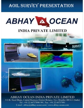
SlideShare a Scribd company logo
AOIL SURVEY PRESENTATION
Abhay Ocean offers a complete range of Marine survey
services, including desktop studies (DTS), topographic landing
surveys, shallow-water (including diver swim) surveys, IHO
bathymetry, pre- and post-dredge, submarine cable and pipeline
route surveys, covering the whole route from landing site, near
shore to full ocean depths.
ABHAY OCEAN INDIA PVT LTD Established in 1998 at
Mumbai, by Capt. Jagdish Khokhar an ex Indian naval
officer, having over 35 years experience in managing &
executing wide variety of projects in Marine/Offshore
Services.
WWW.ABHAY-OCEAN.COM ABHAY@ABHAY-OCEAN.COM
Abhay Ocean offers a complete range of Marine survey
services, including desktop studies (DTS), topographic landing
surveys, shallow-water (including diver swim) surveys, IHO
bathymetry, pre- and post-dredge, submarine cable and pipeline
route surveys, covering the whole route from landing site, near
shore to full ocean depths.
Abhay Ocean is ready to provide customized geotechnical
services to ISO, ASTM and NGI guidelines. Our track record
includes successful projects.
We routinely utilize various overburden-sampling tools such as
vibrocoring systems, piston corers, gravity corers and grab
sampling units, as well as box samplers and ROV push-type
corers.
Abhay Ocean measures a range of oceanographic and
meteorological parameters, all of which are important both for
design and operational purposes. Oceanographic measurements
are made in water depths ranging from coastal areas to full
ocean depth.
As a part of our survey services, we Abhay Ocean provide comprehensive survey and
marine services to both offshore and onshore industry to support every stage of the
development of construction facilities.
ABHAY OCEAN’S Survey services support every stage in the development of both
onshore, offshore and near shore facilities. These include geophysical and
geotechnical investigations, bathymetry, Hydrographical survey to provide the
information required by engineers designing offshore platforms, pipelines and cables,
and to support dredging, reclamation and other near shore civil works.
Shallow seismic records are interpreted by our geophysicists to understand complex
seabed geology and sonar records are used to map seabed features that have been
identified and located during the survey.
Our engineers examine soil samples recovered from drilling operations to calculate
soil strength and perform foundation engineering studies required by the engineers
and designers of both onshore and offshore structures / constructions.
The geophysical information gathered is required prior to the design and installation
of subsea pipelines and offshore structures. Hydrographic surveys are carried out to
chart the seafloor and used for navigation or engineering, design purposes and
volume calculation for dredging activities.
WWW.ABHAY-OCEAN.COM ABHAY@ABHAY-OCEAN.COM
As a part of our survey services, we Abhay Ocean provide comprehensive survey and
marine services to both offshore and onshore industry to support every stage of the
development of construction facilities.
ABHAY OCEAN’S Survey services support every stage in the development of both
onshore, offshore and near shore facilities. These include geophysical and
geotechnical investigations, bathymetry, Hydrographical survey to provide the
information required by engineers designing offshore platforms, pipelines and cables,
and to support dredging, reclamation and other near shore civil works.
Shallow seismic records are interpreted by our geophysicists to understand complex
seabed geology and sonar records are used to map seabed features that have been
identified and located during the survey.
Our engineers examine soil samples recovered from drilling operations to calculate
soil strength and perform foundation engineering studies required by the engineers
and designers of both onshore and offshore structures / constructions.
The geophysical information gathered is required prior to the design and installation
of subsea pipelines and offshore structures. Hydrographic surveys are carried out to
chart the seafloor and used for navigation or engineering, design purposes and
volume calculation for dredging activities.
•Pipeline and cable route surveys
•Rig and platform site surveys
•High resolution seismic surveys
•Large scale mapping / hazard surveys
•Near shore geophysical Surveys
•Bathymetric surveys
•Hydrographic Surveys
•Hydro Dam & Reservoir Surveys
• Land Survey
• Oceanographic Survey
• Dredging Survey
• Geotechnical & Geophysical Survey
• Navigational & Positioning Survey
• Mooring
• Offshore survey
• Soil Investigation & Material Testing
WE PROVIDE THE FOLLOWING SERVICES FOR:
AOIL uses a wide variety of technologies in order to create
accurate assessments of a range of underwater conditions. All
surveys use a combination of technologies as necessary for the
requirements of the project.
Digital sonar
Scanning or side-scan sonar
Sub-bottom profiling systems
Differential global positioning system (DGPS)
Robotic total station
Laser
Digital CCTV
Special camera lenses
Gas sensor
Solid state bearing and inclinometer
Electronic tide gauge
Long tether
UNDERWATER SURVEY TECHNOLOGIES FOR
INSPECTION OF UNDERWATER CONDITIONS
WWW.ABHAY-OCEAN.COM ABHAY@ABHAY-OCEAN.COM
AOIL uses a wide variety of technologies in order to create
accurate assessments of a range of underwater conditions. All
surveys use a combination of technologies as necessary for the
requirements of the project.
Digital sonar
Scanning or side-scan sonar
Sub-bottom profiling systems
Differential global positioning system (DGPS)
Robotic total station
Laser
Digital CCTV
Special camera lenses
Gas sensor
Solid state bearing and inclinometer
Electronic tide gauge
Long tether
DIGITAL SONAR
Sonar is a basic tool of underwater surveys.
A programmable, narrow-beam sonar head generates an acoustic pulse. The sound
frequency and pulse can be modified and calibrated to suit conditions. When the
sound pulse hits a target, it bounces back and the echo appears as a data point.
Data points are calculated using the angle of the sonar head, the speed of sound in
water and the travel time.
Consecutive profiles or cross-sections of the pipe, surface or other targeted feature
are built as the rotating sonar head mechanically sweeps about its axis and travels
along a pre-determined path. When operating within a ±45° angle of incidence to
the targeted feature, the overall accuracy of our sonar system is considered to be
better than 0.5% of range.
The sonar system can be deployed from a robotic tractor, skid, float or small boat.
Data from the sonar, attitude sensor and other technologies is fed into our software
and used to calculate X, Y and Z information, and can then be produced in a
variety of formats. When the sonar is combined with a CCTV camera, the sonar
image is displayed on screen as a picture in picture.
Using sonar, data can be gathered from a vertical dam face, across the bottom,
under overhangs or other vertical structures, or inside pipes and sewers.
WWW.ABHAY-OCEAN.COM ABHAY@ABHAY-OCEAN.COM
DIGITAL SONAR
Sonar is a basic tool of underwater surveys.
A programmable, narrow-beam sonar head generates an acoustic pulse. The sound
frequency and pulse can be modified and calibrated to suit conditions. When the
sound pulse hits a target, it bounces back and the echo appears as a data point.
Data points are calculated using the angle of the sonar head, the speed of sound in
water and the travel time.
Consecutive profiles or cross-sections of the pipe, surface or other targeted feature
are built as the rotating sonar head mechanically sweeps about its axis and travels
along a pre-determined path. When operating within a ±45° angle of incidence to
the targeted feature, the overall accuracy of our sonar system is considered to be
better than 0.5% of range.
The sonar system can be deployed from a robotic tractor, skid, float or small boat.
Data from the sonar, attitude sensor and other technologies is fed into our software
and used to calculate X, Y and Z information, and can then be produced in a
variety of formats. When the sonar is combined with a CCTV camera, the sonar
image is displayed on screen as a picture in picture.
Using sonar, data can be gathered from a vertical dam face, across the bottom,
under overhangs or other vertical structures, or inside pipes and sewers.
SCANNING OR SIDE-SCAN SONAR
WWW.ABHAY-OCEAN.COM ABHAY@ABHAY-OCEAN.COM
AOIL uses side-scan sonar to investigate seafloor conditions such as scour
patterns, obstructions, the type and size of debris, and the condition of
pipelines and cables. Side-scan is useful in detecting debris items and other
obstructions that may be hazardous to shipping or to seafloor installations by
the oil and gas industry. Side-scan sonar is also used for dredging operations
and environmental studies.
Side-scan uses a sonar device that emits fan-shaped pulses toward the seafloor
across a wide angle perpendicular to the path of the sensor through the water,
which may either be towed from a surface vessel, or the sensor may be rotated
about a stationary point.
The intensity of the acoustic reflections from the seafloor is recorded in a
series of cross-track slices. When stitched together along the direction of
motion, these slices form an image of the sea bottom within the swath
(coverage width) of the beam, and the resulting images can be combined and
overlaid on a 3D wire mesh surface.
Side-scan data are frequently acquired along with sub-bottom profiler data.
SUB-BOTTOM PROFILING SYSTEMS
WWW.ABHAY-OCEAN.COM ABHAY@ABHAY-OCEAN.COM
Especially useful in surveys of river crossings, sub-bottom
profiling systems measure the positions of objects that exist below
the bottom. A sound source emits a signal downwards into the
water and a receiver records the reflected return. Some of the
acoustic signal will penetrate the bottom and be reflected when it
encounters a change in density such as a pipeline or sediment
layers. The system uses this reflected energy to provide
information on features beneath the bottom.
Sub-bottom profiling systems can be useful for calculating pipe
cover or exposure, or areas of concern. The penetration depth
depends on the hardness of the overlying layers and the presence
of gas deposits, such as methane.
Differential Global Positioning System (DGPS)
WWW.ABHAY-OCEAN.COM ABHAY@ABHAY-OCEAN.COM
Accurate positioning allows precise geo referencing and accurate
collation of data from multiple technology sources.
The Differential Global Positioning System (DGPS) is an
enhancement to the Global Positioning System. It uses a network of
fixed, ground-based reference stations to broadcast the difference
between the positions indicated by the satellite systems and the
known fixed positions.
Depending on the accuracy required, AOIL uses a Trimble Pro
XRS (sub metre) or RTK GPS (centimetre) receiver. The Pro XRS
offers GPS, WAAS, EGNOS, satellite differential, and beacon
capabilities. It also uses patented multipath rejection technology to
remove multipath signals in reflective environments.
Robotic total station
For tracking and positioning to
centimetre accuracy we use a
Trimble 5600 or Trimble S6
robotic total station in
combination with the sonar
head prism. The S6 has a spin
rate of 115 degrees per second
and a distance accuracy of +/-
0.8 mm +1 ppm.
WWW.ABHAY-OCEAN.COM ABHAY@ABHAY-OCEAN.COM
Laser
AOIL uses proprietary laser
measurement devices
specifically to obtain data on
pipe profiles above the water
line. Combining sonar and laser
data provides a complete pipe
profile, while adding digital
CCTV images enables post-
survey review of actual pipe
condition.
ELECTRONIC TIDE GAUGE
WWW.ABHAY-OCEAN.COM ABHAY@ABHAY-OCEAN.COM
To track water elevation we us a submersible pressure
transmitter. This device stores pressure, temperature and time
data, and the data is also monitored in real time via a radio link.
The tide gauge is calibrated on site by following our written
procedures for field calibration.
HYDROGRAPHIC SURVEYS
WWW.ABHAY-OCEAN.COM ABHAY@ABHAY-OCEAN.COM
AOIL Surveyor conducts hydrographic surveys using single-
beam and multi-beam depth sounders with hull-mounted
transducers. We use the most stringent Class 1 standards
required by the Engineers for pre- and post-dredge
hydrographic surveys.
The activities in the offshore industry are the mainstay of our
business. From positioning to surveying and mapping; the
company is well-equipped to offer a full service to the oil and
diamond mining industries.
The supply and interpretation of high resolution multibeam
surveys is key to the success of many of our clients and
Underwater Surveys has undertaken work for most of the larger
diamond mining and oil exploration companies.
Oil exploration/drilling activities off the West and East coasts are
of particular interest and Underwater Surveys is well geared to
support companies operating there.
Demand for marine phosphates is on the increase and some marine
diamond miners are focusing on this resource as the price
continues to climb on international markets.
OFFSHORE SURVEYS
WWW.ABHAY-OCEAN.COM ABHAY@ABHAY-OCEAN.COM
The activities in the offshore industry are the mainstay of our
business. From positioning to surveying and mapping; the
company is well-equipped to offer a full service to the oil and
diamond mining industries.
The supply and interpretation of high resolution multibeam
surveys is key to the success of many of our clients and
Underwater Surveys has undertaken work for most of the larger
diamond mining and oil exploration companies.
Oil exploration/drilling activities off the West and East coasts are
of particular interest and Underwater Surveys is well geared to
support companies operating there.
Demand for marine phosphates is on the increase and some marine
diamond miners are focusing on this resource as the price
continues to climb on international markets.
PORT/ DREDGING SURVEYS
WWW.ABHAY-OCEAN.COM ABHAY@ABHAY-OCEAN.COM
The ongoing activity in India with regard to harbour and port
upgrades is also of particular interest to Underwater Surveys as
we focus on port and harbour breakwater surveys as well as pre
and post dredge surveys.
It is important to establish an accurate measure of dredging
volumes, because dredgers charge per cubic metre dredged and a
discrepancy in the amount invoiced versus the actual amount
dredged should be avoided.
We have done a lot of work to enhance the safety of navigation.
In some cases a port survey in the developing countries has
increased the usability of the port, as well as lowered the
insurance premiums for internationally registered vessels entering
the port.
OFFSHORE SURVEYS
The activities in the offshore industry are the mainstay of our
business. From positioning to surveying and mapping; the
company is well-equipped to offer a full service to the oil and
diamond mining industries.
The supply and interpretation of high resolution multi-beam
surveys is key to the success of many of our clients and
Underwater Surveys has undertaken work for most of the
larger mining and oil exploration companies.
Oil exploration/drilling activities off the West and East coasts
are of particular interest and Underwater Surveys is well
geared to support companies operating there.
Demand for marine phosphates is on the increase and some
marine diamond miners are focusing on this resource as the
price continues to climb on international markets.
Offshore Surveys Services
Port Clearance & Harbour Breakwater Surveys
Approach Channel Surveys
Cable Route Surveys
Pipeline Inspection/Route Surveys
Pre- and Post Dredge Surveys
Diamond Mining Surveys
Regional Mapping Surveys
Archaeological Surveys
WWW.ABHAY-OCEAN.COM ABHAY@ABHAY-OCEAN.COM
OFFSHORE SURVEYS
The activities in the offshore industry are the mainstay of our
business. From positioning to surveying and mapping; the
company is well-equipped to offer a full service to the oil and
diamond mining industries.
The supply and interpretation of high resolution multi-beam
surveys is key to the success of many of our clients and
Underwater Surveys has undertaken work for most of the
larger mining and oil exploration companies.
Oil exploration/drilling activities off the West and East coasts
are of particular interest and Underwater Surveys is well
geared to support companies operating there.
Demand for marine phosphates is on the increase and some
marine diamond miners are focusing on this resource as the
price continues to climb on international markets.
Offshore Surveys Services
Port Clearance & Harbour Breakwater Surveys
Approach Channel Surveys
Cable Route Surveys
Pipeline Inspection/Route Surveys
Pre- and Post Dredge Surveys
Diamond Mining Surveys
Regional Mapping Surveys
Archaeological Surveys
POSITIONING
WWW.ABHAY-OCEAN.COM ABHAY@ABHAY-OCEAN.COM
Accurate underwater positioning is extremely important in the
offshore environment/industry and with satellite-based wide area
GPS positioning system that we offer – we are able to provide
"decimeter accuracy" anywhere in the world.
Our positioning services include the following-
Satellite Navigation Services
Surface and Underwater Positioning Solutions
ROV Positioning Support
Rig and Anchor Handling Positioning Support
RTK GPS Positioning
AOIL has a survey division that specialize in inland hydrographic
surveys and the whole spectrum of engineering surveys.
Specialised Inland Hydrographic and Engineering Surveys
Inland Hydrographic Surveys (Single / High Resolution
Multibeam Echo Sounding)
Sedimentation Surveys in Dams, Barrages and Rivers
Capacity Surveys of Reservoirs/Dams (% Useable Water and %
Dead Water)
Determining Lowest Outlet of Reservoirs/Dams
River Profiling for Hydrological Studies
River Profiling for Flood Line Calculation
River Profiling for Environmental Studies
River Profiling for Engineering Design
As-Built Structure Surveys on Land and in Water
Engineering Inspections of Dam Walls
Capacity and Engineering data plan for Water Resource
Management of dams using singlebeam/multibeam echosounder
and a combination of conventional survey methods
WWW.ABHAY-OCEAN.COM ABHAY@ABHAY-OCEAN.COM
AOIL has a survey division that specialize in inland hydrographic
surveys and the whole spectrum of engineering surveys.
Specialised Inland Hydrographic and Engineering Surveys
Inland Hydrographic Surveys (Single / High Resolution
Multibeam Echo Sounding)
Sedimentation Surveys in Dams, Barrages and Rivers
Capacity Surveys of Reservoirs/Dams (% Useable Water and %
Dead Water)
Determining Lowest Outlet of Reservoirs/Dams
River Profiling for Hydrological Studies
River Profiling for Flood Line Calculation
River Profiling for Environmental Studies
River Profiling for Engineering Design
As-Built Structure Surveys on Land and in Water
Engineering Inspections of Dam Walls
Capacity and Engineering data plan for Water Resource
Management of dams using singlebeam/multibeam echosounder
and a combination of conventional survey methods
TOPOGRAPHIC SURVEY SERVICES
Our experience has
seen us tested in
some of the most
challenging
environments in
India, from wind
swept coastlines &
beaches, tidal
causeways, dry-dock
installations and
working quarry &
landfill sites.
WWW.ABHAY-OCEAN.COM ABHAY@ABHAY-OCEAN.COM
We have also completed surveys on airport runways, road bridges,
piers, carriageways, within water treatment works, along pipeline
routes, and almost every other modern day location and facility.
Our experience has
seen us tested in
some of the most
challenging
environments in
India, from wind
swept coastlines &
beaches, tidal
causeways, dry-dock
installations and
working quarry &
landfill sites.
HYDROGRAPHIC SURVEY SERVICES
Single Beam Bathymetry
Multibeam Bathymetry
Side-Scan Sonar
Sub-Bottom Profiling
Geophysical Survey
Magentometer Surveys
Diver Inspection Surveys
Diver Inspections
Marine Support Services
Survey Vessel Charter
Aspect Land & Hydrographic Surveys' marine survey division offers a wide
variety of skills and services, including bathymetric surveys, side-scan sonar
imagery, magnetometer surveys, sub-bottom profiling, full geophysical
interpretation & analysis and dock wall surveys / investigation.
Our capabilities include single or multibeam echosounder bathymetry to
provide the client's required resolution in either 2D paper or electronic plot
or as a 3D model, be that a fly through for presentation purposes or
conventional models to allow engineering development or scientific
interpretation. Our bathymetric data can be overlain with geo-referenced
sonar backscatter imagery either from side-scan or Multibeam echosounder.
Full, high-resolution multibeam bathymetry products can include a variety
of digital files for ingestion in other modelling or design software, paper
products including detailed bathymetry, colour-banded contours,
geomorphological assessment and underwater target detection and
classification.
WWW.ABHAY-OCEAN.COM ABHAY@ABHAY-OCEAN.COM
HYDROGRAPHIC SURVEY SERVICES
Single Beam Bathymetry
Multibeam Bathymetry
Side-Scan Sonar
Sub-Bottom Profiling
Geophysical Survey
Magentometer Surveys
Diver Inspection Surveys
Diver Inspections
Marine Support Services
Survey Vessel Charter
Aspect Land & Hydrographic Surveys' marine survey division offers a wide
variety of skills and services, including bathymetric surveys, side-scan sonar
imagery, magnetometer surveys, sub-bottom profiling, full geophysical
interpretation & analysis and dock wall surveys / investigation.
Our capabilities include single or multibeam echosounder bathymetry to
provide the client's required resolution in either 2D paper or electronic plot
or as a 3D model, be that a fly through for presentation purposes or
conventional models to allow engineering development or scientific
interpretation. Our bathymetric data can be overlain with geo-referenced
sonar backscatter imagery either from side-scan or Multibeam echosounder.
Full, high-resolution multibeam bathymetry products can include a variety
of digital files for ingestion in other modelling or design software, paper
products including detailed bathymetry, colour-banded contours,
geomorphological assessment and underwater target detection and
classification.
SINGLE BEAM BATHYMETRY
WWW.ABHAY-OCEAN.COM ABHAY@ABHAY-OCEAN.COM
Our single beam (SBES) bathymetric surveys are primarily
conducted using survey grade Kongsberg Maritime EA400 dual
frequency echo sounders. Other equipment may be utilized to suit
the client's needs and the operating environment as required. RTK
GPS positioning is preferred and heave compensation is applied to
all surveys.
Tidal data is either processed from the RTK GPS or obtained from
the deployment of a fully calibrated and referenced tide gauge.
High quality survey planning, real time quality assurance and
stringent post survey quality control assure appropriate survey
standards are met. We adhere to nationally and internationally
accepted hydrographic survey standards including the
International Hydrographic Organization's.
MULTIBEAM BATHYMETRY
WWW.ABHAY-OCEAN.COM ABHAY@ABHAY-OCEAN.COM
AOIL operate a Kongsberg EM3002 shallow water high definition multibeam
(MBES) system. This system is optimized to operate in depths between 0.5 and
200m.
The system operates a swath width of 4 x water depth as standard. When
operating in extreme shallow water and when the client requires 100% seabed
insonification we prefer to utilize a second transducer making this system a dual
head EM3002, capable of swath widths up to 10x water depth and thereby
reducing the time taken on the data gathering task very significantly.
Multibeam Bathymetry Services-
- Bathymetric surveys to IHO Special Order standard
- Environmental surveys
- Offshore renewable energy projects
- Dock wall inspections
- Marine archaeology projects
- Wreck and object detection
- Dredging control and monitoring
Side-scan sonar is used to create an image of large areas of the
sea floor, this system is used for mapping the seabed for a wide
variety of purposes, including creation of nautical charts and the
detection and identification of underwater objects and
bathymetric features.
It is also used to conduct surveys for marine archaeology and in
conjunction with seafloor samples it is able to provide an
understanding of the differences in material and texture type of
the seabed.
Side-scan sonar imagery is also commonly used to detect items of
debris and other obstructions on the seafloor that may be
hazardous to shipping or to seafloor installations, such oil and gas
pipelines, outfalls, cable routes, oil / gas platform positioning and
marine industry construction works.
SIDE-SCAN SONAR SURVEY
SIDE SCAN SONAR TO IDENTIFY & PIPELINES OR OUTFALLS.
WWW.ABHAY-OCEAN.COM ABHAY@ABHAY-OCEAN.COM
Side-scan sonar is used to create an image of large areas of the
sea floor, this system is used for mapping the seabed for a wide
variety of purposes, including creation of nautical charts and the
detection and identification of underwater objects and
bathymetric features.
It is also used to conduct surveys for marine archaeology and in
conjunction with seafloor samples it is able to provide an
understanding of the differences in material and texture type of
the seabed.
Side-scan sonar imagery is also commonly used to detect items of
debris and other obstructions on the seafloor that may be
hazardous to shipping or to seafloor installations, such oil and gas
pipelines, outfalls, cable routes, oil / gas platform positioning and
marine industry construction works.
GEOPHYSICAL SURVEY
Geophysical survey, or
reflection seismology, is a
method of exploratory
geophysics that uses the
principles of seismology to
estimate the properties of the
earth's subsurface from
reflected seismic waves.
The method requires a controlled seismic source of energy, and by
noting the time it takes for a reflection to arrive at a receiver it is
possible to estimate the depth of the feature that generated the
reflection.
Some of the acoustic signal will penetrate the seabed and be
reflected when it encounters a boundary between two layers that
have different acoustical properties, known as acoustic impedance.
WWW.ABHAY-OCEAN.COM ABHAY@ABHAY-OCEAN.COM
Geophysical survey, or
reflection seismology, is a
method of exploratory
geophysics that uses the
principles of seismology to
estimate the properties of the
earth's subsurface from
reflected seismic waves.
Magnetometry measures local variations in the earth's magnetic field.
Small local anomalies result from the contrasting levels of magnetic
susceptibility which exist between in filled 'cut' features or structures and
the local substrate or bedrock. This effect is principally due to the varying
iron content in the soil and rock forming minerals.
The majority of magnetometer surveys are undertaken with a gradiometer
which measures the magnetic gradient between two sensors
(magnetometers) arranged on a horizontal separation, normally 1m or 2m
apart.
Readings can be automatically logged allowing large amounts of data to be
recorded and stored quite rapidly.
Surveys are usually undertaken along predetermined gridlines, logging at
an average of four readings per metre.
Post-processing of data on-site allows the survey results to be monitored
and modified as required.
MAGNETOMETER SURVEY
WWW.ABHAY-OCEAN.COM ABHAY@ABHAY-OCEAN.COM
Magnetometry measures local variations in the earth's magnetic field.
Small local anomalies result from the contrasting levels of magnetic
susceptibility which exist between in filled 'cut' features or structures and
the local substrate or bedrock. This effect is principally due to the varying
iron content in the soil and rock forming minerals.
The majority of magnetometer surveys are undertaken with a gradiometer
which measures the magnetic gradient between two sensors
(magnetometers) arranged on a horizontal separation, normally 1m or 2m
apart.
Readings can be automatically logged allowing large amounts of data to be
recorded and stored quite rapidly.
Surveys are usually undertaken along predetermined gridlines, logging at
an average of four readings per metre.
Post-processing of data on-site allows the survey results to be monitored
and modified as required.
DIVER INSPECTION SURVEYS
WWW.ABHAY-OCEAN.COM ABHAY@ABHAY-OCEAN.COM
The divers represent some of the most experienced in the country
and have developed a reputation for performing the most difficult
of underwater tasks safely, efficiently and in a timely & cost
effective manner.
Complex survey and salvage operations have been accomplished
at open water locations in water depths of up to 40 metres, with
safety and professionalism paramount in all operations.
.
MICRO-BATHYMETRYAND UNDERWATER METROLOGY
WWW.ABHAY-OCEAN.COM ABHAY@ABHAY-OCEAN.COM
Micro-bathymetry relies on high precision acoustic
measurements and definition. It is done by surveying with high
accuracy and resolution multibeams that result in clouds of
georeferenced sounding points that can be visualized in 3D. It is
done by scanning in multiple passes with either remote
controlled vehicles or autonomous from various vantage points.
It has applications in 3D site surveys and structure inspections,
dam, bridge and harbor inspection, archaeology related
activities and scour and erosion monitoring. Following the high
precision and resolution data, distances and surfaces can be very
rigorously measured.
We have the equipment and
expertise to undertake a wide
range of marine support
services, including pre & post
dredge surveys, turbidity
monitoring, barge & rig
positioning and associated
works whether in open
waters or congested
harbours, waterways or
approach channels.
Dredging Surveys &
Supervision
We have significant
experience in dredging
supervision works, including
pre and post dredge surveys
and payment volume
calculations.
MARINE SUPPORT SERVICES
WWW.ABHAY-OCEAN.COM ABHAY@ABHAY-OCEAN.COM
We have the equipment and
expertise to undertake a wide
range of marine support
services, including pre & post
dredge surveys, turbidity
monitoring, barge & rig
positioning and associated
works whether in open
waters or congested
harbours, waterways or
approach channels.
Dredging Surveys &
Supervision
We have significant
experience in dredging
supervision works, including
pre and post dredge surveys
and payment volume
calculations.
We regularly conduct interim surveys for numerous dredging
contractors throughout India- although we act as an independent
survey company, which is a major benefit to the client or port authority.
Dredger Operations
Plough Dredging-We also act as the client's representative on
contractor's surveys to witness and verify survey results, as required in
many contracts. Projects include both Capital Dredging works (quay
construction, etc) utilising Backhoe or Bucket dredgers and
Maintenance Dredging (removal of silt / sediment over a previously
established level) usually carried out by Grab Hopper dredgers and
workboats operating Plough Levelling techniques.
UNDERWATER INFRASTRUCTURE MAINTENANCE
Underwater infrastructure is often business critical. By
conducting a survey of your underwater infrastructure and creating
a maintenance plan you can maximize utilization and increase
lifespan.
AOIL can carry out a
survey of your maritime
infrastructure to assess
its current status.
Typical structures
surveyed include e.g.
port basins, piers,
breakwaters, bridges,
dams, power plants and
offshore wind parks.
Underwater survey is
carried out with high
resolution MBES
sensors that gather
significantly detailed
information compared
to traditional survey
methods. Survey results
are not dependent on the
water visibility and
surveys can be carried
out even during night
time.
BERTH BOTTOM EROSION
PIPE LINE SURVEY
WWW.ABHAY-OCEAN.COM ABHAY@ABHAY-OCEAN.COM
Simultaneously with the
underwater survey, also
above water structures are
documented with a laser
scanner, providing an
integrated model of both
under and above water
structures.
When extreme preciseness
is needed, the survey
results can be further
enhanced with a scanning
sonar survey, which is the
most accurate underwater
survey method available
LASER SCANNER
Simultaneously with the
underwater survey, also
above water structures are
documented with a laser
scanner, providing an
integrated model of both
under and above water
structures.
When extreme preciseness
is needed, the survey
results can be further
enhanced with a scanning
sonar survey, which is the
most accurate underwater
survey method available
WWW.ABHAY-OCEAN.COM ABHAY@ABHAY-OCEAN.COM
3D MODEL OF UNDERWATER INFRASTRUCTURE
WWW.ABHAY-OCEAN.COM ABHAY@ABHAY-OCEAN.COM
Survey results are 3D point clouds, which our experts build
into an extremely accurate, fully integrated model of
underwater and above the water infrastructures. Experts
analyze the data and point out any changes in the structures.
Typical issues found include quay wall damages, scouring that
has led to slope deformation as well as foreign objects and
other changes on sea bed.
channel slope inspection
SCOUR PROTECTION, MONITORING & PREVENTION
WWW.ABHAY-OCEAN.COM ABHAY@ABHAY-OCEAN.COM
The presence of scour (erosion of the seabed surface)
around marine structures including offshore wind farm
turbines is a common occurrence. Scour prevention
measures are often deployed when wind turbines are
installed in order to minimize the risk of future problems
associated with scour.
Scour erosion around an offshore wind turbine base
captured real time
UNDERWATER BRIDGE INSPECTION & SCOUR MONITORING
WWW.ABHAY-OCEAN.COM ABHAY@ABHAY-OCEAN.COM
Bridge inspections, conducted by certified bridge inspection
divers, are the most common activity. Sonars have been used to a
small degree for remote depth monitoring, post-navigational
incident and search/recovery activities. However, bridge
inspections are still primarily conducted using only divers. These
inspections can be time consuming and present significant health
and safety risks to divers .
The 3D sonar provides a real-time, geo-referenced, high
resolution imaging that is intuitive and easily understood. It is
uniquely suited to fill the role of a submerged structure imaging
system that equals or exceeds the current standard of visual
inspection.
Bridge Inspection close up – visual marks.
UNDERWATER BRIDGE INSPECTION & SCOUR MONITORING
WWW.ABHAY-OCEAN.COM ABHAY@ABHAY-OCEAN.COM
The 3D sonar provides a real-time, geo-referenced, high
resolution imaging that is intuitive and easily understood. It is
uniquely suited to fill the role of a submerged structure imaging
system that equals or exceeds the current standard of visual
inspection.
Wind Turbine Inspection.
UNDERWATER MANIFOLD 3D INSPECTION & SCOUR MONITORING
WWW.ABHAY-OCEAN.COM ABHAY@ABHAY-OCEAN.COM
CODA OCTOPUS 3D SONAR- SCOUR PROTECTION
WWW.ABHAY-OCEAN.COM ABHAY@ABHAY-OCEAN.COM
CODA OCTOPUS- 3D SONAR- JACKET INSPECTION
WWW.ABHAY-OCEAN.COM ABHAY@ABHAY-OCEAN.COM
CODA OCTOPUS- 3D SONAR PIPELINE INSPECTION
WWW.ABHAY-OCEAN.COM ABHAY@ABHAY-OCEAN.COM
Thank You.
For Any Query Please Contact :
CAPT. JAGDISH KHOKHAR
(Managing Director)
Cell: +91 99 2030 9055
E-mail: jk@abhay-ocean.com
www.abhay-ocean.com
WWW.ABHAY-OCEAN.COM ABHAY@ABHAY-OCEAN.COM
Thank You.
For Any Query Please Contact :
CAPT. JAGDISH KHOKHAR
(Managing Director)
Cell: +91 99 2030 9055
E-mail: jk@abhay-ocean.com
www.abhay-ocean.com

More Related Content

Viewers also liked

Вук Стефановић Караџић
Вук Стефановић КараџићВук Стефановић Караџић
Вук Стефановић КараџићMajaMS
 
Desafio dos times - confraternização
Desafio dos times - confraternizaçãoDesafio dos times - confraternização
Desafio dos times - confraternização
Ester Rebecchi
 
Manga Rosario + vampire Tomo 10
Manga Rosario + vampire Tomo 10Manga Rosario + vampire Tomo 10
Manga Rosario + vampire Tomo 10
Kuroe
 
Mdr tb management in emr updates from r glc
Mdr tb management in emr updates from r glcMdr tb management in emr updates from r glc
Mdr tb management in emr updates from r glc
Essam Elmoghazy
 
Downhill
DownhillDownhill
Creación de experiencias desde la calidad
Creación de experiencias desde la calidadCreación de experiencias desde la calidad
Creación de experiencias desde la calidad
Asociación Española para la Calidad
 
Maia & Leite Propaganda
Maia & Leite PropagandaMaia & Leite Propaganda
Maia & Leite Propaganda
Gax Brasil
 
The Annual Quality Statement for NHS Wales 2014: Delivering high quality heal...
The Annual Quality Statement for NHS Wales 2014: Delivering high quality heal...The Annual Quality Statement for NHS Wales 2014: Delivering high quality heal...
The Annual Quality Statement for NHS Wales 2014: Delivering high quality heal...
scarletdesign
 
Music Therapy
Music TherapyMusic Therapy
Music Therapy
Maanveer Singh
 
Chukotka slides (p2 text1)
Chukotka slides (p2 text1)Chukotka slides (p2 text1)
Chukotka slides (p2 text1)
Boun Yadyok
 
Petrobras Oil Platform
Petrobras Oil PlatformPetrobras Oil Platform
Petrobras Oil Platform
lenduffy
 
5 factores a considerar en el proceso de transformación digital
5 factores a considerar en el proceso de transformación digital5 factores a considerar en el proceso de transformación digital
5 factores a considerar en el proceso de transformación digital
Corporacion Colombia Digital
 
Submarine outfalls & intakes ppt
Submarine outfalls & intakes pptSubmarine outfalls & intakes ppt
Submarine outfalls & intakes ppt
Abhay Ocean India ltd.
 
Lean startup: convierta su idea en un negocio
Lean startup: convierta su idea en un negocioLean startup: convierta su idea en un negocio
Lean startup: convierta su idea en un negocio
Corporacion Colombia Digital
 
RIFAMPICIN [MEDICINAL CHEMISTRY] BY P.RAVISANKAR.
RIFAMPICIN [MEDICINAL CHEMISTRY] BY P.RAVISANKAR.RIFAMPICIN [MEDICINAL CHEMISTRY] BY P.RAVISANKAR.
RIFAMPICIN [MEDICINAL CHEMISTRY] BY P.RAVISANKAR.
Dr. Ravi Sankar
 
Rifampicin ppt. ravi (medicinal chemistry)
Rifampicin ppt. ravi (medicinal chemistry)Rifampicin ppt. ravi (medicinal chemistry)
Rifampicin ppt. ravi (medicinal chemistry)
Dr. Ravi Sankar
 

Viewers also liked (16)

Вук Стефановић Караџић
Вук Стефановић КараџићВук Стефановић Караџић
Вук Стефановић Караџић
 
Desafio dos times - confraternização
Desafio dos times - confraternizaçãoDesafio dos times - confraternização
Desafio dos times - confraternização
 
Manga Rosario + vampire Tomo 10
Manga Rosario + vampire Tomo 10Manga Rosario + vampire Tomo 10
Manga Rosario + vampire Tomo 10
 
Mdr tb management in emr updates from r glc
Mdr tb management in emr updates from r glcMdr tb management in emr updates from r glc
Mdr tb management in emr updates from r glc
 
Downhill
DownhillDownhill
Downhill
 
Creación de experiencias desde la calidad
Creación de experiencias desde la calidadCreación de experiencias desde la calidad
Creación de experiencias desde la calidad
 
Maia & Leite Propaganda
Maia & Leite PropagandaMaia & Leite Propaganda
Maia & Leite Propaganda
 
The Annual Quality Statement for NHS Wales 2014: Delivering high quality heal...
The Annual Quality Statement for NHS Wales 2014: Delivering high quality heal...The Annual Quality Statement for NHS Wales 2014: Delivering high quality heal...
The Annual Quality Statement for NHS Wales 2014: Delivering high quality heal...
 
Music Therapy
Music TherapyMusic Therapy
Music Therapy
 
Chukotka slides (p2 text1)
Chukotka slides (p2 text1)Chukotka slides (p2 text1)
Chukotka slides (p2 text1)
 
Petrobras Oil Platform
Petrobras Oil PlatformPetrobras Oil Platform
Petrobras Oil Platform
 
5 factores a considerar en el proceso de transformación digital
5 factores a considerar en el proceso de transformación digital5 factores a considerar en el proceso de transformación digital
5 factores a considerar en el proceso de transformación digital
 
Submarine outfalls & intakes ppt
Submarine outfalls & intakes pptSubmarine outfalls & intakes ppt
Submarine outfalls & intakes ppt
 
Lean startup: convierta su idea en un negocio
Lean startup: convierta su idea en un negocioLean startup: convierta su idea en un negocio
Lean startup: convierta su idea en un negocio
 
RIFAMPICIN [MEDICINAL CHEMISTRY] BY P.RAVISANKAR.
RIFAMPICIN [MEDICINAL CHEMISTRY] BY P.RAVISANKAR.RIFAMPICIN [MEDICINAL CHEMISTRY] BY P.RAVISANKAR.
RIFAMPICIN [MEDICINAL CHEMISTRY] BY P.RAVISANKAR.
 
Rifampicin ppt. ravi (medicinal chemistry)
Rifampicin ppt. ravi (medicinal chemistry)Rifampicin ppt. ravi (medicinal chemistry)
Rifampicin ppt. ravi (medicinal chemistry)
 

Similar to Aoil survey presentation

Hydrographic Survey
Hydrographic SurveyHydrographic Survey
Hydrographic Survey
Shubham Bathwal
 
Beneath the Surface: Navigating the Depths with Hydrographic Surveys
Beneath the Surface: Navigating the Depths with Hydrographic SurveysBeneath the Surface: Navigating the Depths with Hydrographic Surveys
Beneath the Surface: Navigating the Depths with Hydrographic Surveys
falconsurveyme
 
CE203 -Hydrographic survey.pptx
CE203 -Hydrographic survey.pptxCE203 -Hydrographic survey.pptx
CE203 -Hydrographic survey.pptx
AbdulQHannan
 
Hazard Detection and Debris Clearance - Total Hydrographic
Hazard Detection and Debris Clearance - Total HydrographicHazard Detection and Debris Clearance - Total Hydrographic
Hazard Detection and Debris Clearance - Total Hydrographic
Total Hydrographic Survey
 
Bridge Scour
Bridge Scour Bridge Scour
Pipeline Depth Of Cover Surveys
Pipeline Depth Of Cover SurveysPipeline Depth Of Cover Surveys
Pipeline Depth Of Cover Surveys
Sidescan
 
Introduction to surveying
Introduction to surveyingIntroduction to surveying
Introduction to surveying
santosh927
 
Deep sea underwater surveying
Deep sea underwater surveyingDeep sea underwater surveying
Deep sea underwater surveying
bbinitha
 
The Ultimate Guide for Hydrographic Surveys
The Ultimate Guide for Hydrographic SurveysThe Ultimate Guide for Hydrographic Surveys
The Ultimate Guide for Hydrographic Surveys
falconsurveyme
 
How We Conduct Bathymetric Surveys?
How We Conduct Bathymetric Surveys?How We Conduct Bathymetric Surveys?
How We Conduct Bathymetric Surveys?
Total Hydrographic Survey
 
W7b Side Scan Sonar 2018-19.pdf
W7b  Side Scan Sonar 2018-19.pdfW7b  Side Scan Sonar 2018-19.pdf
W7b Side Scan Sonar 2018-19.pdf
AzryHafize
 
Petroleum lunch seminar 30.10.2014
Petroleum lunch seminar 30.10.2014Petroleum lunch seminar 30.10.2014
Petroleum lunch seminar 30.10.2014
Geodata AS
 
Edgetech Marine technologies presentation at Codevintec's Workshop (by Nick L...
Edgetech Marine technologies presentation at Codevintec's Workshop (by Nick L...Edgetech Marine technologies presentation at Codevintec's Workshop (by Nick L...
Edgetech Marine technologies presentation at Codevintec's Workshop (by Nick L...
Codevintec Italiana srl
 
Introduction to Seismic Method
Introduction to Seismic Method Introduction to Seismic Method
Introduction to Seismic Method
Ahmed Younhais Tariq
 
Reconnaissance for Hydrographic Survey Project
Reconnaissance for Hydrographic  Survey ProjectReconnaissance for Hydrographic  Survey Project
Reconnaissance for Hydrographic Survey Project
Nzar Braim
 
Site Surveys_Rig Safety-Link
Site Surveys_Rig Safety-LinkSite Surveys_Rig Safety-Link
Site Surveys_Rig Safety-LinkAbdul Rahim
 
Lec (remote sensing).pptx
Lec (remote sensing).pptxLec (remote sensing).pptx
Lec (remote sensing).pptx
SarfrazFaiz
 
Nick - Benefits of Using Combined Bathymetry and Side Scan Sonar in Shallow W...
Nick - Benefits of Using Combined Bathymetry and Side Scan Sonar in Shallow W...Nick - Benefits of Using Combined Bathymetry and Side Scan Sonar in Shallow W...
Nick - Benefits of Using Combined Bathymetry and Side Scan Sonar in Shallow W...
Codevintec Italiana srl
 
Ground water resource evaluation
Ground water resource evaluationGround water resource evaluation
Ground water resource evaluation
Renel Alucilja
 
Presentation of Introduction to basics of SONAR.pptx
Presentation of Introduction to basics of SONAR.pptxPresentation of Introduction to basics of SONAR.pptx
Presentation of Introduction to basics of SONAR.pptx
asadmohammedjmu
 

Similar to Aoil survey presentation (20)

Hydrographic Survey
Hydrographic SurveyHydrographic Survey
Hydrographic Survey
 
Beneath the Surface: Navigating the Depths with Hydrographic Surveys
Beneath the Surface: Navigating the Depths with Hydrographic SurveysBeneath the Surface: Navigating the Depths with Hydrographic Surveys
Beneath the Surface: Navigating the Depths with Hydrographic Surveys
 
CE203 -Hydrographic survey.pptx
CE203 -Hydrographic survey.pptxCE203 -Hydrographic survey.pptx
CE203 -Hydrographic survey.pptx
 
Hazard Detection and Debris Clearance - Total Hydrographic
Hazard Detection and Debris Clearance - Total HydrographicHazard Detection and Debris Clearance - Total Hydrographic
Hazard Detection and Debris Clearance - Total Hydrographic
 
Bridge Scour
Bridge Scour Bridge Scour
Bridge Scour
 
Pipeline Depth Of Cover Surveys
Pipeline Depth Of Cover SurveysPipeline Depth Of Cover Surveys
Pipeline Depth Of Cover Surveys
 
Introduction to surveying
Introduction to surveyingIntroduction to surveying
Introduction to surveying
 
Deep sea underwater surveying
Deep sea underwater surveyingDeep sea underwater surveying
Deep sea underwater surveying
 
The Ultimate Guide for Hydrographic Surveys
The Ultimate Guide for Hydrographic SurveysThe Ultimate Guide for Hydrographic Surveys
The Ultimate Guide for Hydrographic Surveys
 
How We Conduct Bathymetric Surveys?
How We Conduct Bathymetric Surveys?How We Conduct Bathymetric Surveys?
How We Conduct Bathymetric Surveys?
 
W7b Side Scan Sonar 2018-19.pdf
W7b  Side Scan Sonar 2018-19.pdfW7b  Side Scan Sonar 2018-19.pdf
W7b Side Scan Sonar 2018-19.pdf
 
Petroleum lunch seminar 30.10.2014
Petroleum lunch seminar 30.10.2014Petroleum lunch seminar 30.10.2014
Petroleum lunch seminar 30.10.2014
 
Edgetech Marine technologies presentation at Codevintec's Workshop (by Nick L...
Edgetech Marine technologies presentation at Codevintec's Workshop (by Nick L...Edgetech Marine technologies presentation at Codevintec's Workshop (by Nick L...
Edgetech Marine technologies presentation at Codevintec's Workshop (by Nick L...
 
Introduction to Seismic Method
Introduction to Seismic Method Introduction to Seismic Method
Introduction to Seismic Method
 
Reconnaissance for Hydrographic Survey Project
Reconnaissance for Hydrographic  Survey ProjectReconnaissance for Hydrographic  Survey Project
Reconnaissance for Hydrographic Survey Project
 
Site Surveys_Rig Safety-Link
Site Surveys_Rig Safety-LinkSite Surveys_Rig Safety-Link
Site Surveys_Rig Safety-Link
 
Lec (remote sensing).pptx
Lec (remote sensing).pptxLec (remote sensing).pptx
Lec (remote sensing).pptx
 
Nick - Benefits of Using Combined Bathymetry and Side Scan Sonar in Shallow W...
Nick - Benefits of Using Combined Bathymetry and Side Scan Sonar in Shallow W...Nick - Benefits of Using Combined Bathymetry and Side Scan Sonar in Shallow W...
Nick - Benefits of Using Combined Bathymetry and Side Scan Sonar in Shallow W...
 
Ground water resource evaluation
Ground water resource evaluationGround water resource evaluation
Ground water resource evaluation
 
Presentation of Introduction to basics of SONAR.pptx
Presentation of Introduction to basics of SONAR.pptxPresentation of Introduction to basics of SONAR.pptx
Presentation of Introduction to basics of SONAR.pptx
 

More from Abhay Ocean India ltd.

Aoil profile 2016
Aoil  profile  2016 Aoil  profile  2016
Aoil profile 2016
Abhay Ocean India ltd.
 
Proposed subsea power grid AOIL
Proposed subsea power grid AOILProposed subsea power grid AOIL
Proposed subsea power grid AOIL
Abhay Ocean India ltd.
 
Aoil Tidal energy ppt
Aoil Tidal energy pptAoil Tidal energy ppt
Aoil Tidal energy ppt
Abhay Ocean India ltd.
 
Aoil wind power ppt 2015
Aoil wind power ppt 2015Aoil wind power ppt 2015
Aoil wind power ppt 2015
Abhay Ocean India ltd.
 
Immersed tunnels Proposal Mumbai, India
Immersed tunnels Proposal Mumbai, IndiaImmersed tunnels Proposal Mumbai, India
Immersed tunnels Proposal Mumbai, India
Abhay Ocean India ltd.
 
Technical catalogue submarine installations of pipes
Technical catalogue submarine installations of pipesTechnical catalogue submarine installations of pipes
Technical catalogue submarine installations of pipes
Abhay Ocean India ltd.
 
Aoil diving code,& standards 2016
Aoil diving code,& standards 2016 Aoil diving code,& standards 2016
Aoil diving code,& standards 2016
Abhay Ocean India ltd.
 
Aoil floating solar power plant ppt 2015
Aoil floating solar power plant ppt 2015Aoil floating solar power plant ppt 2015
Aoil floating solar power plant ppt 2015
Abhay Ocean India ltd.
 
Floating resorts Project in India
Floating resorts Project in  IndiaFloating resorts Project in  India
Floating resorts Project in India
Abhay Ocean India ltd.
 
Funicular railways Proposal ppt
Funicular railways Proposal pptFunicular railways Proposal ppt
Funicular railways Proposal ppt
Abhay Ocean India ltd.
 
Aoil dredging ppt
Aoil dredging ppt Aoil dredging ppt
Aoil dredging ppt
Abhay Ocean India ltd.
 
Aoil diving
Aoil diving Aoil diving

More from Abhay Ocean India ltd. (12)

Aoil profile 2016
Aoil  profile  2016 Aoil  profile  2016
Aoil profile 2016
 
Proposed subsea power grid AOIL
Proposed subsea power grid AOILProposed subsea power grid AOIL
Proposed subsea power grid AOIL
 
Aoil Tidal energy ppt
Aoil Tidal energy pptAoil Tidal energy ppt
Aoil Tidal energy ppt
 
Aoil wind power ppt 2015
Aoil wind power ppt 2015Aoil wind power ppt 2015
Aoil wind power ppt 2015
 
Immersed tunnels Proposal Mumbai, India
Immersed tunnels Proposal Mumbai, IndiaImmersed tunnels Proposal Mumbai, India
Immersed tunnels Proposal Mumbai, India
 
Technical catalogue submarine installations of pipes
Technical catalogue submarine installations of pipesTechnical catalogue submarine installations of pipes
Technical catalogue submarine installations of pipes
 
Aoil diving code,& standards 2016
Aoil diving code,& standards 2016 Aoil diving code,& standards 2016
Aoil diving code,& standards 2016
 
Aoil floating solar power plant ppt 2015
Aoil floating solar power plant ppt 2015Aoil floating solar power plant ppt 2015
Aoil floating solar power plant ppt 2015
 
Floating resorts Project in India
Floating resorts Project in  IndiaFloating resorts Project in  India
Floating resorts Project in India
 
Funicular railways Proposal ppt
Funicular railways Proposal pptFunicular railways Proposal ppt
Funicular railways Proposal ppt
 
Aoil dredging ppt
Aoil dredging ppt Aoil dredging ppt
Aoil dredging ppt
 
Aoil diving
Aoil diving Aoil diving
Aoil diving
 

Recently uploaded

一比一原版(IIT毕业证)伊利诺伊理工大学毕业证成绩单专业办理
一比一原版(IIT毕业证)伊利诺伊理工大学毕业证成绩单专业办理一比一原版(IIT毕业证)伊利诺伊理工大学毕业证成绩单专业办理
一比一原版(IIT毕业证)伊利诺伊理工大学毕业证成绩单专业办理
zwunae
 
J.Yang, ICLR 2024, MLILAB, KAIST AI.pdf
J.Yang,  ICLR 2024, MLILAB, KAIST AI.pdfJ.Yang,  ICLR 2024, MLILAB, KAIST AI.pdf
J.Yang, ICLR 2024, MLILAB, KAIST AI.pdf
MLILAB
 
Runway Orientation Based on the Wind Rose Diagram.pptx
Runway Orientation Based on the Wind Rose Diagram.pptxRunway Orientation Based on the Wind Rose Diagram.pptx
Runway Orientation Based on the Wind Rose Diagram.pptx
SupreethSP4
 
Top 10 Oil and Gas Projects in Saudi Arabia 2024.pdf
Top 10 Oil and Gas Projects in Saudi Arabia 2024.pdfTop 10 Oil and Gas Projects in Saudi Arabia 2024.pdf
Top 10 Oil and Gas Projects in Saudi Arabia 2024.pdf
Teleport Manpower Consultant
 
Hybrid optimization of pumped hydro system and solar- Engr. Abdul-Azeez.pdf
Hybrid optimization of pumped hydro system and solar- Engr. Abdul-Azeez.pdfHybrid optimization of pumped hydro system and solar- Engr. Abdul-Azeez.pdf
Hybrid optimization of pumped hydro system and solar- Engr. Abdul-Azeez.pdf
fxintegritypublishin
 
在线办理(ANU毕业证书)澳洲国立大学毕业证录取通知书一模一样
在线办理(ANU毕业证书)澳洲国立大学毕业证录取通知书一模一样在线办理(ANU毕业证书)澳洲国立大学毕业证录取通知书一模一样
在线办理(ANU毕业证书)澳洲国立大学毕业证录取通知书一模一样
obonagu
 
AKS UNIVERSITY Satna Final Year Project By OM Hardaha.pdf
AKS UNIVERSITY Satna Final Year Project By OM Hardaha.pdfAKS UNIVERSITY Satna Final Year Project By OM Hardaha.pdf
AKS UNIVERSITY Satna Final Year Project By OM Hardaha.pdf
SamSarthak3
 
space technology lecture notes on satellite
space technology lecture notes on satellitespace technology lecture notes on satellite
space technology lecture notes on satellite
ongomchris
 
H.Seo, ICLR 2024, MLILAB, KAIST AI.pdf
H.Seo,  ICLR 2024, MLILAB,  KAIST AI.pdfH.Seo,  ICLR 2024, MLILAB,  KAIST AI.pdf
H.Seo, ICLR 2024, MLILAB, KAIST AI.pdf
MLILAB
 
Industrial Training at Shahjalal Fertilizer Company Limited (SFCL)
Industrial Training at Shahjalal Fertilizer Company Limited (SFCL)Industrial Training at Shahjalal Fertilizer Company Limited (SFCL)
Industrial Training at Shahjalal Fertilizer Company Limited (SFCL)
MdTanvirMahtab2
 
一比一原版(SFU毕业证)西蒙菲莎大学毕业证成绩单如何办理
一比一原版(SFU毕业证)西蒙菲莎大学毕业证成绩单如何办理一比一原版(SFU毕业证)西蒙菲莎大学毕业证成绩单如何办理
一比一原版(SFU毕业证)西蒙菲莎大学毕业证成绩单如何办理
bakpo1
 
Architectural Portfolio Sean Lockwood
Architectural Portfolio Sean LockwoodArchitectural Portfolio Sean Lockwood
Architectural Portfolio Sean Lockwood
seandesed
 
一比一原版(UofT毕业证)多伦多大学毕业证成绩单如何办理
一比一原版(UofT毕业证)多伦多大学毕业证成绩单如何办理一比一原版(UofT毕业证)多伦多大学毕业证成绩单如何办理
一比一原版(UofT毕业证)多伦多大学毕业证成绩单如何办理
ydteq
 
Planning Of Procurement o different goods and services
Planning Of Procurement o different goods and servicesPlanning Of Procurement o different goods and services
Planning Of Procurement o different goods and services
JoytuBarua2
 
English lab ppt no titlespecENG PPTt.pdf
English lab ppt no titlespecENG PPTt.pdfEnglish lab ppt no titlespecENG PPTt.pdf
English lab ppt no titlespecENG PPTt.pdf
BrazilAccount1
 
Final project report on grocery store management system..pdf
Final project report on grocery store management system..pdfFinal project report on grocery store management system..pdf
Final project report on grocery store management system..pdf
Kamal Acharya
 
power quality voltage fluctuation UNIT - I.pptx
power quality voltage fluctuation UNIT - I.pptxpower quality voltage fluctuation UNIT - I.pptx
power quality voltage fluctuation UNIT - I.pptx
ViniHema
 
CME397 Surface Engineering- Professional Elective
CME397 Surface Engineering- Professional ElectiveCME397 Surface Engineering- Professional Elective
CME397 Surface Engineering- Professional Elective
karthi keyan
 
CFD Simulation of By-pass Flow in a HRSG module by R&R Consult.pptx
CFD Simulation of By-pass Flow in a HRSG module by R&R Consult.pptxCFD Simulation of By-pass Flow in a HRSG module by R&R Consult.pptx
CFD Simulation of By-pass Flow in a HRSG module by R&R Consult.pptx
R&R Consult
 
Hierarchical Digital Twin of a Naval Power System
Hierarchical Digital Twin of a Naval Power SystemHierarchical Digital Twin of a Naval Power System
Hierarchical Digital Twin of a Naval Power System
Kerry Sado
 

Recently uploaded (20)

一比一原版(IIT毕业证)伊利诺伊理工大学毕业证成绩单专业办理
一比一原版(IIT毕业证)伊利诺伊理工大学毕业证成绩单专业办理一比一原版(IIT毕业证)伊利诺伊理工大学毕业证成绩单专业办理
一比一原版(IIT毕业证)伊利诺伊理工大学毕业证成绩单专业办理
 
J.Yang, ICLR 2024, MLILAB, KAIST AI.pdf
J.Yang,  ICLR 2024, MLILAB, KAIST AI.pdfJ.Yang,  ICLR 2024, MLILAB, KAIST AI.pdf
J.Yang, ICLR 2024, MLILAB, KAIST AI.pdf
 
Runway Orientation Based on the Wind Rose Diagram.pptx
Runway Orientation Based on the Wind Rose Diagram.pptxRunway Orientation Based on the Wind Rose Diagram.pptx
Runway Orientation Based on the Wind Rose Diagram.pptx
 
Top 10 Oil and Gas Projects in Saudi Arabia 2024.pdf
Top 10 Oil and Gas Projects in Saudi Arabia 2024.pdfTop 10 Oil and Gas Projects in Saudi Arabia 2024.pdf
Top 10 Oil and Gas Projects in Saudi Arabia 2024.pdf
 
Hybrid optimization of pumped hydro system and solar- Engr. Abdul-Azeez.pdf
Hybrid optimization of pumped hydro system and solar- Engr. Abdul-Azeez.pdfHybrid optimization of pumped hydro system and solar- Engr. Abdul-Azeez.pdf
Hybrid optimization of pumped hydro system and solar- Engr. Abdul-Azeez.pdf
 
在线办理(ANU毕业证书)澳洲国立大学毕业证录取通知书一模一样
在线办理(ANU毕业证书)澳洲国立大学毕业证录取通知书一模一样在线办理(ANU毕业证书)澳洲国立大学毕业证录取通知书一模一样
在线办理(ANU毕业证书)澳洲国立大学毕业证录取通知书一模一样
 
AKS UNIVERSITY Satna Final Year Project By OM Hardaha.pdf
AKS UNIVERSITY Satna Final Year Project By OM Hardaha.pdfAKS UNIVERSITY Satna Final Year Project By OM Hardaha.pdf
AKS UNIVERSITY Satna Final Year Project By OM Hardaha.pdf
 
space technology lecture notes on satellite
space technology lecture notes on satellitespace technology lecture notes on satellite
space technology lecture notes on satellite
 
H.Seo, ICLR 2024, MLILAB, KAIST AI.pdf
H.Seo,  ICLR 2024, MLILAB,  KAIST AI.pdfH.Seo,  ICLR 2024, MLILAB,  KAIST AI.pdf
H.Seo, ICLR 2024, MLILAB, KAIST AI.pdf
 
Industrial Training at Shahjalal Fertilizer Company Limited (SFCL)
Industrial Training at Shahjalal Fertilizer Company Limited (SFCL)Industrial Training at Shahjalal Fertilizer Company Limited (SFCL)
Industrial Training at Shahjalal Fertilizer Company Limited (SFCL)
 
一比一原版(SFU毕业证)西蒙菲莎大学毕业证成绩单如何办理
一比一原版(SFU毕业证)西蒙菲莎大学毕业证成绩单如何办理一比一原版(SFU毕业证)西蒙菲莎大学毕业证成绩单如何办理
一比一原版(SFU毕业证)西蒙菲莎大学毕业证成绩单如何办理
 
Architectural Portfolio Sean Lockwood
Architectural Portfolio Sean LockwoodArchitectural Portfolio Sean Lockwood
Architectural Portfolio Sean Lockwood
 
一比一原版(UofT毕业证)多伦多大学毕业证成绩单如何办理
一比一原版(UofT毕业证)多伦多大学毕业证成绩单如何办理一比一原版(UofT毕业证)多伦多大学毕业证成绩单如何办理
一比一原版(UofT毕业证)多伦多大学毕业证成绩单如何办理
 
Planning Of Procurement o different goods and services
Planning Of Procurement o different goods and servicesPlanning Of Procurement o different goods and services
Planning Of Procurement o different goods and services
 
English lab ppt no titlespecENG PPTt.pdf
English lab ppt no titlespecENG PPTt.pdfEnglish lab ppt no titlespecENG PPTt.pdf
English lab ppt no titlespecENG PPTt.pdf
 
Final project report on grocery store management system..pdf
Final project report on grocery store management system..pdfFinal project report on grocery store management system..pdf
Final project report on grocery store management system..pdf
 
power quality voltage fluctuation UNIT - I.pptx
power quality voltage fluctuation UNIT - I.pptxpower quality voltage fluctuation UNIT - I.pptx
power quality voltage fluctuation UNIT - I.pptx
 
CME397 Surface Engineering- Professional Elective
CME397 Surface Engineering- Professional ElectiveCME397 Surface Engineering- Professional Elective
CME397 Surface Engineering- Professional Elective
 
CFD Simulation of By-pass Flow in a HRSG module by R&R Consult.pptx
CFD Simulation of By-pass Flow in a HRSG module by R&R Consult.pptxCFD Simulation of By-pass Flow in a HRSG module by R&R Consult.pptx
CFD Simulation of By-pass Flow in a HRSG module by R&R Consult.pptx
 
Hierarchical Digital Twin of a Naval Power System
Hierarchical Digital Twin of a Naval Power SystemHierarchical Digital Twin of a Naval Power System
Hierarchical Digital Twin of a Naval Power System
 

Aoil survey presentation

  • 2. Abhay Ocean offers a complete range of Marine survey services, including desktop studies (DTS), topographic landing surveys, shallow-water (including diver swim) surveys, IHO bathymetry, pre- and post-dredge, submarine cable and pipeline route surveys, covering the whole route from landing site, near shore to full ocean depths. ABHAY OCEAN INDIA PVT LTD Established in 1998 at Mumbai, by Capt. Jagdish Khokhar an ex Indian naval officer, having over 35 years experience in managing & executing wide variety of projects in Marine/Offshore Services. WWW.ABHAY-OCEAN.COM ABHAY@ABHAY-OCEAN.COM Abhay Ocean offers a complete range of Marine survey services, including desktop studies (DTS), topographic landing surveys, shallow-water (including diver swim) surveys, IHO bathymetry, pre- and post-dredge, submarine cable and pipeline route surveys, covering the whole route from landing site, near shore to full ocean depths. Abhay Ocean is ready to provide customized geotechnical services to ISO, ASTM and NGI guidelines. Our track record includes successful projects. We routinely utilize various overburden-sampling tools such as vibrocoring systems, piston corers, gravity corers and grab sampling units, as well as box samplers and ROV push-type corers. Abhay Ocean measures a range of oceanographic and meteorological parameters, all of which are important both for design and operational purposes. Oceanographic measurements are made in water depths ranging from coastal areas to full ocean depth.
  • 3. As a part of our survey services, we Abhay Ocean provide comprehensive survey and marine services to both offshore and onshore industry to support every stage of the development of construction facilities. ABHAY OCEAN’S Survey services support every stage in the development of both onshore, offshore and near shore facilities. These include geophysical and geotechnical investigations, bathymetry, Hydrographical survey to provide the information required by engineers designing offshore platforms, pipelines and cables, and to support dredging, reclamation and other near shore civil works. Shallow seismic records are interpreted by our geophysicists to understand complex seabed geology and sonar records are used to map seabed features that have been identified and located during the survey. Our engineers examine soil samples recovered from drilling operations to calculate soil strength and perform foundation engineering studies required by the engineers and designers of both onshore and offshore structures / constructions. The geophysical information gathered is required prior to the design and installation of subsea pipelines and offshore structures. Hydrographic surveys are carried out to chart the seafloor and used for navigation or engineering, design purposes and volume calculation for dredging activities. WWW.ABHAY-OCEAN.COM ABHAY@ABHAY-OCEAN.COM As a part of our survey services, we Abhay Ocean provide comprehensive survey and marine services to both offshore and onshore industry to support every stage of the development of construction facilities. ABHAY OCEAN’S Survey services support every stage in the development of both onshore, offshore and near shore facilities. These include geophysical and geotechnical investigations, bathymetry, Hydrographical survey to provide the information required by engineers designing offshore platforms, pipelines and cables, and to support dredging, reclamation and other near shore civil works. Shallow seismic records are interpreted by our geophysicists to understand complex seabed geology and sonar records are used to map seabed features that have been identified and located during the survey. Our engineers examine soil samples recovered from drilling operations to calculate soil strength and perform foundation engineering studies required by the engineers and designers of both onshore and offshore structures / constructions. The geophysical information gathered is required prior to the design and installation of subsea pipelines and offshore structures. Hydrographic surveys are carried out to chart the seafloor and used for navigation or engineering, design purposes and volume calculation for dredging activities. •Pipeline and cable route surveys •Rig and platform site surveys •High resolution seismic surveys •Large scale mapping / hazard surveys •Near shore geophysical Surveys •Bathymetric surveys •Hydrographic Surveys •Hydro Dam & Reservoir Surveys • Land Survey • Oceanographic Survey • Dredging Survey • Geotechnical & Geophysical Survey • Navigational & Positioning Survey • Mooring • Offshore survey • Soil Investigation & Material Testing WE PROVIDE THE FOLLOWING SERVICES FOR:
  • 4. AOIL uses a wide variety of technologies in order to create accurate assessments of a range of underwater conditions. All surveys use a combination of technologies as necessary for the requirements of the project. Digital sonar Scanning or side-scan sonar Sub-bottom profiling systems Differential global positioning system (DGPS) Robotic total station Laser Digital CCTV Special camera lenses Gas sensor Solid state bearing and inclinometer Electronic tide gauge Long tether UNDERWATER SURVEY TECHNOLOGIES FOR INSPECTION OF UNDERWATER CONDITIONS WWW.ABHAY-OCEAN.COM ABHAY@ABHAY-OCEAN.COM AOIL uses a wide variety of technologies in order to create accurate assessments of a range of underwater conditions. All surveys use a combination of technologies as necessary for the requirements of the project. Digital sonar Scanning or side-scan sonar Sub-bottom profiling systems Differential global positioning system (DGPS) Robotic total station Laser Digital CCTV Special camera lenses Gas sensor Solid state bearing and inclinometer Electronic tide gauge Long tether
  • 5. DIGITAL SONAR Sonar is a basic tool of underwater surveys. A programmable, narrow-beam sonar head generates an acoustic pulse. The sound frequency and pulse can be modified and calibrated to suit conditions. When the sound pulse hits a target, it bounces back and the echo appears as a data point. Data points are calculated using the angle of the sonar head, the speed of sound in water and the travel time. Consecutive profiles or cross-sections of the pipe, surface or other targeted feature are built as the rotating sonar head mechanically sweeps about its axis and travels along a pre-determined path. When operating within a ±45° angle of incidence to the targeted feature, the overall accuracy of our sonar system is considered to be better than 0.5% of range. The sonar system can be deployed from a robotic tractor, skid, float or small boat. Data from the sonar, attitude sensor and other technologies is fed into our software and used to calculate X, Y and Z information, and can then be produced in a variety of formats. When the sonar is combined with a CCTV camera, the sonar image is displayed on screen as a picture in picture. Using sonar, data can be gathered from a vertical dam face, across the bottom, under overhangs or other vertical structures, or inside pipes and sewers. WWW.ABHAY-OCEAN.COM ABHAY@ABHAY-OCEAN.COM DIGITAL SONAR Sonar is a basic tool of underwater surveys. A programmable, narrow-beam sonar head generates an acoustic pulse. The sound frequency and pulse can be modified and calibrated to suit conditions. When the sound pulse hits a target, it bounces back and the echo appears as a data point. Data points are calculated using the angle of the sonar head, the speed of sound in water and the travel time. Consecutive profiles or cross-sections of the pipe, surface or other targeted feature are built as the rotating sonar head mechanically sweeps about its axis and travels along a pre-determined path. When operating within a ±45° angle of incidence to the targeted feature, the overall accuracy of our sonar system is considered to be better than 0.5% of range. The sonar system can be deployed from a robotic tractor, skid, float or small boat. Data from the sonar, attitude sensor and other technologies is fed into our software and used to calculate X, Y and Z information, and can then be produced in a variety of formats. When the sonar is combined with a CCTV camera, the sonar image is displayed on screen as a picture in picture. Using sonar, data can be gathered from a vertical dam face, across the bottom, under overhangs or other vertical structures, or inside pipes and sewers.
  • 6. SCANNING OR SIDE-SCAN SONAR WWW.ABHAY-OCEAN.COM ABHAY@ABHAY-OCEAN.COM AOIL uses side-scan sonar to investigate seafloor conditions such as scour patterns, obstructions, the type and size of debris, and the condition of pipelines and cables. Side-scan is useful in detecting debris items and other obstructions that may be hazardous to shipping or to seafloor installations by the oil and gas industry. Side-scan sonar is also used for dredging operations and environmental studies. Side-scan uses a sonar device that emits fan-shaped pulses toward the seafloor across a wide angle perpendicular to the path of the sensor through the water, which may either be towed from a surface vessel, or the sensor may be rotated about a stationary point. The intensity of the acoustic reflections from the seafloor is recorded in a series of cross-track slices. When stitched together along the direction of motion, these slices form an image of the sea bottom within the swath (coverage width) of the beam, and the resulting images can be combined and overlaid on a 3D wire mesh surface. Side-scan data are frequently acquired along with sub-bottom profiler data.
  • 7. SUB-BOTTOM PROFILING SYSTEMS WWW.ABHAY-OCEAN.COM ABHAY@ABHAY-OCEAN.COM Especially useful in surveys of river crossings, sub-bottom profiling systems measure the positions of objects that exist below the bottom. A sound source emits a signal downwards into the water and a receiver records the reflected return. Some of the acoustic signal will penetrate the bottom and be reflected when it encounters a change in density such as a pipeline or sediment layers. The system uses this reflected energy to provide information on features beneath the bottom. Sub-bottom profiling systems can be useful for calculating pipe cover or exposure, or areas of concern. The penetration depth depends on the hardness of the overlying layers and the presence of gas deposits, such as methane.
  • 8. Differential Global Positioning System (DGPS) WWW.ABHAY-OCEAN.COM ABHAY@ABHAY-OCEAN.COM Accurate positioning allows precise geo referencing and accurate collation of data from multiple technology sources. The Differential Global Positioning System (DGPS) is an enhancement to the Global Positioning System. It uses a network of fixed, ground-based reference stations to broadcast the difference between the positions indicated by the satellite systems and the known fixed positions. Depending on the accuracy required, AOIL uses a Trimble Pro XRS (sub metre) or RTK GPS (centimetre) receiver. The Pro XRS offers GPS, WAAS, EGNOS, satellite differential, and beacon capabilities. It also uses patented multipath rejection technology to remove multipath signals in reflective environments.
  • 9. Robotic total station For tracking and positioning to centimetre accuracy we use a Trimble 5600 or Trimble S6 robotic total station in combination with the sonar head prism. The S6 has a spin rate of 115 degrees per second and a distance accuracy of +/- 0.8 mm +1 ppm. WWW.ABHAY-OCEAN.COM ABHAY@ABHAY-OCEAN.COM Laser AOIL uses proprietary laser measurement devices specifically to obtain data on pipe profiles above the water line. Combining sonar and laser data provides a complete pipe profile, while adding digital CCTV images enables post- survey review of actual pipe condition.
  • 10. ELECTRONIC TIDE GAUGE WWW.ABHAY-OCEAN.COM ABHAY@ABHAY-OCEAN.COM To track water elevation we us a submersible pressure transmitter. This device stores pressure, temperature and time data, and the data is also monitored in real time via a radio link. The tide gauge is calibrated on site by following our written procedures for field calibration.
  • 11. HYDROGRAPHIC SURVEYS WWW.ABHAY-OCEAN.COM ABHAY@ABHAY-OCEAN.COM AOIL Surveyor conducts hydrographic surveys using single- beam and multi-beam depth sounders with hull-mounted transducers. We use the most stringent Class 1 standards required by the Engineers for pre- and post-dredge hydrographic surveys.
  • 12. The activities in the offshore industry are the mainstay of our business. From positioning to surveying and mapping; the company is well-equipped to offer a full service to the oil and diamond mining industries. The supply and interpretation of high resolution multibeam surveys is key to the success of many of our clients and Underwater Surveys has undertaken work for most of the larger diamond mining and oil exploration companies. Oil exploration/drilling activities off the West and East coasts are of particular interest and Underwater Surveys is well geared to support companies operating there. Demand for marine phosphates is on the increase and some marine diamond miners are focusing on this resource as the price continues to climb on international markets. OFFSHORE SURVEYS WWW.ABHAY-OCEAN.COM ABHAY@ABHAY-OCEAN.COM The activities in the offshore industry are the mainstay of our business. From positioning to surveying and mapping; the company is well-equipped to offer a full service to the oil and diamond mining industries. The supply and interpretation of high resolution multibeam surveys is key to the success of many of our clients and Underwater Surveys has undertaken work for most of the larger diamond mining and oil exploration companies. Oil exploration/drilling activities off the West and East coasts are of particular interest and Underwater Surveys is well geared to support companies operating there. Demand for marine phosphates is on the increase and some marine diamond miners are focusing on this resource as the price continues to climb on international markets.
  • 13. PORT/ DREDGING SURVEYS WWW.ABHAY-OCEAN.COM ABHAY@ABHAY-OCEAN.COM The ongoing activity in India with regard to harbour and port upgrades is also of particular interest to Underwater Surveys as we focus on port and harbour breakwater surveys as well as pre and post dredge surveys. It is important to establish an accurate measure of dredging volumes, because dredgers charge per cubic metre dredged and a discrepancy in the amount invoiced versus the actual amount dredged should be avoided. We have done a lot of work to enhance the safety of navigation. In some cases a port survey in the developing countries has increased the usability of the port, as well as lowered the insurance premiums for internationally registered vessels entering the port.
  • 14. OFFSHORE SURVEYS The activities in the offshore industry are the mainstay of our business. From positioning to surveying and mapping; the company is well-equipped to offer a full service to the oil and diamond mining industries. The supply and interpretation of high resolution multi-beam surveys is key to the success of many of our clients and Underwater Surveys has undertaken work for most of the larger mining and oil exploration companies. Oil exploration/drilling activities off the West and East coasts are of particular interest and Underwater Surveys is well geared to support companies operating there. Demand for marine phosphates is on the increase and some marine diamond miners are focusing on this resource as the price continues to climb on international markets. Offshore Surveys Services Port Clearance & Harbour Breakwater Surveys Approach Channel Surveys Cable Route Surveys Pipeline Inspection/Route Surveys Pre- and Post Dredge Surveys Diamond Mining Surveys Regional Mapping Surveys Archaeological Surveys WWW.ABHAY-OCEAN.COM ABHAY@ABHAY-OCEAN.COM OFFSHORE SURVEYS The activities in the offshore industry are the mainstay of our business. From positioning to surveying and mapping; the company is well-equipped to offer a full service to the oil and diamond mining industries. The supply and interpretation of high resolution multi-beam surveys is key to the success of many of our clients and Underwater Surveys has undertaken work for most of the larger mining and oil exploration companies. Oil exploration/drilling activities off the West and East coasts are of particular interest and Underwater Surveys is well geared to support companies operating there. Demand for marine phosphates is on the increase and some marine diamond miners are focusing on this resource as the price continues to climb on international markets. Offshore Surveys Services Port Clearance & Harbour Breakwater Surveys Approach Channel Surveys Cable Route Surveys Pipeline Inspection/Route Surveys Pre- and Post Dredge Surveys Diamond Mining Surveys Regional Mapping Surveys Archaeological Surveys
  • 15. POSITIONING WWW.ABHAY-OCEAN.COM ABHAY@ABHAY-OCEAN.COM Accurate underwater positioning is extremely important in the offshore environment/industry and with satellite-based wide area GPS positioning system that we offer – we are able to provide "decimeter accuracy" anywhere in the world. Our positioning services include the following- Satellite Navigation Services Surface and Underwater Positioning Solutions ROV Positioning Support Rig and Anchor Handling Positioning Support RTK GPS Positioning
  • 16. AOIL has a survey division that specialize in inland hydrographic surveys and the whole spectrum of engineering surveys. Specialised Inland Hydrographic and Engineering Surveys Inland Hydrographic Surveys (Single / High Resolution Multibeam Echo Sounding) Sedimentation Surveys in Dams, Barrages and Rivers Capacity Surveys of Reservoirs/Dams (% Useable Water and % Dead Water) Determining Lowest Outlet of Reservoirs/Dams River Profiling for Hydrological Studies River Profiling for Flood Line Calculation River Profiling for Environmental Studies River Profiling for Engineering Design As-Built Structure Surveys on Land and in Water Engineering Inspections of Dam Walls Capacity and Engineering data plan for Water Resource Management of dams using singlebeam/multibeam echosounder and a combination of conventional survey methods WWW.ABHAY-OCEAN.COM ABHAY@ABHAY-OCEAN.COM AOIL has a survey division that specialize in inland hydrographic surveys and the whole spectrum of engineering surveys. Specialised Inland Hydrographic and Engineering Surveys Inland Hydrographic Surveys (Single / High Resolution Multibeam Echo Sounding) Sedimentation Surveys in Dams, Barrages and Rivers Capacity Surveys of Reservoirs/Dams (% Useable Water and % Dead Water) Determining Lowest Outlet of Reservoirs/Dams River Profiling for Hydrological Studies River Profiling for Flood Line Calculation River Profiling for Environmental Studies River Profiling for Engineering Design As-Built Structure Surveys on Land and in Water Engineering Inspections of Dam Walls Capacity and Engineering data plan for Water Resource Management of dams using singlebeam/multibeam echosounder and a combination of conventional survey methods
  • 17. TOPOGRAPHIC SURVEY SERVICES Our experience has seen us tested in some of the most challenging environments in India, from wind swept coastlines & beaches, tidal causeways, dry-dock installations and working quarry & landfill sites. WWW.ABHAY-OCEAN.COM ABHAY@ABHAY-OCEAN.COM We have also completed surveys on airport runways, road bridges, piers, carriageways, within water treatment works, along pipeline routes, and almost every other modern day location and facility. Our experience has seen us tested in some of the most challenging environments in India, from wind swept coastlines & beaches, tidal causeways, dry-dock installations and working quarry & landfill sites.
  • 18. HYDROGRAPHIC SURVEY SERVICES Single Beam Bathymetry Multibeam Bathymetry Side-Scan Sonar Sub-Bottom Profiling Geophysical Survey Magentometer Surveys Diver Inspection Surveys Diver Inspections Marine Support Services Survey Vessel Charter Aspect Land & Hydrographic Surveys' marine survey division offers a wide variety of skills and services, including bathymetric surveys, side-scan sonar imagery, magnetometer surveys, sub-bottom profiling, full geophysical interpretation & analysis and dock wall surveys / investigation. Our capabilities include single or multibeam echosounder bathymetry to provide the client's required resolution in either 2D paper or electronic plot or as a 3D model, be that a fly through for presentation purposes or conventional models to allow engineering development or scientific interpretation. Our bathymetric data can be overlain with geo-referenced sonar backscatter imagery either from side-scan or Multibeam echosounder. Full, high-resolution multibeam bathymetry products can include a variety of digital files for ingestion in other modelling or design software, paper products including detailed bathymetry, colour-banded contours, geomorphological assessment and underwater target detection and classification. WWW.ABHAY-OCEAN.COM ABHAY@ABHAY-OCEAN.COM HYDROGRAPHIC SURVEY SERVICES Single Beam Bathymetry Multibeam Bathymetry Side-Scan Sonar Sub-Bottom Profiling Geophysical Survey Magentometer Surveys Diver Inspection Surveys Diver Inspections Marine Support Services Survey Vessel Charter Aspect Land & Hydrographic Surveys' marine survey division offers a wide variety of skills and services, including bathymetric surveys, side-scan sonar imagery, magnetometer surveys, sub-bottom profiling, full geophysical interpretation & analysis and dock wall surveys / investigation. Our capabilities include single or multibeam echosounder bathymetry to provide the client's required resolution in either 2D paper or electronic plot or as a 3D model, be that a fly through for presentation purposes or conventional models to allow engineering development or scientific interpretation. Our bathymetric data can be overlain with geo-referenced sonar backscatter imagery either from side-scan or Multibeam echosounder. Full, high-resolution multibeam bathymetry products can include a variety of digital files for ingestion in other modelling or design software, paper products including detailed bathymetry, colour-banded contours, geomorphological assessment and underwater target detection and classification.
  • 19. SINGLE BEAM BATHYMETRY WWW.ABHAY-OCEAN.COM ABHAY@ABHAY-OCEAN.COM Our single beam (SBES) bathymetric surveys are primarily conducted using survey grade Kongsberg Maritime EA400 dual frequency echo sounders. Other equipment may be utilized to suit the client's needs and the operating environment as required. RTK GPS positioning is preferred and heave compensation is applied to all surveys. Tidal data is either processed from the RTK GPS or obtained from the deployment of a fully calibrated and referenced tide gauge. High quality survey planning, real time quality assurance and stringent post survey quality control assure appropriate survey standards are met. We adhere to nationally and internationally accepted hydrographic survey standards including the International Hydrographic Organization's.
  • 20. MULTIBEAM BATHYMETRY WWW.ABHAY-OCEAN.COM ABHAY@ABHAY-OCEAN.COM AOIL operate a Kongsberg EM3002 shallow water high definition multibeam (MBES) system. This system is optimized to operate in depths between 0.5 and 200m. The system operates a swath width of 4 x water depth as standard. When operating in extreme shallow water and when the client requires 100% seabed insonification we prefer to utilize a second transducer making this system a dual head EM3002, capable of swath widths up to 10x water depth and thereby reducing the time taken on the data gathering task very significantly. Multibeam Bathymetry Services- - Bathymetric surveys to IHO Special Order standard - Environmental surveys - Offshore renewable energy projects - Dock wall inspections - Marine archaeology projects - Wreck and object detection - Dredging control and monitoring
  • 21. Side-scan sonar is used to create an image of large areas of the sea floor, this system is used for mapping the seabed for a wide variety of purposes, including creation of nautical charts and the detection and identification of underwater objects and bathymetric features. It is also used to conduct surveys for marine archaeology and in conjunction with seafloor samples it is able to provide an understanding of the differences in material and texture type of the seabed. Side-scan sonar imagery is also commonly used to detect items of debris and other obstructions on the seafloor that may be hazardous to shipping or to seafloor installations, such oil and gas pipelines, outfalls, cable routes, oil / gas platform positioning and marine industry construction works. SIDE-SCAN SONAR SURVEY SIDE SCAN SONAR TO IDENTIFY & PIPELINES OR OUTFALLS. WWW.ABHAY-OCEAN.COM ABHAY@ABHAY-OCEAN.COM Side-scan sonar is used to create an image of large areas of the sea floor, this system is used for mapping the seabed for a wide variety of purposes, including creation of nautical charts and the detection and identification of underwater objects and bathymetric features. It is also used to conduct surveys for marine archaeology and in conjunction with seafloor samples it is able to provide an understanding of the differences in material and texture type of the seabed. Side-scan sonar imagery is also commonly used to detect items of debris and other obstructions on the seafloor that may be hazardous to shipping or to seafloor installations, such oil and gas pipelines, outfalls, cable routes, oil / gas platform positioning and marine industry construction works.
  • 22. GEOPHYSICAL SURVEY Geophysical survey, or reflection seismology, is a method of exploratory geophysics that uses the principles of seismology to estimate the properties of the earth's subsurface from reflected seismic waves. The method requires a controlled seismic source of energy, and by noting the time it takes for a reflection to arrive at a receiver it is possible to estimate the depth of the feature that generated the reflection. Some of the acoustic signal will penetrate the seabed and be reflected when it encounters a boundary between two layers that have different acoustical properties, known as acoustic impedance. WWW.ABHAY-OCEAN.COM ABHAY@ABHAY-OCEAN.COM Geophysical survey, or reflection seismology, is a method of exploratory geophysics that uses the principles of seismology to estimate the properties of the earth's subsurface from reflected seismic waves.
  • 23. Magnetometry measures local variations in the earth's magnetic field. Small local anomalies result from the contrasting levels of magnetic susceptibility which exist between in filled 'cut' features or structures and the local substrate or bedrock. This effect is principally due to the varying iron content in the soil and rock forming minerals. The majority of magnetometer surveys are undertaken with a gradiometer which measures the magnetic gradient between two sensors (magnetometers) arranged on a horizontal separation, normally 1m or 2m apart. Readings can be automatically logged allowing large amounts of data to be recorded and stored quite rapidly. Surveys are usually undertaken along predetermined gridlines, logging at an average of four readings per metre. Post-processing of data on-site allows the survey results to be monitored and modified as required. MAGNETOMETER SURVEY WWW.ABHAY-OCEAN.COM ABHAY@ABHAY-OCEAN.COM Magnetometry measures local variations in the earth's magnetic field. Small local anomalies result from the contrasting levels of magnetic susceptibility which exist between in filled 'cut' features or structures and the local substrate or bedrock. This effect is principally due to the varying iron content in the soil and rock forming minerals. The majority of magnetometer surveys are undertaken with a gradiometer which measures the magnetic gradient between two sensors (magnetometers) arranged on a horizontal separation, normally 1m or 2m apart. Readings can be automatically logged allowing large amounts of data to be recorded and stored quite rapidly. Surveys are usually undertaken along predetermined gridlines, logging at an average of four readings per metre. Post-processing of data on-site allows the survey results to be monitored and modified as required.
  • 24. DIVER INSPECTION SURVEYS WWW.ABHAY-OCEAN.COM ABHAY@ABHAY-OCEAN.COM The divers represent some of the most experienced in the country and have developed a reputation for performing the most difficult of underwater tasks safely, efficiently and in a timely & cost effective manner. Complex survey and salvage operations have been accomplished at open water locations in water depths of up to 40 metres, with safety and professionalism paramount in all operations. .
  • 25. MICRO-BATHYMETRYAND UNDERWATER METROLOGY WWW.ABHAY-OCEAN.COM ABHAY@ABHAY-OCEAN.COM Micro-bathymetry relies on high precision acoustic measurements and definition. It is done by surveying with high accuracy and resolution multibeams that result in clouds of georeferenced sounding points that can be visualized in 3D. It is done by scanning in multiple passes with either remote controlled vehicles or autonomous from various vantage points. It has applications in 3D site surveys and structure inspections, dam, bridge and harbor inspection, archaeology related activities and scour and erosion monitoring. Following the high precision and resolution data, distances and surfaces can be very rigorously measured.
  • 26. We have the equipment and expertise to undertake a wide range of marine support services, including pre & post dredge surveys, turbidity monitoring, barge & rig positioning and associated works whether in open waters or congested harbours, waterways or approach channels. Dredging Surveys & Supervision We have significant experience in dredging supervision works, including pre and post dredge surveys and payment volume calculations. MARINE SUPPORT SERVICES WWW.ABHAY-OCEAN.COM ABHAY@ABHAY-OCEAN.COM We have the equipment and expertise to undertake a wide range of marine support services, including pre & post dredge surveys, turbidity monitoring, barge & rig positioning and associated works whether in open waters or congested harbours, waterways or approach channels. Dredging Surveys & Supervision We have significant experience in dredging supervision works, including pre and post dredge surveys and payment volume calculations. We regularly conduct interim surveys for numerous dredging contractors throughout India- although we act as an independent survey company, which is a major benefit to the client or port authority. Dredger Operations Plough Dredging-We also act as the client's representative on contractor's surveys to witness and verify survey results, as required in many contracts. Projects include both Capital Dredging works (quay construction, etc) utilising Backhoe or Bucket dredgers and Maintenance Dredging (removal of silt / sediment over a previously established level) usually carried out by Grab Hopper dredgers and workboats operating Plough Levelling techniques.
  • 27. UNDERWATER INFRASTRUCTURE MAINTENANCE Underwater infrastructure is often business critical. By conducting a survey of your underwater infrastructure and creating a maintenance plan you can maximize utilization and increase lifespan. AOIL can carry out a survey of your maritime infrastructure to assess its current status. Typical structures surveyed include e.g. port basins, piers, breakwaters, bridges, dams, power plants and offshore wind parks. Underwater survey is carried out with high resolution MBES sensors that gather significantly detailed information compared to traditional survey methods. Survey results are not dependent on the water visibility and surveys can be carried out even during night time. AOIL can carry out a survey of your maritime infrastructure to assess its current status. Typical structures surveyed include e.g. port basins, piers, breakwaters, bridges, dams, power plants and offshore wind parks. Underwater survey is carried out with high resolution MBES sensors that gather significantly detailed information compared to traditional survey methods. Survey results are not dependent on the water visibility and surveys can be carried out even during night time. BERTH BOTTOM EROSION PIPE LINE SURVEY WWW.ABHAY-OCEAN.COM ABHAY@ABHAY-OCEAN.COM
  • 28. Simultaneously with the underwater survey, also above water structures are documented with a laser scanner, providing an integrated model of both under and above water structures. When extreme preciseness is needed, the survey results can be further enhanced with a scanning sonar survey, which is the most accurate underwater survey method available LASER SCANNER Simultaneously with the underwater survey, also above water structures are documented with a laser scanner, providing an integrated model of both under and above water structures. When extreme preciseness is needed, the survey results can be further enhanced with a scanning sonar survey, which is the most accurate underwater survey method available WWW.ABHAY-OCEAN.COM ABHAY@ABHAY-OCEAN.COM
  • 29. 3D MODEL OF UNDERWATER INFRASTRUCTURE WWW.ABHAY-OCEAN.COM ABHAY@ABHAY-OCEAN.COM Survey results are 3D point clouds, which our experts build into an extremely accurate, fully integrated model of underwater and above the water infrastructures. Experts analyze the data and point out any changes in the structures. Typical issues found include quay wall damages, scouring that has led to slope deformation as well as foreign objects and other changes on sea bed. channel slope inspection
  • 30. SCOUR PROTECTION, MONITORING & PREVENTION WWW.ABHAY-OCEAN.COM ABHAY@ABHAY-OCEAN.COM The presence of scour (erosion of the seabed surface) around marine structures including offshore wind farm turbines is a common occurrence. Scour prevention measures are often deployed when wind turbines are installed in order to minimize the risk of future problems associated with scour. Scour erosion around an offshore wind turbine base captured real time
  • 31. UNDERWATER BRIDGE INSPECTION & SCOUR MONITORING WWW.ABHAY-OCEAN.COM ABHAY@ABHAY-OCEAN.COM Bridge inspections, conducted by certified bridge inspection divers, are the most common activity. Sonars have been used to a small degree for remote depth monitoring, post-navigational incident and search/recovery activities. However, bridge inspections are still primarily conducted using only divers. These inspections can be time consuming and present significant health and safety risks to divers . The 3D sonar provides a real-time, geo-referenced, high resolution imaging that is intuitive and easily understood. It is uniquely suited to fill the role of a submerged structure imaging system that equals or exceeds the current standard of visual inspection. Bridge Inspection close up – visual marks.
  • 32. UNDERWATER BRIDGE INSPECTION & SCOUR MONITORING WWW.ABHAY-OCEAN.COM ABHAY@ABHAY-OCEAN.COM The 3D sonar provides a real-time, geo-referenced, high resolution imaging that is intuitive and easily understood. It is uniquely suited to fill the role of a submerged structure imaging system that equals or exceeds the current standard of visual inspection. Wind Turbine Inspection.
  • 33. UNDERWATER MANIFOLD 3D INSPECTION & SCOUR MONITORING WWW.ABHAY-OCEAN.COM ABHAY@ABHAY-OCEAN.COM
  • 34. CODA OCTOPUS 3D SONAR- SCOUR PROTECTION WWW.ABHAY-OCEAN.COM ABHAY@ABHAY-OCEAN.COM
  • 35. CODA OCTOPUS- 3D SONAR- JACKET INSPECTION WWW.ABHAY-OCEAN.COM ABHAY@ABHAY-OCEAN.COM
  • 36. CODA OCTOPUS- 3D SONAR PIPELINE INSPECTION WWW.ABHAY-OCEAN.COM ABHAY@ABHAY-OCEAN.COM
  • 37. Thank You. For Any Query Please Contact : CAPT. JAGDISH KHOKHAR (Managing Director) Cell: +91 99 2030 9055 E-mail: jk@abhay-ocean.com www.abhay-ocean.com WWW.ABHAY-OCEAN.COM ABHAY@ABHAY-OCEAN.COM Thank You. For Any Query Please Contact : CAPT. JAGDISH KHOKHAR (Managing Director) Cell: +91 99 2030 9055 E-mail: jk@abhay-ocean.com www.abhay-ocean.com