Downloaded 135 times

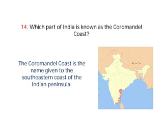

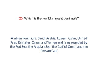


The document discusses various geographical terms and features. It begins by defining monsoon as a seasonal shift in wind direction that brings different weather when a warm air mass forms over a heated continent. It also defines El Nino and La Nina in relation to warming and cooling of surface waters in the Eastern Pacific. The Tropics of Cancer and Capricorn are described as the lines where the sun is directly overhead at noon on the summer and winter solstices in the Northern and Southern Hemispheres. Several other terms are defined such as peninsula, isthmus, trade winds, alluvial soil, and features like the Deccan Plateau, Brahmaputra River, Coromandel Coast, and Kosi


![Ch_1_geographical_diviersity_notes[1].docx](https://cdn.slidesharecdn.com/ss_thumbnails/ch1geographicaldiviersitynotes1-260121191317-3e5c211e-thumbnail.jpg?width=640&height=640&fit=bounds)