King County GIS Staff Usage Analysis
•Download as PPT, PDF•
1 like•442 views

Analysis against the 12 GIS roles identified in Gaudet, Annulis & Carr, Geospatial Technology Competency Model

Recommended
Recommended
More Related Content
What's hot
Viewers also liked
Similar to King County GIS Staff Usage Analysis
Similar to King County GIS Staff Usage Analysis (20)
More from Greg Babinski
More from Greg Babinski (20)
Recently uploaded
Recently uploaded (20)
King County GIS Staff Usage Analysis
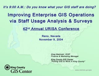
- 1. www.metrokc.gov/gis Greg Babinski, GISP Finance & Marketing Manager King County GIS Center “Putting GIS to Work in King County” It’s 9:00 A.M.: Do you know what your GIS staff are doing? Improving Enterprise GIS Operations via Staff Usage Analysis & Surveys 42nd Annual URISA Conference Reno, Nevada November 9, 2004
- 2. King County, Washington www.metrokc.gov/gis Microsoft Boeing Paccar Nordstrom's Amazon.Com Starbucks Port of Seattle Weyerhaeuser Washington Mutual Univ. of Washington Population (2000): 1,737,000 (12th most populous US county) Area: 2130 square miles (sea level to 8,000’) 39 incorporated cities Viable agricultural and private forestry areas Remote wilderness & watershed lands
- 3. King County GIS The King County Geographic Information System (KCGIS) is a consolidated and coordinated regional geographic information resource, organized to meet the business needs of King County, local agencies, and the general public. KCGIS is comprised of both the King County GIS Center (an internal service fund, responsible for core GIS resources and enterprise GIS services for the entire County) and business specific activity in various GIS programs distributed across other County agencies. KCGIS is managed by the Director of DNRP, supported by a management level GIS Oversight Committee and an operational level GIS Technical Committee. www.metrokc.gov/gis
- 4. KCGIS Organization DNRP Director (P. Bissonnette) DNRP KCGI S Center SWD WLRD DNRP TU (G. Hocking) Parks DNRP GI S Unit Enterprise Operations GI S Client Services Transit DDES KCA EMDRoads DOT DDES KCA DES KCSO RELSD KCSO Budget Office Budget Office DPH Council DPH Council KCGI S Oversight Committee KCGI S Technical Committee Transit GI S Unit Roads GI S Program DDES I S Section KCA GI S Program EMD- E911 GI S Program Elections GI S Section 1 GI S Mgr 3 GI S FTEs 2 GI S TLTs (5.45 net) 1 GI S Lead (1.00 net) DPH 3 GI S Pow er Users 9 Casual GI S Users GI S Clients KCSO 4 GI S Pow er Users (0.6 net) GI S Clients 1 GI S Lead 5 GI S FTEs 1 GI S TLT (3.01 net) 1 GI S Mgr 5 GI S FTEs (6.15 net) Council 1 GI S Pow er User (0.15 net) GI S Clients Budget Office 2 GI S Power Users (0.60 net) GI S Clients 1 GI S Lead 3 GI S FTEs (4.33 net) 1 GI S Lead 1 Mapping Spvr 7 Mappers (8.40 net ) Business Reporting Relationship GI S Oversight Committee Membership (lines depict business units w ith 2004 membership) DNRP Technology Unit Manager (Gary Hocking) is permanent Chair GI S Technical Committee Membership (lines depict w here member is draw n from each agency) GI S Service Delivery - via KCGI S Center Enterprise Operations and/ or Client Services Direct GI S Service Delivery - via KCGI S Center Matrixed Staff GI S Service Delivery - via Dedicated Department GI S Unit King County Consolidated GI S Organization 2004 DES: RELSD GI S Users GI S Clients KCA GI S Users GI S Clients DDES GI S Users GI S Clients DES: EMD-E911 GI S Users GI S Clients DOT: Transit GI S Users GI S Clients DOT: Roads GI S Users GI S Clients WTD FMD DES: FMD GI S Clients KCI A DOT: KCI A GI S Clients Outside Regional Public Agencies and Public Users of KCGI S Data & Services (Parcel View er, iMap, VMC, CDs, Client Services, etc.) GB: November 17, 2003 10.5 GI S FTEs 9.0 GI S FTEs 7.5 GI S FTEs 1 GI S Center Mgr 2 GI S Function Mgrs 1 Office Mgr DNRP: WTD GI S Clients DNRP: Parks GI S Clients DNRP: SWD GI S Clients DNRP: WLRD GI S Clients Executive GISSponsor Department GISSponsor KCGIS Governance GISService Providers GISEnd Users BusinessDirectionto GISServiceProviders KCGI S Cent er Management Represents DNRP Parks & SWD on KCGI S Technical Committee Agencies that Fund KCGI S Center O&M (entitled to a seat on the KCGI S Technical Committee). These agencies provide business direction to GI S service providers. Typical KCGI S Service Provider Organization (FTE count indicates both positions assigned GI S tasks and net FTEs assigned to GI S, based on 2004 KCGI S O&M Plan) KCGI S Center GI S Unit GI S Mgr GI S FTEs
- 5. How is GIS Used for King County Business? How is GIS used for County Business? Mapping Public information delivery Growth management & planning Property assessment Land development permitting Site selection Simulating environmental conditions Emergency response planning Crime analysis Transportation planning Bus & van routing Road maintenance management Public health service delivery E911 operations Airport sound abatement Boundary management (legislative districts, voter precincts, tax unit boundaries, etc.) And the list goes on….. www.metrokc.gov/gis
- 6. A GIS Management Challenge Enterprise GIS operation is complex (Geospatial Technology Competency Model identifies 12 distinct ‘roles’ required for enterprise GIS operations) - - But what is the ideal mix of GIS roles and competencies? Each GIS ‘role’ requires mastery of a set of knowledge, skills, and abilities (KSA’s) - - But what KSA’s are actually used and to what degree? Each GIS ‘role’ delivers ‘outputs’ to customers or co- workers - - But how effectively do GIS staff members apply KSA’s to deliver the outputs demanded?
- 7. The KCGIS Center Approach Develop and implement a time recording system (TRS) that meets GIS management reporting and analysis needs Analyze KCGIS Center time activity data and trends against expectations Compare KCGIS Center data against peer agencies
- 8. Geospatial Technology Competency Model The 12 Roles: Applications Development Coordination Data Acquisition Data Analysis Data Management Management Each ‘Role’ requires a set of competencies comprised of KSA’s Each ‘Role’ delivers GIS outputs to customers or co- workers Marketing Project Management Systems Analysis Systems Management Training Visualization
- 9. Why Track GIS Staff Activity? Analyze actual level of effort for each GIS staff person Analyze level of effort by GIS ‘role’ for enterprise GIS Analyze level of effort to deliver ‘outputs’ Aid work load balancing Improve hiring decisions Facilitate development of backup capability and succession planning Support individual staff career development
- 10. Why Track GIS Staff Activity? Management ‘due-diligence’ Customer billing Setting costs or rates for services Grant requirement Auditable Comparison with other agencies Comparison with previous years Supports ‘activity-based cost analysis’
- 11. What are Time Tracking System Requirements? Web based Support activity recording Support project reporting Flexible to use Easy to administer Support invoicing Cheap to acquire & use
- 12. What Options Did KCGIS Consider? Adapt the Countywide time reporting system Custom application (Time Card) Replicon Web TimeSheet (www.replicon.com) ClickTime (www.clicktime.com) King County DDES TRS
- 13. King County TRS Developed by KC DDES for Permit Technician Use Adapted for use by GIS and Parks Division Web based & very robust Customizable
- 14. King County TRS
- 15. King County TRS: Start-up Lessons Learned Normalize entries during implementation Think about expected entries for each employee Work with ‘foot-draggers’ First and last activity each day
- 16. King County TRS: Preliminary Lessons Learned Actual management = 220% Actual application development = 46% Actual mapping & analysis = 78% Actual system management = 114% Actual training & end user support = 45% Actual program management = 427%
- 17. Regional GIS Staff Analysis Survey 13 question survey sent to 96 GIS managers in PNW 45 agencies responded: 19 cities 14 counties 5 utilities 3 tribes Federal, state, provincial, regional agencies
- 18. Regional GIS Staff Analysis Survey All Agencies Raw Average vs. FTE-Weighted Average Total staff/GIS FTE’s: 11.76 7.64 Application Development: 7.9% 10.8% Data Acquisition: 5.3% 5.4% Data Development: 11.3% 10.4% Data Maintenance: 17.0% 14.8% Data Management: 5.6% 5.8% Systems Management: 4.1% 4.5% Systems Analysis: 3.8% 3.7% Data Analysis: 8.5% 10.7% GIS Mapping: 17.5% 15.2% Management & Administration: 8.6% 7.5% Project Management: 5.4% 5.3% Training & User Support: 4.3% 4.8% Other: 0.8% 1.2%
- 19. Regional GIS Staff Analysis Survey All Agencies FTE-Weighted Average vs. KCGIS Total Total GIS FTE’s: 7.64 29.0 Application Development: 10.8% 10.0% Data Acquisition: 5.4% 2.5% Data Development: 10.4% 5.0% Data Maintenance: 14.8% 15.0% Data Management: 5.8% 7.5% Systems Management: 4.5% 5.0% Systems Analysis: 3.7% 2.5% Data Analysis: 10.7% 20.0% GIS Mapping: 15.2% 7.5% Management & Administration: 7.5% 12.5% Project Management: 5.3% 7.5% Training & User Support: 4.8% 5.0% Other: 1.2% 0.0%
- 20. Regional GIS Staff Analysis Survey All Counties FTE-Weighted Average vs. KCGIS Total Total GIS FTE’s: 10.34 29.0 Application Development: 8.9% 10.0% Data Acquisition: 3.5% 2.5% Data Development: 11.8% 5.0% Data Maintenance: 16.3% 15.0% Data Management: 4.8% 7.5% Systems Management: 3.7% 5.0% Systems Analysis: 2.3% 2.5% Data Analysis: 11.2% 20.0% GIS Mapping: 20.1% 7.5% Management & Administration: 8.1% 12.5% Project Management: 4.3% 7.5% Training & User Support: 5.1% 5.0% Other: 0.0% 0.0%
- 21. Conclusions & Questions www.metrokc.gov/gis Staff activity tracking & analysis results in more effective GIS operation KCGIS is committed to continued TRS use Comparison with other agency data aids GIS operational analysis How does your agency compare? Questions? Reference Gaudet, C., Annulis, H., and Carr, J., 2001. Workforce Development Models for Geospatial Technology, Hattiesburg, MS: The University of Southern Mississippi.
Editor's Notes
- An effective enterprise GIS requires a team performing various distinct roles (management, programming, analysis, etc.). Gaudet, Annulis & Carr proposed a ‘Geospatial Technology Competency Model’ based on typical knowledge, skills, and abilities (KSA’s) associated with each GIS role. Each role includes typical outputs (maps, data, applications, etc.) that enterprise GIS customers expect. But what is the ideal mix of enterprise GIS-related roles and competencies? Within enterprise GIS, what KSA’s are being used and to what degree? How efficiently do GIS staff members apply KSA’s to deliver the outputs demand?
- This paper outlines data from the King County GIS (KCGIS) Center’s staff activity time recording system (TRS). KCGIS TRS data will be analyzed against similar data collected from a 2004 survey of four-dozen city, county, and regional enterprise GIS operations in the Pacific Northwest.