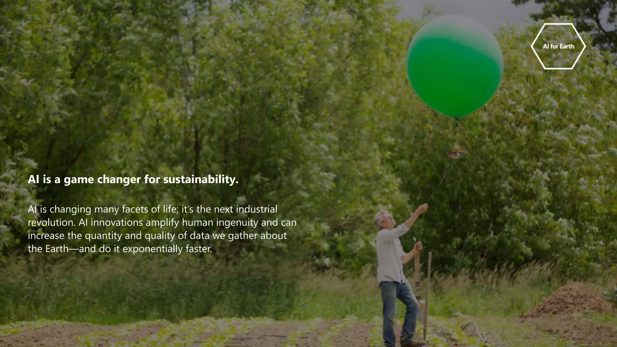
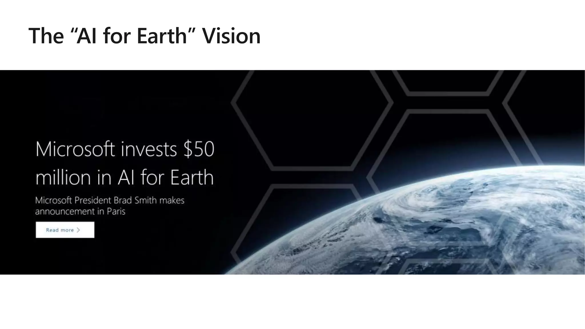
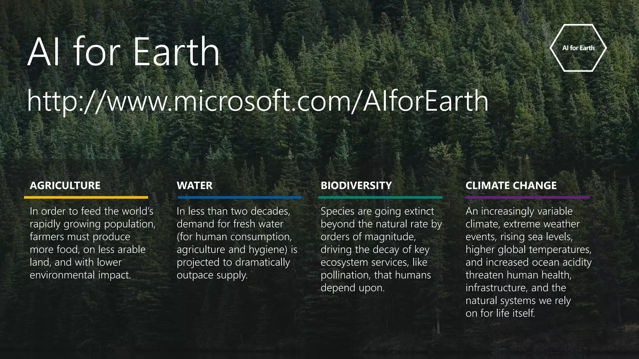
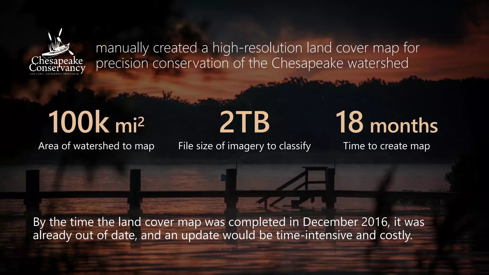
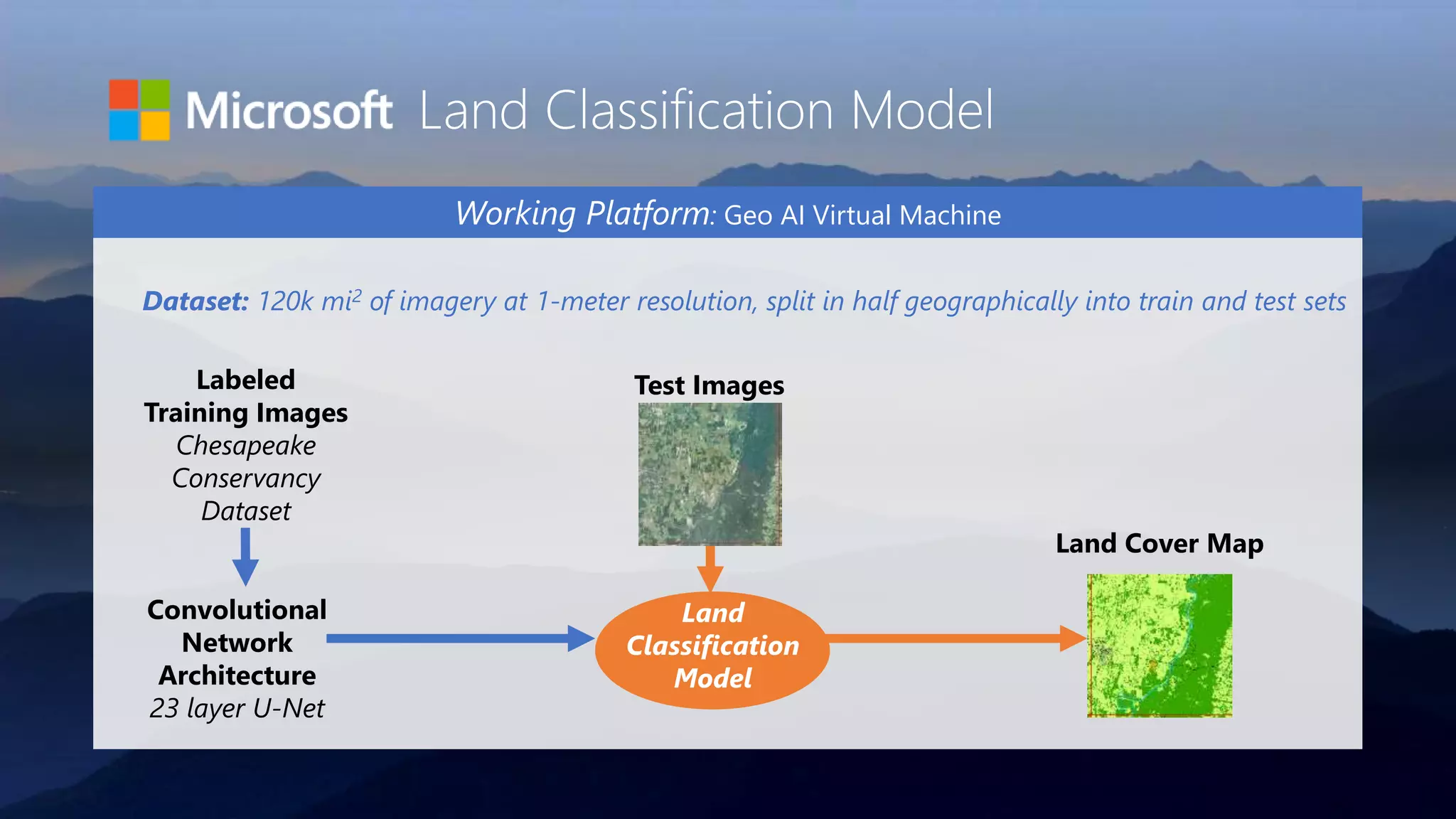
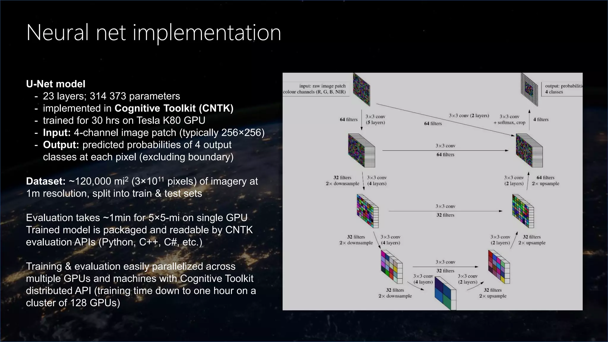
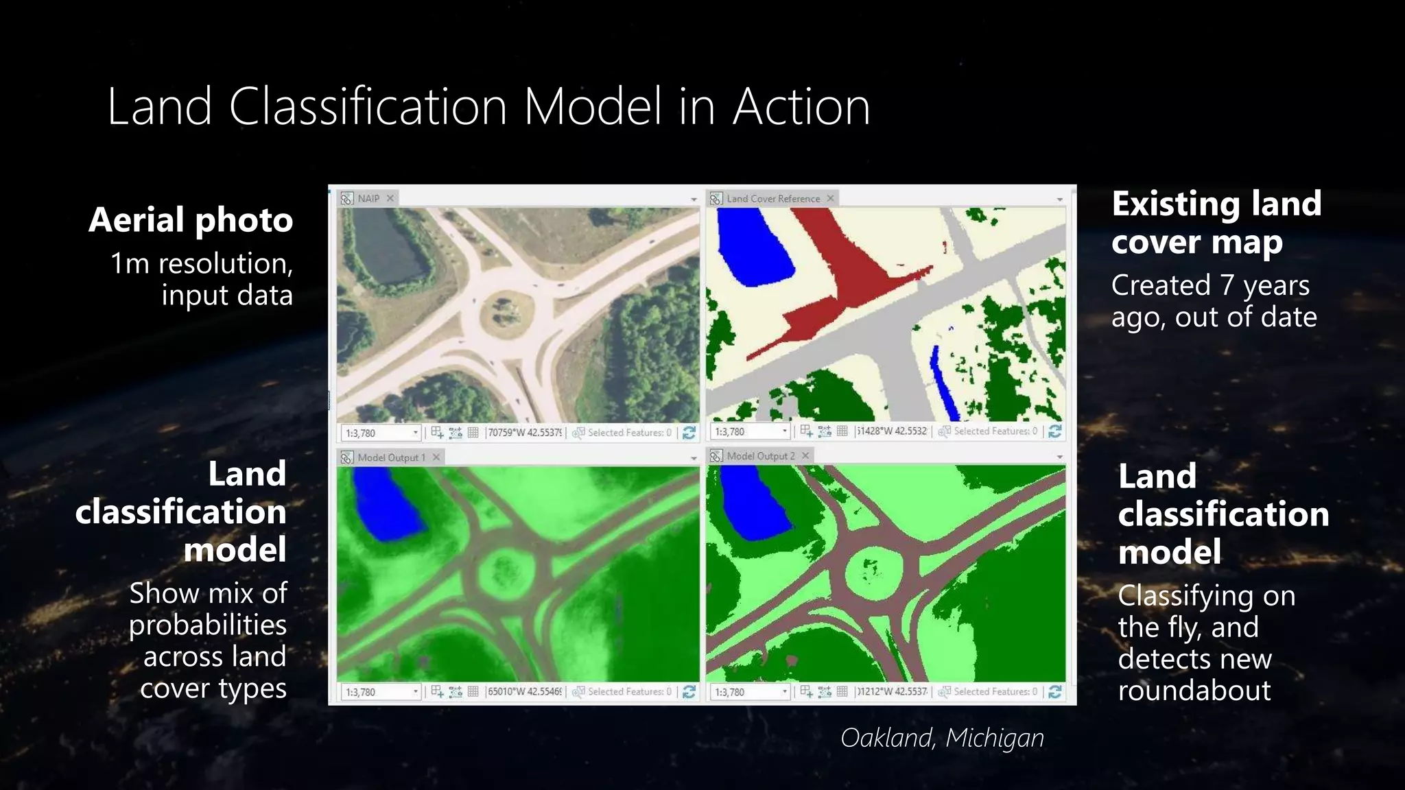
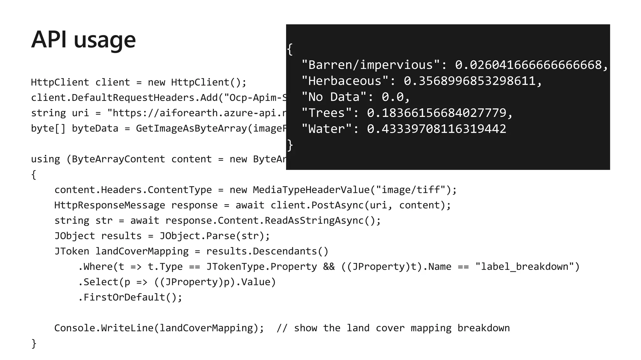
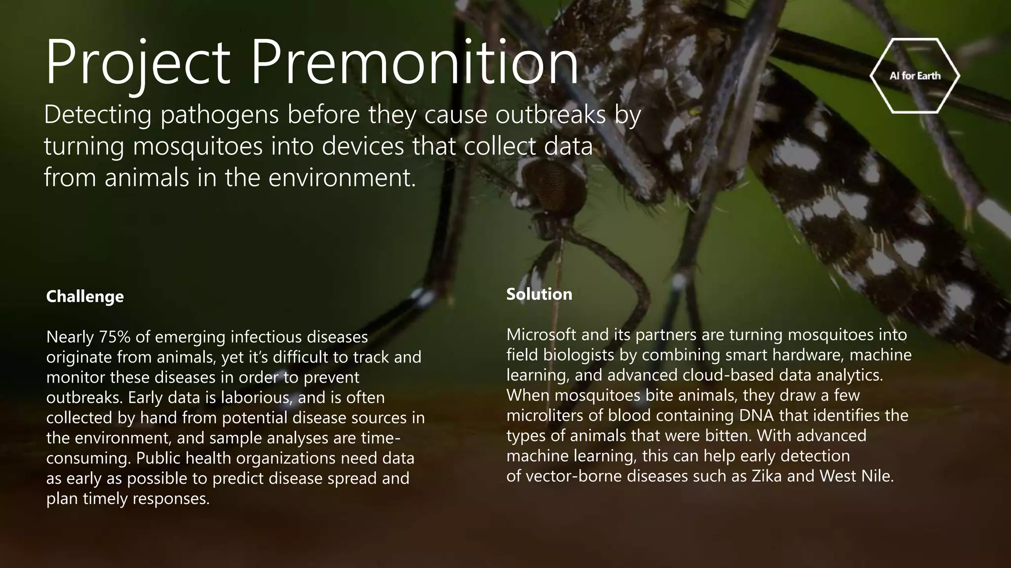
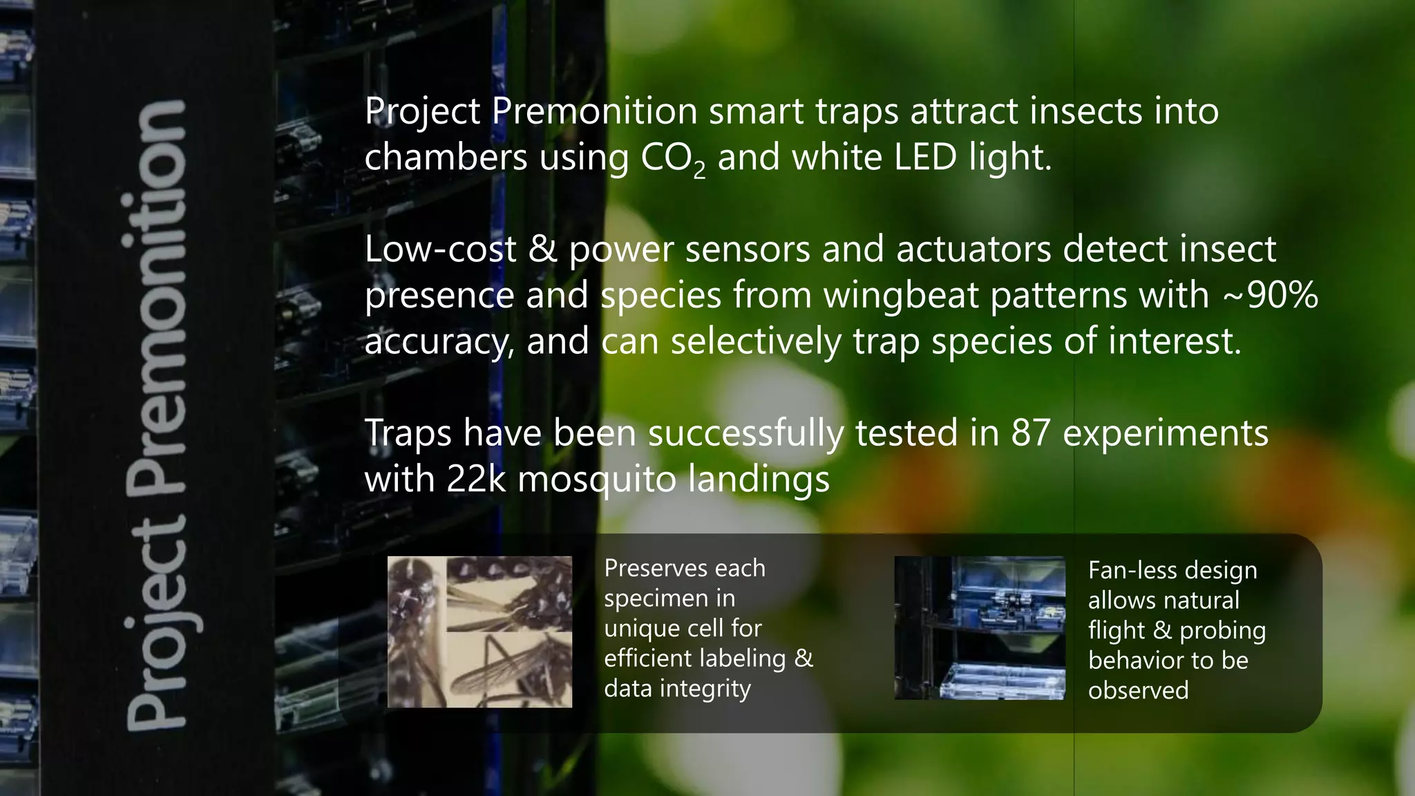
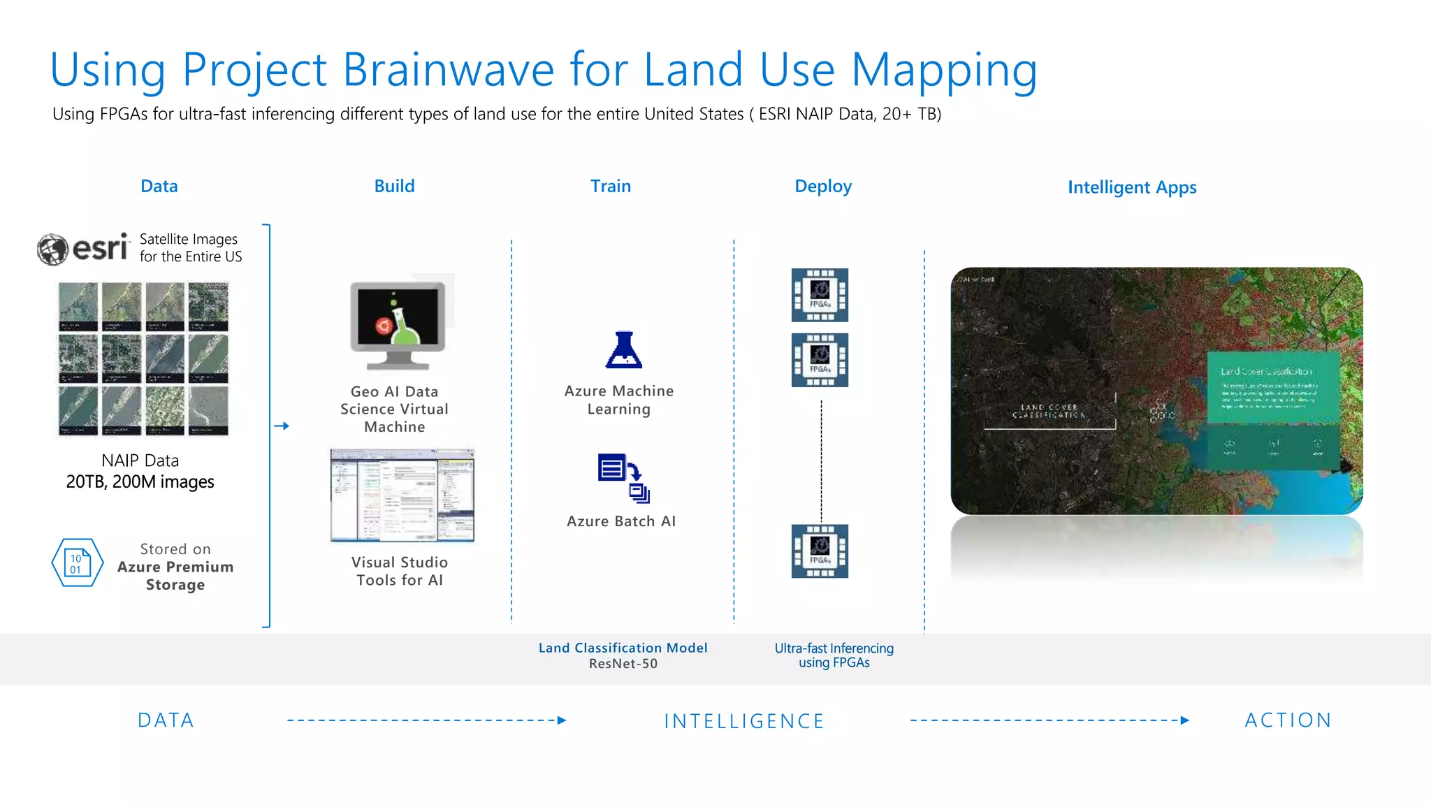
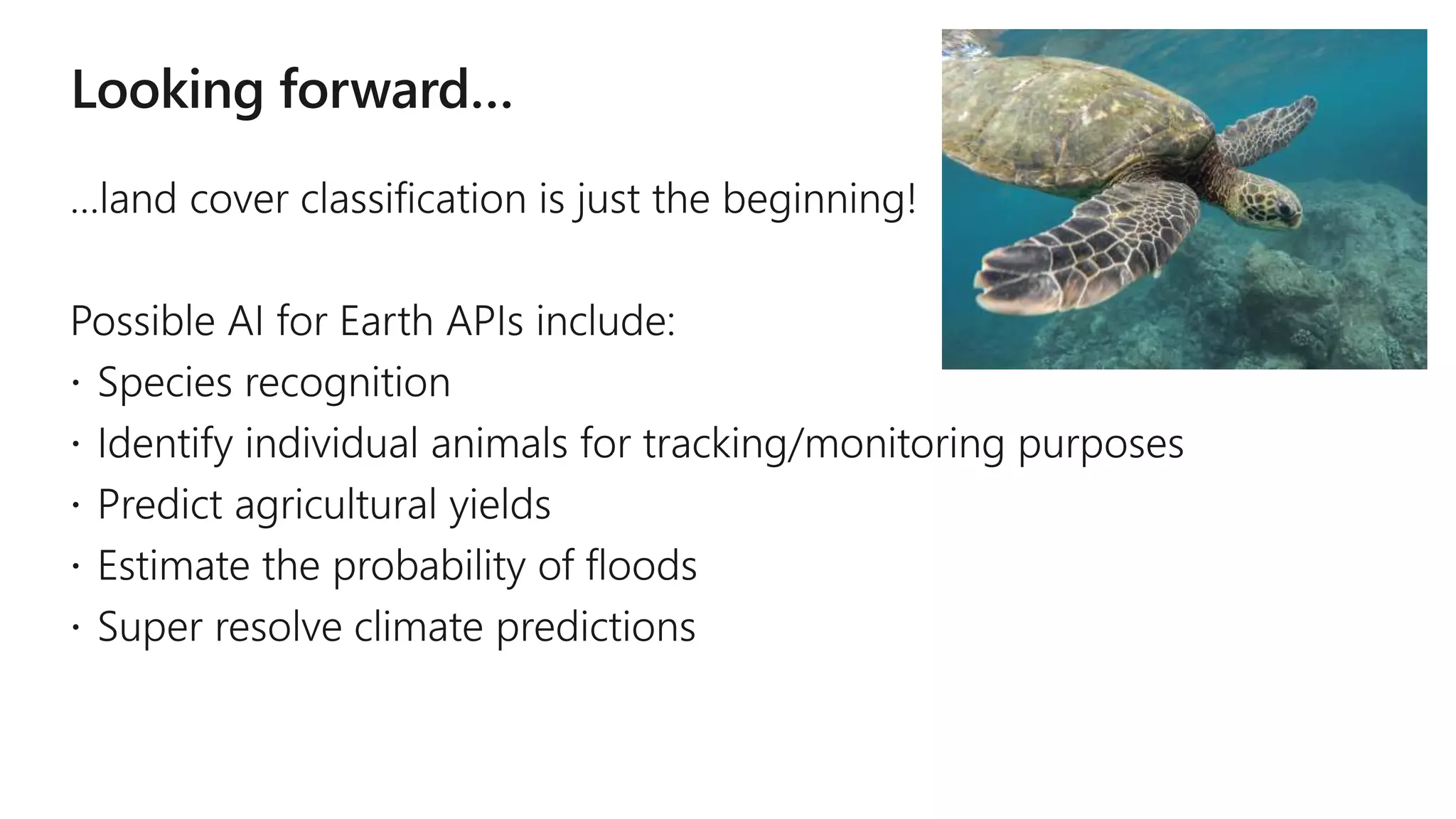
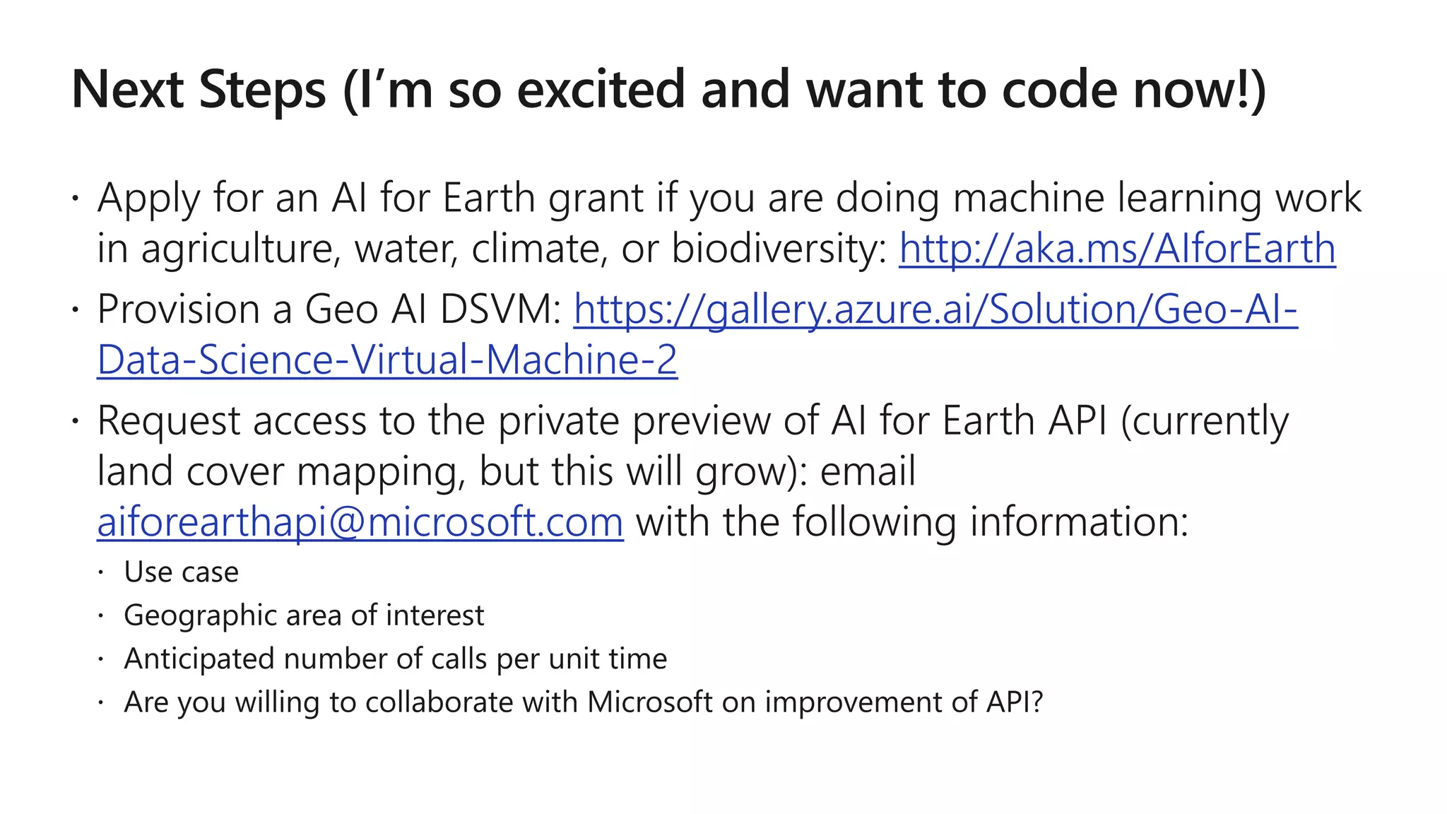
http://blogs.msdn.microsoft.com/jennifer
AI is a game changer for sustainability.
AI is changing many facets of life; it’s the next industrial
revolution. AI innovations amplify human ingenuity and can
increase the quantity and quality of data we gather about
the Earth—and do it exponentially faster.
AGRICULTURE
In order to feed the world’s
rapidly growing population,
farmers must produce
more food, on less arable
land, and with lower
environmental impact.
WATER
In less than two decades,
demand for fresh water
(for human consumption,
agriculture and hygiene) is
projected to dramatically
outpace supply.
BIODIVERSITY
Species are going extinct
beyond the natural rate by
orders of magnitude,
driving the decay of key
ecosystem services, like
pollination, that humans
depend upon.
CLIMATE CHANGE
An increasingly variable
climate, extreme weather
events, rising sea levels,
higher global temperatures,
and increased ocean acidity
threaten human health,
infrastructure, and the
natural systems we rely
on for life itself.
AI for Earth
http://www.microsoft.com/AIforEarth
Commitments
Increase Access
We are providing seed grants so
researchers and organizations can
gain access to cloud and AI
computing resources.
Fuel Innovation
We are accelerating the pace of
innovation by showcasing lighthouse
projects, publishing research, and
collaborating with others to expand
and grow initial projects.
Provide Education
We are providing educational resources
to make sure organizations know what
is available, how to use it, and how it
can meet their specific needs.
Challenge
Creating high-quality land cover maps with today’s
high-resolution imagery is a resource-intensive
process. It can take up to a year to become available
to the public, and is time-consuming to sort, manage,
and classify images into land cover data.
Solution
Microsoft’s goal is to help make the land cover mapping
process faster, easier, and more accessible to everyone.
We want to enable on-the-fly land cover mapping, and
allow conservation groups to create high-resolution
land cover maps with their own data; develop accurate,
actionable insights more quickly; and easily transfer
maps and insights to other organizations.
Land Cover Mapping
Giving organizations a faster, more effective, and lower cost land
cover mapping tool to help them better analyze, monitor, and
manage natural resources.
manually created a high-resolution land cover map for
precision conservation of the Chesapeake watershed
100k mi2
Area of watershed to map
2TB
File size of imagery to classify
18 months
Time to create map
By the time the land cover map was completed in December 2016, it was
already out of date, and an update would be time-intensive and costly.
Land Classification Model
Convolutional
Network
Architecture
23 layer U-Net
Test ImagesLabeled
Training Images
Chesapeake
Conservancy
Dataset
Land
Classification
Model
Land Cover Map
Working Platform: Geo AI Virtual Machine
Dataset: 120k mi2 of imagery at 1-meter resolution, split in half geographically into train and test sets
AI for Earth
Neural net implementation
U-Net model
- 23 layers; 314 373 parameters
- implemented in Cognitive Toolkit (CNTK)
- trained for 30 hrs on Tesla K80 GPU
- Input: 4-channel image patch (typically 256×256)
- Output: predicted probabilities of 4 output
classes at each pixel (excluding boundary)
Dataset: ~120,000 mi2 (3×1011 pixels) of imagery at
1m resolution, split into train & test sets
Evaluation takes ~1min for 5×5-mi on single GPU
Trained model is packaged and readable by CNTK
evaluation APIs (Python, C++, C#, etc.)
Training & evaluation easily parallelized across
multiple GPUs and machines with Cognitive Toolkit
distributed API (training time down to one hour on a
cluster of 128 GPUs)
Land Classification Model in Action
Oakland, Michigan
Aerial photo
1m resolution,
input data
Existing land
cover map
Created 7 years
ago, out of date
Land
classification
model
Classifying on
the fly, and
detects new
roundabout
Land
classification
model
Show mix of
probabilities
across land
cover types
https://earthexplorer.usgs.gov
 https://gis.apfo.usda.gov/arcgis/rest/services/NAIP
 http://www.arcgis.com/home/item.html?id=3f8d2d3828f24c00ae279db4af26d566
https://www.fsa.usda.gov/Assets/USDA-FSA-
Public/usdafiles/APFO/appendix_c.pdf
{
"Barren/impervious": 0.026041666666666668,
"Herbaceous": 0.3568996853298611,
"No Data": 0.0,
"Trees": 0.18366156684027779,
"Water": 0.43339708116319442
}
https://github.com/aiforearth/Samples
Project Premonition
Detecting pathogens before they cause outbreaks by
turning mosquitoes into devices that collect data
from animals in the environment.
Challenge
Nearly 75% of emerging infectious diseases
originate from animals, yet it’s difficult to track and
monitor these diseases in order to prevent
outbreaks. Early data is laborious, and is often
collected by hand from potential disease sources in
the environment, and sample analyses are time-
consuming. Public health organizations need data
as early as possible to predict disease spread and
plan timely responses.
Solution
Microsoft and its partners are turning mosquitoes into
field biologists by combining smart hardware, machine
learning, and advanced cloud-based data analytics.
When mosquitoes bite animals, they draw a few
microliters of blood containing DNA that identifies the
types of animals that were bitten. With advanced
machine learning, this can help early detection
of vector-borne diseases such as Zika and West Nile.
Project Premonition smart traps attract insects into
chambers using CO2 and white LED light.
Low-cost & power sensors and actuators detect insect
presence and species from wingbeat patterns with ~90%
accuracy, and can selectively trap species of interest.
Traps have been successfully tested in 87 experiments
with 22k mosquito landings
Preserves each
specimen in
unique cell for
efficient labeling &
data integrity
Fan-less design
allows natural
flight & probing
behavior to be
observed
https://github.com/jennifermarsman/PremonitionPlacement
aiforearthapi@microsoft.com
Microsoft Confidential – to be shared under NDA onlyMicrosoft Confidential to be shared under NDA only
Azure Maps
AT GENERAL AVAILABILITY
Time Zones
The ability to query
for a time zone
Note: Additional services will be added to the offering in the future
Maps
The ability to fetch a
visual rendition of
map data
Routing
The ability to
calculate a route
from point A to B or
n points, and receive
step by step
directions
Search and
Geocoding
The ability to find
places, addresses,
businesses, POIs etc.
Traffic
The ability to show
dynamic traffic and
incident information
Map Control
A web control
mechanism for
developers to more
easily integrate
mapping capabilities
into their
applications
Microsoft Confidential – to be shared under NDA only
choose Azure Maps?
WHY
In-vehicle use
licensing rights
End-to-end location
aware solutions
Functionality in over
30 languages
Commercial routing
Best in class
traffic data
Build on and integrated
into Azure!
Powered by leading map
supplier TomTom
Key reasons for customers to opt for Azure
Maps for their geospatial needs
Learn more at azure.com/maps
A Z U R E M A C H I N E L E A R N I N G
A C C E L E R A T E D B Y P R O J E C T B R A I N W A V E
Real-time AI at cloud scale with industry-leading performance and lowest cost
Models are easy to create and deploy into Azure
Write once, deploy anywhere – to intelligent cloud or edge
http://aka.ms/aml-real-time-ai
Record-setting DNN performance with accelerated ResNet50
• Record speed: Object classification on FPGA in <1.8 ms per image
• Lowest cost: Only 21 cents per million images during preview
More accelerated models coming soon
Data Build Train Deploy Intelligent Apps
AC TIONINTELLIGENC EDATA
Stored on
Azure Premium
Storage
Azure Machine
Learning
10
01
Using Project Brainwave for Land Use Mapping
Land Classification Model
ResNet-50
NAIP Data
20TB, 200M images
Visual Studio
Tools for AI
Geo AI Data
Science Virtual
Machine
Azure Batch AI
Ultra-fast Inferencing
using FPGAs
Satellite Images
for the Entire US
https://gallery.azure.ai/Solution/Geo-AI-Data-Science-Virtual-Machine-2
http://aka.ms/geoaidsvm
https://blogs.technet.microsoft.com/machinelearning/2018/03/12/pixel
-level-land-cover-classification-using-the-geo-ai-data-science-virtual-
machine-and-batch-ai/
https://github.com/Azure/pixel_level_land_classification
Train model
Evaluate
model
Containerize
model
Deploy
model
http://aka.ms/aieapisdoc
https://github.com/Azure/pixel_level_land_classification
http://aka.ms/dsvm/GeoAI
http://aka.ms/dsvm/GeoAI/docs
https://gallery.azure.ai/Tutorial/365edf3b151d4456a180f99d464f3893
https://github.com/aiforearth/Samples
https://github.com/jennifermarsman/PremonitionPlacement
http://aka.ms/AIforEarth
https://gallery.azure.ai/Solution/Geo-AI-
Data-Science-Virtual-Machine-2
aiforearthapi@microsoft.com
AI for Earth
AI for EarthLearn more at microsoft.com/aiforearth
http://blogs.msdn.microsoft.com/jennifer
AI for Earth: Analyzing Global Data with Azure

AI for Earth: Analyzing Global Data with Azure

  • 2.
  • 4.
    AI is agame changer for sustainability. AI is changing many facets of life; it’s the next industrial revolution. AI innovations amplify human ingenuity and can increase the quantity and quality of data we gather about the Earth—and do it exponentially faster.
  • 6.
    AGRICULTURE In order tofeed the world’s rapidly growing population, farmers must produce more food, on less arable land, and with lower environmental impact. WATER In less than two decades, demand for fresh water (for human consumption, agriculture and hygiene) is projected to dramatically outpace supply. BIODIVERSITY Species are going extinct beyond the natural rate by orders of magnitude, driving the decay of key ecosystem services, like pollination, that humans depend upon. CLIMATE CHANGE An increasingly variable climate, extreme weather events, rising sea levels, higher global temperatures, and increased ocean acidity threaten human health, infrastructure, and the natural systems we rely on for life itself. AI for Earth http://www.microsoft.com/AIforEarth
  • 7.
    Commitments Increase Access We areproviding seed grants so researchers and organizations can gain access to cloud and AI computing resources. Fuel Innovation We are accelerating the pace of innovation by showcasing lighthouse projects, publishing research, and collaborating with others to expand and grow initial projects. Provide Education We are providing educational resources to make sure organizations know what is available, how to use it, and how it can meet their specific needs.
  • 9.
    Challenge Creating high-quality landcover maps with today’s high-resolution imagery is a resource-intensive process. It can take up to a year to become available to the public, and is time-consuming to sort, manage, and classify images into land cover data. Solution Microsoft’s goal is to help make the land cover mapping process faster, easier, and more accessible to everyone. We want to enable on-the-fly land cover mapping, and allow conservation groups to create high-resolution land cover maps with their own data; develop accurate, actionable insights more quickly; and easily transfer maps and insights to other organizations. Land Cover Mapping Giving organizations a faster, more effective, and lower cost land cover mapping tool to help them better analyze, monitor, and manage natural resources.
  • 12.
    manually created ahigh-resolution land cover map for precision conservation of the Chesapeake watershed 100k mi2 Area of watershed to map 2TB File size of imagery to classify 18 months Time to create map By the time the land cover map was completed in December 2016, it was already out of date, and an update would be time-intensive and costly.
  • 13.
    Land Classification Model Convolutional Network Architecture 23layer U-Net Test ImagesLabeled Training Images Chesapeake Conservancy Dataset Land Classification Model Land Cover Map Working Platform: Geo AI Virtual Machine Dataset: 120k mi2 of imagery at 1-meter resolution, split in half geographically into train and test sets
  • 14.
    AI for Earth Neuralnet implementation U-Net model - 23 layers; 314 373 parameters - implemented in Cognitive Toolkit (CNTK) - trained for 30 hrs on Tesla K80 GPU - Input: 4-channel image patch (typically 256×256) - Output: predicted probabilities of 4 output classes at each pixel (excluding boundary) Dataset: ~120,000 mi2 (3×1011 pixels) of imagery at 1m resolution, split into train & test sets Evaluation takes ~1min for 5×5-mi on single GPU Trained model is packaged and readable by CNTK evaluation APIs (Python, C++, C#, etc.) Training & evaluation easily parallelized across multiple GPUs and machines with Cognitive Toolkit distributed API (training time down to one hour on a cluster of 128 GPUs)
  • 15.
    Land Classification Modelin Action Oakland, Michigan Aerial photo 1m resolution, input data Existing land cover map Created 7 years ago, out of date Land classification model Classifying on the fly, and detects new roundabout Land classification model Show mix of probabilities across land cover types
  • 17.
  • 20.
    { "Barren/impervious": 0.026041666666666668, "Herbaceous": 0.3568996853298611, "NoData": 0.0, "Trees": 0.18366156684027779, "Water": 0.43339708116319442 }
  • 21.
  • 23.
    Project Premonition Detecting pathogensbefore they cause outbreaks by turning mosquitoes into devices that collect data from animals in the environment. Challenge Nearly 75% of emerging infectious diseases originate from animals, yet it’s difficult to track and monitor these diseases in order to prevent outbreaks. Early data is laborious, and is often collected by hand from potential disease sources in the environment, and sample analyses are time- consuming. Public health organizations need data as early as possible to predict disease spread and plan timely responses. Solution Microsoft and its partners are turning mosquitoes into field biologists by combining smart hardware, machine learning, and advanced cloud-based data analytics. When mosquitoes bite animals, they draw a few microliters of blood containing DNA that identifies the types of animals that were bitten. With advanced machine learning, this can help early detection of vector-borne diseases such as Zika and West Nile.
  • 25.
    Project Premonition smarttraps attract insects into chambers using CO2 and white LED light. Low-cost & power sensors and actuators detect insect presence and species from wingbeat patterns with ~90% accuracy, and can selectively trap species of interest. Traps have been successfully tested in 87 experiments with 22k mosquito landings Preserves each specimen in unique cell for efficient labeling & data integrity Fan-less design allows natural flight & probing behavior to be observed
  • 26.
  • 27.
  • 29.
    Microsoft Confidential –to be shared under NDA onlyMicrosoft Confidential to be shared under NDA only Azure Maps AT GENERAL AVAILABILITY Time Zones The ability to query for a time zone Note: Additional services will be added to the offering in the future Maps The ability to fetch a visual rendition of map data Routing The ability to calculate a route from point A to B or n points, and receive step by step directions Search and Geocoding The ability to find places, addresses, businesses, POIs etc. Traffic The ability to show dynamic traffic and incident information Map Control A web control mechanism for developers to more easily integrate mapping capabilities into their applications
  • 30.
    Microsoft Confidential –to be shared under NDA only choose Azure Maps? WHY In-vehicle use licensing rights End-to-end location aware solutions Functionality in over 30 languages Commercial routing Best in class traffic data Build on and integrated into Azure! Powered by leading map supplier TomTom Key reasons for customers to opt for Azure Maps for their geospatial needs Learn more at azure.com/maps
  • 32.
    A Z UR E M A C H I N E L E A R N I N G A C C E L E R A T E D B Y P R O J E C T B R A I N W A V E Real-time AI at cloud scale with industry-leading performance and lowest cost Models are easy to create and deploy into Azure Write once, deploy anywhere – to intelligent cloud or edge http://aka.ms/aml-real-time-ai Record-setting DNN performance with accelerated ResNet50 • Record speed: Object classification on FPGA in <1.8 ms per image • Lowest cost: Only 21 cents per million images during preview More accelerated models coming soon
  • 33.
    Data Build TrainDeploy Intelligent Apps AC TIONINTELLIGENC EDATA Stored on Azure Premium Storage Azure Machine Learning 10 01 Using Project Brainwave for Land Use Mapping Land Classification Model ResNet-50 NAIP Data 20TB, 200M images Visual Studio Tools for AI Geo AI Data Science Virtual Machine Azure Batch AI Ultra-fast Inferencing using FPGAs Satellite Images for the Entire US
  • 37.
  • 43.
  • 45.
  • 46.
  • 47.
    AI for Earth AIfor EarthLearn more at microsoft.com/aiforearth
  • 48.