Download to read offline


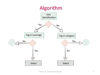


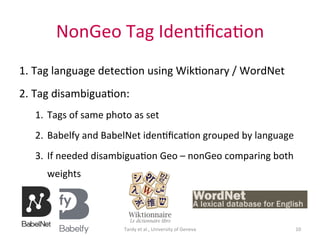
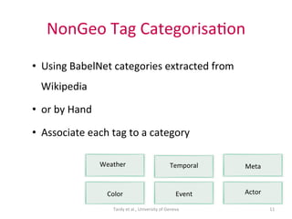
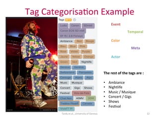


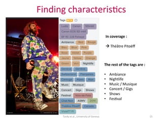


This document proposes a framework that uses spatial coverage to discover geospatial semantics from volunteer geographic information (VGI) sources tagged with location data. The framework models tags using multiple facets including geographic features, classes, temporal data. It identifies tags and categorizes them using an algorithm based on whether tags are spatially covered in a photo's location. The framework aims to fill gaps in missing geographic characteristics for places with limited location data.