Download to read offline
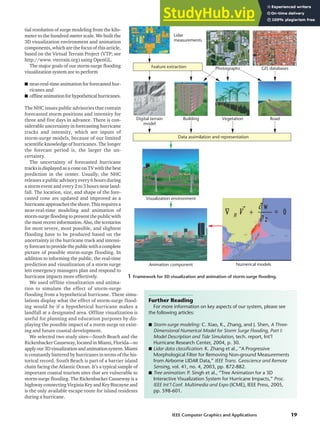
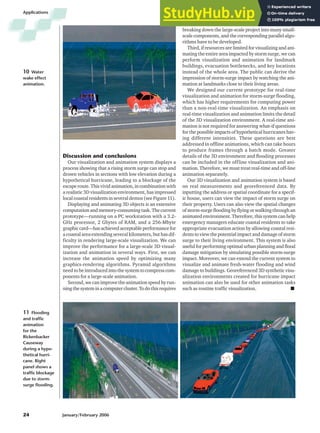

Hurricanes pose a major threat through storm surge flooding, which can damage infrastructure and claim thousands of lives. Three-dimensional visualization and animation can help coastal residents understand this danger by showing how storm surge would impact their area in a realistic way. The authors present a prototype system that generates near-real-time and hypothetical animations of storm surge flooding for two sites in Miami, Florida. The system incorporates accurate terrain, infrastructure and flooding models to educate the public and support emergency planning.