This document provides a tutorial for creating maps and calculating spatial overlap in MRMapping, a software for species distribution modeling. The tutorial instructs the user to:
1. Select a ModestR database containing species data and start MRMapping.
2. Add species distribution maps from the database by selecting individual species or groups like families. Colors can be customized for each map.
3. Create more complex maps by grouping selections from the database and displaying each group with a unique color.
4. Calculate the geographic or environmental spatial overlap between maps in the analysis to obtain overlap reports.
7.- ModestR tools for taxonomy (Version ModestR v5.3 or higher)modestrsoftware
This tutorial describes some tools provided by ModestR to work with taxonomic data. ModestR can use ITIS taxonomic database to explore and export taxonomic data.
It can also use GBIF to check and complete taxonomic data from a list of species.
24. Creating virtual species with ModestR (Version ModestR 6.4 or higher)modestrsoftware
This tutorial describes how to easily create virtual species and importing them directly in ModestR. Virtual species are a procedure increasingly used in ecology to improve species distribution models. This feature uses the R virtualspecies package from Leroy et al (https://cran.r-project.org/web/packages/virtualspecies/index.html)
21.- Creating virtual species and calculating simple ensemble models with R ...modestrsoftware
In this tutorial we describe two simple scripts in R to generate random virtual species, and to calculate species distribution models (SDM's) using ensemble models.
Those scripts may be useful to test hypotesis, or to work with ModestR or other tools
7.- ModestR tools for taxonomy (Version ModestR v6.5 or higher)modestrsoftware
This tutorial describes some tools provided by ModestR to work with taxonomic data. ModestR can use ITIS taxonomic database to explore and export taxonomic data.
It can also use GBIF to check and complete taxonomic data from a list of species.
18. Estimating species composition in one or more regions with KnowBr and Mo...modestrsoftware
In this tutorial we describe how to use ModestR with KnowBR results to estimate species composition by region. Using SDM results for several species and the expected richness estimated by KnowBR, ModestR can determine the most suitable composition of species of a region.
19. Calculating 3D species distribution in marine habitats with ModestR (Ver...modestrsoftware
In this tutorial we describe how to calculate species distribution along depth (3D) in marine habitats with ModestR. In this way, if you have occurrences with depth information from a species, and environmental/climatic data for different depths (such as those from NOAA or Copernicus), with ModestR you can calculate species distribution in 3D, for each depth where the species is present
17. An example using ModestR to assess species distribution in different cli...modestrsoftware
In this tutorial we describe how to use ModestR to model species distribution in different climatic change scenarios. To do that, we’ll use the 3D Niche capability of ModestR, taking time as 3th dimension.
1. How to create a database (Version ModestR v6.5 or higher)modestrsoftware
In this tutorial we’ll describe how to create a new ModestR database, how to populate it using taxonomic data stored in a CSV file.
ModestR software can be freely downloaded from http://www.ipez.es/ModestR
20. Calculating most probable distribution of a species with Niche of Occurr...modestrsoftware
In this tutorial we describe how to perform species distribution modelling (SDM) with Niche Of Occurrence (NOO) in ModestR. NOO is a new proposed SDM that offers a very good performance and it's easier to perform and understand than other existing SDM's
16. Importing different climatic change scenarios from WorldClim to ModestR ...modestrsoftware
In this tutorial we describe how to import different climatic change scenarios from WorldClim to ModestR. This is necessary for example to use the 3D Niche capability of ModestR to model species distribution along those scenarios.
11.- Calculating species distribution for different periods with ModestR (Ve...modestrsoftware
In this tutorial we’ll describe how to calculate species distribution for different periods. To do that, we’ll use the 3D Niche capability of ModestR, taking time as 3th dimension
25. Phylogenetics trees with ModestRr and bold (Version ModestR 6.5 or higher)modestrsoftware
This tutorial describes how to donwload DNA barcoding data from BOLD to ModestR for any species, and how to use those data to calculate phylogenetic distances and build phylogenetic trees
4.- How to use data cleaning, EOO estimation and environmental of occurrence ...modestrsoftware
How to use data cleaning, EOO estimation and environmental occurrence features in ModestR.
Describes data cleaning; EOO methods supported in ModestR (convex hull, alpha shape, kernel density); environmental occurrence in ModestR.
15. Locating species occupied river basins with ModestR (Version ModestR 5.3...modestrsoftware
In this tutorial we'll explain how to automatically find the river basins that are occupied by a species, using the species known occurences. River basins are very interesting because they can be considered a natural geographical extent for a species.
12.- Recommendations for marine environments and Economic Exclusive Zones (Ve...modestrsoftware
In this tutorial we’ll give you some tips to work with ModestR in marine environments, different sources of information and how to use the marine Economic Exclusive Zones.
Instruction to MAPINFO
This course is intended to give a brief introduction to MAPINFO on the following aspects:
To get a knowledge of basic functions of MAPINFO and be familiar with normal operations of MAPINFO
To carry out network planning, optimization and map maintenance with MAPINFO
A geographic information system (GIS) is a collection of hardware,
software, geographicdata, and personnel designed to create, store, edit,
manipulate, analyze and display geographically referenced information.
YARCA (Yet Another Raycasting Application) Projectgraphitech
The scope of this project is to extend NASA’s World Wind to make it possible to visualize ray casting not only in intersection with the terrain, but also to consider 3D objects, which we call barriers, that will be hit by rays emitted by other objects which we call transmitters, calculating the coverage area and field of view of the transmitters and showing how the transmission signal is reflected onto the objects’ surfaces.
Training materials developed with peers at Columbia University for Google, Inc. These materials illustrate methods to incorporate JavaScript into Google Earth Engine to generate relevant products for stakeholders using climate data.
Micro RNA genes and their likely influence in rice (Oryza sativa L.) dynamic ...Open Access Research Paper
Micro RNAs (miRNAs) are small non-coding RNAs molecules having approximately 18-25 nucleotides, they are present in both plants and animals genomes. MiRNAs have diverse spatial expression patterns and regulate various developmental metabolisms, stress responses and other physiological processes. The dynamic gene expression playing major roles in phenotypic differences in organisms are believed to be controlled by miRNAs. Mutations in regions of regulatory factors, such as miRNA genes or transcription factors (TF) necessitated by dynamic environmental factors or pathogen infections, have tremendous effects on structure and expression of genes. The resultant novel gene products presents potential explanations for constant evolving desirable traits that have long been bred using conventional means, biotechnology or genetic engineering. Rice grain quality, yield, disease tolerance, climate-resilience and palatability properties are not exceptional to miRN Asmutations effects. There are new insights courtesy of high-throughput sequencing and improved proteomic techniques that organisms’ complexity and adaptations are highly contributed by miRNAs containing regulatory networks. This article aims to expound on how rice miRNAs could be driving evolution of traits and highlight the latest miRNA research progress. Moreover, the review accentuates miRNAs grey areas to be addressed and gives recommendations for further studies.
Diabetes is a rapidly and serious health problem in Pakistan. This chronic condition is associated with serious long-term complications, including higher risk of heart disease and stroke. Aggressive treatment of hypertension and hyperlipideamia can result in a substantial reduction in cardiovascular events in patients with diabetes 1. Consequently pharmacist-led diabetes cardiovascular risk (DCVR) clinics have been established in both primary and secondary care sites in NHS Lothian during the past five years. An audit of the pharmaceutical care delivery at the clinics was conducted in order to evaluate practice and to standardize the pharmacists’ documentation of outcomes. Pharmaceutical care issues (PCI) and patient details were collected both prospectively and retrospectively from three DCVR clinics. The PCI`s were categorized according to a triangularised system consisting of multiple categories. These were ‘checks’, ‘changes’ (‘change in drug therapy process’ and ‘change in drug therapy’), ‘drug therapy problems’ and ‘quality assurance descriptors’ (‘timer perspective’ and ‘degree of change’). A verified medication assessment tool (MAT) for patients with chronic cardiovascular disease was applied to the patients from one of the clinics. The tool was used to quantify PCI`s and pharmacist actions that were centered on implementing or enforcing clinical guideline standards. A database was developed to be used as an assessment tool and to standardize the documentation of achievement of outcomes. Feedback on the audit of the pharmaceutical care delivery and the database was received from the DCVR clinic pharmacist at a focus group meeting.
"Understanding the Carbon Cycle: Processes, Human Impacts, and Strategies for...MMariSelvam4
The carbon cycle is a critical component of Earth's environmental system, governing the movement and transformation of carbon through various reservoirs, including the atmosphere, oceans, soil, and living organisms. This complex cycle involves several key processes such as photosynthesis, respiration, decomposition, and carbon sequestration, each contributing to the regulation of carbon levels on the planet.
Human activities, particularly fossil fuel combustion and deforestation, have significantly altered the natural carbon cycle, leading to increased atmospheric carbon dioxide concentrations and driving climate change. Understanding the intricacies of the carbon cycle is essential for assessing the impacts of these changes and developing effective mitigation strategies.
By studying the carbon cycle, scientists can identify carbon sources and sinks, measure carbon fluxes, and predict future trends. This knowledge is crucial for crafting policies aimed at reducing carbon emissions, enhancing carbon storage, and promoting sustainable practices. The carbon cycle's interplay with climate systems, ecosystems, and human activities underscores its importance in maintaining a stable and healthy planet.
In-depth exploration of the carbon cycle reveals the delicate balance required to sustain life and the urgent need to address anthropogenic influences. Through research, education, and policy, we can work towards restoring equilibrium in the carbon cycle and ensuring a sustainable future for generations to come.
Characterization and the Kinetics of drying at the drying oven and with micro...Open Access Research Paper
The objective of this work is to contribute to valorization de Nephelium lappaceum by the characterization of kinetics of drying of seeds of Nephelium lappaceum. The seeds were dehydrated until a constant mass respectively in a drying oven and a microwawe oven. The temperatures and the powers of drying are respectively: 50, 60 and 70°C and 140, 280 and 420 W. The results show that the curves of drying of seeds of Nephelium lappaceum do not present a phase of constant kinetics. The coefficients of diffusion vary between 2.09.10-8 to 2.98. 10-8m-2/s in the interval of 50°C at 70°C and between 4.83×10-07 at 9.04×10-07 m-8/s for the powers going of 140 W with 420 W the relation between Arrhenius and a value of energy of activation of 16.49 kJ. mol-1 expressed the effect of the temperature on effective diffusivity.
Willie Nelson Net Worth: A Journey Through Music, Movies, and Business Venturesgreendigital
Willie Nelson is a name that resonates within the world of music and entertainment. Known for his unique voice, and masterful guitar skills. and an extraordinary career spanning several decades. Nelson has become a legend in the country music scene. But, his influence extends far beyond the realm of music. with ventures in acting, writing, activism, and business. This comprehensive article delves into Willie Nelson net worth. exploring the various facets of his career that have contributed to his large fortune.
Follow us on: Pinterest
Introduction
Willie Nelson net worth is a testament to his enduring influence and success in many fields. Born on April 29, 1933, in Abbott, Texas. Nelson's journey from a humble beginning to becoming one of the most iconic figures in American music is nothing short of inspirational. His net worth, which estimated to be around $25 million as of 2024. reflects a career that is as diverse as it is prolific.
Early Life and Musical Beginnings
Humble Origins
Willie Hugh Nelson was born during the Great Depression. a time of significant economic hardship in the United States. Raised by his grandparents. Nelson found solace and inspiration in music from an early age. His grandmother taught him to play the guitar. setting the stage for what would become an illustrious career.
First Steps in Music
Nelson's initial foray into the music industry was fraught with challenges. He moved to Nashville, Tennessee, to pursue his dreams, but success did not come . Working as a songwriter, Nelson penned hits for other artists. which helped him gain a foothold in the competitive music scene. His songwriting skills contributed to his early earnings. laying the foundation for his net worth.
Rise to Stardom
Breakthrough Albums
The 1970s marked a turning point in Willie Nelson's career. His albums "Shotgun Willie" (1973), "Red Headed Stranger" (1975). and "Stardust" (1978) received critical acclaim and commercial success. These albums not only solidified his position in the country music genre. but also introduced his music to a broader audience. The success of these albums played a crucial role in boosting Willie Nelson net worth.
Iconic Songs
Willie Nelson net worth is also attributed to his extensive catalog of hit songs. Tracks like "Blue Eyes Crying in the Rain," "On the Road Again," and "Always on My Mind" have become timeless classics. These songs have not only earned Nelson large royalties but have also ensured his continued relevance in the music industry.
Acting and Film Career
Hollywood Ventures
In addition to his music career, Willie Nelson has also made a mark in Hollywood. His distinctive personality and on-screen presence have landed him roles in several films and television shows. Notable appearances include roles in "The Electric Horseman" (1979), "Honeysuckle Rose" (1980), and "Barbarosa" (1982). These acting gigs have added a significant amount to Willie Nelson net worth.
Television Appearances
Nelson's char
Artificial Reefs by Kuddle Life Foundation - May 2024punit537210
Situated in Pondicherry, India, Kuddle Life Foundation is a charitable, non-profit and non-governmental organization (NGO) dedicated to improving the living standards of coastal communities and simultaneously placing a strong emphasis on the protection of marine ecosystems.
One of the key areas we work in is Artificial Reefs. This presentation captures our journey so far and our learnings. We hope you get as excited about marine conservation and artificial reefs as we are.
Please visit our website: https://kuddlelife.org
Our Instagram channel:
@kuddlelifefoundation
Our Linkedin Page:
https://www.linkedin.com/company/kuddlelifefoundation/
and write to us if you have any questions:
info@kuddlelife.org
growbilliontrees.com-Trees for Granddaughter (1).pdf
5.- Doing a map in MRMapping (Version ModestR v5.3 or higher)
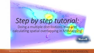
1. MODESTR QUICK TUTORIALS HTTP://WWW.IPEZ.ES/MODESTR/
Step by step tutorial:
Doing a multiple distributions map and
calculating spatial overlapping in MRMapping
2. What do you need for this tutorial:
1. ModestR v2.1 or higher (previous versions still not include
MRMapping)
2. A ModestR database already created and
populated with species distribution data (see our
tutorial “How to create a ModestR database” for details about how to create
a ModestR database, or use the ModestR “Elasmobranchii” sample database
available in ModestR website)
3. Internet connection
4. About 30 minutes
ModestR software can be freely downloaded from http://www.ipez.es/ModestR
MODESTR QUICK TUTORIALS HTTP://WWW.IPEZ.ES/MODESTR/
3. We’ll describe how to create maps that can
include data from several species, grouped
by any rank (class, order, family…), using
MRMapping, and how to calculate spatial
overlappings.
Follow the next steps!
MODESTR QUICK TUTORIALS HTTP://WWW.IPEZ.ES/MODESTR/
4. MODESTR QUICK TUTORIALS HTTP://WWW.IPEZ.ES/MODESTR/
If you still don’t have a ModestR database, you can download a sample database.
5. First of all, start MRMapping, and select a ModestR database that already contains species distribution data, going to
menu File/Select database, and then selecting the wanted database.
MODESTR QUICK TUTORIALS HTTP://WWW.IPEZ.ES/MODESTR/
1. Download a sample
database:
www.ipez.es/ModestR
>> Download >>
Databases >> ModestR
Elasmobranchii
database.
2. Decompress the zip file.
3. Select the
decompressed file from
MRMapping:
Menu>>File>>Select
Database.
4. This database only has
the taxonomy, please
import the GBIF data
samples as you did in
Tutorial No.2.
6. Now you can easily add to the map a species dataset from the selected database. Just go to the menu File/Add/Maps
from ModestR database.
MODESTR QUICK TUTORIALS HTTP://WWW.IPEZ.ES/MODESTR/
Go to File/Add/Maps from ModestR database
7. A tree view of the database will be shown, where you can easily navigate though the different levels (classes, orders,
families, genuses and species).
MODESTR QUICK TUTORIALS HTTP://WWW.IPEZ.ES/MODESTR/
By default, each selected species will
be added as a distinct individual
series data to the map.
Expand any branch(es) and
selected two different species,
whether or not from the same
branch.
Click on “Select” button
You can, for example, go to the species level of
the same or of different branches, and select two
different species by using the corresponding
checkboxes.
This counter displays how many species are
currently selected. This is useful to know how
many species are involved when you selected a
whole rank (e.g. a family, an order…).
8. Both selected species will be shown on the map. For this example we are using species with occurrence data. So each
occurrence is shown in the map as a colored point, but you can also see the occurrence area like colored areas.
MODESTR QUICK TUTORIALS HTTP://WWW.IPEZ.ES/MODESTR/
Note: occurrences are usually named ‘samples’ in ModestR
9. To change map settings, go to Edit/Distribution list editor menu.
MODESTR QUICK TUTORIALS HTTP://WWW.IPEZ.ES/MODESTR/
Go to Edit/Distribution list
editor menu.
Here are displayed the colors
assigned to samples, land and sea
presence areas (those two last
colors are used in range maps).
10. To change colors of a series data just double-click on the name of the wanted series (in this example, each series
corresponds to a species).
MODESTR QUICK TUTORIALS HTTP://WWW.IPEZ.ES/MODESTR/
To modify the
color of the valid
samples, for
example, click on
the
corresponding
colored square.
A color-selection
box will be
displayed. Select
the new color
and accept. The
corresponding
samples will be
immediately
updated in the
map.
A dialog box will be
displayed where you
can change any color
just by clicking on it.
Double-click on the name of the
wanted series
If you are using range maps (such as “Elasmobranchii” sample database), you should modify presence areas colors (e.g. sea color) in turn of sample colors.
11. Once you have changed the colors to your liking, you can export the map as an image.
MODESTR QUICK TUTORIALS HTTP://WWW.IPEZ.ES/MODESTR/
Go to File/Export/Current map view as image menu option.
12. Let’s go to Legend tab, and:
1. Check the “Add legend to map” option.
2. Then click on the Preview button. A preview of the
image to be exported will be shown on the default
image viewer of your system.
3. Close this preview, and click on the Accept button
to export the image to a file.
When you export an image, the
current map view is exported. So you
can zoom to a specific area, for
example, then export this view.
MODESTR QUICK TUTORIALS HTTP://WWW.IPEZ.ES/MODESTR/
A dialog box will be displayed where you can set the dimensions and format of the image to be exported, add a grid or
a legend..
13. The exported image will probably look like this one (if you’re using “Elasmobranchii”).
MODESTR QUICK TUTORIALS HTTP://WWW.IPEZ.ES/MODESTR/
14. Now let’s see how to do more complex maps, grouping presence data by ranks (orders, families, genuses…).
First of all, we’ll start a new map, going to File/New menu option.
MODESTR QUICK TUTORIALS HTTP://WWW.IPEZ.ES/MODESTR/
Go to File/New menu
option to create a new
map.
15. Then go to File/Add/Maps from ModestR database menu option, to select several species distribution maps to add.
MODESTR QUICK TUTORIALS HTTP://WWW.IPEZ.ES/MODESTR/
Go to File/ File/Add/Maps
from ModestR database
menu option.
16. Then go to File/Add/Maps from ModestR database menu option, to select several species distribution maps to add.
MODESTR QUICK TUTORIALS HTTP://WWW.IPEZ.ES/MODESTR/
Expand any
branch(es) and
selected for
example a whole
class, or one or
two orders.
Change the Add mode to “Group by”, and select to group selected species by families, for example.
Click on “Select” button.
If the selection you have
done includes many
species, a message may be
displayed warning that the
operation may take some
time.
MRMapping will collect the
data of every selected
species and group them by
the category you have
selected.
17. Resulting map will show a different color for the data of each category you have selected (orders, families, genuses…)
MODESTR QUICK TUTORIALS HTTP://WWW.IPEZ.ES/MODESTR/
18. Resulting map will show a different color for the data of each category you have selected (orders, families, genus).
Go to Edit/Map list editor menu as you did before.
MODESTR QUICK TUTORIALS HTTP://WWW.IPEZ.ES/MODESTR/
A dialog box with the list of
different datasets currently
shown in the map will be
displayed.
In this example, data has been
grouped by families. So here we
can see that each family is a
dataset, and, as previously
explained, we can double click
on any dataset name to modify
colors and other settings.
19. You can also easily delete one or more datasets from the map.
MODESTR QUICK TUTORIALS HTTP://WWW.IPEZ.ES/MODESTR/
Then click on the
Del button to
delete the checked
datasets.
Map will be
immediately
updated.
Use the checkboxes
on the left of the
datasets to select
them.
20. You can modify the order in which datasets are displayed on the map, thus modifying how they overlap. Order column
indicates the order in which the datasets are displayed. The order nº1 indicates the topmost dataset, that is, the
dataset that is painted above all the others. The order nº 2 is the next one, etc. So you may want to change this order
to do that a dataset shall be more visible than another one.
MODESTR QUICK TUTORIALS HTTP://WWW.IPEZ.ES/MODESTR/
Once all settings done, click on
“Close” button to close this dialog
box.
To do that, just select the wanted
dataset, and change its relative
order using the buttons Top, Up,
Down and Bottom.The map will be
immediately updated.
Verify that the
Show option is
unchecked.
21. You can decide to add more data in any moment, just by going again to File/Add/Maps from ModestR database menu
option, and selecting new data. There is no restriction in the way you may add data: you can now add a single species,
or a whole family, etc. Finally you can export resulting going to File/Export/Current map view as image menu option,
as explained before.
MODESTR QUICK TUTORIALS HTTP://WWW.IPEZ.ES/MODESTR/
22. There are more things you can do un MRMapping, such as adding environmental data or visual templates. More
information about environmental variables in Tutorial No. 3
MODESTR QUICK TUTORIALS HTTP://WWW.IPEZ.ES/MODESTR/
This is an example of a map generated with MRMapping with surface temperature as marine environmental layer.
23. If you use range maps (e.g. those from “Elasmobranchii” sample database available in ModestR website), you can also
calculate spatial overlapping between the distributions you have added to the map.
MODESTR QUICK TUTORIALS HTTP://WWW.IPEZ.ES/MODESTR/
You will have three options:
1. Geographic overlapping.
2. Environmental overlapping.
3. Areas summary report.
24. MODESTR QUICK TUTORIALS HTTP://WWW.IPEZ.ES/MODESTR/
Geographic overlapping option: exporting and map processing steps.
✓ Short report only calculates global spatial overlapping between each pair of
distributions.
✓ Full report also provides information about occupied surface of each
distribution and overlapping by habitat type.
Select the option you’re interested in and wait until the map processing step
finishes.
25. Geographic overlapping option: saving and analyzing steps.
✓ Save the .csv file in the folder and click Ok.
MODESTR QUICK TUTORIALS HTTP://WWW.IPEZ.ES/MODESTR/
26. Environmental overlapping option: exporting and saving steps. To estimate the environmental overlapping, you need
to create the environmental layer before (Tutorial No. 3).
✓ Short report only calculates global spatial overlapping between
each pair of distributions.
✓ Full report also provides information about occupied surface of
each distribution and overlapping by habitat type.
Select the option you’re interested in and save the .file in the folder
and click Accept.
MODESTR QUICK TUTORIALS HTTP://WWW.IPEZ.ES/MODESTR/
27. Areas summary reports: This option generates a report in CSV format with the areas in km2 of each type of habitat
where the species is present..
MODESTR QUICK TUTORIALS HTTP://WWW.IPEZ.ES/MODESTR/
✓ Then, you can open
the file with any
spreadsheet.
28. MODESTR QUICK TUTORIALS HTTP://WWW.IPEZ.ES/MODESTR/
Areas summary reports: Total Area Of Occupancy of the species: Total.AOO. Total area for each habitat type occupied
by the species: Sea.Area, Land.Area, Large.Rivers.Area, Small.Rivers.Area, Lentic.waters.Area, etc. Minimum and
maximum coordinates where the species is present. Min.Longitude, Max.Longitude, Min.Latitude, Max.Latitude.
29. It was the
Step by step tutorial:
Doing a map in MRMapping
Thank you for your interest.
MODESTR QUICK TUTORIALS HTTP://WWW.IPEZ.ES/MODESTR/º
You can find this one and other tutorials in
http://www.ipez.es/ModestR