Minnette Boesel, the City of Houston Mayor's Assistant for Cultural Affairs, presents on "City of Houston Cultural Resources: Why Are They Important to REALTORS?"
Historic preservation protects places that tell our history's stories. It preserves the ice cream shops, coffee stops, and parks integral to communities. Preserving historic places is vital for sustainability by creating jobs, stimulating economies, and fostering social connections. Historic buildings were designed harmoniously with their environments, using natural heating, lighting, and cooling methods well-suited to each climate. Preservation thus benefits the environment by avoiding demolitions and waste while retaining efficient structures.
The West Side Village Neighborhood Land Use Plan outlines strategies to improve the neighborhood in several key areas:
1) Housing quality and home ownership by providing code enforcement, housing rehabilitation assistance, and programs to help 30 new families become homeowners over 5 years.
2) Walkability through improving sidewalks, lighting, and traffic calming measures on local streets. A priority project is upgrading Second Street Park.
3) Community identity and marketing by promoting the neighborhood's affordability, walkability, and village character to attract young homebuyers.
4) Focus areas for improvements include Second Street Park, the First Street corridor, and developing a regional entertainment district along the waterfront.
Dockside Green in Victoria, BC is a mixed-use sustainable development on a former industrial site. It has achieved LEED Platinum certification through strategies like on-site wastewater treatment and district heating from a biomass plant. The development supports local businesses, includes affordable and rental housing, and promotes health and active living through its network of trails and open spaces.
The document summarizes the Aranya Low Cost Housing project in Indore, India designed by architect B.V. Doshi. It accommodates over 80,000 individuals through 6,500 residences arranged in sectors, ranging from one-room units to larger houses. The project was planned at the township, sector, street, and dwelling levels to provide shelter and amenities to residents across income levels. It features vernacular materials, climatically responsive design like shaded streets, and community spaces to foster neighborhood. The project won the Aga Khan Award in 1996 for addressing affordable housing needs through comprehensive planning and design.
This document provides an overview of historic preservation presented by Jo-Anne Peck. It defines historic preservation as saving physical remnants of the past that tell the story of people and events. It notes that resources don't need to be high-end to be significant. The document discusses what is considered historic, why we care about old buildings, approaches to dealing with historic buildings like restoration and adaptive reuse, and tools for recognizing and regulating historic buildings at the local level like preservation ordinances and design review. It aims to clarify that designation does not require owners to do anything and explains benefits of preservation initiatives.
Former Star Market site, Somerville MA. Preliminary discussionmem_somerville
On May 8 2018, a public meeting to discuss early concepts for the site were presented. These are not final plans, community discussion is just beginning.
The Aranya Low-Cost Housing project in Indore, India provided serviced housing plots and infrastructure for 6,500 low-income families. The project was led by architect Balkrishna Doshi and included mixed income neighborhoods organized around a central spine. It featured a hierarchy of pedestrian-prioritized roads and distributed open spaces to improve accessibility. Climate-responsive design like north-south orientation and shared walls minimized solar heat gain. The "site and service" approach provided basic infrastructure like water, sewer, and electricity to allow residents to construct homes appropriate to their needs.
Indore is a city located in Madhya Pradesh, India. The Aranya housing project was developed on a 220 acre site located 6 km north of Indore. The project was planned in 1982 to provide housing for 40,000 initially and 65,000 eventually. The site has a gentle slope and black cotton soil that is unsuitable for building foundations. The project utilized a cost-effective, progressive approach by providing core infrastructure and dividing the land into plots for residents to build houses themselves over time.
OSU City Planning East Franklinton Final Presentation Condensedlundine
The document outlines 5 guiding principles and implementation strategies for redeveloping an area. The principles are: preserving history, creating a walkable neighborhood, becoming an urban green neighborhood, attracting artists/young professionals, and becoming a mixed-use/mixed-income area. Short term strategies include creating a community group, developing parks and green spaces, defining the neighborhood brand, and creating artist housing. Long term strategies involve street conversions, mixed-use development, utilizing large parcels for housing, and developing a north peninsula park.
The community meeting discussed renovation plans for the Benning Park Community Center with a $5 million budget. Representatives from the Department of Parks and Recreation and Department of General Services presented the renovation process, timeline, and list of needed accessibility, safety, security, and infrastructure upgrades. The community was invited to provide input on desired improvements. Next steps include selecting an architectural/engineering firm in the fall and developing conceptual drawings with another community meeting scheduled for November.
The site visit was conducted to study Avishkar Colony housing developed by MHADA in 1985. It consists of housing for low, middle, and high income groups. The objectives were to assess planning, services, amenities, and socio-economic mix. Low income group plots are 35 sqm with 1.5m service lanes. Middle income groups have larger plots of 20 sqm rooms. There is encroachment of open spaces and services lanes. Roads are in a grid pattern but some are narrow with high traffic. Services like parking, garbage disposal, and fire safety were not properly planned.
This document provides a status update for the Kentucky National Guard Memorial project as of August 15, 2014. It details the mission to identify and honor Kentucky Guard members who died in the line of duty since 1912 by constructing a memorial. Over 400 names have been found so far. The project team and contractors are outlined. The bronze statue of Daniel Boone by sculptor Wyatt Gragg is underway. Fundraising efforts like the recent Walmart campaign have helped reach the $1.4 million goal, with some items still needing funds. Upcoming events are planned and construction is expected to be substantially complete in January 2015.
The document summarizes a public kick-off meeting for the Conway Citywide Historic Preservation Plan. It introduces the project consultants and steering committee, provides an overview of the project purpose and process, and shares initial findings on Conway's history, evolution, historic districts and properties, local regulations and incentives. The meeting covered the project overview, initial research findings, and next steps to gather input on challenges and opportunities for historic preservation in Conway.
Retrofitting Trees in an Urban Corridor: Perspectives from a Designer, a Fore...Arbor Day Foundation
This document summarizes a presentation about retrofitting trees along Brighton Boulevard in Denver, Colorado. It discusses the project goals of transforming the boulevard into a vibrant multi-modal transportation corridor while improving sustainability. The presentation outlines the history and background of the project, design tradeoffs considered, and sustainability strategies to be implemented. It also describes what the boulevard currently looks like, how it is starting to transform through development, and what the final design will entail. Next steps and challenges ahead are also reviewed.
This document summarizes Judy Tymon's presentation on combining affordable housing and historic preservation. The presentation discussed two case studies, one in Newburyport, MA and one in Providence, RI. For the Newburyport project, the YWCA partnered with a developer to renovate a historic property and expand from 5 to 10 affordable housing units while maintaining the building's historic character. Cooperation between the non-profit, developer, and historic commission was key. The Providence project involved the renovation and new construction of over 200 affordable housing units on the Smith Hill neighborhood over many years through partnerships between a non-profit and various stakeholders. The presentation emphasized the importance of partnerships, funding, and cooperation/compromise for
Conservation Development in Jerome Village: A Case Study of Responsible Devel...OHM Advisors
The presentation summarizes a proposed planned community development called Jerome Village in Jerome Township, Ohio. It discusses how the development will use smart growth and conservation design principles to create a walkable mixed-use community centered around open space that preserves the township's rural character. These include clustering homes, preserving natural areas, and incorporating a town center with housing, offices, and retail. The development aims to be a model for managing future growth in a way that benefits both developers and the township.
The Belapur Housing project in Navi Mumbai, also known as the Artist's Village, was designed by architect Charles Correa in 1986 to provide affordable housing for artists. The project consisted of 550 low-rise dwelling units spread across 6 hectares of land in a high-density development. Each unit was placed on its own plot to allow residents to freely modify and expand their homes over time. While originally intended for artists, few artists ultimately lived there as it was located far from Mumbai's urban center. Over the decades, residents have significantly modified the structures, often expanding vertically rather than horizontally as originally planned.
The document discusses the CIDCO Housing project in Belapur, Navi Mumbai built between 1988-1993. It was planned as low-cost housing to accommodate the lowest income groups, comprising 1048 apartments of 1-2 rooms each. Architect Raj Rewal designed the project using cluster housing typologies organized around shared courtyards to maximize density while maintaining quality of life. The design incorporated 16 unit types and public, semi-public, and private spaces corresponding to social relationships.
The development of Sears Hill as a residential neighborhood took place in three phases that coincided with the growth of Staunton. The first was spurred in part, by its proximity to the major employers of the working and middle classes. Sears Hill is located immediately south of the C&O Railroad tracks and the commercial downtown area and a few blocks west of the original location of Western State Hospital.West Middlebrook Ave, Sears Hill Road and Robertson Street bound it on the west. It is bounded on the east by Greenville Avenue, on the north by the C&O Railroad tracks, and on the south by Gay Street.
The document discusses the concepts and principles of neighborhood planning. It describes Clarence Perry's neighborhood unit model from the early 1900s which centered schools in neighborhoods and used arterial streets to define boundaries while prioritizing walkability. The purpose of neighborhood planning is to enable social interaction, share amenities, and ensure safety. Principles include limiting neighborhood size, using major roads as boundaries, internal street hierarchies, and dedicating 10% of land to open space. Southern Village in Chapel Hill, NC is provided as an example, being a 312-acre mixed-use development with housing, retail, offices, and civic spaces organized around a central green.
Gather by TinyCamp - Sustainable Conservation Design Tiny House VillageDarin Dinsmore
Gather by TinyCamp - Sustainable Conservation Design Tiny House Village
GATHER by TinyCamp
Calling all artists, creators, and innovators. We are actively working on a 22 unit Tiny House Village in the wine-growing area of the Verde Valley between Jerome, Clarkdale and Old Town Cottonwood - about 22 minutes from Sedona. The weather is awesome and so are the views.
Guiding Principles
The community is being designed around eight sustainability guiding principles to improve quality of life and build a sustainable + resilient community.
1. Improve housing choices
2. Preserve the landscape through conservation development
3. Enhance food security with a community garden
4. Demonstrate community resiliency
5. Incorporate water sustainability features
6. Integrate ecological design
7. Feature native landscaping + dark sky lighting
8. Create a sustainable community
Become Part of A Sustainable Community
GATHER is our latest community, years in the making. Features include community gardens, two acres of open space/trails, and great views. Let us know if you might be interested in a Tiny House Space to rent with us in 2021. We will also offer custom tiny homes and Park Models for sale/rent.
For more information
www.tinycamp.com/gather
The document outlines the 16 steps involved in planning a housing scheme in Pakistan. It details each step from acquiring land and khasra plans, conducting surveys, designing the layout, assigning plots and facilities, calculating areas and land usage, and finalizing submission drawings. The planning process involves dividing the land into neighborhoods, placing roads and infrastructure, considering expansion needs, and ensuring self-sufficient communities with access to basic amenities like schools, parks and commercial areas.
Cottage building company overview july 2017Kevin Henry
This document provides an overview of a company called The Cottage Building Company that builds custom cottage homes. It is seeking $1,000,000 in investments at 12% annual interest to purchase lots and fund construction of presold homes. It has successfully built over 100 homes across two communities in North Carolina and has a team of experienced professionals led by owner Scott Cook to oversee design, construction, and community development.
Amm 144654-10-152-1 scott point estate guideMichael Zhang
The document provides design guidelines for the Scott Point Estate development. It outlines the purpose to provide consistent high quality development and match aspects of Hobsonville Point's design guidance. Key design values identified include directness, openness, lightness, informality, variety, connectedness, greenness, and setting. The guidelines describe criteria for building placement, form, materials, and landscaping to achieve these values. Developers must go through a design review process to ensure proposals meet the standards in the document.
Karl Pepple, Director of Environmental Programming with the City of Houston. He reviewed the City of Houston's wastewater treatment energy expenditures and emissions associated with that energy use.
This document lists sponsors for an August 26, 2010 dinner meeting of the SE TAWWA organization. It provides contact information for over 80 sponsor companies, including company name, contact person, phone number, email, who from the company will attend, sponsorship level (bronze, silver, gold), sponsorship amount, and whether a logo is needed. The majority of sponsors are at the bronze ($250) or silver ($500) level, with a few at the gold ($1000) level.
How the West Midlands Fire Service use GISGavin Wray
The document discusses fire incident data and prevention strategies in the West Midlands region. It analyzes which household types ("mosaic types") historically experience the most accidental dwelling fires. It also examines data on vehicle arson hotspots, injuries from fires, and demographics of those affected by cooking fires, finding older people and those living alone are most at risk. Prevention strategies include targeted community programs and working with partners like police.
Lindsey Brown, the Director of Marketing & PR for the GHCVB, presents on the exciting aspects of the City of Houston that make it such an amazing draw for tourists, visitors and local Houstonians.
Using GIS in the Management of Animal Health CrisisEsri
The document discusses how GIS is used in managing animal health crises in Spain. It describes (1) how GIS is used in the Ministry of Environment, Rural and Marine Affairs, including maintaining a corporate GIS database with nearly 3,000 layers and 2,100 ArcGIS services. (2) The architecture uses .NET, ArcObjects, ArcGIS Server and Oracle to manage dynamic map services. (3) GIS applications help manage farming data. (4) GIS plays a key role in animal disease contingency plans by helping to describe and summarize epidemiological data, identify at-risk areas and farms for surveillance, and communicate information to support outbreak control and eradication.
Geo-Information in Animal Disease Outbreak ManagementEsri
This document discusses how geo-information tools can support animal disease outbreak management in the Netherlands. It summarizes:
1) Two geo-information applications developed for the Dutch Food and Consumer Product Safety Authority (nVWA) - PIKET to determine and describe quarantine areas, and GEMMA for data selection and mapping.
2) How these tools help visualize farm locations and boundaries, draw quarantine zones, and select affected farms to support nVWA's workflow during disease outbreaks.
3) That initial pilots found the available Dutch datasets on parcels and farm locations could be coupled to provide timely and accurate information to manage outbreaks, though further data synchronization is still needed.
The City of Houston Storm Water Section is responsible for maintaining over 3,500 miles of storm water lines, 3,000 miles of roadside ditches, and 75 miles of off-road ditches. They have 12 teams that inspect and repair infrastructure on a 3-year cycle. Previously, maps were stored in file cabinets and took over 3 weeks to update, but they now use ESRI's Graphic Information Management System (GIMS) and HP printers to create and share updated digital maps, allowing changes to be made within 2 days. The new workflow involves creating maps with GIMS, printing them with an HP printer, scanning edited maps, and sharing digitally to update the database more efficiently.
The Ames Shovel Works site in Easton, Massachusetts underwent a miraculous transformation from an abandoned historic industrial site into a mixed-use development through a consensus approach and public-private partnership between the developer and town. The partnership addressed the community's need for affordable housing and solved its wastewater issues by building a municipal wastewater treatment plant on site. The development was made financially viable through various funding sources including historic preservation grants and tax incentives while carefully preserving the historic buildings through a sensitive master planning process.
Historic preservation, economic development, and community revitalization programs are interrelated. Significant dates in historic preservation include the Antiquities Act of 1906, Colonial Williamsburg in 1926, and the National Historic Preservation Act of 1966. Economic development theories include von Thunen's model of land use, central place theory, economic base theory, and clusters. Community revitalization strategies involve creating special districts, strategic plans, tax incentives, and programs like enterprise zones, business improvement districts, and Main Street programs.
The City Council considered several items: 1) A petition to annex land southwest of the city; 2) A zone change from Ranch & Estate to Light Manufacturing for industrial use on properties near highways; 3) A Historic Overlay Zone designation for a historic home constructed in 1903. The Council was also asked to approve amendments to the Vision Plan, Thoroughfare Plan, and a Planned Development for manufacturing on property near residential areas, subject to various conditions to mitigate impacts.
How we listed our local heritage assets - Marple Civic SocietyCivicVoice2010
This document discusses the process of creating a local heritage list for Marple, UK to recognize and protect important heritage assets not already designated. It began in 2009 in response to a development threat. Criteria for listing were established including architectural, historic, and group value. Over 370 buildings were surveyed based on public nominations, and 109 were recommended for the local list. Benefits include protection for local heritage and consideration in planning. Lessons highlighted the importance of community involvement. Next steps proposed expanding protections for some sites through additional designation as Assets of Community Value.
The City Council heard public comments on two petitions for annexation and considered a proposed schedule to approve the annexations. The Council also reviewed two zone change requests from the Planning Commission, including changing zoning from Light Manufacturing to General Commercial for a vacant property, and changing zoning from Ranch and Estate to Heavy Commercial for a proposed animal crematorium. The Planning Commission recommended approving the first zone change request but modifying the second to change the zoning to General Commercial instead of Heavy Commercial.
The City Council considered a petition seeking annexation of a 20-acre vacant tract located at the intersection of US Highway 67 and Appaloosa Trail. If accepted, staff would analyze the annexation and hold required public hearings before making a recommendation. The Council also reviewed a request to change the zoning of a property from Light Manufacturing to General Commercial to allow for a retail development, and recommended approval. Finally, the Council reviewed a request to change the zoning of a property from Ranch and Estate to Heavy Commercial to allow for an animal crematorium; staff recommended denying the original request but approving a modification to General Commercial zoning.
This document discusses the revitalization of downtown Carrollton, Texas over recent decades. It provides a brief history of downtown from 1902 to the 1950s, then describes recent improvements like new apartments, restaurants, parks, and trails. Current and future projects are aimed at bringing more retail, restaurants, housing, and improving transportation infrastructure to continue activating the downtown area and fulfill the city's vision of a vibrant urban center.
The City Council considered a petition to annex vacant land adjacent to an existing residential subdivision. If accepted, staff would analyze the annexation and hold public hearings before the city decides whether to annex the land. The Council also reviewed a request to change the zoning of a property from light manufacturing to general commercial to allow for a retail use. Planning staff and the Planning Commission recommended approving the zone change request.
The presentation for open house #2 / community workshop: Concepts for a Future Bridge Square, Northfield MN: A community master planning update for 'Northfield's living room'
The document discusses policy options for San Jose's Distinctive Neighborhoods Program. It considers requiring permits for demolishing older homes, defines demolition, and outlines options for conservation areas. Key points include:
1. Using 1955 as a cutoff date for requiring permits for demolishing homes, as this marked a period of major city expansion.
2. Defining demolition of older homes as removal of over 50% of walls or 40% of street-facing elevations.
3. Streamlining the process for designating conservation areas to provide pre-designation protection for properties.
The Landmarks Preservation Commission (LPC) was established in 1965 to protect New York City's historic, aesthetic, and cultural heritage embodied in buildings and places. The demolition of Pennsylvania Station in 1963 increased public awareness of the need to protect architectural and cultural heritage. The LPC regulates changes to designated landmarks through various permit types to ensure appropriateness. Designation provides benefits like tax incentives but also maintenance obligations for property owners.
1/24/2018 - Jackson County Planning Departmentprofcyclist
The Jackson County Planning Department is responsible for current planning like ordinance administration, site plan review, and permitting as well as long range planning such as land use plans and transportation plans. It reviews development projects, subdivision proposals, and issues permits. It works with various planning boards and councils. The department seeks to update the county's ordinances into a unified development ordinance and implements the recommendations of plans like the 1974 Land Development Plan. It coordinates with municipalities and holds regular public meetings.
This document discusses proposed amendments to zoning ordinances for three new zoning districts in the Wellborn area: Wellborn Estate (WE), Wellborn Restricted Suburban (WRS), and Wellborn Commercial (WC). For each district, it provides information on permitted land uses and architectural standards. It notes a public meeting was held in November 2015 to gather feedback, and revised drafts were then posted online for a three week review period. Future public hearings will be held before the Planning and Zoning Commission and City Council.
Restoring 715 Main St in Bolton - a preliminary proposal by Pat CarrollMeg O'Leary
This presentation offers a preliminary approach to restoring 715 Main Street in Bolton, Mass. to its original historical structure. Patrick Carroll shared this proposal at the Bolton Town Common Initiative Discussion held on July 16, 2014.
Kamo's Heritage - Just a Thing of the Past?kamoplacerace
This document discusses Kamo's heritage and options for how the community could celebrate and preserve it. It notes the importance of heritage in providing identity, history and economic opportunities. The community could do nothing, rely on an outside organization, conduct a comprehensive review, or use a combination of statutory protections and non-statutory methods like heritage trails. The document outlines current heritage provisions in the District Plan, including protected buildings, sites of significance to Māori, and trees. It notes that few Kamo sites are officially protected and provides examples of other areas that embrace heritage through various methods beyond formal protection. The community is invited to consider how best to recognize Kamo's heritage going forward.
This document provides an internal briefing on proposed zoning changes and a coastal village designation for Tantallon Crossroads. It summarizes the background and vision for the area, and outlines details of the proposed Village Centre, Village Gateway, and Village Residential zones, including permitted uses, lot requirements, and development agreement criteria. It also discusses signage, landscaping, and building design standards and provides context on the planning process and timelines.
Washburn Crosby Elevator 1 Preservation ProjectMill City Times
This document provides details on a request for a Certificate of Appropriateness to complete preservation and stabilization work on the Washburn Crosby Elevator No. 1 in Minneapolis. The Minnesota Historical Society is applying to repair deteriorating concrete, replace the roof decking with new wood decking to match the original, and install parging on the exterior. The scope of work involves concrete repair, rebuilding a deteriorated parapet wall, installing new parging and roof decking to match the original, and removing non-historic materials. The work aims to stabilize the historic structure while repairing and replacing deteriorated materials in-kind according to historic preservation standards.
Eastwood Village Public Private partnershipDennisChurch
This document provides an overview of the Eastwood Village public-private partnership project in Fort Myers, Florida. The key points are:
1) The project redevelops a former city wellfield site into a new mixed-use community using traditional neighborhood design principles.
2) The partnership between the City of Fort Myers and developer Bonita Bay Group includes agreements for land acquisition, permitting, infrastructure development, and funding affordable housing through a mortgage assistance program.
3) The project will create a new residential community with 2,300 units, as well as commercial and recreational spaces, funded in part through a Community Redevelopment Area that establishes a tax increment financing district.
This document outlines College Station's plans for municipal properties from 1969 to 2015. It discusses:
1) The timeline of expansions to City Hall from 1969 to 2010, including moving to a new location in 1969 and two additions.
2) Studies from 1994 and later recommending consolidating municipal functions into a new "City Center" area near the geographic center.
3) Bond elections from 1995 to 2008 that allocated funds towards purchasing land for future facilities and planning for a new City Hall and community center.
4) Conceptual plans developed from 1999 to 2008 for a City Center located on the Krenek Tap and Kapchinski properties, including municipal buildings, parks, and other amenities.
The document discusses the benefits of exercise for mental health. Regular physical activity can help reduce anxiety and depression and improve mood and cognitive functioning. Exercise causes chemical changes in the brain that may help protect against developing mental illness and improve symptoms for those who already suffer from conditions like anxiety and depression.
The document discusses global and US economic trends and statistics. It provides GDP forecasts for various countries from the IMF and notes current positive factors in the US economy like job and employment growth. Specific data is given on job growth and numbers in various US states and metro areas like Houston which is shown to be experiencing strong growth in jobs, home sales, prices and construction permits. Charts show trends in economic indicators over time. Offshore buyers of US commercial real estate are also summarized with top countries and destination metro areas.
This document discusses how Houston has emerged from the recession stronger than other major cities and is poised to become a global city. It provides statistics showing Houston's economy remained strong through the recession with steady job and population growth. Specifically, Houston had relatively shallow job losses in the recession compared to other large cities and has recovered jobs faster than most peer cities. The document argues Houston is well-positioned for continued growth due to its diverse economy, low costs, business-friendly environment, and focus on key industries like energy and healthcare.
Catherine Mosbacher with the Center for Houston's Future presents two very different Scenarios for the future of H-Town. This is her powerpoint presentation. The videos on the two scenarios are separated out for you to view individually.
The Buffalo Bayou Partnership was established in 1986 to revitalize and transform Buffalo Bayou, which is Houston's most significant natural resource. It consists of over 2,500 miles of watersheds and bayous. Since its establishment, the Partnership has raised over $100 million, with 80% of that coming since 1995, to fund major capital projects like Sesquicentennial Park, Sabine Promenade, Allen's Landing, and Buffalo Bend Nature Park. Current projects include expanding the East End Trail, cleaning programs, and transforming 160 acres into Buffalo Bayou Park, an urban park visited by 500,000 people within 30 minutes of downtown Houston.
This document compares two locations, highlighting their strengths in energy, technology, healthcare, manufacturing, exports, renewable energy production, electricity markets, jobs, diversity, and cost of living. It also describes an accelerator program focused on energy and water technologies, noting its results in investments, pilots/customers, jobs created, and global recognition. The document argues that energy demand will increase significantly with population growth, industries are decentralizing enabled by software and data availability, and now is the time for entrepreneurs to solve challenges in these areas. It poses the question of which location will win and asks the reader to invest, get involved, and take action.
The document includes photos and maps related to the NAU Center for Texas Cultural Heritage. The photos show aerial and street views of the center and surrounding area. One map outlines the southeastern region of Texas that the center focuses on, including various counties. Other images depict planned exhibits for the center that will provide immersive and engaging experiences about Texas culture and history.
This document discusses how Houston is poised to become the next great global city. It highlights Houston's steady job growth and economic recovery since the recession, with the metro area outpacing other large cities in the US in jobs recovered. Charts show growth in key economic indicators for Houston such as vehicle sales, building permits, and home sales. The energy industry continues to be an important driver for Houston, as shown in charts on oil production and gas prices. However, the document also notes Houston is working to diversify its economy beyond energy. It concludes by identifying seven emerging themes that will be important for Houston's further development as a leading global city, including education, transportation, quality of life, economic drivers, and its increasing diversity.
Dholera Smart City Latest Development Status 2024.pdfShivgan Infratech
Explore the latest development status of Dholera Smart City in 2024. Discover the progress, infrastructure, and future plans of India's first greenfield smart city.
Stark Builders: Where Quality Meets Craftsmanship!shuilykhatunnil
At Stark Builders our vision is to redefine the renovation experience by combining both stunning design and high quality construction skills. We believe that by delivering both these key aspects together we are able to achieve incredible results for our clients and ensure every project reflects their vision and enhances their lifestyle.
Although we are not all related by blood we have created a team of highly professional and hardworking individuals who share the common goal of delivering beautiful and functional renovated spaces. Our tight nit team are able to work together in a way where we pour our passion into each and every project as we have a love for what we do. Building is our life.
AVRUPA KONUTLARI ESENTEPE - ENGLISH - Listing TurkeyListing Turkey
Looking for a new home in Istanbul? Look no further than Avrupa Konutlari Esentepe! Our beautifully designed homes provide the perfect blend of luxury and comfort, making them the perfect choice for anyone looking for a high-quality home in the city.
With a wide range of apartment types available, from 1+1 to 4+1, we have something to suit every need and budget. Each apartment is designed with attention to detail and features spacious and bright living areas, making them the perfect place to relax and unwind after a long day.
One of the things that sets Avrupa Konutlari Esentepe apart from other developments is our focus on creating a community that is both comfortable and convenient. Our homes are surrounded by lush green spaces, perfect for enjoying a peaceful stroll or having a picnic with friends and family. Additionally, our complex includes a variety of social and recreational amenities, such as swimming pools, sports fields, and playgrounds, making it easy for residents to stay active and socialize with their neighbors.
https://listingturkey.com/property/avrupa-konutlari-esentepe/
BEST FARMLAND FOR SALE | FARM PLOTS NEAR BANGALORE | KANAKAPURA | CHICKKABALP...knox groups real estate
welcome to knox groups real estate company in Bangalore. best farm land for sale near Bangalore and madhugiri . Managed farmland near Kanakapura and Chickkabalapur get know more details about the projects .Knox groups is a leading real estate company dedicated to helping individuals and businesses navigate the dynamic real estate market. With our extensive knowledge, experience, and commitment to excellence, we deliver exceptional results for our clients. Discover the perfect foundation for your agricultural aspirations with KNOX Groups' prime farm lands. These aren't just plots; they're the fertile grounds where vibrant crops flourish, livestock thrives, and unique agricultural ventures come to life. At KNOX, we go beyond selling land we curate sustainable ecosystems, ensuring that your journey toward agricultural success is seamless and prosperous.
The SVN® organization shares a portion of their new weekly listings via their SVN Live® Weekly Property Broadcast. Visit https://svn.com/svn-live/ if you would like to attend our weekly call, which we open up to the brokerage community.
Living in an UBER World - June '24 Sales MeetingTom Blefko
June 2024 Lancaster County Sales Meeting for Berkshire Hathaway HomeServices Homesale Realty covering the following topics: 1. VA Suspends Buyer Agent Payment Plan (article), 2. Frequently Used Terms in title, 3. Zillow Showcase Overview, 4. QuickBuy commission promotion, 5. Documenting Cooperative Compensation, 6. NAR's Code of Ethics - Mass Media Solicitations, 7. Is it really cheaper to rent? 8. Do's and Don't's when Terminating the Agreement of Sale, 9. Living in an UBER World
Deed 3754 S Honeysuckle Mesa AZ 85212 owner Shawn Freeman - Pamela Brown Nota...
H-Town Day: Minnette Boesel
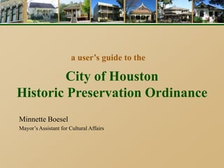
1. a user’s guide to the
City of Houston
Historic Preservation Ordinance
Minnette Boesel
Mayor’s Assistant for Cultural Affairs
2. Historic Preservation
1.Preservation in Houston
2.Historic Districts and Landmarks
3.Certificates of Appropriateness
4.Benefits of Designation
5.Online Resources
3. Historic Preservation
• City’s Historic Preservation program started
in 1995.
• City can designate both Landmarks and
Historic Districts.
• Houston Archaeological and Historical
Commission meets monthly to review
applications and issue Certificates of
Appropriateness.
5. Landmarks
• Approximately 300 currently
• Range from structures built in 1800s to mid-
century moderns.
• Must have historical, cultural, or architectural
significance.
• Building generally must be at least 50 years old to
be a landmark, unless exceptionally significant -
‘youngest’ was built in 1968.
6. Dr. John Hoskins Foster House (1912)
320 Branard Street – First Montrose Commons
9. Raymond and Daisy Powell House
3640 Piping Rock Lane – River Oaks
May 2011
July 1941
10. Landmark Designation
• Owners may nominate their property, or in
rare cases, HAHC may do it.
• Two types of Landmark
• ‘Regular’
• Protected
• Application will go first to HAHC for a
recommendation, then to City Council for a
decision.
11. Historic Districts
• 19 city districts
• Contain over 6000 properties
• Covers only 2.5 sq mi of 656 sq mi in Houston.
• Largest is Glenbrook Valley (1255 tracts),
smallest is West Eleventh Place (10 tracts).
• Most historic districts are clustered in Heights
area (6), Montrose (6), and Museum District (4).
• Glenbrook Valley is first post-WWII district and
first district outside the loop.
12.
13. Boulevard Oaks
Boulevard Oaks
1802 North Blvd (1927) 1611 North Blvd (1928)
Russell Brown Company
1617 South Blvd (1927)
J. W. Northrop Jr.
1659 North Blvd (1935)
Hiram Salisbury
1707 South Blvd (1927)
J.W. Northrop Jr.
15. Glenbrook Valley
8015 Glen Forest Ct. 7834 Santa Elena 7911 Santa Elena
7959 Rockhill 8610 Glen Aire 8210 Colgate
16. Historic District Designation
Process begins:
• Application can be initiated with the support
of 10% of the owners in the proposed
district.
• HAHC may also initiate
district designation.
17. Historic District Designation
Valid application includes:
• Petitions signed by 10% of the owners of
tracts within the proposed district
• Map reflecting the proposed boundary –
district limited to 400 properties
• Inventory – contributing & noncontributing
• Photos of all properties.
• Statement of Significance – why is the
district worthy of designation?
18. Historic District Designation
Review Process:
• P&D holds public meeting in community.
• P&D mails a notice to all owners with a card to
be returned indicating support or nonsupport.
• 67% must indicate support within 30 days.
• Public hearing held at HAHC.
• HAHC makes recommendation.
• City Council makes final decision.
20. Certificates of Appropriateness
A COA is required for:
• New construction in
historic districts
• Additions or exterior
alterations to existing
structures
• Relocation or demolition
of contributing structure
21. Certificates of Appropriateness
A COA is not required:
• Ordinary repair and maintenance
• Exterior paint, landscaping, HVAC
units, light fixtures, porch ceiling
fans, fences, re-roofing, mailboxes
• Changes to the interior of the house
• To rebuild your home back as it was if it is
destroyed by fire or natural disaster
• Demolition of a noncontributing (non-historic)
structure
22. Building Materials
• New materials (visible from the public right
of way excluding alleys) must be visually
compatible, but not necessarily the same as,
the materials being replaced in form, scale,
texture, and design for alteration,
rehabilitation, restoration, or additions to
historic structures
23. Additions
• Eleven criteria that additions must meet (ex.
whether addition retains the historic character
of the property, does not destroy historic
materials, compatible with setbacks, etc.)
• Incentives for certain additions that HAHC
must approve: the ‘shall approves’
– Second-story camelback
– Side addition
– Rear addition
28. New Construction
__
• Must be compatible with the existing
contributing structures within the historic
district in setback, proportions, roofline, and
height.
• No particular architectural style is required.
30. Demolition Requests
A COA for demolition of a contributing structure
may be granted if the owner can show:
• Unreasonable economic hardship or
• Unusual and compelling circumstances
33. Design Guidelines
• Contain standards for alteration, restoration,
new construction, relocation and demolition of
structures in historic districts.
• Design Guidelines are being created for all
city historic districts.
• Already adopted for Old Sixth Ward.
35. Benefits of Historic Designation
• City tax exemptions are available for rehab.
• 50% discount on building permit fees.
• Energy code requirements may be waived to
preserve historic materials.
• Stabilizes neighborhood and property values.
• Ensures that new construction and additions
are compatible with neighborhood character.
• County, state and federal tax benefits may
also be available.
36. Economic Incentives
Historic Site Tax Exemption
• Landmarks and contributing buildings may
qualify if restoration expenses equal at least
50% of assessed improvement value prior
to starting work
• City will ‘look-back’ for expenses incurred
up to five years prior to designation.
• Exemption for up to 15 years.
37. Economic Incentives
Significant Historic Building Tax Exemption
• Protected Landmarks only
• Must be identified as ‘Significant’
• Single-family residences not eligible
• HAHC and Council must approve
• Exemption of up to $30,000/yr in
perpetuity.