
Recommended
Recommended
More Related Content
What's hot
What's hot (9)
Viewers also liked
Viewers also liked (19)
Similar to 11.1 polk county calles completas manual
Similar to 11.1 polk county calles completas manual (20)
More from Sierra Francisco Justo
More from Sierra Francisco Justo (20)
Recently uploaded
Recently uploaded (20)
11.1 polk county calles completas manual
- 1. Prepared by 148970000.12 Polk Transportation Planning Organization A P R I L 2 0 1 3
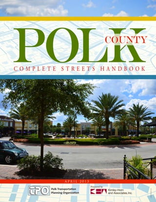
- 2. POLK County | COMPLETE STREETS HANDBOOK POLK COUNTY - COMPLETE STREETS HANDBOOK Acknowledgements POLK TRANSPORTATION PLANNING ORGANIZATION Thomas Deardorff Director RJ Walters Communications Specialist Cherie Simmons Office Manager Ryan Kordek Transportation Planning Administrator Ben Dunn Senior Transportation Planner Diane Slaybaugh Senior Transportation Planner Curtis Knowles Senior Transportation Planner Laura Lockwood Senior Transportation Planner Portions of this handbook first appeared in “Designing Walkable Urban Thoroughfares: A Context-Sensitive Approach,” Institute of Transportation Engineers, 2010. COMPLETE STREETS STEERING COMMITTEE CAC Members: Michael Finch (CAC Vice Chair) Paul Staes Walter O’Rourke TAC Members: Mark Bennett (TAC Chair) City of Haines City Richard Lilyquist (TAC Vice Chair) City of Lakeland Jerry Rodriguez City of Davenport Richard Ranck CFRPC Sean Byers City of Winter Haven Chandra Frederick Polk County Land Development Division Tom Phillips Citrus Connection Celeste Deardorff City of Lakeland Chuck Barmby City of Lakeland Lori Carlton FDOT Bill Skelton Polk County Transportation Engineering Jay Jarvis Polk County Transportation Engineering CONSULTING TEAM Christopher Hatton, P.E. Fred Schwartz, P.E. Merle Bishop, FAICP, CPM Jode Ballard, P.E.
- 3. POLK County | COMPLETE STREETS HANDBOOK POLK COUNTY - COMPLETE STREETS HANDBOOK Table of Contents CHAPTER ONE A COMPLETE STREETS VISION................................3 What Are Complete Streets?................................................ 4 Types of Complete Streets................................................... 5 Standards for Complete Streets........................................... 5 TPO Complete Street Policy............................................... 6 Local Government Complete Street Policy.......................... 7 CHAPTER TWO USING THIS HANDBOOK.........................................11 New Complete Streets Approach....................................... 12 Balancing Right-of-Way Elements..................................... 13 Roles and Responsibilities................................................. 14 Existing Plans and Standards............................................. 15 TPO 2035 Mobility Vision Plan.................................... 15 Polk County Land Development Code.......................... 15 Winter Haven’s Sidewalk, Pedestrian and Multimodal Infrastructure Plan................................... 15 City of Lakeland Citywide Pathways Plan...................... 15 Transportation Element of Lakeland’s Comprehensive Plan................................................... 15 Haines City Vision........................................................15 CHAPTER THREE DESIGNING THE TRAVELED WAY..........................19 Traveled Way Strategies..................................................... 20 Intersection Strategies....................................................... 22 Intersections for All Users................................................. 23 Road Diets........................................................................ 24 Medians............................................................................ 25 Paving Treatment.............................................................. 26 Bicycle Facilities................................................................ 27 Strategies for Bicycle Facilities........................................ 28 Sharrows........................................................................ 29 Bicycle Lanes................................................................. 30 Cycle Tracks .................................................................. 31 Bicycle Boulevards......................................................... 32 Intersection Strategies.................................................... 33 Bicycle Lanes at Intersections......................................... 34 Bicycles at Signalized Intersections................................. 35 Bicycle Boxes................................................................. 36 Cycle Tracks at Intersections.......................................... 37 Transit Strategies............................................................... 38 Transit Priority............................................................... 38 Bus Stop Location.......................................................... 39 Bus Bulbs....................................................................... 42 On-Street Parking............................................................. 43 Modern Roundabouts....................................................... 44 Modern Roundabout Strategies...................................... 44 Intersection Design Strategies........................................... 46 Stop-Controlled Intersections........................................ 46 Signalized Intersections.................................................. 46 Corner Design.................................................................. 47 Curb Radii Design Strategies......................................... 47 Curb Ramps...................................................................... 48 Curb Extensions................................................................ 50 Best Locations For Use/Design Considerations.............. 50 Pedestrian Crossing Strategies........................................... 51 Crosswalks..................................................................... 51 Design Strategies............................................................ 52 Uncontrolled Pedestrian Crossings................................. 53 Crossing Islands................................................................ 55 Raised Crossings and Intersections................................. 56 Signing and Marking..................................................... 57 Rectangular Rapid-Flash Pedestrian Beacons.................. 59 Traffic Signalization.......................................................... 60 Pedestrian Signal Heads................................................. 60 Accessible Pedestrian Signals (APS)................................ 61 Signal Phases for Pedestrians.......................................... 62 Pedestrian Priority at Signals.......................................... 63 CHAPTER FOUR DESIGNING THE STREETSIDE................................67 Streetside Strategies........................................................... 68 Streetside Zones................................................................ 69 Polk County Street Types.................................................. 69 Urban Street Types............................................................ 70 The Edge Zone ............................................................. 70 The Furnishing Zone..................................................... 70 The Pedestrian Zone ..................................................... 70 The Frontage Zone........................................................ 71 Suburban Street Types...................................................... 71 Shoulder........................................................................ 72 Swale............................................................................. 72 Sidewalk........................................................................ 72 Easement....................................................................... 72 Streetside Dimensions....................................................... 73 Street Furniture................................................................. 74 Seating.............................................................................. 75 Bicycle Racks..................................................................... 76 Bicycle Shelters................................................................. 77 Bollards............................................................................. 78 Trash Receptacles.............................................................. 79 Bus Stops and Shelters...................................................... 80 Transit Nodes................................................................. 80 Bus Stops....................................................................... 81 Bus Shelters................................................................... 82 Driveways......................................................................... 83 Urban Open Spaces........................................................... 84 Sidewalk Cafés.................................................................. 86 What’s Next for Polk County?........................................... 88
- 4. 1 A COMPLETE STREETS VISION POLK COUNTY | COMPLETE STREETS HANDBOOK
- 6. POLK County | COMPLETE STREETS HANDBOOK | 3 CHAPTER ONE The Polk County Transportation Planning Organization’s (TPO) mission is to coordinate funding countywide and share limited transportation tax dollars sensibly and judiciously. In today’s economic climate, one trend that counties and municipalities nationwide are pursuing involves the establishment of a “Complete Streets” approach for planned and needed transportation infrastructure. The Complete Streets philosophy is a smart way for the TPO to maximize the positive, regional impacts from limited available funds for roadway, sidewalk, and transit upgrades. The County’s goal is to provide streets that are safe and stress free for motorists, bicyclists, pedestrians, and transit riders — whether young or old, able-bodied or physically challenged. Chapter 1 of this handbook presents a vision for complete streets in Polk County, the benefits provided by adopting and implementing a complete streets program, and the principles that guide the development of the complete streets vision. Chapter 2 addresses how to use this handbook, as well as a description of the complete streets process and related handbooks and manuals. Chapters 3 and 4 include design strategies for the traveled way and streetside, respectively. A Complete Streets Vision Transit streets Lakeland Healthy streets Lakeland Streets for people Lakeland Lakeland Modern roundabout
- 7. CHAPTER ONE 4 | WHAT ARE COMPLETE STREETS? There has been a trend toward driving less, walking and cycling more, and taking public transportation. Not because people have to — but because they want to. But in the quest for economic growth and unfettered mobility over the past 50 years, many urban and suburban municipalities sacrificed neighborhood and community character, trees, landscaping, crosswalks and sidewalks in exchange for wide, car-friendly thoroughfares. As a result, most of today’s roads are designed to favor one form of transportation — automobiles. “Complete Streets” is a planning and design philosophy that considers all modes of travel — cars and trucks, public transit, walking, and bicycling — so cities and towns can offer their citizens safe, appropriate choices for any preferred mode of travel. Workers, drivers, students, seniors, and disabled persons all benefit from reliable access to well-planned streets, wide sidewalks, crosswalks, on-street parking and convenient public transportation. And communities benefit from the energy and vitality of people walking, bicycling, and being outdoors. When planned and implemented properly, Complete Streets ¾¾ Enhance pedestrian, bicyclist, and driver safety ¾¾ Increase foot traffic in downtown business districts. Retail sales go up. Commercial vacancies go down. ¾¾ Increase property values by providing quick, convenient access between homes, work, and schools ¾¾ Decrease roadway congestion with enhanced public transit options ¾¾ Improve air quality with fewer single-occupant cars on the road, and ¾¾ Conserve limited public infrastructure funds by maximizing use of existing corridors for multiple modes of transportation, reducing the need for new roads and costly overhauls Complete Streets is not a new idea. Polk County streets once hosted diverse modes of transportation. In 1914 the county issued a $1.5 million bond (equivalent to $34.4 million in 2012 dollars) to pave a number of roads. That bond issue paid for 9-foot-wide roads to connect Bartow to Mulberry, Lake Wales, Fort Meade, Winter Haven, Lakeland and Auburndale. According to historical reports, then-county commission clerk W.S. Wev suggested erecting an arch over every paved road at its entrance to Polk County, proclaiming that the motorist was about to enter “Imperial Polk County.” The name has since remained. Polk County has a history of diverse modes of transportation.
- 8. 1 | A COMPLETE STREETS VISION | 5POLK County | COMPLETE STREETS HANDBOOK TYPES OF COMPLETE STREETS A Complete Street is designed with its community context at the forefront. A Complete Street in a rural area would look much different than a Complete Street in a city. Features such as sidewalks, bicycle lanes or wide paved shoulders, dedicated bus lanes, easily accessible transit stops, safe crosswalks, medians, curb extensions, narrower travel lanes, roundabouts — or some combination of these options — are utilized during the planning and design process. No matter the location, however, the pivotal focus of Complete Streets is always on balancing the transportation needs of an entire community; enhancing pedestrian, bicyclist, and driver safety; and providing for judicious use of limited infrastructure improvement dollars. STANDARDS FOR COMPLETE STREETS Polk County wants to make its streets and roadways more accessible to all users. This handbook addresses the following questions as the primary framework under which roadway improvements are planned, designed, and implemented in the County: ¾¾ Does the improvement encourage sustainability and economic growth through improved access to multiple transportation modes? ¾¾ Do residents, workers, shoppers, seniors, the disabled, students, and bicyclists have adequate choices for mobility within the community? Is there a systemic over- reliance on automobiles for transportation? ¾¾ Are there opportunities for public/private partnerships to advocate Complete Street principles such as walking and bicycling for improved health and promoting public transit for energy efficiency and reduced congestion? ¾¾ Are there adequate set asides for appropriate public spaces adjacent to roadway corridors to help frame and define neighborhoods and business districts as places where people want live, work, shop and visit? Complete streets foster economic development; not just transportation. Winter Haven Our roadways belong to all of us, no matter how we choose to travel them. Lakeland
- 9. CHAPTER ONE 6 | TPO COMPLETE STREET POLICY The Polk TPO Complete Street Policy was created and adopted by the Polk TPO and the local municipalities within Polk County. The resolution adopting the TPO Complete Streets Policy (TPO Resolution 2012-05) outlines how the TPO will support the provision of Complete Streets as part of its planning process. This includes technical support and funding for local governments.
- 10. 1 | A COMPLETE STREETS VISION | 7POLK County | COMPLETE STREETS HANDBOOK LOCAL GOVERNMENT COMPLETE STREET POLICY Below is the draft local government policy which is the common policy recommended for adoption by all local governments in Polk County. It does not represent a mandate, but rather, a statement of intent to provide complete streets within physical and fiscal constraints.
- 11. 2 USING THIS HANDBOOK POLK COUNTY | COMPLETE STREETS HANDBOOK
- 13. POLK County | COMPLETE STREETS HANDBOOK CHAPTER TWO | 11 Using This Handbook This handbook is a compendium of Complete Streets information and recommendations gathered from the documents shown below combined with the TPO’s study of industry best practices related to the specific needs of Polk County. The opportunities available for Complete Streets implementation in Polk County are as numerous as they are flexible and the following pages highlight just a few of the elements that can be used to create Complete Streets in Polk County. The manuals listed below are used by engineers to design intersections and roadways: ¾¾ U.S. Access Board’s Public Right-of-Way Accessibility Guidelines (PROWAG) ¾¾ AASHTO’s Policy on Geometric Design of Highways and Streets ¾¾ Florida Department of Transportation (FDOT) Design Manual ¾¾ FDOT Manual of Uniform Minimum Standards for Design, Construction and Maintenance for Streets and Highways (“Florida Greenbook”) ¾¾ Highway Capacity Manual (HCM) ¾¾ Manual on Uniform Traffic Control Devices (MUTCD) ¾¾ Institute of Traffic Engineers (ITE) Traffic Signal Timing Manual ¾¾ Designing Walkable Urban Thoroughfares: A Context Sensitive Approach by ITE The Polk County Complete Streets Handbook is a supplement to these manuals and focuses on the importance of multimodal design of streets and intersections. Different design elements that improve conditions for one mode may negatively impact conditions for another — there likely will be tradeoffs with all designs.
- 14. CHAPTER TWO 12 | NEW COMPLETE STREETS APPROACH From now on, streets and neighborhoods in Polk County will be planned and designed to be user-friendly for all primary modes of transportation — pedestrians, bicyclists, transit users and motorists. The following guidelines will result in cost-effective, safe, multimodal and environmentally friendly facilities that optimize available right of way with adjacent land uses. ¾¾ Polk County will expand its focus from roadway designs that accommodate only cars and trucks to roadways that accommodate other modes of transportation as much as possible. ¾¾ Streets will be designed to limit excessive speeds and space once primarily dedicated to motorists will be reallocated as practical to wider sidewalks, bikeways, on-street parking and green space ¾¾ New roadway design and improvement projects will blend into the context of their surrounding land uses with appropriate plantings, building setbacks, decorative pavers, and median landscaping ¾¾ Complete Streets will be designed and treated as community resources like public parks, cultural facilities and green space accessible for use (and enjoyment) by all citizens Complete streets are designed with all users in mind, not just motorists.
- 15. 2 | USING THIS HANDBOOK POLK County | COMPLETE STREETS HANDBOOK | 13 BALANCING RIGHT-OF-WAY ELEMENTS The challenge of thoroughfare design is balancing the desired design elements of the thoroughfare with right- of-way (ROW) constraints. The thoroughfare designs at the planning stage often illustrate the desired elements within the cross-section, but actual conditions frequently limit the width of the street. Designing thoroughfares in constrained rights-of-way requires prioritizing the design elements and emphasizing the higher-priority elements in constrained conditions. Higher-priority design elements are those that help the thoroughfare meet the vision and context sensitive objectives of the community (the objectives established through the planning process). Lower-priority elements have less influence on achieving the objectives and can be relinquished in cases of insufficient right-of-way. Often the width of the public right-of-way varies along the thoroughfare, making the job of the designer even more challenging. When the width of the right-of-way varies, it is useful to prioritize design elements and develop a series of varying cross- sections representing: 1. Optimal conditions — sections without right-of- way constraints that can accommodate all desirable elements; 2. Predominant — representing sections of the predominant right-of-way width in the corridor that accommodate all of the higher-priority elements; 3. Functional minimum — representing a typically constrained section where most of the higher priority elements can be accommodated; and 4. Absolute minimum — representing severely constrained sections where only the highest-priority design elements can be accommodated without changing the type of thoroughfare. If the predominant right-of-way is equal to or less than the absolute minimum, the designer should consider changing the thoroughfare to a different type while attempting to maintain basic function, or consider converting the thoroughfare to a pair of one-way thoroughfares (couplet)—or, further still, consider other solutions that achieve the community vision. Reconsideration of a cross section requires recycling through the steps of the design process, potentially requiring a review of the community vision for the thoroughfare and the area transportation plan and/ or identifying a new context zone/thoroughfare relationship. If the vision for the corridor is long range, then the necessary right-of-way should be acquired over time as the adjacent property redevelops. Under these circumstances the optimal (or the predominant) thoroughfare width can be phased in over time, beginning with the functional or absolute minimum design in the initial phase. In constrained conditions it might be tempting to minimize the street side width and only provide the minimum pedestrian throughway (5 feet). In urban areas, however, even under constrained conditions, it is critical to provide at least a minimum width furnishing zone to accommodate street trees, utility poles and other accouterments. Without the furnishing zone, trees, utilities, benches and shelters and other street equipment might encroach into the throughway for pedestrians or result in an inadequate width street side when the community’s vision for the context zone is ultimately achieved.
- 16. CHAPTER TWO 14 | ROLES AND RESPONSIBILITIES In general, street projects may be initiated by either the public sector or the private sector. Projects may be new streets in a new location or reconstruction projects. Reconstruction projects may be resurfacing or rehabilitations; underground utility upgrades that require replacing the pavement surface afterwards or complete reconstruction projects. Projects may be fully funded by a Capital Improvement Program or financed from the enterprise fund of the particular utility or combination of both public funding sources. Projects may be the result of a public/private partnership in which private funds are matched by state, federal or local funds. And finally, projects may be financed entirely by the private sector. The table at right lists agencies, authorities and other organizations that are frequently involved in the design of streets in Polk County. This list is provided as a reference tool, for informational purposes only and is not an exhaustive list. Department/Agency Involved in Roadway Planning Construction TPO Polk County Transportation Planning Organization OPD Polk County Office of Planning and Development (unincorporated Polk County) Water Resources Polk County Water Resource Management Parks Polk County Parks and Natural Resources Economics Polk County Economic Development and Tourism Transportation Polk County Transportation Engineering Division CRA Community Redevelopment Agency Transit Polk Transit, Citrus Connection, Winter Haven Area Transit, and Polk County Transit Services Local Planning Department Municipal planning and/or engineering agencies (17 municipalities in Polk County) Water/Sewer Polk County Utilities Division, City of Lakeland, City of Winter Haven, City of Auburndale, City of Haines City, Town of Dundee, City of Lake Wales, City of Bartow, City of Mulberry, City of Polk City, City of Frostproof, City of Fort Meade, City of Davenport, City of Alfred, City of Eagle Lake (water only), Town of Lake Hamilton (water only) Parks Parks and Recreation SWFWMD Southwest Florida Water Management District SFWMD South Florida Water Management District Fire Polk County Fire/Rescue Housing Polk County Housing Neighborhood Development (State and Federal Grant projects) FDEO Florida Department of Economic Opportunity FDOT Florida Department of Transportation (District 1 and Turnpike) FDEP Florida Department of Environmental Protection CFRPC Central Florida Regional Planning Council Communication Verizon, ATT, Bright House Networks Gas Utilities Central Florida Gas, TECO - People’s Gas Electric Utility Providers Progress Energy, Tampa Electrical Company, City of Lakeland, City of Bartow, and City of Fort Meade Streets Street Services Utilities Atmos, Verizon, ATT, ONCOR
- 17. 2 | USING THIS HANDBOOK POLK County | COMPLETE STREETS HANDBOOK | 15 EXISTING PLANS AND STANDARDS Polk County and its municipalities have created plans and standards that support/encourage Complete Streets. A sampling of these follows. TPO 2035 Mobility Vision Plan Defines the transportation needs for the Polk TPO, including the unincorporated area and cities within Polk County, establishes priorities and identifies cost feasible road projects. This plan includes priorities for bicycle routes, sidewalks, multi-use trails, and intermodal facilities. Polk County Land Development Code Polk County’s unified land development regulations contains development criteria for the design, location and construction of subdivision roads, driveways, vehicle parking and sidewalks. Requirements such as interconnected parking areas along arterial and collector roads help to reduce the number of driveways accessing the road and conflicting with non-motorized transportation within the roadway corridor. Winter Haven’s Sidewalk, Pedestrian and Multimodal Infrastructure Plan This document is intended to increase and enhance travel options in the City to allow residents and visitors to access the City’s key destinations without using an automobile. The plan is intended to fill gaps in the existing multimodal transportation network and address barriers to accessing destinations by transit or non-motorized modes. The Plan provides specific recommendations that can be incorporated and referenced in policy documents that guide capital improvements funding and long range transportation decision making. The Plan includes a multimodal network plan which depicts existing parks and multi- use trails, and recommends additional bicycle facilities, multi-use trails, and priority pedestrian corridors. City of Lakeland Citywide Pathways Plan The City’s plan provides details for capital funding of sidewalks. Bicycle lanes and unmarked paved shoulders are also evaluated for inclusion in all roadway construction projects. This plan also provides a classification and evaluation of bicycle and pedestrian pathways according to the function they serve in overall mobility. Transportation Element of Lakeland’s Comprehensive Plan The City’s Transportation Element includes Roadway Typology Designations and cross sections. The roadway typologies adopted by the City of Lakeland recognizes the importance of all transportation modes by identifying specific facilities that must be considered for inclusion in the design of all public and private road projects and adjacent development. The City of Lakeland Citywide Pathways Plan is included in the Transportation Element of the City’s Comprehensive Plan. Haines City Vision The Haines City Vision Plan includes a transportation circulation plan for existing and planned transportation corridors within the City. The plan describes different roadway types, i.e. boulevard/residential and boulevard/ commercial, and identifies how these roads will be constructed using 16 different roadway cross sections. All of the road cross sections include space for bicycles and pedestrians.
- 18. 3 DESIGNING THE TRAVELED WAY POLK COUNTY | COMPLETE STREETS HANDBOOK
- 20. POLK County | COMPLETE STREETS HANDBOOK CHAPTER THREE | 19 Designing the Traveled Way When designing a complete street one must consider how to allocate the various elements of the street within the right-of-way. All users must be considered. Elements within the traveled way will dictate how safe the roadway is, how much traffic it can carry and how accessible and attractive each mode of travel is. An important element of the traveled way is the intersection. Intersections are often the focus of traffic engineers because that is where streets converge, where most conflicts occur and where efficiencies can be realized. But intersections are also where designers of complete streets need to focus. Prioritizing intersection safety for the pedestrian, bicyclist and transit user needs to play an equal role with moving vehicles efficiently through the intersection. Designing a complete street starts with its context — how the street interacts with adjacent land uses. The context within which the intersection is found also needs to be considered. Intersections are an opportunity to introduce themes of the surrounding space, whether a neighborhood or a downtown setting. This chapter addresses the effective design of elements in the traveled way, including the multimodal intersection. TraveledWay
- 21. CHAPTER THREE 20 | TRAVELED WAY STRATEGIES 1. Safety First – If one mode is given priority, the street design cannot compromise the safety of any mode for the benefit of another. 2. Slower Speeds – The safety and comfort of pedestrians and bicyclists is reduced by speeding vehicles. For pedestrian- and bicycle-oriented streets, vehicle speeds should be slower. A variety of design strategies can help to reduce vehicle speeds without causing undue frustration for drivers. 3. Consider All Modes – Street design should include balanced considerations for every mode — pedestrians, bicyclists, transit riders, and motorists — and not dominated by cars. 4. Importance of Context – The design of the traveled way should complement and reinforce adjacent uses. This approach can help to increase property values and foot traffic to local businesses. There are numerous Complete Street treatments with various applications depending on the context of the street. The checklist below is provided to identify only a sample of the potential Complete Street features that can be applied to the traveled way and is not meant to be a comprehensive list of potential applications. On-street parking. Lakeland Street design should strive for clear sight lines between pedestrians and drivers. TRAVELED WAY STRATEGY CHECKLIST Road diets Medians Paving treatment Bicycle facilities Bicycle lanes Bicycles at signalized intersections Bicycle boxes Cycle tracks Transit strategies Bus stop location Transit prioritization at intersections Bus bulbs On-street parking Modern roundabouts
- 22. 3 | DESIGNING THE TRAVELED WAY POLK County | COMPLETE STREETS HANDBOOK | 21 When designing elements of the Traveled Way a number of considerations are needed to balance the needs of the user: ¾¾ Minimum street widths (10 feet) are suitable only in locations with low truck traffic. ¾¾ Separate bicycle facilities are preferred; however there may be locations where they cannot be used due to insufficient width. As a solution, shared lane markings are permitted on lanes of any width, in locations with and without parking, in accordance with the Manual on Uniform Traffic Control Devices (MUTCD). ¾¾ Back-in angled parking is preferred to front-in angled parking due to its safety benefits for pedestrians and bicyclists. ¾¾ If parallel parking and bicycle lanes are adjacent to one another, the minimum combined width is 13 feet. Decisions regarding parking lane width when adjacent to bicycle lanes should consider parking turnover rates. ¾¾ Managing vehicle speeds is particularly important on streets where pedestrian and bicycle use is desired. In crashes involving bicyclists and pedestrians, vehicle speed at the point of impact is directly related to pedestrian or bicyclist survival. Studies have also shown that motor vehicle crashes decline where roadway speeds are reduced. Drivers also are far more likely to yield to pedestrians at crosswalks (in accordance with Florida Statutes) when speeds are lower. ¾¾ During major roadway construction and reconstruction projects, the geometric design of the roadway should make excessive speeds feel uncomfortable. This can be accomplished through curves (chicanes), long vistas broken with vertical elements such as trees, and traffic calming features. Road diets and medians are used to reduce excess travel lane capacity. Lakeland Clearly marked crosswalks and bulb-outs increase pedestrian safety. Lakeland
- 23. CHAPTER THREE 22 | INTERSECTION STRATEGIES 1. Safety first. Intersections should be designed to minimize conflicts, reinforce the message that drivers and bicyclists should slow down, and respect the needs of pedestrians. National and State of Florida guidelines for accessible design in the public right- of-way should be followed with a commitment to achieving the best outcome for all users within the constraints of each site. Design should facilitate predictable movements by all modes, and encourage everyone to obey traffic laws. 2. Signal cycle lengths should be kept as short as practical. For coordinated signal corridors, consideration for pedestrian movements should be factored into the timing plans. As technology advances, traffic signalization should move towards a system that passively detects all modes in order to become more efficient, reducing delay and improving safety. Shorter cycle lengths will encourage pedestrians and bicyclists to obey traffic signal indications. 3. Keep intersections small. Intersections and roadway design have been traditionally oriented toward automobile traffic. Undefined and underutilized areas of pavement not necessary for the efficient movement of motor vehicles should be used to reclaim street space for pedestrians, transit users, and bicyclists. Intersection designs should strive to live within the current right-of-way, and incorporate green, sustainable street elements wherever possible to reduce impervious surfaces, treat stormwater at the source, and reduce the heat island effect. Underutilized areas of pavement should be reclaimed for pedestrian use. Lakeland Safe and accessible designs for all modes of transportation must guide intersection design.
- 24. 3 | DESIGNING THE TRAVELED WAY POLK County | COMPLETE STREETS HANDBOOK | 23 There are numerous Complete Street treatments with various applications depending on the context of the street. The following checklist is provided to identify only a sample of the potential Complete Street features that can be applied to intersections and is not meant to be a comprehensive list of potential applications. INTERSECTIONS FOR ALL USERS Safety, with an emphasis on safety for at-risk users, is the driving factor of multimodal intersection design. Non-motorized users suffer far greater injuries in a crash with a motor vehicle. Intersections are the places where modes come together and where the most conflicts and crashes occur. Regardless whether a trip is made on foot, by bicycle, via transit or in an automobile, people should feel safe, comfortable, and experience a minimal amount of delay. Extensive engineering guidance exists to design streets for safe motor vehicle use. Specific engineering factors include horizontal and vertical alignments, sight distance calculations, capacity, and coordinated signal timing. INTERSECTION STRATEGY CHECKLIST Curb radii Curb ramps Curb extensions Crosswalk design Crosswalk markings at uncontrolled locations Crossing islands Raised crossings and intersections Advance yield markings and signs In-street yield to pedestrian signs Rectangular rapid-flash pedestrian beacons Pedestrian signal heads Accessible pedestrian signals (APS) Exclusive signal phases for pedestrians Signalization strategies to reduce conflicts People should feel safe, comfortable, and experience minimal delay during all trips. Lakeland
- 25. CHAPTER THREE 24 | ROAD DIETS Sometimes streets are wider than necessary given the volume of traffic they carry during peak hours. “Road diets” are a solution that can be applied to many streets across Polk County. A road diet reduces the number of travel lanes on a roadway, typically one lane of traffic in each direction, in exchange for expanded sidewalks, bicycle lanes, or landscaping. Road diets not only provide additional space necessary for a complete street, they also provide measurable safety benefits to all users. Research has shown that road diets reduce total crashes between 20% to 50% and they are officially recognized by the Federal Highway Administration as a proven safety countermeasure. In January 2012, FHWA Division offices were advised to recommend the use of road diets with their state DOT counterparts. Road diets are an important tool in the implementation of complete streets principles. The table at right summarizes issues that should be considered when reducing travel lanes on streets. Road diets require special consideration to the needs of surrounding communities. Gaining public support is a key aspect in its success. Road diets can be implemented during repaving projects. A low-cost road diet reconfigures existing roadway space and does not involve curb reconstruction. While sidewalk widths remain the same, these types of road diets still benefit pedestrians due to the larger buffers between the sidewalk and traffic lane. Road diet with median on Martin Luther King Boulevard in Lakeland Lakeland Road diet with median on Parker Street in Lakeland Lakeland Road Configuration/Location Recommendation Four-lane roads with ADT volumes up to 20,000 vehicles per day Good candidate for road diet. A capacity analysis may be necessary to ensure the lane reductions do not create significant motorist delays. Six-lane roads with ADT volumes up to 30,000 vehicles per day Good candidate for road diet. A capacity analysis may be necessary to ensure the lane reductions do not create significant motorist delays. Four-lane undivided roadways Remove two travel lanes and convert road to two lanes with a center-turn lane and bicycle lanes. Five-lane undivided roadways Additional space can be used for buffered bicycle lanes, transit lanes, and expanded streetscape improvements. Intersections Pay special attention to vehicle capacity issues. ROAD DIET STRATEGIES
- 26. 3 | DESIGNING THE TRAVELED WAY POLK County | COMPLETE STREETS HANDBOOK | 25 MEDIANS Raised separators in the center of the roadway are one form of roadway median. Median widths can vary greatly, from a minimum of 6 feet to 20 feet or more along parkways. To add prominence to a segment of road, medians with landscaping can be used extend a park-like environment along a corridor and reduce the heat island effect. Medians can also be used as a safe haven for crossing pedestrians on multi-lane roadways, particularly those with uncontrolled crossings — in this case, landscaping should not obstruct the ability for pedestrians and motorists to see one another. See page 51 for additional information on pedestrian crossing strategies. The minimum width of six feet for center medians is necessary to ensure that it serves as an adequate pedestrian refuge. Wider medians are necessary if they serve a dual purpose as a left turn lane to accommodate both the width of a turn lane and allow adequate space for the pedestrian refuge. Signalized intersections with medians should be designed to allow pedestrians to cross the entire roadway during a single signal cycle. Pedestrian cuts through medians should be as wide as the approaching sidewalks. Consider angling the pedestrian cut at midblock locations to direct pedestrian sightlines to on-coming traffic. Care should be taken so that median plantings do not limit the sightlines for pedestrians and motorists. Additional information. Center medians need to be carefully designed to ensure proper drainage. Drought- resistant and low-maintenance plant species should be used. Sidewalk and bicycle lane widths should not be reduced or eliminated to provide space or additional width for medians. Landscaped median for mixed-use / downtown / main street. Lakeland Another example of a landscaped median for mixed-use / downtown / main street.
- 27. CHAPTER THREE 26 | PAVING TREATMENT One way to reduce speeds, increase durability, manage stormwater, or indicate special zones like bicycle lanes, bus stops, or speed tables is to use a special paving treatment on the roadway surface. Changes in color or material can be an aesthetic feature and can result in a traffic calming effect. Some examples include colored asphalt or concrete, textured asphalt or concrete, pervious pavement, stamped patterns, and pavers. The location and amount of special paving materials depend on the roadway’s design and expected vehicle types and volumes. Keep in mind how ever, that contrasting paving materials impact the safety and maintenance needs of the road. Different materials have different qualities with respect to road noise, porosity, heat absorption, surface friction, bicyclist comfort, and maintenance. Additional information. Noise can be a concern with textured pavements. Care must be taken to ensure textured pavements are structurally sound and able to support the volume and type of vehicles likely to use the street. Particular care should be taken when placing pavers made of different materials next to each other (e.g., concrete pavers adjacent to asphalt). Over time, the edges between the two materials can become uneven, creating maintenance issues and a safety hazard. Any pavement used by pedestrians must be ADA compliant. Colored and textured pavement Colored and textured pavement Lakeland Location Application/Use Asphalt and concrete Light colored asphalt and concrete should be utilized wherever possible to reduce heat Colored pavement Can be used to delineate special lanes for transit, bicycles or on-street parking Concrete bus pads Should be considered on high-frequency bus routes where heat and the heavy vehicles can create channels in asphalt Porous pavement Water moves through the pavement to be absorbed into the soil below, rather than running off into drains and ditches. Porous pavements sometimes collect particulates over time, which reduces their porosity. Porous pavements are expensive and still experimental. Crosswalks and sidewalks The rough texture of pavers may not be desirable for walkers, strollers or other small- wheeled devices. PAVING TREATMENT STRATEGIES
- 28. 3 | DESIGNING THE TRAVELED WAY POLK County | COMPLETE STREETS HANDBOOK | 27 BICYCLE FACILITIES On roads where bicyclists are legally allowed to operate, they should be anticipated. Bicycling is an excellent option for short trips (less than three miles). The TPO Mobility Vision Plan, City of Lakeland Citywide Pathways Plan, and Winter Haven’s Sidewalk Pedestrian and Multimodal Infrastructure Plan outlines a vision for bicycle facilities and identifies specific locations where roadway retrofits are feasible to accommodate bicycles. However, simple collisions can seriously injure bicyclists. For many people, bicycling close to fast moving vehicles can be an unnerving experience. Inadequate bicycle accommodations on the street increase the number of bicyclists on the sidewalk, which in turn conflicts with pedestrian traffic. Well-designed bikeways reduce these conflicts and create a more comfortable traffic environment for everyone. Bicycle facilities can be divided into two general categories: Exclusive (where roadway space is designated for bicycle use) ¾¾ Bicycle lane (typical) ¾¾ Left side bicycle lane ¾¾ Buffered bicycle lane ¾¾ Climbing bicycle lane ¾¾ Contra-flow bicycle lane ¾¾ Cycle track Shared (where bicycles and other vehicles share roadway space). ¾¾ Shared roadway ¾¾ Marked shared lane ¾¾ Priority shared lane ¾¾ Shared bus/bicycle lanes ¾¾ Bicycle boulevard ¾¾ Shared use path Shared facilities are appropriate in low speed ( 35 mph) environments where motorists can see and react to the presence of bicyclists. Higher vehicle speeds justify the need to separate bicyclists and motor vehicles. Left side bicycle lane Bicycle lane with parallel parking
- 29. CHAPTER THREE 28 | Strategies for Bicycle Facilities Road diets and lane diets should be considered to provide adequate space for bicycle facilities. Bicycling is exercise and bicyclists are sensitive to distance and frequent stops. They usually seek the most direct, continuous route that does not require a lot of stops and starts. Bikeway design should always keep this in mind. Potholes, uneven or sunken drainage structures, broken and uneven pavement, drainage inlets, and utility access covers create dangerous hazards to bicyclists. Where possible, the installation of bicycle facilities should involve an evaluation of pavement conditions and improvements as necessary to ensure a smooth riding surface. If an on-street bikeway is adjacent to angled parking, the parking style should be back-in parking. This configuration improves the exiting drivers’ ability to see passing bicycles. More detailed information on several common types of bicycle facilities is provided on the pages that follow. Guidance on bicycle facility design at intersections is provided on page 34. Buffered bicycle lane, Portland, OR Drainage inlets and utility access covers create dangerous hazards for bicyclists.
- 30. 3 | DESIGNING THE TRAVELED WAY POLK County | COMPLETE STREETS HANDBOOK | 29 Sharrows Sharrows are shared lane pavement markings on a road that alert motorists to locations where bicyclists are expected to ride. They do not designate a particular part of the road for the exclusive use of bicyclists. The symbols communicate the need for drivers to use care when passing bicycles. Marked shared lanes should be provided after considering narrowing or removing travel lanes, parking lanes and medians as necessary to provide a bicycle lane or cycle track. Refer to the MUTCD and the AASHTO Guide for the Development of Bicycle Facilities for more information on the application of shared lane markings. Location/Conflict Application/Use Streets with space constraints Should not be used on streets with speed limits 35mph Streets with narrow lanes Shared lane markings typically placed in center of lane to indicate motorists must change lanes to pass bicyclists Narrow lanes adjacent to on- street parking Shared lane markings should be placed outside the vehicle door zone Streets with on-street parking that is underutilized Shared lane markings are less effective. Bicyclists often feel more comfortable riding in the parking lane. Streets with downhill grades where bicyclists operate near same speeds as vehicles Shared lane markings can be used in lieu of bicycle lanes Constrained corridors Shared lane markings can be used as a temporary solution to complete connections between bicycle lanes and other facilities SHARED LANE MARKING STRATEGIES Shared lane markingShared lane marking
- 31. CHAPTER THREE 30 | Bicycle Lanes The MUTCD and the AASHTO Guide for the Development of Bicycle Facilities provide more comprehensive and detailed information on bicycle lane design. Bicycle lanes use lines and symbols on the roadway surface to delineate space for the exclusive use of bicyclists. They are for one-way travel only and are usually provided on both sides of two-way streets, or on one side of one-way streets. Bicyclists do not have to remain in bicycle lanes on a street. They may leave the bicycle lane as necessary to make turns, pass other bicyclists, or to position themselves for other movements. Vehicles can only momentarily cross bicycle lanes accessing parking spaces and entering and exiting driveways and alleys. Note that bicycle lanes require on-going maintenance to ensure debris does not collect in the lane. Additional information. Left-side bicycle lanes can be useful on one-way streets and streets with wide medians, particularly in the case of heavy bus traffic or frequent right-turns. Also consider providing a buffered bicycle lane (three-foot minimum) when additional space is available. The buffer can either be placed between the bicycle lane and the travel lane (in locations with higher speeds and volumes), or between the bicycle lane and the parking lane (in locations with high parking turnover). For heavily traveled bicycle routes on one-way streets, contra-flow bicycle lanes may be used. Wider bicycle lanes allow a bicyclist to pass a slower bicyclist and increase separation from traffic. Green-colored pavement is frequently used to highlight the presence of a bicycle lane in locations where traffic merges across a bicycle lane. Bicycle lane with right-turn lane
- 32. 3 | DESIGNING THE TRAVELED WAY POLK County | COMPLETE STREETS HANDBOOK | 31 Cycle Tracks Bicyclists feel safer if they can be separated from traffic. Cycle tracks are reserved for the exclusive use of bicyclists and provide a physical separation between bicycles and vehicles. There are several ways to create cycle tracks: some cycle tracks are installed at a higher elevation than the street, such as curb height. Others are installed at street level, but are separated from travel lanes by median, parked cars, bollards, or some combination of these. Cycle tracks can be one-directional (one-way on each side of the street) or two-directional (two-way on one side of the street). The National Association of City Transportation Officials (NACTO) Urban Bikeway Design Guide provides more information on cycle track design. Cycle track in Stockholm Cycle track Location/Conflict Application/Use Adjacent to on-street parking 3 ft. min. buffer between parking and cycle track (used as pedestrian loading/ unloading zone) Parking conflicts Cycle tracks require increased parking restrictions compared to bicycle lanes to provide for visibility at intersection transitions. Driveway crossings Frequent driveway crossings are incompatible with cycle track design. Transit stops Transit stops and waiting areas should be provided between the cycle track and the roadway to reduce conflicts with pedestrians loading and unloading. Drainage and utility structures The presence of drainage and utility structures along the curb may reduce the effective width of the cycle track. CYCLE TRACK STRATEGIES
- 33. CHAPTER THREE 32 | Bicycle Boulevards Bicycle boulevards are streets with slower vehicle speed postings and are designed to let bicyclists travel comfortably and less stressfully. Bicycle boulevards are designed as bicycle-priority facilities and through-traffic at slow speeds is allowed. They are designed to minimize the number of stops a bicyclist must make along the route. Separate bicycle facilities (e.g., bicycle lanes) are unnecessary on bicycle boulevards due to low vehicle speeds and bicycle priority. Special signage and pavement symbols typically indicate an area designated as a bicycle boulevard. Other information. Ideally, bicycle boulevards should not carry more than 1,000 motor vehicles per day to be compatible with bicycling. Diverters and other traffic management devices are typically used to discourage motor vehicle through-traffic, while still enabling local traffic access to the street. Bicycle boulevards should be long enough to provide connectivity between neighborhoods and common destinations. Location Application/Use Neighborhoods with a grid street network One street can be designated as the bicycle boulevard. Can also be accomplished by combining a series of road and trail segments to form one continuous route. Major street crossings Bicycle boulevards may need additional crossing measures for bicyclists, such as traffic signal timing and detection or curb extensions. Controlling vehicle speeds Traffic calming measures can be used to maintain lower speeds ( 20 mph) BICYCLE BOULEVARD STRATEGIES Bicycle boulevard
- 34. 3 | DESIGNING THE TRAVELED WAY POLK County | COMPLETE STREETS HANDBOOK | 33 Intersection Strategies Most crashes involving bicycles occur at intersections. Well-designed intersections reduce crashes and injuries, make bicycling more convenient and attractive, minimize delays, and reduce conflicts with vehicles and pedestrians. Intersections designed to accommodate bicyclists should provide: ¾¾ Signal designs and timings to accommodate bicyclists based on an engineering study ¾¾ Access to off-street destinations ¾¾ A direct, continuous facility to the intersection ¾¾ A clear route for bicyclists through the intersection ¾¾ Reduced conflicts with turning vehicles Intersection improvements for bicycles should be considered during all roadway/safety improvement and street redesign projects. More information about accommodating bicycles at signalized intersections can be found on page 35. Well-designed intersections make bicycling more convenient and attractive.
- 35. CHAPTER THREE 34 | Bicycle Lanes at Intersections When designing intersections for bicyclists, the approaches should maintain the continuity of the bicycle facilities to the maximum extent possible. Striping through unsignalized and complicated intersections may continue on streets with dedicated bicycle lanes to provide additional guidance and safety for bicyclists. This is especially important at intersections with conflicting vehicle movements, unsignalized crossings, and/or more than four lanes of moving traffic. Striping through each intersection may not be required, however, and should be evaluated case by case. Shared lane markings can supplement dashed bicycle lane lines at crossings where bicycles are not anticipated, such as contra-flow bike or cycle tracks. Additional information. Bicycle lane markings, including green colored pavement, shared lane markings, dashed bicycle lane lines, and signage, may be provided through intersections. Selective removal of parking spaces may be needed to provide adequate visibility and to establish sufficient bicycle lane width at approaches to intersections. Shared lane markings can be used where space is not available for bicycle lanes at intersections. Although the minimum recommended width for a bicycle lane is 5 feet, 4-foot-wide bicycle lanes may be considered at constrained intersections in order to provide a dedicated space for bicyclists. Bicycle lanes at the entrance and exit of roundabouts should allow direct access to a shared use bicycle/pedestrian path around the perimeter of the roundabout through properly designed ramps. They should also enable bicyclists to mix with traffic and proceed through the roundabout as would a vehicle. Bicycle lane at intersection Location Indication/Application Markings at intersections Standard details can be found in the MUTCD and AASHTO Guide for the Development of Bicycle Facilities Major intersection approaches Dedicated bicycle lanes should be provided. Major intersection approaches on higher-speed roads Dedicated bicycle lanes may not be suitable. Context and land use need to be considered. Grade-separated cycle tracks or off-street facilities may be more appropriate. Intersection approaches on residential, lower volume roads Shared lane markings are appropriate Intersections with a dedicated right-turn lane Bicycle lanes should be provided to the left of the right-turn-only lane unless bicycle signals and dedicated phasing is provided STRATEGIES FOR BICYCLE LANES AT INTERSECTIONS
- 36. 3 | DESIGNING THE TRAVELED WAY POLK County | COMPLETE STREETS HANDBOOK | 35 Bicycles at Signalized Intersections Special considerations are necessary to design traffic signals that serve both motorists and bicyclists because bicycles have different operating characteristics than motor vehicles. Bicyclists have slower acceleration and velocity rates than motorists. To offset this disadvantage, traffic signal design should include minimum green intervals, clearance time, and extension time to ensure bicyclists can safely cross the intersection. Appropriate signal timing can minimize cyclist delays, discourage red-light running, and reduce the potential for crashes. Signal progression also should balance the needs of all users with appropriate design speeds and traffic signal coordination settings. Additional information. Refer to the latest edition of the AASHTO Guide for the Development of Bicycle Facilities for more details on the signal timing needs of bicyclists at intersections. Special attention should be given to signal timing at locations with higher vehicular speeds and longer crossing distances. At these locations bicyclists are more likely to have different signal timing needs than motorists. Dedicated signal indications can be provided by bicycle heads. They should be positioned to maximize visibility to bicyclists. They also should be coordinated with pedestrian and non-conflicting vehicular movements to increase safety and minimize overall delay. Bicycle signal heads should be installed on a case-by-case basis determined by an engineering study. Bicycle lane signal call buttons Location Indication/Application Intersections with actuated signals (loop or video detectors) The signal system should detect bicycles and motor vehicles. The loop or video detectors should be adjusted to detect bicycles, or separate bicycle-detectors should be installed. Within bicycle lanes or bicycle boxes Detection devices should be located within lane or box, marked with a detector symbol, and supplemented with appropriate MUTCD signage. If not feasible within bicycle lanes or bicycle boxes Detection device should be located prior to the stop bar and span an appropriate distance to provide for left-, through-, and right-turning bicyclists. Other locations Bicycle signals can be used to separate conflicting movements, provide leading bicycle intervals, provide controls at shared-use paths, or control an exclusive left-turn phase. Intersections with a dedicated right-turn lane Bicycle lanes should be provided to the left of the right-turn-only lane unless bicycle signals and dedicated phasing is provided. STRATEGIES FOR BICYCLES AT SIGNALIZED INTERSECTIONS
- 37. CHAPTER THREE 36 | Bicycle Boxes Dedicated space between the crosswalk and the motor vehicle stop line used to provide bicyclists a dedicated space to wait during a red light is known as a bicycle box. Putting bicyclists ahead of stopped traffic at a red light improves visibility and reduces conflicts. Bicycle boxes also provide bicyclists a head start through the intersection, which helps them make difficult turning movements and improves safety and comfort due to the difference in acceleration rates between bicycles and vehicles. In effect, the bicycle box puts bicyclists in front of vehicles, allowing them to “claim the lane.” Bicycle boxes also provide more space for several bicyclists to wait at a red light as opposed to being constrained to a 5-foot-wide bicycle lane. Additional information. Bicycle boxes are typically painted green with a minimum 13-foot depth and should be supplemented with appropriate MUTCD signage. Where right-turn- only lanes for vehicles occur, bicycle lanes should be designed to the left of the turn lane. If right-turn- on-red is desired, consider ending the bicycle box at the edge of the bicycle lane to allow motor vehicles to make this turning movement. Location Indication/Application Areas with high volumes of turning bicyclists Use a bicycle box to allow bicyclists to shift toward their desired side of the travel way. Depending on the location of the bicycle lane, left or right side, bicyclists can shift sides of the street to align themselves with vehicles making the same movement through the intersection. Areas where motor vehicles can continue straight or turn right crossing a right-side bicycle lane Bicycle boxes allow bicyclists to move to the front of the queue and make the first movement, minimizing conflicts with right turning vehicles. In these locations, right-turn-on-red movements should be prohibited. BICYCLE BOX STRATEGIES Bicycle box at an intersection Lakeland Bicycle box at an intersection Lakeland
- 38. 3 | DESIGNING THE TRAVELED WAY POLK County | COMPLETE STREETS HANDBOOK | 37 Cycle Tracks at Intersections Separated from motor vehicle travel lanes, parking lanes, and sidewalks, cycle tracks offer bicyclists an exclusive travelway alongside roadways. Although cycle tracks may increase bicyclist comfort, this can create a false sense of security at intersections and decrease visibility between all modes. Cycle track designs at intersections must manage conflicts with turning vehicles and visibility for all. Additional information. Cycle track design often involves relocating transit stops to the far-side of the intersection to reduce conflicts. Consider narrowing or removing the separation prior to the intersection and providing standard bicycle lanes with bicycle boxes to raise awareness and increase visibility. Location/Design Goal Indication/Application Increasing visibility and awareness at intersections Restrict parking 20 ft. to 40 ft. from each corner of the intersection. More space may be needed based on ultimate sight distance calculations. Near transit stops Cycle tracks should be routed behind a transit stop (i.e., the transit stop should be between the cycle track and vehicle lane). If not feasible, cycle track should include pavement markings, rumble strips, and signage to alert bicyclists to stop for buses and pedestrians. At intersections Must consider signals and phasing to manage conflicts with turning vehicles. Bicycle signal heads should be considered, especially for two-way tracks. At non-signalized intersections Design options for increased visibility and safety include warning signs, raised intersections, special pavement markings (including green surface treatment), shared lane markings, and removal of parking prior to the intersection. At low-volume intersections Cycle tracks should be given priority, indicated with signage and pavement markings. STRATEGIES FOR CYCLE TRACKS AT INTERSECTIONS
- 39. CHAPTER THREE 38 | TRANSIT STRATEGIES Key goals for designing intersections to accommodate transit vehicles include improving the reliability and efficiency of transit service. Traffic signal waits account for 10% of overall bus trip time and up to 50% or more of bus delays. This section discusses design strategies to improve transit operations and reduce delays for transit vehicles at intersections and presents design guidance on the individual bus stops and sidewalk connections. Individual strategies can be implemented; however, a combination of strategies to determine the appropriate bus stop location and method of traffic signal prioritization will be the most effective. These strategies should be complemented by operational improvements by the bus operator, including smart fare payment systems and real-time tracking. Transit Priority Bus service becomes more reliable and efficient when transit is prioritized at intersections. Transit prioritization strategies include signal coordination, signal priority, transit-only lanes, and queue jump or bypass lanes. Improved traffic flow needs coordinated signal timing. In addition to signal coordination, transit signal priority allows transit vehicles to shorten or extend a traffic signal phase without changing the phase sequence or overall signal timing. Transit-only lanes at intersections allow transit vehicles to bypass queued traffic. Queue jump or bypass lanes are specially designated transit lanes at intersections. Queue jump lanes give an early green or steady green signal for transit vehicles while other vehicles traveling in the same direction or through the intersection are given a red light. Indication Application Signal coordination Can reduce delays for transit and motor vehicles. Should not appreciably increase delays for other modes, however, and should consider the acceleration rates and speeds of bicyclists. Signal priority for transit vehicles Allows transit to stay on schedule during peak hours when there is congestion. The difference in time can be made up during the next cycle, but all other signal operations can remain unchanged. May be considered for late buses to keep them on schedule. With dedicated transit-only lanes Signal coordination and signal priority can be used with or without the presence of dedicated transit only lanes along a corridor or queue jump. Queue jump lanes Can be can be used at intersections without a bus stop or at intersections with a bus stop located at either at the near- or far- side if there is enough space in the roadway. STRATEGIES FOR TRANSIT PRIORITY
- 40. 3 | DESIGNING THE TRAVELED WAY POLK County | COMPLETE STREETS HANDBOOK | 39 Additional information. Queue jump lanes with a leading signal phase must take into consideration the overall signal cycle lengths and impacts to delay for other users. If space is not available for a queue jump lane or bypass lane, consider using a right-hand turn lane to double as a bus advantage lane by allowing buses to move up in the queue at a signal where right turn on red is permitted. If right-turn lanes are used, appropriate signage such as “Right Lane Must Turn Right” must be accompanied by “Except Buses” placards. Transit signal priority elements should be considered on all priority transit routes in conjunction with an engineering study conducted to assess the impacts on cross street traffic. Polk transit agencies must train employees how to handle bus and bicycle interactions in transit- and bus-only lanes. Bicycles and transit complement each other. Allowing bicycles on buses can extend the area served by transit, and integrated transit can encourage bicycling. Bus Stop Location All bus stop locations should be safe, convenient, well- lit, clearly visible and must be ADA-compliant. Proper spacing and siting of bus stops involves considerations, such as the bus route, population density, popular destinations, transfer locations, intersection operations and geometry, parking restrictions, and sightlines. Selecting a location for a bus stop at an intersection also depends on available curbside space, sidewalk condition, sidewalk width, traffic and pedestrian volumes, number and width of travel lanes, turning movements, sight distances, on-street parking, bicycle facilities, and crosswalks. Transit service can increase bicycle usage. Location Indication/Application Where buses are required to pull out of traffic Bus stops should be located at the near- or far- side of intersections wherever possible (not at mid-block locations). Midblock Requires the most amount of curbside space At intersections Convenient for passengers because they can intercept other transit connections, crosswalks, pedestrian routes and building entrances easily. Where bus bulbs are provided The length of the bus stop can be less than the prescribed minimums because buses do not have to pull out of traffic. The minimum bus stop length at bus bulbs should provide a clear and level landing pad at each door of the bus. At signalized intersections Far-side placement is preferred; however, location selection should be done on a site-by- site basis in consultation with the bus operator and local agency representatives. STRATEGIES FOR BUS STOP LOCATIONS
- 41. CHAPTER THREE 40 | Location Advantages Disadvantages Recommended Uses Far-side bus stop • Eliminates conflicts with right tuning vehicles • Facilitate bus reentry into the traffic stream • Requires shorter deceleration distance • Encourages pedestrians to cross behind the bus • Potential for intersection blockage by queued buses • Potential for increase rear-end collisions • Obstructed sight distances for crossing vehicles and pedestrians` • When near-side traffic is heavier than far-side traffic • At intersections with heavy right-turn volumes • At intersections with transit signal priority Near-side bus stop • Allows transit drivers to utilize the intersection and available sight distance when pulling away from the curb • Provides pedestrian access closest to the crosswalk • Potentially creates double stopping at intersections • Generates conflicts with right turning vehicles • Potential for through-lane blockage by queued buses • Obstructs sight distances for crossing pedestrians • When far-side traffic is heavier than near-side traffic • At intersections with pedestrian safety concerns on the far side Mid-block bus stop • Less overall traffic congestion • Minimized sight distance concerns • Ability to directly serve mid- block generators • Encourages unsafe pedestrian crossings • Increased walking distances for users crossing the street • Increase construction costs or no-parking restrictions • When there is a major mid- block passenger generator • When the interval between adjacent intersections exceeds stop spacing recommendations BUS STOP LOCATIONS Bus stop locations can be far-side, near-side or mid- block. Locating stops on the far-side of the intersection is usually preferred because it encourages pedestrians to cross behind the bus, reducing conflict and bus delay; allows buses to take advantage of gaps in traffic flow, especially with signal prioritization, rather than needing to be at the front of the queue at an intersection for a near-side stop; minimizes conflicts between buses and right-turning vehicles; and provides additional right-turn capacity on the near-side of the intersection. Additional considerations related to bus stops, especially from the pedestrian’s perspective, are presented on pages 80 and 81.
- 42. 3 | DESIGNING THE TRAVELED WAY POLK County | COMPLETE STREETS HANDBOOK | 41 Typical Far-Side Bus Stop Bus Stop AreaNo Parking Area BusParking L'55' Landing Pad Shelter Bench Trash Receptacle Sign Legend Near-side bus stop
- 43. CHAPTER THREE 42 | Bus Bulbs Curb extensions along the length of a bus stop that eliminate the need for buses to pull in and out of traffic are called bus bulbs. Like curb extensions at intersections, bus bulbs help reduce crossing distances for pedestrians and provide additional space for street furniture such as bus shelters, landscaping, and pedestrian queues. Since the bus remains in the travel lane while stopped, bus bulbs can result in traffic delays or unsafe maneuvers by drivers and bicyclists to steer around buses. Designs must consider the street type, number of travel lanes, and headways of buses. Bus bulbs are most effective at reducing travel time if they are utilized throughout a corridor by eliminating the need for buses to pull in and out of traffic all-together. A creative application bus bulbs is the transit node concept shown on page 80. Additional information. Bus bulbs are effective in enforcing parking restrictions within bus stops and do not require as much space as curbside stops because the bus does not need space to pull in and out of the stop. They should be installed on a case-by-case basis determined by an engineering study. Location Indication/Application On streets with on-street parking These are the only locations where bus bulbs are appropriate Areas with high passenger volumes Bus bulbs are appropriate At near-side intersections Bus bulbs can interfere with right-turning vehicles BUS BULB DESIGN CONSIDERATIONS Bus Stop Area Bus ParkingParking 15' 15' L Landing Pad Shelter Bench Trash Receptacle Sign Legend Typical Bus Bulb
- 44. 3 | DESIGNING THE TRAVELED WAY POLK County | COMPLETE STREETS HANDBOOK | 43 ON-STREET PARKING Local businesses in downtowns depend on on- street parking. Furthermore, on-street parking has a positive impact on the pedestrian realm by buffering the pedestrians from passing traffic. Pedestrians feel far more comfortable and safe on streets with occupied on-street parking. Parked cars help calm traffic by visually narrowing and increasing friction along the edge of the roadway. All the ingredients must be in the right mix to get the maximum benefit from on-street parking. When on-street parking is under-utilized, the result is a wider street with faster speeds. Other information. A parking lane can be designated for different purposes throughout the day, such as commercial loading during the morning, public parking during the day, and valet parking at night. On-street parking should be prohibited approaching intersections or driveways because it can obscure site lines for all users of the road. Back-in angled parking in Seattle Lakeland Parallel parking Location Application/Use Downtowns and residential streets Most appropriate locations for on-street parking. Enhances traffic calming effect and improves access to local shops and residences. Parking lanes (parallel parking) should be a minimum of 7 ft. wide, with 8 ft. preferred. Areas with high parking turnover Although it is illegal for motorists to open car doors into oncoming traffic, this hazard should be considered when developing an appropriate design. Crashes can occur in locations with high parking turnover, such as main streets and commercial streets with restaurants and businesses. Where there are narrow parking lanes (7 ft.) with high turnover, an adjacent 6-ft. bicycle lane is recommended. Controlling vehicle speeds Parking creates traffic calming measures Areas with angled parking The preferred orientation is back-in angled parking. It provides more visibility when pulling back into traffic, and more visibility between bicyclists and motorists. The longer rear overhang requires the use of wheel stops to ensure parked vehicles do not encroach upon the sidewalk. ON-STREET PARKING STRATEGIES
- 45. CHAPTER THREE 44 | MODERN ROUNDABOUTS Circular intersections designed for lower speeds and yield-controlled entry, are called modern roundabouts. Pedestrian access is only allowed across the legs of the roundabout behind yield lines. In general, multilane roundabouts are not recommended because of the safety concerns for pedestrians (especially those who are visually impaired) and bicyclists. Another type of circular intersection is a neighborhood traffic circle, which is a smaller type of roundabout and generally used for low speed, residential streets. Modern Roundabout Strategies Installation considerations include the design vehicle, pedestrian volumes, number of pedestrians with visual impairments, and pedestrian route directness. If they create greater vehicle delays or increase the difficulty for pedestrians to navigate the intersection, then roundabouts are not recommended. Roundabouts are not meant for high-speed roadways, and are more appropriate for collector streets. Intersections with more than four legs can be good candidates for conversion to roundabouts; however, an engineering study must be conducted in order to determine whether a roundabout is appropriate. Modern roundabouts can result in reduced relative speeds and improved traffic flows. Pedestrian crosswalks should be ADA-compliant with detectable warning strips and ramps at least 20 feet from the roundabout entry. Sight distance for drivers entering the roundabout should be to the left so drivers are aware of vehicles and bicycles in the circle. (Visibility across the center of the circle is not critical.) Signing and pavement markings must conform to the latest version of the MUTCD. Residential street roundabouts Example of markings for approach and circulatory roadways at a roundabout
- 46. 3 | DESIGNING THE TRAVELED WAY POLK County | COMPLETE STREETS HANDBOOK | 45 Modern roundabout Lakeland Location Application/Use Entry to the roundabout Yield lines should be provided Crosswalks High pedestrian volumes may require wider crosswalks Areas with high levels of bicycle activity Multi-lane roundabouts are not recommended. Okay with shared lanes (sharrows). Areas with high levels of pedestrian activity Multi-lane roundabouts are not recommended. Signal controls should be considered. Multi-lane roundabouts Need to provide pedestrian signals and splitter island medians to reduce crossing distances and allow pedestrians to cross one direction of travel at a time. At-grade pedestrian cut-throughs should be provided at splitter island medians with ADA-compliant detectable warning strips. Intersections near active railroad at-grade crossings Poor candidates for roundabouts since traffic would be blocked in all directions during train crossings Sidewalks at roundabouts Permitting bicyclists to use the sidewalk at roundabouts should be considered for comfort and safety. Ramps from the street to the sidewalk and appropriate signage to inform pedestrians of a mixing zone should be installed if sidewalk bicycling is allowed Stormwater management facilities Roundabouts are excellent places to implement stormwater management systems; however visibility must not be obstructed by plant growth MODERN ROUNDABOUT STRATEGIES
- 47. CHAPTER THREE 46 | INTERSECTION DESIGN STRATEGIES The key to safe, efficient, and multimodal intersections is well-designed intersection geometry. Changes in geometry can help reduce vehicle turning speeds, increase pedestrian comfort and safety, and create space for bicycle facilities. Safety for all users is maximized in intersections with well-designed geometry and efficient traffic control measures. Stop-Controlled Intersections Stop-controlled intersection approaches are the easiest for pedestrians to cross because motorists and cyclists must stop, yield to pedestrians, and reduce pedestrian wait time. However, the use of stop signs must balance safety with efficient traffic flow for all modes, including bicycles and transit vehicles. Stop sign installation on a major street requires specific warrants as determined by the MUTCD. In general, stop signs may be appropriate if one or more of the following conditions exist: ¾¾ A street entering a highway or through street ¾¾ An unsignalized intersection in a signalized area ¾¾ High speeds, restricted views, or crash records indicate a need for control by a stop sign. Stop signs should be installed in a manner that minimizes the number of vehicles having to stop. At intersections where a full stop is not necessary at all times, consideration should be given to using yield signs. The use of stop signs should also be limited on streets with bikeways, especially on bicycle boulevards, as it requires significant energy to stop and start for bicyclists, resulting in lower levels of compliance and discouraging cyclists from using the boulevard. Signalized Intersections Signalized intersections should provide indications for motor vehicles and pedestrians. Bicycle signals and transit signals also should be considered where appropriate. Signal phasing and timing should be designed to meet the unique needs of all users at the intersection. By optimizing signal phasing and timings, multiple modes are able to move safely and comfortably through the intersection with limited conflicts and delays. Signalized intersections should conform to the latest version of the MUTCD, HCM and the Institute Lakeland Stop-controlled intersections Lakeland Signalized intersections
- 48. 3 | DESIGNING THE TRAVELED WAY POLK County | COMPLETE STREETS HANDBOOK | 47 of Transportation Engineer’s Traffic Signal Timing Manual. The MUTCD contains specific warrants for the installation of a traffic signal at an intersection. CORNER DESIGN The radius at the corner has a significant impact on an intersection. Larger curb radii encourages turns at higher speeds, while smaller curb radii reduce speeds, shorten crossing distances for pedestrians, and improve sight distances. The effective radius and the actual curb radius are the most important corner design elements. Actual curb radius refers to the curvature along the curb line; effective radius refers to the curvature that vehicles follow when turning. It may be affected by on-street parking, bicycle lanes, medians, and other roadway features, which create a larger effective radius. Curb Radii Design Strategies The effective radius should be designed to accommodate the design vehicle. However, the actual curb radius should be designed so that pedestrian needs on the sidewalk are accommodated. An actual curb radius between 5 feet and 10 feet should be used wherever possible, including where there are higher pedestrian volumes and an adequate effective radius or where there are low volumes of large vehicles. Where there are high volumes of large vehicles making turns, inadequate curb radii could cause large vehicles to regularly travel across the curb and into the pedestrian waiting area. The maximum effective radius for large vehicles is 35 feet; however, all factors that may affect the curb radii must be taken into consideration, including: ¾¾ Type of street ¾¾ Angle of the intersection ¾¾ Curb extensions ¾¾ Receiving lane width ¾¾ Design vehicle R1 R 2 R1 = Actual Curb Radius R2 = Effective Radius Adding parking and/or bicycle lanes increases the effective radius of a corner. Lakeland Intersection of Orange Street and Massachusetts Avenue
- 49. CHAPTER THREE 48 | Considerations Accommodating large vehicles with an adequate effective radius while maintaining a small actual curb radius to benefit pedestrians can be achieved with a number of strategies, including: ¾¾ Varying the actual curb radius over the length of the turn, also known as a compound curve, creating a smaller radius as vehicles approach a crosswalk and larger as they make the turn. ¾¾ Adding parking and/or bicycle lanes to increase the effective radius of the corner ¾¾ Striping advance stop lines on the destination street of multilane roadways (at least two lanes in each direction) to enable large vehicles to make the turn by encroaching into the opposing lane ¾¾ Installing textured, at-grade paving treatments to discourage high-speed turns while still permitting turns by larger vehicles. CURB RAMPS A curb ramp provides a smooth transition from the sidewalk to the street. Appropriately designed curb ramps are critical for providing access across intersections for people with mobility and visibility disabilities. One of the key considerations of intersection geometry is the location of curb ramps and crossings relative to desire lines and vehicle paths. Wherever feasible, curb ramps should be located to reflect pedestrians’ desired path of travel through an intersection while also considering sight lines of approaching motor vehicles. If possible, two separate curb ramps should be provided at corners instead of a single ramp that opens diagonally at the intersection. Curb ramps should be designed to avoid the accumulation of water or debris to the maximum extent feasible. The locations and elevations of drainage inlets should be considered with the design of curb ramps. Element Specification Width Minimum 4 ft. wide Location Must be contained within a marked crosswalk Slope No more than 8.33% Warning strip Minimum 2 ft. detectable, color contrast warning strip Landing pads At top and bottom of ramp. Must be level *Always check current federal and Florida ADA standards as they may change. CURB RAMP DESIGN STRATEGIES* Polk County buses must be able to navigate intersections. Lakeland
- 50. 3 | DESIGNING THE TRAVELED WAY POLK County | COMPLETE STREETS HANDBOOK | 49 Additional information. There are a variety of standard curb ramp designs, including perpendicular ramps and parallel ramps. The appropriate design for a particular location is determined on a site-by-site basis. Key factors to consider include pedestrian desire lines, sidewalk widths, buffer widths, curb heights, street slopes, and drainage patterns. Flares are required when the surface adjacent to the ramp’s sides is walkable, but they are unnecessary when a landscaped buffer occupies this space. Where appropriate, elimination of flares can help to reduce the amount of impervious surface and can increase the overall capacity of a ramp in high-pedestrian areas. Curb ramp Lakeland Downtown curb ramps Major thoroughfare curb ramps
- 51. CHAPTER THREE 50 | CURB EXTENSIONS Curb extensions, also known as neck-downs or bulb-outs, reduce the effective width of the street by extending the curb line across a parking lane to the adjacent travel lane. Curb extensions have a variety of benefits: ¾¾ Reduces crossing distances for pedestrians ¾¾ Enhances visibility between pedestrians and other roadway users ¾¾ Additional space for pedestrians to queue before crossing ¾¾ Improves safety by slowing vehicle traffic and emphasizing pedestrian crossings ¾¾ Creates space for ADA-compliant curb ramps where sidewalks are narrow ¾¾ Restricts cars from parking too close to crosswalks ¾¾ Provides space for utilities, signs, and amenities such as bus shelters or waiting areas, bicycle parking, public seating, street vendors, newspaper stands, trash and recycling receptacles, and stormwater management elements Best Locations For Use/Design Considerations ¾¾ Curb extensions are valuable in locations with high volumes of pedestrian traffic, near schools, or where there are pedestrian safety issues. ¾¾ Curb extension installation may require the relocation of existing storm drainage inlets. ¾¾ Curb extensions are not feasible on arterials that have peak hour parking restrictions to move traffic more efficiently. ¾¾ The turning needs of larger vehicles need to be considered. Where curb extensions conflict with turning movements, they should be reduced in size rather than eliminated. ¾¾ Curb extensions may also impact underground utilities, curbside parking, delivery access, garbage collection, and street sweepers. These impacts should be evaluated when considering installation of a curb extension. Location Application In areas with on- street parking Should be used, especially at corners and midblock Adjacent to travel lanes or bicycle lanes Should not reduce travel or bicycle lanes to an unsafe width Intersections May extend into one or two legs of the intersection, depending on parking configuration CURB EXTENSION DESIGN STRATEGIES Curb extension Residential street curb ramps
- 52. 3 | DESIGNING THE TRAVELED WAY POLK County | COMPLETE STREETS HANDBOOK | 51 PEDESTRIAN CROSSING STRATEGIES The most vulnerable users of the transportation system are pedestrians. High pedestrian activity should dictate slow motor vehicle speeds on streets, which can be achieved through roadway design and traffic calming strategies. Pedestrian-oriented designs should also minimize conflicts with other modes and vehicle traffic. Intersections should be designed for pedestrians of all abilities. ADA-compliant curb ramps, crosswalks, and accessible pedestrian signals must be provided to the extent feasible and follow the guidelines set by the U.S. Access Board Public Right of Way Accessibility Guidelines (PROWAG). Crosswalks Pedestrian-friendly walking environments depend on well-designed crosswalks. Crosswalks serve a dual function of guiding pedestrians to locations where they should cross the street and alerting drivers of pedestrian movements. Safety for all, especially those with disabilities, is the single most important criteria in crosswalk design. Crosswalks may be marked or unmarked. While most marked crosswalks are at intersections, other locations may be marked specifically to emphasize unique pedestrian lines to ensure safe access to local institutions, parks, and housing for the elderly. Marked pedestrian crosswalk Pedestrian-oriented signs help minimize conflicts with vehicles
- 53. CHAPTER THREE 52 | Design Strategies ¾¾ All crosswalk designs must conform to the latest edition of the MUTCD. ¾¾ Crosswalks should be at least 10 feet wide or the width of the approaching sidewalk, whichever is greater. In areas of heavy pedestrian volumes, crosswalks can be up to 25 feet wide. ¾¾ Different types of crosswalk markings can be used. Typically, two parallel transverse lines (or continental style) crosswalk markings are recommended. ¾¾ ADA-compliant curb ramps should direct pedestrians into the crosswalk and the bottom of the ramp should lie within the area of the crosswalk (flares do not need to fall within the crosswalk). Additional Information. Crosswalk markings should be located at right angles to the roadway where practical and must be balanced with pedestrian desire lines, accessibility requirements, and site constraints. At complex intersections, crosswalks should be placed at the safest locations (where there is the least conflict with other modes) that reflect pedestrian desire lines. Crosswalk placement should also maximize the visibility of pedestrians to turning vehicles. Pedestrian crosswalk with special pavers Lakeland Pedestrian crosswalk with special pavers Lakeland Textured crosswalk pavement
- 54. 3 | DESIGNING THE TRAVELED WAY POLK County | COMPLETE STREETS HANDBOOK | 53 Uncontrolled Pedestrian Crossings Guidance is provided in this section as to where marked crosswalks are appropriate at uncontrolled locations, as well as where safety enhancements are needed to increase driver and pedestrian visibility and awareness. Uncontrolled intersections are defined as placed where no traffic control devices regulate the movement of traffic. Users must yield the right-of-way to those already in the intersection or those approaching from the right. A midblock crossing is defined as a pedestrian crossing that is not located at an intersection. If a midblock crossing is not designated by a marked crosswalk, then pedestrians must yield the right-of-way to motorists. NCHRP Report 562, “Improving Pedestrian Safety at Unsignalized Intersections,” states that the “safest and most effective pedestrian crossings use several traffic control devices or design elements to meet the information and control needs of both motorists and pedestrians.” Additional safety improvements are discussed on the following pages: ¾¾ Raised Crossings and Intersections ¾¾ Advance Yield Markings and Signs ¾¾ In-Street “Yield To Pedestrian” Signs ¾¾ Rectangular Rapid Flash Beacons An engineering study should be performed to determine the appropriateness of a marked crosswalk at uncontrolled locations. Marked crosswalks are not appropriate for many intersections. A study should examine and assess: 1. Traffic speeds and volumes 2. Crossing distances 3. Need/demand for crossing 4. Distance from adjacent signalized intersections and other crosswalks, and the possibility to consolidate multiple crossing points 5. Sight distance/geometry of the location 6. Availability of street lighting 7. Locations of drainage structures The MUTCD outlines specific warrants that must be met in order to create signalized midblock crossings. Uncontrolled intersections and midblock crossings should strive to maximize safety for all users by providing, as appropriate: ¾¾ Lighting ¾¾ Regulatory and warning signage ¾¾ Marked crosswalks (as determined by an engineering study. See “Crosswalk Markings at Uncontrolled Locations”) ¾¾ Traffic calming ¾¾ Clear sightlines Uncontrolled intersections are where no traffic control devices regulate movement. Locations where crosswalk markings alone are insufficient to address pedestrian safety include any street where any of the following conditions exist: The roadway has four or more lanes of travel without a raised median or pedestrian refuge island and an ADT of 12,000 vehicles per day or greater The roadway has four or more lanes of travel with a raised median or pedestrian refuge island and an ADT of 15,000 vehicles per day or greater The speed limit exceeds 35 MPH
- 55. CHAPTER THREE 54 | Considerations Marked crosswalks may not be appropriate on each leg of an uncontrolled intersection at major arterials. It is best to mark only one side of the intersection, particularly to areas where pedestrians can easily be directed. In selecting the most appropriate side for the marked crosswalk, the following should be considered: ¾¾ Pedestrian demand (such as location of bus stops or metro stations) ¾¾ Vehicle turning movements. Multi-leg intersections (three or more roadways) require a careful consideration of vehicular turning movements balanced against the pedestrian crossing ¾¾ Sight distance ¾¾ Proximity to other marked crosswalks or crossing locations In addition to marked crosswalks, there are a number of measures available to use at uncontrolled locations to improve pedestrian safety: Reduce the effective crossing distance for pedestrians by providing curb extensions, raised pedestrian refuge islands Install traffic calming measures to slow vehicle speeds Provide adequate nighttime lighting for pedestrians Use various pedestrian warning signs, advance stop lines, rapid-flashing beacons, and other traffic control devices to supplement marked crosswalks Install traffic signals with pedestrian signals where warranted Midblock crossing with pavers Lakeland Midblock crossing design should emphasize clear sightlines for all users. Lakeland
- 56. 3 | DESIGNING THE TRAVELED WAY POLK County | COMPLETE STREETS HANDBOOK | 55 CROSSING ISLANDS Medians that provide protected areas within a crosswalk so pedestrians only have to focus on and cross one direction of traffic at a time are called crossing islands. They reduce pedestrian exposure and are best used along multilane roadways. Although they can be used at signalized intersections, they should always be designed to allow pedestrians to cross the entire roadway in one pedestrian phase. Crossing islands should: ¾¾ Include at-grade pedestrian cut-throughs as wide as the connecting crosswalks ¾¾ Include detectable warning strips ¾¾ Be gently sloped to prevent ponding and ensure proper drainage ¾¾ Direct pedestrians at an angle to face on-coming traffic. ¾¾ Provide a median width at least 6 ft. wide ¾¾ Meet MUTCD standards Additional information. Crossing islands should be considered where crossing distances are greater than 50 feet. Where possible, stormwater management systems should be utilized on crossing islands with adequate space, but not in pedestrian paths to and from crosswalks. Plantings should not obstruct sight lines. One innovative and low-cost pedestrian treatment at intersections or mid-block is the use of pedestrian flags. The basic concept is to assist the pedestrian in gaining the attention of the approaching motorist. With the aid of the brightly colored flag that can be held out in front of the pedestrian and/or waved, the pedestrian is better able to attract the attention of the driver sooner by becoming more visible. This is a device that is low in cost and can be installed quickly. Once the equipment is installed at the crossing, the only ongoing cost is the replacement of the flags. Crossing island on commercial thoroughfare Crossing median islands
- 57. CHAPTER THREE 56 | Raised Crossings and Intersections One traffic-calming device that helps improve sight lines between pedestrians and motorists is called a raised crossing. Raised crossings are a type of speed table with a marked crosswalk on the flat plateau at the top of the table. They eliminate vertical transitions for pedestrians and the need for curb ramps, although detectable warning strips must be provided along the edge of the roadway to alert visually impaired pedestrians. Raised crossings can be installed at midblock, at one or more crosswalks, or an entire intersection can be raised. Raised crossings should be at least 10 feet wide, and preferably as wide as the approaching sidewalk. They normally extend the full width of the roadway and should be flush with the sidewalk, although sometimes they are tapered to accommodate drainage needs or bicycles. Signage should be provided for motorists at the approach and at raised crossings. High-visibility or textured pavements can be used to enhance the contrast between the raised crossing and the surrounding roadway. Raised crossings and intersections are most appropriate at high-traffic pedestrian locations. They help delineate specific street types, retail districts, or special destinations. Unless determined otherwise by an engineering study, raised crossings are not appropriate on high-speed roadways. Considerations ¾¾ Raised crossings can have parabolic or trapezoidal cross sections, however a parabolic profile with a smooth leading edge is the preferred transition for bicyclists. ¾¾ Reflective pavement markings conforming to the MUTCD must clearly delineate raised crossings so motorists and bicyclists know where they occur and can adjust their speeds accordingly. ¾¾ Other traffic calming measures can supplement raised crossings to reduce travel speeds throughout a neighborhood or corridor. ¾¾ Longer speed tables (up to 22 feet long) with design speeds between 25 to 30 mph are easier for large vehicles to negotiate. ¾¾ Avoid placing raised crossings at the bottom of steep inclines where bicyclists travel at higher speeds and may be startled by their presence. ¾¾ At unsignalized mid-block locations raised crossings are particularly useful — at these locations drivers are less likely to expect or yield to pedestrians. ¾¾ Ramp slope and design speeds must be taken into consideration. ¾¾ Proper drainage needs to be taken into consideration. Raised intersections can simplify drainage inlet placement by directing water away from the intersection. If the intersection is on a slope, catch basins should be placed on the high side of the intersection. Raised intersection at Orange Street and Massachusetts Avenue Lakeland
- 58. 3 | DESIGNING THE TRAVELED WAY POLK County | COMPLETE STREETS HANDBOOK | 57 Signing and Marking Advance yield markings improve motorist expectations that a pedestrian may be present on multilane roadways. They are placed further back from the crosswalk and used in conjunction with “Yield to Pedestrian” signs. They help reduce multiple-threat collisions that occur when there are several travel lanes in the same direction and the vehicle in the near lane yields to the pedestrian, blocking the view of the motorist in the far lane. Additional Information. When determining where to place advance yield markings and signs within the 20 ft. to 50 ft. range, consider the number of lanes pedestrians must cross, motor vehicle speeds, sight lines, on street parking, and turning movements. Advance yield markings may be staggered, so that yield markings in one lane are closer to the crosswalk than the yield markings in an adjacent lane. Staggered yield lines can improve drivers’ view of pedestrians, provide better sight distance for turning vehicles, and increase the turning radius for left-turning vehicles. Advance yield sign Pedestrian crossing Lakeland Location Application/Use Two-lane and three-lane roadways Advance yield markings and signs can be used Four-lane roadways with operating speeds of 25 mph or less Less effective, but can be used Four-lane roadways with operating speeds greater than 25 mph Rapid flashing beacon is a better solution Unsignalized crossings Use “Yield Here to Pedestrian” signs Crosswalks on unsignalized multilane approaches Advance yield markings and signs should be placed 20 ft. to 50 ft. before crosswalk Area between yield line and crosswalk Parking should be prohibited. Pavement markings can reinforce “No Parking” signage. Areas with stop signs, traffic signals, or other traffic control device Yield lines should not be used STRATEGIES FOR SIGNING AND MARKING