1) The document discusses a new paradigm of considering the Tasmanides geological structure in 3D rather than the previous 2D view, recognizing curvature and oroclines rather than simple north-south strike.
2) Evidence from tilt-filtered magnetics, seismic, and palaeomagnetic data supports the existence of large-scale oroclines in the Tasmanides, demonstrating rotation of terranes during orogeny.
3) The proposed "Cayley hypothesis" of a congested subduction zone and rollback explains geological problems and similarities to the Banda arc provide a new and valuable conceptual model for the evolution of the complexly structured Tasmanides.
2015 Broken Hill Resources Investment Symposium - Geological Survey of New So...Symposium
"Uncovering the Curnamona and Surround: A New South Wales Perspective."
Phil Gilmore, Senior Geoscientist, Geological Survey of New South Wales.
Technical presentation at 2015 Broken Hill Resources Investment symposium.
2015 Broken Hill Resources Investment Symposium - Geology Survey of South Aus...Symposium
The Curnamona Province is a remnant of a once continuous Late Palaeoproterozoic sedimentary basin and orogenic belt extending from Queensland to South Australia. It experienced several periods of sedimentation, volcanism, deformation and metamorphism between 1.72-1.59 Ga during the Olarian Orogeny, including the deposition of the Willyama Supergroup, intrusion of the Ameroo Subsuite, and formation of the Broken Hill Pb-Zn deposit at 1.685 Ga. The province was further deformed by the Delamerian Orogeny between 0.51-0.49 Ga.
Given to the Gold Prospectors Association of America in 2018 this talk illustrates a workflow on how to research, evaluate and put together a resource prospect. it is designed to be from the type of individual who is planning a trip, how do they use the tools available to find and look for rocks and minerals.
This document summarizes a talk given at the Geological Survey Technical Talks on June 1st, 2016 in Orange, NSW. The talk discussed the transition from the Geological Survey of NSW's (GSNSW) first generation 1:250,000 metallogenic maps to new mineral potential mapping. This included an overview of recently completed metallogenic maps of the Bathurst and Broken Hill areas at 1:250,000 scale, which updated deposit information and incorporated mineral system models. Future work discussed included mineral potential studies and metallogenic syntheses of the Cobar, New England, and Macquarie Volcanic Province areas at 500,000 scale. The talk concluded with preliminary work on the new Cobar metallogenic project,
This document discusses developing a new metallogenic framework to aid mineral exploration in the Cobar Basin region of New South Wales, Australia. It involves creating metallogenic maps to better understand the timing, sources, and conditions of mineralization. This includes commodity studies, mineral potential studies, and developing mineral system models from the state to regional scale. Broken Hill and Cobar metallogenic syntheses projects are underway at 500k scales. The Cobar project involves new basement interpretations, metamorphic mapping with over 11,000 petrographic observations, and HyLogger studies on 9,000m of core to better understand alteration associated with mineralization.
The document summarizes geological modeling work done on the Zeehan Ag Pb (Zn Sn) Mining Field in Tasmania using simple CAD software. Key findings include:
- Most mineralization in the central field is stratabound and located near contacts between volcanic and black shale units in the Upper Oonah Formation.
- Mineralized horizons are disrupted by NW-SE faults but the faults are largely unmineralized.
- Lodes generally dip southeast, parallel to folding in the cover strata. There is a spatial association with southeast-plunging fold hinges.
- A simple zonal model of mineralization does not fit; stratigraphy and lithology are more important
The document discusses mineral systems as complex dynamic systems exhibiting self-organized critical behavior. It identifies four critical elements of mineral systems: whole lithosphere architecture, transient geodynamic triggers, fertility, and preservation of the primary depositional zone. It emphasizes that the scale of decision-making in mineral exploration must match the scale of the relevant geological processes, such as considering lithosphere-scale architecture when making camp-scale exploration decisions.
Gold Prospectors Association of America Presentation 2017Mike Bingle-Davis
The document provides a detailed overview of Wyoming's geologic history and associated mineral deposits from the Archean Eon to present day. It describes how Wyoming's landscape has evolved over time through tectonic plate interactions, mountain building events, and changing sea levels. These geological processes emplaced various mineral deposits in the state, including chromium, platinum, and gold in Archean rocks. Younger formations from the Paleozoic through Cenozoic eras contain fossils, petrified wood, agates, jade, and uranium deposits that were uncovered through erosion. Wyoming's complex geological past shaped the distribution and types of valuable mineral resources found across the state today.
This document outlines a proposed study of the geological evolution of the Greater Kara Sea region in Russia. The study area includes the Kara Sea and surrounding areas. The region contains two large sedimentary basins, the North Kara and South Kara basins, which were formed at different times in the geologic past. Currently, the geological history of the area is not well understood due to a lack of deep wells and limited existing data. The proposed study aims to compile existing data and conduct new laboratory analyses of rock samples to better understand the tectonic evolution, sedimentary history, and thermal history of the basins over time. If funded, the 12-month study would deliver interim and final reports detailing the findings.
The Geological Survey of NSW collects and manages geological data to inform the government, resource industry, and community about NSW's geology, mineral and energy resources. It aims to facilitate sustainable development of these resources. The talk discusses GSNSW's role, structure, budget, assets and capabilities. Key projects outlined include completing seamless geology maps, drilling in the Southern Thomson region, and expanding core storage facilities. A 5-year strategic plan details ongoing mapping, data acquisition and management, modeling, and resource assessment work.
Petroleum Geology of Wyoming - Rocky Mountain Landman Institute 2016Mike Bingle-Davis
Presentation given to the RMLI on the petroleum history of Wyoming. Using geologic time and field specific examples we cover the types of petroleum fields seen in Wyoming.
The document provides information about wellsite geology and mudlogging operations in the Bakken formation in North Dakota. It discusses the roles of geologists and mudloggers who work 12-hour shifts monitoring wells. It also outlines the stratigraphy of the Bakken and Three Forks formations, lithofacies, common logging measurements, drilling phases, and historical drilling results in the area.
1) The document describes the geological evolution of the Porcupine Basin offshore Ireland, from initial Late Jurassic rifting through Early Cretaceous hyperextension and thermal subsidence.
2) During the Late Jurassic, rifting created fault-bounded sub-basins that were filled by fluvial-deltaic and later marine sediments. In the Early Cretaceous, the basin transitioned to hyperextension, forming structurally rotated depocentres perched on basin flanks.
3) Major unconformities reflect periods of erosion and mass wasting during basin evolution. Younger Cretaceous strata onlapped and buried the older rotated sequences.
1) The document discusses the Wilson Cycle of plate tectonics as it relates to the opening of the North Atlantic and Norwegian-Greenland Sea. It describes the stages of continental rifting, ocean spreading, and continental collision over multiple cycles from the Precambrian to present.
2) Fracture zones that formed during earlier tectonic phases were reactivated and controlled sediment entry points, hydrocarbon migration, and structural traps during the breakup of Pangea and opening of the North and Norwegian-Greenland Seas.
3) Asymmetric continental margins developed along Greenland and Norway, with the Greenland margin exhibiting more complex structure and a wider continental shelf as the lower plate during rift
The document summarizes the geology of the Isle of Raasay in Scotland. It describes the island's basement rocks as Lewisian gneiss formed over 3 billion years ago. Sediments from eroded mountain ranges were deposited as Torridonian Sandstone over 1 billion years ago. Younger Mesozoic sediments including Triassic, Jurassic and Cretaceous periods were deposited in various shallow marine to terrestrial environments. During the Cenozoic era, the region experienced volcanism and intrusions of basalt and granite. Glaciation during the Pleistocene sculpted the modern landscape and deposited till.
Three Sisters and Whychus Creek— A Geologic Past and PresentDesLandTrust
Join Ellen Morris Bishop, noted geologist, author, and photographer, for a talk on the geologic history of the Sisters and Whychus Creek. Ellen will discuss the geology of the Three Sisters region and the early volcanism revealed in Whychus Creek’s lower stretches.
The document discusses lessons that can be learned from the South Atlantic basin and applied to exploration in the North Atlantic basin. It summarizes that fracture zones in the South Atlantic influenced continental and oceanic crust morphology, hydrocarbon migration, and led to complex trap geometries from reactivation. Similarly, fracture zones are recognized in the North Atlantic and likely influenced structural development. New exploration concepts can be developed for the North Atlantic by considering this model of conjugate margins and fracture zone influence from the South Atlantic.
The USACE Tulsa District commissioned a boundary survey of the Cleveland, Oklahoma levee in 2011. Continental Mapping performed the survey to establish the specific boundary lines and identify adjoining landowners. They located existing monuments, reset missing monuments, and delivered the final survey within the required timeframe. The purpose of the survey was to clearly define the property boundaries along the 3 mile levee protecting Cleveland from flood waters of Lake Keystone.
The Chilcotin Basalts: implications for mineral explorationGraham Andrews
This is a presentation I gave at the GSA Cordilleran Meeting in Kelowna, BC, in May 2009. It presents advanced results from geological studies of the Chilcotin Group basalts in south-central BC, and their impact on mineral exploration activities.
This document summarizes key information about fracture zones in the North Atlantic and Norwegian-Greenland Sea region based on lessons from the opening of the South Atlantic. It discusses how fracture zones were set up during earlier ocean openings and influenced basin architecture, reservoir distribution, migration pathways, and trap formation. It also describes how fracture zones on the eastern US seaboard were reactivated during the breakup of Pangaea and are still active today due to plate tectonic movements. Additionally, it summarizes the tectonic history of the Norwegian-Greenland Sea region and how a symmetric spreading model can explain its opening, with fracture zones influencing the region's structure and creating opportunities for hydrocarbon exploration.
The document discusses high-temperature hydrothermal systems associated with Cobar-type copper-gold-silver-zinc-lead deposits in the Cobar Basin of Australia. Mineral chemistry and textures indicate an early high-temperature skarn-forming event was subsequently overprinted by lower-temperature retrograde alteration and deformation during cooling. While deformation played a role in mineralization, the deposits likely required a proximal magmatic heat source to drive the hydrothermal systems. Stratigraphic controls on mineralization were also noted, suggesting compositionally favorable horizons hosted mineralization.
The document summarizes PIRSA's role in geological mapping and promoting sustainable communities in the APY Lands. It discusses mapping of the Musgrave Province to understand the tectonic history and assist mineral explorers. The outcomes will be marketable GIS datasets, ranking regions by prospectivity, new exploration models, and increased exploration expenditure in the Musgrave Province. It also outlines plans for an agreement enabling mineral exploration, cultural awareness training, and granting exploration licenses to mining companies in the APY Lands.
The document discusses the opening of the North Atlantic and Norwegian-Greenland Sea basins, drawing comparisons to the evolution of the South Atlantic. It notes that the northern basins have asymmetric conjugate margins due to reactivation of mid-ocean ridge fracture zones, which create structural traps and influence sediment entry and hydrocarbon migration. These fracture zones can be traced onshore in outcrops and seismic data, indicating they act as long-lived shear zones that influence regional geology over millions of years. Understanding the interplay between seafloor spreading and fracture zone reactivation provides insights that can help develop new exploration models in the northern basins.
The document discusses using remote sensing data from the South Atlantic to develop a model for how the North Atlantic opened. It presents data on fracture zones in the South Atlantic and Jan Mayen region that divided the seafloor into depositional basins. A symmetric spreading model is proposed to explain North Atlantic opening from the Eocene to present, with plate motion changing in the Oligocene with the opening of Fram Strait. Lava flows obscure some magnetic anomalies but the model fits available data.
This project aims to integrate offshore and onshore data to determine the geological evolution and petroleum prospectivity of the inshore basins along Scotland’s West Coast. The project will combine recent seismic, gravity, magnetic, and seabed bathymetry data with detailed fieldwork and geochemistry analysis of source and reservoir rocks. This integrated analysis will provide a better understanding of the stratigraphy, structure, and effects of igneous activity on the maturity of source rocks in the region. The project aims to open up new areas for hydrocarbon exploration by reducing major uncertainties in the geology and petroleum systems of Scotland’s inshore basins.
Mines vs Mineralisation - McCuaig, Vann & Sykes - Aug 2014 - Centre for Explo...John Sykes
Resources added to the global metal inventory through exploration over the past 15 years have been generally of poor quality (declining grades, recoveries and lack of acceptable financial return). Similarly, companies opting for an acquisitions-based strategy have had to pick from a group of poorer quality resources left from previous exploration booms, and will struggle to deliver this metal to market economically. Increasing difficulty in obtaining sufficient social and community acceptance of mining projects and potentially an energy-constrained future may exacerbate this problem, redefining what is considered ‘ore’. There will need to be more focus on deposit quality,
defined as sustainable margin in the future business environment.
The document introduces solids modelling in Surpac 6.0, which allows the creation of 3D solid models using triangulation of digital terrain models and string data. It provides examples of different triangulation techniques including between segments, using control strings, and many segments. The goal is to help users gain skills in constructing, editing, and modifying solid models for applications like visualization, volume calculations, and intersection with other models and data.
This tutorial demonstrates how to create and work with geological databases in Surpac. Key steps covered include:
1. Creating DTMs from strings, spot heights, and a combination of breaklines and spot heights.
2. Setting up a new Surpac database by defining mandatory collar and survey tables, as well as optional tables for assays and geology.
3. Importing data, viewing tables, displaying and manipulating drillholes, creating sections, compositing, extracting data using domains, and displaying histograms.
The tutorial provides a comprehensive introduction to building and utilizing geological databases in Surpac for tasks such as resource estimation and feasibility studies.
This presentation discusses implementing proximity detection devices to reduce traffic fatalities in surface coal mining. It begins by sharing loss investigation findings and outlines the presentation topics. Traffic incident data from 1960-2005 shows 78 fatalities, or about 1 every 3 years. Risk charts show how vehicle, equipment, and road factors can lead to collisions without proper preventative and reactive controls. Proximity detection could reduce the fatality rate to about 1 every 10 years. Without such technology, operators would need skills far exceeding experts in other fields to avoid incidents given the number of required trips and decisions. However, proximity detection is not preventative on its own and new technology could cause new issues, so a broader safety system is needed.
Kafeel Ahmed has over 15 years of experience in IT and networking roles. His experience includes installation, configuration, and troubleshooting of various software applications related to ATM management and security. He has worked with multiple banks in Pakistan and Afghanistan on projects involving ProView, PC/E Terminal Security Suite, and V-LOG deployment.
The document summarizes new mining safety laws in New South Wales that will harmonize regulations and introduce a comprehensive safety management system. It describes the consultation process, key elements of the new laws such as principal hazard management plans and control plans, requirements for registering plants and notifying of high-risk activities, and transitional arrangements. The presentation was part of an information seminar about the new laws.
Palava is a city located near Mumbai that is poised to become a major business hub due to its location at the center of the economic triangle formed by Navi Mumbai, Thane, and Kalyan, as well as its proximity to Mumbai's airport, port, and rail connections.
1) New Zealand has rolled out smart meters across the country, called advanced metering infrastructure (AMI), which provides more accurate and timely electricity usage data.
2) AMI has enabled new time-of-use pricing plans for customers, improved two-way communication networks, and opportunities to mine useful information from usage data.
3) The rollout of AMI is part of wider electricity market reforms in New Zealand including improved customer switching, integration of distributed generation, and regulated guidelines for metering providers.
The Geological Survey of NSW collects and manages geological, geophysical, geochemical and geospatial data to inform the government, resource industry and the community about the state's geology, and mineral, coal, petroleum and renewable energy resources to facilitate the safe and sustainable development of NSW mineral and energy resources for the benefit of all NSW citizens.
The document discusses an update on proximity detection from RTCA and Coal and Allied. An initial trial of an off-the-shelf proximity detection system was conducted on two track dozers at RTCA to monitor objects when reversing. The system was then modified and additional displays added before expanding the trial to four dozers, with antennas monitoring only in the reverse direction. Work has focused on preventing dozers from making contact with objects when reversing.
Dr. David Sweeting is working on an arc hazards guide with three parts. Part 1 deals with legal issues, part 2 is for workers, explaining what to do, and part 3 is for experts on arc hazard exposure. Safe Work Australia created model work health and safety regulations in 2011 that were legally binding in some states, except for electrical supply authorities. The regulations require identifying electrical hazards like electrocution, electric shock, and arcing hazards. They also require managing identified risks so far as is reasonably practical using a hierarchy of control measures, from elimination to substitution to engineering to administrative to personal protective equipment. "Operating work" involving energizing, de-energizing, connecting, and earthing equipment is permitted energized
This document discusses boxing, including the different weight classes ranging from light flyweight to heavyweight, and provides details about the career of boxer Naseem Hameed. It lists his achievements of 36 wins and 31 knockouts with 1 loss, and that he was a WBO champion. Pictures and video links are also included.
The Lekcin property is located 10 kilometres northwest of Hope, British Columbia and consists of 23 mineral tenures covering 7,289 hectares. It is adjacent to claims formerly owned by Barrick Gold Corp that contain their past-producing Giant Mascot Mine. The property has potential for nickel-copper deposits based on similar geology and mineralization to deposits found at the Giant Mascot Mine. Exploration is recommended to further explore discoveries already made on the property and conduct additional regional geochemical sampling. The Lekcin property is available for option from its four owners.
Impact Minerals | ASX:IPT | RIS2014 Broken Hill Investor PresentationSymposium
Impact Minerals ASX:IPT - Investor presentation delivered at the 4th annual Resources Investment Symposium held in Broken Hill NSW Australia, 26-28 May 2014.
Crystal Lake Mining: TECHNICAL HIGHLIGHTS OF THE NICOBAT PROJECT: A PIPELINE ...MomentumPR
Crystal Lake Mining is a Canada-based junior exploration company focused on building shareholder value through the discovery of new magmatic nickel sulphide deposits using technical excellence in exploration target development.
The document provides an overview of metalliferous basins in New South Wales that host lead-zinc and other base metal deposits. It discusses the Broken Hill basin, which contains the giant Broken Hill deposit, as well as other significant basins such as the Ponto Group, Girilambone District, and Cobar Basin. The Broken Hill deposit formed during the rift phase of basin development from exhalative and inhalative processes, aided by an elevated geotherm from magmatic underplating. Other examples like the Ponto Group contain smaller Besshi-type copper deposits that formed from seafloor exhalative processes in an oceanic fore-arc setting. The document analyzes factors important for
Skyharbour Resources Ltd. explores for uranium in the Athabasca Basin of northern Saskatchewan and owns several uranium properties in the region. The company's properties near the Patterson Lake South discovery area have potential for high-grade uranium mineralization. Skyharbour also explores for gold in Red Lake, Ontario and owns copper-zinc and gold properties prospective for base and precious metal deposits. The company is led by an experienced management team with decades of expertise in mineral exploration.
After emerging from the resources wilderness thanks to its world-class geology and industry-friendly government policies, South Australia is now a leader in Australian mining and hydrocarbon developments over the last decade.
In little more than a decade the State has gone from four operating mines to more than 20 and is rated Australia’s second most popular exploration destination.
With a comprehensive review of the Mining Act under way, the State’s attractiveness as a place for resources and energy investment is expected to be strengthened.
South Australia is now a leader in the exploration for next generation energy sources with companies such as Santos and BP leading the charge, while initiatives such as the Government’s Copper Strategy – designed to treble annual copper production to 1 mtpa – is set to establish the State as one of the world’s premier producers of the red metal.
In the energy space, uranium and nuclear energy is another area of keen interest, with the South Australian Government initiating a Royal Commission into Participation in the Nuclear Fuel Cycle in 2016.
The State has become synonymous with innovation, cutting-edge development and a remarkable rate of discovery. From uranium prospects, to geothermal energy and the buoyant hydrocarbons sector, South Australia is now a leader in the exploration for next generation energy sources.
With full support from the Department of State Development, the South Australian Resources and Energy Investment Conference will continue to showcase this burgeoning sector in 2017. From copper plays in the Gawler Craton, to iron ore and graphite developments on the Eyre Peninsula and the emergence of the State as a new hydrocarbon frontier, South Australia’s resources potential is at last being fully recognised.
The conference will feature the success stories and emerging players in the State from both minerals and oil and gas and will also tackle thorny industry issues such as infrastructure, corporate social responsibility and the future of the Woomera Prohibited Area.
This document summarizes a field trip to Lathkill Dale, located 5km south of Bakewell in Derbyshire, England. It introduces the group members and their roles. The trip covers the geology, history, and landscape of Lathkill Dale. Key sites visited include the entrance with fossilized limestone, areas showing bedding planes and mining holes, and Jacobs Ladder with fossils of brachiopods, sea lilies, and other marine life from the Carboniferous period approximately 340 million years ago. Pictures were meant to be included to illustrate the different fossils, geological features, and historical sites discussed.
Columbia queen property fact sheet 20141115John Chapman
The Columbia Queen property contains four types of mineral deposits and is located 30km north of Revelstoke, BC. It consists of eleven mineral claims covering 4,753 hectares. Exploration has found copper, zinc, lead, silver, and gold mineralization at targets including the Copper Queen showing and the adjacent Mastodon deposit. Recommended exploration includes prospecting around a high-grade float sample, extending soil sampling grids, and drilling targets like the Copper Queen showing and a VTEM and soil anomaly near Mastodon. The property is available for option.
Skyharbour owns several gold exploration properties in the prolific Red Lake gold camp of Ontario. The properties have potential for gold mineralization based on their proximity to producing mines and recent discoveries by other companies on adjacent lands. Skyharbour's key property, Broulan Reef, has returned encouraging drill results that are similar in grade and style to a nearby multi-million ounce deposit. Management has over 80 years of combined experience exploring and developing projects in Red Lake.
Skyharbour owns several gold exploration properties in the prolific Red Lake gold camp of Ontario. The properties have potential for high-grade gold mineralization based on their proximity to major discoveries by Goldcorp. Drilling on the Broulan Reef property has intersected gold mineralization in the same structure as the nearby Bruce Channel deposit. The McKenzie Island property also shows continuity of mineralization between properties. Skyharbour aims to explore the untapped potential of these properties through future drilling programs.
The Krof property targets two types of mineral deposits - a volcanogenic massive sulfide (VMS) deposit hosting copper, zinc, silver and gold, and an ultramafic-hosted nickel, copper, cobalt and platinum group element deposit similar to the nearby historic Giant Mascot Mine. Exploration at Krof since the 1980s has identified VMS mineralization at the main zone with drilling intersecting up to 4.82% copper and 19.94 g/t silver. Geophysical surveys have also identified additional electromagnetic anomalies across the property that remain untested targets. The property is available for option and further exploration is recommended to test priority drill targets at the main VMS zone and electromagnetic and geochemical anomalies elsewhere that may
ERSC / GEOG 2P17 Library Assignment October 2014Brock University
This document outlines an assignment for students in the ERSC 2P17 Earth Sciences course. The assignment requires students to research an Earth Science topic of their choosing using library databases and resources. They will produce a one-page report summarizing their topic with a location map, description, significance, and references. During a library session, the librarians will demonstrate how to use resources like the Brock Library research guide, map library, geology databases, and reference materials to complete the assignment.
This document provides a summary of North Carolina's geology, beginning with the oldest Appalachian Mountain province that was formed 480 million years ago through plate collisions. It describes how the shifting of tectonic plates led to the formation of various supercontinents like Rodinia and Pangea over hundreds of millions of years. As these landmasses broke apart, the sediments eroded from the mountains formed the Coastal Plain where North Carolina's coastline and features like barrier islands and sounds are now located. The document uses the geological clues and structures visible today to reconstruct North Carolina's geological history over millions of years.
This document describes sediment-hosted copper deposits, which are stratabound deposits formed after sediment deposition but before lithification. They occur in two main rock types - low-energy carbonate/shale sediments and high-energy sandstones/conglomerates. The deposits are described by mineralogy, textures, alteration, controls on ore deposition, and environmental considerations. Sediment-hosted copper deposits are most common in Neoproterozoic and Paleozoic rocks, particularly in shallow marine basins near the paleo-equator with high evaporation rates.
British Columbia’s MINFILE database lists more than 90 rare metal occurrences hosted by carbonatites, nepheline syenites, rare element enriched pegmatites, skarns, massive sulphide deposits, sedimentary phosphate deposits and placer deposits. In approximately 25 of these occurrences, rare metals are considered the primary
commodities. The recent surge in interest has added a number of new occurrences.
The document discusses rare metals in British Columbia. It notes that rare metals are essential for high-tech applications but currently have limited worldwide supply, creating opportunities. BC is well-positioned geographically and geologically to become a new supplier of rare earth elements. The document outlines over 90 rare metal occurrences in BC, hosted in deposit types such as carbonatites and pegmatites. It highlights several deposits that have seen recent exploration success, including Aley and Wicheeda, which have outlined significant rare earth mineralization.
Golden Dawn Minerals Inc. is exploring several precious and base metal properties in British Columbia, Canada. The document provides details on the Wild Rose property, which contains high-grade gold and copper veins similar to the Rossland deposits. Drilling data indicates potential for expanding known veins and defining a bulk tonnage target at the Deadwood zone. The company also discusses its Boundary Falls, Royal Attwood, and other properties that show similarities to major deposits in the region.
The document summarizes a geology fieldtrip to Lathkill Dale located 5km south of Bakewell in the Derbyshire Dales National Nature Reserve. It describes the landscape which was underwater during the early Carboniferous period approximately 340 million years ago. During the fieldtrip, participants observed limestone bridges with visible fossils, limestone rock with bedding planes dipping north, and an old mining hole used to drain mines for iron and lead since the Bronze Age. The document provides an introduction and overview to the sites visited during the geology presentation and fieldtrip to Lathkill Dale.
2015 Broken Hill Resources Investment Symposium - Geological Survey of New S...Symposium
"Recent Developments and mineral potential in the Murray Basin: Heavy Mineral sands and more. "
David Forster, Senior Geoscientist, Geological Survey of New South Wales.
Technical presentation at 2015 Broken Hill Resources Investment symposium.
This document outlines the roles of group members and provides information about Lathkill Dale. It describes the location as being 5km south of Bakewell in the Derbyshire Dales National Nature Reserve. The document then discusses the history, landscape, and past and present of Lathkill Dale. Key points along a trail are summarized, including the entrance, three sites that describe the geology and mining history, and site four which details fossils found there like brachiopods and sea lilies. The conclusion recaps the areas covered in the document such as geology, geomorphology, impacts of tourism, industrial archaeology, and biogeography.
Similar to Exploration in the House 2015: A commodity and mineral system approach to mineral potential mapping in NSW by Phillip Blevin (20)
The document outlines the compliance priorities and planned assessments for small mines from October to December 2020. It discusses setting compliance priorities every 6 months to increase transparency, community confidence, and compliance levels. The priorities include key statutory functions, roads and vehicle areas, structural integrity, electrical safety, and underground strata failure. It also notes 126 incidents from September 2019 to September 2020 and plans for 355 assessments of 149 mines to check statutory functions, roads, air quality, COVID-19 compliance, and other areas of concern.
The document discusses occupational hygiene monitoring of dust in small mines and quarries. It outlines the types of dust monitored, including inhalable and respirable dust as well as crystalline silica dust. It describes how monitoring is conducted through personal and static sampling using filters and pumps to collect dust samples. Samples are then analyzed in a lab to determine dust composition and concentration, which are compared to workplace exposure standards. A free dust sampling program has been offered to small mines and quarries to assess high exposure activities and areas.
This document provides information about learning from mining disasters, including case studies on specific incidents. It discusses Professor Michael Quinlan's 10 pathways to death and disaster, which include flaws in design, risk assessment, management systems, and regulatory oversight. Two case studies from Australia are examined in depth: the Albury Quarry dangerous blasting incident and the Maules Creek Mine incident. Both cases involved failures in design, risk assessment, management systems, and communication. The document also outlines responsibilities for safety of mine operators, quarry managers, contractors, and workers under Australian law. It stresses the importance of learning lessons from past incidents to strengthen safety practices and prevent future disasters.
This document provides an overview of explosives awareness for small mines. It covers explosives legislation, transportation and storage, firing of shots, post-blast inspections, misfires, and responsibilities. Key points include that only licensed personnel can handle explosives, explosives must be transported and stored properly, exclusion zones must be established for safety during blasting, post-blast inspections are required before entry, and procedures for handling misfires are important for safety. Graphic examples of explosives incidents emphasize the need for proper handling and safety precautions when using explosives.
The document outlines notification requirements for incidents at mines under WHS laws. There are two types of notifiable incidents - prescribed serious injuries or illnesses, and prescribed dangerous incidents. Examples of each are provided. Mine operators must notify the regulator immediately of any notifiable incidents. The site of a notifiable incident must be preserved until an inspector arrives. Other incidents requiring medical treatment or that are high potential incidents also need to be reported.
This document provides information from a small mines roadshow on dust safety and health surveillance. It discusses silicosis prevention, lowering the national silica exposure standard, and ensuring controls are effective. Monitoring results from a quarry showed exposures exceeding standards. Mine operators must review their plans, monitoring, and training to ensure compliance with the new standard of 0.05mg/m3 for respirable crystalline silica which took effect in July 2020. Health monitoring is important to complement safety controls and identify risks to workers.
The Small Mines Roadshow provided feedback and consultation for mine managers and safety personnel from October to December 2020. It asked how participants and their businesses were affected by the wildfires, floods, and Covid pandemic over the past 12 months. Attendees were encouraged to discuss what worked and didn't work in their emergency management plans, how their operations have modified due to Covid, and any changes in safety practices as mine managers. The roadshow aimed to facilitate open discussion on these issues.
This document outlines the various methods used by the NSW Resources Regulator to communicate safety information to the mining industry. It discusses communication channels like inspections, safety alerts, bulletins, investigation reports, weekly incident summaries, notices, YouTube videos, and a regulator portal. It encourages mining site representatives to review these communications, ensure any recommendations are considered and implemented, and share applicable information with contractors and workers. Effective communication of safety information is important for compliance with work health and safety laws.
The document discusses reviewing safety management systems for mines and petroleum sites. It notes that operators must review their SMS within 12 months of starting operations and every 3 years after. Additionally, if a risk control measure is revised, the SMS must be reviewed and revised accordingly. The review should consider audit results, incident reports, hazard identification, and regulatory changes. Information like these can help inform the SMS review process. The review aims to improve safety performance and prioritize higher risk issues through developing an action plan with tracked progress.
This document discusses slinging and lifting equipment requirements for small mines. It provides information on operator competency licensing, types of work requiring different licenses, care and use of equipment, inspection schedules, storage requirements, discard criteria, and examples of compliant versus non-compliant equipment. Safety is emphasized, including using competent personnel, fit for purpose equipment, and never standing under suspended loads.
This document summarizes autonomous mining projects in Australia and issues related to autonomous equipment. It describes several levels of automation from fully manual to fully autonomous operations. It then discusses specific autonomous projects using haul trucks, dozers, and drill rigs in New South Wales. The document outlines potential issues with autonomous equipment including safety, task planning, communications, and change management. It also describes an incident where a semi-autonomous dozer collided with a manned excavator, injuring no one. The document concludes with recommendations around controls to prevent workers from entering autonomous equipment areas and having physical barriers between manned and autonomous zones.
This document analyzes fire incident data on mobile plant from July 2014 to March 2019. It shows trends in fires by month, quarter, sector, and potential heat and fuel sources. Investigation findings identify failures to identify risks, implement safe work systems, properly supervise work, provide adequate training, and use fit-for-purpose equipment. Recommendations focus on risk assessment, supervision, training, equipment design, and procedures to prevent fires during refueling. Specific case studies on refueling truck and grader fires provide additional investigation findings and recommendations.
This document discusses several incidents involving mobile plant rollovers and collisions at coal mines. It summarizes three cases where dozers preparing shot ground rolled over due to a lack of situational awareness. Common factors identified were inadequate risk assessments and operators continuing work when unable to maintain situational awareness. Four light vehicle rollovers are also examined, with the primary causes found to be operators not focusing on their task or being distracted. Finally, the document outlines planned assessments of roads, traffic management, and operator competency at mines to improve safety.
Workers were evacuated from Metropolitan Colliery on March 21st 2019 after gas levels rose in the longwall return. At 6:00pm, high CO2 was detected at the longwall face, causing operations to stop. At 7:15pm, all underground workers began withdrawing as CH4 levels continued rising. By 8:45pm all workers had been withdrawn and accounted for on the surface. Gas levels in the longwall return reached 16.1% CH4 and 15.9% CO2, while levels in the main upcast shaft were 3.01% CH4 and 4.16% CO2. Workers remained out of the mine for seven days as 2.9 million cubic metres of 38% CH
This document summarizes airborne dust monitoring results and discusses best practices for dust control in mining operations. Key points:
- Airborne dust monitoring results from 2017-2019 show levels decreasing but some operations still exceeding standards.
- Factors contributing to exceedances include increased stone cutting, poor panel ventilation, and inadequate dust controls when cutting.
- Examples of good dust control initiatives seen in industry include dust awareness training, respiratory protection policies, pre-start checklists, and use of real-time dust monitors.
- Effective dust control requires identifying all sources, implementing controls at each source, monitoring control effectiveness, and having response plans to address changing conditions before exposures occur. Complacency must be avoided to prevent
This document summarizes electrical incident data from various mining industries between 2018-2019. It reports on:
- 74 failures of explosion-protected equipment, primarily related to Ex d and cap lamp equipment.
- 44 electric shock events, most occurring in coal and metals mining. Common causes included welding, low voltage contact and lightning.
- 36 electrical fires identified across coal, metals and extractive mining industries. The majority involved mobile plant such as haul trucks and loaders.
The death of a truck operator in the USA in 2018 at a Peabody mine as a result of a fire highlights the importance of installing fire suppression systems. Firestorm has been involved in the world's largest retrofit of fire supression systems on buses. While buses may be considered simple for fire protection versus a mining machine, buses can carry up to 100 passengers and typically there is a lack of mechanical protection with the majority of the body made of fibreglass, wood and plastics that burn very quickly and are highly toxic. The risk for multiple deaths is therefore a much higher factor compared with a mining machine with one operator. The risk assessment required in AS5062-2016 needs to consider the egress paths available for an operator/passenger to safely evacuate the machine and consideration for actuators and fire extinguishers along this path.
Changes to laws in 2016 required the removal of PFAS and PFOS in both Queensland and South Australia with penalties noe effective for non-compliance. Several NSW mines have been put on notice by the Environmental Protection Agency (EPA) to prevent further contamination of waterways. Firestorm is now moving away from exposing our own people to PFAS/PFOS systems to ensure we are providing best practice even though laws are not yet in place for NSW. This presentation looks at what it means if you choose to move away from PFAS/PFOS systems.
SDSS1335+0728: The awakening of a ∼ 106M⊙ black hole⋆Sérgio Sacani
Context. The early-type galaxy SDSS J133519.91+072807.4 (hereafter SDSS1335+0728), which had exhibited no prior optical variations during the preceding two decades, began showing significant nuclear variability in the Zwicky Transient Facility (ZTF) alert stream from December 2019 (as ZTF19acnskyy). This variability behaviour, coupled with the host-galaxy properties, suggests that SDSS1335+0728 hosts a ∼ 106M⊙ black hole (BH) that is currently in the process of ‘turning on’. Aims. We present a multi-wavelength photometric analysis and spectroscopic follow-up performed with the aim of better understanding the origin of the nuclear variations detected in SDSS1335+0728. Methods. We used archival photometry (from WISE, 2MASS, SDSS, GALEX, eROSITA) and spectroscopic data (from SDSS and LAMOST) to study the state of SDSS1335+0728 prior to December 2019, and new observations from Swift, SOAR/Goodman, VLT/X-shooter, and Keck/LRIS taken after its turn-on to characterise its current state. We analysed the variability of SDSS1335+0728 in the X-ray/UV/optical/mid-infrared range, modelled its spectral energy distribution prior to and after December 2019, and studied the evolution of its UV/optical spectra. Results. From our multi-wavelength photometric analysis, we find that: (a) since 2021, the UV flux (from Swift/UVOT observations) is four times brighter than the flux reported by GALEX in 2004; (b) since June 2022, the mid-infrared flux has risen more than two times, and the W1−W2 WISE colour has become redder; and (c) since February 2024, the source has begun showing X-ray emission. From our spectroscopic follow-up, we see that (i) the narrow emission line ratios are now consistent with a more energetic ionising continuum; (ii) broad emission lines are not detected; and (iii) the [OIII] line increased its flux ∼ 3.6 years after the first ZTF alert, which implies a relatively compact narrow-line-emitting region. Conclusions. We conclude that the variations observed in SDSS1335+0728 could be either explained by a ∼ 106M⊙ AGN that is just turning on or by an exotic tidal disruption event (TDE). If the former is true, SDSS1335+0728 is one of the strongest cases of an AGNobserved in the process of activating. If the latter were found to be the case, it would correspond to the longest and faintest TDE ever observed (or another class of still unknown nuclear transient). Future observations of SDSS1335+0728 are crucial to further understand its behaviour. Key words. galaxies: active– accretion, accretion discs– galaxies: individual: SDSS J133519.91+072807.4
Sexuality - Issues, Attitude and Behaviour - Applied Social Psychology - Psyc...PsychoTech Services
A proprietary approach developed by bringing together the best of learning theories from Psychology, design principles from the world of visualization, and pedagogical methods from over a decade of training experience, that enables you to: Learn better, faster!
Embracing Deep Variability For Reproducibility and Replicability
Abstract: Reproducibility (aka determinism in some cases) constitutes a fundamental aspect in various fields of computer science, such as floating-point computations in numerical analysis and simulation, concurrency models in parallelism, reproducible builds for third parties integration and packaging, and containerization for execution environments. These concepts, while pervasive across diverse concerns, often exhibit intricate inter-dependencies, making it challenging to achieve a comprehensive understanding. In this short and vision paper we delve into the application of software engineering techniques, specifically variability management, to systematically identify and explicit points of variability that may give rise to reproducibility issues (eg language, libraries, compiler, virtual machine, OS, environment variables, etc). The primary objectives are: i) gaining insights into the variability layers and their possible interactions, ii) capturing and documenting configurations for the sake of reproducibility, and iii) exploring diverse configurations to replicate, and hence validate and ensure the robustness of results. By adopting these methodologies, we aim to address the complexities associated with reproducibility and replicability in modern software systems and environments, facilitating a more comprehensive and nuanced perspective on these critical aspects.
https://hal.science/hal-04582287
Evidence of Jet Activity from the Secondary Black Hole in the OJ 287 Binary S...Sérgio Sacani
Wereport the study of a huge optical intraday flare on 2021 November 12 at 2 a.m. UT in the blazar OJ287. In the binary black hole model, it is associated with an impact of the secondary black hole on the accretion disk of the primary. Our multifrequency observing campaign was set up to search for such a signature of the impact based on a prediction made 8 yr earlier. The first I-band results of the flare have already been reported by Kishore et al. (2024). Here we combine these data with our monitoring in the R-band. There is a big change in the R–I spectral index by 1.0 ±0.1 between the normal background and the flare, suggesting a new component of radiation. The polarization variation during the rise of the flare suggests the same. The limits on the source size place it most reasonably in the jet of the secondary BH. We then ask why we have not seen this phenomenon before. We show that OJ287 was never before observed with sufficient sensitivity on the night when the flare should have happened according to the binary model. We also study the probability that this flare is just an oversized example of intraday variability using the Krakow data set of intense monitoring between 2015 and 2023. We find that the occurrence of a flare of this size and rapidity is unlikely. In machine-readable Tables 1 and 2, we give the full orbit-linked historical light curve of OJ287 as well as the dense monitoring sample of Krakow.
Candidate young stellar objects in the S-cluster: Kinematic analysis of a sub...Sérgio Sacani
Context. The observation of several L-band emission sources in the S cluster has led to a rich discussion of their nature. However, a definitive answer to the classification of the dusty objects requires an explanation for the detection of compact Doppler-shifted Brγ emission. The ionized hydrogen in combination with the observation of mid-infrared L-band continuum emission suggests that most of these sources are embedded in a dusty envelope. These embedded sources are part of the S-cluster, and their relationship to the S-stars is still under debate. To date, the question of the origin of these two populations has been vague, although all explanations favor migration processes for the individual cluster members. Aims. This work revisits the S-cluster and its dusty members orbiting the supermassive black hole SgrA* on bound Keplerian orbits from a kinematic perspective. The aim is to explore the Keplerian parameters for patterns that might imply a nonrandom distribution of the sample. Additionally, various analytical aspects are considered to address the nature of the dusty sources. Methods. Based on the photometric analysis, we estimated the individual H−K and K−L colors for the source sample and compared the results to known cluster members. The classification revealed a noticeable contrast between the S-stars and the dusty sources. To fit the flux-density distribution, we utilized the radiative transfer code HYPERION and implemented a young stellar object Class I model. We obtained the position angle from the Keplerian fit results; additionally, we analyzed the distribution of the inclinations and the longitudes of the ascending node. Results. The colors of the dusty sources suggest a stellar nature consistent with the spectral energy distribution in the near and midinfrared domains. Furthermore, the evaporation timescales of dusty and gaseous clumps in the vicinity of SgrA* are much shorter ( 2yr) than the epochs covered by the observations (≈15yr). In addition to the strong evidence for the stellar classification of the D-sources, we also find a clear disk-like pattern following the arrangements of S-stars proposed in the literature. Furthermore, we find a global intrinsic inclination for all dusty sources of 60 ± 20◦, implying a common formation process. Conclusions. The pattern of the dusty sources manifested in the distribution of the position angles, inclinations, and longitudes of the ascending node strongly suggests two different scenarios: the main-sequence stars and the dusty stellar S-cluster sources share a common formation history or migrated with a similar formation channel in the vicinity of SgrA*. Alternatively, the gravitational influence of SgrA* in combination with a massive perturber, such as a putative intermediate mass black hole in the IRS 13 cluster, forces the dusty objects and S-stars to follow a particular orbital arrangement. Key words. stars: black holes– stars: formation– Galaxy: center– galaxies: star formation
BIRDS DIVERSITY OF SOOTEA BISWANATH ASSAM.ppt.pptxgoluk9330
Ahota Beel, nestled in Sootea Biswanath Assam , is celebrated for its extraordinary diversity of bird species. This wetland sanctuary supports a myriad of avian residents and migrants alike. Visitors can admire the elegant flights of migratory species such as the Northern Pintail and Eurasian Wigeon, alongside resident birds including the Asian Openbill and Pheasant-tailed Jacana. With its tranquil scenery and varied habitats, Ahota Beel offers a perfect haven for birdwatchers to appreciate and study the vibrant birdlife that thrives in this natural refuge.
Signatures of wave erosion in Titan’s coastsSérgio Sacani
The shorelines of Titan’s hydrocarbon seas trace flooded erosional landforms such as river valleys; however, it isunclear whether coastal erosion has subsequently altered these shorelines. Spacecraft observations and theo-retical models suggest that wind may cause waves to form on Titan’s seas, potentially driving coastal erosion,but the observational evidence of waves is indirect, and the processes affecting shoreline evolution on Titanremain unknown. No widely accepted framework exists for using shoreline morphology to quantitatively dis-cern coastal erosion mechanisms, even on Earth, where the dominant mechanisms are known. We combinelandscape evolution models with measurements of shoreline shape on Earth to characterize how differentcoastal erosion mechanisms affect shoreline morphology. Applying this framework to Titan, we find that theshorelines of Titan’s seas are most consistent with flooded landscapes that subsequently have been eroded bywaves, rather than a uniform erosional process or no coastal erosion, particularly if wave growth saturates atfetch lengths of tens of kilometers.
JAMES WEBB STUDY THE MASSIVE BLACK HOLE SEEDSSérgio Sacani
The pathway(s) to seeding the massive black holes (MBHs) that exist at the heart of galaxies in the present and distant Universe remains an unsolved problem. Here we categorise, describe and quantitatively discuss the formation pathways of both light and heavy seeds. We emphasise that the most recent computational models suggest that rather than a bimodal-like mass spectrum between light and heavy seeds with light at one end and heavy at the other that instead a continuum exists. Light seeds being more ubiquitous and the heavier seeds becoming less and less abundant due the rarer environmental conditions required for their formation. We therefore examine the different mechanisms that give rise to different seed mass spectrums. We show how and why the mechanisms that produce the heaviest seeds are also among the rarest events in the Universe and are hence extremely unlikely to be the seeds for the vast majority of the MBH population. We quantify, within the limits of the current large uncertainties in the seeding processes, the expected number densities of the seed mass spectrum. We argue that light seeds must be at least 103 to 105 times more numerous than heavy seeds to explain the MBH population as a whole. Based on our current understanding of the seed population this makes heavy seeds (Mseed > 103 M⊙) a significantly more likely pathway given that heavy seeds have an abundance pattern than is close to and likely in excess of 10−4 compared to light seeds. Finally, we examine the current state-of-the-art in numerical calculations and recent observations and plot a path forward for near-future advances in both domains.
Exploration in the House 2015: A commodity and mineral system approach to mineral potential mapping in NSW by Phillip Blevin
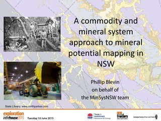
1. A commodity and
mineral system
approach to mineral
potential mapping in
NSW
Phillip Blevin
on behalf of
the MinSysNSW team
State Library; www.northparkes.com
2. End of an era….
• Warwick-Tweed Heads: last of the 250k 1st edition
series.
• 21 maps, >30,000 occurrences, 30 years. Extensive
explanatory notes and datasheets.
• State-wide 1.5M synthesis.
• Bathurst 2nd edition.
• Broken Hill 250k special (new geological base, and
time space plot, and metamorphic reinterpretation.
• Going from the “Where”, “When” through to “Why”
and finally “Where Else?”
4. Metallogenic Mapping to Mineral Potential
Studies
• Need to understand mineral system drivers
– Age of mineralisation
– Source of metals
– Traps
– Broken Hill, Cobar, Mac Arc/Ord Sil, New England
• Need to define realistic mineral potential
tracts that are geologically and politically
defensible.
5. NSW metal endowment
• How much known metal is
there and how much
remains to be mined?
• How big really are NSW
systems and mineral camps?
• Large systems and/or
regions with high potential
will attract large explorers.
• Where did the metal come
from, where else are the
sources. Ages, structures,
traps.
6. Value of metallic commodities
• Present day resources
• Historical production
• Reserves – unmined
• Calculated at $AUD 2009
• Total contained metal
• Reconciliations
Broken Hill
Cobar Basin
East Lachlan
Eastern
Lachlan Basins
New England
Orogen
Ordovician
Basement
Kanimblan
Macquarie Arc
Murray Basin
Wagga
Tin Belt
Coastal System
Tabberabberan
Koonenberry
7. Calculated at $AUD 2009
(State Metallogenic Map).
1 $AUD was 1.47 $USD
Previous base point was 1967 when Au was $30 an
ounce.
NSW metal endowment
Commodity Jan 2009 May 2015 %
Ag 369000 660000 79
Au 42700000 48100000 13
Cu 4890 8100 66
Pb 1765 2725 54
Sn 17700 20650 17
Zn 1850 3000 62
AU$ value (per tonne)
9. Broken Hill
Cobar Basin
East Lachlan
Eastern
Lachlan Basins
New England
Orogen
Ordovician
Basement
Kanimblan
Macquarie Arc
Murray Basin
Wagga
Tin Belt
Coastal System
Koonenberry
Tabberabberan
Production vs Resources
Au Cu Pb Ag
Zn Sn HM
10. Production vs Resources
63% of NSW’s mineral
endowment comprises
unmined resources.
Resources
Production
40
80
120
160
Billions
$AUD2009
11. Production vs Resources
Broken Hill
Cobar Basin
East Lachlan
Eastern
Lachlan Basins
New England
Orogen
Ordovician
Basement
Kanimblan
Macquarie Arc
Murray Basin
Wagga
Tin Belt
Coastal System
Koonenberry
Tabberabberan
Value of Broken Hill
production by deposit
type.
13. Gold endowment for NSW
classified by deposit type
Gold production for Vic
classified by deposit type
Total endowment >3160t
Total production ~2300t
Others
Au endowment
17. • Will be compiled for
metallics and
industrials.
• Tips of data icebergs
as all background data
is refreshed.
Commodity Flyers
18.
19.
20.
21.
22.
23.
24. • Existing series: 1959
to 1979
• Comprehensive data
instantly available for
government,
promotional and
general enquiries.
• Input to policy and
data requests, e.g.
asbestos, silica/marine
aggregate, uranium.
Mineral Industry Resource Series
25. • MetIndex: >30,000
occurrences.
• Deposits have been
given “size” and
classified.
• DIGS – source of
exploration and Survey
reports. Can search on
expl’n history.
• Map explanatory notes
have mineralization
chapters.
Mineral Industry Resource Series
30. New Discoveries Map
Industrial Minerals Map
Mineral System Classification
Statewide Metallogenic Map
Mineral System Models
METINDEX, DIGS
Production & Resources
250k Metallogenic Map
Explanatory Notes
Mining Histories
Time Space
Commodities: a new approach
500K Metallogenic
Synthesis and Potential
Studies
Commodity Flyers
Promotional
Mineral Industry Series
31. New Discoveries Map
Industrial Minerals Map
Mineral System Classification
Statewide Metallogenic Map
Mineral System Models
METINDEX, DIGS
Production & Resources
Mineral Industry Series
250k Metallogenic Map
Explanatory Notes
Mining Histories
Time Space
Commodities: a new approach
32. MinSysNSW Outputs
“in press” or submitted
• Mineralisation in the Braidwood project area. David B. Forster, Peter M. Downes
• A HyLogger™ case study of regional metamorphism and the
alteration in Nymagee area. Peter M. Downes, David B. Tilley, Joel Fitzherbert and Meagan E. Clissold
• New lead isotopic and geochronological constraints on
mineralisation in the Macquarie Arc – NSW — Insights from the
Lake Cowal District, New South Wales. David B. Forster, Paul McInnes, Peter M. Downes,
Roland Maas and Phillip L. Blevin
• Metallogenesis and geodynamics of the Lachlan Orogen: new
(and old) insights from spatial and temporal variations in lead
isotopes. Huston D.L., Champion D.C., Mernagh T.P., Downes P.M., Jones P., Carr G., Forster D. & David V.
33. • Application of metamorphic facies/isograd maps to the
understanding of a regionally stratified anatectic/igneous
complex and its associated mineralisation, Broken Hill. Joel Fitzherbert and
Peter M. Downes
• Towards a greater understanding of the Central Lachlan, Peter M Downes,
Phil L Blevin, Carol J. Simpson, Richard Armstrong, Lawrence Sherwin, David B. Tilley and Gary R. Burton
• 40Ar/39Ar geochronology of the mineral systems in the southern
Cobar Superbasin: implications for metallogenesis in the central
Lachlan Orogen, New South Wales. Peter M. Downes and David Phillips
• Isotope signatures of selected Silurian to Devonian mineral
systems in the Nymagee area — Central Lachlan Orogen, New
South Wales. Peter M. Downes and Simon Poulson
MinSysNSW Outputs