Csae study selected and presented.
•Download as PPTX, PDF•
4 likes•225 views

Presentation for Remote sensing and GIS , Case study done by Others and i did a presentation in class as assigned Professor.

Recommended
Recommended
More Related Content
What's hot
What's hot (17)
Similar to Csae study selected and presented.
Similar to Csae study selected and presented. (20)
Recently uploaded
Recently uploaded (20)
Csae study selected and presented.
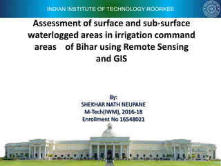
- 1. INDIAN INSTITUTE OF TECHNOLOGY ROORKEE Assessment of surface and sub-surface waterlogged areas in irrigation command areas of Bihar using Remote Sensing and GIS By: SHEKHAR NATH NEUPANE M-Tech(IWM), 2016-18 Enrollment No 16548021
- 2. 2 Introduction What is Water logging? An irrigated area is said to be water logged • When surplus water stagnates due to poor water drainage. • when the shallow water table rises to an extent that soil pores in the root zone of a crop become saturated. Resulting • restriction of the normal circulation of the air, decline in the level of oxygen and increase in the level of carbon dioxide in the root zone, increasing soil salinity and declination of CROP YIELD.
- 3. 3 Introduction…… Severity classes of water logging (MOWR, GOI 1991) Nomenclature for water logging condition Water level depth 1.Water logged due to rise in water table < 2 m (from ground surface) 2.Potential to water logging 2 – 3 m 3.Safe areas from water logging > 3 m Factors resulting to water logging. Natural Factors Man Made Factors •Poor natural drainage due to unfavorable topography. •Heavy storm rainfall and flood causing submergence of agricultural land. •Deforestation, poor upkeep of watersheds. •Development activities like Roads, Bridges and embankments/Dyke choking natural drains •Seepage from dams, reservoirs and unlined canal •Poor OFD Works.
- 5. 5 Case study- Introduction and objective. • Mapping of Waterlogged areas by conventional ground survey is time consuming and costly. • Satellite based RS data coupled with GIS is an excellent alternative for water logging mapping. (Surface water absorbs a major part of EMR in visible range and almost all in near Infrared (NIR) region) • Bihar- food basket of India and South Asia, Agricultural land suffering from water logging. • Agricultural land reclamation plan can be prepared based on water logging map developed using RS and GIS.
- 6. 6 study area •Total Area of Bihar = 9480000 Ha. •74 Irrigation Command Area=5939x103 Ha Location map
- 7. 7 Study area description • Bihar – Part of eastern Gangetic plain- eastern part of India. • Rich in Monsoon and snow fed river water resources. • Lying between 21 o 30’ -27 o 31’ N(latitude) and 82 o 19’ -88 o 17’ E (Longitude) • Land locked with Nepal in Northern Part. • West Bengal in east and UP in West and Jharkhand in south. • Average rainfall – 1200 mm/ ( Max-1800mm in Northern part) ( 85% from June - Oct,4 month) • Overall Climate- Tropical to sub humid Tropical. • Temperature – Mean minimum Temperature =11 o C – Mean maximum Temperature = 42 o C
- 8. 8 Data Used for Study • Remote Sensing Data – Indian Remote Sensing (IRS-1D) linear imaging self scanning sensor (LISS- III) data for the year – 2002 and 2003 • Ground water table data – pre and post monsoon data for all observation well from State Ground water Department (SGWD) • Collateral Data – SOI Topo-sheets of scale 1:50000 for preparation of base map and remote sensing data interpretation
- 9. 9 Methodology • Image geo-referencing – Pre monsoon satellite image data – geo-referenced based on control points taken from SOI maps. – Post monsoon satellite data – geo-referenced based on Pre- monsoon data. • Mapping of surface water logged areas – Normalized difference water index (NDWI) is calculated for delineation of Water logged areas. » NDWI = (RG-RNIR)/(RG+RNIR) ,ranges from -1 to +1, +ve value for water and -ve value for Vegetation, for this study area , NDWI lied between 0.28 to 0.34. Where • RG= Spectral Reflectance in Green Band Of Electromagnetic Wave. • RNIR = Spectral Reflectance in Near Infra Red Band.
- 10. 10 Methodology…… • Mapping of surface water logged areas…… – On Screen editing is done for when water surface is covered with vegetation. – Classification Scheme for surface Water logged areas Type of water logging Pre Monsoon Post Monsoon Remarks Surface Inundation No Yes Surface Inundation (Seasonal) Surface Inundation Yes No Surface Inundation (Seasonal) Surface Inundation Yes Yes Surface Inundation (Perennial) Saturated soil Surface No Yes Saturated Soil (Seasonal) Saturated soil Surface Yes No Saturated Soil (Seasonal) Saturated soil Surface Yes Yes Saturated Soil (Perennial)
- 11. 11 Methodology…. • Delineation of sub surface water logged areas. – Pre and Post monsoon WT data were presented in GIS. – The water table depth values for both Pre and post monsoon season interpolated spatially using Point location in ArcGIS, TopoGrID function). – Classified in to four classes as below. Class Water Table depth, m Most Critical GWT<1 Critical 1<GWT<2 Less Critical 2<GWT<3 Not Critical GWT>3
- 13. 13 Results and conclusion Map for Surface water logging
- 14. 14 Results and conclusion….. % Area of surface water logging for different Command area.
- 15. 15 Results and conclusion …… Map for sub- Surface water logging
- 16. 16 Results and conclusion …… % Area of sub surface water logging for different Command.
- 17. 17 Results and conclusion …… Surface Water Logging • Total water logged area of Bihar =628x103 Ha / 5939x103 (Irrigation Command) Ha i.e. 10.57 % Irrigation area is surface water logged . • 90.2 % of waterlogged area is under seasonal water logging. (both surface inundation and saturated ground) • Maximum water logging, Observed in Gandak system=212x103 Ha/1632x103 Ha, Followed by Eastern Koshi System= 116x103 Ha/950 x103 Ha % of water logged area of command area Nos of Irrigation command <1% Water logging 20 Nos. 1- 5 % 16 5-10 % 13 10-20 % 14 > 20 % 11
- 18. 18 Results and conclusion …… Water logging by rise in GWT Category Pre Monsoon area ,Ha Post Monsoon Area, Ha Non Critical (GWT> 3m) 4287x10 3 (72.72 %) 1391x10 3 (23.42%) Most Critical (GWT < 1m) 0.083 x10 3 50 x10 3
- 19. 19 Results and conclusion …… Conclusions. • We can use spatial and temporal assessment of water logging techniques to evaluate the impact of excessive canal irrigation, accumulation of rain and flood waters. • For this analysis of Remote sensing data at frequent interval is required.
- 20. 20 THANQ