SlideShare a Scribd company logo
1 of 67
i
Project Report on
“Ujjain Simhastha Bypass”
Department of Civil Engineering
Submitted By:
Pratha Garg
MBA Tech Civil – Semester VI
Academic Year: 2015-16
ii
Department of Civil Engineering
Project Report on
“Ujjain Simhastha Bypass”
Submitted By :
Pratha Garg
MBA Tech Civil, Semester VI
Supervisor:
Prof. Anand Awathe
Mentor:
Mr. J.K. Jain
iii
Acknowledgments
I am very thankful to Mr. T.C. Garg, Director and Head of the organization, of
Kalyan Group for having given me the opportunity to undertake my summer
internship training at their prestigious project. It was a very good learning
experience for me to have worked at this site as this project involved many unique
construction practices as well as challenges I would like to give my heart-felt thanks
to Mr. J.K.Jain, Project Manager, Mentor at Kalyan Toll Infra who guided and
encouraged me all through the summer training and imparted in depth knowledge of
the project. I would like to thank all the department heads of Kalyan Group, for
giving their precious time and valuable guidance during my internship program.
Also, I would like to express my gratitude to all the employees at Kalyan Toll
Infrastructure right from the labors, foremen, and engineers to the department heads
who all welcomed my doubts wholeheartedly and devoted their valuable time in
explaining me the work process.
I would also like to express my gratitude towards Dr.Ramachandra Hegde (HOD,
Civil), Mr. Anand Awathe (Faculty In charge) and all the faculties of the civil
department for guiding me through the entire internship period.
iv
Table of Contents
Page No.
Acknowledgements …………………………………. III
List of Figures ………………………………. VI
List of Tables ……………………………… VII
Abstract .……………………………..... VIII
1. Introduction
1.1 Comprehensive study of the
problem
1.2 Purpose, Scope and
Limitations
1.3 Source and methods
1.4 Objective of the study
1.5 Organization of the report
2. Industry Analysis
2.1 Site detail
2.2 Indian Construction Industry
2.2.1 Indian Road Network
2.2.2 Kalyan Toll Infrastructure
2.3 Project Features
2.3.1 Project Completion Details
2.4 Project Details
2.4.1 Cross Sections and Width
2.5 Design Standard Summary
2.6 Project Facilities
2.7 Types of Pavements
2.8 Methodology :Procedure of
Pavement Construction
…………………………………. 1
………………………………….. 1
…………………………………..... 1
……………………………………. 2
……………………………………. 2
……………………………………. 2
……………………………………. 3
…………………………………….. 4
……………………………………. 7
………………………………….…. 8
…………………………………….. 9
…………………………………… 9
……………………………………. 10
……………………………………. 10
…………………………………….. 14
…………………………………….. 25
……………………………………..26
…………………………………….28
2.8.1Cleaning And Grubbing
2.8.2Earthwork Excavation
2.8.3Embankment Construction
……………………………………28
……………………………………..29
………………………………………..30
v
2.8.4Sub Grade Construction
2.8.5Granular Sub-base Construction
2.8.6Wet Mix Macadam
Construction
2.8.7Dense Bituminous Macadam
Construction
2..8.8 Bituminous Concrete Layer
2.8.9 Laying of Kerbs
2.8.10 Application of Prime Coat
2.8.11Application of Tack Coat
2.9 Execution Of the Project
2.10 Pre- Construction Activities
2.11 Machinery
2.12 Road Furniture
2.13 Landscaping And Plantation
2.14 Laboratory Test Procedures
………………………………………….30
…………………………………..….…..32
……………………………………..……33
…………………………………………..35
………………………………....………..37
………………………………..….……..37
………………………………..………..38
…………………………………………38
………………………………………....38
……………………………..…………..39
,………………………………..………..40
………………………………………….42
………………………………..…………45
…………………………….……………45
3.Conclusion
References
…………………………………….……..52
…………………………………………..53
Appendices:
Appendix A: Site Map
Appendix B: Site Visit Report
Photograph
vi
List Of Figures
Image 2.1 …………………………………….27
Image 2.2 …………………………………..…27
Image 2.3 …………………………………..…30
Image 2.4 …………………………………..…32
Image 2.5 …………………………………..…33
Image 2.6 …………………………………..…35
Image 2.7 …………………………………..…37
Image 2.8 …………………………………..…46
Image 2.9 …………………………………..…47
Image 2.10 ………………………………...…49
Image 2.11 ………………………………...…51
Image 2.12 ………………………………...…69
Image 2.13 ………………………………...…69
Image 2.14 ………………………………...…69
vii
List Of Tables
Table 2.1 ………………………………...…7
Table 2.2 ………………………………...…11
Table 2.3 ………………………………...…12
Table 2.4 ………………………………...…12
Table 2.5 ………………………………...…13
Table 2.6 ………………………………...…13
Table 2.7 ………………………………...…13
Table 2.8 ………………………………...…14
Table 2.9 ………………………………...…16
Table 2.10 ………………………………...…17
Table 2.11 ………………………………...…18
Table 2.12 ………………………………...…18
Table 2.13 ………………………………...…19
Table 2.14 ………………………………...…21
Table 2.15 ………………………………...…23
Table 2.16 ………………………………...…24
Table 2.17 ………………………………...…24
Table 2.18 ………………………………...…26
Table 2.19 ………………………………...…27
Table 2.20 ………………………………...…40
Table 2.21 ………………………………...…41
viii
Abstract
Roads bring about all-round development in the region. A good road network
helps in the success of all development activities. It is in the sphere of movement of
people and goods, agriculture, commerce, education, health, and social welfare, or
even maintenance of law and order and security. This report contains the
development process of the Highway Project. This project simplifies the movement
of the vehicles during the Simhastha Mela 2016 at Ujjain (Madhya Pradesh). Ujjain
Simhastha Bypass Road (“Project Road”) situated in western part of Madhya
Pradesh, having total length of 14.290 Km including 01 Major Bridge, 03 Minor
Bridges, 02 ROBs, 23 Pipe Culverts, 11 Box Culverts & 02 VUPs. Kalyan Toll
Infrastructure Limited, Indore has been awarded the project through Madhya
Pradesh Road Development Corporation. The production of a good piece of
technical writing for a project report is as much a part of the project as doing the
experimental work. However excellent and original a piece of work the project may
be, unless the results can be communicated to other people it may as well not have
been done. This report contains the following information:
 Flexible pavements construction.
 Rigid pavements construction
 GSB , WMM , earthwork, BC and other layers information.
1
CHAPTER 1
INTRODUCTION
1.1 Comprehensive study of the problem
A comprehensive study of the problem tells us how things are different in theory and
practical. Hence we should try to understand and apply our theoretical knowledge of
civil engineering to the practical field.
1.2 Purpose, Scope and Limitations
Technical and Practical are the two roads of knowledge but due to training we are
able to combine these two in a single road. It is the performance of the students that
attracts more and more companies to join hands with our college .Hence to get a
proper practical knowledge, it is very important for a student to get practical
experience that is why Technical Internship Programme (TIP) is introduced. This
training gives students self-confidence and helps in using their theoretical
knowledge on site. The scope of learning is very wide.
It is a golden opportunity to learn under different environment. Earlier, the students
were provided with theoretical knowledge only. Due to this the students had to face
a lot of problems in applying their theoretical knowledge at the practical work on
site.
1.3 Sources and Methods
Our main source of knowledge for TIP was to go on site and with the help of the
engineers and supervisors learn as much as possible. This all was done by observing
the day-to-day work of the project and try to relate our theoretical and practical
knowledge and note as much as possible in our daily log book and understand the
use of instruments, drawings and plans and last but not the least by shear
observation.
2
1.4 Objective of the study
The objective of the study are :
1. To get exposed to industrial environment that cannot be simulated in the
institute.
2. To work under organization discipline.
3. To understand the psychology of workers, their habits, their attitudes and
approach to problems along with the practices followed at site.
4. To realize the size and scale of operation on site.
5. To understand the scope, functions and job responsibilities in various
departments of an organization.
1.5 Organizationof the Report
The organization of the report has been done in a few parts. The tender documents,
design, drawings, government documents and IS codes have been used for reference.
Building of flexible pavements, rigid pavements was seen on site and has been
translated in the report.
3
CHAPTER 2
INDUSTRIAL ANALYSIS
2.1 Site Details
Roads bring about all-round development in the region. A good road network helps
in the success of all development activities. It is in the sphere of movement of people
and goods, agriculture, commerce, education, health, and social welfare, or even
maintenance of law and order and security.
MPRDC has decided to take up the Construction of Ujjain Simhastha Bypass
on DBFO (Design Build Finance Operate) mode with annuity for better connectivity
catering future traffic, efficient commercial transportation, and decongestion traffic
in the city areas and to reduce pollution and travel time especially during the
Simhastha Mela, 2016. Ujjain Simhastha Bypass is a proposed new alignment.
Proposed Bypass road starts besides Hotel Shanti Palace on SH-27 Indore- Ujjain
Road (Km. 46+970) near junction with Nanakheda Bus Stand road & road near
Ujjain-Unhel – Jaora Road on SH-17 (Km. 3+300).
Madhya Pradesh Road Development Corporation Ltd. (MPRDC), an
undertaking of the Government of Madhya Pradesh have been implementing
several road projects over the years with the state, centre and multi-lateral
funding agencies like Asian Development Bank (ADB) and World Bank. In
pursuance of the above, SAI Consulting Engineers Pvt. Ltd., Ahmedabad have
been appointed as Consultant to carryout Feasibility Study for “Two-Laning
with Paved Shoulder of Ujjain Simhastha Bypass. After the completion of the
preparation of the Feasibility Report the Tendering Process for the Project
highway has been commenced. As per the Feasibility Report prepared by the
consultant the cost of the project was Rs. 70.63 Crores. Due to less traffic during
the remaining Simhastha Period the project is viable on the DBFO (Design Built
Finance and Operate) + Annuity Basis. Here Annuity means a fixed amount that
will be deposited to the concessionaire’s account in semi-annual basis in the
entire the concession period. It is also fixed that during the Simhastha, toll will
4
not be collected from the vehicles. The Concession Period for this project has
been fixed to the 15 Years (02 Years for the construction of project highway and
remaining for the collection of Toll and maintenance of the Highway). In the
Tendering process of the project the Kalyan Toll Infrastructure Limited quoted
the lowest Annuity amount i.e. Rs. 5.93 Crores. The Letter for the acceptance
has been issued to the Kalyan Toll Infrastructure Limited and they have got the
06 months period for the Financial Closure. The Kalyan Toll Infrastructure
Limited created the SPV Company “Ujjayini Highways Private Limited” for the
execution of this project. The Ujjayini Highways Private Limited got the Bank
Loan for this project from the Canara Bank. After the achievement of the
Financial Closure the work has been commenced and the execution started
from 05.05.2014 and expected to complete before the stipulated time
31.08.2015. The MPRDC has appointed the Independent Engineer M/s L N
Malviya for the supervision of the Project and concessionaire.
2.2 INDIAN CONSTRUCTION INDUSTRY
The construction industry was founded by Government and slowly taken over by
enterprises. After independence the need for industrial and infrastructural
developments in India laid the foundation stone of construction, architectural and
engineering services.
The period from 1950 to mid 60‟s witnessed the government playing an active role
in the development of these services and most of construction activities during this
period were carried out by state owned enterprises and supported by government
departments. In the first five-year plan, construction of civil works was allotted
nearly 50 per cent of the total capital outlay.
In the late 1960s government started encouraging foreign collaborations in these
services. The Guidelines for Foreign Collaboration, first issued in 1968, stated that
local consultant would be the prime contractor in such collaboration.
5
The objective of such an imposition was to develop local design capabilities parallel
with the inflow of imported technology and skills. This measure encouraged
international construction and consultancy organizations to set up joint ventures and
register their presence in India.
In India Construction has accounted for around 40 per cent of the development
investment during the past 50 years. Around 16 per cent of the nation's working
population depends on construction for its livelihood. The Indian construction
industry employs over 3 crore people and creates assets worth over 20,000 crore.
It contributes more than 5 per cent to the nation's GDP and 78 per cent to the gross
capital formation. Total capital expenditure of state and central govt. will be
touching 8,02,087 crores in 2011-12 from 1,43,587 crores (1999-2000).
The share of the Indian construction sector In total gross capital formation (GCF)
came down from 60 per cent in 1970-71 to 34 per cent in 1990-91. Thereafter, it
increased to 48 per cent in 1993-94 and stood at 44 per cent in 1999-2000. In the 21
st century, there has been an increase in the share of the construction sector in GDP
and capital formation.
GDP from Construction at factor cost (at current prices) increased to 1,74,571 crores
(12.02% of the total GDP ) in 2004-05 from 1,16,238 crores (10.39% of the total
GDP) in 2000-01.
The main reason for this is the increasing emphasis on involving the private sector
infrastructure development through public-private partnerships and mechanisms like
build-operate-transfer (BOT), private sector investment has not reached the expected
levels. The Indian construction industry comprises 200 firms in the corporate sector.
In addition to these firms, there are about 1,20,000 class A contractors registered
with various government construction bodies. There are thousands of small
contractors, which compete for small jobs or work as sub-contractors of prime or
other contractors. Total sales of construction industry have reached 42,885.38 crores
in 2004 05 from 21,451.9 crore in 2000-01.
6
BUILD-OPERATE-TRANSFER (BOT) SYSTEM:
A type of arrangement in which the private sector builds an infrastructure project,
operates it and eventually transfers ownership of the project to the government. In
many instances, the government becomes the firm's only customer and promises to
purchase at least a predetermined amount of the project's output. This ensures that
the firm recoups its initial investment in a reasonable time span.
This type of arrangement is used typically in complicated long-term projects as seen
in power plants and water treatment facilities. In some arrangements, the
government does not assume ownership of the project. In those cases, the company
continues running the facility and the government acts as both the consumer and
regulator.
Build-own-operate-transfer (BOOT) or build-operate-transfer (BOT) is a form of
project financing, wherein a private entity receives a concession from the private or
public sector to finance, design, construct, and operate a facility stated in the concession
contract. This enables the project proponent to recover its investment, operating and
maintenance expenses in the project.
Due to the long-term nature of the arrangement, the fees are usually raised during the
concession period. The rate of increase is often tied to a combination of internal and
external variables, allowing the proponent to reach a satisfactory internal rate of return
for its investment.
DBFO (Design Build Finance Operate)
Design- Build- Finance- Operate is a project delivery method very similar to BOOT
except that there is no actual ownership transfer. Moreover, the contractor assumes
the risk of financing till the end of the contract period. The owner then assumes the
responsibility for maintenance and operation. Some disadvantages of DCMF are the
difficulty with long term relationships and the treat of possible future political
changes which may not agree with prior commitments. This model is extensively
used in specific infrastructure projects such as toll roads. The construction company
build a private entity which is in charge to design and construct an infrastructure for
the government which is the true owner. Moreover the private entity has the
7
responsibility to raise finance during the construction and the exploitation period.
The cash flows serve to repay the investment and reward its shareholders. They end
up in form of periodical payment to the government for the use of the infrastructure.
The government has the advantage that it remains the owner of the facility and at the
same time avoids direct payment from the users. Additionally, 11 the government
succeeds to avoid getting into debt and to spread out the cost for the road over the
years of exploitation.
2.2.1 Indian road network
India has a road network of over 4,689,842 kilometers (2,914,133 mi) in 2013, the
second largest road network in the world. At 0.66 km of roads per square kilometer
of land, the quantitative density of India's road network is similar to that of the
United States (0.65) and far higher than that of China (0.16) or Brazil (0.20).
However, qualitatively India's roads are a mix of modern highways and narrow,
unpaved roads, and are being improved. As of 2011, 54 percent – about 2.53 million
kilometers – of Indian roads were paved.
Table 2.1
Road classification Authority responsible
Total
kilometers
(as of
2011)
National Highways
Ministry of Road Transport & Highways
(Central government)
92,851
State Highways
State governments (state's public works
department)
1,63,898
8
Major and other
district roads
Local governments, panchayats and
municipalities
17,05,706
Rural roads
Local governments, panchayats and
municipalities
27,49,805
2.2.2 Kalyan Toll Infrastructure Ltd.
Kalyan Toll Infrastructure Limited was incorporated in the year 2002.
Kalyan Toll Infrastructure Limited is one of the leading four construction company
in Madhya Pradesh. The company has been registered for construction works with
Public Works Department of Maharashtra and Madhya Pradesh as "A" category
contractor. The Company is registered for VAT & TIN, EPF, Service Tax,
Professional Tax, Income Tax, and Importer Exporter Code.
Its construction activities comprise of :
 Road Projects
 Railway Projects
 Bridges, ROB and Flyover Projects
 Water Supply Projects
 Commercial and Residential Complexes
 Sewerage Projects
 Construction of Dams
Promoters of Kalyan Toll Infrastructure Limited have rich experience of over 25
years backed by technical acumen and experience of more than two decades in
construction industry. During this period Kalyan Toll Infrastructure Limited has
executed projects more than 15000 million. Kalyan Toll Infrastructure Limited is
9
one of the few construction companies in M.P., which has successfully
executed TEN BOT projects and THREE are under execution.
2.3 PROJECT FEATURES
Project Title: Ujjain Simhastha Bypass Road (“Project Road”) situated in western
part of
Madhya Pradesh, having total length of 14.290 Km. The project road lies between
23°18' N Latitude to 75°77' E Longitude and 23°10' N Latitude to 75°46' N Latitude.
Project Details:
Source of Fund: Design, Build, Finance, Operate and Transfer (DBFOT) basis.
Total Project cost: Rs.70.6 Crore.
Client/Employer: Madhya Pradesh Road Development Corporation Limited
Concessionaire: Ujjayini Highways Private Limited
DesignConsultant: K & J Projects Pvt Ltd
Length of Project : 14.29 kms
Timelines for the entire project
Work ExecutionDate:05.05.2014
Appointed date for Project completion:31.08.2015
Concession Period : 15 years
Construction Period: 24 Months.
2.3.1 ProjectCompletionSchedule
1. Project Milestone-I:
180th day from Appointed Date
Commenced Construction of Project Highway
Expected not less than 10% of the total capital cost set forth in the Financial Package
2. Project Milestone-II:
365th day from Appointed Date
10
Commenced Construction of all Bridges
Expected not less than 35% of the total capital cost set forth in the Financial Package
3. Project Milestone-III:
600th day from Appointed Date
Commenced Construction of all Project Facilities
Expected not less than 70% of the total capital cost set forth in the Financial Package
4. Scheduled Four Lanning Date
730th day from Appointed Date
Should have completed the Four Lane Project Highway
2.4 DETAILS OF PROJECT HIGHWAY
2.4.1 Cross Sections and Width
2.4.1.1 Two-Laning with paved Shoulder
The carriageway shall be 7 meters wide with paved shoulder of 1.5 m &
granular shoulder of 1.0 m on each side shall be provided along the
project road.
2.4.1.2 Cross Sections
Road shall be constructed with a carriageway of 7.0 m and paved
shoulder 1.5 m on each side and 1.0 m granular shoulder each side.
The cross section of the highway shall be placed eccentrically in
proposed ROW to accommodate future lane requirement. No built
up sections having four lane divided carriageway with footpath. No
service road is proposed along entire stretch of the project Road.
11
2.4.1.3 At Grade Intersections
There are total 2 major road junctions which are needed to be
improved.
Table 2.2
Sr. Design Description of Type of Remarks
No. Chainage Road Junction
1 0+000 Indore – Ujjain 3 Legged
Road (SH – 27)
(Ch. 46/970)
2 14+290 Ujjain – Unhel – 3 Legged
Jaora Road
(SH – 17)
(Ch. 3.300)
2.4.1.4 Road Over Bridge (ROB)
There are two proposed ROB’s on the project road crossing two
Railway tracks one on meter gauge and second on broad gauge.
Details of Proposed ROB are given below:
12
Table 2.3 : Details of Proposed Rail Over Bridge (ROB) (New construction)
Sr. Existing Design Proposal Details of Proposed Proposed Remarks
No. Chainage Ch. Structure width (mt)
(km.) (in Km) No x Span
1. - 3+542 New construction 1x15m+1x30m 12.0(8.5m with footpath
+1x15m Clear on both side
width)
2. - 4+928 New construction 1x15m+1x30muuuuu 12.0(8.5m with footpath
+1x15m Clear on both side
width)
2.4.1.5 Grade Separated Structures and Under Passes
Vehicular underpasses are proposed on project road corridor as mentioned
in the table below. Slip roads on all four sides shall be constructed to
facilitate directional changes. The details of proposed VUP are given
below:
Table 2.4 : Details of Proposed Vehicular Underpass (VUP) (New construction)
Sr. Existing Design Proposal Details of Proposed Proposed Remarks
No. Chainage Ch. Structure width (mt)
(km.) (in Km) No x Span
1. 1+000 3+858 New construction 1x12m 12.00 -
2. 4+400 7+000 New construction 2x12m 12.00 -
2.4.1.6 Rigid Pavement
Rigid Pavement shall be provided at Toll Plaza location.
13
2.4.1.7Structures
Brief details of existing structures and proposal of Major Bridge, Minor
Bridge, Slab Culverts and Pipe Culverts proposed for new construction
are given in tables below:
Table 2.5 : Summary of Proposed Structures
Improvement Type of Structure
Proposed Pipe Slab/Box Minor ROB VUP
Culvert Culvert Bridges
New Construction 23 11 03 02 02
Total 23 11 03 02 02
Grand Total 42
Table 2.6 : Details of Major Bridges (New Construction)
Sr. Existing Design Existing Proposal Details of Proposed Remarks
No. Ch. Ch. Width Proposed Structure Width (m)
(km.) (in Km) (m) No x Span
1 - 0+354 - New 4nos X30.00m PSC 12.00 With Bank
construction Span Protection
Table 2.7 : Details of Proposed Minor Bridges (New construction)
Sr. Existing Design Proposal Details of Proposed Proposed Remarks
No. Chainage Ch. Structure width
(km.) (in Km) No x Span (mt)
1. -- 1+150 New construction 1x10m RCC Slab type 12.00 -
2. -- 2+595 New construction 2x10m RCC Slab type 12.00 -
3 - 4+265 New construction 2x10m RCC Slab type 12.00 -
14
2.5 Design Standards Summary
Following is a summary of the recommended design standards proposed to be
adopted for the project road other than service road and intersections:
Table 2.8
1. Design speed
Plain terrain : 100(ruling), 80(minimum)
2. Roadway Widths (m) : 12m for 2-lanes with paved
shoulders/
Granular Shoulder
10m for 2-lane with paved shoulder
(approaches to grade separator
3. Roadway Elements : Carriageway
2-lane- 2X3.5m
Paved Shoulder
2-lane with PSS- 2x1.5m
Unpaved Shoulder
2 lane -2X2.5m
2 lane with PSS – 2X2.0m
3.0m for mountainous/Hilly Terrain
4. Camber Carriageway/Paved Shoulder-
2.50%
Unpaved Shoulder- 3.50%
5. Embankment/ Cutting Slope In filling- 1V: 2 H
In cutting- 1V:1H
6. Right of Way 30 m for 2 lane
7. Stopping Sight Distance
Intermediate sight distance
180m for design speed of 100km/hr
120m for design speed of 80 km/hr
90m for design speed of 65 Km /hr
360m for design speed of 100km/hr
240m for design speed of 80km/hr
15
180m for design speed of 65 Km/hr
8. Super-elevation Maximum 7% for Two lane section
9. Radii for Horizontal Curves Ruling Minimum 360 M
Absolute minimum 230 m
10. Ruling Gradient 3.3% for plain and rolling terrain
5% limiting gradient
11. Minimum K- factor
Summit Curve 74 for Design speed of 100 km/hr
33 for Design speed of 80 km/hr
18.5 for Design speed of 65 km/h
Valley Curve 42 for Design speed of 100 km/hr
25.5 for Design speed of 80 km/hr
17.5 for Design speed of 65 km/hr
12. Bridge Clearance
Railway Over Bridge 7.3m
Vehicular underpass 5.5m
Cattle and Pedestrian 3.0 m
13. Design Flood Frequency
Bridges 50 years
Sewers and Ditches 10 years
14. Minimum Drainage Channel
Width
0.50 m
Terrain Classification
Terrain is classified by the general slope of the ground across the highway
alignment. As IRC: SP: 73-2007 terrain of the project road can be classified based
on following cross slope of the ground.
16
Table 2.9
Nature of Terrain Cross Slope of the Ground
Plain Less than 10 %
Rolling Between 10 to 25%
Mountainous Between 25 to 60%
Steep More than 60%
Design Speed
The project road passes through Plain terrain. For geometric design of the highway
design speed is used as an index which links road function, traffic flow and terrain.
An appropriate design speed should correspond to general topography and adjacent
land use. The speed selected for design should also cater to travel needs and
behavior of the road users. Rural highways, except expressways, are normally
designed for speed of 100 km/hr, however depending on terrain and whether the
design is for new alignment or reconstruction of an existing facility, the design speed
is determined to the site requirement.
Assuming a diverse mix of traffic on the project roads, a ruling design speed of 100
km/h and minimum design speed of 80km/hr for plain terrain is proposed for the
project road as per IRC SP: 73-2007. Use of speed regulatory sign is proposed at
locations such as hairpin bends and other sharp curves where design speed cannot be
maintain.
Sight Distance
Visibility is an important requirement for the safety of travel on roads. For this it is
necessary that sight distance of adequate length is available in different situations, to
permit drivers enough time and distance to control their vehicles so that chances of
accidents are minimized. Sight distance is a direct function of the design speed. On
divided highways the design should correspond to Stopping Sight Distance, which is
the clear distance ahead needed by a driver to bring his vehicle to a stop before
17
meeting a stationary object in his path. On two-lane roads, normally intermediate
sight distance should be available throughout for design proposed. In stretches where
even intermediate sight distance is not available, safe stopping site distance should
be provided with traffic signs depicting “Overhead Prohibited” at all such locations.
Sight distance corresponding to various design speeds are given below.
Table 2.10 : Sight distance for various Speeds
Design Speed
Km/h
Stopping Sight
Distance (m)
Intermediate Sight
Distance (m)
Overtaking Sight
Distance (m)
65 90 180 340
80 120 240 470
100 180 360 650
Horizontal Alignment
a) General
For balance in highway design, all geometrical elements should be determined for
consistent operation under the design speed in general. A horizontal alignment
should be as smooth and consistent as possible with the surrounding topography. To
achieve that, an appropriate blending with the natural contours is preferable to the
one with long tangents through the terrain.
b) Horizontal Curve
The minimum horizontal curve radius is the limiting value of curvature for a given
design speeds and is determined based on from the maximum rate of super elevation
and the side friction factor. As per the IRC: SP:73 – 1997 the minimum ruling radii
of Horizontal curve for National Highways corresponding to different terrain
conditions are as follows:
18
Table 2.11 : Horizontal Radii Criteria
Type of terrain Minimum Radii of Horizontal Curve
Desirable Minimum Absolute Minimum
Plain 360 230
Absolute minimum and ruling minimum radii correspond to the minimum design
speed and the ruling design speeds respectively.
On new roads, horizontal curves are designed with liberal radius provision that
blends well with the overall geometry and topography. However, for locations with
constraints and to make use of available roadway, it is proposed to keep minimum
radius in accordance with the IRC recommendations.
Table 2.12 : Adopted Horizontal Radii
Speed (km/h) Absolute Minimum Radius (m)
100 350
80 230
65 155
c) Transition (Spiral) Curves :
The purpose of a transition (spiral) curve is to provide a smooth and aesthetically
pleasing transition from a tangent and a circular curve. In addition the transition
curves provide the necessary length for attainment of super-elevation runoff.
The IRC: 73-1980 and IRC:38-1988 design standards suggest 130m, 90m, 80m and
75m transition curve lengths for circular curves of radii 360m, 230m ,155m and 90m
(design speeds of 100 km/hr, 80 km/hr, 65 km/hr and 50 km/hr). The AASHTO
(2001) design guidelines specify transition curve lengths of 72m, 65m and 50m; and
the TAC (1999) design guidelines recommend transition curve lengths of 80m, 80m
and 50m for curve radii of 440m, 250m, 90m (design speeds of 100 km/hr, 80 km/hr
and 50 km/hr) respectively.
19
It is proposed to adopt transition curve lengths of 130m, 90m, 80m and 75m for
design speeds of 100 km/hr, 80 km/hr, 65 km/hr and 50 km/hr respectively at their
minimum recommended moves.
d) Extra Width of Pavement and Roadways :
Since the project road is of two lane category, extra widening is necessary on curves
having radius less than 300 mt. to counter balance mechanical and psychological
disorder of the vehicle. Extra widening is achieved by increasing the width at a
uniform rate along the curve. On curve having no transition, widening is achieved in
the same way as super elevation i.e. two third is being attained on the straight
section before start of the curve and one third in the curve. On hilly roads and curves
without transitions extra widening is provided on inner side of the curve. As per
IRC: SP: 73-2007, the extra widening shall be increased as follows:
Table 2.13 : Extra width of Pavement and Roadway
Radius of Curve Extra Width(m)
Up to 40m 1.5
41-60m 1.2
61-100m 0.9
101-300m 0.6
e) Super-elevation
The IRC: 73-1980 design standards propose a maximum super-elevation rate of 7%
for plain and rolling terrains, and 10% or the mountainous terrain. The AASHTO
(2001) and TAC (1999) design guidelines recommend maximum super-elevation
rates of 8% and 6% respectively, regardless of the terrain.
The limiting value of the super-elevation on the project road in both plain rolling and
hilly terrain is proposed to be 7% for two lane section.
20
Vertical Alignment
a) General
The vertical alignment should produce a smooth longitudinal profile consistent with
the standard of the road and the terrain. Wherever possible horizontal and vertical
curvature should be so combined that the safety and operational efficiency of the
road is enhanced.
b) Gradients
The IRC: SP: 73-2007 propose ruling vertical grades of 3.3% to 5.0% for plain and
rolling terrains; and 5.0% to 6.0% for hilly terrain. The AASHTO (2004) design
guidelines suggest desirable vertical grades of 3.0% to 4.0% for plain and rolling
terrains, and 6.0% for hilly areas. The TAC (1999) design guidelines recommend a
maximum 3% vertical grade for plain and rolling terrains, and 6.0% for hilly
terrains. To ensure adequate drainage, roadways typically have a minimum
longitudinal grade of 0.5% to 0.6%, depending on the terrain. The minimum
longitudinal grades as per IRC: 731980 design standards are 0.5% for lined side
ditches, and 1.0% for unlined side ditches.
c) Vertical Curves
As per IRC: 73-1980 design standards, the minimum lengths of vertical curves are
60 m and 50 m for design speeds of 100 km/h and 80 km/h respectively. According
to AASHTO
(2001) and TAC (1999) design guidelines the vertical curves should be designed to
ensure safe stopping sight distance. At complex locations such as interchanges and
major intersections the minimum lengths of vertical curves should be designed for
safe decision sight distance. The length of a vertical curve is calculated using the
following equation:
L = K x A,
Where L = Length of vertical curve in meters;
K = Coefficient, a measure of the flatness of a vertical curve; and
21
A = Algebraic difference of grade lines (%)
Summit or Crest Curves
According to AASHTO (2001) design guidelines, the minimum K values for
stopping sight distance requirements are 52, 26 and 7 for design speeds of 100
km/hr, 80 km/h and 50 km/hr. respectively.
According to TAC (1999) design guidelines, the minimum K valves for stopping
sight distance requirements are 45 to 80, 24 to 36 and 6 to 16 for design speeds of
100 km/hr, 80 km/hr. and 50 km/hr. respectively.
Cross Sectional Elements
Adequate roadway width will be provided for the requisite number of traffic lanes
besides the shoulders and a central median dividing the traffic flow directions.
As specified in the IRC SP: 73-2007 in general, standard lane width shall be 3.5m
for project highway. Based on a comparative review of international standards and
safety, the values proposed to be adopted for the roadway elements by the
Consultant for the project highway are as follows:
a) Roadway Width for Two lane Highways
Table 2.14 Road Cross Section
Item Two-Lane with
Granular Shoulder
Two-Lane with
Paved Shoulder
Carriageways 2x3.5m 2x3.5m
Paved shoulder N.A. 2X1.5 m
Unpaved shoulder Plain/ rolling
terrain
Hilly terrain*
2 X 2.5 m
3 m (1 on Hill side
2
on Valley Side)
2X1m
NA
Total Roadway width
Plain/rolling terrain
Hilly terrain*
12 m
10 m
12 m
10 m
22
* Exclusive of parapets and side drains
b) Lane Width
Lane width has a significant influence on the safety and comfort of the road. The
capacity of a roadway is markedly affected by the lane width. In general, safety
increases with wider lanes up to a width of about 3.7 m. The lane width as per IRC:
SP: 73-2007 is 3.5 m.
AASHTO (2004) and TAC (1999) recommended lane widths for this type of facility
are 3.6 m and 3.7 m respectively for design speed of 100 km/h.
Experience shows that operating speed normally remains less than the design speed
because of the partially access controlled facility and the other ambient conditions.
Based on this assumption a 3.5 m lane width is proposed. This also concurs with
other National
Highways in India currently under construction.
c) Shoulders
Shoulders are a critical element of the roadway cross section. Shoulders provide
recovery area for errant vehicles; a refuge for stopped or disabled vehicles; and
access for emergency and maintenance vehicles. Shoulders can also provide an
opportunity to improve sight distance through cut sections.
According to IRC: SP: 73-2007, for two lane highways the normal shoulder width
shall be
2.5m on either side for Plain or Rolling terrain and for mountainous terrain. As per
IRC:
SP: 73-2007 the recommended shoulder width is 1.0m on Hill side and 2.0m on
valley side. The AASHTO (2001) and the TAC (1999) design guidelines suggest
paved outer shoulder widths of 3.0 m for high speed highways carrying large
number of trucks.
For Two-Lane Section the Consultants proposes to adopt an outer shoulder width of
minimum 2.5 m plain terrain. Out of this 1.5 m will be paved as per lane
requirements and the balance 1.0 m will be unpaved shoulder as per the capacity
23
analysis results. : SP: 732007, unpaved shoulder should be covered with 150mm
granular material.
d) Land Width (Right of Way)
The IRC: 73-1980 has specified following land width values or Right-of Way for
National Highways:
Table 2.15 : Provision for ROW
Right of Way (m) Plain/ Rolling Terrain
Range Normal
Open area 30 – 60 45
Built up area 25 – 30 30
e) Embankment Slopes
The slope of embankment is linked with its height. In accordance with the Manual
for
Safety in Road Design (MoRT&H publication), the following are proposed to be
adopted:
Ht of embankment 4.5 m and above: 2 H: 1V with crash barriers
Ht of embankment 3 m to 4.5 m: 2.5 H: 1 V
Ht of embankment 1.5 m to 3 m: 3 H: 1 V
Ht of embankment less than 1.5 m: 4 H: 1 V
As per IRC: SP: 73-2007 the side slopes for embankment shall not be steeper than
2H:1Vunless soil is retained by suitable soil retaining structure. The side slopes of
cutting shall be provided in accordance with the nature of soil encountered. The
slope shall be stable for type of strata. Where required, benching including use of
slope stability measures like pitching, breast wall, etc. shall be adopted to make the
slopes stable and safe.
The Consultant proposes to provide slopes of 2H: 1V in Fill sections. Cut slopes are
proposed as 1H: 1V in general however, these sections will be specifically analyzed
for stability before adopting this slope or steeper slopes
24
Pavement Camber (Cross Fall)
IRC: SP: 73:2007 recommends the following camber for various surface types:
Table 2.16 : Provision for Cross Fall
Category of surface Annual Low rainfall
(less than 1500 mm)
Annual High rainfall
(more than 1500 mm)
Bituminous 2.5% 2.5%
Cement concrete 2.0% 2.0%
Metal / gravel 2.5% 3.0%
Earth 3.0% 4.0%
Considering of bituminous surfacing (bituminous concrete) the Consultants propose
to provide a camber of 2.5 % for the main carriageway as well as paved shoulders
and 3.5 % for the unpaved shoulder.
Service Road Standards
Following values are proposed to be adopted for service roads wherever applicable:
Table 2.17
Particulars Two – lane section
Design speed 40 to 50kmph
Camber 2.5%
Horizontal curve radius 90-60m
Gradient 3.33 %
Shoulder 1.5m
Footpath 2.0m
Width of carriage Minimum 5.5m
Roadway width Minimum 8.5m
25
2.6 PROJECT FACILITIES
The Project Facilities shall include:
 Toll Plaza
 Road side Furniture
 Street lighting
 Pedestrian Facilities
 Landscaping and Tree Plantation
 Rest areas
 Truck Lay-Byes
 Bus-bays and Bus Shelters
 Vehicular underpasses and Pedestrian/cattle underpasses
 Traffic aid posts
 Medical aid posts
26
2.7 Types of pavement
1) Flexible Pavement
2) Rigid Pavement
Flexible pavement Rigid Pavement
Table 2.18 :Flexible Pavement Design width 10.00 Mtrs
Design Chainage (Km 0+000 to 14+295)
Bituminous Concrete (mm) 40
Dense Bituminous Macadam (mm) 75
Wet Mix Macadam (mm) 250
Granular Sub-base (mm) 230
Sub grade (mm) 500
27
Table 2.19 : Rigid Pavement Design width 10.00 Mtrs
Design Chainage (Km 0+000 to 14+295)
Pavement Quality Concrete (mm) 250
Dry Lean Concrete (mm) 150
Granular Sub base (mm) 230
Sub grade (mm) 500
Image 2.1 : Flexible Pavement Image 2.2 : Rigid Pavement
28
2.8 METHODOLOGY : Procedure Of Pavement
Construction
2.8.1 CLEARING AND GRUBBING
Procedure:
The work shall commence soon after mobilization at the site has been completed to
the extent that this activity can be taken up.
Clearing and grubbing shall be carried out using bull dozers to generally scrap off
the top crest of the formation bed with the main aim to clear the proposed road
corridor of major bushes, unwanted waste materials and vegetation and roots so as to
enable field survey works to be carried out up to reasonable precision and accuracy
besides conducting soil sampling and testing, visual or laboratory, on the existing
ground materials to enable decision on further course of action on mode of road
construction.
During this course of such clearance unwanted materials shall be disposed off to the
designated places as directed, by using tippers. At the same time all that soil which
is found reusable in terms of execution of this project shall be stock piled along the
work stretches.
Equipment Required:
1. Dozer
2. Excavators
3. Tippers
29
2.8.2 EARTHWORK EXCAVATION
Procedure:
1) Before the earthwork is started, the whole area where the work is to be done
should be cleared of grass, roots of trees and unwanted debris.
2) Excavation should be carried out exactly in accordance with the dimensions
shown on the drawings or any other dimension, as decided by the Site-in-Charge.
3) Sides of the trenches shall be vertical and its bottom shall be perfectly leveled,
both longitudinally and transversely. Where the soil is soft, lose or slushy, the trench
shall be widened for allowing steps on either side or the sides sloped or shored up.
4) During excavation if rocks or rocky soils are found, they shall be leveled as far as
possible and the small spaces which are difficult to level shall be filled in with
concrete.
5) If the excavation is in earth, the bottom of the trenches shall be sprinkled with a
little water and rammed.
6) No material excavated from the foundation trenches shall be placed nearer than
one meter to the outer edges of the excavation.
7) Water in trenches must be bailed or pumped out and where it is apprehended that
the sides may fall down or cave in, arrangement shall be made for adequate timber
shoring.
8) When it is specified that the work is to be carried out without removing cables,
pipes, sewers etc. all of them shall be temporarily shored and saved from any
damage.
9) The cost of all materials and labor required for fencing/barricading in and
protection against risk of accidents due to open excavation should be provided.
Equipment used:
1. Excavators
2. Tippers
3. Water Pumps
30
2.8.3 EMBANKMENT CONSTRUCTION
Procedure:
1. The toe line and center line are marked and pegs will be driven.
2. The material shall be dumped in site at respective location.
3. The material shall be spread in layers of uniform thickness not exceeding 200mm
compacted thicknesses over the entire width of the embankment by mechanical
means and will be graded with motor grader to the required camber.
4. Moisture content of the material shall be checked and extra required will be
added.
5. The moisture content of each layer shall be checked and it should be within the
range of OMC +1% to OMC -2%. If moisture content is found out of these limits the
same will be brought within the limits by addition of water or by aeration as the case
may be.
6. The compaction shall be done with the help of vibratory roller of 8 to 10 ton static
weight. Each layer shall be thoroughly compacted to the densities specified.
7. Loose pockets if any will be removed and replaced with approved material.
8. The above stages shall be repeated till the top level of the embankment is reached
to the specified levels and grades. The top levels are checked and shall be within the
+20mm and 25mm of the designed level.
2.8.4 SUBGRADE CONSTRUCTION
Image 2.3
31
SUBGRADE:
Subgrade is one of the most crucial part of embankment fills or natural surface just
below the sub-base or lower sub-base of road pavement and shoulder. The surface
above the subgrade is known as the formation level or finishing level. Subgrade is
the in situ material upon which the pavement structure is placed or constructed at
selected location.
Formation level is defined as the final level of soil surface after completion of
earthworks and when trough the process of compaction, stabilization and reinforced.
The subgrade’s main function is to withstand the loading of road pavement (sub-
base, base, etc.) above it.
Procedure:
1. The toe line and center line are marked and pegs will be driven.
2. The material shall be dumped in site at respective location.
3. The material shall be spread in layers of uniform thickness not exceeding 200mm
compacted thicknesses over the entire width of the subgrade by mechanical means
and will be graded to the required camber.
4. Moisture content of the material shall be checked and extra required will be
added.
5. The moisture content of each layer shall be checked and it should be within the
range of OMC +1% to OMC -2%. If moisture content is found out of these limits the
same will be brought within the limits by addition of water or by aeration as the case
may be.
6. The compaction shall be done with the help of vibratory roller of 8 to 10 ton static
weight. Each layer shall be thoroughly compacted to the densities specified.
7. Loose pockets if any will be removed and replaced with approved material.
32
8. The above stages shall be repeated till the top level of the embankment is reached
to the specified levels and grades. The top levels are checked and shall be within the
+20mm and -25mm of the designed level.
Performance of Subgrade
The subgrade’s performance generally depends on two interrelated characteristics:
Load Bearing Capacity
The subgrade must be able to sustain loads transmitted from the pavement structure.
The load bearing capacity is frequently affected by the types of soil, moisture
content, and degree of compaction. A subgrade that can sustain a highly sum of
loading without an excessive deformation was considered good quality.
The types of soil especially from gravel type considered the best and from peat type
considered as the worst material. Moisture content of soil is also important and
determine by conducting the soil compaction test at lab as to find out which type
contains more water. The degree of compaction normally reflects to the method of
compaction used at construction site, by means of machinery and the numbers of
passes.
2.8.5 GRANULAR SUB-BASE CONSTRUCTION
Image 2.4
33
Procedure:
1. The toe line and center line are marked and pegs will be driven.
2. The material shall be dumped in site at respective location.
3. The material shall be spread in layers of uniform thickness not exceeding
200mmcompacted thicknesses over the entire width of the embankment by
mechanical means and will be graded with motor grader to the required camber.
4. Moisture content of the material shall be checked and extra required will be
added.
5. The moisture content of each layer shall be checked and it should be within the
range of OMC +1% to OMC -2%. If moisture content is found out of these limits the
same will be brought within the limits by addition of water or by aeration as the case
may be.
6. The compaction shall be done with the help of vibratory roller of 8 to 10 ton static
weight. Each layer shall be thoroughly compacted to the densities specified.
7. Loose pockets if any will be removed and replaced with approved material.
8. The above stages shall be repeated till the top level of the embankment is reached
to the specified levels and grades. The top levels are checked and shall be within the
+20mm and -25mm of the designed level.
2.8.6 WET MIX MACADAM CONSTRUCTION
Image 2.5
34
Procedure:
Preparation of Mix:
1. The individual materials gradation shall be checked combined, proportions shall
be fixed
LAYING W.M.M.: - BASE
1. Scope: Wet mix macadam base shall consist of laying and compacting clean,
crushed graded aggregate and granular material, premixed with water to a dense
mass on prepared sub base in accordance with the specifications.
2. Proposed Sample: Coarse aggregate proposed to be used in WMM are obtained by
crushing the rocks, obtained from approved quarries. Before removing the rock, the
quarry area is stripped of earth loam, clay and vegetable matter.
3. Independent tests will be carried out on this material as follows:
Sieve analysis.
Los Angeles abrasion
Aggregate impact value
Combined flakiness & elongation indices
Modified proctor density
Liquid limit & plasticity index of portion through 425 micron sieve.
4. Mixing : Proposed „Base‟ material will be obtained by mixing various sizes of
aggregates (as per approved mix design) & water in the wet mix macadam plant.
5. Transportation: W.M.M. material will be carried to the site in dumpers of
adequate capacity.
6. Laying and compaction: W.M.M. material will be laid in layers (150 mm
compacted) on prepared sub – base using mechanical pavers or motor grader to
maintain required thickness and slope and to achieve finished surface in narrow
areas, WMM will be spread manually, in layers.
7. Each layer will be compacted with 10 T Vibro Roller, to achieve required degree
of compaction i.e. 98% of modified density. The areas not accessible to roller will be
compacted with plate compactor/ or mini rollers.
35
8. Top surface will be checked for its designed levels, before & after compaction &
material will be removed or added as required.
9. Surface finish and quality control of work: - Segregated material will not be
allowed to be placed. The tolerance on levels shall not exceed 12 mm and deviation
from 3000mm straight edge shall not exceed 10mm.
10. Rectification of defects: After final compaction, surface will be checked for its
finish and top levels. Any segregated material like only coarse or only fine will be
removed and the pocket will be filled with premixed material.
2.8.7 DENSE BITUMINOUS MACADAM
CONSTRUCTION
Image 2.6
Preparationand Transportationof Mix:
1. The Individual bins of hot mix plant shall be calibrated for the particular size of
material.
2. Material shall be fed to the mixing plant bins provided for individual sizes of
aggregates to meet the required gradation.
3. The temperature of binder at the time of mixing shall be in the range of 150-165
degree centigrade and the aggregate in the range 150 to 170 degree centigrade. The
36
difference between the aggregate temperatures shall not exceed 14 degree centigrade
any time.
4. The mix shall be transported to the site with Tippers properly covered with
tarpaulins.
Preparationof Base:
1. The sub base shall be checked for proper lines and levels.
2. The surface shall be swept free from dust with air compressor.
3. The tack coat shall be done if the WMM surface was primed and left for quite
some time.
Laying of DBM:
The mix shall be laid with paver finisher. The paver shall have suitable loading
hoppers and distribution mechanism. The paver shall have electronic sensor paver
and string wire shall be run on steel pegs driven on both sides at 10 m interval in
straight portions and 5m interval in curved portions.
The mix shall be laid manually in places where the paver movement is not possible.
The compaction of DBM shall be done as per clause 501.6 and 501.7. The rolling
shall be done with 80-100 KN smooth wheeled tandem rollers, 12-15 tones
pneumatic tiered roller.
The DBM should be laid in 2 layers.
The compaction shall be checked by taking cores for every 250 sq.m area and the
degree of compaction shall not be less than 98% of lab Marshall Density or as
specified. The top shall be checked for level control and the levels shall be within +
or -6mm of designed level.
37
2.8.8 Bituminous concrete layer
Image 2.7
2.8.9 LAYING OF KERB
1. The kerb machine should be clean and oiling thoroughly. Machine will be placed
to the proper position so that the line of mark on the sensor touches the string line.
2. The mix is proposed in the concrete mixture and transported to kerb machine. Mix
material should be used within 30 minutes after production. Sand should be screened
before using for slurry. The slurry will be prepared separately and transported to the
slurry chamber.
3. The operator should check the machine before starting it; He has to check the
string line time to time to get the proper kerb dimensions. Finishing should made
through sponge to avoid plastic cracks. Additional material should not be used for
finishing.
4. Curing should be done by curing compound at wet condition of concrete and up to
15 to 20m behind the kerb machine. The rate of spray will be specified.
5. Cutting groves for the kerb shall be provided by using diamond cutter at every 5
m intervals prior to hardening.
38
2.8.10 APPLICATION OF PRIME COAT
Preparationof Road Surface:
Make clean the top surface of wet mix macadam by engaging labours with wire brush
and all organic contents shall be blown up by using compressed air. The surface to be
primed will be swept clean, free from dust and remain dry.
Application of Primer:
The Primer will be sprayed uniformly over the dry surface using a self-propelled sprayer
with the distribution bar at temperature of 30 to 60 degree centigrade.
Curing:
The primed surface will be allowed to cure for 24 hours minimum or even more as
directed, so that the primer will penetrate into the base of wet mix macadam layer.
2.8.11 APPLICATION OF TACK COAT
The Tack coat “Bituminous emulsion” will be heated to the temperature 20 -30
degrees centigrade. This tack coat will be applied uniformly at the rate of 0.25 to
0.30 Kg/sq.m for granular surface with the help of self propelled emulsion sprayer.
2.9 EXECUTION OF THE PROJECT
Reconnaissance of the stretch of the road to be re-aligned, study of the deficiencies
and the possible changes in alignment.
1) Survey of existing road recording the topographic features and all other existing
features including drainage conditions along the strip of land on either side of the
39
road. The width of the land to be surveyed depends on the amount of shifting
anticipated when the road is realigned.
2) Observation of spot levels along the centre line of the road and cross section
levels at suitable intervals to note the gradient, cross slope, super elevation etc. The
cross section levels should be taken at closer intervals at horizontal and vertical
curves and at cross drainage works.
3) Soil survey along the stretches of land which the re-aligned road may possibly
pass; preparation of typical soil profiles after testing the soil samples in the
laboratory.
4) Comparison of economics and considerations of feasibility of alternate proposals
of re-alignment and special study of stretches which are difficult for the re-
alignment.
5) Preparation of drawings
6) Checking the geometric design elements of the newly aligned stretches of the
road.
7) Design and construction of the highway pavements.
2.10 PRE-CONSTRUCTION ACTIVITIES
40
2.11 Machinery
 Owned by the company
KALYAN TOLL INFRASTRUCTURE LTD.
Table 2.20 : Machine List UP TO 12/07/2015
S.No Machine Category Machine No Status
1 BACKHOE LOADER 2823-MP-09-GF BAKO-13-11 Running
2 BACKHOE LOADER RJ-25-EA-0083 Running
3 CONCRETE PUMP CON PUMP-2-11 CON PUMP-2-11 Running
4 CONCRETE PUMP CON PUMP-4-14 CON PUMP-4-14 Running
5 CAR 0765-RJ-25-GA 0765-RJ-25-GA Running
6 HYVA 0084-MH-26-AD HWA-29-11 Running
7 HYVA 0132-MH-26-A HWA-31-11 Running
8 HYVA 1905- RJ-20-G HWA-07-06 Running
9 HYVA 3619- MH-20-A HWA-15-07 Running
10 HYVA 6765- MH-26-H HWA-10-07 Running
11 LOADER 2853- MP-09-GF LOD-10-11 Running
12 LOADER LOD-01-07 LOD-01-07 Running
13 LOADER LOD-02-07 LOD-02-07 Running
14 TRANSIT MIXER 3793-MH-21-X TM-7-10 Running
15 TRANSIT MIXER 3794-MH-21-X TM-6-10 Running
16 TRANSIT MIXER 8894-MP-09-HG TM-18-13 Running
17 TRANSIT MIXER 9016-MP-09-HG TM-17-13 Running
18 MOTOR GRADER 0209-MG-GMCO MG-02-09 Running
19 MOTOR GRADER 0411-MG-LUNG MG-04-11 Running
20 MOTOR GRADER 1528-MH-26-S MG-5-11 Running
21 SOIL COMPACTOR SCOMP-05-07 SCOMP-05-07 Running
22 SOIL COMPACTOR SCOMP-1-04 SCOMP-1-04 Running
23 TANDEM COMPACTOR TCOMP-13-11 TCOMP-13-11 Running
41
24 TANDEM COMPACTOR TCOMP-8-09 TCOMP-8-09 Running
25 MOTOR CYCLE 2001-MP-13-DU 2001-MP-13-DU Running
26 MOTOR CYCLE 4943-MP-13 Running
27 MOTOR CYCLE 3753-RJ-25-SE 3753-RJ-25-SE Running
28 MOTOR CYCLE 9318-RJ-25-SD 9318-RJ-25-SD Running
29 MOTOR CYCLE 9362-RJ-25-SD 9362-RJ-25-SD Running
30 HYDRA 0084-RJ-25-EA CRHY-03-09 Running
31 HYDRA 9195-MP-09-GF CRHY-6-13 Running
32 TANKER MP-13KC-7367 Running
33 BOWSER 7161-MH-20-CTBZR-02-10 Running
34
CONCRETE BATCHING
PLANT
23 CUM-RMC-06-10 FBPA-110002 Running
35 EXCAVATOR 0709-EXCV-110 TATA EXCV-07-09 Running
36 HOT MIX PLANT APDM50-4- APDM50-4- Running
37 PAVER MACHINE SPAV-02-07 SPAV-02-07 Running
38 TRALLA 5918-MP-09-KC TLA-04-03 Running
 Rented by the company
Table 2.21
HIRE LIST UP TO 12/7/2015
1 CAR 0205-MP-13-CB Running
2 CAR 1708-MP-13-BA (BOLERO) Running
3 D.G. SETS 125-DG-PLANT 125-DG-PLANT Running
4 D.G. SETS 63-DG-Chabra Running
5 D.G. SETS 45-DG Running
6 D.G. SETS
63-KVA -01 NO. (KRISHNA
ELECTRIC)
Running
7 D.G. SETS
35-KVA -01 NO. (KRISHNA
ELECTRIC)
Running
8 TANKER 6006-MP-13-K (SHREE RAM ) Running
42
9 TANKER 9733-MP-13-R(SHREE RAM ) Running
10 TANKER 2088-MP-13-AA (MANISH) Running
11 TANKER 3132-MP11K (RAJENDRA SINGH ) Running
12 TRACTOR MP-41-AA-4586 Running
13 TRACTOR Compressor MP-13-K-9667 Running
2.12 Road Furniture
Kilometer Stones
Design:
1. A National Highway route marker sign should consists of a shield
painted on a rectangular plate 450mm by 600 mm.
2. The sign should have a yellow background and the lettering should be in
black.
3. The sign should be created on National Highway ahead of their
intersections with other important roads, immediately after the
intersections as confirmatory route markers, at suitable locations through
built up areas, and at such other points that may be considered necessary
to guide the through traffic.
4. The sign should be erected as indicated in the drawing titled
“Arrangement for Erection of National Highway Route Marker
Signs”.
5. On roads without kerbs, the signs should be erected with a clear
43
distance of 2-3 meters between the post and the edge of the
carriageway. On roads with kerbs the sign post should not be less
than 600 mm away from the edge of the kerb.
6. The distance of the sign from the junction on either side of it, should be
100-150 meters. Also, it should be fixed on the left hand side as one
approaches the junction.
Definition Plate:
When the sign is erected in advance of a junction, the direction which the
National Highway takes at the junction should be indicated on a definition plate
of the size 300 mm by 250 mm fixed below the shield.
Background color of the definition plate should be canary yellow. The border and
arrow should be in black.
Road Markings
Road markings are defined as lines, patterns, words or other devices, except
signs, set into, applied or attached to the carriageway or kerbs or to objects
within or adjacent to the carriageway, for controlling, warning, guiding and
informing.
Materials:
Hot applied thermoplastic paints should be used instead of ordinary paints,
wherever feasible for better visibility and longer service life.
Improved night visibility is obtained by the use of minute glass beads embedded in
44
the pavement marking materials to produce a reflective surface and the same are
recommended for use in markings.
Other Materials:
1. Pavement markings may also be in the form of pre-fabricated sheet
materials which may be attached to or set into pavement surface in such a
way that their upper surfaces are flush with the pavement surface.
2. Cold rolled or glue down plastic stripes which have an adhesive backing
have primarily been used for cross walks and stop lines on bituminous
pavements
Reflecting road studs may be either of reflex lens type or solid white beads.
They may be unidirectional or bidirectional and the lenses may be of red or
white color according to the requirements.
Type designs for Highway Kilometer Stones
Design of kilometer stones:
1. On National Highways, State Highways and major District Roads, and
the kilometer stones used will have two sizes.
(a) Ordinary kilometer stones of smaller size
(b) Fifth kilometer stones (installed for every five kilometers) of bigger
size.
2. On other District roads and village roads, the kilometer stones will be
uniformly of one size.
45
2.13 LANDSCAPING AND PLANTATION
Tree Plantation is the responsibility of the road agencies to offset the loss of trees
and other changes resulted into the surroundings.
Objectives of Tree Plantation:
To provide for aesthetic enhancement of the Project corridors.
To reduce the impacts of air pollution and dust, as trees and shrubs are
known to be natural sink for air pollutants.
To provide much needed shade on glaring hot roads during summer.
To arrest soil erosion at the embankment slopes.
Prevention of glare from the headlight of incoming vehicles.
2.14 Laboratory Test Procedures
Concrete
Slump test
Concrete Slump Test
The concrete slump test is used for the measurement of a property of fresh concrete.
The test is an empirical test that measures the workability of fresh concrete. More
specifically, it measures consistency between batches. The test is popular due to the
simplicity of apparatus used and simple procedure.
46
Principle
The slump test result is a measure of the behavior of a compacted inverted cone of
concrete under the action of gravity. It measures the consistency or the wetness of
concrete.
Apparatus
o Slump cone,
o Scale for measurement,
o Temping rod (steel)
Types Of Slump
The slumped concrete takes various shapes, and according to the profile of slumped
concrete, the slump is termed as;
1. Collapse Slump
2. Shear Slump
3. True Slump
Image 2.8
Collapse Slump
In a collapse slump the concrete collapses completely. A collapse slump will
generally mean that the mix is too wet or that it is a high workability mix, for which
slump test is not appropriate.
47
Shear Slump
In a shear slump the top portion of the concrete shears off and slips sideways. OR
If one-half of the cone slides down an inclined plane, the slump is said to be a shear
slump.
1. If a shear or collapse slump is achieved, a fresh sample should be taken and
the test is repeated.
2. If the shear slump persists, as may the case with harsh mixes, this is an
indication of lack of cohesion of the mix.
True Slump
In a true slump the concrete simply subsides, keeping more or less to shape
1. This is the only slump which is used in various tests.
2. Mixes of stiff consistence have a Zero slump, so that in the rather dry range
no variation can be detected between mixes of different workability.
However , in a lean mix with a tendency to harshness, a true slump can easily
change to the shear slump type or even to collapse, and widely different values of
slump can be obtained in different samples from the same mix; thus, the slump test
is unreliable for lean mixes.
Image 2.9
48
Procedure of Concrete Slump test:
o The mold for the slump test is a frustum of a cone, 300 mm (12 in) of
height. The base is 200 mm (8in) in diameter and it has a smaller
opening at the top of 100 mm (4 in).
o The base is placed on a smooth surface and the container is filled
with concrete in three layers, whose workability is to be tested .
o Each layer is temped 25 times with a standard 16 mm (5/8 in)
diameter steel rod, rounded at the end.
o When the mold is completely filled with concrete, the top surface is
struck off (leveled with mould top opening) by means of screening
and rolling motion of the temping rod.
o The mould must be firmly held against its base during the entire
operation so that it could not move due to the pouring of concrete and
this can be done by means of handles or foot - rests brazed to the
mould.
o Immediately after filling is completed and the concrete is leveled, the
cone is slowly and carefully lifted vertically, an unsupported concrete
will now slump.
o The decrease in the height of the center of the slumped concrete is
called slump.
o The slump is measured by placing the cone just besides the slump
concrete and the temping rod is placed over the cone so that it should
also come over the area of slumped concrete.
o The decrease in height of concrete to that of mould is noted with
scale. (usually measured to the nearest 5 mm (1/4 in)
ELONGATION INDEX OF COARSE
AGGREGATES
Elongation index of an aggregate is the percentage by weight of particles whose
greatest dimension (length) is greater than one and four-fifth times their mean
49
dimension. It is measured on particles passing through mesh size of 63mm and
retained on mesh size of 6.3mm. Determination of elongation index of coarse
aggregate is explained below.
Image 2.10
Apparatus required:
Apparatus required for elongation index determination tests are balance, elongation
gauge (length gauge) and IS sieves of the following mesh sizes – 63mm, 50mm,
40mm, 31.5mm, 25mm, 20mm, 16mm, 10mm and 6.3mm.
Procedure of the test:
1. Take enough quantity of dry blended sample so that at least 200 pieces of any
fraction is present. This is not applicable for the biggest and smallest size.
50
2. Sieve the blended sample through all the sieves mentioned above starting from the
largest sieve i.e. 63mm.
3. Separate all the individual fractions – 63mm to 50mm, 50mm to 40mm, 40mm to
25mm, 25mm to 20mm, 20mm to 16mm. 16mm to 12.5mm. 12.5mm to 10mm and
10mm to 6.3mm.
4. Take all the fraction separately, gauge them one by one through the corresponding
slot provided in the gauge. Keep the particles retained by the length separately. The
aim should be to retain as much as possible to avoid testing bias.
5. Weigh the particles retained on length gauge.
6. Elongation index is the total weight of the material retained on the various length
gauges, expressed as a percentage of the total weight of the sample gauged.
Calculations:
Elongation index of aggregate in % is calculated as follows:
Where, W1 = weight of particles retained in length gauge (grams).
W2 = weight of total sample taken for test (grams).
51
Flakiness Index
Use this test method to determine the percentage of particles in a coarse aggregate
material that have a thickness (smallest dimension) of less than one-half of the
nominal size.
Image 2.11
Testing procedure
 The dried aggregates sample is allowed to passing and retained on a set of
sieve.
 The weight of retained aggregate on each sieve is measured and determined
the percentage of retained.
 Each of the particles fractions of aggregate is tried to passing through the slot
of the thickness gauge.
 The weight of aggregates passing on each gauge is measured.
 Discarded the fraction of aggregate if it has the percentage of retained is less
than or equal to 5 percent.
 Then, the FI is the total weight of the material passing the various thickness
gauges expressed as a percentage of the total weight of the sample gauged.
The flakiness index value of the aggregate should be below 35 % that
recommended for the road construction.
52
Calculation
3. Conclusion
 Roads bring about all-round development in the region. A good road network helps
in the success of all development activities. It is in the sphere of movement of
people and goods, agriculture, commerce, education, health, and social welfare, or
even maintenance of law and order and security.
 This project simplifies the movement of the vehicles during the Simhastha Mela
2016 at Ujjain (Madhya Pradesh). Ujjain Simhastha Bypass Road (“Project Road”)
situated in western part of Madhya Pradesh.
 The total length of 14.290 Km includes 01 Major Bridge, 03 Minor Bridges, 02
ROBs,23 Pipe Culverts, 11 Box Culverts & 02 VUPs.
 The tender had been awarded to Kalyan Toll Infrastructure Limited through
its SPV “Ujjayni Highway Pvt. Ltd.
 The above presented report is on the flexible pavements of the project
excluding the bridges, ROB’s, VUP’s.
 The highway construction consists of survey works, clearing and grubbing,
Earthwork Excavation, construction of Embankment, subgrade, Granular Sub
base, Wet mix macadam, dense bituminous macadam, application of prime
coat and tack coat and laying of kerb.
 The geometric design of the highway is maintained throughout the road
length.
53
References:
o “Ministry of Surface Transport” Specifications – Third Addition
o Contract Agreement of “Ujjain Simhastha Bypass”
o www.google.com
o www.wikipedia.com
o http://mprdc.nic.in/
o Project Manager and Engineers - Ujjain Simhastha Bypass
`
54
Road map
55
Site Visit Report
56
57
58
Photographs
59

More Related Content

What's hot

Summer Training Report (GAMMON INDIA)
Summer Training Report (GAMMON INDIA)Summer Training Report (GAMMON INDIA)
Summer Training Report (GAMMON INDIA)Er Mohtisham Ali
 
Industrial Summer Training Report at Construction Site of CPWD
Industrial Summer Training Report at Construction Site of CPWD Industrial Summer Training Report at Construction Site of CPWD
Industrial Summer Training Report at Construction Site of CPWD Alok Mishra
 
Industrial training ppt.
Industrial training ppt.Industrial training ppt.
Industrial training ppt.Tarun Sharma
 
Industrial Training Report of Construction Site in Civil Engineering
Industrial Training Report of Construction Site in Civil EngineeringIndustrial Training Report of Construction Site in Civil Engineering
Industrial Training Report of Construction Site in Civil EngineeringRAVI KUMAR
 
Civil Engineering Summer Training Report at RITES Ltd.
Civil Engineering Summer Training Report at RITES Ltd.Civil Engineering Summer Training Report at RITES Ltd.
Civil Engineering Summer Training Report at RITES Ltd.Sahab Assas Ajaz
 
REPORTS ON BUILDING CONSTRUCTION
REPORTS ON BUILDING CONSTRUCTIONREPORTS ON BUILDING CONSTRUCTION
REPORTS ON BUILDING CONSTRUCTIONRising Sher
 
Training report of road construction
Training report of road constructionTraining report of road construction
Training report of road constructionManavSinghal8
 
training report civil engg. 7th sem
training report civil engg. 7th semtraining report civil engg. 7th sem
training report civil engg. 7th semRajat kashv
 
AN INTERNSHIP REPORT ON RESIDENTIAL BUILDING CONSTRUCTION
AN INTERNSHIP  REPORT  ON  RESIDENTIAL  BUILDING  CONSTRUCTIONAN INTERNSHIP  REPORT  ON  RESIDENTIAL  BUILDING  CONSTRUCTION
AN INTERNSHIP REPORT ON RESIDENTIAL BUILDING CONSTRUCTIONAbhishek Singh
 
training report on pwd
training report on pwdtraining report on pwd
training report on pwdAjay Upadhyay
 
Summer Internship Presentation on "CONSTRUCTION OF PERMANENT CAMPUS FOR INDIA...
Summer Internship Presentation on "CONSTRUCTION OF PERMANENT CAMPUS FOR INDIA...Summer Internship Presentation on "CONSTRUCTION OF PERMANENT CAMPUS FOR INDIA...
Summer Internship Presentation on "CONSTRUCTION OF PERMANENT CAMPUS FOR INDIA...Yogesh Gunasekaran
 
ROAD CONSTRUCTION(BITUMEN) SUMMER TRAINING REPORT
ROAD CONSTRUCTION(BITUMEN) SUMMER TRAINING REPORTROAD CONSTRUCTION(BITUMEN) SUMMER TRAINING REPORT
ROAD CONSTRUCTION(BITUMEN) SUMMER TRAINING REPORTssuser5fea8f
 
SUMMER TRAINING REPORT ON BUILDING CONSTRUCTION
SUMMER TRAINING REPORT ON BUILDING CONSTRUCTIONSUMMER TRAINING REPORT ON BUILDING CONSTRUCTION
SUMMER TRAINING REPORT ON BUILDING CONSTRUCTIONVed Jangid
 
Summer Internship Report of Civil Engineering in Construction Site
Summer Internship Report of Civil Engineering in Construction SiteSummer Internship Report of Civil Engineering in Construction Site
Summer Internship Report of Civil Engineering in Construction SiteRAVI KUMAR
 
RESIDENTIAL CONSTRUCTION BUILDING
RESIDENTIAL CONSTRUCTION BUILDING RESIDENTIAL CONSTRUCTION BUILDING
RESIDENTIAL CONSTRUCTION BUILDING Vikas Sukhwal
 
INDUSTRIAL ATTACHMENT REPORT By Innocent Nsengimana
INDUSTRIAL ATTACHMENT REPORT By Innocent NsengimanaINDUSTRIAL ATTACHMENT REPORT By Innocent Nsengimana
INDUSTRIAL ATTACHMENT REPORT By Innocent NsengimanaInnocent Nsengimana
 
PRESENTATION ON SUMMER INTERNSHIP ON MULTISTOREY BUILDING CONSTRUCTION
PRESENTATION ON SUMMER INTERNSHIP ON MULTISTOREY BUILDING CONSTRUCTION PRESENTATION ON SUMMER INTERNSHIP ON MULTISTOREY BUILDING CONSTRUCTION
PRESENTATION ON SUMMER INTERNSHIP ON MULTISTOREY BUILDING CONSTRUCTION Ved Jangid
 

What's hot (20)

Summer Training Report (GAMMON INDIA)
Summer Training Report (GAMMON INDIA)Summer Training Report (GAMMON INDIA)
Summer Training Report (GAMMON INDIA)
 
Industrial Summer Training Report at Construction Site of CPWD
Industrial Summer Training Report at Construction Site of CPWD Industrial Summer Training Report at Construction Site of CPWD
Industrial Summer Training Report at Construction Site of CPWD
 
internship report
internship reportinternship report
internship report
 
Industrial training ppt.
Industrial training ppt.Industrial training ppt.
Industrial training ppt.
 
Industrial Training Report of Construction Site in Civil Engineering
Industrial Training Report of Construction Site in Civil EngineeringIndustrial Training Report of Construction Site in Civil Engineering
Industrial Training Report of Construction Site in Civil Engineering
 
Civil Engineering Summer Training Report at RITES Ltd.
Civil Engineering Summer Training Report at RITES Ltd.Civil Engineering Summer Training Report at RITES Ltd.
Civil Engineering Summer Training Report at RITES Ltd.
 
REPORTS ON BUILDING CONSTRUCTION
REPORTS ON BUILDING CONSTRUCTIONREPORTS ON BUILDING CONSTRUCTION
REPORTS ON BUILDING CONSTRUCTION
 
Training report of road construction
Training report of road constructionTraining report of road construction
Training report of road construction
 
training report civil engg. 7th sem
training report civil engg. 7th semtraining report civil engg. 7th sem
training report civil engg. 7th sem
 
AN INTERNSHIP REPORT ON RESIDENTIAL BUILDING CONSTRUCTION
AN INTERNSHIP  REPORT  ON  RESIDENTIAL  BUILDING  CONSTRUCTIONAN INTERNSHIP  REPORT  ON  RESIDENTIAL  BUILDING  CONSTRUCTION
AN INTERNSHIP REPORT ON RESIDENTIAL BUILDING CONSTRUCTION
 
training report on pwd
training report on pwdtraining report on pwd
training report on pwd
 
Summer Internship Presentation on "CONSTRUCTION OF PERMANENT CAMPUS FOR INDIA...
Summer Internship Presentation on "CONSTRUCTION OF PERMANENT CAMPUS FOR INDIA...Summer Internship Presentation on "CONSTRUCTION OF PERMANENT CAMPUS FOR INDIA...
Summer Internship Presentation on "CONSTRUCTION OF PERMANENT CAMPUS FOR INDIA...
 
Road construction report
Road construction reportRoad construction report
Road construction report
 
ROAD CONSTRUCTION(BITUMEN) SUMMER TRAINING REPORT
ROAD CONSTRUCTION(BITUMEN) SUMMER TRAINING REPORTROAD CONSTRUCTION(BITUMEN) SUMMER TRAINING REPORT
ROAD CONSTRUCTION(BITUMEN) SUMMER TRAINING REPORT
 
SUMMER TRAINING REPORT ON BUILDING CONSTRUCTION
SUMMER TRAINING REPORT ON BUILDING CONSTRUCTIONSUMMER TRAINING REPORT ON BUILDING CONSTRUCTION
SUMMER TRAINING REPORT ON BUILDING CONSTRUCTION
 
Summer Internship Report of Civil Engineering in Construction Site
Summer Internship Report of Civil Engineering in Construction SiteSummer Internship Report of Civil Engineering in Construction Site
Summer Internship Report of Civil Engineering in Construction Site
 
RESIDENTIAL CONSTRUCTION BUILDING
RESIDENTIAL CONSTRUCTION BUILDING RESIDENTIAL CONSTRUCTION BUILDING
RESIDENTIAL CONSTRUCTION BUILDING
 
INDUSTRIAL ATTACHMENT REPORT By Innocent Nsengimana
INDUSTRIAL ATTACHMENT REPORT By Innocent NsengimanaINDUSTRIAL ATTACHMENT REPORT By Innocent Nsengimana
INDUSTRIAL ATTACHMENT REPORT By Innocent Nsengimana
 
PRESENTATION ON SUMMER INTERNSHIP ON MULTISTOREY BUILDING CONSTRUCTION
PRESENTATION ON SUMMER INTERNSHIP ON MULTISTOREY BUILDING CONSTRUCTION PRESENTATION ON SUMMER INTERNSHIP ON MULTISTOREY BUILDING CONSTRUCTION
PRESENTATION ON SUMMER INTERNSHIP ON MULTISTOREY BUILDING CONSTRUCTION
 
Industrial training report
Industrial training report Industrial training report
Industrial training report
 

Similar to Ujjain Simhastha Bypass Project Report

Major project report of diploma civil engineering at mamts gothatar to jorpat...
Major project report of diploma civil engineering at mamts gothatar to jorpat...Major project report of diploma civil engineering at mamts gothatar to jorpat...
Major project report of diploma civil engineering at mamts gothatar to jorpat...Suman Jyoti
 
Dhruv atal 030
Dhruv atal 030Dhruv atal 030
Dhruv atal 030DRatal2505
 
most final report of industrial training for college
most final report of industrial training for collegemost final report of industrial training for college
most final report of industrial training for collegeindrajeet kumar
 
Design engineering 2A report
Design engineering 2A reportDesign engineering 2A report
Design engineering 2A reporttirath prajapati
 
internship presentation.pptx
internship presentation.pptxinternship presentation.pptx
internship presentation.pptxPramodPramu10
 
Internship Report Semester 2 Civil Engineering.
Internship Report Semester 2 Civil Engineering.Internship Report Semester 2 Civil Engineering.
Internship Report Semester 2 Civil Engineering.Siana Ann Sebastian
 
L&T B&F IC SUMMER INTERNSHIP REPORT BIHAR MUSEUM PROJECT
L&T B&F IC SUMMER INTERNSHIP REPORT BIHAR MUSEUM PROJECTL&T B&F IC SUMMER INTERNSHIP REPORT BIHAR MUSEUM PROJECT
L&T B&F IC SUMMER INTERNSHIP REPORT BIHAR MUSEUM PROJECTDeepak Kumar
 
Kara pavan final sip presentation
Kara pavan final sip presentationKara pavan final sip presentation
Kara pavan final sip presentationKaraPavan1
 
final year civil engineering training report
final year civil engineering training report final year civil engineering training report
final year civil engineering training report Poojan Patel
 
Highway construction Report
Highway construction Report Highway construction Report
Highway construction Report Vikas Sukhwal
 
Central Public Works Department (CPWD) summer training report
Central Public Works Department (CPWD) summer training reportCentral Public Works Department (CPWD) summer training report
Central Public Works Department (CPWD) summer training reportAman Gupta
 
HYDERABAD METRO RAIL - IMPACT ON EXISTING TRAFFIC, FUTURE TRAFFIC AND SUSTAIN...
HYDERABAD METRO RAIL - IMPACT ON EXISTING TRAFFIC, FUTURE TRAFFIC AND SUSTAIN...HYDERABAD METRO RAIL - IMPACT ON EXISTING TRAFFIC, FUTURE TRAFFIC AND SUSTAIN...
HYDERABAD METRO RAIL - IMPACT ON EXISTING TRAFFIC, FUTURE TRAFFIC AND SUSTAIN...L&W BUILDING SOLUTIONS PVT. LMT.
 
Training report on railway structure at tata aldesa
Training report on railway structure at tata aldesaTraining report on railway structure at tata aldesa
Training report on railway structure at tata aldesaUtsav Tripathy
 
Feasibility Study of Samruddhi Expressway
Feasibility Study of Samruddhi ExpresswayFeasibility Study of Samruddhi Expressway
Feasibility Study of Samruddhi Expresswayvivatechijri
 
Report on Planning & scheduling of a Minor bridge
Report on Planning & scheduling of a Minor bridgeReport on Planning & scheduling of a Minor bridge
Report on Planning & scheduling of a Minor bridgeKundan Sanap
 

Similar to Ujjain Simhastha Bypass Project Report (20)

Final Project
Final ProjectFinal Project
Final Project
 
Major project report of diploma civil engineering at mamts gothatar to jorpat...
Major project report of diploma civil engineering at mamts gothatar to jorpat...Major project report of diploma civil engineering at mamts gothatar to jorpat...
Major project report of diploma civil engineering at mamts gothatar to jorpat...
 
Dhruv atal 030
Dhruv atal 030Dhruv atal 030
Dhruv atal 030
 
most final report of industrial training for college
most final report of industrial training for collegemost final report of industrial training for college
most final report of industrial training for college
 
Design engineering 2A report
Design engineering 2A reportDesign engineering 2A report
Design engineering 2A report
 
“DESIGN AND DEVELOPMENT OF FIXTURE FOR FIXING BEARING IN CRANK-CASE
“DESIGN AND DEVELOPMENT OF FIXTURE FOR  FIXING BEARING IN CRANK-CASE“DESIGN AND DEVELOPMENT OF FIXTURE FOR  FIXING BEARING IN CRANK-CASE
“DESIGN AND DEVELOPMENT OF FIXTURE FOR FIXING BEARING IN CRANK-CASE
 
internship presentation.pptx
internship presentation.pptxinternship presentation.pptx
internship presentation.pptx
 
Project Report
Project ReportProject Report
Project Report
 
Internship Report Semester 2 Civil Engineering.
Internship Report Semester 2 Civil Engineering.Internship Report Semester 2 Civil Engineering.
Internship Report Semester 2 Civil Engineering.
 
L&T B&F IC SUMMER INTERNSHIP REPORT BIHAR MUSEUM PROJECT
L&T B&F IC SUMMER INTERNSHIP REPORT BIHAR MUSEUM PROJECTL&T B&F IC SUMMER INTERNSHIP REPORT BIHAR MUSEUM PROJECT
L&T B&F IC SUMMER INTERNSHIP REPORT BIHAR MUSEUM PROJECT
 
Traffic Project Report
 Traffic Project Report Traffic Project Report
Traffic Project Report
 
Kara pavan final sip presentation
Kara pavan final sip presentationKara pavan final sip presentation
Kara pavan final sip presentation
 
final year civil engineering training report
final year civil engineering training report final year civil engineering training report
final year civil engineering training report
 
RCD INTERNSHIP REPORT
RCD INTERNSHIP REPORTRCD INTERNSHIP REPORT
RCD INTERNSHIP REPORT
 
Highway construction Report
Highway construction Report Highway construction Report
Highway construction Report
 
Central Public Works Department (CPWD) summer training report
Central Public Works Department (CPWD) summer training reportCentral Public Works Department (CPWD) summer training report
Central Public Works Department (CPWD) summer training report
 
HYDERABAD METRO RAIL - IMPACT ON EXISTING TRAFFIC, FUTURE TRAFFIC AND SUSTAIN...
HYDERABAD METRO RAIL - IMPACT ON EXISTING TRAFFIC, FUTURE TRAFFIC AND SUSTAIN...HYDERABAD METRO RAIL - IMPACT ON EXISTING TRAFFIC, FUTURE TRAFFIC AND SUSTAIN...
HYDERABAD METRO RAIL - IMPACT ON EXISTING TRAFFIC, FUTURE TRAFFIC AND SUSTAIN...
 
Training report on railway structure at tata aldesa
Training report on railway structure at tata aldesaTraining report on railway structure at tata aldesa
Training report on railway structure at tata aldesa
 
Feasibility Study of Samruddhi Expressway
Feasibility Study of Samruddhi ExpresswayFeasibility Study of Samruddhi Expressway
Feasibility Study of Samruddhi Expressway
 
Report on Planning & scheduling of a Minor bridge
Report on Planning & scheduling of a Minor bridgeReport on Planning & scheduling of a Minor bridge
Report on Planning & scheduling of a Minor bridge
 

Ujjain Simhastha Bypass Project Report

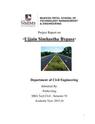
  • 1. i Project Report on “Ujjain Simhastha Bypass” Department of Civil Engineering Submitted By: Pratha Garg MBA Tech Civil – Semester VI Academic Year: 2015-16
  • 2. ii Department of Civil Engineering Project Report on “Ujjain Simhastha Bypass” Submitted By : Pratha Garg MBA Tech Civil, Semester VI Supervisor: Prof. Anand Awathe Mentor: Mr. J.K. Jain
  • 3. iii Acknowledgments I am very thankful to Mr. T.C. Garg, Director and Head of the organization, of Kalyan Group for having given me the opportunity to undertake my summer internship training at their prestigious project. It was a very good learning experience for me to have worked at this site as this project involved many unique construction practices as well as challenges I would like to give my heart-felt thanks to Mr. J.K.Jain, Project Manager, Mentor at Kalyan Toll Infra who guided and encouraged me all through the summer training and imparted in depth knowledge of the project. I would like to thank all the department heads of Kalyan Group, for giving their precious time and valuable guidance during my internship program. Also, I would like to express my gratitude to all the employees at Kalyan Toll Infrastructure right from the labors, foremen, and engineers to the department heads who all welcomed my doubts wholeheartedly and devoted their valuable time in explaining me the work process. I would also like to express my gratitude towards Dr.Ramachandra Hegde (HOD, Civil), Mr. Anand Awathe (Faculty In charge) and all the faculties of the civil department for guiding me through the entire internship period.
  • 4. iv Table of Contents Page No. Acknowledgements …………………………………. III List of Figures ………………………………. VI List of Tables ……………………………… VII Abstract .……………………………..... VIII 1. Introduction 1.1 Comprehensive study of the problem 1.2 Purpose, Scope and Limitations 1.3 Source and methods 1.4 Objective of the study 1.5 Organization of the report 2. Industry Analysis 2.1 Site detail 2.2 Indian Construction Industry 2.2.1 Indian Road Network 2.2.2 Kalyan Toll Infrastructure 2.3 Project Features 2.3.1 Project Completion Details 2.4 Project Details 2.4.1 Cross Sections and Width 2.5 Design Standard Summary 2.6 Project Facilities 2.7 Types of Pavements 2.8 Methodology :Procedure of Pavement Construction …………………………………. 1 ………………………………….. 1 …………………………………..... 1 ……………………………………. 2 ……………………………………. 2 ……………………………………. 2 ……………………………………. 3 …………………………………….. 4 ……………………………………. 7 ………………………………….…. 8 …………………………………….. 9 …………………………………… 9 ……………………………………. 10 ……………………………………. 10 …………………………………….. 14 …………………………………….. 25 ……………………………………..26 …………………………………….28 2.8.1Cleaning And Grubbing 2.8.2Earthwork Excavation 2.8.3Embankment Construction ……………………………………28 ……………………………………..29 ………………………………………..30
  • 5. v 2.8.4Sub Grade Construction 2.8.5Granular Sub-base Construction 2.8.6Wet Mix Macadam Construction 2.8.7Dense Bituminous Macadam Construction 2..8.8 Bituminous Concrete Layer 2.8.9 Laying of Kerbs 2.8.10 Application of Prime Coat 2.8.11Application of Tack Coat 2.9 Execution Of the Project 2.10 Pre- Construction Activities 2.11 Machinery 2.12 Road Furniture 2.13 Landscaping And Plantation 2.14 Laboratory Test Procedures ………………………………………….30 …………………………………..….…..32 ……………………………………..……33 …………………………………………..35 ………………………………....………..37 ………………………………..….……..37 ………………………………..………..38 …………………………………………38 ………………………………………....38 ……………………………..…………..39 ,………………………………..………..40 ………………………………………….42 ………………………………..…………45 …………………………….……………45 3.Conclusion References …………………………………….……..52 …………………………………………..53 Appendices: Appendix A: Site Map Appendix B: Site Visit Report Photograph
  • 6. vi List Of Figures Image 2.1 …………………………………….27 Image 2.2 …………………………………..…27 Image 2.3 …………………………………..…30 Image 2.4 …………………………………..…32 Image 2.5 …………………………………..…33 Image 2.6 …………………………………..…35 Image 2.7 …………………………………..…37 Image 2.8 …………………………………..…46 Image 2.9 …………………………………..…47 Image 2.10 ………………………………...…49 Image 2.11 ………………………………...…51 Image 2.12 ………………………………...…69 Image 2.13 ………………………………...…69 Image 2.14 ………………………………...…69
  • 7. vii List Of Tables Table 2.1 ………………………………...…7 Table 2.2 ………………………………...…11 Table 2.3 ………………………………...…12 Table 2.4 ………………………………...…12 Table 2.5 ………………………………...…13 Table 2.6 ………………………………...…13 Table 2.7 ………………………………...…13 Table 2.8 ………………………………...…14 Table 2.9 ………………………………...…16 Table 2.10 ………………………………...…17 Table 2.11 ………………………………...…18 Table 2.12 ………………………………...…18 Table 2.13 ………………………………...…19 Table 2.14 ………………………………...…21 Table 2.15 ………………………………...…23 Table 2.16 ………………………………...…24 Table 2.17 ………………………………...…24 Table 2.18 ………………………………...…26 Table 2.19 ………………………………...…27 Table 2.20 ………………………………...…40 Table 2.21 ………………………………...…41
  • 8. viii Abstract Roads bring about all-round development in the region. A good road network helps in the success of all development activities. It is in the sphere of movement of people and goods, agriculture, commerce, education, health, and social welfare, or even maintenance of law and order and security. This report contains the development process of the Highway Project. This project simplifies the movement of the vehicles during the Simhastha Mela 2016 at Ujjain (Madhya Pradesh). Ujjain Simhastha Bypass Road (“Project Road”) situated in western part of Madhya Pradesh, having total length of 14.290 Km including 01 Major Bridge, 03 Minor Bridges, 02 ROBs, 23 Pipe Culverts, 11 Box Culverts & 02 VUPs. Kalyan Toll Infrastructure Limited, Indore has been awarded the project through Madhya Pradesh Road Development Corporation. The production of a good piece of technical writing for a project report is as much a part of the project as doing the experimental work. However excellent and original a piece of work the project may be, unless the results can be communicated to other people it may as well not have been done. This report contains the following information:  Flexible pavements construction.  Rigid pavements construction  GSB , WMM , earthwork, BC and other layers information.
  • 9. 1 CHAPTER 1 INTRODUCTION 1.1 Comprehensive study of the problem A comprehensive study of the problem tells us how things are different in theory and practical. Hence we should try to understand and apply our theoretical knowledge of civil engineering to the practical field. 1.2 Purpose, Scope and Limitations Technical and Practical are the two roads of knowledge but due to training we are able to combine these two in a single road. It is the performance of the students that attracts more and more companies to join hands with our college .Hence to get a proper practical knowledge, it is very important for a student to get practical experience that is why Technical Internship Programme (TIP) is introduced. This training gives students self-confidence and helps in using their theoretical knowledge on site. The scope of learning is very wide. It is a golden opportunity to learn under different environment. Earlier, the students were provided with theoretical knowledge only. Due to this the students had to face a lot of problems in applying their theoretical knowledge at the practical work on site. 1.3 Sources and Methods Our main source of knowledge for TIP was to go on site and with the help of the engineers and supervisors learn as much as possible. This all was done by observing the day-to-day work of the project and try to relate our theoretical and practical knowledge and note as much as possible in our daily log book and understand the use of instruments, drawings and plans and last but not the least by shear observation.
  • 10. 2 1.4 Objective of the study The objective of the study are : 1. To get exposed to industrial environment that cannot be simulated in the institute. 2. To work under organization discipline. 3. To understand the psychology of workers, their habits, their attitudes and approach to problems along with the practices followed at site. 4. To realize the size and scale of operation on site. 5. To understand the scope, functions and job responsibilities in various departments of an organization. 1.5 Organizationof the Report The organization of the report has been done in a few parts. The tender documents, design, drawings, government documents and IS codes have been used for reference. Building of flexible pavements, rigid pavements was seen on site and has been translated in the report.
  • 11. 3 CHAPTER 2 INDUSTRIAL ANALYSIS 2.1 Site Details Roads bring about all-round development in the region. A good road network helps in the success of all development activities. It is in the sphere of movement of people and goods, agriculture, commerce, education, health, and social welfare, or even maintenance of law and order and security. MPRDC has decided to take up the Construction of Ujjain Simhastha Bypass on DBFO (Design Build Finance Operate) mode with annuity for better connectivity catering future traffic, efficient commercial transportation, and decongestion traffic in the city areas and to reduce pollution and travel time especially during the Simhastha Mela, 2016. Ujjain Simhastha Bypass is a proposed new alignment. Proposed Bypass road starts besides Hotel Shanti Palace on SH-27 Indore- Ujjain Road (Km. 46+970) near junction with Nanakheda Bus Stand road & road near Ujjain-Unhel – Jaora Road on SH-17 (Km. 3+300). Madhya Pradesh Road Development Corporation Ltd. (MPRDC), an undertaking of the Government of Madhya Pradesh have been implementing several road projects over the years with the state, centre and multi-lateral funding agencies like Asian Development Bank (ADB) and World Bank. In pursuance of the above, SAI Consulting Engineers Pvt. Ltd., Ahmedabad have been appointed as Consultant to carryout Feasibility Study for “Two-Laning with Paved Shoulder of Ujjain Simhastha Bypass. After the completion of the preparation of the Feasibility Report the Tendering Process for the Project highway has been commenced. As per the Feasibility Report prepared by the consultant the cost of the project was Rs. 70.63 Crores. Due to less traffic during the remaining Simhastha Period the project is viable on the DBFO (Design Built Finance and Operate) + Annuity Basis. Here Annuity means a fixed amount that will be deposited to the concessionaire’s account in semi-annual basis in the entire the concession period. It is also fixed that during the Simhastha, toll will
  • 12. 4 not be collected from the vehicles. The Concession Period for this project has been fixed to the 15 Years (02 Years for the construction of project highway and remaining for the collection of Toll and maintenance of the Highway). In the Tendering process of the project the Kalyan Toll Infrastructure Limited quoted the lowest Annuity amount i.e. Rs. 5.93 Crores. The Letter for the acceptance has been issued to the Kalyan Toll Infrastructure Limited and they have got the 06 months period for the Financial Closure. The Kalyan Toll Infrastructure Limited created the SPV Company “Ujjayini Highways Private Limited” for the execution of this project. The Ujjayini Highways Private Limited got the Bank Loan for this project from the Canara Bank. After the achievement of the Financial Closure the work has been commenced and the execution started from 05.05.2014 and expected to complete before the stipulated time 31.08.2015. The MPRDC has appointed the Independent Engineer M/s L N Malviya for the supervision of the Project and concessionaire. 2.2 INDIAN CONSTRUCTION INDUSTRY The construction industry was founded by Government and slowly taken over by enterprises. After independence the need for industrial and infrastructural developments in India laid the foundation stone of construction, architectural and engineering services. The period from 1950 to mid 60‟s witnessed the government playing an active role in the development of these services and most of construction activities during this period were carried out by state owned enterprises and supported by government departments. In the first five-year plan, construction of civil works was allotted nearly 50 per cent of the total capital outlay. In the late 1960s government started encouraging foreign collaborations in these services. The Guidelines for Foreign Collaboration, first issued in 1968, stated that local consultant would be the prime contractor in such collaboration.
  • 13. 5 The objective of such an imposition was to develop local design capabilities parallel with the inflow of imported technology and skills. This measure encouraged international construction and consultancy organizations to set up joint ventures and register their presence in India. In India Construction has accounted for around 40 per cent of the development investment during the past 50 years. Around 16 per cent of the nation's working population depends on construction for its livelihood. The Indian construction industry employs over 3 crore people and creates assets worth over 20,000 crore. It contributes more than 5 per cent to the nation's GDP and 78 per cent to the gross capital formation. Total capital expenditure of state and central govt. will be touching 8,02,087 crores in 2011-12 from 1,43,587 crores (1999-2000). The share of the Indian construction sector In total gross capital formation (GCF) came down from 60 per cent in 1970-71 to 34 per cent in 1990-91. Thereafter, it increased to 48 per cent in 1993-94 and stood at 44 per cent in 1999-2000. In the 21 st century, there has been an increase in the share of the construction sector in GDP and capital formation. GDP from Construction at factor cost (at current prices) increased to 1,74,571 crores (12.02% of the total GDP ) in 2004-05 from 1,16,238 crores (10.39% of the total GDP) in 2000-01. The main reason for this is the increasing emphasis on involving the private sector infrastructure development through public-private partnerships and mechanisms like build-operate-transfer (BOT), private sector investment has not reached the expected levels. The Indian construction industry comprises 200 firms in the corporate sector. In addition to these firms, there are about 1,20,000 class A contractors registered with various government construction bodies. There are thousands of small contractors, which compete for small jobs or work as sub-contractors of prime or other contractors. Total sales of construction industry have reached 42,885.38 crores in 2004 05 from 21,451.9 crore in 2000-01.
  • 14. 6 BUILD-OPERATE-TRANSFER (BOT) SYSTEM: A type of arrangement in which the private sector builds an infrastructure project, operates it and eventually transfers ownership of the project to the government. In many instances, the government becomes the firm's only customer and promises to purchase at least a predetermined amount of the project's output. This ensures that the firm recoups its initial investment in a reasonable time span. This type of arrangement is used typically in complicated long-term projects as seen in power plants and water treatment facilities. In some arrangements, the government does not assume ownership of the project. In those cases, the company continues running the facility and the government acts as both the consumer and regulator. Build-own-operate-transfer (BOOT) or build-operate-transfer (BOT) is a form of project financing, wherein a private entity receives a concession from the private or public sector to finance, design, construct, and operate a facility stated in the concession contract. This enables the project proponent to recover its investment, operating and maintenance expenses in the project. Due to the long-term nature of the arrangement, the fees are usually raised during the concession period. The rate of increase is often tied to a combination of internal and external variables, allowing the proponent to reach a satisfactory internal rate of return for its investment. DBFO (Design Build Finance Operate) Design- Build- Finance- Operate is a project delivery method very similar to BOOT except that there is no actual ownership transfer. Moreover, the contractor assumes the risk of financing till the end of the contract period. The owner then assumes the responsibility for maintenance and operation. Some disadvantages of DCMF are the difficulty with long term relationships and the treat of possible future political changes which may not agree with prior commitments. This model is extensively used in specific infrastructure projects such as toll roads. The construction company build a private entity which is in charge to design and construct an infrastructure for the government which is the true owner. Moreover the private entity has the
  • 15. 7 responsibility to raise finance during the construction and the exploitation period. The cash flows serve to repay the investment and reward its shareholders. They end up in form of periodical payment to the government for the use of the infrastructure. The government has the advantage that it remains the owner of the facility and at the same time avoids direct payment from the users. Additionally, 11 the government succeeds to avoid getting into debt and to spread out the cost for the road over the years of exploitation. 2.2.1 Indian road network India has a road network of over 4,689,842 kilometers (2,914,133 mi) in 2013, the second largest road network in the world. At 0.66 km of roads per square kilometer of land, the quantitative density of India's road network is similar to that of the United States (0.65) and far higher than that of China (0.16) or Brazil (0.20). However, qualitatively India's roads are a mix of modern highways and narrow, unpaved roads, and are being improved. As of 2011, 54 percent – about 2.53 million kilometers – of Indian roads were paved. Table 2.1 Road classification Authority responsible Total kilometers (as of 2011) National Highways Ministry of Road Transport & Highways (Central government) 92,851 State Highways State governments (state's public works department) 1,63,898
  • 16. 8 Major and other district roads Local governments, panchayats and municipalities 17,05,706 Rural roads Local governments, panchayats and municipalities 27,49,805 2.2.2 Kalyan Toll Infrastructure Ltd. Kalyan Toll Infrastructure Limited was incorporated in the year 2002. Kalyan Toll Infrastructure Limited is one of the leading four construction company in Madhya Pradesh. The company has been registered for construction works with Public Works Department of Maharashtra and Madhya Pradesh as "A" category contractor. The Company is registered for VAT & TIN, EPF, Service Tax, Professional Tax, Income Tax, and Importer Exporter Code. Its construction activities comprise of :  Road Projects  Railway Projects  Bridges, ROB and Flyover Projects  Water Supply Projects  Commercial and Residential Complexes  Sewerage Projects  Construction of Dams Promoters of Kalyan Toll Infrastructure Limited have rich experience of over 25 years backed by technical acumen and experience of more than two decades in construction industry. During this period Kalyan Toll Infrastructure Limited has executed projects more than 15000 million. Kalyan Toll Infrastructure Limited is
  • 17. 9 one of the few construction companies in M.P., which has successfully executed TEN BOT projects and THREE are under execution. 2.3 PROJECT FEATURES Project Title: Ujjain Simhastha Bypass Road (“Project Road”) situated in western part of Madhya Pradesh, having total length of 14.290 Km. The project road lies between 23°18' N Latitude to 75°77' E Longitude and 23°10' N Latitude to 75°46' N Latitude. Project Details: Source of Fund: Design, Build, Finance, Operate and Transfer (DBFOT) basis. Total Project cost: Rs.70.6 Crore. Client/Employer: Madhya Pradesh Road Development Corporation Limited Concessionaire: Ujjayini Highways Private Limited DesignConsultant: K & J Projects Pvt Ltd Length of Project : 14.29 kms Timelines for the entire project Work ExecutionDate:05.05.2014 Appointed date for Project completion:31.08.2015 Concession Period : 15 years Construction Period: 24 Months. 2.3.1 ProjectCompletionSchedule 1. Project Milestone-I: 180th day from Appointed Date Commenced Construction of Project Highway Expected not less than 10% of the total capital cost set forth in the Financial Package 2. Project Milestone-II: 365th day from Appointed Date
  • 18. 10 Commenced Construction of all Bridges Expected not less than 35% of the total capital cost set forth in the Financial Package 3. Project Milestone-III: 600th day from Appointed Date Commenced Construction of all Project Facilities Expected not less than 70% of the total capital cost set forth in the Financial Package 4. Scheduled Four Lanning Date 730th day from Appointed Date Should have completed the Four Lane Project Highway 2.4 DETAILS OF PROJECT HIGHWAY 2.4.1 Cross Sections and Width 2.4.1.1 Two-Laning with paved Shoulder The carriageway shall be 7 meters wide with paved shoulder of 1.5 m & granular shoulder of 1.0 m on each side shall be provided along the project road. 2.4.1.2 Cross Sections Road shall be constructed with a carriageway of 7.0 m and paved shoulder 1.5 m on each side and 1.0 m granular shoulder each side. The cross section of the highway shall be placed eccentrically in proposed ROW to accommodate future lane requirement. No built up sections having four lane divided carriageway with footpath. No service road is proposed along entire stretch of the project Road.
  • 19. 11 2.4.1.3 At Grade Intersections There are total 2 major road junctions which are needed to be improved. Table 2.2 Sr. Design Description of Type of Remarks No. Chainage Road Junction 1 0+000 Indore – Ujjain 3 Legged Road (SH – 27) (Ch. 46/970) 2 14+290 Ujjain – Unhel – 3 Legged Jaora Road (SH – 17) (Ch. 3.300) 2.4.1.4 Road Over Bridge (ROB) There are two proposed ROB’s on the project road crossing two Railway tracks one on meter gauge and second on broad gauge. Details of Proposed ROB are given below:
  • 20. 12 Table 2.3 : Details of Proposed Rail Over Bridge (ROB) (New construction) Sr. Existing Design Proposal Details of Proposed Proposed Remarks No. Chainage Ch. Structure width (mt) (km.) (in Km) No x Span 1. - 3+542 New construction 1x15m+1x30m 12.0(8.5m with footpath +1x15m Clear on both side width) 2. - 4+928 New construction 1x15m+1x30muuuuu 12.0(8.5m with footpath +1x15m Clear on both side width) 2.4.1.5 Grade Separated Structures and Under Passes Vehicular underpasses are proposed on project road corridor as mentioned in the table below. Slip roads on all four sides shall be constructed to facilitate directional changes. The details of proposed VUP are given below: Table 2.4 : Details of Proposed Vehicular Underpass (VUP) (New construction) Sr. Existing Design Proposal Details of Proposed Proposed Remarks No. Chainage Ch. Structure width (mt) (km.) (in Km) No x Span 1. 1+000 3+858 New construction 1x12m 12.00 - 2. 4+400 7+000 New construction 2x12m 12.00 - 2.4.1.6 Rigid Pavement Rigid Pavement shall be provided at Toll Plaza location.
  • 21. 13 2.4.1.7Structures Brief details of existing structures and proposal of Major Bridge, Minor Bridge, Slab Culverts and Pipe Culverts proposed for new construction are given in tables below: Table 2.5 : Summary of Proposed Structures Improvement Type of Structure Proposed Pipe Slab/Box Minor ROB VUP Culvert Culvert Bridges New Construction 23 11 03 02 02 Total 23 11 03 02 02 Grand Total 42 Table 2.6 : Details of Major Bridges (New Construction) Sr. Existing Design Existing Proposal Details of Proposed Remarks No. Ch. Ch. Width Proposed Structure Width (m) (km.) (in Km) (m) No x Span 1 - 0+354 - New 4nos X30.00m PSC 12.00 With Bank construction Span Protection Table 2.7 : Details of Proposed Minor Bridges (New construction) Sr. Existing Design Proposal Details of Proposed Proposed Remarks No. Chainage Ch. Structure width (km.) (in Km) No x Span (mt) 1. -- 1+150 New construction 1x10m RCC Slab type 12.00 - 2. -- 2+595 New construction 2x10m RCC Slab type 12.00 - 3 - 4+265 New construction 2x10m RCC Slab type 12.00 -
  • 22. 14 2.5 Design Standards Summary Following is a summary of the recommended design standards proposed to be adopted for the project road other than service road and intersections: Table 2.8 1. Design speed Plain terrain : 100(ruling), 80(minimum) 2. Roadway Widths (m) : 12m for 2-lanes with paved shoulders/ Granular Shoulder 10m for 2-lane with paved shoulder (approaches to grade separator 3. Roadway Elements : Carriageway 2-lane- 2X3.5m Paved Shoulder 2-lane with PSS- 2x1.5m Unpaved Shoulder 2 lane -2X2.5m 2 lane with PSS – 2X2.0m 3.0m for mountainous/Hilly Terrain 4. Camber Carriageway/Paved Shoulder- 2.50% Unpaved Shoulder- 3.50% 5. Embankment/ Cutting Slope In filling- 1V: 2 H In cutting- 1V:1H 6. Right of Way 30 m for 2 lane 7. Stopping Sight Distance Intermediate sight distance 180m for design speed of 100km/hr 120m for design speed of 80 km/hr 90m for design speed of 65 Km /hr 360m for design speed of 100km/hr 240m for design speed of 80km/hr
  • 23. 15 180m for design speed of 65 Km/hr 8. Super-elevation Maximum 7% for Two lane section 9. Radii for Horizontal Curves Ruling Minimum 360 M Absolute minimum 230 m 10. Ruling Gradient 3.3% for plain and rolling terrain 5% limiting gradient 11. Minimum K- factor Summit Curve 74 for Design speed of 100 km/hr 33 for Design speed of 80 km/hr 18.5 for Design speed of 65 km/h Valley Curve 42 for Design speed of 100 km/hr 25.5 for Design speed of 80 km/hr 17.5 for Design speed of 65 km/hr 12. Bridge Clearance Railway Over Bridge 7.3m Vehicular underpass 5.5m Cattle and Pedestrian 3.0 m 13. Design Flood Frequency Bridges 50 years Sewers and Ditches 10 years 14. Minimum Drainage Channel Width 0.50 m Terrain Classification Terrain is classified by the general slope of the ground across the highway alignment. As IRC: SP: 73-2007 terrain of the project road can be classified based on following cross slope of the ground.
  • 24. 16 Table 2.9 Nature of Terrain Cross Slope of the Ground Plain Less than 10 % Rolling Between 10 to 25% Mountainous Between 25 to 60% Steep More than 60% Design Speed The project road passes through Plain terrain. For geometric design of the highway design speed is used as an index which links road function, traffic flow and terrain. An appropriate design speed should correspond to general topography and adjacent land use. The speed selected for design should also cater to travel needs and behavior of the road users. Rural highways, except expressways, are normally designed for speed of 100 km/hr, however depending on terrain and whether the design is for new alignment or reconstruction of an existing facility, the design speed is determined to the site requirement. Assuming a diverse mix of traffic on the project roads, a ruling design speed of 100 km/h and minimum design speed of 80km/hr for plain terrain is proposed for the project road as per IRC SP: 73-2007. Use of speed regulatory sign is proposed at locations such as hairpin bends and other sharp curves where design speed cannot be maintain. Sight Distance Visibility is an important requirement for the safety of travel on roads. For this it is necessary that sight distance of adequate length is available in different situations, to permit drivers enough time and distance to control their vehicles so that chances of accidents are minimized. Sight distance is a direct function of the design speed. On divided highways the design should correspond to Stopping Sight Distance, which is the clear distance ahead needed by a driver to bring his vehicle to a stop before
  • 25. 17 meeting a stationary object in his path. On two-lane roads, normally intermediate sight distance should be available throughout for design proposed. In stretches where even intermediate sight distance is not available, safe stopping site distance should be provided with traffic signs depicting “Overhead Prohibited” at all such locations. Sight distance corresponding to various design speeds are given below. Table 2.10 : Sight distance for various Speeds Design Speed Km/h Stopping Sight Distance (m) Intermediate Sight Distance (m) Overtaking Sight Distance (m) 65 90 180 340 80 120 240 470 100 180 360 650 Horizontal Alignment a) General For balance in highway design, all geometrical elements should be determined for consistent operation under the design speed in general. A horizontal alignment should be as smooth and consistent as possible with the surrounding topography. To achieve that, an appropriate blending with the natural contours is preferable to the one with long tangents through the terrain. b) Horizontal Curve The minimum horizontal curve radius is the limiting value of curvature for a given design speeds and is determined based on from the maximum rate of super elevation and the side friction factor. As per the IRC: SP:73 – 1997 the minimum ruling radii of Horizontal curve for National Highways corresponding to different terrain conditions are as follows:
  • 26. 18 Table 2.11 : Horizontal Radii Criteria Type of terrain Minimum Radii of Horizontal Curve Desirable Minimum Absolute Minimum Plain 360 230 Absolute minimum and ruling minimum radii correspond to the minimum design speed and the ruling design speeds respectively. On new roads, horizontal curves are designed with liberal radius provision that blends well with the overall geometry and topography. However, for locations with constraints and to make use of available roadway, it is proposed to keep minimum radius in accordance with the IRC recommendations. Table 2.12 : Adopted Horizontal Radii Speed (km/h) Absolute Minimum Radius (m) 100 350 80 230 65 155 c) Transition (Spiral) Curves : The purpose of a transition (spiral) curve is to provide a smooth and aesthetically pleasing transition from a tangent and a circular curve. In addition the transition curves provide the necessary length for attainment of super-elevation runoff. The IRC: 73-1980 and IRC:38-1988 design standards suggest 130m, 90m, 80m and 75m transition curve lengths for circular curves of radii 360m, 230m ,155m and 90m (design speeds of 100 km/hr, 80 km/hr, 65 km/hr and 50 km/hr). The AASHTO (2001) design guidelines specify transition curve lengths of 72m, 65m and 50m; and the TAC (1999) design guidelines recommend transition curve lengths of 80m, 80m and 50m for curve radii of 440m, 250m, 90m (design speeds of 100 km/hr, 80 km/hr and 50 km/hr) respectively.
  • 27. 19 It is proposed to adopt transition curve lengths of 130m, 90m, 80m and 75m for design speeds of 100 km/hr, 80 km/hr, 65 km/hr and 50 km/hr respectively at their minimum recommended moves. d) Extra Width of Pavement and Roadways : Since the project road is of two lane category, extra widening is necessary on curves having radius less than 300 mt. to counter balance mechanical and psychological disorder of the vehicle. Extra widening is achieved by increasing the width at a uniform rate along the curve. On curve having no transition, widening is achieved in the same way as super elevation i.e. two third is being attained on the straight section before start of the curve and one third in the curve. On hilly roads and curves without transitions extra widening is provided on inner side of the curve. As per IRC: SP: 73-2007, the extra widening shall be increased as follows: Table 2.13 : Extra width of Pavement and Roadway Radius of Curve Extra Width(m) Up to 40m 1.5 41-60m 1.2 61-100m 0.9 101-300m 0.6 e) Super-elevation The IRC: 73-1980 design standards propose a maximum super-elevation rate of 7% for plain and rolling terrains, and 10% or the mountainous terrain. The AASHTO (2001) and TAC (1999) design guidelines recommend maximum super-elevation rates of 8% and 6% respectively, regardless of the terrain. The limiting value of the super-elevation on the project road in both plain rolling and hilly terrain is proposed to be 7% for two lane section.
  • 28. 20 Vertical Alignment a) General The vertical alignment should produce a smooth longitudinal profile consistent with the standard of the road and the terrain. Wherever possible horizontal and vertical curvature should be so combined that the safety and operational efficiency of the road is enhanced. b) Gradients The IRC: SP: 73-2007 propose ruling vertical grades of 3.3% to 5.0% for plain and rolling terrains; and 5.0% to 6.0% for hilly terrain. The AASHTO (2004) design guidelines suggest desirable vertical grades of 3.0% to 4.0% for plain and rolling terrains, and 6.0% for hilly areas. The TAC (1999) design guidelines recommend a maximum 3% vertical grade for plain and rolling terrains, and 6.0% for hilly terrains. To ensure adequate drainage, roadways typically have a minimum longitudinal grade of 0.5% to 0.6%, depending on the terrain. The minimum longitudinal grades as per IRC: 731980 design standards are 0.5% for lined side ditches, and 1.0% for unlined side ditches. c) Vertical Curves As per IRC: 73-1980 design standards, the minimum lengths of vertical curves are 60 m and 50 m for design speeds of 100 km/h and 80 km/h respectively. According to AASHTO (2001) and TAC (1999) design guidelines the vertical curves should be designed to ensure safe stopping sight distance. At complex locations such as interchanges and major intersections the minimum lengths of vertical curves should be designed for safe decision sight distance. The length of a vertical curve is calculated using the following equation: L = K x A, Where L = Length of vertical curve in meters; K = Coefficient, a measure of the flatness of a vertical curve; and
  • 29. 21 A = Algebraic difference of grade lines (%) Summit or Crest Curves According to AASHTO (2001) design guidelines, the minimum K values for stopping sight distance requirements are 52, 26 and 7 for design speeds of 100 km/hr, 80 km/h and 50 km/hr. respectively. According to TAC (1999) design guidelines, the minimum K valves for stopping sight distance requirements are 45 to 80, 24 to 36 and 6 to 16 for design speeds of 100 km/hr, 80 km/hr. and 50 km/hr. respectively. Cross Sectional Elements Adequate roadway width will be provided for the requisite number of traffic lanes besides the shoulders and a central median dividing the traffic flow directions. As specified in the IRC SP: 73-2007 in general, standard lane width shall be 3.5m for project highway. Based on a comparative review of international standards and safety, the values proposed to be adopted for the roadway elements by the Consultant for the project highway are as follows: a) Roadway Width for Two lane Highways Table 2.14 Road Cross Section Item Two-Lane with Granular Shoulder Two-Lane with Paved Shoulder Carriageways 2x3.5m 2x3.5m Paved shoulder N.A. 2X1.5 m Unpaved shoulder Plain/ rolling terrain Hilly terrain* 2 X 2.5 m 3 m (1 on Hill side 2 on Valley Side) 2X1m NA Total Roadway width Plain/rolling terrain Hilly terrain* 12 m 10 m 12 m 10 m
  • 30. 22 * Exclusive of parapets and side drains b) Lane Width Lane width has a significant influence on the safety and comfort of the road. The capacity of a roadway is markedly affected by the lane width. In general, safety increases with wider lanes up to a width of about 3.7 m. The lane width as per IRC: SP: 73-2007 is 3.5 m. AASHTO (2004) and TAC (1999) recommended lane widths for this type of facility are 3.6 m and 3.7 m respectively for design speed of 100 km/h. Experience shows that operating speed normally remains less than the design speed because of the partially access controlled facility and the other ambient conditions. Based on this assumption a 3.5 m lane width is proposed. This also concurs with other National Highways in India currently under construction. c) Shoulders Shoulders are a critical element of the roadway cross section. Shoulders provide recovery area for errant vehicles; a refuge for stopped or disabled vehicles; and access for emergency and maintenance vehicles. Shoulders can also provide an opportunity to improve sight distance through cut sections. According to IRC: SP: 73-2007, for two lane highways the normal shoulder width shall be 2.5m on either side for Plain or Rolling terrain and for mountainous terrain. As per IRC: SP: 73-2007 the recommended shoulder width is 1.0m on Hill side and 2.0m on valley side. The AASHTO (2001) and the TAC (1999) design guidelines suggest paved outer shoulder widths of 3.0 m for high speed highways carrying large number of trucks. For Two-Lane Section the Consultants proposes to adopt an outer shoulder width of minimum 2.5 m plain terrain. Out of this 1.5 m will be paved as per lane requirements and the balance 1.0 m will be unpaved shoulder as per the capacity
  • 31. 23 analysis results. : SP: 732007, unpaved shoulder should be covered with 150mm granular material. d) Land Width (Right of Way) The IRC: 73-1980 has specified following land width values or Right-of Way for National Highways: Table 2.15 : Provision for ROW Right of Way (m) Plain/ Rolling Terrain Range Normal Open area 30 – 60 45 Built up area 25 – 30 30 e) Embankment Slopes The slope of embankment is linked with its height. In accordance with the Manual for Safety in Road Design (MoRT&H publication), the following are proposed to be adopted: Ht of embankment 4.5 m and above: 2 H: 1V with crash barriers Ht of embankment 3 m to 4.5 m: 2.5 H: 1 V Ht of embankment 1.5 m to 3 m: 3 H: 1 V Ht of embankment less than 1.5 m: 4 H: 1 V As per IRC: SP: 73-2007 the side slopes for embankment shall not be steeper than 2H:1Vunless soil is retained by suitable soil retaining structure. The side slopes of cutting shall be provided in accordance with the nature of soil encountered. The slope shall be stable for type of strata. Where required, benching including use of slope stability measures like pitching, breast wall, etc. shall be adopted to make the slopes stable and safe. The Consultant proposes to provide slopes of 2H: 1V in Fill sections. Cut slopes are proposed as 1H: 1V in general however, these sections will be specifically analyzed for stability before adopting this slope or steeper slopes
  • 32. 24 Pavement Camber (Cross Fall) IRC: SP: 73:2007 recommends the following camber for various surface types: Table 2.16 : Provision for Cross Fall Category of surface Annual Low rainfall (less than 1500 mm) Annual High rainfall (more than 1500 mm) Bituminous 2.5% 2.5% Cement concrete 2.0% 2.0% Metal / gravel 2.5% 3.0% Earth 3.0% 4.0% Considering of bituminous surfacing (bituminous concrete) the Consultants propose to provide a camber of 2.5 % for the main carriageway as well as paved shoulders and 3.5 % for the unpaved shoulder. Service Road Standards Following values are proposed to be adopted for service roads wherever applicable: Table 2.17 Particulars Two – lane section Design speed 40 to 50kmph Camber 2.5% Horizontal curve radius 90-60m Gradient 3.33 % Shoulder 1.5m Footpath 2.0m Width of carriage Minimum 5.5m Roadway width Minimum 8.5m
  • 33. 25 2.6 PROJECT FACILITIES The Project Facilities shall include:  Toll Plaza  Road side Furniture  Street lighting  Pedestrian Facilities  Landscaping and Tree Plantation  Rest areas  Truck Lay-Byes  Bus-bays and Bus Shelters  Vehicular underpasses and Pedestrian/cattle underpasses  Traffic aid posts  Medical aid posts
  • 34. 26 2.7 Types of pavement 1) Flexible Pavement 2) Rigid Pavement Flexible pavement Rigid Pavement Table 2.18 :Flexible Pavement Design width 10.00 Mtrs Design Chainage (Km 0+000 to 14+295) Bituminous Concrete (mm) 40 Dense Bituminous Macadam (mm) 75 Wet Mix Macadam (mm) 250 Granular Sub-base (mm) 230 Sub grade (mm) 500
  • 35. 27 Table 2.19 : Rigid Pavement Design width 10.00 Mtrs Design Chainage (Km 0+000 to 14+295) Pavement Quality Concrete (mm) 250 Dry Lean Concrete (mm) 150 Granular Sub base (mm) 230 Sub grade (mm) 500 Image 2.1 : Flexible Pavement Image 2.2 : Rigid Pavement
  • 36. 28 2.8 METHODOLOGY : Procedure Of Pavement Construction 2.8.1 CLEARING AND GRUBBING Procedure: The work shall commence soon after mobilization at the site has been completed to the extent that this activity can be taken up. Clearing and grubbing shall be carried out using bull dozers to generally scrap off the top crest of the formation bed with the main aim to clear the proposed road corridor of major bushes, unwanted waste materials and vegetation and roots so as to enable field survey works to be carried out up to reasonable precision and accuracy besides conducting soil sampling and testing, visual or laboratory, on the existing ground materials to enable decision on further course of action on mode of road construction. During this course of such clearance unwanted materials shall be disposed off to the designated places as directed, by using tippers. At the same time all that soil which is found reusable in terms of execution of this project shall be stock piled along the work stretches. Equipment Required: 1. Dozer 2. Excavators 3. Tippers
  • 37. 29 2.8.2 EARTHWORK EXCAVATION Procedure: 1) Before the earthwork is started, the whole area where the work is to be done should be cleared of grass, roots of trees and unwanted debris. 2) Excavation should be carried out exactly in accordance with the dimensions shown on the drawings or any other dimension, as decided by the Site-in-Charge. 3) Sides of the trenches shall be vertical and its bottom shall be perfectly leveled, both longitudinally and transversely. Where the soil is soft, lose or slushy, the trench shall be widened for allowing steps on either side or the sides sloped or shored up. 4) During excavation if rocks or rocky soils are found, they shall be leveled as far as possible and the small spaces which are difficult to level shall be filled in with concrete. 5) If the excavation is in earth, the bottom of the trenches shall be sprinkled with a little water and rammed. 6) No material excavated from the foundation trenches shall be placed nearer than one meter to the outer edges of the excavation. 7) Water in trenches must be bailed or pumped out and where it is apprehended that the sides may fall down or cave in, arrangement shall be made for adequate timber shoring. 8) When it is specified that the work is to be carried out without removing cables, pipes, sewers etc. all of them shall be temporarily shored and saved from any damage. 9) The cost of all materials and labor required for fencing/barricading in and protection against risk of accidents due to open excavation should be provided. Equipment used: 1. Excavators 2. Tippers 3. Water Pumps
  • 38. 30 2.8.3 EMBANKMENT CONSTRUCTION Procedure: 1. The toe line and center line are marked and pegs will be driven. 2. The material shall be dumped in site at respective location. 3. The material shall be spread in layers of uniform thickness not exceeding 200mm compacted thicknesses over the entire width of the embankment by mechanical means and will be graded with motor grader to the required camber. 4. Moisture content of the material shall be checked and extra required will be added. 5. The moisture content of each layer shall be checked and it should be within the range of OMC +1% to OMC -2%. If moisture content is found out of these limits the same will be brought within the limits by addition of water or by aeration as the case may be. 6. The compaction shall be done with the help of vibratory roller of 8 to 10 ton static weight. Each layer shall be thoroughly compacted to the densities specified. 7. Loose pockets if any will be removed and replaced with approved material. 8. The above stages shall be repeated till the top level of the embankment is reached to the specified levels and grades. The top levels are checked and shall be within the +20mm and 25mm of the designed level. 2.8.4 SUBGRADE CONSTRUCTION Image 2.3
  • 39. 31 SUBGRADE: Subgrade is one of the most crucial part of embankment fills or natural surface just below the sub-base or lower sub-base of road pavement and shoulder. The surface above the subgrade is known as the formation level or finishing level. Subgrade is the in situ material upon which the pavement structure is placed or constructed at selected location. Formation level is defined as the final level of soil surface after completion of earthworks and when trough the process of compaction, stabilization and reinforced. The subgrade’s main function is to withstand the loading of road pavement (sub- base, base, etc.) above it. Procedure: 1. The toe line and center line are marked and pegs will be driven. 2. The material shall be dumped in site at respective location. 3. The material shall be spread in layers of uniform thickness not exceeding 200mm compacted thicknesses over the entire width of the subgrade by mechanical means and will be graded to the required camber. 4. Moisture content of the material shall be checked and extra required will be added. 5. The moisture content of each layer shall be checked and it should be within the range of OMC +1% to OMC -2%. If moisture content is found out of these limits the same will be brought within the limits by addition of water or by aeration as the case may be. 6. The compaction shall be done with the help of vibratory roller of 8 to 10 ton static weight. Each layer shall be thoroughly compacted to the densities specified. 7. Loose pockets if any will be removed and replaced with approved material.
  • 40. 32 8. The above stages shall be repeated till the top level of the embankment is reached to the specified levels and grades. The top levels are checked and shall be within the +20mm and -25mm of the designed level. Performance of Subgrade The subgrade’s performance generally depends on two interrelated characteristics: Load Bearing Capacity The subgrade must be able to sustain loads transmitted from the pavement structure. The load bearing capacity is frequently affected by the types of soil, moisture content, and degree of compaction. A subgrade that can sustain a highly sum of loading without an excessive deformation was considered good quality. The types of soil especially from gravel type considered the best and from peat type considered as the worst material. Moisture content of soil is also important and determine by conducting the soil compaction test at lab as to find out which type contains more water. The degree of compaction normally reflects to the method of compaction used at construction site, by means of machinery and the numbers of passes. 2.8.5 GRANULAR SUB-BASE CONSTRUCTION Image 2.4
  • 41. 33 Procedure: 1. The toe line and center line are marked and pegs will be driven. 2. The material shall be dumped in site at respective location. 3. The material shall be spread in layers of uniform thickness not exceeding 200mmcompacted thicknesses over the entire width of the embankment by mechanical means and will be graded with motor grader to the required camber. 4. Moisture content of the material shall be checked and extra required will be added. 5. The moisture content of each layer shall be checked and it should be within the range of OMC +1% to OMC -2%. If moisture content is found out of these limits the same will be brought within the limits by addition of water or by aeration as the case may be. 6. The compaction shall be done with the help of vibratory roller of 8 to 10 ton static weight. Each layer shall be thoroughly compacted to the densities specified. 7. Loose pockets if any will be removed and replaced with approved material. 8. The above stages shall be repeated till the top level of the embankment is reached to the specified levels and grades. The top levels are checked and shall be within the +20mm and -25mm of the designed level. 2.8.6 WET MIX MACADAM CONSTRUCTION Image 2.5
  • 42. 34 Procedure: Preparation of Mix: 1. The individual materials gradation shall be checked combined, proportions shall be fixed LAYING W.M.M.: - BASE 1. Scope: Wet mix macadam base shall consist of laying and compacting clean, crushed graded aggregate and granular material, premixed with water to a dense mass on prepared sub base in accordance with the specifications. 2. Proposed Sample: Coarse aggregate proposed to be used in WMM are obtained by crushing the rocks, obtained from approved quarries. Before removing the rock, the quarry area is stripped of earth loam, clay and vegetable matter. 3. Independent tests will be carried out on this material as follows: Sieve analysis. Los Angeles abrasion Aggregate impact value Combined flakiness & elongation indices Modified proctor density Liquid limit & plasticity index of portion through 425 micron sieve. 4. Mixing : Proposed „Base‟ material will be obtained by mixing various sizes of aggregates (as per approved mix design) & water in the wet mix macadam plant. 5. Transportation: W.M.M. material will be carried to the site in dumpers of adequate capacity. 6. Laying and compaction: W.M.M. material will be laid in layers (150 mm compacted) on prepared sub – base using mechanical pavers or motor grader to maintain required thickness and slope and to achieve finished surface in narrow areas, WMM will be spread manually, in layers. 7. Each layer will be compacted with 10 T Vibro Roller, to achieve required degree of compaction i.e. 98% of modified density. The areas not accessible to roller will be compacted with plate compactor/ or mini rollers.
  • 43. 35 8. Top surface will be checked for its designed levels, before & after compaction & material will be removed or added as required. 9. Surface finish and quality control of work: - Segregated material will not be allowed to be placed. The tolerance on levels shall not exceed 12 mm and deviation from 3000mm straight edge shall not exceed 10mm. 10. Rectification of defects: After final compaction, surface will be checked for its finish and top levels. Any segregated material like only coarse or only fine will be removed and the pocket will be filled with premixed material. 2.8.7 DENSE BITUMINOUS MACADAM CONSTRUCTION Image 2.6 Preparationand Transportationof Mix: 1. The Individual bins of hot mix plant shall be calibrated for the particular size of material. 2. Material shall be fed to the mixing plant bins provided for individual sizes of aggregates to meet the required gradation. 3. The temperature of binder at the time of mixing shall be in the range of 150-165 degree centigrade and the aggregate in the range 150 to 170 degree centigrade. The
  • 44. 36 difference between the aggregate temperatures shall not exceed 14 degree centigrade any time. 4. The mix shall be transported to the site with Tippers properly covered with tarpaulins. Preparationof Base: 1. The sub base shall be checked for proper lines and levels. 2. The surface shall be swept free from dust with air compressor. 3. The tack coat shall be done if the WMM surface was primed and left for quite some time. Laying of DBM: The mix shall be laid with paver finisher. The paver shall have suitable loading hoppers and distribution mechanism. The paver shall have electronic sensor paver and string wire shall be run on steel pegs driven on both sides at 10 m interval in straight portions and 5m interval in curved portions. The mix shall be laid manually in places where the paver movement is not possible. The compaction of DBM shall be done as per clause 501.6 and 501.7. The rolling shall be done with 80-100 KN smooth wheeled tandem rollers, 12-15 tones pneumatic tiered roller. The DBM should be laid in 2 layers. The compaction shall be checked by taking cores for every 250 sq.m area and the degree of compaction shall not be less than 98% of lab Marshall Density or as specified. The top shall be checked for level control and the levels shall be within + or -6mm of designed level.
  • 45. 37 2.8.8 Bituminous concrete layer Image 2.7 2.8.9 LAYING OF KERB 1. The kerb machine should be clean and oiling thoroughly. Machine will be placed to the proper position so that the line of mark on the sensor touches the string line. 2. The mix is proposed in the concrete mixture and transported to kerb machine. Mix material should be used within 30 minutes after production. Sand should be screened before using for slurry. The slurry will be prepared separately and transported to the slurry chamber. 3. The operator should check the machine before starting it; He has to check the string line time to time to get the proper kerb dimensions. Finishing should made through sponge to avoid plastic cracks. Additional material should not be used for finishing. 4. Curing should be done by curing compound at wet condition of concrete and up to 15 to 20m behind the kerb machine. The rate of spray will be specified. 5. Cutting groves for the kerb shall be provided by using diamond cutter at every 5 m intervals prior to hardening.
  • 46. 38 2.8.10 APPLICATION OF PRIME COAT Preparationof Road Surface: Make clean the top surface of wet mix macadam by engaging labours with wire brush and all organic contents shall be blown up by using compressed air. The surface to be primed will be swept clean, free from dust and remain dry. Application of Primer: The Primer will be sprayed uniformly over the dry surface using a self-propelled sprayer with the distribution bar at temperature of 30 to 60 degree centigrade. Curing: The primed surface will be allowed to cure for 24 hours minimum or even more as directed, so that the primer will penetrate into the base of wet mix macadam layer. 2.8.11 APPLICATION OF TACK COAT The Tack coat “Bituminous emulsion” will be heated to the temperature 20 -30 degrees centigrade. This tack coat will be applied uniformly at the rate of 0.25 to 0.30 Kg/sq.m for granular surface with the help of self propelled emulsion sprayer. 2.9 EXECUTION OF THE PROJECT Reconnaissance of the stretch of the road to be re-aligned, study of the deficiencies and the possible changes in alignment. 1) Survey of existing road recording the topographic features and all other existing features including drainage conditions along the strip of land on either side of the
  • 47. 39 road. The width of the land to be surveyed depends on the amount of shifting anticipated when the road is realigned. 2) Observation of spot levels along the centre line of the road and cross section levels at suitable intervals to note the gradient, cross slope, super elevation etc. The cross section levels should be taken at closer intervals at horizontal and vertical curves and at cross drainage works. 3) Soil survey along the stretches of land which the re-aligned road may possibly pass; preparation of typical soil profiles after testing the soil samples in the laboratory. 4) Comparison of economics and considerations of feasibility of alternate proposals of re-alignment and special study of stretches which are difficult for the re- alignment. 5) Preparation of drawings 6) Checking the geometric design elements of the newly aligned stretches of the road. 7) Design and construction of the highway pavements. 2.10 PRE-CONSTRUCTION ACTIVITIES
  • 48. 40 2.11 Machinery  Owned by the company KALYAN TOLL INFRASTRUCTURE LTD. Table 2.20 : Machine List UP TO 12/07/2015 S.No Machine Category Machine No Status 1 BACKHOE LOADER 2823-MP-09-GF BAKO-13-11 Running 2 BACKHOE LOADER RJ-25-EA-0083 Running 3 CONCRETE PUMP CON PUMP-2-11 CON PUMP-2-11 Running 4 CONCRETE PUMP CON PUMP-4-14 CON PUMP-4-14 Running 5 CAR 0765-RJ-25-GA 0765-RJ-25-GA Running 6 HYVA 0084-MH-26-AD HWA-29-11 Running 7 HYVA 0132-MH-26-A HWA-31-11 Running 8 HYVA 1905- RJ-20-G HWA-07-06 Running 9 HYVA 3619- MH-20-A HWA-15-07 Running 10 HYVA 6765- MH-26-H HWA-10-07 Running 11 LOADER 2853- MP-09-GF LOD-10-11 Running 12 LOADER LOD-01-07 LOD-01-07 Running 13 LOADER LOD-02-07 LOD-02-07 Running 14 TRANSIT MIXER 3793-MH-21-X TM-7-10 Running 15 TRANSIT MIXER 3794-MH-21-X TM-6-10 Running 16 TRANSIT MIXER 8894-MP-09-HG TM-18-13 Running 17 TRANSIT MIXER 9016-MP-09-HG TM-17-13 Running 18 MOTOR GRADER 0209-MG-GMCO MG-02-09 Running 19 MOTOR GRADER 0411-MG-LUNG MG-04-11 Running 20 MOTOR GRADER 1528-MH-26-S MG-5-11 Running 21 SOIL COMPACTOR SCOMP-05-07 SCOMP-05-07 Running 22 SOIL COMPACTOR SCOMP-1-04 SCOMP-1-04 Running 23 TANDEM COMPACTOR TCOMP-13-11 TCOMP-13-11 Running
  • 49. 41 24 TANDEM COMPACTOR TCOMP-8-09 TCOMP-8-09 Running 25 MOTOR CYCLE 2001-MP-13-DU 2001-MP-13-DU Running 26 MOTOR CYCLE 4943-MP-13 Running 27 MOTOR CYCLE 3753-RJ-25-SE 3753-RJ-25-SE Running 28 MOTOR CYCLE 9318-RJ-25-SD 9318-RJ-25-SD Running 29 MOTOR CYCLE 9362-RJ-25-SD 9362-RJ-25-SD Running 30 HYDRA 0084-RJ-25-EA CRHY-03-09 Running 31 HYDRA 9195-MP-09-GF CRHY-6-13 Running 32 TANKER MP-13KC-7367 Running 33 BOWSER 7161-MH-20-CTBZR-02-10 Running 34 CONCRETE BATCHING PLANT 23 CUM-RMC-06-10 FBPA-110002 Running 35 EXCAVATOR 0709-EXCV-110 TATA EXCV-07-09 Running 36 HOT MIX PLANT APDM50-4- APDM50-4- Running 37 PAVER MACHINE SPAV-02-07 SPAV-02-07 Running 38 TRALLA 5918-MP-09-KC TLA-04-03 Running  Rented by the company Table 2.21 HIRE LIST UP TO 12/7/2015 1 CAR 0205-MP-13-CB Running 2 CAR 1708-MP-13-BA (BOLERO) Running 3 D.G. SETS 125-DG-PLANT 125-DG-PLANT Running 4 D.G. SETS 63-DG-Chabra Running 5 D.G. SETS 45-DG Running 6 D.G. SETS 63-KVA -01 NO. (KRISHNA ELECTRIC) Running 7 D.G. SETS 35-KVA -01 NO. (KRISHNA ELECTRIC) Running 8 TANKER 6006-MP-13-K (SHREE RAM ) Running
  • 50. 42 9 TANKER 9733-MP-13-R(SHREE RAM ) Running 10 TANKER 2088-MP-13-AA (MANISH) Running 11 TANKER 3132-MP11K (RAJENDRA SINGH ) Running 12 TRACTOR MP-41-AA-4586 Running 13 TRACTOR Compressor MP-13-K-9667 Running 2.12 Road Furniture Kilometer Stones Design: 1. A National Highway route marker sign should consists of a shield painted on a rectangular plate 450mm by 600 mm. 2. The sign should have a yellow background and the lettering should be in black. 3. The sign should be created on National Highway ahead of their intersections with other important roads, immediately after the intersections as confirmatory route markers, at suitable locations through built up areas, and at such other points that may be considered necessary to guide the through traffic. 4. The sign should be erected as indicated in the drawing titled “Arrangement for Erection of National Highway Route Marker Signs”. 5. On roads without kerbs, the signs should be erected with a clear
  • 51. 43 distance of 2-3 meters between the post and the edge of the carriageway. On roads with kerbs the sign post should not be less than 600 mm away from the edge of the kerb. 6. The distance of the sign from the junction on either side of it, should be 100-150 meters. Also, it should be fixed on the left hand side as one approaches the junction. Definition Plate: When the sign is erected in advance of a junction, the direction which the National Highway takes at the junction should be indicated on a definition plate of the size 300 mm by 250 mm fixed below the shield. Background color of the definition plate should be canary yellow. The border and arrow should be in black. Road Markings Road markings are defined as lines, patterns, words or other devices, except signs, set into, applied or attached to the carriageway or kerbs or to objects within or adjacent to the carriageway, for controlling, warning, guiding and informing. Materials: Hot applied thermoplastic paints should be used instead of ordinary paints, wherever feasible for better visibility and longer service life. Improved night visibility is obtained by the use of minute glass beads embedded in
  • 52. 44 the pavement marking materials to produce a reflective surface and the same are recommended for use in markings. Other Materials: 1. Pavement markings may also be in the form of pre-fabricated sheet materials which may be attached to or set into pavement surface in such a way that their upper surfaces are flush with the pavement surface. 2. Cold rolled or glue down plastic stripes which have an adhesive backing have primarily been used for cross walks and stop lines on bituminous pavements Reflecting road studs may be either of reflex lens type or solid white beads. They may be unidirectional or bidirectional and the lenses may be of red or white color according to the requirements. Type designs for Highway Kilometer Stones Design of kilometer stones: 1. On National Highways, State Highways and major District Roads, and the kilometer stones used will have two sizes. (a) Ordinary kilometer stones of smaller size (b) Fifth kilometer stones (installed for every five kilometers) of bigger size. 2. On other District roads and village roads, the kilometer stones will be uniformly of one size.
  • 53. 45 2.13 LANDSCAPING AND PLANTATION Tree Plantation is the responsibility of the road agencies to offset the loss of trees and other changes resulted into the surroundings. Objectives of Tree Plantation: To provide for aesthetic enhancement of the Project corridors. To reduce the impacts of air pollution and dust, as trees and shrubs are known to be natural sink for air pollutants. To provide much needed shade on glaring hot roads during summer. To arrest soil erosion at the embankment slopes. Prevention of glare from the headlight of incoming vehicles. 2.14 Laboratory Test Procedures Concrete Slump test Concrete Slump Test The concrete slump test is used for the measurement of a property of fresh concrete. The test is an empirical test that measures the workability of fresh concrete. More specifically, it measures consistency between batches. The test is popular due to the simplicity of apparatus used and simple procedure.
  • 54. 46 Principle The slump test result is a measure of the behavior of a compacted inverted cone of concrete under the action of gravity. It measures the consistency or the wetness of concrete. Apparatus o Slump cone, o Scale for measurement, o Temping rod (steel) Types Of Slump The slumped concrete takes various shapes, and according to the profile of slumped concrete, the slump is termed as; 1. Collapse Slump 2. Shear Slump 3. True Slump Image 2.8 Collapse Slump In a collapse slump the concrete collapses completely. A collapse slump will generally mean that the mix is too wet or that it is a high workability mix, for which slump test is not appropriate.
  • 55. 47 Shear Slump In a shear slump the top portion of the concrete shears off and slips sideways. OR If one-half of the cone slides down an inclined plane, the slump is said to be a shear slump. 1. If a shear or collapse slump is achieved, a fresh sample should be taken and the test is repeated. 2. If the shear slump persists, as may the case with harsh mixes, this is an indication of lack of cohesion of the mix. True Slump In a true slump the concrete simply subsides, keeping more or less to shape 1. This is the only slump which is used in various tests. 2. Mixes of stiff consistence have a Zero slump, so that in the rather dry range no variation can be detected between mixes of different workability. However , in a lean mix with a tendency to harshness, a true slump can easily change to the shear slump type or even to collapse, and widely different values of slump can be obtained in different samples from the same mix; thus, the slump test is unreliable for lean mixes. Image 2.9
  • 56. 48 Procedure of Concrete Slump test: o The mold for the slump test is a frustum of a cone, 300 mm (12 in) of height. The base is 200 mm (8in) in diameter and it has a smaller opening at the top of 100 mm (4 in). o The base is placed on a smooth surface and the container is filled with concrete in three layers, whose workability is to be tested . o Each layer is temped 25 times with a standard 16 mm (5/8 in) diameter steel rod, rounded at the end. o When the mold is completely filled with concrete, the top surface is struck off (leveled with mould top opening) by means of screening and rolling motion of the temping rod. o The mould must be firmly held against its base during the entire operation so that it could not move due to the pouring of concrete and this can be done by means of handles or foot - rests brazed to the mould. o Immediately after filling is completed and the concrete is leveled, the cone is slowly and carefully lifted vertically, an unsupported concrete will now slump. o The decrease in the height of the center of the slumped concrete is called slump. o The slump is measured by placing the cone just besides the slump concrete and the temping rod is placed over the cone so that it should also come over the area of slumped concrete. o The decrease in height of concrete to that of mould is noted with scale. (usually measured to the nearest 5 mm (1/4 in) ELONGATION INDEX OF COARSE AGGREGATES Elongation index of an aggregate is the percentage by weight of particles whose greatest dimension (length) is greater than one and four-fifth times their mean
  • 57. 49 dimension. It is measured on particles passing through mesh size of 63mm and retained on mesh size of 6.3mm. Determination of elongation index of coarse aggregate is explained below. Image 2.10 Apparatus required: Apparatus required for elongation index determination tests are balance, elongation gauge (length gauge) and IS sieves of the following mesh sizes – 63mm, 50mm, 40mm, 31.5mm, 25mm, 20mm, 16mm, 10mm and 6.3mm. Procedure of the test: 1. Take enough quantity of dry blended sample so that at least 200 pieces of any fraction is present. This is not applicable for the biggest and smallest size.
  • 58. 50 2. Sieve the blended sample through all the sieves mentioned above starting from the largest sieve i.e. 63mm. 3. Separate all the individual fractions – 63mm to 50mm, 50mm to 40mm, 40mm to 25mm, 25mm to 20mm, 20mm to 16mm. 16mm to 12.5mm. 12.5mm to 10mm and 10mm to 6.3mm. 4. Take all the fraction separately, gauge them one by one through the corresponding slot provided in the gauge. Keep the particles retained by the length separately. The aim should be to retain as much as possible to avoid testing bias. 5. Weigh the particles retained on length gauge. 6. Elongation index is the total weight of the material retained on the various length gauges, expressed as a percentage of the total weight of the sample gauged. Calculations: Elongation index of aggregate in % is calculated as follows: Where, W1 = weight of particles retained in length gauge (grams). W2 = weight of total sample taken for test (grams).
  • 59. 51 Flakiness Index Use this test method to determine the percentage of particles in a coarse aggregate material that have a thickness (smallest dimension) of less than one-half of the nominal size. Image 2.11 Testing procedure  The dried aggregates sample is allowed to passing and retained on a set of sieve.  The weight of retained aggregate on each sieve is measured and determined the percentage of retained.  Each of the particles fractions of aggregate is tried to passing through the slot of the thickness gauge.  The weight of aggregates passing on each gauge is measured.  Discarded the fraction of aggregate if it has the percentage of retained is less than or equal to 5 percent.  Then, the FI is the total weight of the material passing the various thickness gauges expressed as a percentage of the total weight of the sample gauged. The flakiness index value of the aggregate should be below 35 % that recommended for the road construction.
  • 60. 52 Calculation 3. Conclusion  Roads bring about all-round development in the region. A good road network helps in the success of all development activities. It is in the sphere of movement of people and goods, agriculture, commerce, education, health, and social welfare, or even maintenance of law and order and security.  This project simplifies the movement of the vehicles during the Simhastha Mela 2016 at Ujjain (Madhya Pradesh). Ujjain Simhastha Bypass Road (“Project Road”) situated in western part of Madhya Pradesh.  The total length of 14.290 Km includes 01 Major Bridge, 03 Minor Bridges, 02 ROBs,23 Pipe Culverts, 11 Box Culverts & 02 VUPs.  The tender had been awarded to Kalyan Toll Infrastructure Limited through its SPV “Ujjayni Highway Pvt. Ltd.  The above presented report is on the flexible pavements of the project excluding the bridges, ROB’s, VUP’s.  The highway construction consists of survey works, clearing and grubbing, Earthwork Excavation, construction of Embankment, subgrade, Granular Sub base, Wet mix macadam, dense bituminous macadam, application of prime coat and tack coat and laying of kerb.  The geometric design of the highway is maintained throughout the road length.
  • 61. 53 References: o “Ministry of Surface Transport” Specifications – Third Addition o Contract Agreement of “Ujjain Simhastha Bypass” o www.google.com o www.wikipedia.com o http://mprdc.nic.in/ o Project Manager and Engineers - Ujjain Simhastha Bypass `
  • 64. 56
  • 65. 57
  • 67. 59