Landscape agronomy at the watershed scale

Agriculture is challenged by large scale issues, like impacts of land system changes on the preservation of environmental resources, urging agronomy to evolve. Landscape agronomy has been proposed as new perspective to address these issues (Benoît, Rizzo et al. 2012). It stressed the need for developing spatially-explicit modeling and assessment of agricultural activities at spatial levels encompassing the farm and its contexts. In line with this, we aimed at comparing two empirical studies whose common purpose was to characterize the landscape organization of agricultural land uses within a hydrological spatial framework. In particular, primary catchments were aggregated or segmented according to land use dynamics, stressing out the role of crops and meadows dynamics at different stream order levels (see Strahler, 1957). Both studies had thus to face difficulties at retrieving datasets to describe agriculture at wide spatial levels over long periods.
![D. RIZZOet al. | Landscape agronomy at the watershed scale
IALE 2013 • Symposium 1 “Land system change impacts on European landscapes”Manchester 09/09/2013
biblioat bit.ly/IALE2013
A landscape agronomy perspective
• landscapeagronomyconceptualmodel
adaptedfromBenoit, Rizzoet al. 2012
[LP] temporal and spatialconfigurations
[FP] of agricultural land uses
[NR] withintheircontextinrelation to water quality
* on land system architecture cf. Turner II et al., 2013
hierarchicalapproachto support watershedmanagers atdealing
withLUCC
to addressland system architecture* atthe watershedlevel
AIM
.02](data:image/gif;base64,R0lGODlhAQABAIAAAAAAAP///yH5BAEAAAAALAAAAAABAAEAAAIBRAA7)
Recommended
Recommended
More Related Content
What's hot
What's hot (20)
Similar to Landscape agronomy at the watershed scale
Similar to Landscape agronomy at the watershed scale (20)
More from Davide Rizzo
More from Davide Rizzo (20)
Recently uploaded
Recently uploaded (20)
Landscape agronomy at the watershed scale
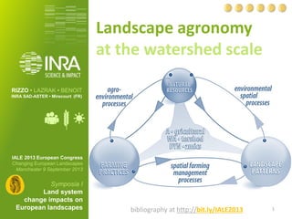
- 1. Landscape agronomy at the watershed scale IALE 2013 European Congress Changing European Landscapes Manchester 9 September 2013 Symposia I Land system change impacts on European landscapes RIZZO • LAZRAK• BENOIT INRA SAD-ASTER • Mirecourt (FR) 1 bibliographyathttp://bit.ly/IALE2013
- 2. D. RIZZOet al. | Landscape agronomy at the watershed scale IALE 2013 • Symposium 1 “Land system change impacts on European landscapes”Manchester 09/09/2013 biblioat bit.ly/IALE2013 A landscape agronomy perspective • landscapeagronomyconceptualmodel adaptedfromBenoit, Rizzoet al. 2012 [LP] temporal and spatialconfigurations [FP] of agricultural land uses [NR] withintheircontextinrelation to water quality * on land system architecture cf. Turner II et al., 2013 hierarchicalapproachto support watershedmanagers atdealing withLUCC to addressland system architecture* atthe watershedlevel AIM .02
- 3. D. RIZZOet al. | Landscape agronomy at the watershed scale IALE 2013 • Symposium 1 “Land system change impacts on European landscapes”Manchester 09/09/2013 biblioat bit.ly/IALE2013 Hierarchical approach stream order cf. Strahler1957 aggregationof the PWs PrimaryWatershed segmentationof the PW new spatial unitscombining PW & agricultural dynamics new spatial unitscombining agricultural dynamicswithinthe PW biggerStrahlerorder Strahlersub-order definedby spatial configuration of agricultural LU & naturalresources landscapepatterns .03
- 4. D. RIZZOet al. | Landscape agronomy at the watershed scale IALE 2013 • Symposium 1 “Land system change impacts on European landscapes”Manchester 09/09/2013 biblioat bit.ly/IALE2013 Material& Methods •Land use stratifiedsamplingTerUtipoints for 90 land use classes for the period1981-2010 •land use return times5 yearstemporal slidingwindowon 11 land use groups •Prim. Waters. clusteringHierarchicalclus. on Principal Comp. (FactoMiner, Houssonet al., 2012) •mapsof homogeneousLU sequencedynamics •seriesof satellite imagesmapsof 6 land coverclasses for the period1997-2008 •adjacent pixel withsimilarLC sequences •temporo-spatial segmentationHiddenMarkov Model withinthe PW (Arpentage, Mari et al., 2013) •synchronicimage of land coverchanges aggregation• predefinedspatial units segmentation • custom groups of pixels .04
- 5. D. RIZZOet al. | Landscape agronomy at the watershed scale IALE 2013 • Symposium 1 “Land system change impacts on European landscapes”Manchester 09/09/2013 biblioat bit.ly/IALE2013 Aggregation(Meuse and Moselle) stable unstable (barley, mixed, semi-natural) barley‘80 rapeseed- wheat mixed farming crops‘80 semi- natural stable .05 16 PWs(~24k Km2) 11 land use groups, 1981-2010 6 clusters with 2 major dynamics intensification extensification
- 6. D. RIZZOet al. | Landscape agronomy at the watershed scale IALE 2013 • Symposium 1 “Land system change impacts on European landscapes”Manchester 09/09/2013 biblioat bit.ly/IALE2013 Segmentation (Yarprimarywatershed) .06 1 PW (~60Km2) 6 land coverclasses years1997-2008 5 groups of pixels with1 gatheringcropdynamics Corgne, 2004 Lazrak 2012, PhDThesis Mari et al., 2013 Arpentage
- 7. D. RIZZOet al. | Landscape agronomy at the watershed scale IALE 2013 • Symposium 1 “Land system change impacts on European landscapes”Manchester 09/09/2013 biblioat bit.ly/IALE2013 Conclusions Focussing on temporo-spatial dynamics of (agricultural) land use for natural resource spatial units (watershed) can enhance the understanding of the land system architecture aggregation• predefinedspatial units segmentation• custom groups of pixels Reinterpreting watershed hierarchy on homogenous land management units can help match action spaces of relevant managers and coordinating landscape level decision-making Rizzo et al., 2013 Farming systems designing landscapes Danish Journal of Geography (under review) (take-home message) .07
- 8. D. RIZZOet al. | Landscape agronomy at the watershed scale IALE 2013 • Symposium 1 “Land system change impacts on European landscapes”Manchester 09/09/2013 biblioat bit.ly/IALE2013 Thankyoufor the attention ! .08 • bibliographyatbit.ly/IALE2013 Davide RIZZO INRA SAD-ASTER Mirecourt (FR) • e-mail ridavide@gmail.com • twitter@pievarino • websitebit.ly/RizzoD anyquestion?