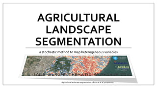
Agricultural landscape segmentation: a stochastic method to map heterogeneous variables

Agricultural landscapes are composed of many land management units. Involved stakeholders or specific research foci can define these units differently (Straume, 2014; Zanten et al., 2013); therefore, their study requires innovative approaches able to address temporal and spatial dynamics using multiple data sources (Brown et al., 2013). Methods to do so, in the literature, differ mainly in disciplinary backgrounds and study targets (e.g. environmental protection, conservation of cultural features). In this context, agronomy appears to have a marginal role because of relatively little interest in spatially explicit and context-related issues in agriculture. Accordingly, the emerging landscape agronomy field claims for to increase understanding of interactions between farming practices and natural resources at the landscape level (Benoît, Rizzo et al., 2012). We aimed to develop a method able to handle heterogeneous spatial data when defining land management units. We tested a stochastic data mining method originally developed for temporal and spatial modelling of agricultural land uses (Mari, Lazrak, & Benoît, 2013). We stressed the Markov random field (MRF) assumption of this method by assuming that characteristics of a spatial unit depend on characteristics of neighbouring units. The study was carried out on a Mediterranean terraced olive grove farming system (62 km 2 , Monte Pisano, central Italy). Different sets and classifications of variables were tested based on natural and management issues. Finally, the landscape was segmented using six variables: geology, aspect, morphology, land cover, terrace type and proximity to roads. The layers were sampled on a regular point grid, and then the MRF was approximated to a hidden Markov model using a space-filling curve. Results consisted of a set of maps of agro-environmental land management units and a hierarchy of related landscape characteristics. This exploratory method can improve landscape research by providing a rapid assessment of heterogeneous data in a spatially explicit way. _______________ suggested citation: Rizzo D, Mari JF, Marraccini E, Lazrak EG (2014) Agricultural landscape segmentation: a stochastic method to map heterogeneous variables. 1st IALE-Europe Thematic Workshop: Advances in Spatial Typologies: How to move from concepts to practice? Lisbon (Portugal). http://bit.ly/1Ag59mV

Recommended
Recommended
More Related Content
What's hot
What's hot (19)
Similar to Agricultural landscape segmentation: a stochastic method to map heterogeneous variables
Similar to Agricultural landscape segmentation: a stochastic method to map heterogeneous variables (20)
More from Davide Rizzo
More from Davide Rizzo (20)
Recently uploaded
Recently uploaded (20)
Agricultural landscape segmentation: a stochastic method to map heterogeneous variables
- 1. AGRICULTURAL LANDSCAPE SEGMENTATION a stochastic method to map heterogeneous variables Agricultural landscape segmentation • Rizzo et al. • Symposium 1
- 2. Researchgroup RIZZO Davide INRA SAD-ASTER Mirecourt(France) MARI Jean-François Universitéde Lorraine, LORIA & CNRS UMR 7503 Vandoeuvre-lès-Nancy F-54506, France INRIA Villers-lès-Nancy, F-54600 France MARRACCINI Elisa ScuolaSuperioreSant’Anna Institute of Life Sciences Pisa (Italy) LAZRAK El Ghali INRA SAD-ASTER Mirecourt(France) IALE-Europe Thematic Workshop 4th July 2014 Agricultural landscape segmentation • Rizzo et al. • Symposium 1 2
- 3. Introduction#1 | Agriculturallandscapemanagement Agricultural landscapes are composed of many land management units. Involved stakeholders or specific research foci can define these units differently Innovative approaches to address temporal and spatial dynamics using multiple data sources IALE-Europe Thematic Workshop 4th July 2014 Agricultural landscape segmentation • Rizzo et al. • Symposium 1 3 biblioat http://bit.ly/IALE2014 Straume, 2014 Zantenet al., 2013 Brown et al., 2013Rizzo et al., 2013
- 4. Introduction#2| Landscapeagronomy IALE-Europe Thematic Workshop 4th July 2014 Agricultural landscape segmentation • Rizzo et al. • Symposium 1 4 Agricultural land uses: randomly distributed among fields managed by farmers ? Understanding how spatial organization & temporal evolution of farming practices reveal logical processes and driving forces Benoît, Rizzo et al., 2012 a major challenge for landscape agronomists biblioat http://bit.ly/IALE2014
- 5. Aim| context-wiselandscapesegmentation IALE-Europe Thematic Workshop 4th July 2014 Agricultural landscape segmentation • Rizzo et al. • Symposium 1 6 Arpentageis a HMM based software specifically developed to perform (un)supervised segmentations of agricultural landscapes Developed to map crop sequences as support to evaluate agricultural impact on water quality and on biodiversity Mari et al. 2013 biblioat http://bit.ly/IALE2014 Test this method in new contexts with an explicit landscape agronomic approach Profileof heterogeneousspatialdata insteadof (crop) time sequences Focus on abandonedareasin a Mediterraneanterracedlandscapedominatedby olive groves Mignolet2008 Lazraket al. 2009 Temporospatialmethod… …to maplandscaperegularities HMM= Hidden Markov Model
- 6. Methods#1 | Landscapesegmentation IALE-Europe Thematic Workshop 4th July 2014 Agricultural landscape segmentation • Rizzo et al. • Symposium 1 7 Mari et al. 2013, EMS • Lazraket al. 2009& Schaller et al. 2012, Lands Ecol biblioat http://bit.ly/IALE2014 Space dominant sequenceof images Software for LUCC analysis generally implement unsupervised clustering on spatial entities based on space-dominant attributes Data mining approaches involving clustering of sequences allowed knowledge extraction to get a landscape description in terms of land-use patterns Time dominant image of sequences
- 7. IALE-Europe Thematic Workshop 4th July 2014 Agricultural landscape segmentation • Rizzo et al. • Symposium 1 8 temporal segmentation Linear Ergodic* spatial segmentation (andtransition analysis) *all states are inter connected Markov chain land use of a given field in a year depends only on the land-use of the recent previous years in the same field. Markov random field land use of a given field depends only on the land-use of the neighboring fields probably the 1stsoftware in the agronomic area implementing a time-dominant model and processing time-space data. It relies on a stochastic principle to model time space landscape regularities on 2 Markovianassumptions free download: http://www.loria.fr/~jfmari/App Methods #2 | ArpentAge French acronym for: Landscape Regularities Analysis: Environment, Territory, Agronomy Arpenteris a French verb meaning to survey
- 8. Methods #3 | Approximating a MRF by a HMM IALE-Europe Thematic Workshop 4th July 2014 Agricultural landscape segmentation • Rizzo et al. • Symposium 1 9 the Hilbert-Peanofractalcurve isusedto approximatethe MarkovRamdomField (MRF) assumptionthrougha HiddenMarkovModel (HMM) a space filling curve allows to approximate the 2D as a simple chain Lazrak2012, PhD thesis biblioat http://bit.ly/IALE2014
- 9. Methods#4 | hierarchicalmodel IALE-Europe Thematic Workshop 4th July 2014 Agricultural landscape segmentation • Rizzo et al. • Symposium 1 10 HierarchicalHMM isstrictlyergodicto segment the landscapeintopatches of homogeneoustime sequences Each “super state” of a “super model” is a HMM (generally linear) to describe the (time) sequences Twostochasticprocessescan be represented, the first (hidden) driving the second(knwonand visible) HMM= Hidden Markov Model Combiningheterogeneousdata to deal with drivers of management dynamics(insteadof pixels) ArpentAgeinstead of clustering because “context- wise” (cf. fractal curve) Context-wiselandscapesegmentationfocusedon management relatedvariables
- 10. Materials#1 | studyarea: Monte Pisano IALE-Europe Thematic Workshop 4th July 2014 Agricultural landscape segmentation • Rizzo et al. • Symposium 1 12 Mediterranean terraced olive grove farming system (62 km2)
- 11. Materials#2 | input data IALE-Europe Thematic Workshop 4th July 2014 Agricultural landscape segmentation • Rizzo et al. • Symposium 1 13 Markov random field approximated to a hidden Markov model using a space-filling curve Layers were sampled on a 10m regular point grid Geology 5 cl. • anthropic • alluvial & sand-loam sediments • quartzes • limestone • schist Orientation 4 cl. N, S, E, W Morphology 4 cl. • Plains • valleys • slopes • ridges Land cover 14 cl. • Urban • garden • cultivated olive groves • abandoned olive groves • vineyards • orchards • arable lands • fallows • garigues• outcrops • wetland vegetation • water • pine wood • wood Terracetype 5 cl. (bench) terraces • talwegs• pocket terraces • broad field terraces • extensive Dry-stonewalldensity 6 cl. From 0to 44.5 m/ha (natural breaks)
- 12. Results#1 | an output map IALE-Europe Thematic Workshop 4th July 2014 Agricultural landscape segmentation • Rizzo et al. • Symposium 1 15 terraces talwegs extensive West exposedterraces periurban warmwoods coldwoods terracedgroves foothills hectares
- 13. Results#2 | variablesegmentation IALE-Europe Thematic Workshop 4th July 2014 Agricultural landscape segmentation • Rizzo et al. • Symposium 1 16 Three majorsmanagement regions: • Terracedgrovesmedium-high densityDSW on quartz, E-S orientedwith some gariguesand pine woods • Woodsmaydifferfor morphologyor exposition • Foothillsmaybe segmentedfor specificterracetypes, mix with urbanlandcover or plainmorphology The increasing segmentation allows to define a hierarchy of the variables Especially relevant for management issues periurban periurban
- 14. Results#3 | location of abandonedolive groves IALE-Europe Thematic Workshop 4th July 2014 Agricultural landscape segmentation • Rizzo et al. • Symposium 1 17 Eastern side prevalently associated to sand-loam sediment area, with low density terraced in valleys. A C B A B C Western side prevalently associated to the cluster grouping the foothills, with the prevalence of the anthropic bedrock and S-W exposition West exposedterraces periurban terracedgroves foothills
- 15. Conclusionsand perspectives IALE-Europe Thematic Workshop 4th July 2014 Agricultural landscape segmentation • Rizzo et al. • Symposium 1 18 Flexibilityof variables treated remote sensing map, census data, etc. Flexibilityof scale of analysis potentially no limit if input data are defined coherently to the research question variable choicee.g., what if we introduce proximity to road? input variable classificationtype and number of classes variable input qualitydifferent geometric scales HHMM parameterizationspacefillingcurve, numberof states Future applications could address the temporospatialcharacterization of agricultural practicesat the watershed scale Leverages… …and potentials
- 16. Participate! 9th IALE World Congress July 5-10, 2015 Portland, Oregon Landscape agronomy: advances and challenges of a new field addressing the management of rural land systems read more at http://bit.ly/IALE2015_Symposium_LA RIZZO Davide, FERGUSON Rafter Sass, BENOIT Marc, PADOA-SCHIOPPA Emilio contact & info ridavide@gmail.com IALE-Europe Thematic Workshop 4th July 2014 Agricultural landscape segmentation • Rizzo et al. • Symposium 1 19