
Recommended
More Related Content
What's hot
What's hot (20)
Viewers also liked
Similar to History and Current Status of the Corvallis Mill Race
Similar to History and Current Status of the Corvallis Mill Race (20)
Recently uploaded
Recently uploaded (20)
History and Current Status of the Corvallis Mill Race
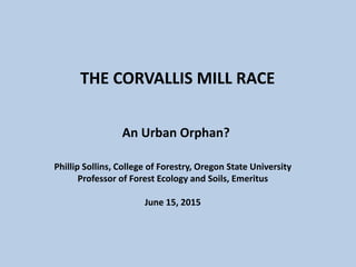
- 1. THE CORVALLIS MILL RACE An Urban Orphan? Phillip Sollins, College of Forestry, Oregon State University Professor of Forest Ecology and Soils, Emeritus June 15, 2015
- 3. Jackson-Frazier Park - OregonHikes.net
- 5. Flour Mill Wheel Ground Grain by Water Power
- 6. Mill Race Delivered Steady Water Supply to Mill
- 8. Diversion Dam – Inlet Structures Date Unknown
- 9. 1853
- 11. 1939 USGS Quadrangle Map
- 13. Abandoned Sluice Gate Partitioned water flow between Mill and overflow spillway
- 14. 1921 Survey G12500006 (CS212)
- 15. 1936
- 16. 1940
- 17. 1948
- 18. 1958
- 19. 1959 4/20
- 20. 1963
- 21. 1978
- 22. 1993
- 23. Dam Washout (1950-74) Caused Big Channel Change 1956 1993
- 24. Relocation of Mill Race between 1965 & 1969 19691965
- 25. 1981 City Plan for Realignment of Mill Race New Crystal Lake Dr. built in part atop old Mill Race channel
- 27. 1996 Flood Maximum Extent
- 28. Mill Race inlet under railroad spur in 1997 Installed 1960s when channel relocated - ~20 inch diameter
- 29. Day 1 – Installation of 20x12 ft culvert under SP railroad spur (1997)
- 30. 1997 – Day 2 - Installation of culvert under SP rr spur
- 31. Culvert (20’x12’) as installed under Evanite (1985) & Southern Pacific RR spur (1997)
- 32. View upstream from bridge at Crystal Lake Dr. Photo by Allen Throop(1997)
- 33. View downstream from Crystal Lake Dr. Photo by Allen Throop (1997)
- 34. South Corvallis Annexation History as of 2011
- 35. 2014
- 36. CONCLUSIONS • Multiple alterations - Mill Race “watershed” has been altered many times for over 200 years to meet changing needs. • Unintended consequences - Many of these changes have had unanticipated and undesirable consequences. • Lost history - We had lost the history of these changes and have not dealt adequately with the problems caused by them.
- 37. • Marys River flooding impact - Mill Race capacity is adequate except when Marys River overflows its banks at golf course and possibly at Mill Race inlet. • Willamette flooding impact - No alterations to the Mill Race will eliminate the periodic flooding of South Corvallis by the Willamette. CONCLUSIONS
- 38. Summer flow – Inadequate for good fish habitat. CONCLUSIONS
- 39. • Summer flow source – Summer source is mostly groundwater from the most industrialized part of Corvallis • Marys River - No practical way to increase summer flow w/o also increasing flooding from Marys R. overflow. CONCLUSIONS
- 40. • Storm water runoff - Winter water quality is poor because it’s almost entirely runoff from paved areas, roofs and Marysville Golf Course. • Bioswales- Water quality can and should be improved by installing bioswales throughout the watershed. CONCLUSIONS
- 41. Acknowledgements Doug Sackinger, Joe Mardis, Jason Hotchkiss (Benton County) Linda Stevens, Kevin Loso, Clay Brooks, and Matt Gressel (City of Corvallis); Mary Gallagher (Benton County Historical Museum) Dave Eckert (Corvallis Sustainability Coalition, Water Action Team) Bill Gellatly (Marys River Watershed Council) Charles Newlin (long-time Allen Street resident) Meghna Babbar-Sebens (OSU College of Engineering) Anita Ragan (H&V) Bill Pepper (Pepper Construction) OSU Library U of O Aerial Photo Library Literature Cited Christy JA, Alverson ER (2011) Historical vegetation of the Willamette Valley, Oregon, circa 1850. Northwest Science, 85, 93–107.
Editor's Notes
- This slide show is a work in progress and will be updated frequently as further research uncovers additional information. All of the aerial photos and many of the maps are included at their original full resolution. Use the zoom feature to see details.
- Note the Willamette and Marys Rivers, 99W, the Portland & Western railroad going south toward Monroe, the Marysville Golf Course, and Hollingsworth & Vose (formerly Evanite). The main flood point is at the bridge on 99W across the Mill Race. The nearest river gauges, at Harrison St Bridge and Bellfountain Rd. downstream from Philomath, are too distant to allow accurate forecasting of flooding in South Corvallis. This was seen in January 2015 when NOAA forecasted flooding but it didn’t happen.
- Pre-1800, parts of South Corvallis probably looked much like this – for example where wet prairie bordered riparian forest along the Marys River (see next slide). By the early 1800s, beavers had been extirpated by French trappers who hired native Americans to do the trapping. Next, the flat land was converted to agriculture by clearing forest and ditching wetlands. All of this led to well incised channels where none had existed before. This incision drastically reduced wildlife habitat and changed the flood dynamics of the entire Willamette Valley.
- Vegetation in the early 1850s (with current streets shown). The Mill Race channel was dug by Chinese labor following an existing wetland drainage path upstream to where Allen St. now ends. The new channel then turned almost due west toward the Marys River. Two tributary drainage paths flowed into Mill Race path. The eastern one is termed here Bridgeway Cr. in honor of its having been obliterated by the residential development along Bridgeway Ave. The western one is termed here Leonard Cr. for an analogous reason. Original map by Denis White based on paper by Christy and Alverson (2011).
- Fischer Mill, along the west bank of the Willamette, was powered by water from the Mill Race. The tower on the left appears also in the next slide.
- This photo from the early 1900s shows the annual tug-of-war between students at OSU and U of O held in conjunction with the “civil war” football game. Note the tower visible in the distance on the right.
- A diversion dam was built across the Marys River to channel water into the Mill Race. It was also a popular recreation site!
- The dam was maintained until the late 1940s when the Chapman hardboard plant stopped using the Mill Race for power. By the late 1960s it had deteriorated badly and the last remnants appear to have been washed out during the 1974 flood. Concrete structures, including the concrete fish ladder built in 1948, are still visible in the inlet area but thick cover of blackberry (and some poison oak) make assessment of the condition of the inlet difficult.
- Map published in 1853 by General Land Office. Note that Mill Race is shown as beginning just downstream from a substantial bend in the Marys River. However, the earliest aerial photo (1936, next slide) shows the Marys straightened both upstream and downstream from the dam. The Territorial Road at that time headed southwest after the ferry crossing on the Marys River, rather than due south as it does today.
- The Mill Race dam and inlet in 1936 (aerial photo). Note the very straight and wide reaches immediately upstream (SW) and downstream from the dam. These reaches were probably excavated in 1855 when the dam was rebuilt a third time after two previous dams had failed. By straightening these reaches the water flow was better aligned with the dam. Spoil from the upstream excavation appears to have been piled along the east bank of the river, creating a berm that has since prevented the Marys from overflowing along this part of the river. It overflows instead upstream, just past the next horseshoe bend. The flood waters then travel NE toward the railroad berm creating the swale topography seen at center bottom of the photo (now the Marysville Golf Course). The dam was last rebuilt in 1948, at which time a fish ladder was constructed adjacent to the eastern end of the dam. Downstream from the dam, a shorter reach of the of the Marys was likely also dug. Note also the abandoned river horseshoes to the NW of the new channel. These “magically” appeared on the 1939 USGS Corvallis quadrangle map as shown on the next slide.
- This is a greatly enlarged portion of the USGS 1939 Corvallis Quadrangle map showing the same area as the previous slide. The islands, bounded to the west by curved channels, did not appear on earlier versions this map. Note the almost perfect correspondence between these curved channels and the abandoned horseshoe bends that can be seen in the 1936 (and subsequent) aerial photos. These curved channels probably only become water filled when the Marys is at flood stage. The map was based on aerial photography taken by US Army in 1939, possibly during winter when water levels were high and trees were leafless. These channels continued to appear on USGS quadrangle maps until the 1997 revision.
- Note the Mill Race channel into the mill, the overflow spillway to the north, the diversion dam and straightened Marys River channel. The overflow swales through what is now Marysville Golf Course were largely blocked by construction of the Corvallis & Alsea Railroad in 1908. Bridgeway Cr., extending from behind Lincoln School to the Mill Race, and Leonard Cr. show up nicely in this photo.
- Abandoned between 1965 and 1969, when Mill Race was rerouted as surface ditch north across Evanite into the Marys River. Channel was not back-filled until 1984. No date is yet known for the construction of this structure.
- South Corvallis has long been the most heavily industrialized portion of Corvallis. In 1921, three petroleum product tank farms were in place along 99W just S of the former Southern Pacific railroad spur. The Shell lot includes access to railroad spur (still there in 2015 , property of Corvallis Rental). The Standard Oil lot has been vacant since about 1980 following removal of the last Dog Face Lumber structures (see below) and is possibly still contaminated. The Union Oil lot is now the site of Pacific Pride commercial fueling.
- Note creek draining under railroad spur about half-way between 99W and Mill Race, then through what’s now H&V. Remnants of that creek (culvert under railroad spur and various ditches) are still present (2015). Bridgeway Cr. much in evidence.
- Still no development along Mill Race between 99W and the railroad spur.
- Log pond for the Dog Face Lumber Company (Lester Harvey) first appears in this aerial photo. Area on opposite side of Mill Race was not yet in use for storing saw logs. Bridgeway graded but no houses yet constructed.
- First houses built along Bridgeway. Dogface Lumber log pond still in use.
- Dogface Lumber at its peak. More houses built along Bridgeway but creek still quite visible.
- Dogface sawmill no longer in use. Bridgeway house construction almost complete. Mill Race still drains into Willamette. Evanite battery separator and glass fiber plants not yet built.
- Evanite pond built. Corvallis Rental in place. Dogface sawmill structures removed. Mill Race drains across Evanite between battery separator and glass fiber plants (hard to see due to poor resolution of photo).
- Public storage buildings built upon site of log pond. Note no vegetation along Mill Race from Evanite to south of the public storage site. Martial Arts not yet built. Railroad spur still crosses entrance to Evanite.
- Shows dam and inlet structure. Dam maintenance stopped in about 1950, but the dam was still largely intact in this 1956 photo. It was well breached at western end by 1970. The last remnants washed out in the 1974 flood, except for the Mill Race inlet structures, which were still present in 2014. The 1993 photo shows the extensive erosion of the neck of land extending NW downstream from the former dam site (Charles Newlin property). The Marys will very likely cut through the remaining narrow neck in the next few floods. Channel changes will then likely propagate downstream all the way to Avery Park
- Sometime between 1965 and 1969 the entire downstream portion of the Mill Race was relocated. In 1965 (photo on left) the Mill Race still flowed toward, although possibly not through, the hardboard plant and also through the overflow spillway to the north. By 1969 photo on right), a narrow, and possibly quite shallow, surface ditch had been dug almost due north into the Marys River. Note the abrupt 90o turn to the left. A 30” culvert was installed under Crystal Lake Drive and a 20” culvert under the Southern Pacific railroad spur. As discussed later, these culverts were grossly undersize. Note that in 1969 the Mill Race was well forested from west of 99W all the way to 90o bend at the start of the newly dug surface ditch.
- The original intersection of Crystal Lake Dr. and 99W, at the current site of Chapman Pl. just N of the Co-op, had been a traffic nightmare ever since the second bridge was built across the Marys River. The City and Evanite both wanted the intersection moved south to where Avery Dr. entered from the west. Evanite’s goal was to eliminate public traffic across its property. The City also recognized the need to redesign the Mill Race, eliminating the 90o left turn and increasing the capacity of the new channel to match that of the original portion. Enginering plans for the relocation of Crystal Lake Dr. and the Mill Race were finalized in 1981. The work was done in 1984 by Pepper Construction. Included in the contract was backfilling those parts of the Mill Race that had been abandoned but were not covered over by the newly constructed Crystal Lake Drive.
- Lidar shaded relief, acquired in 2008, shows Crystal Lake Dr. as relocated in 1984, and the Mill Race as relocated in 1985. Evident also are the remnants of Bridgeway Cr. and the abandoned Marys River meanders west of the inlet to the Mill Race.
- The Marys River peaked on Wednesday (2/7) but then dropped only inches until after Willamette peaked on Friday, which is when this photo was flown. The Willamette peaked at 219.1 ft (at old Van Buren St gauge but converted to NGVD88) . As best we can determine, the Willamette backed up the Marys to a point just upstream from Avery Park and backed the Mill Race up to between the Bridgeview and Lilly Ave. bridges. On the day of this photo (February 9), water was still overflowing the Marys south of the golf course, the majority flowing under the southern of the two railroad trestles and following the ditch immediately to the east of the railroad berm until it intersected the Mill Race just under the northern railroad trestle. From here the flow path split with some water flowing northeast along the Mill Race despite the back-up of water from the Willamette. The majority, however, flowed west under the railroad trestle, through the Allen St. neighborhood (where residents recall white-water between several of their houses), then back into Marys well upstream from Avery Park. Note that the 20 inch culvert under railroad spur had not yet been replaced with the current 20x12 foot culvert. This probably contributed to the long duration of the flooding.
- Until 1985 the culverts under both Crystal Lake Dr. (at its original location) and the Southern Pacific railroad spur were totally inadequate to handle even a major rainstorm, much less overflow from the Marys. In the early 1980s the City began planning to greatly enlarge the channel through Evanite. In November 1984 Evanite requested that the City enclose the Mill Race in a large buried culvert where it crossed the Evanite property. Evanite agreed to pay the extra costs involved in buying and installing the culvert. Work began on July 15. On August 6 the project was shut down due to trichlorethylene (TCE) fumes encountered during the excavation. The project was restarted on Sept. 23 with CH2M Hill providing equipment to analyze each shovel-full of soil removed by the excavator for TCE. Soil exceeding 20 ppm TCE was trucked to the Arlington hazardous waste disposal site. It is unclear what was done with soil that tested below this limit. For reasons unknown at present, the pipe under the railroad spur was not replaced until 1997.
- Day 1 (1997) of the culvert replacement under the railroad spur. Note the 20” diameter pipe that had been in place since the Mill Race was relocated in the 1960s.
- Day 2 of the excavation. Amazing what two excavators can do in one day, especially with no TCE to worry about.
- Shows the size of the finished culvert.
- Note low summer flow. The 1993 and 2000 aerials show almost no trees until upstream from the bend shown in this photo .
- View north from relocated Crystal Lake Dr. during culvert installation under railroad spur. Note lack of trees. The Mill Race was cleaned of trash and all trees and shrubs regularly until perhaps 1997. There have been no changes to the Mill Race since 1997 except for letting trees seed in naturally along with copious amounts of Himalayan blackberry. The culvert under Allen is now completely blocked and the Mill Race is cut off from its original source except when the Marys River overflows its banks at the southern end of the golf course.
- The annexation history is important because it determines when various portions of the Mill Race and Evanite passed from County to City responsibility. The first annexation (1962) included only the extreme western portion of the Evanite property but did include most of the portion of the Mill Race that was rerouted between 1965 and 1969. The second (1973) annexation included all the remaining Evanite property but somehow did not include Crystal Lake Dr. This was remedied in the 1981 annexation. The last portions of the Evanite property were not annexed until 1988.
- Note continued erosion on both sides of neck of land just downstream from the former dam site. Also the overflow swale features still present trending SW-NE across the golf course.
- City stormwater and bioswales