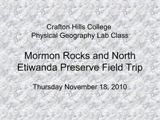
1. Mormon Rocks and North
Etiwanda Preserve Field Trip
Thursday November 18, 2010
Crafton Hills College
Physical Geography Lab Class
2. Meeting Time and Location
• Meet at the MacDonald's located at the 15
FWY and HWY 138, the address is:
– 3230 Wagon Train Road, Phelan, CA 92371
• The meeting time is 2 PM.
– From this location we will caravan into
Mormon Rocks.
– Driving directions have been posted on
Blackboard and on the class website.
3.
4. What is Required:
• You must bring a camera and a notebook.
• You are required to take pictures and you
will create a photo journal.
• A handout will be given when we meet
detailing what you will need to photograph.
5. • The following slides contain some
information about the places we will be
going.
• The last few slides are example photos so
you can see how you can highlight and
label items in your photos.
7. The San Andreas fault runs nearly 400 miles from
San Francisco out to the Salton Sea and Imperial
Valley of Southern California.
Along the legnth through the San Gabriel
Mountains, folding along the
fault has occurred between the North American
and Pacific Plates.
The result: interesting rock
formations between the Antelope Valley (14)
Freeway and the Cajon (15) Freeways along
Highway
138.
The Mormon Rocks, Devil's Punchbowl. and
Vasquez Rocks are all areas where underlying
sedimentary rocks have been pushed through
eroded soils from the San Gabriel Mountains to
reveal
themselves as very interesting and beautiful
formations of smooth and sloping rock formations.
San Andreas Fault
8. In 1851, Amasa Lymand and Charles Rich led a band of Mormon settlers from Salt Lake City across the
Mojave Desert. A smoother route (rather than the original Mojave Indian Trail) was needed to enter their
"Promised Land", the San Bernardino Valley.
For centuries, Native Americans had approached the mountains on foot and horseback along the
Mojave River from the north. They continued up Sawpit Canyon near Crestline, and entered the Valley
by Devil's Canyon behind the site of the present state college.
Early explorers, including Jedediah Smith, Ewing Young and Kit Carson traveled this route. But with the
gradual build-up of wheeled traffic as part of the young United States' westward expansion, "the box " or
"El Cajon " began to acquire its importance for generations of Americans.
9. The Union Pacific,
Southern Pacific and the
Santa Fe railroads, US
Highways 91, 395, 66
and 1-15, natural gas
and oil pipelines,
electrical power
transmission facilities,
and hydraulic facilities at
Lake Silverwood, have
made the Pass a virtual
lifeline for the huge
urban population of
Southern California.
Today, 50 freight trains and four passenger trains push through the Pass daily.
10. Pockmarked and weather-
worn though they appear,
the Mormon Rocks are a
series of cemented
sandstone beds much
more resistant to erosion
than the surrounding
gravel and silt sands.
Mormon Rocks is an area of sandstone
blocks exposed to the elements through
plate tectonics. Located along the San
Andreas Fault in the San Andreas Rift
Zone.
The formations are spread out for
some distance along Route 138 and
also onRoute 2, both roads leading
to the town of Wrightwood. This
area is one of the youngest and
most active geological regions in
North America.
11.
12. North Etiwanda Preserve
The North Etiwanda Preserve was established as a
habitat preservation area on February 10, 1998, when
the San Bernardino County Board of Supervisors
accepted mitigation land from San Bernardino
Associated Governments (SANBAG) for impacts related
to construction of the 210 Freeway.
The initial 762 acres acquired for the North Etiwanda
Preserve consisted primarily of a unique Riversidean
Alluvial Fan Sage Scurb plant community and was
purchased by SANBAG to be preserved as natural
habitat for impacts to the Costal California Gnatcatcher
and similar habitat consumed by the development of the
freeway. Ongoing conservation efforts have enabled
expansion of the Preserve to over 1200 acres.
13. ***POINTS OF INTEREST***
A. Remnants of Water
Delivery System
B. Native American Cultural
Site
C. Riparian Wetland
D. Early Settlers Ruin
E. Stone Terrace &
Shelterbelt
F. Antique Pumping Station
G. Water Gauging Station
H. Panoramic Viewing Area
I. Fresh Water Cienega
J. Earthquake Fault Zone
14. From the 210 Freeway
Exit Day Creek Boulevard in the City of Rancho Cucamonga and head north.
Proceed on Day Creek Blvd 2.2 miles until you reach Etiwanda Avenue.
Day Creek will veer east and end at Etiwanda Avenue.
Take Etiwanda Avenue north approximately .3 mile until the pavement ends.
Continue on dirt road approximately 600 feet to the designate gravel parking area.
Directions:
The North Etiwanda
Preserve is located at the
northern terminus of
Etiwanda Avenue in the
foothill
area above Rancho
Cucamonga.
15.
16. The Etiwanda Fan is home to a
number of endangered,
threatened, and sensitive
species that include, but are not
limited to, the Coastal California
Gnatcatcher, Southwestern
Willow Flycatcher, Least Bell’s
Vireo, San Bernardino Kangaroo
Rat, Bell’s Sage Sparrow,
Rufous-crowned Sparrow, San
Diego Horned Lizard, Los
Angeles Pocket Mouse,
Plummer’s Lily, and Mariposa
Lily.
California Sage
18. The Etiwanda Fan
The Etiwanda Fan is
located in the
southwest corner of
San Bernardino
County California in
the foothills of the San
Gabriel Mountains and
north of the City of
Rancho Cucamonga.
Although much of the
fan has been altered
by flood control
practices, sand
mining, and urban
development, large
areas of the Etiwanda
Fan are minimally
disturbed by human
activities.
North Etiwanda Preserve
19. Habitats on the Etiwanda Fan are composed of Oak Woodland, Chaparral, Coastal Sage
Scrub, Alluvial Fan Sage Scrub, White Alder/Willow Riparian, Sycamore/Oak Riparian,
and non-native grassland.
It is estimated that 75% to
90% of all Coastal Sage
Scrub habitats have been
extirpated from Southern
California and the Etiwanda
Fan is one of three
remaining expanses of
Alluvial Fan Sage Scrub.
Most imperiled of these is the Coastal Sage Scrub habitat and is sub-association of
Alluvial Fan Sage Scrub, which are state threatened and rare natural communities.
In addition, the Preserve
and surrounding lands also
contain significant amounts
of other rare and
threatened habitats that
include Sycamore Alluvial
Woodland, California
Walnut Woodland, and
Fresh Water Marsh.
20. COASTAL SAGE SCRUB
Coastal sage scrub is generally found on dry, rocky slopes of mountains and hillside
below 3,000 feet in elevation. On the Etiwanda Fan, coastal sage scrub is found on
the lower slopes. The Coastal Sage Scrub climate is characterized by annual rainfall
of 10-20 inches primarily falling during the winter, hot dry summers, and an 8-12
month growing season with 230-350 frost-free days. Coastal Sage Scrub vegetation
is less dense than chaparral and grows to 1-5 feet tall. Coastal Sage Scrub is a
drought-adapted community. Coastal Sage Scrub communities have fewer fire-
adapted plants than Chaparral and may take longer to recover after a fire. Indicator
species include California Sagebrush (Artemisia californica), White sage (Salvia
apiana), Black Sage (Salvia mellifera), California Buckwheat (Eriogonum
fasciculatum), Lemonadeberry (Rhus integrifolia), and California Brittlebush (Encelia
californica).
Coastal Sage Scrub at Torrey Pines State Park
This photo was taken at Torrey Pines,
notice the similarity between this area
and the one at the North Etiwanda Preserve.
21. Alluvial fan sage scrub is a sub-type of coastal
sage scrub found on the alluvial fans and flood
plains of the coastal side of the San Bernardino
and San Gabriel Mountains.
The climatic features of alluvial fan sage scrub
are similar to those for Coastal Sage Scrub, but
differ in the frequency and intensity of surface
flooding that occurs within the habitat. The soil
is a complex, unsorted structure of alluvium
composed of boulders, rocks and sands.
The vegetation is less dense than that of
coastal sage scrub when it occurs in river
channels where it is subject to frequent
flooding. The primary indicator plant for alluvial
fan sage scrub is Scale-broom (Lepidospartum
squamatum). Alluvial Fan Sage Scrub
Communities have been severely altered by
flood control activities that circumvent the
periodic flooding necessary to maintain the
habitat, leading to the gradual type conversion
of this unique community type. The State of
California considers Alluvial Fan Sage Scrub to
be a very threatened and rare natural
community.
All remaining significant expanses of
alluvial fan sage scrub habitats now
occur only in San Bernardino County,
specifically on the Etiwanda Fan, Lytle
Creek, Cajon Creek and the Santa Ana
River.
ALLUVIAL FAN SAGE SCRUB
22. RIPARIAN
Riparian communities are found along
side perennial (annual) or ephemeral
(seasonal) watercourses. On the
Etiwanda Fan, small remnants of
riparian are scattered on the upper
slopes and canyons.
The climate regime is the same as that for
the surrounding communities with the
exception of the moisture gradients afforded
by the presence of the watercourse.
Indicator species include Fremont
Cottonwood (Populus fremontii), Western
Sycamore (Platanus racemosa), a number
of willow species (Salix spp.), and Mule Fat
(Baccharis salicifolia). The largest tracts of
riparian in the North Etiwanda Preserve are
found within Day Canyon and Etiwanda
Creek. Over-story components in Day
Canyon and Etiwanda Creek vary and may
include White Alder (Alnus rhombifolia),
Canyon Live Oak (Quercus chrysolepis),
numerous willow species and Western
Sycamore. Under-story components
frequently consist of Poison Oak
(Toxicodendron diversilobum), California
Wild Grape (Vitis californica), shade tolerant
shrubs, ferns and non-native grasses.
23. FIRE
The wildfires of October 2003 burned nearly all of the
vegetation on the Etiwanda Fan. Not discounting the
tragic loss of life and property, the fire on the Preserve
and Etiwanda Fan is not the ecological disaster it
might appear to be. Biological systems are dynamic
and resilient. And, fire is a frequent and natural
component to many southern California ecosystems.
When left undisturbed after a major fire, the plant
and animal communities on the Preserve and
Etiwanda Fan will recover as they have always
done in the past. Plant recovery can come from
seed germination and crown sprouting. Many fire-
adapted plants will re-sprout after a fire from the
root crown at and below the soil surface. Re-
sprouting can be immediate and generally results
in the same pre-fire vegetative community.
When fire intensity is high,
root crowns may not survive
the intense heat. In these
instances, plant recovery
comes from the existing seeds
bank. In most fires, recovery
of the vegetative community
comes from both crown
sprouting and seed
germination. How long the
recovery of the vegetation
communities will take can be
highly variable and heavily
dependent on fire intensity,
amount of annual rainfall, the
timing of the annual rains, and
the absence of further large-
scale disturbances.
25. Water
Water diversions and flood control
change the alluvial scrub habitats
and have played a large part in the
destruction of this once abundant
but now rare habitat.
26. • The following slides have photos that have
been digitally highlighted to give you an
example of how to properly label your
photos.
27. These photos are examples of
some of the plant species in the
North Etiwanda Preserve.