Geography Options Presentation
•
1 like•677 views

A presentation about geography as an option at secondary school level.

Recommended
Recommended
More Related Content
What's hot
What's hot (19)
Similar to Geography Options Presentation
Similar to Geography Options Presentation (20)
Recently uploaded
Recently uploaded (20)
Geography Options Presentation
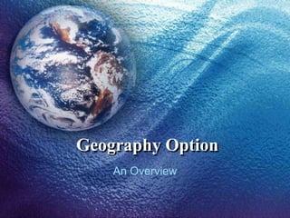
- 1. Geography Option An Overview
- 2. Geography Geography is a multidisciplinary subject which can be combined with a variety of subjects. Some popular combinations are; Geography and History Geography and Social Studies Geography and Biology Geography and Graphical Communication Geography and Computer Studies
- 3. Syllabus Structure The syllabus is structured on 4 areas of study; Map Skills Human Geography Physical Geography Fieldworks Each area is divided into different topics.
- 4. Map Skills 1 Map Reading and Interpretation of Ordnance Survey Sheets This area includes basic cartographic skills, recognition of landforms resulting from river, ice and marine erosion, Interpretation of settlements, urban/rural land-use patterns, communication patterns and location of economic activity.
- 6. Physical Geography 2 The Earth as a Planet 3 Rocks and Soils 4 Plate Tectonics 5 The Hydrological Cycle and Rivers 6 Coasts 7 Ice Landscapes 8 Hot Deserts 9 Weather and Climate 10 World Climates and Ecosystems
- 7. Human Geography 11 Population 12 Settlement 13 Urbanisation 14 Industrial activity 15 Agriculture 16 Tourism 17 World Development 18 Energy Resources
- 8. Fieldwork Fieldwork activities are specified by the Matsec Board as these provide hands-on practice. (a) Rural fieldwork (i) Settlement Pattern Study (ii) Agricultural Land-use (iii) Micro-biogeography
- 9. (b) Urban fieldwork (i) Settlement pattern study (ii) Functions of settlement (iii) Traffic problems and solutions (iv) Shopping activities in various parts of a city
- 10. (c) Fieldwork in coastal areas A survey of coastal erosion. A survey of coastal deposition. A survey of coastal man-made structures.
- 11. Weather observation (a) Temperature (b) Humidity (c) Rainfall (d) Atmospheric Pressure (e) Wind (f) Clouds (g) Visibility
- 12. Geography in Post-Secondary Junior College – Intermediate – Geography A-Level – Geography University - B.A. (Hons.) – Geography B.Ed. (Hons.) – Geography
- 13. Geography in the world of jobs Teacher Planner (transport + settlements) Cartographer GIS Specialist Geologist / Pedologist Meteorologist Census Analyst Property Appraisal Tourist Guide / Travel Agency
- 14. The End Mr. C. Formosa (2008)