Compliance Report Outline
•
0 likes•92 views

The compliance report must be submitted within one year of receiving the NOC from CGWA and should include: 1. Details of the proposed project, location, compliance conditions, and details of constructed tubewells including their depth, diameter, lithology, pump details, discharge rates, and locations. 2. Monthly water usage data from installed water meters on tubewells and average daily consumption. 3. Groundwater quality and water level data from tubewells and piezometers. 4. Details of artificial recharge and rainwater harvesting measures implemented along with designs, structures, recharge computations, locations, and photographs.

Recommended
Recommended
More Related Content
What's hot
What's hot (20)
Similar to Compliance Report Outline
Similar to Compliance Report Outline (20)
More from Amardeep Jadeja
More from Amardeep Jadeja (20)
Recently uploaded
Recently uploaded (20)
Compliance Report Outline
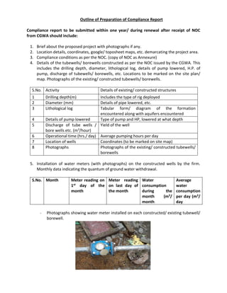
- 1. Outline of Preparation of Compliance Report Compliance report to be submitted within one year/ during renewal after receipt of NOC from CGWA should include: 1. Brief about the proposed project with photographs if any. 2. Location details, coordinates, google/ toposheet maps, etc. demarcating the project area. 3. Compliance conditions as per the NOC. (copy of NOC as Annexure) 4. Details of the tubewells/ borewells constructed as per the NOC issued by the CGWA. This includes the drilling depth, diameter, lithological log, details of pump lowered, H.P. of pump, discharge of tubewells/ borewells, etc. Locations to be marked on the site plan/ map. Photographs of the existing/ constructed tubewells/ borewells. S.No. Activity Details of existing/ constructed structures 1 Drilling depth(m) Includes the type of rig deployed 2 Diameter (mm) Details of pipe lowered, etc. 3 Lithological log Tabular form/ diagram of the formation encountered along with aquifers encountered 4 Details of pump lowered Type of pump and HP, lowered at what depth 5 Discharge of tube wells / bore wells etc. (m3/hour) Yield of the well 6 Operational time (hrs./ day) Average pumping hours per day 7 Location of wells Coordinates (to be marked on site map) 8 Photographs Photographs of the existing/ constructed tubewells/ borewells 5. Installation of water meters (with photographs) on the constructed wells by the firm. Monthly data indicating the quantum of ground water withdrawal. S.No. Month Meter reading on 1st day of the month Meter reading on last day of the month Water consumption during the month (m3/ month Average water consumption per day (m3/ day - Photographs showing water meter installed on each constructed/ existing tubewell/ borewell.
- 2. 6. Ground water quality both for pre-monsoon & post monsoon period for the tubewells/ borewells and piezometers constructed within the project area. - Water quality analysis of water samples collected during April/ May and November from Accredited Laboratory. 7. Water level data for the tubewells/ borewells existing/ constructed within the project area. 8. Details of artificial recharge & rainwater harvesting measures implemented by the firm with details indicating designs, type & number of recharge structures/ shafts; quantum of water recharged/ proposed to be recharged per annum; impact of recharge; photographs of the constructed recharge structures, etc. - Details of recharge computations for roof top; paved/ roads; open; green belt. - Designs of the implemented recharge structures (both plan and section view). - Location of the recharge structures implemented within the project premises (on layout plan). - Photograph of the implemented recharge structures. - Computation of runoff from the catchments intended to divert to the pond/ ponds (if any). - Location of constructed pond/ ponds (on layout plan). - Design of recharge shaft/ shafts constructed within the pond/ ponds. - Photographs of the recharge structures along with pond/ ponds. - Computation of recharge quantum along with photographs implemented outside the project area (viz. ponds with recharge shafts; check dams/ nala bunds/ cement plugs; gabion structures; contour trenches; sub-surface dykes, etc. (if any). - Details/ measures taken for maintenance activities carried out (photographs, if any) for the implemented recharge structures for ensuring effective recharge. - Location on map constructed recharge structures for rain water conservation and recharge. 9. Measures adopted for water conservation which includes recycle; reuse; treatment; etc. This includes the water balance chart being adopted by the firm along with details of water conservation methods adopted by the firm including photographs of the same. - Brief write up along with capacity and flow chart of STP/ ETP/ CEPT existing within the project. - Details of water conservation measures adopted to reduce/ save the ground water. - Total water balance chart showing the usage of water for various processes. - Photographs of the STP/ ETP implemented along with its optimal utilization. S.No Type of well Location Depth(meters below ground level) Year January April/ May August November
- 3. 10. Installation of piezometers (with photographs) with details indicating design, depth diameter, lithology, etc. along with monitoring schedule. S.No. Details PZ-1 PZ-2 PZ-3 1 Location Coordinates with layout plan showing the locations 2 Depth (m) 3 Diameter 4 lithology Tabular form/ diagram of the formation encountered along with aquifers encountered 5 Monitoring schedule Monthly Monthly Monthly 6 Photographs Photographs showing measurement of water levels 11. Water Security Plan of villages (a separate report to be submitted) 12. Plantation of trees for enhancing infiltration of water to underground. 13. Copy of NOC from CGWA, SPCB, MOEF, etc. as Annexures. 14. Any other details pertaining to compliance of NOC.