

Recommended
Recommended
More Related Content
What's hot
What's hot (20)
Similar to Ir helmi out on a limb
Similar to Ir helmi out on a limb (20)
More from Helmi .
Recently uploaded
Recently uploaded (20)
Ir helmi out on a limb
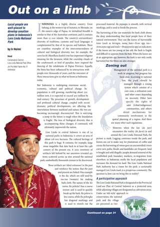
- 1. Out on a limb º Continued on page 31 Local people are well-placed to develop zonation plans in Indonesia’s Lore Lindu National Park by Ir Helmi Head Conservation Section Lore Lindu National Park Office Jln Prof Moh Yamin No 21 Indonesia I NDONESIA is a highly diverse country. From Sabang, at the western tip of Sumatra, to Merauke, on the eastern edge of Papua, its latitudinal breadth is similar to that of the Australian continent, and it contains more than 3 000 islands. The country’s extraordinary diversity of traditions, customs and local languages is complemented by that of its species and habitats. There are countless examples of the interconnectedness of cultural and biological diversity, too: for example, the sawo kecik (Manilkara kaukii) tree has important religious meaning for the Javanese, while the courtship rituals of the cendrawasih, or bird of paradise, have inspired the dancing of the inhabitants of Papua Province. Equally, the biota has been influenced by its interactions with people over thousands of years, and the outcomes of these interactions give us what we know as Indonesia today. But Indonesia is undergoing enormous social, economic, cultural and political change. Its population is still growing; numbering about 220 million now, it is expected to exceed 300 million by mid-century. The processes of growth, development and profound cultural change, coupled with recent dramatic political developments, are affecting the interrelation between mankind and nature; the two are becoming increasingly disconnected. This is worrying: a jump to the future is tough when the foundation is fragile. The loss of biological diversity that is accompanying these changes, if continued, will ultimately impoverish the nation. Lore Lindu in central Sulawesi is one of 34 national parks in Indonesia; it covers an area of about 28 000 hectares. The cultural heritage of this park is huge. It contains, for example, large stone megaliths that date back to at least the 4th century of the present era. A 200 inventory of artifacts left behind by our ancestors revealed 43 items scattered across 39 sites around the national park; undoubtedly thousands remain to be discovered. These artifacts are ‘silent witnesses’ to the past and reinforce the notion that the past and present are linked.One example is the ike, which are still used by ina-ina (women) for making bark cloth. The nature of the ike varies. Ike pehelai’i has a coarse texture and is used to quickly break up the bark.Ike pekero is less coarse,while Ike pebengka has diagonal markings and is used to stretch out the processed material. Ike pepaupu is smooth, with vertical markings, and is used to finish the process. The harvesting of the raw materials for bark cloth shows the deep understanding that local people have of their natural environment. They use the leaves of harvestable trees (such as beringin, nunu, kate—Ficus spp, tea— Artocarpus spp andmalo—Broussonetia spp) as indicators: if the leaves are too young or too old, the bark is fragile and difficult to separate from the bole.When the leaves are at an appropriate age, however, the bark is not only easily harvested but the fibres are also stronger. Zoning out Management of the national park is a work in progress, but progress has been slow. According to national law, the park should be managed through a zoning system which consists of a core zone, a utilisation zone and other zones depending on necessity. Other laws specify the rights of adat (tribal/indigenous) communities, and others detail mechanisms for community involvement in the spatial planning of a region. And there are many other such regulations. However, when the law (de jure) encounters the reality (de facto) in and around the Lore Lindu National Park, the picture is stark. Logging continues inside the park, and forests are cut to make way for plantations of coffee and cocoa;the harvesting of rattan goes on uncontrolled;rivers carve new paths; floods and landslides are frequent; land is bought and sold illegally; people demand removal of the established park boundary markers; in-migration from elsewhere in Indonesia swells the local population and increases the demand for land. The Lore Lindu National Park Authority has a vision for the park: a sustainably managed Lore Lindu leads to a prosperous community. The question is, how can we bring this to reality? A participative approach TheLoreLinduNationalParkisdesignatedintheProvincial Land-use Plan of Central Sulawesi as a protected area, while adjoining villages are designated as cultivation areas. Under an ‘old-style’ approach to conservation, the national park and the village are perceived as two
- 2. Self-help: Ngata Toro community members tend a rice paddy together. ITTO Tropical Forest Update 15/2 2005 31ITTO Tropical Forest Update 15/2 2005 31 Out on a limb º continued from page 32 adjacent but non-overlapping spaces. Such a perception does not reflect reality. When the national park was created in 993, little consideration was given to the traditional use and ownership of the area. Many local people were alienated and became resentful of the park; in some cases this is the root cause of deforestation,illegal logging and other destructive practices that have taken place inside the park. Planning the use of space in a way that provides local people with opportunities for development and the maintenance of their traditions and customary practices without compromising conservation objectives therefore becomes a crucial task. In my view, an approach that relies on restrictions and prohibitions will not work in the current social, economic and political environment of Indonesia.Participativeplanningisessential,startingwiththecoordinated involvement of such local institutions as the BPD (village parliament), customary community forums, religious institutions, youth groups, women’s organisations, the park management authority, and others. The first steps towards zonation have been taken in the park, facilitated by The Nature Conservancy, an international environmental non- governmental organisation; this has produced a draft zonation plan. This draft could be used as a platform, but it is not enough on its own. The daily tasks of both park management and local livelihoods require that the zonation be done at a much more detailed scale, so that we start to see the delineation of specific features like river channels, animal paths, vegetation distribution and so on; deciding how such features will be ‘zoned’needs the involvement of surrounding communities.This is where participative planning is required,and for this we have the example of the Ngata Toro indigenous community to follow. Ngata Toro The Ngata Toro village is an enclave in the Lore Lindu National Park; since the park was proclaimed the community has been working with outside support to establish its rights and responsibilities for the overlapping land. A first step was to document their local knowledge, customary laws and traditions and to map their interaction with the wild things—the vegetation,the fauna and the living space of the wildlife (habitat).This was done through a fully participative process that involved an exploration of the wisdom and mental maps of elders and community leaders, including (importantly) women. The knowledge thus documented was then used in a participatory planning process for the long-term management of the ecosystems that comprise the park. New management concepts have already emerged from this process that combine modern conservation practice, traditional management regimes, and a high degree of local participation in planning, decision-making and benefit-sharing. One of the most important outcomes so far has been recognition from the Lore Lindu National Park Authority of Ngata Toro’s indigenous knowledge and traditional lands; some 8 000 hectares of their traditional lands lie within the borders of the park. The community now has access to important natural resources that might otherwise have been denied. At the same time, the community has developed a new institution to facilitate the role of women in natural resource management decisions. Weknowthatlocalcommunitiescanbeeffectiveandefficientconservation managers. For example, the zonation mandated by federal law would not be new to the people of Ngata Toro, who already have a zoning system comprising the wana ngiki, which is the ‘forest towards the peak of the mountain that is far away’, the wana, which is a pristine jungle that has never been developed as agricultural land, the pangale, the mountain forest, which is a transition between secondary and primaryforest,thepahawapongko,abandonedagricultural land, and the oma, which is frequently cultivated forest agricultural land. Keeping the diversity What is already taking place in the Ngata Toro community could be replicated elsewhere in Lore Lindu National Park, and in other conservation areas. The process of guarding the local space is done not just by one person, institution or party but in a participatory way involving many stakeholders. With the incorporation of local wisdom, and acknowledging local needs, traditions and rights, the management of natural resources becomes tailored to the unique characteristics of an area at a local scale. By taking this approach, the great diversity of this country, Indonesia, will not be lost. New management concepts have already emerged from this process that combine modern conservation practice, traditional management regimes, and a high degree of local participation in planning, decision- making and benefit-sharing.