SlideShare a Scribd company logo
1 of 19
Spectral classificationof WorldView-2 multi-angle sequence Atlanta city-model derived from a  WorldView-2 multi-sequence acquisition N. Longbotham, C. Bleilery, C. Chaapel, C. Padwick, W. J. Emery, and F. Pacifici
Outline 2 This presentation illustrates the unique aspects of the WorldView-2 satellite platform by combining multi-spectral information with multi-angle observations The previous presentation dealt with very high spatial resolution imagery with multi-angle observations What can we do with this kind of data set? Four experiments have been carried out to investigate the classification contribution of multi-angle reflectance (MAR) as well as different feature extraction data sets (reducing the large size of the raw data space)
Methodology (1/2) 3 13 Multispectral Images 13 Panchromatic Images Digital Surface Model Atmospheric Correction Nadir Multispectral Multi-angle Multispectral 13 Multispectral True-Ortho Images Polynomial Multispectral Principal Component Analysis
Methodology (2/2) 4 Polynomial  Multispectral Nadir Multispectral Multi-angle  Multispectral PCA y = ax2 + bx + c Poly fit standard error 104 bands 32bands 10 bands 8 bands
Atmospheric Correction (1/2) 5
Atmospheric Correction (2/2) 6
Information Sources 7 The MAR contains a partial bidirectional reflectance distribution function (BRDF) over a single satellite track at a single sun angle Objects with pitched surfaces, such as trees and residential roofs, will present a different observational cross-section at each angle Surfaces with varying reflectance in both time and angle can be described by an error term that encapsulates the variation of a pixel through the multi-angle sequence
Partial BRDF - over a single satellite track 8
Pitched surfaces 9
Varying reflectance in both time and angle (1/2)  10 Differentiates land-use of similar spectral signature low vs. high volume traffic roads Multi-angle spectral variability stationary vehicles
Varying reflectance in both time and angle (2/2)  11
Four Experiments The most-nadir multi-spectral image is used as base-case 12
Classification and Validation 15 classes of interest have been selected representing a wide variety of both natural and man-made land-covers, including different kind of roof, roads, and vegetation Training: 50 samples per class Validation: 90,000 of independent samples Each of the classification experiments are conducted using the Random Forest algorithm 13
Results (1/2) 14
Results (2/2) 15
Detail 16 ,[object Object]
Empty Parking Spots
Pitched Roofs
Deciduous Trees

More Related Content

What's hot

07 a70401 remotesensingandgisapplications
07 a70401 remotesensingandgisapplications07 a70401 remotesensingandgisapplications
07 a70401 remotesensingandgisapplicationsimaduddin91
 
Automated Construction of Coverage Catalogues of ASTER Satellite Image for Ur...
Automated Construction of Coverage Catalogues of ASTER Satellite Image for Ur...Automated Construction of Coverage Catalogues of ASTER Satellite Image for Ur...
Automated Construction of Coverage Catalogues of ASTER Satellite Image for Ur...Hiroyuki Miyazaki
 
Operational Data Fusion Framework for Building Frequent Land sat-Like Imagery
Operational Data Fusion Framework for Building Frequent Land sat-Like ImageryOperational Data Fusion Framework for Building Frequent Land sat-Like Imagery
Operational Data Fusion Framework for Building Frequent Land sat-Like ImageryKaashivInfoTech Company
 
e-SOTER Regional pilot platform as EU contribution to a Global Soil observing...
e-SOTER Regional pilot platform as EU contribution to a Global Soil observing...e-SOTER Regional pilot platform as EU contribution to a Global Soil observing...
e-SOTER Regional pilot platform as EU contribution to a Global Soil observing...FAO
 
Using Very High Resolution Satellite Images for Planning Activities in Mining
Using Very High Resolution Satellite Images for Planning Activities in MiningUsing Very High Resolution Satellite Images for Planning Activities in Mining
Using Very High Resolution Satellite Images for Planning Activities in MiningArgongra Gis
 
Dr. Costas Sachpazis. 3-D Soil Layer Model from Geotechnical Borehole Data (B...
Dr. Costas Sachpazis. 3-D Soil Layer Model from Geotechnical Borehole Data (B...Dr. Costas Sachpazis. 3-D Soil Layer Model from Geotechnical Borehole Data (B...
Dr. Costas Sachpazis. 3-D Soil Layer Model from Geotechnical Borehole Data (B...Dr.Costas Sachpazis
 
Integrating eo with official statistics using machine learning in mexico geo ...
Integrating eo with official statistics using machine learning in mexico geo ...Integrating eo with official statistics using machine learning in mexico geo ...
Integrating eo with official statistics using machine learning in mexico geo ...Abel Alejandro Coronado Iruegas
 
Integration of Colorized Single-Pol SAR Data Into Optical Image Mosaics.ppt
Integration of Colorized Single-Pol SAR Data Into Optical Image Mosaics.pptIntegration of Colorized Single-Pol SAR Data Into Optical Image Mosaics.ppt
Integration of Colorized Single-Pol SAR Data Into Optical Image Mosaics.pptgrssieee
 
High resolution dem dtm
High resolution dem dtmHigh resolution dem dtm
High resolution dem dtmTTI Production
 
10 recent dfn developments and comparison of dfn and fcm models viswanathan lanl
10 recent dfn developments and comparison of dfn and fcm models viswanathan lanl10 recent dfn developments and comparison of dfn and fcm models viswanathan lanl
10 recent dfn developments and comparison of dfn and fcm models viswanathan lanlleann_mays
 
Generating digital terrain models using lroc nac images
Generating digital terrain models using lroc nac imagesGenerating digital terrain models using lroc nac images
Generating digital terrain models using lroc nac imagesSérgio Sacani
 
ADOpresentation.lv20150714
ADOpresentation.lv20150714ADOpresentation.lv20150714
ADOpresentation.lv20150714Luana Valentini
 
2016 Poster Launch Models
2016 Poster Launch Models2016 Poster Launch Models
2016 Poster Launch ModelsRichard Ottaway
 
On the reconstruction of quad pol sar data from compact polarimetry data for ...
On the reconstruction of quad pol sar data from compact polarimetry data for ...On the reconstruction of quad pol sar data from compact polarimetry data for ...
On the reconstruction of quad pol sar data from compact polarimetry data for ...Ecway Technologies
 
On the reconstruction of quad pol sar data from compact polarimetry data for ...
On the reconstruction of quad pol sar data from compact polarimetry data for ...On the reconstruction of quad pol sar data from compact polarimetry data for ...
On the reconstruction of quad pol sar data from compact polarimetry data for ...Ecwaytech
 
Relative value of radar and optical data for land cover/use mapping: Peru exa...
Relative value of radar and optical data for land cover/use mapping: Peru exa...Relative value of radar and optical data for land cover/use mapping: Peru exa...
Relative value of radar and optical data for land cover/use mapping: Peru exa...rsmahabir
 

What's hot (20)

07 a70401 remotesensingandgisapplications
07 a70401 remotesensingandgisapplications07 a70401 remotesensingandgisapplications
07 a70401 remotesensingandgisapplications
 
Rpc
RpcRpc
Rpc
 
Automated Construction of Coverage Catalogues of ASTER Satellite Image for Ur...
Automated Construction of Coverage Catalogues of ASTER Satellite Image for Ur...Automated Construction of Coverage Catalogues of ASTER Satellite Image for Ur...
Automated Construction of Coverage Catalogues of ASTER Satellite Image for Ur...
 
Operational Data Fusion Framework for Building Frequent Land sat-Like Imagery
Operational Data Fusion Framework for Building Frequent Land sat-Like ImageryOperational Data Fusion Framework for Building Frequent Land sat-Like Imagery
Operational Data Fusion Framework for Building Frequent Land sat-Like Imagery
 
e-SOTER Regional pilot platform as EU contribution to a Global Soil observing...
e-SOTER Regional pilot platform as EU contribution to a Global Soil observing...e-SOTER Regional pilot platform as EU contribution to a Global Soil observing...
e-SOTER Regional pilot platform as EU contribution to a Global Soil observing...
 
Using Very High Resolution Satellite Images for Planning Activities in Mining
Using Very High Resolution Satellite Images for Planning Activities in MiningUsing Very High Resolution Satellite Images for Planning Activities in Mining
Using Very High Resolution Satellite Images for Planning Activities in Mining
 
Taramelli Melelli
Taramelli MelelliTaramelli Melelli
Taramelli Melelli
 
Dr. Costas Sachpazis. 3-D Soil Layer Model from Geotechnical Borehole Data (B...
Dr. Costas Sachpazis. 3-D Soil Layer Model from Geotechnical Borehole Data (B...Dr. Costas Sachpazis. 3-D Soil Layer Model from Geotechnical Borehole Data (B...
Dr. Costas Sachpazis. 3-D Soil Layer Model from Geotechnical Borehole Data (B...
 
Integrating eo with official statistics using machine learning in mexico geo ...
Integrating eo with official statistics using machine learning in mexico geo ...Integrating eo with official statistics using machine learning in mexico geo ...
Integrating eo with official statistics using machine learning in mexico geo ...
 
Machine learning and Satellite Images
Machine learning and Satellite ImagesMachine learning and Satellite Images
Machine learning and Satellite Images
 
Integration of Colorized Single-Pol SAR Data Into Optical Image Mosaics.ppt
Integration of Colorized Single-Pol SAR Data Into Optical Image Mosaics.pptIntegration of Colorized Single-Pol SAR Data Into Optical Image Mosaics.ppt
Integration of Colorized Single-Pol SAR Data Into Optical Image Mosaics.ppt
 
High resolution dem dtm
High resolution dem dtmHigh resolution dem dtm
High resolution dem dtm
 
10 recent dfn developments and comparison of dfn and fcm models viswanathan lanl
10 recent dfn developments and comparison of dfn and fcm models viswanathan lanl10 recent dfn developments and comparison of dfn and fcm models viswanathan lanl
10 recent dfn developments and comparison of dfn and fcm models viswanathan lanl
 
Generating digital terrain models using lroc nac images
Generating digital terrain models using lroc nac imagesGenerating digital terrain models using lroc nac images
Generating digital terrain models using lroc nac images
 
ADOpresentation.lv20150714
ADOpresentation.lv20150714ADOpresentation.lv20150714
ADOpresentation.lv20150714
 
Icelandic Bathy model
Icelandic Bathy modelIcelandic Bathy model
Icelandic Bathy model
 
2016 Poster Launch Models
2016 Poster Launch Models2016 Poster Launch Models
2016 Poster Launch Models
 
On the reconstruction of quad pol sar data from compact polarimetry data for ...
On the reconstruction of quad pol sar data from compact polarimetry data for ...On the reconstruction of quad pol sar data from compact polarimetry data for ...
On the reconstruction of quad pol sar data from compact polarimetry data for ...
 
On the reconstruction of quad pol sar data from compact polarimetry data for ...
On the reconstruction of quad pol sar data from compact polarimetry data for ...On the reconstruction of quad pol sar data from compact polarimetry data for ...
On the reconstruction of quad pol sar data from compact polarimetry data for ...
 
Relative value of radar and optical data for land cover/use mapping: Peru exa...
Relative value of radar and optical data for land cover/use mapping: Peru exa...Relative value of radar and optical data for land cover/use mapping: Peru exa...
Relative value of radar and optical data for land cover/use mapping: Peru exa...
 

Similar to Spectral_classification_of_WorldView2_multiangle_sequence.pptx

Unsupervised Building Extraction from High Resolution Satellite Images Irresp...
Unsupervised Building Extraction from High Resolution Satellite Images Irresp...Unsupervised Building Extraction from High Resolution Satellite Images Irresp...
Unsupervised Building Extraction from High Resolution Satellite Images Irresp...CSCJournals
 
Modeling the Chlorophyll-a from Sea Surface Reflectance in West Africa by Dee...
Modeling the Chlorophyll-a from Sea Surface Reflectance in West Africa by Dee...Modeling the Chlorophyll-a from Sea Surface Reflectance in West Africa by Dee...
Modeling the Chlorophyll-a from Sea Surface Reflectance in West Africa by Dee...gerogepatton
 
MODELING THE CHLOROPHYLL-A FROM SEA SURFACE REFLECTANCE IN WEST AFRICA BY DEE...
MODELING THE CHLOROPHYLL-A FROM SEA SURFACE REFLECTANCE IN WEST AFRICA BY DEE...MODELING THE CHLOROPHYLL-A FROM SEA SURFACE REFLECTANCE IN WEST AFRICA BY DEE...
MODELING THE CHLOROPHYLL-A FROM SEA SURFACE REFLECTANCE IN WEST AFRICA BY DEE...gerogepatton
 
MODELING THE CHLOROPHYLL-A FROM SEA SURFACE REFLECTANCE IN WEST AFRICA BY DEE...
MODELING THE CHLOROPHYLL-A FROM SEA SURFACE REFLECTANCE IN WEST AFRICA BY DEE...MODELING THE CHLOROPHYLL-A FROM SEA SURFACE REFLECTANCE IN WEST AFRICA BY DEE...
MODELING THE CHLOROPHYLL-A FROM SEA SURFACE REFLECTANCE IN WEST AFRICA BY DEE...ijaia
 
presentazione_IGARSS2011.ppt
presentazione_IGARSS2011.pptpresentazione_IGARSS2011.ppt
presentazione_IGARSS2011.pptgrssieee
 
Kim_WE3_T05_2.pptx
Kim_WE3_T05_2.pptxKim_WE3_T05_2.pptx
Kim_WE3_T05_2.pptxgrssieee
 
Estimation of Terrain Gradient Conditions & Obstacle Detection Using a Monocu...
Estimation of Terrain Gradient Conditions & Obstacle Detection Using a Monocu...Estimation of Terrain Gradient Conditions & Obstacle Detection Using a Monocu...
Estimation of Terrain Gradient Conditions & Obstacle Detection Using a Monocu...Connor Goddard
 
Landuse Landcover mapping and Comparative analysis of deM from TerraSAR-X and...
Landuse Landcover mapping and Comparative analysis of deM from TerraSAR-X and...Landuse Landcover mapping and Comparative analysis of deM from TerraSAR-X and...
Landuse Landcover mapping and Comparative analysis of deM from TerraSAR-X and...Kamal Shahi
 
Using Artificial Neural Networks for Digital Soil Mapping – a comparison of M...
Using Artificial Neural Networks for Digital Soil Mapping – a comparison of M...Using Artificial Neural Networks for Digital Soil Mapping – a comparison of M...
Using Artificial Neural Networks for Digital Soil Mapping – a comparison of M...Ricardo Brasil
 
Cnn acuracia remotesensing-08-00329
Cnn acuracia remotesensing-08-00329Cnn acuracia remotesensing-08-00329
Cnn acuracia remotesensing-08-00329Universidade Fumec
 
Big Data, Data and Information Mining for Earth Observation
Big Data, Data and Information Mining for Earth ObservationBig Data, Data and Information Mining for Earth Observation
Big Data, Data and Information Mining for Earth ObservationPier Giorgio Marchetti
 
Pasolli_TU1_TO3.4.pptx
Pasolli_TU1_TO3.4.pptxPasolli_TU1_TO3.4.pptx
Pasolli_TU1_TO3.4.pptxgrssieee
 
Pasolli_TU1_TO3.4.pptx
Pasolli_TU1_TO3.4.pptxPasolli_TU1_TO3.4.pptx
Pasolli_TU1_TO3.4.pptxgrssieee
 
Sensitivity of Support Vector Machine Classification to Various Training Feat...
Sensitivity of Support Vector Machine Classification to Various Training Feat...Sensitivity of Support Vector Machine Classification to Various Training Feat...
Sensitivity of Support Vector Machine Classification to Various Training Feat...Nooria Sukmaningtyas
 
IGARSS_2011_GALLOZA.pptx
IGARSS_2011_GALLOZA.pptxIGARSS_2011_GALLOZA.pptx
IGARSS_2011_GALLOZA.pptxgrssieee
 
A PHYSICAL METHOD TO COMPUTE SURFACE RADIATION FROM GEOSTATIONARY SATELLITES
A PHYSICAL METHOD TO COMPUTE SURFACE RADIATION FROM GEOSTATIONARY SATELLITES  A PHYSICAL METHOD TO COMPUTE SURFACE RADIATION FROM GEOSTATIONARY SATELLITES
A PHYSICAL METHOD TO COMPUTE SURFACE RADIATION FROM GEOSTATIONARY SATELLITES Roberto Valer
 
SIXTEEN CHANNEL, NON-SCANNING AIRBORNE LIDAR SURFACE TOPOGRAPHY (LIST) SIMULATOR
SIXTEEN CHANNEL, NON-SCANNING AIRBORNE LIDAR SURFACE TOPOGRAPHY (LIST) SIMULATORSIXTEEN CHANNEL, NON-SCANNING AIRBORNE LIDAR SURFACE TOPOGRAPHY (LIST) SIMULATOR
SIXTEEN CHANNEL, NON-SCANNING AIRBORNE LIDAR SURFACE TOPOGRAPHY (LIST) SIMULATORgrssieee
 

Similar to Spectral_classification_of_WorldView2_multiangle_sequence.pptx (20)

Unsupervised Building Extraction from High Resolution Satellite Images Irresp...
Unsupervised Building Extraction from High Resolution Satellite Images Irresp...Unsupervised Building Extraction from High Resolution Satellite Images Irresp...
Unsupervised Building Extraction from High Resolution Satellite Images Irresp...
 
Modeling the Chlorophyll-a from Sea Surface Reflectance in West Africa by Dee...
Modeling the Chlorophyll-a from Sea Surface Reflectance in West Africa by Dee...Modeling the Chlorophyll-a from Sea Surface Reflectance in West Africa by Dee...
Modeling the Chlorophyll-a from Sea Surface Reflectance in West Africa by Dee...
 
MODELING THE CHLOROPHYLL-A FROM SEA SURFACE REFLECTANCE IN WEST AFRICA BY DEE...
MODELING THE CHLOROPHYLL-A FROM SEA SURFACE REFLECTANCE IN WEST AFRICA BY DEE...MODELING THE CHLOROPHYLL-A FROM SEA SURFACE REFLECTANCE IN WEST AFRICA BY DEE...
MODELING THE CHLOROPHYLL-A FROM SEA SURFACE REFLECTANCE IN WEST AFRICA BY DEE...
 
MODELING THE CHLOROPHYLL-A FROM SEA SURFACE REFLECTANCE IN WEST AFRICA BY DEE...
MODELING THE CHLOROPHYLL-A FROM SEA SURFACE REFLECTANCE IN WEST AFRICA BY DEE...MODELING THE CHLOROPHYLL-A FROM SEA SURFACE REFLECTANCE IN WEST AFRICA BY DEE...
MODELING THE CHLOROPHYLL-A FROM SEA SURFACE REFLECTANCE IN WEST AFRICA BY DEE...
 
presentazione_IGARSS2011.ppt
presentazione_IGARSS2011.pptpresentazione_IGARSS2011.ppt
presentazione_IGARSS2011.ppt
 
Kim_WE3_T05_2.pptx
Kim_WE3_T05_2.pptxKim_WE3_T05_2.pptx
Kim_WE3_T05_2.pptx
 
Estimation of Terrain Gradient Conditions & Obstacle Detection Using a Monocu...
Estimation of Terrain Gradient Conditions & Obstacle Detection Using a Monocu...Estimation of Terrain Gradient Conditions & Obstacle Detection Using a Monocu...
Estimation of Terrain Gradient Conditions & Obstacle Detection Using a Monocu...
 
PosterV2small
PosterV2smallPosterV2small
PosterV2small
 
Landuse Landcover mapping and Comparative analysis of deM from TerraSAR-X and...
Landuse Landcover mapping and Comparative analysis of deM from TerraSAR-X and...Landuse Landcover mapping and Comparative analysis of deM from TerraSAR-X and...
Landuse Landcover mapping and Comparative analysis of deM from TerraSAR-X and...
 
Af33174179
Af33174179Af33174179
Af33174179
 
Af33174179
Af33174179Af33174179
Af33174179
 
Using Artificial Neural Networks for Digital Soil Mapping – a comparison of M...
Using Artificial Neural Networks for Digital Soil Mapping – a comparison of M...Using Artificial Neural Networks for Digital Soil Mapping – a comparison of M...
Using Artificial Neural Networks for Digital Soil Mapping – a comparison of M...
 
Cnn acuracia remotesensing-08-00329
Cnn acuracia remotesensing-08-00329Cnn acuracia remotesensing-08-00329
Cnn acuracia remotesensing-08-00329
 
Big Data, Data and Information Mining for Earth Observation
Big Data, Data and Information Mining for Earth ObservationBig Data, Data and Information Mining for Earth Observation
Big Data, Data and Information Mining for Earth Observation
 
Pasolli_TU1_TO3.4.pptx
Pasolli_TU1_TO3.4.pptxPasolli_TU1_TO3.4.pptx
Pasolli_TU1_TO3.4.pptx
 
Pasolli_TU1_TO3.4.pptx
Pasolli_TU1_TO3.4.pptxPasolli_TU1_TO3.4.pptx
Pasolli_TU1_TO3.4.pptx
 
Sensitivity of Support Vector Machine Classification to Various Training Feat...
Sensitivity of Support Vector Machine Classification to Various Training Feat...Sensitivity of Support Vector Machine Classification to Various Training Feat...
Sensitivity of Support Vector Machine Classification to Various Training Feat...
 
IGARSS_2011_GALLOZA.pptx
IGARSS_2011_GALLOZA.pptxIGARSS_2011_GALLOZA.pptx
IGARSS_2011_GALLOZA.pptx
 
A PHYSICAL METHOD TO COMPUTE SURFACE RADIATION FROM GEOSTATIONARY SATELLITES
A PHYSICAL METHOD TO COMPUTE SURFACE RADIATION FROM GEOSTATIONARY SATELLITES  A PHYSICAL METHOD TO COMPUTE SURFACE RADIATION FROM GEOSTATIONARY SATELLITES
A PHYSICAL METHOD TO COMPUTE SURFACE RADIATION FROM GEOSTATIONARY SATELLITES
 
SIXTEEN CHANNEL, NON-SCANNING AIRBORNE LIDAR SURFACE TOPOGRAPHY (LIST) SIMULATOR
SIXTEEN CHANNEL, NON-SCANNING AIRBORNE LIDAR SURFACE TOPOGRAPHY (LIST) SIMULATORSIXTEEN CHANNEL, NON-SCANNING AIRBORNE LIDAR SURFACE TOPOGRAPHY (LIST) SIMULATOR
SIXTEEN CHANNEL, NON-SCANNING AIRBORNE LIDAR SURFACE TOPOGRAPHY (LIST) SIMULATOR
 

More from grssieee

Tangent height accuracy of Superconducting Submillimeter-Wave Limb-Emission S...
Tangent height accuracy of Superconducting Submillimeter-Wave Limb-Emission S...Tangent height accuracy of Superconducting Submillimeter-Wave Limb-Emission S...
Tangent height accuracy of Superconducting Submillimeter-Wave Limb-Emission S...grssieee
 
SEGMENTATION OF POLARIMETRIC SAR DATA WITH A MULTI-TEXTURE PRODUCT MODEL
SEGMENTATION OF POLARIMETRIC SAR DATA WITH A MULTI-TEXTURE PRODUCT MODELSEGMENTATION OF POLARIMETRIC SAR DATA WITH A MULTI-TEXTURE PRODUCT MODEL
SEGMENTATION OF POLARIMETRIC SAR DATA WITH A MULTI-TEXTURE PRODUCT MODELgrssieee
 
TWO-POINT STATISTIC OF POLARIMETRIC SAR DATA TWO-POINT STATISTIC OF POLARIMET...
TWO-POINT STATISTIC OF POLARIMETRIC SAR DATA TWO-POINT STATISTIC OF POLARIMET...TWO-POINT STATISTIC OF POLARIMETRIC SAR DATA TWO-POINT STATISTIC OF POLARIMET...
TWO-POINT STATISTIC OF POLARIMETRIC SAR DATA TWO-POINT STATISTIC OF POLARIMET...grssieee
 
THE SENTINEL-1 MISSION AND ITS APPLICATION CAPABILITIES
THE SENTINEL-1 MISSION AND ITS APPLICATION CAPABILITIESTHE SENTINEL-1 MISSION AND ITS APPLICATION CAPABILITIES
THE SENTINEL-1 MISSION AND ITS APPLICATION CAPABILITIESgrssieee
 
GMES SPACE COMPONENT:PROGRAMMATIC STATUS
GMES SPACE COMPONENT:PROGRAMMATIC STATUSGMES SPACE COMPONENT:PROGRAMMATIC STATUS
GMES SPACE COMPONENT:PROGRAMMATIC STATUSgrssieee
 
PROGRESSES OF DEVELOPMENT OF CFOSAT SCATTEROMETER
PROGRESSES OF DEVELOPMENT OF CFOSAT SCATTEROMETERPROGRESSES OF DEVELOPMENT OF CFOSAT SCATTEROMETER
PROGRESSES OF DEVELOPMENT OF CFOSAT SCATTEROMETERgrssieee
 
DEVELOPMENT OF ALGORITHMS AND PRODUCTS FOR SUPPORTING THE ITALIAN HYPERSPECTR...
DEVELOPMENT OF ALGORITHMS AND PRODUCTS FOR SUPPORTING THE ITALIAN HYPERSPECTR...DEVELOPMENT OF ALGORITHMS AND PRODUCTS FOR SUPPORTING THE ITALIAN HYPERSPECTR...
DEVELOPMENT OF ALGORITHMS AND PRODUCTS FOR SUPPORTING THE ITALIAN HYPERSPECTR...grssieee
 
EO-1/HYPERION: NEARING TWELVE YEARS OF SUCCESSFUL MISSION SCIENCE OPERATION A...
EO-1/HYPERION: NEARING TWELVE YEARS OF SUCCESSFUL MISSION SCIENCE OPERATION A...EO-1/HYPERION: NEARING TWELVE YEARS OF SUCCESSFUL MISSION SCIENCE OPERATION A...
EO-1/HYPERION: NEARING TWELVE YEARS OF SUCCESSFUL MISSION SCIENCE OPERATION A...grssieee
 
test 34mb wo animations
test  34mb wo animationstest  34mb wo animations
test 34mb wo animationsgrssieee
 
2011_Fox_Tax_Worksheets.pdf
2011_Fox_Tax_Worksheets.pdf2011_Fox_Tax_Worksheets.pdf
2011_Fox_Tax_Worksheets.pdfgrssieee
 
DLR open house
DLR open houseDLR open house
DLR open housegrssieee
 
DLR open house
DLR open houseDLR open house
DLR open housegrssieee
 
DLR open house
DLR open houseDLR open house
DLR open housegrssieee
 
Tana_IGARSS2011.ppt
Tana_IGARSS2011.pptTana_IGARSS2011.ppt
Tana_IGARSS2011.pptgrssieee
 
Solaro_IGARSS_2011.ppt
Solaro_IGARSS_2011.pptSolaro_IGARSS_2011.ppt
Solaro_IGARSS_2011.pptgrssieee
 

More from grssieee (20)

Tangent height accuracy of Superconducting Submillimeter-Wave Limb-Emission S...
Tangent height accuracy of Superconducting Submillimeter-Wave Limb-Emission S...Tangent height accuracy of Superconducting Submillimeter-Wave Limb-Emission S...
Tangent height accuracy of Superconducting Submillimeter-Wave Limb-Emission S...
 
SEGMENTATION OF POLARIMETRIC SAR DATA WITH A MULTI-TEXTURE PRODUCT MODEL
SEGMENTATION OF POLARIMETRIC SAR DATA WITH A MULTI-TEXTURE PRODUCT MODELSEGMENTATION OF POLARIMETRIC SAR DATA WITH A MULTI-TEXTURE PRODUCT MODEL
SEGMENTATION OF POLARIMETRIC SAR DATA WITH A MULTI-TEXTURE PRODUCT MODEL
 
TWO-POINT STATISTIC OF POLARIMETRIC SAR DATA TWO-POINT STATISTIC OF POLARIMET...
TWO-POINT STATISTIC OF POLARIMETRIC SAR DATA TWO-POINT STATISTIC OF POLARIMET...TWO-POINT STATISTIC OF POLARIMETRIC SAR DATA TWO-POINT STATISTIC OF POLARIMET...
TWO-POINT STATISTIC OF POLARIMETRIC SAR DATA TWO-POINT STATISTIC OF POLARIMET...
 
THE SENTINEL-1 MISSION AND ITS APPLICATION CAPABILITIES
THE SENTINEL-1 MISSION AND ITS APPLICATION CAPABILITIESTHE SENTINEL-1 MISSION AND ITS APPLICATION CAPABILITIES
THE SENTINEL-1 MISSION AND ITS APPLICATION CAPABILITIES
 
GMES SPACE COMPONENT:PROGRAMMATIC STATUS
GMES SPACE COMPONENT:PROGRAMMATIC STATUSGMES SPACE COMPONENT:PROGRAMMATIC STATUS
GMES SPACE COMPONENT:PROGRAMMATIC STATUS
 
PROGRESSES OF DEVELOPMENT OF CFOSAT SCATTEROMETER
PROGRESSES OF DEVELOPMENT OF CFOSAT SCATTEROMETERPROGRESSES OF DEVELOPMENT OF CFOSAT SCATTEROMETER
PROGRESSES OF DEVELOPMENT OF CFOSAT SCATTEROMETER
 
DEVELOPMENT OF ALGORITHMS AND PRODUCTS FOR SUPPORTING THE ITALIAN HYPERSPECTR...
DEVELOPMENT OF ALGORITHMS AND PRODUCTS FOR SUPPORTING THE ITALIAN HYPERSPECTR...DEVELOPMENT OF ALGORITHMS AND PRODUCTS FOR SUPPORTING THE ITALIAN HYPERSPECTR...
DEVELOPMENT OF ALGORITHMS AND PRODUCTS FOR SUPPORTING THE ITALIAN HYPERSPECTR...
 
EO-1/HYPERION: NEARING TWELVE YEARS OF SUCCESSFUL MISSION SCIENCE OPERATION A...
EO-1/HYPERION: NEARING TWELVE YEARS OF SUCCESSFUL MISSION SCIENCE OPERATION A...EO-1/HYPERION: NEARING TWELVE YEARS OF SUCCESSFUL MISSION SCIENCE OPERATION A...
EO-1/HYPERION: NEARING TWELVE YEARS OF SUCCESSFUL MISSION SCIENCE OPERATION A...
 
EO-1/HYPERION: NEARING TWELVE YEARS OF SUCCESSFUL MISSION SCIENCE OPERATION A...
EO-1/HYPERION: NEARING TWELVE YEARS OF SUCCESSFUL MISSION SCIENCE OPERATION A...EO-1/HYPERION: NEARING TWELVE YEARS OF SUCCESSFUL MISSION SCIENCE OPERATION A...
EO-1/HYPERION: NEARING TWELVE YEARS OF SUCCESSFUL MISSION SCIENCE OPERATION A...
 
Test
TestTest
Test
 
test 34mb wo animations
test  34mb wo animationstest  34mb wo animations
test 34mb wo animations
 
Test 70MB
Test 70MBTest 70MB
Test 70MB
 
Test 70MB
Test 70MBTest 70MB
Test 70MB
 
2011_Fox_Tax_Worksheets.pdf
2011_Fox_Tax_Worksheets.pdf2011_Fox_Tax_Worksheets.pdf
2011_Fox_Tax_Worksheets.pdf
 
DLR open house
DLR open houseDLR open house
DLR open house
 
DLR open house
DLR open houseDLR open house
DLR open house
 
DLR open house
DLR open houseDLR open house
DLR open house
 
Tana_IGARSS2011.ppt
Tana_IGARSS2011.pptTana_IGARSS2011.ppt
Tana_IGARSS2011.ppt
 
Solaro_IGARSS_2011.ppt
Solaro_IGARSS_2011.pptSolaro_IGARSS_2011.ppt
Solaro_IGARSS_2011.ppt
 

Recently uploaded

Introduction to Multilingual Retrieval Augmented Generation (RAG)
Introduction to Multilingual Retrieval Augmented Generation (RAG)Introduction to Multilingual Retrieval Augmented Generation (RAG)
Introduction to Multilingual Retrieval Augmented Generation (RAG)Zilliz
 
TrustArc Webinar - Unlock the Power of AI-Driven Data Discovery
TrustArc Webinar - Unlock the Power of AI-Driven Data DiscoveryTrustArc Webinar - Unlock the Power of AI-Driven Data Discovery
TrustArc Webinar - Unlock the Power of AI-Driven Data DiscoveryTrustArc
 
MINDCTI Revenue Release Quarter One 2024
MINDCTI Revenue Release Quarter One 2024MINDCTI Revenue Release Quarter One 2024
MINDCTI Revenue Release Quarter One 2024MIND CTI
 
WSO2's API Vision: Unifying Control, Empowering Developers
WSO2's API Vision: Unifying Control, Empowering DevelopersWSO2's API Vision: Unifying Control, Empowering Developers
WSO2's API Vision: Unifying Control, Empowering DevelopersWSO2
 
Six Myths about Ontologies: The Basics of Formal Ontology
Six Myths about Ontologies: The Basics of Formal OntologySix Myths about Ontologies: The Basics of Formal Ontology
Six Myths about Ontologies: The Basics of Formal Ontologyjohnbeverley2021
 
Simplifying Mobile A11y Presentation.pptx
Simplifying Mobile A11y Presentation.pptxSimplifying Mobile A11y Presentation.pptx
Simplifying Mobile A11y Presentation.pptxMarkSteadman7
 
API Governance and Monetization - The evolution of API governance
API Governance and Monetization -  The evolution of API governanceAPI Governance and Monetization -  The evolution of API governance
API Governance and Monetization - The evolution of API governanceWSO2
 
Cloud Frontiers: A Deep Dive into Serverless Spatial Data and FME
Cloud Frontiers:  A Deep Dive into Serverless Spatial Data and FMECloud Frontiers:  A Deep Dive into Serverless Spatial Data and FME
Cloud Frontiers: A Deep Dive into Serverless Spatial Data and FMESafe Software
 
DEV meet-up UiPath Document Understanding May 7 2024 Amsterdam
DEV meet-up UiPath Document Understanding May 7 2024 AmsterdamDEV meet-up UiPath Document Understanding May 7 2024 Amsterdam
DEV meet-up UiPath Document Understanding May 7 2024 AmsterdamUiPathCommunity
 
AI in Action: Real World Use Cases by Anitaraj
AI in Action: Real World Use Cases by AnitarajAI in Action: Real World Use Cases by Anitaraj
AI in Action: Real World Use Cases by AnitarajAnitaRaj43
 
Design and Development of a Provenance Capture Platform for Data Science
Design and Development of a Provenance Capture Platform for Data ScienceDesign and Development of a Provenance Capture Platform for Data Science
Design and Development of a Provenance Capture Platform for Data SciencePaolo Missier
 
AWS Community Day CPH - Three problems of Terraform
AWS Community Day CPH - Three problems of TerraformAWS Community Day CPH - Three problems of Terraform
AWS Community Day CPH - Three problems of TerraformAndrey Devyatkin
 
Stronger Together: Developing an Organizational Strategy for Accessible Desig...
Stronger Together: Developing an Organizational Strategy for Accessible Desig...Stronger Together: Developing an Organizational Strategy for Accessible Desig...
Stronger Together: Developing an Organizational Strategy for Accessible Desig...caitlingebhard1
 
Choreo: Empowering the Future of Enterprise Software Engineering
Choreo: Empowering the Future of Enterprise Software EngineeringChoreo: Empowering the Future of Enterprise Software Engineering
Choreo: Empowering the Future of Enterprise Software EngineeringWSO2
 
Quantum Leap in Next-Generation Computing
Quantum Leap in Next-Generation ComputingQuantum Leap in Next-Generation Computing
Quantum Leap in Next-Generation ComputingWSO2
 
Connector Corner: Accelerate revenue generation using UiPath API-centric busi...
Connector Corner: Accelerate revenue generation using UiPath API-centric busi...Connector Corner: Accelerate revenue generation using UiPath API-centric busi...
Connector Corner: Accelerate revenue generation using UiPath API-centric busi...DianaGray10
 
"I see eyes in my soup": How Delivery Hero implemented the safety system for ...
"I see eyes in my soup": How Delivery Hero implemented the safety system for ..."I see eyes in my soup": How Delivery Hero implemented the safety system for ...
"I see eyes in my soup": How Delivery Hero implemented the safety system for ...Zilliz
 
JohnPollard-hybrid-app-RailsConf2024.pptx
JohnPollard-hybrid-app-RailsConf2024.pptxJohnPollard-hybrid-app-RailsConf2024.pptx
JohnPollard-hybrid-app-RailsConf2024.pptxJohnPollard37
 
Introduction to use of FHIR Documents in ABDM
Introduction to use of FHIR Documents in ABDMIntroduction to use of FHIR Documents in ABDM
Introduction to use of FHIR Documents in ABDMKumar Satyam
 
The Zero-ETL Approach: Enhancing Data Agility and Insight
The Zero-ETL Approach: Enhancing Data Agility and InsightThe Zero-ETL Approach: Enhancing Data Agility and Insight
The Zero-ETL Approach: Enhancing Data Agility and InsightSafe Software
 

Recently uploaded (20)

Introduction to Multilingual Retrieval Augmented Generation (RAG)
Introduction to Multilingual Retrieval Augmented Generation (RAG)Introduction to Multilingual Retrieval Augmented Generation (RAG)
Introduction to Multilingual Retrieval Augmented Generation (RAG)
 
TrustArc Webinar - Unlock the Power of AI-Driven Data Discovery
TrustArc Webinar - Unlock the Power of AI-Driven Data DiscoveryTrustArc Webinar - Unlock the Power of AI-Driven Data Discovery
TrustArc Webinar - Unlock the Power of AI-Driven Data Discovery
 
MINDCTI Revenue Release Quarter One 2024
MINDCTI Revenue Release Quarter One 2024MINDCTI Revenue Release Quarter One 2024
MINDCTI Revenue Release Quarter One 2024
 
WSO2's API Vision: Unifying Control, Empowering Developers
WSO2's API Vision: Unifying Control, Empowering DevelopersWSO2's API Vision: Unifying Control, Empowering Developers
WSO2's API Vision: Unifying Control, Empowering Developers
 
Six Myths about Ontologies: The Basics of Formal Ontology
Six Myths about Ontologies: The Basics of Formal OntologySix Myths about Ontologies: The Basics of Formal Ontology
Six Myths about Ontologies: The Basics of Formal Ontology
 
Simplifying Mobile A11y Presentation.pptx
Simplifying Mobile A11y Presentation.pptxSimplifying Mobile A11y Presentation.pptx
Simplifying Mobile A11y Presentation.pptx
 
API Governance and Monetization - The evolution of API governance
API Governance and Monetization -  The evolution of API governanceAPI Governance and Monetization -  The evolution of API governance
API Governance and Monetization - The evolution of API governance
 
Cloud Frontiers: A Deep Dive into Serverless Spatial Data and FME
Cloud Frontiers:  A Deep Dive into Serverless Spatial Data and FMECloud Frontiers:  A Deep Dive into Serverless Spatial Data and FME
Cloud Frontiers: A Deep Dive into Serverless Spatial Data and FME
 
DEV meet-up UiPath Document Understanding May 7 2024 Amsterdam
DEV meet-up UiPath Document Understanding May 7 2024 AmsterdamDEV meet-up UiPath Document Understanding May 7 2024 Amsterdam
DEV meet-up UiPath Document Understanding May 7 2024 Amsterdam
 
AI in Action: Real World Use Cases by Anitaraj
AI in Action: Real World Use Cases by AnitarajAI in Action: Real World Use Cases by Anitaraj
AI in Action: Real World Use Cases by Anitaraj
 
Design and Development of a Provenance Capture Platform for Data Science
Design and Development of a Provenance Capture Platform for Data ScienceDesign and Development of a Provenance Capture Platform for Data Science
Design and Development of a Provenance Capture Platform for Data Science
 
AWS Community Day CPH - Three problems of Terraform
AWS Community Day CPH - Three problems of TerraformAWS Community Day CPH - Three problems of Terraform
AWS Community Day CPH - Three problems of Terraform
 
Stronger Together: Developing an Organizational Strategy for Accessible Desig...
Stronger Together: Developing an Organizational Strategy for Accessible Desig...Stronger Together: Developing an Organizational Strategy for Accessible Desig...
Stronger Together: Developing an Organizational Strategy for Accessible Desig...
 
Choreo: Empowering the Future of Enterprise Software Engineering
Choreo: Empowering the Future of Enterprise Software EngineeringChoreo: Empowering the Future of Enterprise Software Engineering
Choreo: Empowering the Future of Enterprise Software Engineering
 
Quantum Leap in Next-Generation Computing
Quantum Leap in Next-Generation ComputingQuantum Leap in Next-Generation Computing
Quantum Leap in Next-Generation Computing
 
Connector Corner: Accelerate revenue generation using UiPath API-centric busi...
Connector Corner: Accelerate revenue generation using UiPath API-centric busi...Connector Corner: Accelerate revenue generation using UiPath API-centric busi...
Connector Corner: Accelerate revenue generation using UiPath API-centric busi...
 
"I see eyes in my soup": How Delivery Hero implemented the safety system for ...
"I see eyes in my soup": How Delivery Hero implemented the safety system for ..."I see eyes in my soup": How Delivery Hero implemented the safety system for ...
"I see eyes in my soup": How Delivery Hero implemented the safety system for ...
 
JohnPollard-hybrid-app-RailsConf2024.pptx
JohnPollard-hybrid-app-RailsConf2024.pptxJohnPollard-hybrid-app-RailsConf2024.pptx
JohnPollard-hybrid-app-RailsConf2024.pptx
 
Introduction to use of FHIR Documents in ABDM
Introduction to use of FHIR Documents in ABDMIntroduction to use of FHIR Documents in ABDM
Introduction to use of FHIR Documents in ABDM
 
The Zero-ETL Approach: Enhancing Data Agility and Insight
The Zero-ETL Approach: Enhancing Data Agility and InsightThe Zero-ETL Approach: Enhancing Data Agility and Insight
The Zero-ETL Approach: Enhancing Data Agility and Insight
 

Spectral_classification_of_WorldView2_multiangle_sequence.pptx

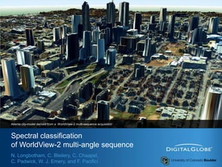
  • 1. Spectral classificationof WorldView-2 multi-angle sequence Atlanta city-model derived from a WorldView-2 multi-sequence acquisition N. Longbotham, C. Bleilery, C. Chaapel, C. Padwick, W. J. Emery, and F. Pacifici
  • 2. Outline 2 This presentation illustrates the unique aspects of the WorldView-2 satellite platform by combining multi-spectral information with multi-angle observations The previous presentation dealt with very high spatial resolution imagery with multi-angle observations What can we do with this kind of data set? Four experiments have been carried out to investigate the classification contribution of multi-angle reflectance (MAR) as well as different feature extraction data sets (reducing the large size of the raw data space)
  • 3. Methodology (1/2) 3 13 Multispectral Images 13 Panchromatic Images Digital Surface Model Atmospheric Correction Nadir Multispectral Multi-angle Multispectral 13 Multispectral True-Ortho Images Polynomial Multispectral Principal Component Analysis
  • 4. Methodology (2/2) 4 Polynomial Multispectral Nadir Multispectral Multi-angle Multispectral PCA y = ax2 + bx + c Poly fit standard error 104 bands 32bands 10 bands 8 bands
  • 7. Information Sources 7 The MAR contains a partial bidirectional reflectance distribution function (BRDF) over a single satellite track at a single sun angle Objects with pitched surfaces, such as trees and residential roofs, will present a different observational cross-section at each angle Surfaces with varying reflectance in both time and angle can be described by an error term that encapsulates the variation of a pixel through the multi-angle sequence
  • 8. Partial BRDF - over a single satellite track 8
  • 10. Varying reflectance in both time and angle (1/2) 10 Differentiates land-use of similar spectral signature low vs. high volume traffic roads Multi-angle spectral variability stationary vehicles
  • 11. Varying reflectance in both time and angle (2/2) 11
  • 12. Four Experiments The most-nadir multi-spectral image is used as base-case 12
  • 13. Classification and Validation 15 classes of interest have been selected representing a wide variety of both natural and man-made land-covers, including different kind of roof, roads, and vegetation Training: 50 samples per class Validation: 90,000 of independent samples Each of the classification experiments are conducted using the Random Forest algorithm 13
  • 16.
  • 21.
  • 22. Conclusions 18 This study showed that there is significant improvement in classification accuracy available from the spectral data in a multi-angle WorldView-2 image sequence. Four spectral classification experiments were separately presented using a nadir multi-spectral image, the full multi-angle multispectral data set, and two feature extraction techniques. The multi-angle spectral information provided 14% improvement in kappa coefficient over the base case of a single nadir multispectral image. Specific classes benefited from the unique aspects of the multi-angle information: The classes car and highway are of particular interest
  • 23.
  • 24.