
Recommended
Recommended
More Related Content
What's hot
What's hot (20)
Similar to GM Symposium 2016: Brendhan Zubricki, Essex
Similar to GM Symposium 2016: Brendhan Zubricki, Essex (20)
More from greenbelt82
More from greenbelt82 (20)
Recently uploaded
Recently uploaded (20)
GM Symposium 2016: Brendhan Zubricki, Essex
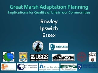
- 1. Great Marsh Adaptation Planning Implications for Quality of Life in our Communities Rowley Ipswich Essex
- 2. ROWLEY
- 3. Rowley Route 1A & Stackyard Road Jewell Mill Dam & Glen Street Bridge Marina,Town Boat Launch & low-lying houses Route 133 at Batchelder Brook RowleyTown Well #3 & well pumping station Identified Areas of Interest for Adaptation Planning Current Status Short-Term Recommendations Long-Term Recommendations ? ? ?
- 4. Route 1A & Stackyard Road VULNERABILITIES: • Coastal flooding • Sea level rise 2030 2070 Nelson Island
- 5. Route 1A & Stackyard Road 2030 2070
- 6. Natural Systems Help Us: Rowley salt marsh • recreation • shellfishing • scenic character • storm protection • floodwater storage • carbon sequestration
- 7. Current Adaptation Activities: Strategic Land Conservation
- 9. Nelson Island, Parker River National Wildlife Refuge
- 10. Continue acquisition of land to allow for salt marsh migration if/when available Increase resiliency of marsh and river systems by removing debris, assessing culverts, supporting natural drainage of water, removing Jewell Mill dam Monitor flood frequency and depth and create early warning system to alert residents when roads are likely to be flooded. Coordinate with evacuation planning for major storms. Need an alternate/primary evacuation route (Route 1). Ultimately further retreat may be needed and buyout of Stackyard Rd and other low-lying homes. Future Adaptation Strategies Rowley Route 1A & Stackyard Road
- 11. IPSWICH
- 12. IPSWICH Jeffrey’s Neck Road Downtown Ipswich Crane Beach – parking lots, road access & facilities Pavilion Beach Town Wharf & Sewage Pumping Station Brown’s Well on Route 1A Identified Areas of Interest for Adaptation Planning Current Status Short-Term Recommendations Long-Term Recommendations ? ? ?
- 13. Downtown Ipswich VULNERABILITIES: Riverine & tidal flooding plus increased stormwater Photo Credits: D. Bates
- 14. Probability of Coastal Inundation in 2030 and 2070 (includes projected storm surge) Downtown Ipswich 2030 2070 Ipswich Mills Dam & Riverwalk Choate Bridge County Street bridge Zumi’s
- 15. Downtown Ipswich 1% Flood Depth in 2030 and 2070 (includes projected storm surge) 2030 2070
- 16. Current Adaptation Activities Photo Credits:Alicia Geilen 2016 CZM Resiliency Grant awarded toTown of Ipswich for study of river bank erosion & future climate impacts Downtown Ipswich
- 17. • Downtown business owner engagement and education on building retrofits and general principles of resiliency • Ipswich Mills Dam Removal Feasibility Study will analyze the effects of removing the downtown dam, including downstream impacts and opportunities to restore upstream flood storage capacity • Encourage green infrastructure for stormwater and floodplain mitigation (i.e. rain gardens, pervious walkways & parking areas, infiltration trenches, and other best management practices) • Create and enhance riparian buffer along the Ipswich River up and downstream ofTown • Consider river bypass throughVeteran's Green/Elm St. area to accommodate 500-year flood Future Adaptation Strategies Downtown Ipswich
- 18. ESSEX
- 19. ESSEX Main Street Causeway & Woodman’s Landing Eastern Avenue at Ebben Creek Conomo Point & Robbins Road Crane Beach (southern tip) Identified Areas of Interest for Adaptation Planning Current Status Short-Term Recommendations Long-Term Recommendations ? ? ?
- 20. Main Street Causeway, Essex VULNERABILITIES: • Tidal flooding • Storm surge flooding
- 21. Probability of Coastal Inundation in 2030 and 2070 (includes projected storm surge) Main Street Causeway 2030 2070
- 22. 1% Flood Depth in 2030 and 2070 (includes projected storm surge) Main Street Causeway 2030 2070
- 23. Current Adaptation Activities • Causeway reconstruction in 2012 • Emergency vehicles are stationed on the East side of the Causeway when flooding is expected Main Street Causeway
- 24. • Engage business owners collectively on resiliency planning • Develop additional emergency monitoring policies & practices such as a live video feed showing if the Causeway is flooded or impassable • Encourage best management practices for floodplain mitigation (i.e. rain gardens, pervious pavement for parking lots and walkways, and other green infrastructure techniques) • Convene Essex CausewayWorking Group to begin resiliency planning for both short-term and long-term impacts (include local business owners, state agencies, and town representatives) • Beneficial Use of Dredged Materials from the Essex River Future Adaptation Strategies Main Street Causeway
- 25. Elevating Roads? Main St. Causeway, Essex Beach Road, Salisbury Plum IslandTurnpike, Newburyport Jeffrey’s Neck Road, Ipswich Route 1A, Rowley Argilla Road, Ipswich Longport, New Jersey
- 26. ThankYou Great Marsh Resiliency Planning Project www.greatmarshresiliency.org
Editor's Notes
- Hello everyone – I’m …. (introduction, member of the municipal task force, etc) Now that you’ve heard about the northern Great Marsh towns from Jon-Eric, I will walk you through some of the significant vulnerabilities in the southern towns of Rowley, Ipswich, and Essex. We’ll start with Rowley.
- A great example of both the role that the Great Marsh plays in protecting our communities, as well as the role WE play in supporting the Great Marsh, is in Rowley. Rural coastal community of 5856 residents, located between Newbury and Ipswich 19 sq. miles in size, of which 20% is Great Marsh 90% of town is zoned for residential use business development located inland along Route 1 & Route 1A corridors The natural systems of Plum Island and the salt marsh do an incredible job of protecting Rowley infrastructure from impacts of coastal storms Human effort has also in many cases been doing a great job of PRESERVING OPEN SPACE so that it can continue to do that job of protecting us.
- Rowley has several areas of concern in their inland region, arising from climate impacts in the form of heavier precipitation events causing increased fresh water flooding. Batchelder Brook which flows under Route 133 near the intersection of Route 1 and the historic Jewell Mill dam at the Mill River along Route 1 near Newbury are both vulnerable inland areas for the town. For today’s discussion, we are going to look more closely at a low-lying area closer to the coast, the marsh that surrounds Route 1A along the border with Newbury near Stackyard Road.
- As you can see from these images, this area is at risk from coastal flooding and storm surge coming in from the Parker River on the north side and the creeks and salt marsh in the east Flooding currently approaches Route 1A which is a major north-south transportation corridor. This hazard will get much worse as sea level rise continues. There are also neighborhoods of houses along Stackyard Road and Old Rowley Road that are at risk from flooding.
- Here’s a closer look at the actual DEPTH of flooding at this location. The purple and blue colors range between a depth of 3 ft to 10 ft, the darkest blue color showing depths greater than 10 feet.
- This area in Rowley emphasizes some good news about the future of the Great Marsh that we want to explore a bit more now. The Great Marsh is an ecosystem that provides a host of benefits to our communities including recreation, shellfishing, scenic character. The largest contiguous saltmarsh complex in New England, it includes more than 20,000 acres of ecological resources that provide critical protection for our communities As we heard from Taj and Melissa earlier, salt marshes also serve as a buffer between the open ocean and coastal storms, with the marsh vegetation slowing down waves and reducing the force of the water on the land. In addition they store floodwaters, and serve an important function storing carbon dioxide which mitigates global warming impacts.
- Strategic Land Conservation is a very important adaptation strategy. As a part of the Great Marsh Planning Project, the task forces worked with a “Marsh Adaptation Strategy Tool” which looked at areas that would be most affected by sea level rise in order to help communities begin the conversation of protecting lands to help preserve the ecosystem resources of the marsh as the climate changes. Towns should and are incorporating strategic land conservation and climate impacts into their open space planning. The Town of Rowley has used its Community Preservation Act funding to conserve some parcels for multiple uses, for example the Bradstreet Farm parcel to the east of the historic downtown on Route 1A. As you can see in the blue outline in the map on screen, sea level rise will result in the salt marsh expanding and approaching Rowley’s infrastructure in the future. Conserving lands that serve to buffer sea level rise from reaching town infrastructure such as homes and roads is a good idea.
- Regional partnerships are also a great tool for communities in preserving land. The Rough Meadows Sanctuary is a 226-acre preserve protected in 2014 as a partnership project by Mass Audubon and Essex County Greenbelt. This sanctuary preserves coastal woodlands, salt marshes, tidal creeks, and salt pannes; as well as an astonishing diversity of wildlife, miles of recreational trails, and non-motorized boating access to the creeks. It also is now a permanent protective buffer to the transportation corridor of Route 1A which runs north-south directly to the west
- Nelson Island, located at the end of Stackyard Road near the Rough Meadows sanctuary, is owned and managed by the U.S. Fish & Wildlife Service as part of the Parker River National Wildlife Refuge. This photo was taken this past October, during a King Tide. It gives a look at what the landscape will be like on a regular basis as the sea level rises. It should be noted that the Refuge has chosen to abandon this road to Nelson Island specifically as an adaptation strategy.
- Future Adaptation Strategies in Rowley include: Continue acquisition of land to allow for salt marsh migration if/when available Increase resiliency of marsh and river systems by removing debris, assessing culverts, supporting natural drainage of water, removing Jewell Mill dam Monitor flood frequency and depth and create early warning system to alert residents when roads are likely to be flooded. Coordinate with evacuation planning for major storms. Need an alternate/primary evacuation route (Route 1). Ultimately further retreat will be needed and buyout of Stackyard Rd and other low-lying homes.
- Ipswich is a mid-sized Great Marsh community of 13,175 residents. Similar to other towns, approximately 20% of its land area is Great Marsh, with hundreds of acres of salt marsh to the north and south. The Ipswich River flows in from the southern tip of Plum Island, with the town’s dense Downtown located along the banks of the river. Crane Beach is our southern Great Marsh barrier beach and is an important community resource for recreation and tourism. Owned by the state-wide conservation organization, the Trustees of Reservations, it is another important example of the way land protection can support natural systems that provide significant ecosystem resources to communities in the region.
- Vulnerable areas in Ipswich that have been identifies as priorities for the town’s adaptation planning include: Jeffrey’s Neck Road – the main road leading to the hundreds of homes located on Great Neck & Little Neck Downtown Ipswich, which we shall talk amore about coming up. Crane Beach – The Trustees of Reservations are doing their own coastal adaptation planning for the Crane Estate property, however the Town needs to address flooding issues that affect the parking lots and the facilities, as well as access along Argilla Road. Pavilion Beach, which is the only public beach in town, is located on Great Neck and faces current impacts from sea level rise Other vulnerable municipal assets include the Town Wharf & Sewage Pumping Station along the river, as well as one of the town’s public drinking water wells, called Brown’s Well on Route 1A, all of which will be impacted by flooding from sea level rise
- Downtown Ipswich businesses and roads are located along the Ipswich River. Riverine & coastal flooding affects roads, downtown businesses which vary from small locally owned shops to the large international publishing company EBSCO, as well as mixed housing Route 133 and 1A run through downtown and cross over the river at the Choate Bridge. River overflowed its bank at the Mother’s Day flood events. Ipswich Mills dam is in the center of the downtown economic business district There are additional flooding impacts on the Town Hall & the sewage pumping station along the river to the northeast of downtown; as well as the Riverwalk trail and the public boat launch at the Town Wharf.
- The CZM grant will support a project to identify vulnerable areas along the Ipswich River between the Ipswich Mills dam downtown and the Town Wharf on Water Street. A team of coastal geologists and engineers have been hired by the town to inspect erosion and areas that have deteriorated due to both tidal and inland flooding. The focus of the study will be areas of the river bank adjacent to town infrastructure such as water, sewer, and roads. The project will also consider the long-term impacts of climate change, including sea level rise and heavier storms, in its recommended improvements, prioritizing nature-based solutions (such as living shorelines) to combat the erosion and provide long-term stabilization of the bank. The project also includes public education on these topics through signage and public presentations next spring, as well as assessment of the feasibility of constructing a public access area for launching non-motorized boats behind the Ipswich Town Hall.
- Downtown business owner engagement and education on building retrofits and general principles of resiliency. Ipswich Mills Dam Removal Feasibility Study (to be completed in 2017) will analyze the feasibility, cost, and effects of removing the downtown dam, including any impacts downstream and opportunities to restore upstream flood storage capacity Encourage landscaping techniques for stormwater mitigation (i.e. rain gardens, pervious walkways & patios, infiltration trenches, and other green infrastructure techniques Create and enhance riparian buffer along the Ipswich River up and downstream of Town Consider river bypass through Veteran's Green/Elm St. area to accommodate 500-year flood
- With 3504 residents, the town encompasses 16 sq. miles of which 48% is forested and 34% is Great Marsh The majority of the town’s infrastructure is located along Rt 133/ Main St Causeway spanning salt marsh and Essex River
- Main Street Causeway & Woodman’s Landing Eastern Avenue at Ebben Creek Conomo Point & Robbins Road Crane Beach (southern tip)
- As you know and can see looking out the window here at Woodman’s, the Main Street Causeway stretches for 0.8 miles and is a critical connective corridor between Cape Ann and Ipswich. The Causeway is home to dozens of restaurants and antique shops, stores, churches, and marinas in the town center. It is the center of the town’s business and recreational economy. The Causeway is subject to regular tidal and storm flooding. The photo on the right was taken in October during the King Tide. Flooding of the Essex River goes under the bridge and back fills the area right here near Woodman’s Beach, lasting for hours. Direct consequences of the hazard are a flooded road. Cumulative consequences of the hazard include cutting off of emergency services and impacts on the store-front economy.
- The Essex Causeway was reconstructed and repaved a few years ago as part of sewer project; flooding was reduced. Emergency vehicles are stationed on the East side of the Causeway when flooding is expected. Flooding of primary transportation corridors is an issue throughout the Great Marsh, including Plum Island Turnpike and Jeffrey’s Neck Road in Ipswich.
- Engage business owners collectively on resiliency planning Develop emergency monitoring policies & practices such as a live video feed showing the Causeway so residents can go online and see in real-time if it’s flooded or impassable Encourage floodplain mitigation (i.e. rain gardens, pervious walkways & patios, infiltration trenches, and other green infrastructure techniques) maximizing the function of the floodplain in slowing down and dissipating flood water energy during storm, or even just high, tides Beneficial Re-use of dredged materials: keeping the sediment in the system and finding ways to enhance green infrastructure is an excellent approach Convene Essex Causeway Working Group to begin planning for long-term impacts (include local business owners, state agencies, and town representatives)
- Flooding of primary transportation corridors is an issue throughout the Great Marsh, including Plum Island Turnpike and Jeffrey’s Neck Road in Ipswich. The Essex Causeway was reconstructed and repaved a few years ago as part of sewer project; flooding was reduced. Emergency vehicles are stationed on the East side of the Causeway when flooding is expected. Jeffrey’s Neck Road in Ipswich is in the design phase of raising the road to reduce flooding. Other communities are doing it in other regions around the country. If/when raising a road or causeway, the following considerations are important: - need to be careful not to block the marsh from draining - permeable pavement - capturing run-off - keeping hydrology as natural as possible - addressing erosion near edges of roads - COST!
- Thank you….