SlideShare a Scribd company logo
1 of 21
CARLOS GABRIEL ASATO - EUGENIA MARIANA WRIGHT
ATLAS TECHNOLOGY, A DIGITAL FRAMEWORK FOR
EFFICIENT MANAGEMENT AND USE OF REGIONAL DATA
THE ARGENTINA SATELLITE ATLAS
Objetives
• Create a reference guide for regional studies of Argentina territory.
• Create a cartographic product oriented to the public, students and
scientists requirements.
• Generate a cartographic product that promotes the geographical
space comprehension, identification or localization of related
spatial information.
• Enhacement of the SEGEMAR SDI capability.
Argentina Geographical and Data Context
Pros and Cons
Argentina 3.000.000 Km2
The Cons
Lack of digital information specially
detailed topographic, geological and
other kind of spatial data.
Strong difficulties in data surveying,
management and maitenance.
Low budgets and little human resources.
Old hardware and software system
The Pros
Strong experience
on automatical digital map production
Free Internet geodata availability
Operative corporate GIS support
Usefull information and data structures
are available at SEGEMAR
Computer and Software
• Arc-Info 8.0 (Unix and WinNT)
• Arc-View 3.2
• X-Terminal emulator
• Corel Draw 9
• Erdas
• Sun Enterprise 250 (application server)
• Pentium Pro 200 mhz (Samba file server)
• Pentium 200 mhz (digitizing and edition)
• Pentium II, 400 mhz (programming)
• Pentium III, 650 mhz (cartographic finishing)
• Pentium III, 1Gz (Image processing, JICA)
• Xerox Docucolor 450 (printing system, JICA)
Data Sources
• Landsat 5 TM Geocover Mosaics, UNEP
• Gtopo 30, NOAA
• Corporate Geodatabase at 1:500.000
• Argentina Cartographic Names List (IGM)
• Country boundary at 1:250.000 (IGM)
System Production Design Criteria
• GIS based Atlas.
• Creation of Cartographic Automated Production System.
• Corporate digital cartographic production techniques.
• Cartographic modular design.
Database Design and Production Concepts
The amount of data and geographic complexity requires the
development of operational and systematic patterns of cartographic
production systems similar to those used at manufacturing
industry
The definition of Institutional or Corporate GIS framework
became critical!!
Perfomance Balance Diagram
Hardware and
Software
Capabilities
Technical
Knowledge &
Experience
Data
Amount,
Availability &
Complexity
Needs
GIS
Product
Work Flow Diagram
GIS
Digital Cartographic Finishing
Corporate Database Services
Final Product
Database and Geo-Information Subsystems
• Corporate Geo Database System
– Auxiliary and contextual information
– Cartographic management system
• Corporate AML Programs
– Main Map Production AML (ontology based)
– Auxiliary maps
– Satellite Key Interpretation Legend Generator
– Others
• Cartographic Names System
• Landsat TM Image Catalog
Atlas Cartographic Structure
• Printed maps, full color, paper size A3
• General Maps
• Index Maps
• Standard Image Maps at 1:1.000.000 scale
Cartographic Elements
Main Display Map Name
and ID
Index Map
References
Geographical
Grid
Auxiliary Information
Scale
Satellite Key Interpretation Legend Generator
Classification adapted from Anderson (1976) and CORINE (1993)
Auxiliary Maps & Diagrams
Future Developments
Metallogenic Atlas of South America (in progress)
Satellite Atlas version 2, 3 & 4 (under development)
Other SDI proyects (under development)
The Argentine Satellite Atlas for Geological and Geographical Studies is a high quality
cartographic product that could be developed by using a GIS technology and by integrating
geodata management and digital cartographic techniques.
Using automated cartographic procedures –similar to industrial production methods- it was
possible to create a cartographic product in a short time (7200 working hours/man) with
little human resources (two persons). Automated process also gives a much more consistent
way for cartographic error handling, facilitating map corrections.
The Argentine Satellite Atlas is a valuable reference document that facilitates the
comprehension and development of different regional studies of the country.
This project has allowed the creation of a technological basement and geoinformation
infrastructure, which will promote the development of new systematic products.
Conclusions
Good geospatial data structures and balanced work infraestructure
promote the efficient use and analysis of a huge amount of data!!!
SEGEMAR
Japan International Cooperation Agency
Geological Survey of Canada (MAP-GAC) - Vancouver
Acknowledgements

More Related Content

What's hot

Emad masadeh resume
Emad masadeh resumeEmad masadeh resume
Emad masadeh resumeemad_masadeh
 
Geographical Information System(GIS) in Urban Design
Geographical Information System(GIS) in Urban DesignGeographical Information System(GIS) in Urban Design
Geographical Information System(GIS) in Urban DesignPurushottam Uttarwar
 
How to play with maps @ 20180321 Google sharing
How to play with maps @ 20180321 Google sharingHow to play with maps @ 20180321 Google sharing
How to play with maps @ 20180321 Google sharingYi Lin
 
GIS and its value in the oil and gas
GIS and its value in the oil and gasGIS and its value in the oil and gas
GIS and its value in the oil and gasAndrew Cutts
 
Unique methods of GIS in Transportation
Unique methods of GIS in TransportationUnique methods of GIS in Transportation
Unique methods of GIS in TransportationAndrew Harrison
 
Gis applications in tourism a tool for sustainable tourism
Gis applications in tourism  a tool for sustainable tourismGis applications in tourism  a tool for sustainable tourism
Gis applications in tourism a tool for sustainable tourismpankaj kumar
 
d|Bootcamp Nairobi 2014 - Why Location Matters
d|Bootcamp Nairobi 2014 - Why Location Mattersd|Bootcamp Nairobi 2014 - Why Location Matters
d|Bootcamp Nairobi 2014 - Why Location MattersCodeForAfrica
 
Application of GIS
Application of GISApplication of GIS
Application of GISRohit Pant
 
UCT GIS Labs
UCT GIS LabsUCT GIS Labs
UCT GIS Labspvhead123
 
Use of AI in commuting
Use of AI in commutingUse of AI in commuting
Use of AI in commutingBansi Mehta
 
My Advice to the future african gis personnel
My Advice to the future african gis personnelMy Advice to the future african gis personnel
My Advice to the future african gis personnelCyhanaWilliams
 
Lect 9 lab-1 intro to interface
Lect 9 lab-1 intro to interfaceLect 9 lab-1 intro to interface
Lect 9 lab-1 intro to interfaceRehana Jamal
 
Crowd-Sourcing Approach of Building Ground Truth Database for Global Urban Ar...
Crowd-Sourcing Approach of Building Ground Truth Database for Global Urban Ar...Crowd-Sourcing Approach of Building Ground Truth Database for Global Urban Ar...
Crowd-Sourcing Approach of Building Ground Truth Database for Global Urban Ar...Hiroyuki Miyazaki
 
Presentation spatial data nata final
Presentation spatial data nata finalPresentation spatial data nata final
Presentation spatial data nata finalMahbubul Hassan
 
Telling Stories with Maps - Esri UK Annual Conference 2016ac
Telling Stories with Maps - Esri UK Annual Conference 2016acTelling Stories with Maps - Esri UK Annual Conference 2016ac
Telling Stories with Maps - Esri UK Annual Conference 2016acEsri UK
 

What's hot (20)

Emad masadeh resume
Emad masadeh resumeEmad masadeh resume
Emad masadeh resume
 
Geographical Information System(GIS) in Urban Design
Geographical Information System(GIS) in Urban DesignGeographical Information System(GIS) in Urban Design
Geographical Information System(GIS) in Urban Design
 
How to play with maps @ 20180321 Google sharing
How to play with maps @ 20180321 Google sharingHow to play with maps @ 20180321 Google sharing
How to play with maps @ 20180321 Google sharing
 
application of gis
application of gisapplication of gis
application of gis
 
Amal Mohamed-CV
Amal Mohamed-CVAmal Mohamed-CV
Amal Mohamed-CV
 
GIS and its value in the oil and gas
GIS and its value in the oil and gasGIS and its value in the oil and gas
GIS and its value in the oil and gas
 
Unique methods of GIS in Transportation
Unique methods of GIS in TransportationUnique methods of GIS in Transportation
Unique methods of GIS in Transportation
 
Gis applications in tourism a tool for sustainable tourism
Gis applications in tourism  a tool for sustainable tourismGis applications in tourism  a tool for sustainable tourism
Gis applications in tourism a tool for sustainable tourism
 
d|Bootcamp Nairobi 2014 - Why Location Matters
d|Bootcamp Nairobi 2014 - Why Location Mattersd|Bootcamp Nairobi 2014 - Why Location Matters
d|Bootcamp Nairobi 2014 - Why Location Matters
 
Application of GIS
Application of GISApplication of GIS
Application of GIS
 
UCT GIS Labs
UCT GIS LabsUCT GIS Labs
UCT GIS Labs
 
Resume
ResumeResume
Resume
 
Resume
ResumeResume
Resume
 
Use of AI in commuting
Use of AI in commutingUse of AI in commuting
Use of AI in commuting
 
My Advice to the future african gis personnel
My Advice to the future african gis personnelMy Advice to the future african gis personnel
My Advice to the future african gis personnel
 
Lect 9 lab-1 intro to interface
Lect 9 lab-1 intro to interfaceLect 9 lab-1 intro to interface
Lect 9 lab-1 intro to interface
 
Deploma
DeplomaDeploma
Deploma
 
Crowd-Sourcing Approach of Building Ground Truth Database for Global Urban Ar...
Crowd-Sourcing Approach of Building Ground Truth Database for Global Urban Ar...Crowd-Sourcing Approach of Building Ground Truth Database for Global Urban Ar...
Crowd-Sourcing Approach of Building Ground Truth Database for Global Urban Ar...
 
Presentation spatial data nata final
Presentation spatial data nata finalPresentation spatial data nata final
Presentation spatial data nata final
 
Telling Stories with Maps - Esri UK Annual Conference 2016ac
Telling Stories with Maps - Esri UK Annual Conference 2016acTelling Stories with Maps - Esri UK Annual Conference 2016ac
Telling Stories with Maps - Esri UK Annual Conference 2016ac
 

Similar to ATLAS TECHNOLOGY, A DIGITAL FRAMEWORK FOR EFFICIENT MANAGEMENT AND USE OF REGIONAL DATA THE ARGENTINA SATELLITE ATLAS

Geographical information system
Geographical information systemGeographical information system
Geographical information systemBipin Karki
 
Geographical information system
Geographical information systemGeographical information system
Geographical information systemBipin Karki
 
Geographic information system
Geographic information systemGeographic information system
Geographic information systemSumanta Das
 
A GIS Based Satellite Data Management Application
A GIS Based Satellite Data Management ApplicationA GIS Based Satellite Data Management Application
A GIS Based Satellite Data Management ApplicationCarlos Gabriel Asato
 
GIS Application in Water Resource Management by Engr. Ehtisham Habib
GIS Application in Water Resource Management by Engr. Ehtisham HabibGIS Application in Water Resource Management by Engr. Ehtisham Habib
GIS Application in Water Resource Management by Engr. Ehtisham HabibEhtisham Habib
 
Introduction to Geographic Information Systems (GIS).pptx
Introduction to Geographic Information Systems (GIS).pptxIntroduction to Geographic Information Systems (GIS).pptx
Introduction to Geographic Information Systems (GIS).pptxUniversity of Colombo
 
GEOMATIC WORLD WITH A SPECIAL LOOK TO GIS
GEOMATIC WORLDWITH A SPECIAL LOOK TO GISGEOMATIC WORLDWITH A SPECIAL LOOK TO GIS
GEOMATIC WORLD WITH A SPECIAL LOOK TO GISMary Adel
 
Data Appliance for ArcGIS
Data Appliance for ArcGISData Appliance for ArcGIS
Data Appliance for ArcGISEsri
 
2017 GIS in Education Track: Sharing Historical Maps and Atlases in Web Apps
2017 GIS in Education Track: Sharing Historical Maps and Atlases in Web Apps2017 GIS in Education Track: Sharing Historical Maps and Atlases in Web Apps
2017 GIS in Education Track: Sharing Historical Maps and Atlases in Web AppsGIS in the Rockies
 
GEOGRAPHICAL INFORMATION SYSTEM (GIS)
GEOGRAPHICAL INFORMATION SYSTEM (GIS)GEOGRAPHICAL INFORMATION SYSTEM (GIS)
GEOGRAPHICAL INFORMATION SYSTEM (GIS)subhashB10
 
Spar 2010 Presetation
Spar 2010 PresetationSpar 2010 Presetation
Spar 2010 Presetationcformeller
 

Similar to ATLAS TECHNOLOGY, A DIGITAL FRAMEWORK FOR EFFICIENT MANAGEMENT AND USE OF REGIONAL DATA THE ARGENTINA SATELLITE ATLAS (20)

Geographical information system
Geographical information systemGeographical information system
Geographical information system
 
Geographical information system
Geographical information systemGeographical information system
Geographical information system
 
Geographic information system
Geographic information systemGeographic information system
Geographic information system
 
A GIS Based Satellite Data Management Application
A GIS Based Satellite Data Management ApplicationA GIS Based Satellite Data Management Application
A GIS Based Satellite Data Management Application
 
GIS Application in Water Resource Management by Engr. Ehtisham Habib
GIS Application in Water Resource Management by Engr. Ehtisham HabibGIS Application in Water Resource Management by Engr. Ehtisham Habib
GIS Application in Water Resource Management by Engr. Ehtisham Habib
 
Introduction to Geographic Information Systems (GIS).pptx
Introduction to Geographic Information Systems (GIS).pptxIntroduction to Geographic Information Systems (GIS).pptx
Introduction to Geographic Information Systems (GIS).pptx
 
gis.pdf
gis.pdfgis.pdf
gis.pdf
 
gis.pdf
gis.pdfgis.pdf
gis.pdf
 
GEOMATIC WORLD WITH A SPECIAL LOOK TO GIS
GEOMATIC WORLDWITH A SPECIAL LOOK TO GISGEOMATIC WORLDWITH A SPECIAL LOOK TO GIS
GEOMATIC WORLD WITH A SPECIAL LOOK TO GIS
 
Rs unit iii-gis--- [repaired]
Rs unit iii-gis--- [repaired]Rs unit iii-gis--- [repaired]
Rs unit iii-gis--- [repaired]
 
Rs unit iii-gis--- [repaired]
Rs unit iii-gis--- [repaired]Rs unit iii-gis--- [repaired]
Rs unit iii-gis--- [repaired]
 
Data Appliance for ArcGIS
Data Appliance for ArcGISData Appliance for ArcGIS
Data Appliance for ArcGIS
 
Gis basic-2
Gis basic-2Gis basic-2
Gis basic-2
 
lecture03.ppt
lecture03.pptlecture03.ppt
lecture03.ppt
 
Geographical Information System
Geographical Information SystemGeographical Information System
Geographical Information System
 
FUnding.ppt
FUnding.pptFUnding.ppt
FUnding.ppt
 
fund.ppt
fund.pptfund.ppt
fund.ppt
 
2017 GIS in Education Track: Sharing Historical Maps and Atlases in Web Apps
2017 GIS in Education Track: Sharing Historical Maps and Atlases in Web Apps2017 GIS in Education Track: Sharing Historical Maps and Atlases in Web Apps
2017 GIS in Education Track: Sharing Historical Maps and Atlases in Web Apps
 
GEOGRAPHICAL INFORMATION SYSTEM (GIS)
GEOGRAPHICAL INFORMATION SYSTEM (GIS)GEOGRAPHICAL INFORMATION SYSTEM (GIS)
GEOGRAPHICAL INFORMATION SYSTEM (GIS)
 
Spar 2010 Presetation
Spar 2010 PresetationSpar 2010 Presetation
Spar 2010 Presetation
 

More from Carlos Gabriel Asato

EXPERIENCIAS EN EL DESARROLLO DE LA PRODUCCIÓN CARTOGRÁFICA AUTOMATIZADA MED...
EXPERIENCIAS EN EL DESARROLLO DE LA  PRODUCCIÓN CARTOGRÁFICA AUTOMATIZADA MED...EXPERIENCIAS EN EL DESARROLLO DE LA  PRODUCCIÓN CARTOGRÁFICA AUTOMATIZADA MED...
EXPERIENCIAS EN EL DESARROLLO DE LA PRODUCCIÓN CARTOGRÁFICA AUTOMATIZADA MED...Carlos Gabriel Asato
 
Introducción a la Creación de Mapas de Potencial Geotérmico Mediante el Métod...
Introducción a la Creación de Mapas de Potencial Geotérmico Mediante el Métod...Introducción a la Creación de Mapas de Potencial Geotérmico Mediante el Métod...
Introducción a la Creación de Mapas de Potencial Geotérmico Mediante el Métod...Carlos Gabriel Asato
 
Proyecto de Transformación Digital de la Información Geológica Regional en YP...
Proyecto de Transformación Digital de la Información Geológica Regional en YP...Proyecto de Transformación Digital de la Información Geológica Regional en YP...
Proyecto de Transformación Digital de la Información Geológica Regional en YP...Carlos Gabriel Asato
 
APLICACIÓN DEL MÉTODO PLAY FAIRWAY PARA LA DETERMINACIÓN DE ZONAS DE FAVORABI...
APLICACIÓN DEL MÉTODO PLAY FAIRWAY PARA LA DETERMINACIÓN DE ZONAS DE FAVORABI...APLICACIÓN DEL MÉTODO PLAY FAIRWAY PARA LA DETERMINACIÓN DE ZONAS DE FAVORABI...
APLICACIÓN DEL MÉTODO PLAY FAIRWAY PARA LA DETERMINACIÓN DE ZONAS DE FAVORABI...Carlos Gabriel Asato
 
Contextual Elements for Geoscience Standards Adoption and Development in SA S...
Contextual Elements for Geoscience Standards Adoption and Development in SA S...Contextual Elements for Geoscience Standards Adoption and Development in SA S...
Contextual Elements for Geoscience Standards Adoption and Development in SA S...Carlos Gabriel Asato
 
Análisis Geoespacial y Potencial Minero
Análisis Geoespacial y Potencial MineroAnálisis Geoespacial y Potencial Minero
Análisis Geoespacial y Potencial MineroCarlos Gabriel Asato
 
Comparación Presupuestaria En el contexto de los aportes de los Servicios Geo...
Comparación Presupuestaria En el contexto de los aportes de los Servicios Geo...Comparación Presupuestaria En el contexto de los aportes de los Servicios Geo...
Comparación Presupuestaria En el contexto de los aportes de los Servicios Geo...Carlos Gabriel Asato
 
Estudio sobre política pública, Servicios Geológicos y Desarrollo (DRAFT=
Estudio sobre política pública, Servicios Geológicos y Desarrollo (DRAFT=Estudio sobre política pública, Servicios Geológicos y Desarrollo (DRAFT=
Estudio sobre política pública, Servicios Geológicos y Desarrollo (DRAFT=Carlos Gabriel Asato
 
2019 Geopackage estándar de OGC para la transferencia física de datos geoespa...
2019 Geopackage estándar de OGC para la transferencia física de datos geoespa...2019 Geopackage estándar de OGC para la transferencia física de datos geoespa...
2019 Geopackage estándar de OGC para la transferencia física de datos geoespa...Carlos Gabriel Asato
 
Las Bases de Datos Geoespaciales. Impactos en SIG y Cartografía Digital
Las Bases de Datos Geoespaciales. Impactos en SIG y Cartografía DigitalLas Bases de Datos Geoespaciales. Impactos en SIG y Cartografía Digital
Las Bases de Datos Geoespaciales. Impactos en SIG y Cartografía DigitalCarlos Gabriel Asato
 
Los Topónimos su manejo mediante SIG y sus aplicaciones en cartografía
Los Topónimos su manejo mediante SIG y sus aplicaciones en cartografíaLos Topónimos su manejo mediante SIG y sus aplicaciones en cartografía
Los Topónimos su manejo mediante SIG y sus aplicaciones en cartografíaCarlos Gabriel Asato
 
La Calidad de la Información Geoespacial Digital, sus Limitaciones, y su Imp...
La Calidad de la Información Geoespacial Digital, sus Limitaciones,  y su Imp...La Calidad de la Información Geoespacial Digital, sus Limitaciones,  y su Imp...
La Calidad de la Información Geoespacial Digital, sus Limitaciones, y su Imp...Carlos Gabriel Asato
 
How cool can be the migration of an old gis corporate dataset to a new system...
How cool can be the migration of an old gis corporate dataset to a new system...How cool can be the migration of an old gis corporate dataset to a new system...
How cool can be the migration of an old gis corporate dataset to a new system...Carlos Gabriel Asato
 
Introducción al los Modelos Digitales de Terreno y su Análisis con Sistemas d...
Introducción al los Modelos Digitales de Terreno y su Análisis con Sistemas d...Introducción al los Modelos Digitales de Terreno y su Análisis con Sistemas d...
Introducción al los Modelos Digitales de Terreno y su Análisis con Sistemas d...Carlos Gabriel Asato
 
Explotación de Información Geocientífica por Internet. Desde Geo-RSS a WMS, h...
Explotación de Información Geocientífica por Internet. Desde Geo-RSS a WMS, h...Explotación de Información Geocientífica por Internet. Desde Geo-RSS a WMS, h...
Explotación de Información Geocientífica por Internet. Desde Geo-RSS a WMS, h...Carlos Gabriel Asato
 
Avances y Desarrollo del Servicio Geológico Minero Argentino en Cartografía D...
Avances y Desarrollo del Servicio Geológico Minero Argentino en Cartografía D...Avances y Desarrollo del Servicio Geológico Minero Argentino en Cartografía D...
Avances y Desarrollo del Servicio Geológico Minero Argentino en Cartografía D...Carlos Gabriel Asato
 
Un Dato Varios Formatos: Generado Salidas con XSLT
Un Dato Varios Formatos: Generado Salidas con XSLTUn Dato Varios Formatos: Generado Salidas con XSLT
Un Dato Varios Formatos: Generado Salidas con XSLTCarlos Gabriel Asato
 

More from Carlos Gabriel Asato (20)

EXPERIENCIAS EN EL DESARROLLO DE LA PRODUCCIÓN CARTOGRÁFICA AUTOMATIZADA MED...
EXPERIENCIAS EN EL DESARROLLO DE LA  PRODUCCIÓN CARTOGRÁFICA AUTOMATIZADA MED...EXPERIENCIAS EN EL DESARROLLO DE LA  PRODUCCIÓN CARTOGRÁFICA AUTOMATIZADA MED...
EXPERIENCIAS EN EL DESARROLLO DE LA PRODUCCIÓN CARTOGRÁFICA AUTOMATIZADA MED...
 
Introducción a la Creación de Mapas de Potencial Geotérmico Mediante el Métod...
Introducción a la Creación de Mapas de Potencial Geotérmico Mediante el Métod...Introducción a la Creación de Mapas de Potencial Geotérmico Mediante el Métod...
Introducción a la Creación de Mapas de Potencial Geotérmico Mediante el Métod...
 
Proyecto de Transformación Digital de la Información Geológica Regional en YP...
Proyecto de Transformación Digital de la Información Geológica Regional en YP...Proyecto de Transformación Digital de la Información Geológica Regional en YP...
Proyecto de Transformación Digital de la Información Geológica Regional en YP...
 
APLICACIÓN DEL MÉTODO PLAY FAIRWAY PARA LA DETERMINACIÓN DE ZONAS DE FAVORABI...
APLICACIÓN DEL MÉTODO PLAY FAIRWAY PARA LA DETERMINACIÓN DE ZONAS DE FAVORABI...APLICACIÓN DEL MÉTODO PLAY FAIRWAY PARA LA DETERMINACIÓN DE ZONAS DE FAVORABI...
APLICACIÓN DEL MÉTODO PLAY FAIRWAY PARA LA DETERMINACIÓN DE ZONAS DE FAVORABI...
 
Características del Sensor Aster
Características del Sensor AsterCaracterísticas del Sensor Aster
Características del Sensor Aster
 
Contextual Elements for Geoscience Standards Adoption and Development in SA S...
Contextual Elements for Geoscience Standards Adoption and Development in SA S...Contextual Elements for Geoscience Standards Adoption and Development in SA S...
Contextual Elements for Geoscience Standards Adoption and Development in SA S...
 
Análisis Geoespacial y Potencial Minero
Análisis Geoespacial y Potencial MineroAnálisis Geoespacial y Potencial Minero
Análisis Geoespacial y Potencial Minero
 
Comparación Presupuestaria En el contexto de los aportes de los Servicios Geo...
Comparación Presupuestaria En el contexto de los aportes de los Servicios Geo...Comparación Presupuestaria En el contexto de los aportes de los Servicios Geo...
Comparación Presupuestaria En el contexto de los aportes de los Servicios Geo...
 
Estudio sobre política pública, Servicios Geológicos y Desarrollo (DRAFT=
Estudio sobre política pública, Servicios Geológicos y Desarrollo (DRAFT=Estudio sobre política pública, Servicios Geológicos y Desarrollo (DRAFT=
Estudio sobre política pública, Servicios Geológicos y Desarrollo (DRAFT=
 
2019 Geopackage estándar de OGC para la transferencia física de datos geoespa...
2019 Geopackage estándar de OGC para la transferencia física de datos geoespa...2019 Geopackage estándar de OGC para la transferencia física de datos geoespa...
2019 Geopackage estándar de OGC para la transferencia física de datos geoespa...
 
Las Bases de Datos Geoespaciales. Impactos en SIG y Cartografía Digital
Las Bases de Datos Geoespaciales. Impactos en SIG y Cartografía DigitalLas Bases de Datos Geoespaciales. Impactos en SIG y Cartografía Digital
Las Bases de Datos Geoespaciales. Impactos en SIG y Cartografía Digital
 
Introduccion sql geoespacial
Introduccion sql geoespacialIntroduccion sql geoespacial
Introduccion sql geoespacial
 
Los Topónimos su manejo mediante SIG y sus aplicaciones en cartografía
Los Topónimos su manejo mediante SIG y sus aplicaciones en cartografíaLos Topónimos su manejo mediante SIG y sus aplicaciones en cartografía
Los Topónimos su manejo mediante SIG y sus aplicaciones en cartografía
 
La Calidad de la Información Geoespacial Digital, sus Limitaciones, y su Imp...
La Calidad de la Información Geoespacial Digital, sus Limitaciones,  y su Imp...La Calidad de la Información Geoespacial Digital, sus Limitaciones,  y su Imp...
La Calidad de la Información Geoespacial Digital, sus Limitaciones, y su Imp...
 
How cool can be the migration of an old gis corporate dataset to a new system...
How cool can be the migration of an old gis corporate dataset to a new system...How cool can be the migration of an old gis corporate dataset to a new system...
How cool can be the migration of an old gis corporate dataset to a new system...
 
Introducción al los Modelos Digitales de Terreno y su Análisis con Sistemas d...
Introducción al los Modelos Digitales de Terreno y su Análisis con Sistemas d...Introducción al los Modelos Digitales de Terreno y su Análisis con Sistemas d...
Introducción al los Modelos Digitales de Terreno y su Análisis con Sistemas d...
 
Ser Informado con RSS
Ser Informado con RSSSer Informado con RSS
Ser Informado con RSS
 
Explotación de Información Geocientífica por Internet. Desde Geo-RSS a WMS, h...
Explotación de Información Geocientífica por Internet. Desde Geo-RSS a WMS, h...Explotación de Información Geocientífica por Internet. Desde Geo-RSS a WMS, h...
Explotación de Información Geocientífica por Internet. Desde Geo-RSS a WMS, h...
 
Avances y Desarrollo del Servicio Geológico Minero Argentino en Cartografía D...
Avances y Desarrollo del Servicio Geológico Minero Argentino en Cartografía D...Avances y Desarrollo del Servicio Geológico Minero Argentino en Cartografía D...
Avances y Desarrollo del Servicio Geológico Minero Argentino en Cartografía D...
 
Un Dato Varios Formatos: Generado Salidas con XSLT
Un Dato Varios Formatos: Generado Salidas con XSLTUn Dato Varios Formatos: Generado Salidas con XSLT
Un Dato Varios Formatos: Generado Salidas con XSLT
 

Recently uploaded

Consent & Privacy Signals on Google *Pixels* - MeasureCamp Amsterdam 2024
Consent & Privacy Signals on Google *Pixels* - MeasureCamp Amsterdam 2024Consent & Privacy Signals on Google *Pixels* - MeasureCamp Amsterdam 2024
Consent & Privacy Signals on Google *Pixels* - MeasureCamp Amsterdam 2024thyngster
 
办理(Vancouver毕业证书)加拿大温哥华岛大学毕业证成绩单原版一比一
办理(Vancouver毕业证书)加拿大温哥华岛大学毕业证成绩单原版一比一办理(Vancouver毕业证书)加拿大温哥华岛大学毕业证成绩单原版一比一
办理(Vancouver毕业证书)加拿大温哥华岛大学毕业证成绩单原版一比一F La
 
Industrialised data - the key to AI success.pdf
Industrialised data - the key to AI success.pdfIndustrialised data - the key to AI success.pdf
Industrialised data - the key to AI success.pdfLars Albertsson
 
Saket, (-DELHI )+91-9654467111-(=)CHEAP Call Girls in Escorts Service Saket C...
Saket, (-DELHI )+91-9654467111-(=)CHEAP Call Girls in Escorts Service Saket C...Saket, (-DELHI )+91-9654467111-(=)CHEAP Call Girls in Escorts Service Saket C...
Saket, (-DELHI )+91-9654467111-(=)CHEAP Call Girls in Escorts Service Saket C...Sapana Sha
 
办理学位证中佛罗里达大学毕业证,UCF成绩单原版一比一
办理学位证中佛罗里达大学毕业证,UCF成绩单原版一比一办理学位证中佛罗里达大学毕业证,UCF成绩单原版一比一
办理学位证中佛罗里达大学毕业证,UCF成绩单原版一比一F sss
 
Building on a FAIRly Strong Foundation to Connect Academic Research to Transl...
Building on a FAIRly Strong Foundation to Connect Academic Research to Transl...Building on a FAIRly Strong Foundation to Connect Academic Research to Transl...
Building on a FAIRly Strong Foundation to Connect Academic Research to Transl...Jack DiGiovanna
 
Beautiful Sapna Vip Call Girls Hauz Khas 9711199012 Call /Whatsapps
Beautiful Sapna Vip  Call Girls Hauz Khas 9711199012 Call /WhatsappsBeautiful Sapna Vip  Call Girls Hauz Khas 9711199012 Call /Whatsapps
Beautiful Sapna Vip Call Girls Hauz Khas 9711199012 Call /Whatsappssapnasaifi408
 
Call Girls In Dwarka 9654467111 Escorts Service
Call Girls In Dwarka 9654467111 Escorts ServiceCall Girls In Dwarka 9654467111 Escorts Service
Call Girls In Dwarka 9654467111 Escorts ServiceSapana Sha
 
DBA Basics: Getting Started with Performance Tuning.pdf
DBA Basics: Getting Started with Performance Tuning.pdfDBA Basics: Getting Started with Performance Tuning.pdf
DBA Basics: Getting Started with Performance Tuning.pdfJohn Sterrett
 
High Class Call Girls Noida Sector 39 Aarushi 🔝8264348440🔝 Independent Escort...
High Class Call Girls Noida Sector 39 Aarushi 🔝8264348440🔝 Independent Escort...High Class Call Girls Noida Sector 39 Aarushi 🔝8264348440🔝 Independent Escort...
High Class Call Girls Noida Sector 39 Aarushi 🔝8264348440🔝 Independent Escort...soniya singh
 
Dubai Call Girls Wifey O52&786472 Call Girls Dubai
Dubai Call Girls Wifey O52&786472 Call Girls DubaiDubai Call Girls Wifey O52&786472 Call Girls Dubai
Dubai Call Girls Wifey O52&786472 Call Girls Dubaihf8803863
 
04242024_CCC TUG_Joins and Relationships
04242024_CCC TUG_Joins and Relationships04242024_CCC TUG_Joins and Relationships
04242024_CCC TUG_Joins and Relationshipsccctableauusergroup
 
1:1定制(UQ毕业证)昆士兰大学毕业证成绩单修改留信学历认证原版一模一样
1:1定制(UQ毕业证)昆士兰大学毕业证成绩单修改留信学历认证原版一模一样1:1定制(UQ毕业证)昆士兰大学毕业证成绩单修改留信学历认证原版一模一样
1:1定制(UQ毕业证)昆士兰大学毕业证成绩单修改留信学历认证原版一模一样vhwb25kk
 
INTERNSHIP ON PURBASHA COMPOSITE TEX LTD
INTERNSHIP ON PURBASHA COMPOSITE TEX LTDINTERNSHIP ON PURBASHA COMPOSITE TEX LTD
INTERNSHIP ON PURBASHA COMPOSITE TEX LTDRafezzaman
 
{Pooja: 9892124323 } Call Girl in Mumbai | Jas Kaur Rate 4500 Free Hotel Del...
{Pooja:  9892124323 } Call Girl in Mumbai | Jas Kaur Rate 4500 Free Hotel Del...{Pooja:  9892124323 } Call Girl in Mumbai | Jas Kaur Rate 4500 Free Hotel Del...
{Pooja: 9892124323 } Call Girl in Mumbai | Jas Kaur Rate 4500 Free Hotel Del...Pooja Nehwal
 
Indian Call Girls in Abu Dhabi O5286O24O8 Call Girls in Abu Dhabi By Independ...
Indian Call Girls in Abu Dhabi O5286O24O8 Call Girls in Abu Dhabi By Independ...Indian Call Girls in Abu Dhabi O5286O24O8 Call Girls in Abu Dhabi By Independ...
Indian Call Girls in Abu Dhabi O5286O24O8 Call Girls in Abu Dhabi By Independ...dajasot375
 

Recently uploaded (20)

Consent & Privacy Signals on Google *Pixels* - MeasureCamp Amsterdam 2024
Consent & Privacy Signals on Google *Pixels* - MeasureCamp Amsterdam 2024Consent & Privacy Signals on Google *Pixels* - MeasureCamp Amsterdam 2024
Consent & Privacy Signals on Google *Pixels* - MeasureCamp Amsterdam 2024
 
办理(Vancouver毕业证书)加拿大温哥华岛大学毕业证成绩单原版一比一
办理(Vancouver毕业证书)加拿大温哥华岛大学毕业证成绩单原版一比一办理(Vancouver毕业证书)加拿大温哥华岛大学毕业证成绩单原版一比一
办理(Vancouver毕业证书)加拿大温哥华岛大学毕业证成绩单原版一比一
 
Industrialised data - the key to AI success.pdf
Industrialised data - the key to AI success.pdfIndustrialised data - the key to AI success.pdf
Industrialised data - the key to AI success.pdf
 
Deep Generative Learning for All - The Gen AI Hype (Spring 2024)
Deep Generative Learning for All - The Gen AI Hype (Spring 2024)Deep Generative Learning for All - The Gen AI Hype (Spring 2024)
Deep Generative Learning for All - The Gen AI Hype (Spring 2024)
 
Saket, (-DELHI )+91-9654467111-(=)CHEAP Call Girls in Escorts Service Saket C...
Saket, (-DELHI )+91-9654467111-(=)CHEAP Call Girls in Escorts Service Saket C...Saket, (-DELHI )+91-9654467111-(=)CHEAP Call Girls in Escorts Service Saket C...
Saket, (-DELHI )+91-9654467111-(=)CHEAP Call Girls in Escorts Service Saket C...
 
办理学位证中佛罗里达大学毕业证,UCF成绩单原版一比一
办理学位证中佛罗里达大学毕业证,UCF成绩单原版一比一办理学位证中佛罗里达大学毕业证,UCF成绩单原版一比一
办理学位证中佛罗里达大学毕业证,UCF成绩单原版一比一
 
Building on a FAIRly Strong Foundation to Connect Academic Research to Transl...
Building on a FAIRly Strong Foundation to Connect Academic Research to Transl...Building on a FAIRly Strong Foundation to Connect Academic Research to Transl...
Building on a FAIRly Strong Foundation to Connect Academic Research to Transl...
 
Beautiful Sapna Vip Call Girls Hauz Khas 9711199012 Call /Whatsapps
Beautiful Sapna Vip  Call Girls Hauz Khas 9711199012 Call /WhatsappsBeautiful Sapna Vip  Call Girls Hauz Khas 9711199012 Call /Whatsapps
Beautiful Sapna Vip Call Girls Hauz Khas 9711199012 Call /Whatsapps
 
Call Girls In Dwarka 9654467111 Escorts Service
Call Girls In Dwarka 9654467111 Escorts ServiceCall Girls In Dwarka 9654467111 Escorts Service
Call Girls In Dwarka 9654467111 Escorts Service
 
Decoding Loan Approval: Predictive Modeling in Action
Decoding Loan Approval: Predictive Modeling in ActionDecoding Loan Approval: Predictive Modeling in Action
Decoding Loan Approval: Predictive Modeling in Action
 
DBA Basics: Getting Started with Performance Tuning.pdf
DBA Basics: Getting Started with Performance Tuning.pdfDBA Basics: Getting Started with Performance Tuning.pdf
DBA Basics: Getting Started with Performance Tuning.pdf
 
High Class Call Girls Noida Sector 39 Aarushi 🔝8264348440🔝 Independent Escort...
High Class Call Girls Noida Sector 39 Aarushi 🔝8264348440🔝 Independent Escort...High Class Call Girls Noida Sector 39 Aarushi 🔝8264348440🔝 Independent Escort...
High Class Call Girls Noida Sector 39 Aarushi 🔝8264348440🔝 Independent Escort...
 
Dubai Call Girls Wifey O52&786472 Call Girls Dubai
Dubai Call Girls Wifey O52&786472 Call Girls DubaiDubai Call Girls Wifey O52&786472 Call Girls Dubai
Dubai Call Girls Wifey O52&786472 Call Girls Dubai
 
04242024_CCC TUG_Joins and Relationships
04242024_CCC TUG_Joins and Relationships04242024_CCC TUG_Joins and Relationships
04242024_CCC TUG_Joins and Relationships
 
1:1定制(UQ毕业证)昆士兰大学毕业证成绩单修改留信学历认证原版一模一样
1:1定制(UQ毕业证)昆士兰大学毕业证成绩单修改留信学历认证原版一模一样1:1定制(UQ毕业证)昆士兰大学毕业证成绩单修改留信学历认证原版一模一样
1:1定制(UQ毕业证)昆士兰大学毕业证成绩单修改留信学历认证原版一模一样
 
E-Commerce Order PredictionShraddha Kamble.pptx
E-Commerce Order PredictionShraddha Kamble.pptxE-Commerce Order PredictionShraddha Kamble.pptx
E-Commerce Order PredictionShraddha Kamble.pptx
 
Call Girls in Saket 99530🔝 56974 Escort Service
Call Girls in Saket 99530🔝 56974 Escort ServiceCall Girls in Saket 99530🔝 56974 Escort Service
Call Girls in Saket 99530🔝 56974 Escort Service
 
INTERNSHIP ON PURBASHA COMPOSITE TEX LTD
INTERNSHIP ON PURBASHA COMPOSITE TEX LTDINTERNSHIP ON PURBASHA COMPOSITE TEX LTD
INTERNSHIP ON PURBASHA COMPOSITE TEX LTD
 
{Pooja: 9892124323 } Call Girl in Mumbai | Jas Kaur Rate 4500 Free Hotel Del...
{Pooja:  9892124323 } Call Girl in Mumbai | Jas Kaur Rate 4500 Free Hotel Del...{Pooja:  9892124323 } Call Girl in Mumbai | Jas Kaur Rate 4500 Free Hotel Del...
{Pooja: 9892124323 } Call Girl in Mumbai | Jas Kaur Rate 4500 Free Hotel Del...
 
Indian Call Girls in Abu Dhabi O5286O24O8 Call Girls in Abu Dhabi By Independ...
Indian Call Girls in Abu Dhabi O5286O24O8 Call Girls in Abu Dhabi By Independ...Indian Call Girls in Abu Dhabi O5286O24O8 Call Girls in Abu Dhabi By Independ...
Indian Call Girls in Abu Dhabi O5286O24O8 Call Girls in Abu Dhabi By Independ...
 

ATLAS TECHNOLOGY, A DIGITAL FRAMEWORK FOR EFFICIENT MANAGEMENT AND USE OF REGIONAL DATA THE ARGENTINA SATELLITE ATLAS

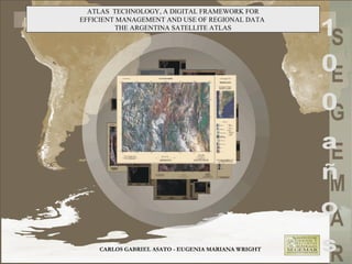
  • 1. CARLOS GABRIEL ASATO - EUGENIA MARIANA WRIGHT ATLAS TECHNOLOGY, A DIGITAL FRAMEWORK FOR EFFICIENT MANAGEMENT AND USE OF REGIONAL DATA THE ARGENTINA SATELLITE ATLAS
  • 2. Objetives • Create a reference guide for regional studies of Argentina territory. • Create a cartographic product oriented to the public, students and scientists requirements. • Generate a cartographic product that promotes the geographical space comprehension, identification or localization of related spatial information. • Enhacement of the SEGEMAR SDI capability.
  • 3. Argentina Geographical and Data Context Pros and Cons Argentina 3.000.000 Km2 The Cons Lack of digital information specially detailed topographic, geological and other kind of spatial data. Strong difficulties in data surveying, management and maitenance. Low budgets and little human resources. Old hardware and software system The Pros Strong experience on automatical digital map production Free Internet geodata availability Operative corporate GIS support Usefull information and data structures are available at SEGEMAR
  • 4. Computer and Software • Arc-Info 8.0 (Unix and WinNT) • Arc-View 3.2 • X-Terminal emulator • Corel Draw 9 • Erdas • Sun Enterprise 250 (application server) • Pentium Pro 200 mhz (Samba file server) • Pentium 200 mhz (digitizing and edition) • Pentium II, 400 mhz (programming) • Pentium III, 650 mhz (cartographic finishing) • Pentium III, 1Gz (Image processing, JICA) • Xerox Docucolor 450 (printing system, JICA)
  • 5. Data Sources • Landsat 5 TM Geocover Mosaics, UNEP • Gtopo 30, NOAA • Corporate Geodatabase at 1:500.000 • Argentina Cartographic Names List (IGM) • Country boundary at 1:250.000 (IGM)
  • 6. System Production Design Criteria • GIS based Atlas. • Creation of Cartographic Automated Production System. • Corporate digital cartographic production techniques. • Cartographic modular design.
  • 7. Database Design and Production Concepts The amount of data and geographic complexity requires the development of operational and systematic patterns of cartographic production systems similar to those used at manufacturing industry The definition of Institutional or Corporate GIS framework became critical!!
  • 8. Perfomance Balance Diagram Hardware and Software Capabilities Technical Knowledge & Experience Data Amount, Availability & Complexity Needs GIS Product
  • 9. Work Flow Diagram GIS Digital Cartographic Finishing Corporate Database Services Final Product
  • 10. Database and Geo-Information Subsystems • Corporate Geo Database System – Auxiliary and contextual information – Cartographic management system • Corporate AML Programs – Main Map Production AML (ontology based) – Auxiliary maps – Satellite Key Interpretation Legend Generator – Others • Cartographic Names System • Landsat TM Image Catalog
  • 11. Atlas Cartographic Structure • Printed maps, full color, paper size A3 • General Maps • Index Maps • Standard Image Maps at 1:1.000.000 scale
  • 12. Cartographic Elements Main Display Map Name and ID Index Map References Geographical Grid Auxiliary Information Scale
  • 13. Satellite Key Interpretation Legend Generator Classification adapted from Anderson (1976) and CORINE (1993)
  • 14. Auxiliary Maps & Diagrams
  • 15. Auxiliary Maps & Diagrams
  • 16.
  • 17.
  • 18.
  • 19. Future Developments Metallogenic Atlas of South America (in progress) Satellite Atlas version 2, 3 & 4 (under development) Other SDI proyects (under development)
  • 20. The Argentine Satellite Atlas for Geological and Geographical Studies is a high quality cartographic product that could be developed by using a GIS technology and by integrating geodata management and digital cartographic techniques. Using automated cartographic procedures –similar to industrial production methods- it was possible to create a cartographic product in a short time (7200 working hours/man) with little human resources (two persons). Automated process also gives a much more consistent way for cartographic error handling, facilitating map corrections. The Argentine Satellite Atlas is a valuable reference document that facilitates the comprehension and development of different regional studies of the country. This project has allowed the creation of a technological basement and geoinformation infrastructure, which will promote the development of new systematic products. Conclusions Good geospatial data structures and balanced work infraestructure promote the efficient use and analysis of a huge amount of data!!!
  • 21. SEGEMAR Japan International Cooperation Agency Geological Survey of Canada (MAP-GAC) - Vancouver Acknowledgements