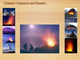
5. What is a volcano?
A volcano is avent or
'chimney' that connects
molten rock (magma)
from within the Earth’s
crust to the Earth's
surface.
The volcano includes the
surrounding cone of
erupted material.
vent
cone
magma chamber
conduit
6. Volcanoes classification
>1300 volcanoes known to have
erupted in Holocene (last 10 000 years)
~500 classified as‘active’ (i.e. known to
haveerupted in recorded history)
Remainder classified as‘dormant’ (may
become active again)or ‘extinct’ (not
expected to erupt again),but Vesuvius
wasthought to beextinct before AD
79! Paricutin (Michoacan, Mexico)
shown erupting in 1943
(graphic byDiego Rivera)
http://www.protezionecivile.gov.it/jcms/it/rischio_vulcanico.wp
8. Volcanoes anderuptivestyle
Eruptive style and hazard depends on:
Tectonic setting
Depth of magma formation
Rateof magmamovement to the surface
Percent andtype of volatiles (gases)
9. How and why do volcanoes erupt?
Hot, molten rock (magma)is buoyant (hasalower density
than the surrounding rocks) andwill rise up through the
crust to erupt on the surface.
When magmareaches the surface it depends on how easily
it flows (viscosity) andthe amount of gas(H2O, CO2, S)it
hasin it asto how it erupts.
Large amounts of gasandahigh viscosity (sticky) magma
will form anexplosiveeruption.
Think about shakingacarbonated drink andthen releasing the cap
Smallamounts of gasand(or) low viscosity (runny) magma
will form aneffusiveeruption.
Where the magmajust trickles out of the volcano (lava flow)
10. V
olcanoes - tectonic settings
Oceanic ridges, hotspots Subduction zones
Basic/Mafic volcanics Acidic/Felsic volcanics
Low SiO2 High SiO2
Fluid lava(10 m/s) Viscous lava(3 m/s)
Low gaspressure
(little explosive activity)
High gaspressure
(explosive activity)
11. Gas Pressure
Low Medium High
LavaType
Fluid
Inter.
Viscous
Icelandic Strombolian Vesuvian
H a w a i i a n
- Vu l c a n i a n P e r r e t i a n
M e r a p i a n Vi n c e n t i a n P e l é e a n
Classification of volcanic eruptions
Low Risk High Risk
Low
High
Oceanic ridge,
Hotspots
Subduction
zone
12. Explosive Eruptions
Mt. Redoubt
Above: Largeeruption column andash
cloud from anexplosive eruption at Mt
Redoubt,Alaska
Explosive volcanic
eruptions canbe
catastrophic
Erupt 10’s-1000’s km3 of
magma
Sendashclouds >25 km
into the stratosphere
Havesevereenvironmental
andclimaticeffects
Hazardous!!!
13. Three products from an
explosive eruption:
Ash fall
Pyroclastic flow
Pyroclastic surge
Explosive Eruptions
Pyroclastic flows on
Montserrat, buried the
capital city.
20. Basaltic lavaflows
Hazards - property burnt and buried by lava
“Aa” (blocky lava)flow, Hawaii “Pahoehoe” (ropy lava)flow,Reunion
21. Volcanic hazards - Hawaii
Fiveactivevolcanoes;
hazardsare mainly lavaflows, although
tephra andgasemissions also occur.
Hazard profile similar for all three.
25. Pompeii (79AD)
On August 24, 79AD Mount Vesuviusliterally blew its top,
erupting tonnes of molten ash,pumice andsulfuric gasmiles
into the atmosphere. Pyroclastic flows flowed over the city
of Pompeii andsurrounding areas.
26. Pompeii (79AD)
Pyroclastic flows of poisonous gas
andhot volcanic debris engulfedthe
cities of Pompeii, Herculaneum and
Stabiaesuffocating the inhabitants
andburying the buildings.
27. Pompeii (79AD)
The cities remained buried and
undiscovered for almost 1700 years
until excavation beganin 1748.These
excavationscontinue today andprovide
insight into life during the Roman
Empire.
32. Pyroclastic Flow - lahars
Hot volcanic activity canmelt
snow and ice
Melt water picks up rock and
debris
Forms fast flowing, high energy
torrents
Destroys all in its path
40. LavaFlow - Heimaey,Iceland
The lavaflows caughtthe
inhabitants by surprise
Before the eruption was
over, approximately one-
third of the town of
Vestmannaeyjer hadbeen
destroyed
41. LavaFlow - Heimaey,Iceland
However, the potential damagewasreduced by spraying
seawater onto the advancinglavaflows.
This causedthem to slow and/or stop, or diverted them away
from the undamagedpart of the town.
43. Volcano Monitoring
Volcano Observatories are
set up on all active
volcanoes that threaten
the human population.
These are designed to
monitor andpotentially to
predict the eruptive
behaviour of the volcano in
question.
45. SeismicActivity
Earthquake activity commonly precedes an eruption
Result of magmapushing up towards the surface
Increasevolume of material in the volcano shatters the rock
This causes earthquakes
46. SeismicActivity
Earthquake activity is measuredbySeismographs
Seismographsare stationed on the flanks of the volcano
These record the frequency, duration andintensity of the
earthquakesandreport it backto the volcano observatory.
47. Deformation Monitoring
“Tiltmeters” are usedto measurethe deformation of
the volcano
The tiltmeters measure changesin slope assmall asone
part per million. A slope changeof one part per million is
equivalent to raising the end of aboard one kilometer long
only one millimeter!
48. Deformation Monitoring
Note the presence
of earthquakes in
relation to the
deformation. Oftenit
is acombination of
eventsthat fore-
warns of an
eruption.
Tilltmeters cantell you when new material enters the magma chamber.
A
B
49. Gas Monitoring
Commonly gasoutput from avolcano increases or changes
composition before an eruption.
As magmarises to the surface it releases(exsolves) much of its
gas content.
This canbemeasured
51. V
olcanic gases
LakeNyos (Cameroon,1986)
More than 1700 people killed asaresult of
amassiverelease of CO2; formed a‘river’
about 50m deep that flowed for 25 km. L.
Nyos currently contains about 350 M m3 of
CO2. Similar event at L.Monoun
(Cameroon) in 1984 resulted in 37 deaths.
In 1783 amassivefissure eruption near Laki, Iceland released hugeamounts of
basaltic lava (5 000 m3/s), and a‘dry fog’rich in SO2 and flourine. Some75%of
stock animalsin Iceland died, the subsequent famine killed 10 000 people.
52. Noxious Gas
1,700 people living in the valley
below LakeNyos in
northwestern Cameroon
mysteriously died on the
eveningof August 26,1986.
53. Noxious Gas
LakeNyos is acrater lakeinside adormant
volcano.
The lakehadbecome laden with carbon dioxide
gas.
This gashadsuddenly bubbled out of the lakeand
asphyxiated nearly every living being in the
surrounding valley.
54. Noxious Gas
A management plan has been developed
to remove gas from the lake to prevent
afurther tragedy.
An artificial vent to the lake surface was
created with pipe.
Water is pumped from the bottom of
the laketo the surface through the
pipe, where it candegas.
57. Noxious Gas
The LakeNyos incident wasnot unique.
Two years earlier, LakeMonoun, 60 miles to the
southeast, releasedaheavycloud of toxic gas,
killing 37 people.
A third lake, LakeKivu, on the Congo-Rwanda
border in Central Africa, is alsoknown to act asa
reservoir of carbon dioxide andmethane, which is
avaluable natural gasthat is gathered from the lake
andusedlocally.
58. Earthquakes
Large volumes of magmamoving through the
shallow crust cancauselargeearthquakes.
This canleadto building collapse, slope failure and
avalanches
Destruction after avolcanic
induced earthquake in Japan
59. A f r i c a n
A p u l i a n
I b e r i a n
E u r a s i a n
E u r a s i a n
Iranian
Io.
Volcanoes
Plate motions
Volcanoesof the Mediterranean
66. The after-effects of a super-eruption
Stratospheric loading of ~1000 Mt of SO2and
sulphate aerosols
Aerosol veil persists for 5 - 10 years
Global cooling of 3-5°C (locally 15°C)
Collapse of agricultural production for several years
--> famine --> conflict
Lastgreat supereruption (Toba,~73,000 BP)may
havereduced humanpopulation to ~10,000 people
(Ambrose, 1998, J.Human Evolution., v.34,623)
(Rampino,2002,Icarus,v.156,p.562)
67. Since1980 some2M m3of CO2 releasedandsubstantial
earthquake activity (some quakesM ~ 6) associated with
intrusion of magma tongue
10 km
71. Ruinsof Roman
market, Pozzuoli; inundated by
sea,uplifted by2m in <10 years
asaresult of volcano-tectonic
forces beneath Campi Flegrei
caldera
1976
1984
73. La Solfatara,
one of several small active craters in the Campi Flegrei
City of Naples
74. The effect of VOLCANIC ACTIONS
Mitigation options for natural hazards, with a special focus on volcanic eruptions
11/16
1. WATER
2. SNOW
3. WIND
4. LANDSLIDES
5. VOLCANIC ACTIONS
6. VOLCANIC RISK
DESCRIPTION
LAVA
FLOWS
BOMBS
and
MISSIL
ES
PYROCLAS
TIC
FLOWS
and
SURGES
AIR
FALL
DEPOSI
TS
EARTHQUA
KE
Seismic events before the
1631 Sub-Plinian Vesuvius
eruption
DESIGN METHODOLOGY FOR TECHNICAL RETROFIT
Cumulative effects given by a complex eruptive scenario
(SpeeD and EXPLORIS projects for Vesuvian area)
WP4 Team
ACTIONS
LAHA
RS
75. The effect of VOLCANIC ACTIONS
Mitigation options for natural hazards, with a special focus on volcanic eruptions
12/16
1. WATER
2. SNOW
3. WIND
4. LANDSLIDES
5. VOLCANIC ACTIONS
6. VOLCANIC RISK
MITIGATION ACTIONS
ASH FALL DEPOSITS
EARTHQUAKE:
SEISMIC REINFORCEMENT: iron chains in masonry building, insertion of infill
panels or resistant elements in soft floors of reinforced concrete buildings
1. pitched roofs by overlapping light structures
(CFS, Cold Formed Steel; UHPC, Ultra High Performance Concrete)
2. the reinforcement of the roof slab:
- FRP, Fiber Reinforced Polymers
(physical and mechanical properties degrade in range above 60-80°C)
- FRCM (Fiber Reinforced Cementitious Matrix)
WP4 Team
Vuln. classes Roofing type Load [kPa] Collapse prob. [%]
A Weak pitched wooden roof 2,0 50
B
Standard wooden flat roof; Flat floor with
steel beams and brick vaults; Sap floors
3,0 50
C1
Flat floor with steel beams and hollow bricks ;
R.C
flat slab (more than 20 year old)
5,0 60
C2
R.C flat slab (less than 20 year old); Last
generation
R.C. flat slab
7,0 51
D
Last generation R.R. pitched slab ; Last
generation
steel pitched roof
12,0 50
76. The effect of VOLCANIC ACTIONS
Mitigation options for natural hazards, with a special focus on volcanic eruptions
13/16
1. WATER
2. SNOW
3. WIND
4. LANDSLIDES
5. VOLCANIC ACTIONS
6. VOLCANIC RISK
MITIGATION ACTIONS
PYROCLASTIC FLOWS
LAHARS PYROCLASTIC FLOWS and LANDSLIDES
WP4 Team
PROTECTION OF OPENINGS :
•Overlay steel anchored along the external perimeter
•Fire safety shutters of steel or alluminium
•Special protective films on glass surfaces
RESISTANCE TO LATERAL PRESSURE OF STRUCTURAL ELEMENTS FOR BUILDING
TYPE.
TECHNICAL ELEMENT CRITICAL PRESSURE
[kPa]
Wooden seasonal structures 3,5
3-4 floors weak masonry buildings with deformable floors 3,5 - 5
4+ floors weak or strong masonry building
6+ floors r.c. buildings 4 - 5
Weak tuff walls (thickness ≤40cm, span>4m) 4 - 7,5
4-6 floors r.c. buildings 4,5 - 6
Non aseismic weak r.c. buildings 4,5 - 8
1-3 floors r.c. buildings 6,5 - 9
Medium strength tufo walls (thickness ≥40cm, span>4m) 7 - 9
Non aseismic strong r.c. buildings
1-2 floors weak masonry buildings with deformable floors 11 - 18
3-4 floors masonry buildings with rigid floors
1-2 floors masonry buildings with rigid floors 14 - 19
77. The effect of VOLCANIC ACTIONS
Mitigation options for natural hazards, with a special focus on volcanic eruptions
WP4 Team
14/16
1. WATER
2. SNOW
3. WIND
4. LANDSLIDES
5. VOLCANIC ACTIONS
6. VOLCANIC RISK
MITIGATION ACTIONS
CHOICE OF THE TECHNICAL OPTIONS
To assess the effectiveness of mitigation actions, it is necessary a
comprehensive analysis of technological options.
A qualitative judgment can be expressed by six key indicators:
1.Quick installation
2.Storability
3.Lightness
4.Cost;
5.Preservation of constructive and architectural features;
6.Multifunctionality (ability of the technical solution to respond to different
phenomena).
Through four categories:
SE – Interventions on elevation structures
SV – Interventions on vertical surfaces
SO – Interventions on horizontal structures
AP – Interventions on openings
78. VOLCANIC RISK
Mitigation options for natural hazards, with a special focus on volcanic eruptions
WP4 Team
15/16
1. WATER
2. SNOW
3. WIND
4. LANDSLIDES
5. VOLCANICACTIONS
6. VOLCANIC RISK
• Development of accurate volcanic models (physical and mathematical),
assessing future eruption scenarios and their consequences on the
surrounding territory.
• Assessment of the global vulnerability and potential damage induced by the
volcano on the entire system (population, built environment, infrastructure,
etc.).
• Production of volcanic risk-reduction guidelines for communities and local/
national governments.
• Promotion of a socio-cultural methodology enhancing consciousness and
auto-regulation of the territory.
• Identification of alternative people settlements and the reorganization of the
entire infrastructural network in the whole region, relieving the current
situation to more manageable scenarios.
SECURE COHABITATION WITH THE VOLCANO
MAIN OBJECTIVES
(Vesuvian area):
79. The Gulf of Naples belongs to the Tyrrhenian seaandis a40 km long and25 km wide
rectangular basinelongated approximately SW-NE
The gulf isshallow with the lowest bathymetric gradients that are found in the south-east corner at the
baseof the Sorrento peninsula around Castellammare (∼1:10near- shore slope).The seabottom lies mostly
between 100 m and200 m depth.The offshore sideof the basincanbetaken to correspond to the sharp
transition from 200 m down to 500 m depth: this hasaquite complex shape,due mostly to alow- altitude
relief located in the seafloor at mid-distance between the islandsof Ischia andCapri.
Simulation of tsunamisinduced by volcanic activity in the Gulf of Naples(Italy)
Tinti, Pagnoni& Piatanesi,2003. Natural hazards,311,320.
Tsunami hazard in the Gulf of Naples
80. Historical tsunamis in Campania
Tinti S.,MaramaiA., Graziani L. (2007).The Italian Tsunami Catalogue(ITC),Version 2.
http://www.ingv.it/servizi-e-risorse/BD/catalogo-tsunami/catalogo-degli-tsunami-italiani
Date Coordinates I M Reliab. Cause VEI Description
8-24-79 40°49’,14°26’ 2 VA 5 Searetreat in the Gulf of Naples
6-20-1112 2 UN Seawithdrawal of about 200 steps
12-17-1631 40°49’,14°26’ 4 VA 4 Searetreat at Pizzo Calabro
5-14-1698 40°49’,14°26’ 2 VA 3 Seaoscillations in Gulf of Naples
6-30-1714 40°49’,14°26’ 0 VA 2 Seawithdrawals in Gulf of Naples
6-16-1760 40°51’,14°16’ VI 4.3 2 ER Seawithdrawal in Portici
7-26-1805 41°30’,14°28’ X 6.6 4 EA Searise in the Gulf of Naples
5-17-1813 40°49’,14°26’ 1 VA 2 Seawithdrawal in Gulf of Naples
8-26-1847 0 UN Sealevel lowering in Naples
4-4-1906 40°49’,14°26’ 4 VA 3 Seaoscillations in Naples Gulf
81. Tsunami hazard in the Gulf of Naples
Tsunamisassociatedwith Vesuviusactivity are rare. However, according to
historical documents, anomalous seaoscillations andwavesin the Gulf of
Naples were observed not only concomitantly to the largest eruptions (79AD
and1631), but alsoto someof the smaller events, suchasthe casesof 14 May
1698, 17 May1813 andApril 1906.
There are no records of catastrophic tsunamis andthe tsunamigenic
mechanismof the Vesuviantsunamis is not certain.
They maybeattributed to:
seafloor displacement determined bythe earthquakes accompanying the
volcanic activity,
to rapid inflation or deflation of the volcanic flanks involving the submarine
areaof the Gulf of Naples,
to pyroclastic flows affecting the sea.
Simulation of tsunamisinduced by volcanic activity in the Gulf of Naples(Italy)
Tinti, Pagnoni& Piatanesi,2003. Natural hazards,311,320.
82. Hydrodynamic characteristics
Hydrodynamic characteristics of the Gulf of
Naples seenasanopen basinsubjected to long-
wave excitationfor a scenario of the largest
expected eruption the Italian Department of Civil
Protection makesuseof in order to plan
emergency actions (DPC, 1995).
shallow water approximation theory
simulate atsunami produced by an
instantaneous displacement of the seasurface
asthe one that is associated with asubmarine
earthquake
Water elevation fields plotted every 8 min until 40 min after tsunami initiation
Simulation of tsunamisinduced by volcanic activity in the Gulf of Naples(Italy)
Tinti, Pagnoni& Piatanesi,2003. Natural hazards,311,320.
83. Tsunamirecords computed at various coastal nodesof the
grid until 50 min after the tsunami excitation
Maximum (solid) andminimum (dashed)water elevation computed
alongthe mainlandcoastline.Vertical lines mark the position of the
localities shown in Fig.1: 1-Miseno, 2- Bagnoli, 3- Naples, 4-
Granatello, 5- Torre del Greco, 6- Torre Annunziata,7-
Castellammare, 8- Sorrento. On the coast outside, the level remains
almost unperturbed.
Earthquake source
84. Pyroclastic flows
Pyroclastic flows havebeen
sometimes speculated to bethe
causeof tsunamis, though their
potential to produce tsunamis is
largely unexplored andgeological
andnumerical studies on this topic
are not frequent.
very denseflows penetrating
underwater,
light flows running on the sea
surface
Pressurepulse fields (on the left) computed at
different times, givenin minutes.Water
elevation fields (on the right) computed at the
sameinstants.Time is measured from tsunami
origin time andcontour line labelsare in cm
85. Tsunamirecords computed at various coastal nodes
Pyroclastic source
Maximum (solid) andminimum (dashed)water elevation computed
alongthe mainlandcoastline.Vertical lines mark the position of the
localities shown in Fig.1: 1-Miseno, 2- Bagnoli,3- Naples, 4-
Granatello, 5- Torre del Greco, 6- Torre Annunziata,7-
Castellammare,8- Sorrento.
On the coast outside, the level remains almost unperturbed.
86. Conclusions
The tsunami amplitude computed is modest. Suchatsunami cannot be
considered hazarduous, andin terms of the Ambraseys-Sieberg scaleadopted for
European tsunamis its intensity would benot larger than 2.
Varying parameters (e.g.amplitude&velocity of the pressure pulse) , provided
however that they remain within the reasonable limits required bythe pyroclastic
flow dynamics,will probably produce more sizeable tsunamis.
If alarge plinian or subplinian eruption of Vesuviusoccurs, the associatedlow-
density component of the pyroclastic flows are expected to produce atsunami
that affectsthe Gulf of Naples, but the tsunami is expectedly not catastrophic, and
it will beat most aslarge asthe one observed in the second dayof the 1631
eruption.
Simulation of tsunamisinduced by volcanic activity in the Gulf of Naples(Italy)
Tinti, Pagnoni& Piatanesi,2003. Natural hazards,311,320.
87. Seismic input for isolated sites - Ercolano
Mapof maximum designground
acceleration (DGA), obtained asthe
result of the deterministic zonation at
national scale,for the Campania region.
Sketchesof the ship supporting system
First application in the world to archaeological
heritage of athree directional SIS,developed in the EC-
funded SP
ACEproject, which provides isolation from
both horizontal and vertical
Shakingtable testing andnumerical calculations have
beencarried out, in order to confirm the SIS
performance, together with astudy of the seismic
characterization of the site
Figure 1. Sketch of the Roman ship after excavation.
Figure 2. The ship in its metallic
frame.
Figure 3. The wreck in its
protective shell.
3D SISdevice (left) androlling-ball
element (right)