Recommended

Recommended
More Related Content
Similar to UNESCO Chair Heidelberg - Earth Monitoring for Sustainable Development of UNESCO World Heritage
Similar to UNESCO Chair Heidelberg - Earth Monitoring for Sustainable Development of UNESCO World Heritage (20)
Recently uploaded
Recently uploaded (20)
UNESCO Chair Heidelberg - Earth Monitoring for Sustainable Development of UNESCO World Heritage
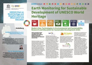
- 1. UNESCO Chair on World Heritage and Biosphere Reserve Observation and Education Earth Monitoring for Sustainable Development of UNESCO World Heritage Heidelberg Heidelberg University of Education Department of Geography The Department of Geography – Research Group for Earth Observation (rgeo) manages and coordinates the UNESCO Chair at the Heidelberg University of Education. With its competence centres GIS-Station and Geco-Lab, rgeo is assisted by two research and training centres to institutionalise its educational and research programmes. Additionally, rgeo is embedded into the NTG-Institute, which is projected to develop to a Heidelberg Centre on Education for Sustainable Development. Prof. Dr. Alexander Siegmund Prof. Siegmund fosters the use of modern geo-technologies in environmental and sustainability research and ESD. His research focuses on regional climate and climate change, geo- ecology, environmental monitoring & modelling, applied remote sensing & GIS, and environmental & geo-education. He is founding and board member of the Heidelberg Center for the Environment (HCE) and member of the Baden-Württemberg Council on Sustainable Development. www.rgeo.de APPLICATION OF GEO- TECHNOLOGIES FOR RESEARCH ON UNESCO WORLD HERITAGE: PRESERVATION THROUGH EDUCATION Digital geo-technologies such as remote sensing and Geographic Information System (GIS), but also innovative geo- ecological laboratory and field methods show a wide range of possible applications in science, planning and administration. However, the use of these technologies for earth observation is still very limited until today, especially in education and geo-communication - not least on World Heritage Sites and other UNESCO designated sites like biosphere reserves and geoparks. Compliance with the specific requirements for UNESCO site management benefits from modern digital geo-technologies as their application support sustainable development, early identification of potential risks as well as UNESCO site related capacity building, education and promotion. The Research Group for Earth Observation (rgeo) is specialised in applied remote sensing and other digital Geo-media for monitoring and education. In several research projects, the rgeo- team examined land use / land cover changes, land degradation, and geo- ecological vulnerability in the context of anthropogenic use and global climate change. Regional focus areas are subtropical and tropical small island ecosystems like the Canary Islands, Cape Verde Islands and Sao Tomé as well as hyper arid drylands in South America. Such research is being evaluated, further developed and implemented in using remote sensing and GIS-based methods to communicate such (un)sustainable development to different target groups. The UNESCO Chair is unique in combining the use of modern methods in environmental and sustainability research and Education for Sustainable Development. The implementation and dissemination of research projects and applications are realised through its two centres of competence and training: The “GIS-Station, Klaus-Tschira-Centre of Competence for digital Geo-media" and the "Geco-Lab, Centre of Competence for Geo-ecological Space Exploration". The GIS-Station is a research and training institution for teachers and an out-of- school learning place for school and university students. The diversified program offered across the topics remote sensing (satellite images), GIS and mobile geotools (GPS, etc.) includes courses, concepts and training for school, adult education and science. The Geco-Lab is an out-of-school learning locaction, training institution for teaching staff as well as research laboratory for students. It builds a bridge between the detection of environmental changes in the field, the exploration and analysis of geographical and geo-ecological processes in the lab and the explanation of environmental phenomena in the context of sustainability. Both research and learning centres offer programs on UNESCO World Heritage related regions and topics. Additionally, rgeo is embedded into the Interdisciplinary Institute for Science, Technology and Society (in German “NTG-Institut”), which is projected to develop to a Heidelberg Centre on Education for Sustainable Development. CURRENT ACTIONS The project “Space2Place” aims at enabling site managers to use satellite images for monitoring, management and sustainable development of UNESCO sites, especially at endangered sites. Preventing UNESCO World Heritage from becoming endangered while also promoting future pathways towards the implementation of the SDGs is a great challenge especially for site managers in developing countries. “Space2Place” bridges this gap by training UNESCO site managers in ESA Copernicus satellite data analysis for observation, monitoring and valuation of sustainable development of cultural and natural world heritage. It provides online e-learning modules promoting monitoring techniques with the help of freely available Copernicus earth observation data from different Sentinel satellites, combined with “BLIF”, a free web-based satellite image analysis toolset developed by rgeo. Modern Geo-Technologies in Environmental and Sustainability Research and Education for Sustainable Development (ESD)